Items Similar to Antique Map of Mauritania 'Africa' by G. Ruscelli, 1574


Want more images or videos?
Request additional images or videos from the seller
1 of 5
Antique Map of Mauritania 'Africa' by G. Ruscelli, 1574
About the Item
A very rare mid-16th century black and white map of North and West Africa called Mauritania by the Italian cartographic editor Girolamo Ruscelli. This print originates from the second edition of Ptolemy's 'Geografica'. Passe partout included, Italian text on verso.
- Dimensions:Height: 13.47 in (34.2 cm)Width: 16.66 in (42.3 cm)Depth: 0.12 in (3 mm)
- Materials and Techniques:
- Period:
- Date of Manufacture:1574
- Condition:Please study image carefully.
- Seller Location:Langweer, NL
- Reference Number:
About the Seller
5.0
Platinum Seller
These expertly vetted sellers are 1stDibs' most experienced sellers and are rated highest by our customers.
Established in 2009
1stDibs seller since 2017
1,922 sales on 1stDibs
Typical response time: <1 hour
- ShippingRetrieving quote...Ships From: Langweer, Netherlands
- Return PolicyA return for this item may be initiated within 14 days of delivery.
More From This SellerView All
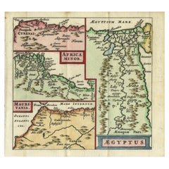
- Antique Map of North Africa showing Egypt, Mauritania and Africa Minor, 1672Located in Langweer, NLAntique map titled 'Africa Minor, Mauritania , Aegyptus.' Charming miniature map of North Africa, showing Egypt, Mauritania and Africa Minor. This map originates from the pocket atla...Category
Antique 17th Century Maps
MaterialsPaper
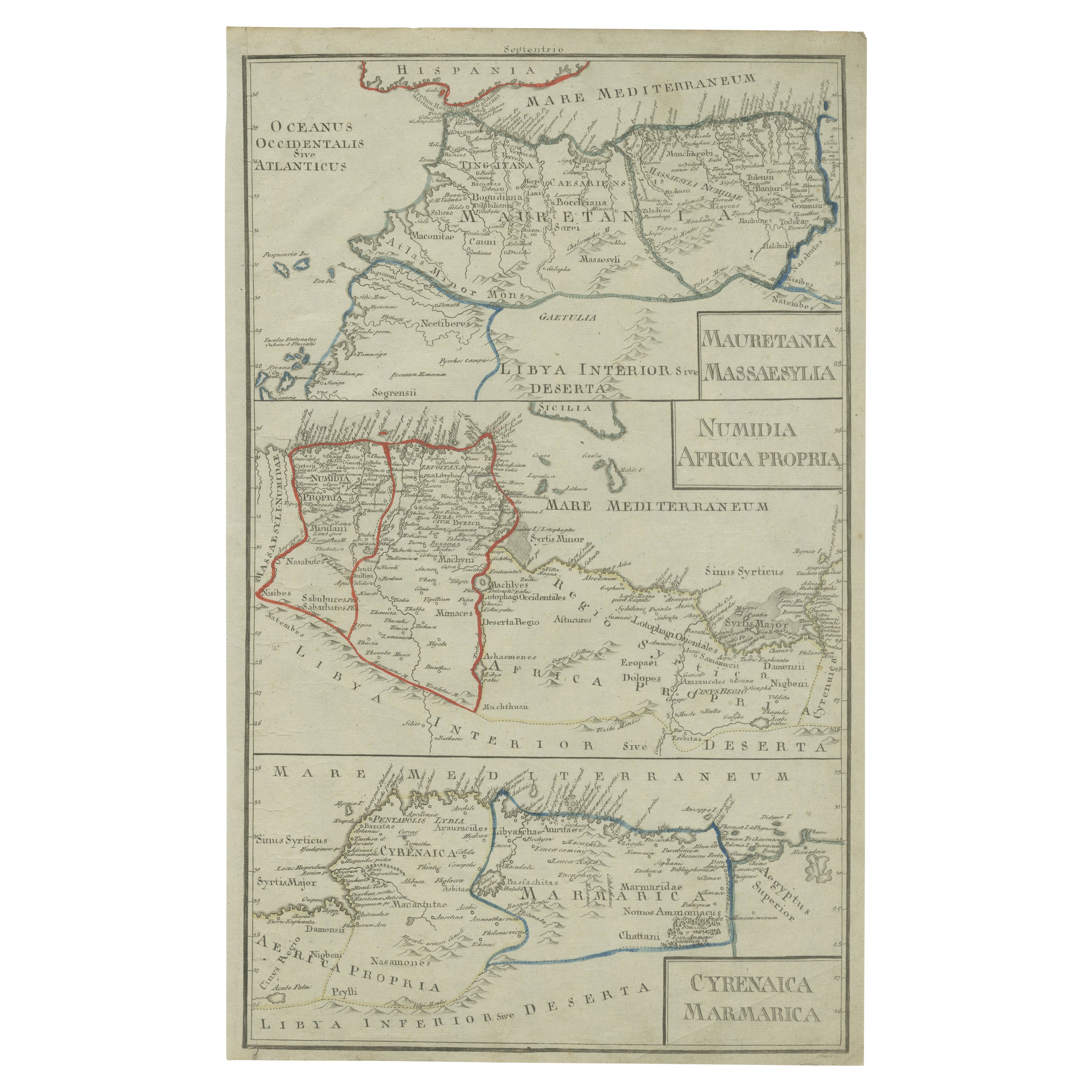
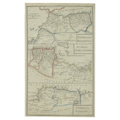
- Antique Map of Mauritania, Massaesylia, Numidia, Tunisia, Cyrenaica & MarmaricaLocated in Langweer, NLThree maps on one sheet showing Mauritania, Massaesylia, Numidia, Tunisia, Cyrenaica and Marmarica (ancient Libya). This map originates from 'Schul-Atlas für die alte Erdbeschreibung...Category
Antique Early 19th Century Maps
MaterialsPaper
- Original Antique Map of AfricaLocated in Langweer, NLAntique map titled 'Afrika'. Original antique map of Africa, drawn by Van Beusekom. Published by 'Seyffardt's Boekhandel' in Amsterdam, circa 1870.Category
Antique Late 19th Century Maps
MaterialsPaper
- Antique Map of Africa by Delamarche, 1806Located in Langweer, NLAntique map titled 'L'Afrique'. Decorative map of Africa by Robert de Vaugondy, revised and published by Delamarche. Source unknown, to be determined. Artists and Engravers: Charl...Category
Antique 19th Century Maps
MaterialsPaper
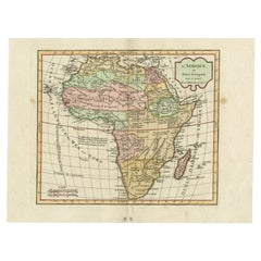
- Antique Map of Africa by Lapie, 1842Located in Langweer, NLAntique map titled 'Carte d'Afrique'. Map of Africa. This map originates from 'Atlas universel de géographie ancienne et moderne (..)' by Pierre M. Lapie...Category
Antique Mid-19th Century Maps
MaterialsPaper
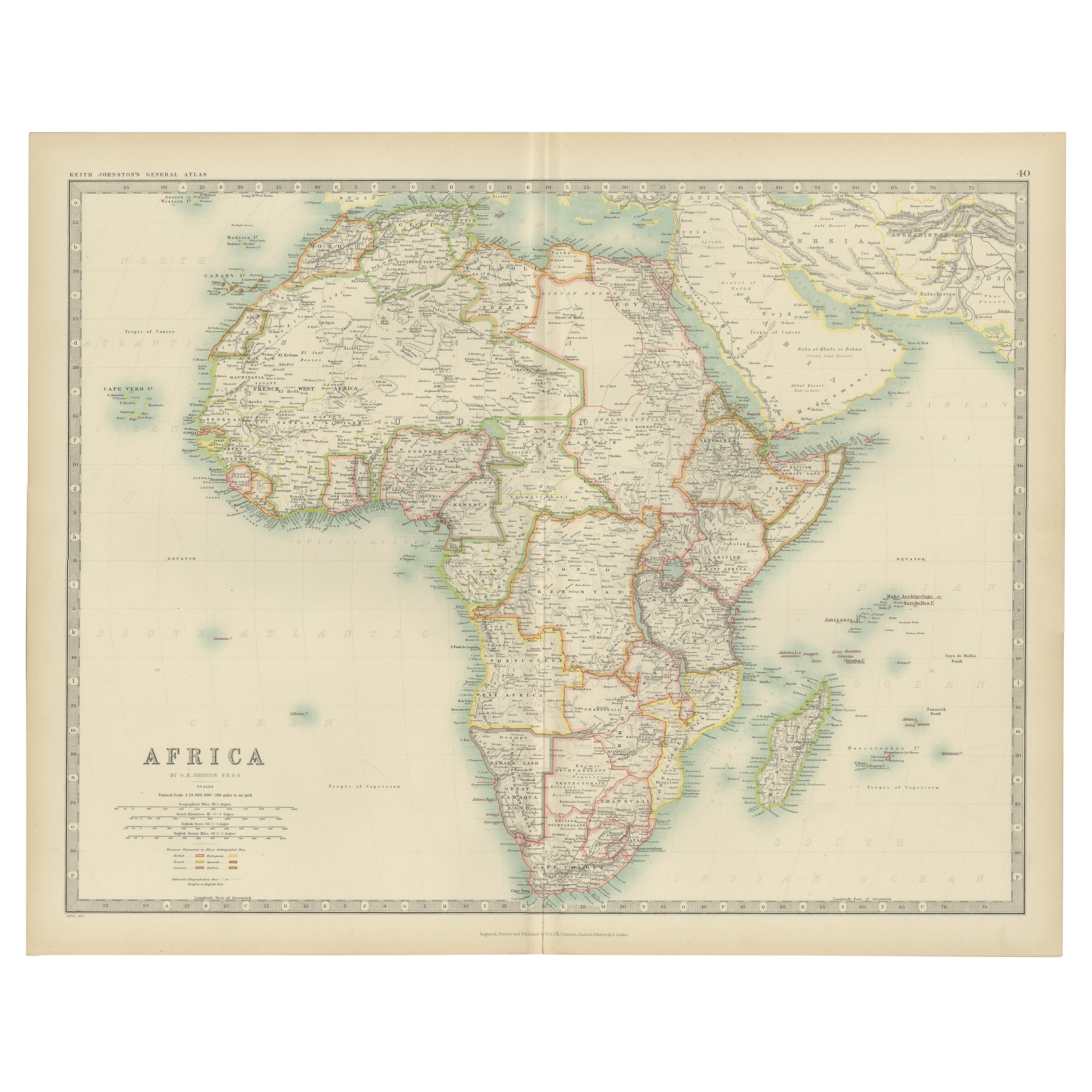
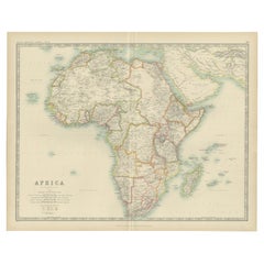
- Antique Map of Africa by Johnston (1909)Located in Langweer, NLAntique map titled 'Africa'. Original antique map of Africa. This map originates from the ‘Royal Atlas of Modern Geography’. Published by W. & A....Category
Early 20th Century Maps
MaterialsPaper


You May Also Like
- Original Antique Map of South Africa, Arrowsmith, 1820Located in St Annes, LancashireGreat map of South Africa. Drawn under the direction of Arrowsmith. Copper-plate engraving. Published by Longman, Hurst, Rees, Orme and Br...Category
Antique 1820s English Maps
MaterialsPaper
- 17th Century Hand-Colored Map of West Africa by Mercator/HondiusLocated in Alamo, CAA 17th century hand-colored map entitled "Guineae Nova Descriptio" by Gerard Mercator and Jodocus Hondius, published in their 'Atlas Minor' in Amsterdam in 1635. It is focused on the...Category
Antique Mid-17th Century Dutch Maps
MaterialsPaper
- Antique Map of Principality of MonacoBy Antonio Vallardi EditoreLocated in Alessandria, PiemonteST/619 - "Old Geographical Atlas of Italy - Topographic map of ex-Principality of Monaco" - ediz Vallardi - Milano - A somewhat special edition ---Category
Antique Late 19th Century Italian Other Prints
MaterialsPaper
- Antique Map of Italy by Andriveau-Goujon, 1843By Andriveau-GoujonLocated in New York, NYAntique Map of Italy by Andriveau-Goujon, 1843. Map of Italy in two parts by Andriveau-Goujon for the Library of Prince Carini at Palazzo Carini i...Category
Antique 1840s French Maps
MaterialsLinen, Paper
- "Africae Accurata", a Hand-Colored 17th Century Map of Africa by VisscherBy Nicolaes Visscher IILocated in Alamo, CAAn 18th century hand-colored map of Africa entitled "Africae Accurata Tabula ex officina" by Nicolaes Visscher, published in Amsterdam in 1680. This beautiful, colorful and detailed map is embellished by eleven sailing ships, a whale, flying fish and multiple land animals. It includes the Mediterranean Sea and adjacent portions of Portugal, Spain, Italy, Greece and Asia Minor. The map perpetuates several long-standing errors, including the origin of the Nile River from two imaginary lakes in southern Africa, which are shown adjacent to the imaginary Lunae Montes (Mountains of the Moon...Category
Antique Late 17th Century Dutch Maps
MaterialsPaper
- "Africa Vetus": a 17th Century Hand-Colored Map by SansonBy Nicolas SansonLocated in Alamo, CAThis original hand-colored copperplate engraved map of Africa entitled "Africa Vetus, Nicolai Sanson Christianiss Galliar Regis Geographi" was originally created by Nicholas Sanson d...Category
Antique Late 17th Century French Maps
MaterialsPaper


Recently Viewed
View AllMore Ways To Browse
West African Antiques
North Africa Map
West Africa Map
Ptolemy Map
Ruscelli Map
George Fleet
Antique Railroad Maps
Map Of New Zealand
Antique Map Art Collectibles
Antique Maps Art Collectibles
James Cook Map
Old Antique Compass
Nautical Charts
Map New Holland
World Map Antique Style
World Maps Antique Style
Antique Style Map Of The World
Maritime Map