World Map Antique Style
2
to
25
133
54
104
83
64
24
22
22
21
18
10
9
8
8
7
6
6
5
5
4
2
2
2
2
2
2
2
2
2
1
1
1
1
1
1
14
13
6
6
4
Sort By
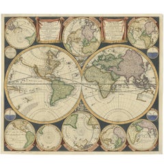
Antique World Map by P. Schenk '1706'
By Peter Schenk
Located in Langweer, NL
Aert-klooten (..)'. One of the earliest Dutch World Maps to focus on a more modern cartographic style
Category
Early 18th Century World Map Antique Style
Materials
Paper
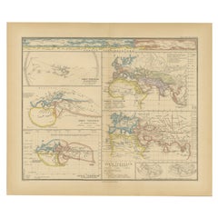
Original Old Composite of Several Maps of the Ancient World on One Sheet, 1880
Located in Langweer, NL
Theodorus Menke. The map is a detailed depiction of the ancient world. The atlas it comes from is known for
Category
1880s World Map Antique Style
Materials
Paper
Free Shipping
H 15.56 in W 18.51 in D 0 in
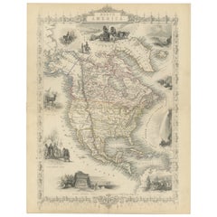
Victorian Visions of the New World: A Detailed Tallis Map of North America, 1851
Located in Langweer, NL
& Company. Tallis maps are known for their detailed and elaborate style, often including ornate borders and
Category
1850s World Map Antique Style
Materials
Paper
H 14.26 in W 10.71 in D 0 in
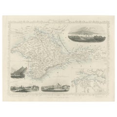
A Decorative Detailed Map of the Crimea, with an Inset Map of Sebastopol, c 1851
Located in Langweer, NL
from 1849 to 1853, was the last decorative world atlas. 'The Crimea' map was typical of the many fine
Category
1850s World Map Antique Style
Materials
Paper
H 10.83 in W 14.18 in D 0 in
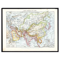
Antique Map of Asia by Larousse, 1897
Located in Langweer, NL
maps to collectors, historians, educators and interior decorators all over the world. Our collection
Category
19th Century World Map Antique Style
Materials
Paper
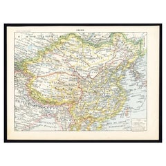
Antique Map of China by Larousse, 1897
By Pierre Larousse
Located in Langweer, NL
interior decorators all over the world. Our collection includes a wide range of authentic antique maps from
Category
19th Century World Map Antique Style
Materials
Paper
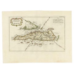
Antique Map of Sumatra by Bellin, 1764
Located in Langweer, NL
Antique map Sumatra titled 'Carte de l'Isle de Sumatra'. Old map of Sumatra, Malaysia and the
Category
18th Century World Map Antique Style
Materials
Paper
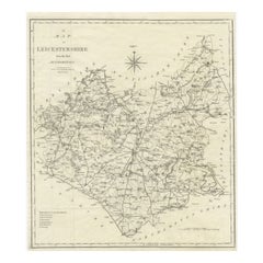
Large Antique County Map of Leicestershire, England, 1805
Located in Langweer, NL
cartographic landscape. His dedication to accuracy and distinct style is evident in this Leicestershire map
Category
Early 19th Century World Map Antique Style
Materials
Paper
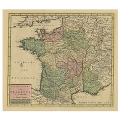
Antique Map of France by Tirion, c.1740
Located in Langweer, NL
maps to collectors, historians, educators and interior decorators all over the world. Our collection
Category
18th Century World Map Antique Style
Materials
Paper
Antique Map of Central Asia, Finely Engraved, 1841
Located in Langweer, NL
over the world. Our collection includes a wide range of authentic antique maps from the 16th to the
Category
19th Century World Map Antique Style
Materials
Paper
Original 1882 Map of Arabia, Red Sea & Persian Gulf
Located in Langweer, NL
," originally published in 1882 as part of the 'Comprehensive Atlas and Geography of the World.'
The map is
Category
1880s World Map Antique Style
Materials
Paper
Old Map of the French Department of Loiret, France
By Victor Levasseur
Located in Langweer, NL
decorative style. He produced numerous maps more admired for the artistic content of the scenes and data
Category
Mid-19th Century World Map Antique Style
Materials
Paper
Antique Map of France Showing Post-Napoleonic Departments, 1816
Located in Langweer, NL
decorators all over the world. Our collection includes a wide range of authentic antique maps from the 16th
Category
19th Century World Map Antique Style
Materials
Paper
Antique Map of the Maluku Islands or Moluccas, Indonesia
Located in Langweer, NL
Antique map titled 'Carte Particuliere des Isles Moluques'. This map depicts the islands of Herij
Category
Mid-18th Century World Map Antique Style
Materials
Paper
Antique Map of Celebes 'Sulawesi', Island in Indonesia, 1754
By Jacques-Nicolas Bellin
Located in Langweer, NL
decorators all over the world. Our collection includes a wide range of authentic antique maps from the 16th
Category
18th Century World Map Antique Style
Materials
Paper
1859 Antique Swiss Panorama: Blackie's Detailed Map of Switzerland
Located in Langweer, NL
The "Antique Map of Switzerland" is a distinguished piece from 'The Imperial Atlas of Modern
Category
Mid-19th Century World Map Antique Style
Materials
Paper
Antique Map of Turkmenistan, Uzbekistan, Tajikistan and Kyrgyzstan, 1749
Located in Langweer, NL
decorators all over the world. Our collection includes a wide range of authentic antique maps from the 16th
Category
18th Century World Map Antique Style
Materials
Paper
H 10.32 in W 14.26 in D 0 in
Old Map of Turkmenistan, Uzbekistan, Afghanistan, Tajikistan, Kyrgyzstan, 1757
Located in Langweer, NL
Antique map titled 'Kort over det Lille Bukarie og de naest graensende Lande. af Engelske
Category
1750s World Map Antique Style
Materials
Paper
H 9.06 in W 13.78 in D 0 in
Antique Decorative Coloured Map Egypt, Nubia, Abyssinia and more, 1882
Located in Langweer, NL
major shift in its colonial status.
2. **Cartographic Style**: The maps reflect the cartographic style
Category
1880s World Map Antique Style
Materials
Paper
Free Shipping
H 14.97 in W 22.45 in D 0 in
Antique Decorative Coloured Map of South Africa and Madagascar, 1882
Located in Langweer, NL
The map of South Africa is from the Blackie & Son Atlas, published in 1882. This historical map is
Category
1880s World Map Antique Style
Materials
Paper
Free Shipping
H 14.97 in W 22.45 in D 0 in
Map of Polynesia Highlighting Cultural Landscapes and Maritime Activities, 1851
Located in Langweer, NL
world in transition, showing how the British saw their empire and its global context. These maps remain
Category
1850s World Map Antique Style
Materials
Paper
H 10.71 in W 14.26 in D 0 in
Hand Colored Antique Map of the Department of Marne, France
By Victor Levasseur
Located in Langweer, NL
department is home to the Champagne region where the world's finest sparkling wine is produced. The map is
Category
Mid-19th Century World Map Antique Style
Materials
Paper
Hand Colored Antique Map of the department of Lozere, France
By Victor Levasseur
Located in Langweer, NL
French cartographer widely known for his distinctive decorative style. He produced numerous maps more
Category
Mid-19th Century World Map Antique Style
Materials
Paper
Hand Colored Antique Map of the department of Loiret, France
By Victor Levasseur
Located in Langweer, NL
decorative style. He produced numerous maps more admired for the artistic content of the scenes and data
Category
Mid-19th Century World Map Antique Style
Materials
Paper
Antique Map of the Region of Dauphiné by Zatta, 1779
Located in Langweer, NL
Antique map titled 'Li Governi del Delfinato e di Provenza la Contea Venaissin ed il Princie
Category
18th Century World Map Antique Style
Materials
Paper
Antique Map of the Tunquin River and Bay, Siam, 1757
Located in Langweer, NL
all over the world. Our collection includes a wide range of authentic antique maps from the 16th to
Category
18th Century World Map Antique Style
Materials
Paper
Original Antique Map of the Maluku Islands or Moluccas, Indonesia
Located in Langweer, NL
Antique map titled 'Carte Particuliere des Isles Moluques'. This map depicts the islands of Herij
Category
Mid-18th Century World Map Antique Style
Materials
Paper
Antique Map of the Coast of China by Bellin, 1752
By Jacques-Nicolas Bellin
Located in Langweer, NL
Antique map titled 'Carte des Costes de Cochinchine, Tunquin et Partie de celles de Chine
Category
18th Century World Map Antique Style
Materials
Paper
Antique Map of the Low Countries by Seutter, c.1745
Located in Langweer, NL
decorators all over the world. Our collection includes a wide range of authentic antique maps from the 16th
Category
18th Century World Map Antique Style
Materials
Paper
Antique Map of the City of Hangzhou by Bellin, 1748
By Jacques-Nicolas Bellin
Located in Langweer, NL
antique maps to collectors, historians, educators and interior decorators all over the world. Our
Category
18th Century World Map Antique Style
Materials
Paper
Antique Map of the Maluku Islands by Bellin, c.1750
By Jacques-Nicolas Bellin
Located in Langweer, NL
the world. Our collection includes a wide range of authentic antique maps from the 16th to the 20th
Category
18th Century World Map Antique Style
Materials
Paper
Louisiana: A Framed 19th Century Map by O. W. Gray
By Gray and Co
Located in Alamo, CA
United States with General Maps of the World, accompanied by Descriptions Geographical, Historical
Category
Mid-19th Century American Other World Map Antique Style
Materials
Paper
Antique Map of Celebes 'Sulawesi', Island in Indonesia, c.1750
By Jacques-Nicolas Bellin
Located in Langweer, NL
the world. Our collection includes a wide range of authentic antique maps from the 16th to the 20th
Category
18th Century World Map Antique Style
Materials
Paper
Antique Map of Guadeloupe, Island in the Caribbean, c.1757
Located in Langweer, NL
the world. Our collection includes a wide range of authentic antique maps from the 16th to the 20th
Category
18th Century World Map Antique Style
Materials
Paper
Antique Map of Spain and Portugal by Tardieu, circa 1795
Located in Langweer, NL
, matching the utilitarian style of the map. The overall aesthetic reflects the Enlightenment ideals of
Category
Late 18th Century World Map Antique Style
Materials
Paper
Antique Map of Java and Madura Island, Indonesia, c.1760
Located in Langweer, NL
Antique map titled 'Idee de l'Isle de Java.'
Well engraved and attractive chart of the island
Category
18th Century World Map Antique Style
Materials
Paper
19th Century Illustrated Map of Ceylon (Sri Lanka) with Notable Landmarks
Located in Langweer, NL
John Tallis & Company is known for producing maps and atlases that were highly regarded for their
Category
1850s World Map Antique Style
Materials
Paper
H 14.26 in W 10.71 in D 0 in
Antique Map of the Bukhari and Surroundings by Bellin, 1749
Located in Langweer, NL
Antique map titled 'Carte de la Petite Bukharie et Pays Voisins'. Old map of the Bukhari (Sinkiang
Category
18th Century World Map Antique Style
Materials
Paper
Decorative Original Antique Map of Valencia in Southern Spain, circa 1601
Located in Langweer, NL
This is an original antique map titled 'Valentiae Regni olim Contestanorum Si Ptolemaeo
Category
Early 17th Century World Map Antique Style
Materials
Paper
Free Shipping
H 17.52 in W 22.45 in D 0.02 in
Antique Map of the Northern Part of Scotland by Black '1854'
Located in Langweer, NL
the Orkney Isles. This map originates from 'General Atlas Of The World: Containing Upwards Of Seventy
Category
Mid-19th Century World Map Antique Style
Materials
Paper
Hand Colored Antique Map of the Department of Haute Marne, France
By Victor Levasseur
Located in Langweer, NL
Antique map titled 'Dépt. de la Hte Marne'. Map of the French department of Haute Marne, France
Category
Mid-19th Century World Map Antique Style
Materials
Paper
Hand Colored Antique Map of the Department of L'Yonne, France
By Victor Levasseur
Located in Langweer, NL
Antique map titled 'Dept. de l'Yonne'. Map of the French department of L'Yonne, France. L'Yonne is
Category
Mid-19th Century World Map Antique Style
Materials
Paper
Antique Map of Bavaria ‘Bayern, Germany’ by N. Visscher, circa 1700
Located in Langweer, NL
circa 1700 in N. Visscher's World Atlas.
The map "Bavariae pars inferior cum insertis et adjacentibus
Category
Early 18th Century World Map Antique Style
Materials
Paper
Antique Map of Chinese and Independent Tartary, Korea and Japan, 1806
Located in Langweer, NL
publisher best known for his clean engraving and distinct style which influenced the entire map industry
Category
19th Century World Map Antique Style
Materials
Paper
Antique Map of Anjouan or Ndzuani, Island of The Comoros, 1748
Located in Langweer, NL
interior decorators all over the world. Our collection includes a wide range of authentic antique maps from
Category
18th Century World Map Antique Style
Materials
Paper
Mid-19th Century Decorative Map of India with Cultural and Natural Vignettes
Located in Langweer, NL
The Tallis maps, including the one of India, are known for their detailed and ornamental style
Category
1850s World Map Antique Style
Materials
Paper
H 14.26 in W 10.71 in D 0 in
Original Antique Map of Tartary 'Northern China & Far Eastern Russia', 1757
Located in Langweer, NL
Antique map titled 'Carte de la Tartarie Orientale (..)'.
Original antique map of what is
Category
1750s World Map Antique Style
Materials
Paper
H 9.61 in W 13.47 in D 0 in
Antique Map of Northern China and Eastern Russia by Bellin, 1757
Located in Langweer, NL
Antique map titled 'Carte de la Tartarie Orientale (..)'. Original antique map of what is present
Category
18th Century World Map Antique Style
Materials
Paper
Antique Map of Northern China and Eastern Russia by Bellin, 1754
Located in Langweer, NL
Antique map titled 'Carte De La Tartarie Orientale (..)'. A map for this far eastern portion of
Category
18th Century World Map Antique Style
Materials
Paper
Antique Map of the Region of Brie and Champagne by Zatta, 1779
Located in Langweer, NL
decorators all over the world. Our collection includes a wide range of authentic antique maps from the 16th
Category
18th Century World Map Antique Style
Materials
Paper
Antique Map of the Region of Poitou and Saintonge by Zatta (1779)
Located in Langweer, NL
original antique maps to collectors, historians, educators and interior decorators all over the world. Our
Category
18th Century World Map Antique Style
Materials
Paper
Antique Map of the Expedition of Govert Knol by Van Schley, 1765
By Jakob van der Schley
Located in Langweer, NL
Antique map titled 'Plan de l' expédition de Mr. le Commiss. re Govert Knol, forti de Soerabaja
Category
18th Century World Map Antique Style
Materials
Paper
Antique Map of the Seven United Provinces of Holland by Seutter, 1727
Located in Langweer, NL
Antique map titled ‘Belgium Foederatum Auctius Et Emendatius‘. Important antique map of the Seven
Category
18th Century World Map Antique Style
Materials
Paper
Antique Map of the Coast of Juan Fernandez by Van Schley, 1757
Located in Langweer, NL
maps to collectors, historians, educators and interior decorators all over the world. Our collection
Category
18th Century World Map Antique Style
Materials
Paper
Antique Map of the Coast of Southern Brazil by Bellin, c.1755
By Jacques-Nicolas Bellin
Located in Langweer, NL
Antique map titled ‘Suite de Bresil’. Map of the coast of southern Brazil, with Lagoa Mirim, and
Category
18th Century World Map Antique Style
Materials
Paper
Antique Map of the Mouth of the Chiang River by Bellin, 1764
By Jacques-Nicolas Bellin
Located in Langweer, NL
original antique maps to collectors, historians, educators and interior decorators all over the world. Our
Category
18th Century World Map Antique Style
Materials
Paper
Antique Map of Cities in the Province of Shanxi in China, 1749
Located in Langweer, NL
interior decorators all over the world. Our collection includes a wide range of authentic antique maps from
Category
18th Century World Map Antique Style
Materials
Paper
Map of Sevilla Province, 1901: A Depiction of The Spanish Cultural Heartland
Located in Langweer, NL
The print for sale here depicts a historical map of the province of Sevilla (Seville) from the year
Category
Early 1900s World Map Antique Style
Materials
Paper
Free Shipping
H 14.77 in W 20.08 in D 0 in
Antique Map Centered on Turkestan, Including the Black and Caspian Seas, 1749
Located in Langweer, NL
Antique map titled 'Carte De Karazm, Turkestan Et Grande Bukarie'.
Original antique map centered
Category
18th Century World Map Antique Style
Materials
Paper
H 9.97 in W 14.69 in D 0 in
Cartographic Elegance: The Art and Science of 17th-Century Asian Maps, ca.1681
Located in Langweer, NL
This original antique map is an artifact from a pivotal era in cartography, reflecting not only the
Category
1680s World Map Antique Style
Materials
Paper
H 7.49 in W 9.22 in D 0 in
- 1
Get Updated with New Arrivals
Save "World Map Antique Style", and we’ll notify you when there are new listings in this category.
World Map Antique Style For Sale on 1stDibs
With a vast inventory of beautiful furniture at 1stDibs, we’ve got just the world map antique style you’re looking for. A world map antique style — often made from paper, metal and wood — can elevate any home. Your living room may not be complete without a world map antique style — find older editions for sale from the 18th Century and newer versions made as recently as the 20th Century. When you’re browsing for the right world map antique style, those designed in Art Deco, Baroque and Louis XVI styles are of considerable interest. Jacques-Nicolas Bellin, Victor Levasseur and Jakob van der Schley each produced at least one beautiful world map antique style that is worth considering.
How Much is a World Map Antique Style?
The average selling price for a world map antique style at 1stDibs is $493, while they’re typically $58 on the low end and $348,500 for the highest priced.
More Ways To Browse
Mark Cross Crocodile
Miniature Bicycle
Bali Deco
Charles Beale
Lionel Ellis
Morgan Bear Painting
Oil England Winston Churchill
Bust Of Winston Churchill
Antique Maps Yorkshire
Antique Dog Whistle
Iceland Map
Parker Pen
W 10th Street
Baja Mexico
Map Of The Bahamas
Clare College Cambridge
Miami Viceroy
Ottoman Tea Set
