Items Similar to Original 1882 Map of Arabia, Red Sea & Persian Gulf


Want more images or videos?
Request additional images or videos from the seller
1 of 6
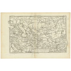
Original 1882 Map of Arabia, Red Sea & Persian Gulf
About the Item
This print is a historically significant map titled "Arabia, the Red Sea, and the Persian Gulf," originally published in 1882 as part of the 'Comprehensive Atlas and Geography of the World.'
The map is characterized by its meticulous detail and the fineness of its engravings, indicative of the high cartographic standards of the late 19th century. It showcases the Arabian Peninsula with geographical features such as mountain ranges, river beds, and desert expanses meticulously plotted. Borders of the time are demarcated in colored outlines, highlighting the territorial divisions known to the world at that time.
Important cities and ports are marked, reflecting the trade routes and strategic locations that were significant for navigation and commerce. The map includes nautical lines indicating sea depths and shipping lanes in the Red Sea and Persian Gulf, emphasizing their importance in global maritime routes. The cartouche in the lower-left corner is elegantly styled, bearing the title in a classic typeface that adds to the antique charm of the piece.
The map's grid lines for latitude and longitude provide a precise framework for the period's navigation and exploration. It is printed on paper that has since aged to a warm tone, with the color palette consisting of subtle yet distinct earth tones for landmasses and a gradient of blues for bodies of water, enhancing its aesthetic and functional value. This map not only serves as a geographical reference but also as a historical artifact, offering insights into the knowledge and perspectives of its time.
- Dimensions:Height: 14.97 in (38 cm)Width: 22.45 in (57 cm)Depth: 0 in (0.02 mm)
- Materials and Techniques:
- Period:
- Date of Manufacture:1882
- Condition:Good condition, folding line in the middle. The outer borders are slightly discolored due to age, but not the image. This map is ideal for framing. Study the image carefully.
- Seller Location:Langweer, NL
- Reference Number:
About the Seller
5.0
Platinum Seller
These expertly vetted sellers are 1stDibs' most experienced sellers and are rated highest by our customers.
Established in 2009
1stDibs seller since 2017
1,922 sales on 1stDibs
Typical response time: <1 hour
- ShippingRetrieving quote...Ships From: Langweer, Netherlands
- Return PolicyA return for this item may be initiated within 14 days of delivery.
More From This SellerView All
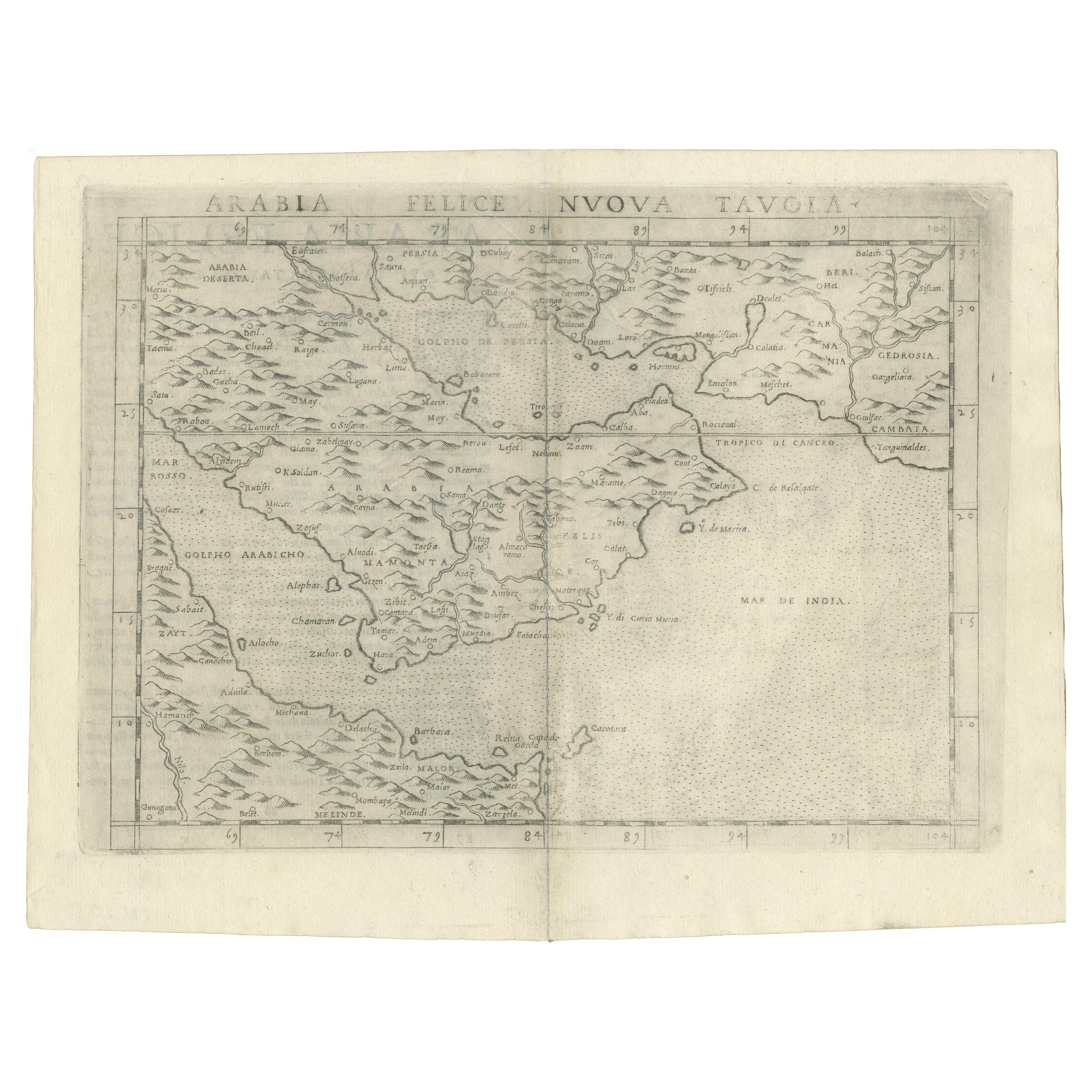
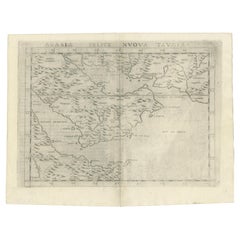
- 16th Century Map of Saudi Arabia, the Persian Gulf and Red Sea, ca. 1574Located in Langweer, NLPtolemaic map of the Arabian Peninsula based on the 1548 map of Giacomo Gastaldi. It covers nearly all of the peninsula, but does not include the head of the Red Sea. The coastlines ...Category
Antique 16th Century Maps
MaterialsPaper
- Original Antique Map of Arabia and the Red SeaLocated in Langweer, NLAntique map titled 'Carte de la Coste d'Arabie (..) - Kaart van de Kust van Arabië (..)'. This is a Dutch version, engraved by J. van Schley, of Bellin's map of Arabia and the Red Se...Category
Antique Mid-18th Century Maps
MaterialsPaper
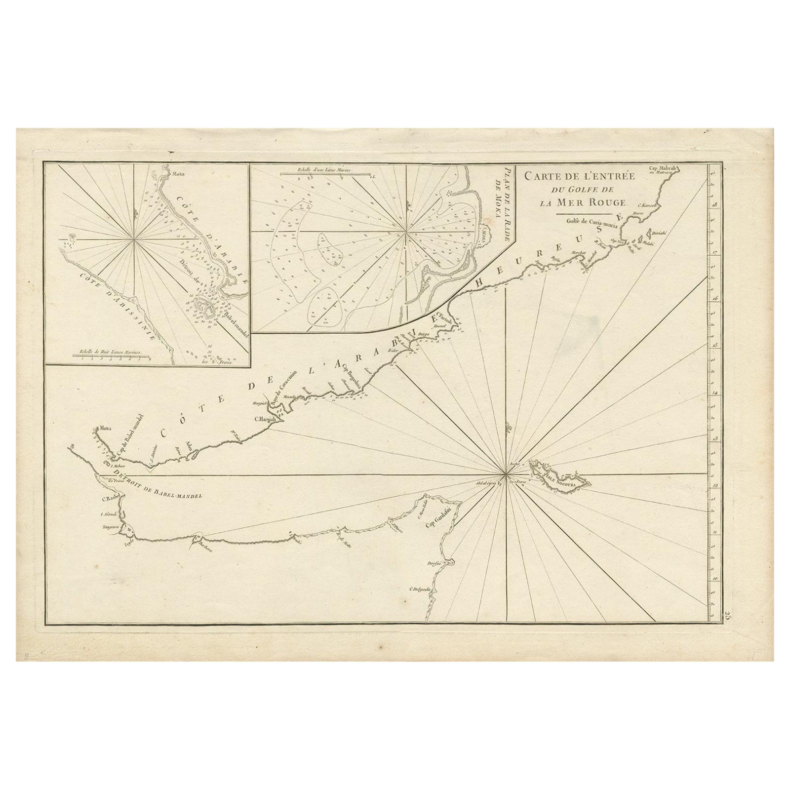
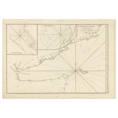
- Original Antique Engraved Map of Part of the Red Sea, Arabia, 1775Located in Langweer, NLAntique map titled 'Carte de l'Entrée du Golfe de la Mer Rouge'. Uncommon sea chart of the entrance to the Red Seas as far as Mocha, with rhumb lines and soundings. Two insets of the...Category
Antique Late 18th Century Maps
MaterialsPaper
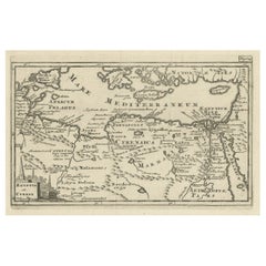
- Original Antique Map of the Region Between the Gulf of Lybia and the Red SeaLocated in Langweer, NLOriginal antique map titled 'Aegyptus et Cyrene'. Detailed ancient map of the region between the Gulf of Lybia and the Red Sea, with marvelous detail along the Mediterranean Coastline and the Nile, Egypt. This map originates from 'Philippi Cluveri Introductionis in universam geographiam (..)' by P. Clüver. Published 1729. Philipp Clüver was an Early Modern German geographer and historian. Cluver's Geography was one of the most enduring works of the 17th & 18th Centuries, issued by several different publishers with many different sets of maps...Category
Antique Early 18th Century Maps
MaterialsPaper
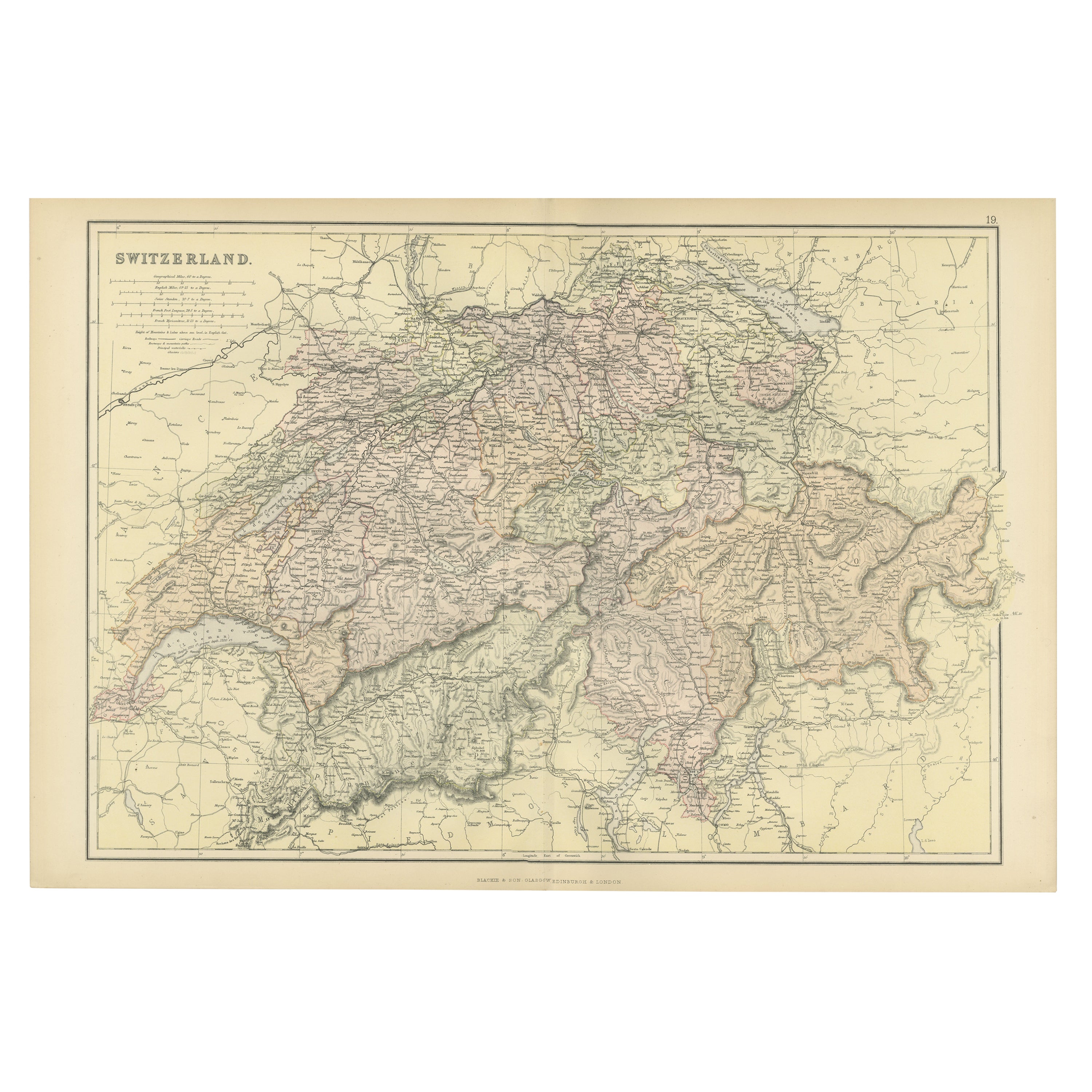
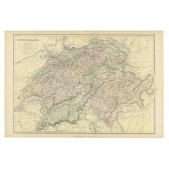
- Original Antique Map of Switzerland, 1882Located in Langweer, NLEmbark on a historical journey with an original Antique Map of Switzerland from the renowned 'Comprehensive Atlas and Geography of the World...Category
Antique 1880s Maps
MaterialsPaper
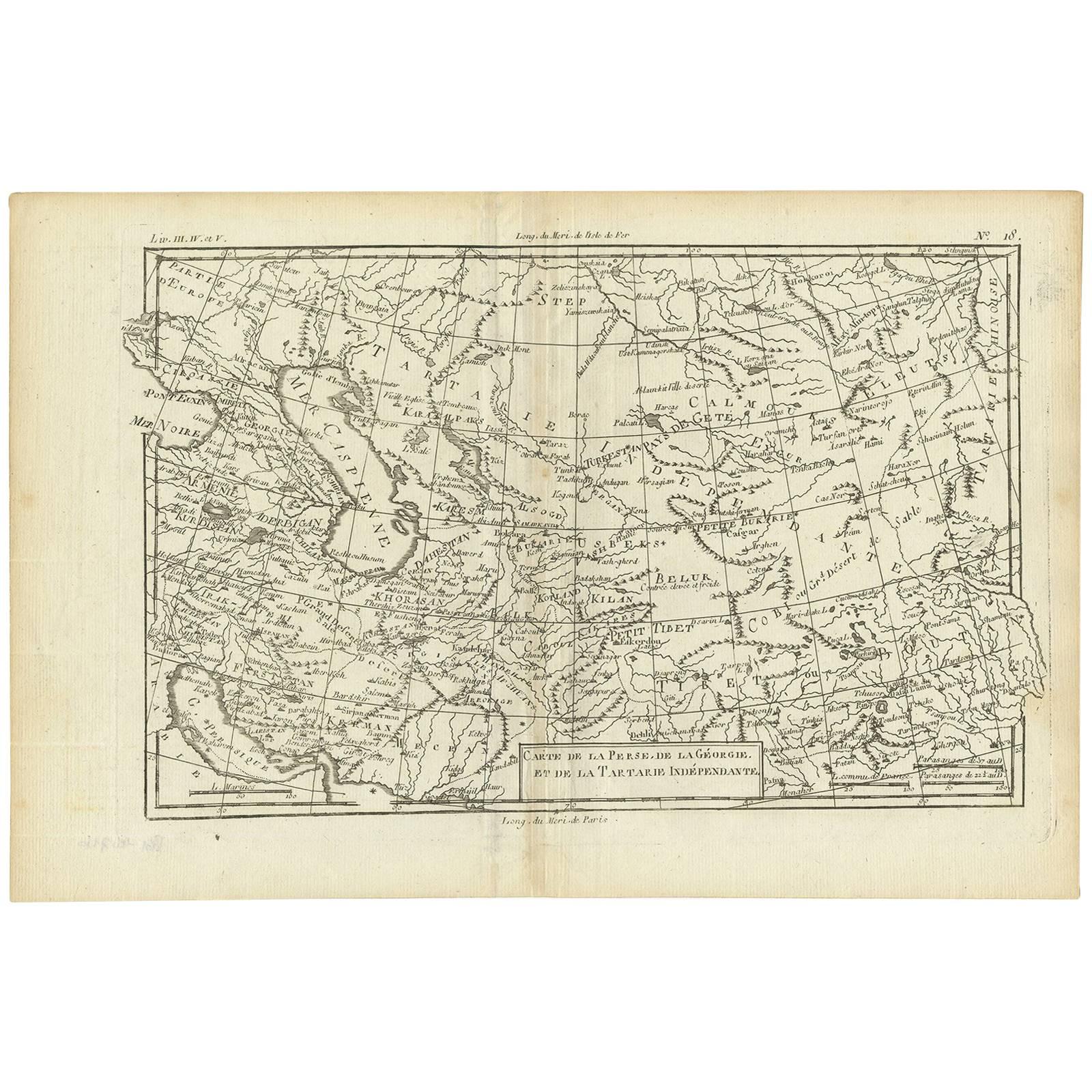
- Antique Map of the Persian Gulf and Caspian Sea Region by R. Bonne, 1780Located in Langweer, NLAntique print titled 'Carte de la Perse, de la Georgie, et de la Tartarie Independante'. Shows the region from the Persian Gulf and Caspian Sea in the wes...Category
Antique Late 18th Century Maps
MaterialsPaper

You May Also Like
- Original Antique Map of Ancient Greece, Phocis, Gulf of Corinth, 1787Located in St Annes, LancashireGreat map of Ancient Greece. Showing the region of Phocis, including the Gulf of Corinth Drawn by J.D. Barbie Du Bocage Copper plate engraving by P.F Tardieu Original hand c...Category
Antique 1780s French Other Maps
MaterialsPaper
- Framed 1838 Mexico & Gulf of Mexico MapLocated in Stamford, CTFramed 1838 Mexico & Gulf of Mexico map. Printed by Fisher, Son & Co. of London in 1838. As found framed condition. Map has not been examined outside of th...Category
Antique 1830s English American Classical Maps
MaterialsGlass, Wood, Paper
- Vintage World Map Mirror Based on the Original by Johnson 1882 Military CampaignLocated in GBWe are delighted to offer for sale this lovely Antique style pictorial plan map of the globe based on the original by Johnson in 1882 This is a very interesting and decorative pie...Category
20th Century English Campaign Maps
MaterialsMirror
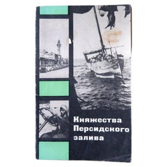
- Vintage Exploration: Realms of the Persian Gulf, 1970, USSR, 1J141Located in Bordeaux, FREmbark on a journey of exploration with this vintage book titled "Княжества Персидского залива" (Realms of the Persian Gulf). Originating from Moscow in the USSR and dating back to 1...Category
Vintage 1970s Books
MaterialsPaper
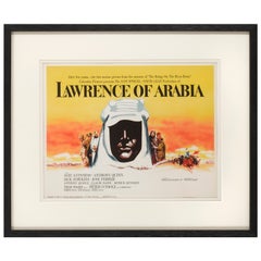
- Lawrence of ArabiaBy Saverio PavoneLocated in London, GBOriginal American Title lobby card for the films US release in 1962. This epic British film is based on the life of T. E. Lawrence. It was directed by David Lean and produced by Sam ...Category
Vintage 1960s American Posters
MaterialsPaper
- Original Antique Map of Italy. C.1780Located in St Annes, LancashireGreat map of Italy Copper-plate engraving Published C.1780 Unframed.Category
Antique Early 1800s English Georgian Maps
MaterialsPaper


Recently Viewed
View AllMore Ways To Browse
Engraved Cross
Collectors And Curiosities
Minature Map
Anguilla Map
James Calvert Smith
Winkler Prins
A Plan City And Castle Of Batavia
Malacca Strait Map
John Speed Isle Of Wight Maps
Antique Map Of Shanghai
Heinrich Kiepert On Sale
Old Teak Petite Artisan
Antique Maps Of Amsterdam
Antique Map Coats Of Arms
Albania Antique Map
Framed Map India
Maps Balkans
Paraguay Antique Map