Items Similar to Framed 1838 Mexico & Gulf of Mexico Map


Want more images or videos?
Request additional images or videos from the seller
1 of 14
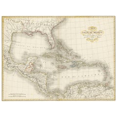
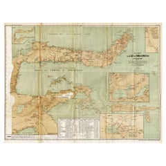
Framed 1838 Mexico & Gulf of Mexico Map
About the Item
Framed 1838 Mexico & Gulf of Mexico map. Printed by Fisher, Son & Co. of London in 1838. As found framed condition. Map has not been examined outside of the frame.
- Dimensions:Height: 14 in (35.56 cm)Width: 16 in (40.64 cm)Depth: 1 in (2.54 cm)
- Style:American Classical (In the Style Of)
- Materials and Techniques:
- Place of Origin:
- Period:
- Date of Manufacture:1838
- Condition:Wear consistent with age and use. As found framed condition, light wear to the frame.
- Seller Location:Stamford, CT
- Reference Number:1stDibs: LU1860319809122
About the Seller
5.0
Platinum Seller
These expertly vetted sellers are 1stDibs' most experienced sellers and are rated highest by our customers.
Established in 2010
1stDibs seller since 2016
393 sales on 1stDibs
Typical response time: 6 hours
- ShippingRetrieving quote...Ships From: Santa Barbara, CA
- Return PolicyA return for this item may be initiated within 2 days of delivery.
More From This SellerView All
- 1830 Mexico and United States Framed MapLocated in Stamford, CTMap of North America published circa 1830. Map shows United States into Canada. Mexico extending into the upper California territory. Texas appears in name but prior to the period of...Category
Antique 1830s American American Classical Maps
MaterialsGlass, Wood, Paper
- Framed 1839 Hand Colored Map of the United StatesLocated in Stamford, CTFramed hand colored map of the United States of America from 1839. Newly framed in a giltwood frame.Category
Antique 1830s American American Classical Maps
MaterialsGiltwood, Paper, Glass
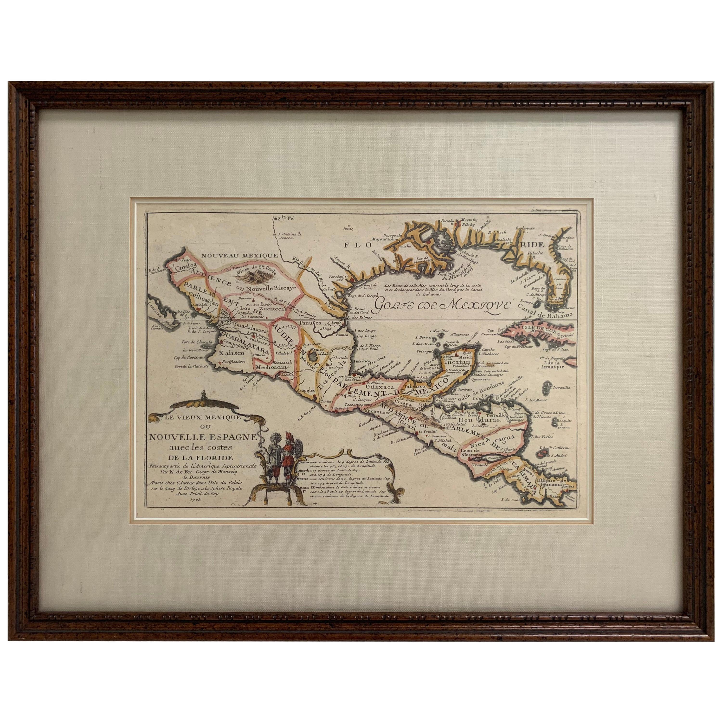
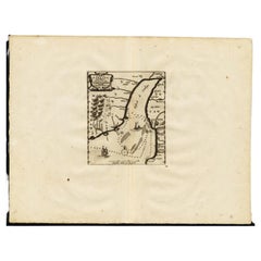
- 1705 Golfe de Mexico and Florida Framed MapLocated in Stamford, CTFramed map of Mexico & Florida circa 1705, Paris. Small map with Mexico and the Gulf Coast. Inset text indicating Panama, Acapulco, Mexico City and the Mississippi. Extends North to ...Category
Antique Early 1700s French Spanish Colonial Maps
MaterialsGlass, Wood, Paper
- Framed 1820s Hand Colored Map of the United StatesLocated in Stamford, CTFramed 1820s hand colored map photos of North America and South America. As found framed in giltwood frame.Category
Antique 1820s American Spanish Colonial Maps
MaterialsGiltwood, Paper, Glass
- Framed Mercator Hondius Hispania Nova Atlas Minor MapLocated in Stamford, CTFramed colored example of this decorative and important minature map. Newly framed in brown wood frame with gold trim. Mercator Hondius “Atlas Minor” pu...Category
Antique 17th Century Dutch Spanish Colonial Maps
MaterialsGlass, Wood, Paper
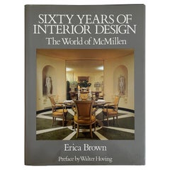
- Sixty Years of Interior Design The World of McMillen Book, 1st EdLocated in Stamford, CTSixty Years of Interior Design: The World of McMillen by Erica Brown. Hardcover, 1st edition. Binding is tight and and there is no visible wear.Category
Vintage 1980s American Hollywood Regency Books
MaterialsPaper


You May Also Like
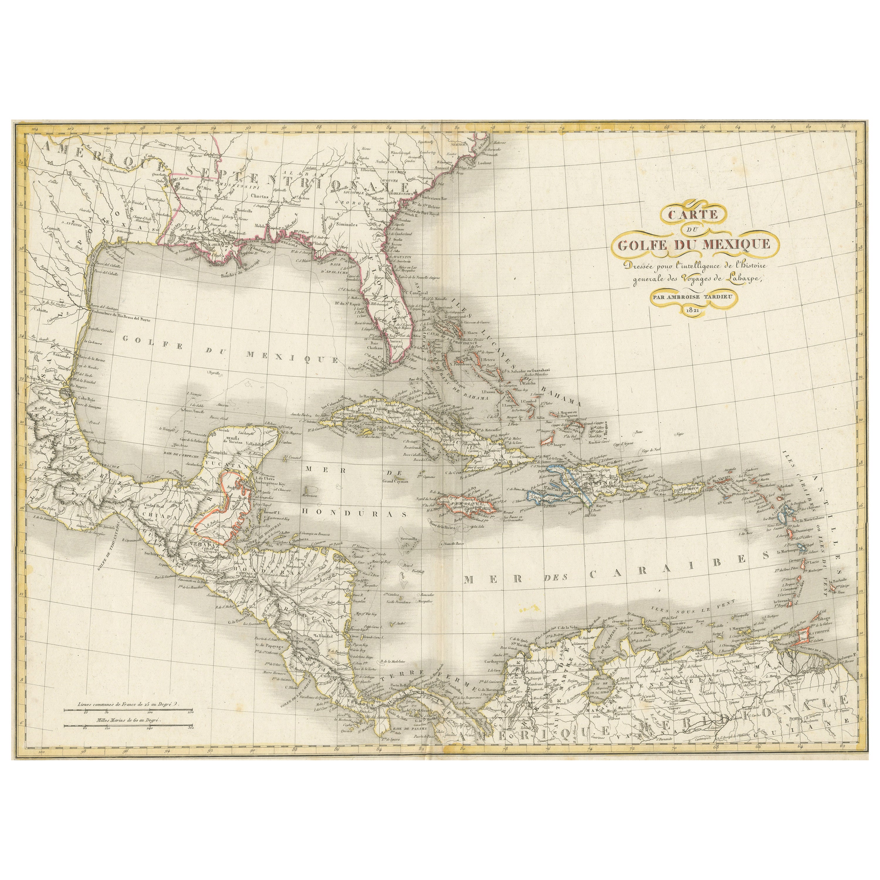
- Antique Map of the Gulf of Mexico and all the islands of the West IndiesLocated in Langweer, NLAntique map titled 'Carte du Golfe du Mexique'. This uncommon map depicts the Gulf of Mexico and all the islands of the West Indies. It also includes ni...Category
Antique Early 19th Century Maps
MaterialsPaper
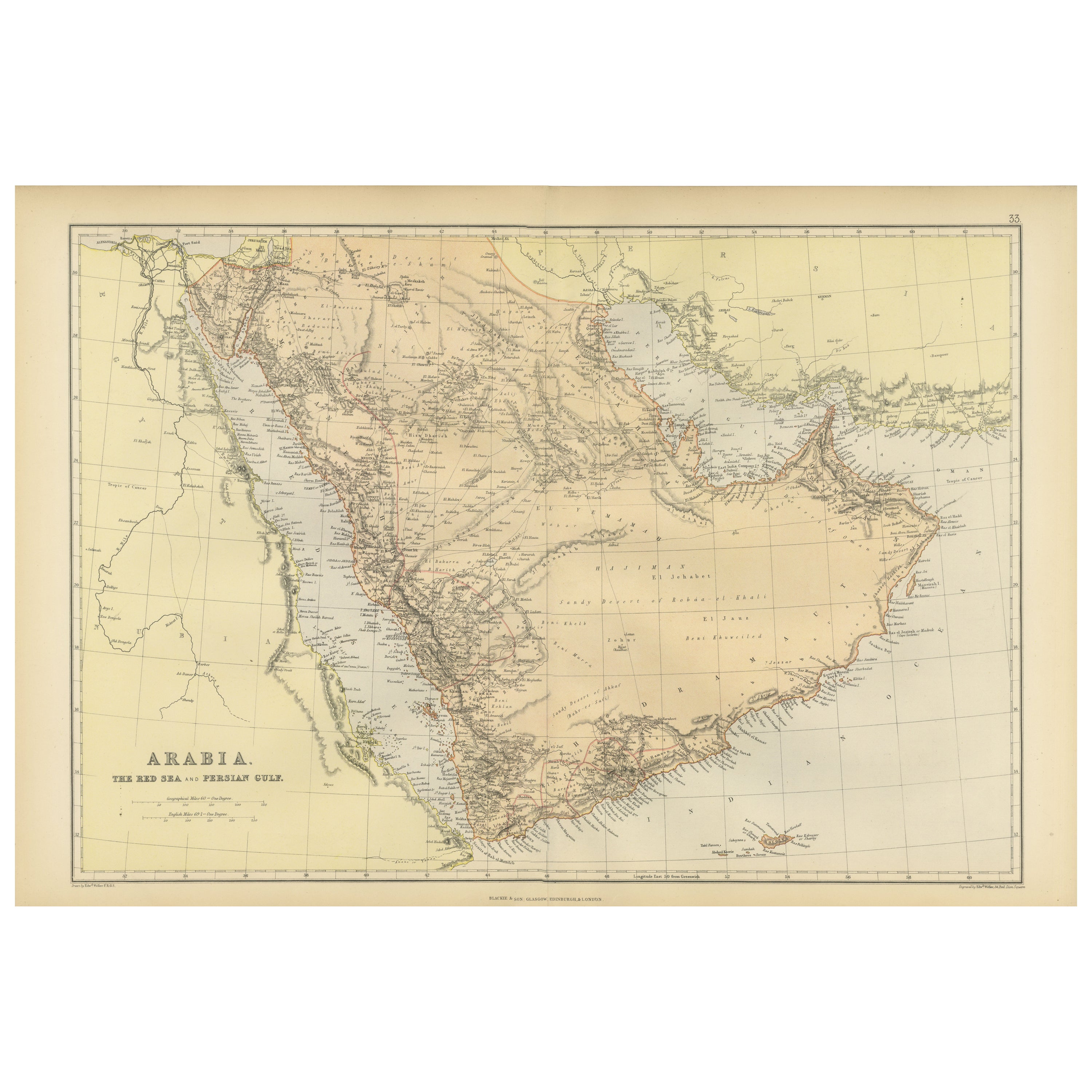
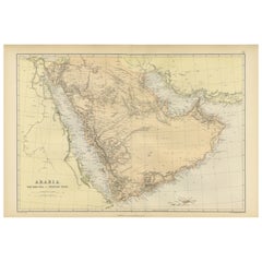
- Original 1882 Map of Arabia, Red Sea & Persian GulfLocated in Langweer, NLThis print is a historically significant map titled "Arabia, the Red Sea, and the Persian Gulf," originally published in 1882 as part of the 'Comprehensive Atlas and Geography of the...Category
Antique 1880s Maps
MaterialsPaper
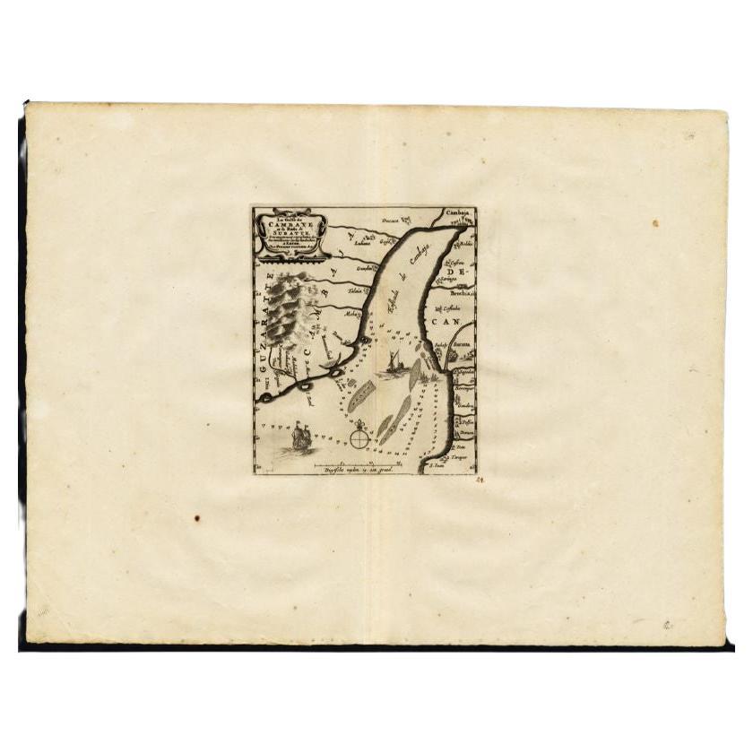
- Antique Map of the Gulf of Cambay, Gujarat, India, 1725By Pieter Van Der AaLocated in Langweer, NLAntique map titled 'Le Golfe de Cambaye at la Rade de Suratt.' (The gulf of Cambay and the coast of Surat, India.) The Gulf of Khambhat, formerly known as the Gulf of Cambay, is an i...Category
Antique 18th Century Maps
MaterialsPaper
- Antique Map of the Region Near the Gulf of Zula, 1870Located in Langweer, NLAntique map titled 'Map of the Country between Annesley Bay and the Plain of Salt'. Lithographed map of the region near the Gulf of Zula, also known as Annesley Bay, Baia di Arafali ...Category
Antique Mid-19th Century Maps
MaterialsPaper
- Antique Map of the Gulf of Tomini by Winkler Prins, 1878Located in Langweer, NLAntique map titled 'Kaart van de Golf van Tomini of Gorontalo.' (Map of the Gulf of Tomini or Gorontalo.) This map shows the Gulf of Tomini near the Island of Sulawesi, Indonesia. Wi...Category
Antique 19th Century Maps
MaterialsPaper
- Original Antique Map of Ancient Greece, Phocis, Gulf of Corinth, 1787Located in St Annes, LancashireGreat map of Ancient Greece. Showing the region of Phocis, including the Gulf of Corinth Drawn by J.D. Barbie Du Bocage Copper plate engraving by P.F Tardieu Original hand c...Category
Antique 1780s French Other Maps
MaterialsPaper


Recently Viewed
View AllMore Ways To Browse
Atlas Relief
1868 Maps
Galicia Map
Antique Maps Sumatra
Santa Cruz Solomon Islands
Original Antique Map Of World
Georg Barque
F V Hayden
Dirk Hartog
Port Antonio Map
Rand Mcnally Map Of California
Rand Mcnally Map Of Colorado
Victor Levasseur On Sale
Map Mozambique
Taiwan Antique Map
Antique Life Buoy
Antique Map Of South Korea
Bolivia Antique Map