Map Mozambique
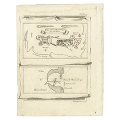
Antique Map of Mozambique Bay and a Map Fort de Mozambique, c.1759
Located in Langweer, NL
Two antique maps on one sheet. The upper antique map is titled 'Plan du Fort de Mozambique tiré de
Category
Antique 18th Century Maps
Materials
Paper
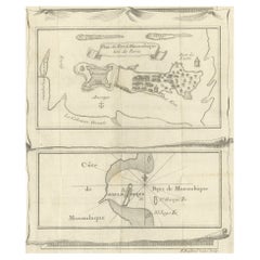
Antique Map of Fort Mozambique and Mozambique Bay in Africa, c.1759
Located in Langweer, NL
Two antique maps on one sheet. The upper antique map is titled 'Plan du Fort de Mozambique tiré de
Category
Antique 18th Century Maps
Materials
Paper
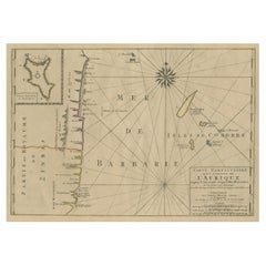
Map of the Mozambique and Tanzania Coast & Inset Map of Anjouan Island, ca.1700
Located in Langweer, NL
Mozambique and Tanzania. With an inset map of Anjouan Island.
Artists and engravers: Published by H
Category
Antique Early 1700s Maps
Materials
Paper
H 20.48 in W 24.81 in D 0 in
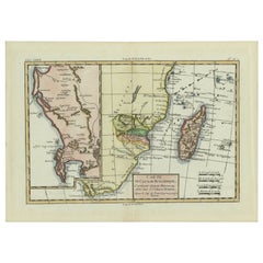
Antique Map of Mozambique Channel with Madagascar and Inset of Cape Region, 1780
Located in Langweer, NL
d'Afrique.' Map of Mozambique Channel, containing the Island of Madagascar with the coasts of Africa from
Category
Antique 18th Century Maps
Materials
Paper
H 14.97 in W 10.24 in D 0 in
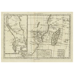
Antique Map of Mozambique and Cape of Good Hope with Kingdom Monomotapa, 1780
Located in Langweer, NL
Antique map titled 'Carte Du Canal De Mozambique.' The main map, on the right, covers from the Cape
Category
Antique 18th Century Maps
Materials
Paper
H 14.69 in W 10.44 in D 0 in
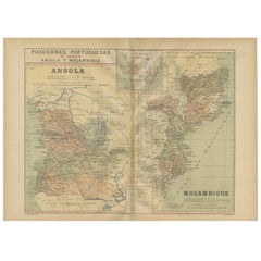
Colonial Crossroads: Angola and Mozambique in 1903
Located in Langweer, NL
The image for sale is an original historical map from 1903 that shows the Portuguese colonies of
Category
Antique Early 1900s Maps
Materials
Paper
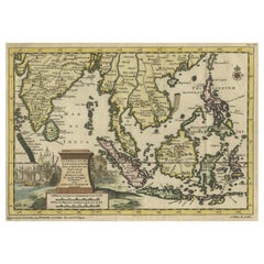
Striking Antique Map Centered on the Malay Peninsula
By Pieter Van Der Aa
Located in Langweer, NL
Antique map titled 'D'Indiaanze Landschappen Zeen en Eylanden, van Couchin af tot in de Moluccos
Category
Antique Early 18th Century Maps
Materials
Paper
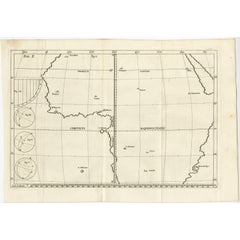
Remarkable Antique Map of Central Africa by Scherer, c.1703
Located in Langweer, NL
Untitled map of Central Africa depicting Tarodant, Lempta, Guber, Borno, Chaxumo, Tombut, Melegvete
Category
Antique 18th Century Maps
Materials
Paper
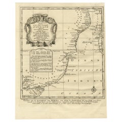
Original Detailed Antique Map of the East Coast of Africa, 1747
Located in Langweer, NL
Antique map titled 'Carte de la coste Orientale d'Afrique - Kaart van de Oostkust van Afrika
Category
Antique 1740s Maps
Materials
Paper
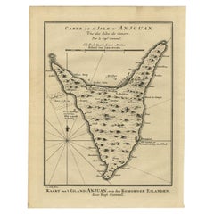
Antique Map of Anjouan or Ndzuani Island, Part of The Comoros, 1749
Located in Langweer, NL
Antique map titled ‘Carte de L’Isle D’Anjouan - Kaart van 't Eiland Anjouan’. Original antique map
Category
Antique 18th Century Maps
Materials
Paper
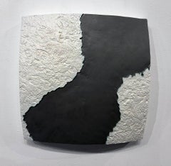
"Choke II: Mozambique Channel (Madagascar & Mozambique)" - ceramic - map
By Gregor Turk
Located in Atlanta, GA
This ceramic wall sculpture features a topographic map in black and white.
Gregor is inspired by
Category
2010s Abstract Sculptures
Materials
Ceramic
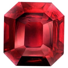
Emilio Jewelry Certified 10.00 Carat Mozambique No Heat Ruby
By Emilio!
Located in New York, NY
rubies of Mozambique. Following the mining of Gemfields, a well-known mining company, Australia’s Mustang
Category
21st Century and Contemporary Three-Stone Rings
Materials
Ruby
''Local Beauties 3 - Ilha do Ibo'' Color etching of woman in Mozambique, Travel
Located in Utrecht, NL
flora and fauna, architecture and culture, landscapes and maps. Together they give an idea of the area
Category
2010s Contemporary Figurative Prints
Materials
Etching
H 13 in W 13 in D 1.19 in
Original Vintage Poster Illustrated Map Madagascar French Colony Industry Travel
Located in London, GB
illustrated map showing the various places on a road route, the cities and towns marked with the highlands and
Category
Vintage 1930s French Posters
Materials
Paper
H 47.25 in W 31.5 in D 0.04 in
Original Vintage Poster Illustrated Map Madagascar French Colony Industry Travel
Located in London, GB
illustrated map showing the various places on a road route, the cities and towns marked with the highlands and
Category
1930s More Prints
Materials
Paper
People Also Browsed
Maharam Bear by PIN-UP
By Maharam, PIN-UP Magazine
Located in New York, NY
Maharam Bear by PIN-UP
001 Terracotta
Initially created for PIN–UP’s Fall/Winter 2016/2017 issue, the Bear is handmade by a small-scale Canadian producer from Loam, a high-qualit...
Category
21st Century and Contemporary Canadian Modern Models and Miniatures
Materials
Leather
Maharam Bear by PIN-UP
By Maharam, PIN-UP Magazine
Located in New York, NY
Maharam Bear by PIN-UP
008 Nightfall
Initially created for PIN–UP’s Fall/Winter 2016/2017 issue, the Bear is handmade by a small-scale Canadian producer from Loam, a high-quality...
Category
21st Century and Contemporary Canadian Modern Models and Miniatures
Materials
Leather
Antique Map of Switzerland by N. Visscher, circa 1690
Located in Langweer, NL
Beautifully detailed map of Switzerland and surrounding regions in present-day France, Germany, and Italy. This map features two decorative cartouches: the larger is flanked by two p...
Category
Antique Late 17th Century Maps
Materials
Paper
Maharam Bear by Pin-Up
By PIN-UP Magazine, Maharam
Located in New York, NY
Maharam Bear by Pin-up
003 Harbor
Initially created for Pin–up’s Fall/Winter 2016/2017 issue, the Bear is handmade by a small-scale Canadian producer from Loam, a high-quality Itali...
Category
21st Century and Contemporary Canadian Modern Models and Miniatures
Materials
Leather
Antique Print of the Fortress Cranganor near Kodungallur in India, 1757
Located in Langweer, NL
Antique print of the Fortress Cranganor, nowadays known by the name Kodungallor. French and Dutch title including scale and compass rose. This print originates from 'L'Histoire génér...
Category
Antique Mid-18th Century Prints
Materials
Paper
Free Shipping
H 13.39 in W 16.54 in D 0 in
Antique Map of Herefordshire 'England' by R. Morden, 1708
Located in Langweer, NL
This antique County map of Herefordshire by Robert Morden was first published in 1701 in a work entitled 'The New Description and State of England', however, a subsequent edition by ...
Category
Antique Early 18th Century Maps
Materials
Paper
Maharam Bear by Pin-Up
By PIN-UP Magazine, Maharam
Located in New York, NY
Maharam bear by Pin-Up
004 Ivy
Initially created for Pin-Up’s Fall/Winter 2016-2017 issue, the Bear is handmade by a small-scale Canadian producer from Loam, a high-quality Italian ...
Category
21st Century and Contemporary Canadian Modern Models and Miniatures
Materials
Leather
Maharam Bear by PIN-UP
By Maharam, PIN-UP Magazine
Located in New York, NY
Maharam bear by PIN-UP
006 Flagstone
Initially created for PIN–UP’s Fall/Winter 2016/2017 issue, the Bear is handmade by a small-scale Canadian producer from Loam, a high-quality...
Category
21st Century and Contemporary Canadian Modern Models and Miniatures
Materials
Leather
Antique Map of the Island of Java, Indonesia by P. Van Der Aa, 1713
Located in Langweer, NL
This rare map shows the Indonesian island of Java. With compass rose and scale. From: Nouvel Atlas, très exact et fort commode pour toutes sortes de personnes, Contenant Les Principa...
Category
Antique Early 18th Century Maps
Materials
Paper
Antique Map of Greece by Allard (c.1698)
Located in Langweer, NL
Antique map titled 'Hellas seu Graecia Universa' Detailed map of Greece, with Crete, the Aegean Islands, and part of Turkey. With two cartouches, compass rose and scale. Carolus Alla...
Category
Antique Late 17th Century Maps
Materials
Paper
Vintage English Sterling Silver Mounted Glass Claret Jug and Matching Goblets
By Anthony Gordon Elson
Located in Jesmond, Newcastle Upon Tyne
An exceptional, fine and impressive vintage Elizabeth II English sterling silver and glass claret jug with matching goblets made by Anthony Elson, an addition to our range of collect...
Category
Vintage 1970s English Pitchers
Materials
Silver, Sterling Silver
Antique Map of the Gulf of Bengal by J.N. Bellin, circa 1760
Located in Langweer, NL
Beautiful chart of the Gulf of Bengal. The map extends from Malabar to Sumatra and today Phuket area in Thailand. Including Pegu, Ceylon, and the Andaman and Nicobar Islands. Numerou...
Category
Antique Mid-18th Century Maps
Materials
Paper
Maximalist Four-Panel Hand Painted Screen, After Jean Cocteau, 1950s
By Jean Cocteau
Located in Miami, FL
A striking surrealist hand painted floor screen comprised of four canvas panels with profiles centering a "visage de faune" (faun's face), a frequent subject of Cocteau's art. The mo...
Category
Vintage 1950s French Modern Screens and Room Dividers
Materials
Brass
Ken Beldin Vintage Jewelry Made in Mexico, Abstract Copper Pin, Signed
By Ken Beldin
Located in Phoenix, AZ
Beautiful vintage copper pin created in Mexico
By ex-patriate artist Ken Beldin 1940s and 1950s.
Measures: 3.5" H x 1.75" W
Signed on the back: Beldin & Mexico.
In excellent vint...
Category
Mid-20th Century Mexican Collectible Jewelry
Materials
Copper
Black Forest Walnut Bear Umbrella Stand
Located in New York, NY
Rustic Black Forest (19th Century) walnut carved bear umbrella stand holding leaf shaped dish
Category
Antique 19th Century German Black Forest Umbrella Stands
Materials
Walnut
Five Mechanical Bank Trade Cards in Frame, circa 1880s
By J. & E. Steven's Company
Located in Incline Village, NV
Five mechanical bank trade cards are displayed in two separate frames. In one frame are three polychrome trade cards, which the salesmen typically carried with them in a catalogue to...
Category
Antique 19th Century American Folk Art Toys and Dolls
Materials
Paper
Recent Sales
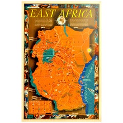
Original Vintage Poster Map East Africa Kenya Uganda Tanganyika Zanzibar Coast
Located in London, GB
Original vintage poster map for East Africa with information on the British settlements and
Category
Vintage 1940s British Posters
Materials
Paper
H 29.93 in W 19.89 in D 0.04 in
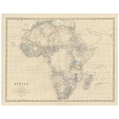
Antique Map of Africa by A.K. Johnston, 1865
Located in Langweer, NL
Antique map titled 'Africa'. Depicting the Sahara, Morocco, Egypt, Nigeria, Cape Colony, Mozambique
Category
Antique Mid-19th Century Maps
Materials
Paper
Antique Map of Aden, Mombasa, Kilwa and Sofala by Braun & Hogenberg, circa 1575
By Georg Braun and Frans Hogenberg
Located in Langweer, NL
, Tanzania) and Sofala (Cefala, Mozambique). This map originates from 'Civitates Orbis Terrarum' by Braun
Category
Antique 16th Century European Maps
Materials
Paper
H 16.15 in W 21.26 in D 0.02 in
Original Vintage Poster Map East Africa Kenya Uganda Tanganyika Zanzibar Coast
Located in London, GB
Original vintage poster map for East Africa with information on the British settlements and
Category
1940s More Prints
Materials
Paper
Get Updated with New Arrivals
Save "Map Mozambique", and we’ll notify you when there are new listings in this category.
Map Mozambique For Sale on 1stDibs
Find many varieties of an authentic map mozambique available at 1stDibs. Each map mozambique for sale was constructed with extraordinary care, often using paper. Your living room may not be complete without a map mozambique — find older editions for sale from the 18th Century and newer versions made as recently as the 20th Century. A well-made map mozambique has long been a part of the offerings for many furniture designers and manufacturers, but those produced by Pieter Van Der Aa are consistently popular.
How Much is a Map Mozambique?
A map mozambique can differ in price owing to various characteristics — the average selling price 1stDibs is $528, while the lowest priced sells for $120 and the highest can go for as much as $1,350.
More Ways To Browse
Burmese Star Ruby No Heat
Burma Star Ruby No Heat
Antique Yemen
Pigeon Blood Ssef
Ssef Pigeon
Mozambique Antique Map
Tanzania Antique Map
Map Zanzibar
Rolf Weijburg
Antique Map Vietnam
Antique Barbie Furniture
Antique Puerto Rico Map
Antique Minnesota Map
Antique Maps Scandinavia
Antique Map Of Michigan
Antique Map Of Puerto Rico
Antique Map Of Argentina
Maltese Falcon
