Items Similar to Colonial Crossroads: Angola and Mozambique in 1903

Want more images or videos?
Request additional images or videos from the seller
1 of 6
Colonial Crossroads: Angola and Mozambique in 1903
About the Item
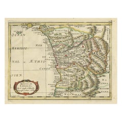
The image for sale is an original historical map from 1903 that shows the Portuguese colonies of Angola on the left and Mozambique on the right. These two territories on the African continent were major parts of Portugal's overseas empire.
Angola and Mozambique are unique for various reasons:
**Angola:**
1. **Rich Natural Resources**: Angola is known for its abundant natural resources, including oil, diamonds, and minerals.
2. **Biodiversity**: The country has diverse ecosystems ranging from the Atlantic coastline to savanna and rainforests in the interior.
3. **Cultural Diversity**: Angola is home to a wide range of ethnic groups, each with their own languages and customs.
4. **Colonial Architecture**: The capital city, Luanda, features Portuguese colonial architecture alongside modern developments.
**Mozambique:**
1. **Stunning Coastline**: Mozambique's coastline is dotted with breathtaking beaches, coral reefs, and is a popular destination for water sports like diving and fishing.
2. **Cultural Melting Pot**: The country has a rich cultural heritage with influences from the Bantu peoples, Portuguese, and other immigrant groups.
3. **Wildlife**: Mozambique's conservation areas, like the Gorongosa National Park, are making a comeback and are home to a variety of wildlife species.
4. **Historic Trade Centers**: The island of Mozambique, a UNESCO World Heritage site, was an ancient trading port and has historical significance dating back to the era of Arab trade in the Indian Ocean.
Both countries have complex histories, marked by the struggle for independence from colonial rule and civil conflicts that followed. However, today, they are known for their efforts in rebuilding, conservation, and cultural richness.
- Dimensions:Height: 14.77 in (37.5 cm)Width: 20.08 in (51 cm)Depth: 0 in (0.02 mm)
- Materials and Techniques:
- Period:1900-1909
- Date of Manufacture:1903
- Condition:Good condition. Central vertical folding lines as issued. Aged paper with typically warm, yellowish-brown hue, especially around the edges and folding lines, adding to its patina. Check the images carefully.
- Seller Location:Langweer, NL
- Reference Number:
About the Seller
5.0
Platinum Seller
These expertly vetted sellers are 1stDibs' most experienced sellers and are rated highest by our customers.
Established in 2009
1stDibs seller since 2017
1,928 sales on 1stDibs
Typical response time: <1 hour
- ShippingRetrieving quote...Ships From: Langweer, Netherlands
- Return PolicyA return for this item may be initiated within 14 days of delivery.
More From This SellerView All
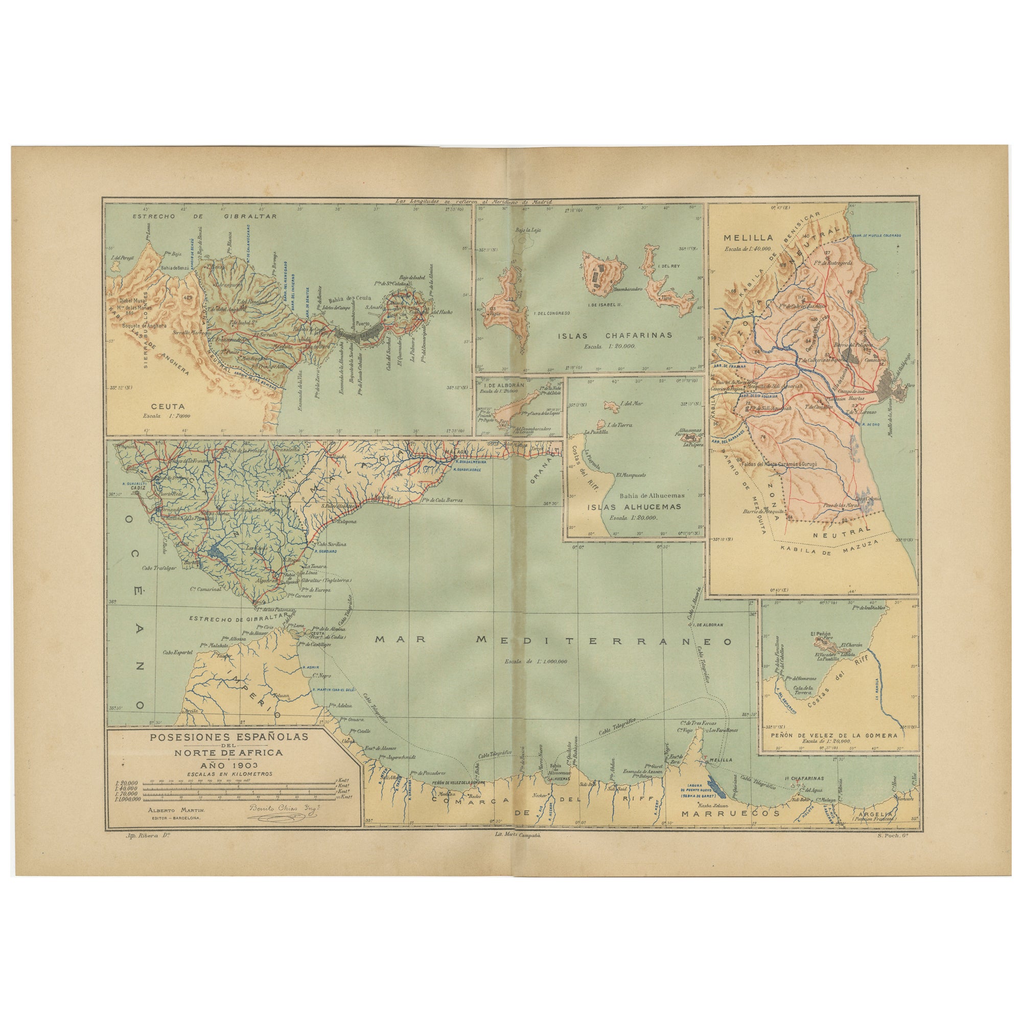
- Crossroads of Continents: Spain's North African Enclaves in 1903Located in Langweer, NLThe image for sale is a historical map of Spanish possessions in North Africa, dated 1903. The map includes the enclaves of Ceuta and Melilla, the Chafarinas Islands, the Alhucemas I...Category
Antique Early 1900s Maps
MaterialsPaper
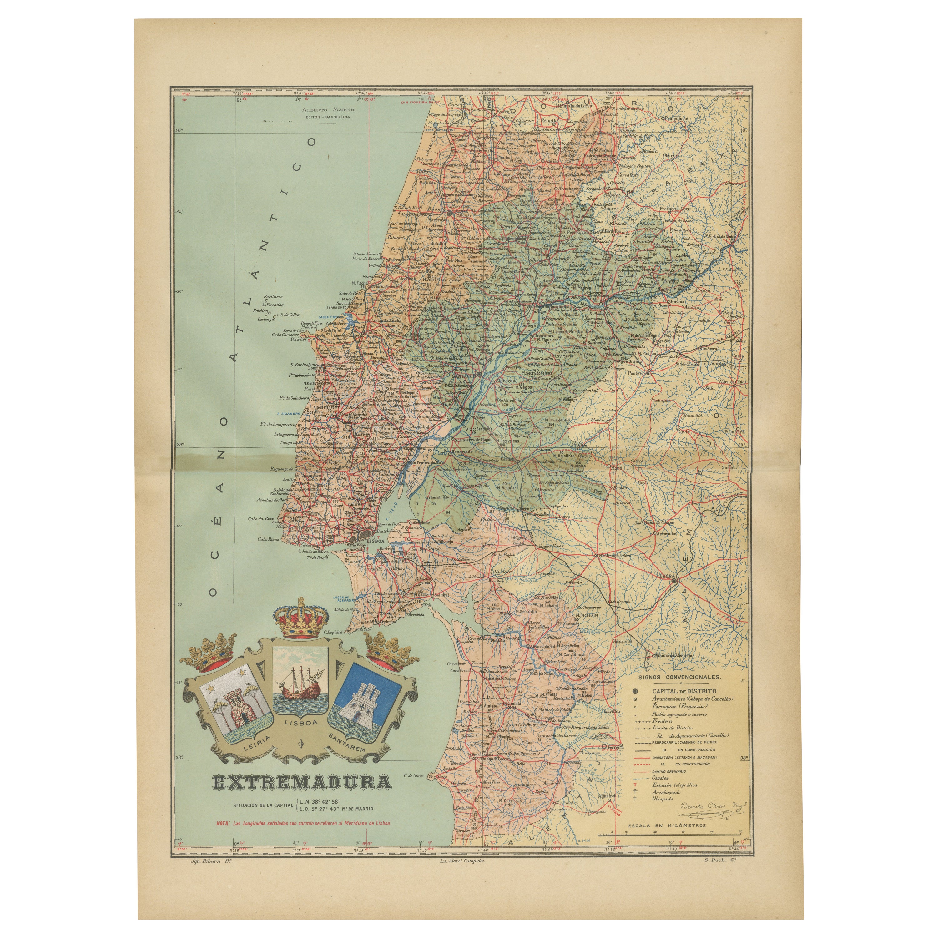
- An Antique Map of Extremadura: Crossroads of History and Nature, 1903Located in Langweer, NLThe image is a historical map of Extremadura, an autonomous community of Spain, from an unspecified year. The map features the region's topography, including mountain ranges, river s...Category
Antique Early 1900s Maps
MaterialsPaper
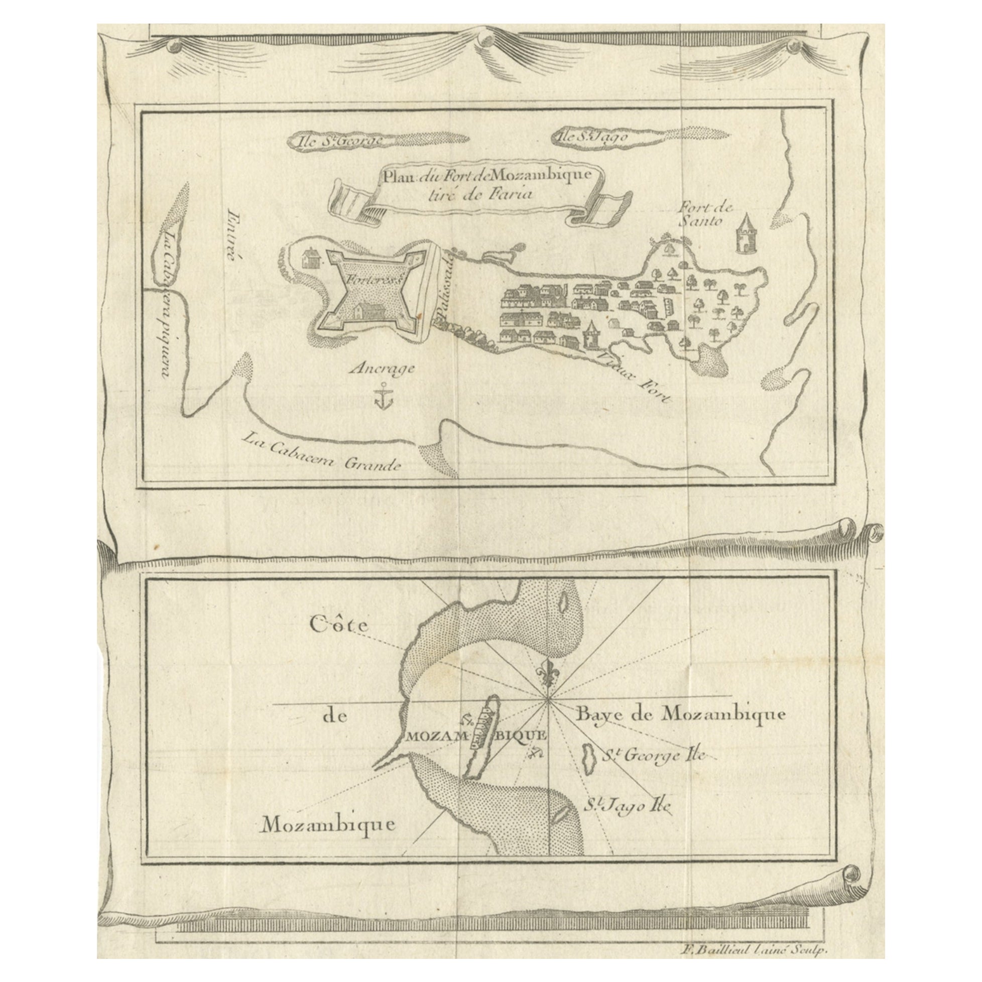
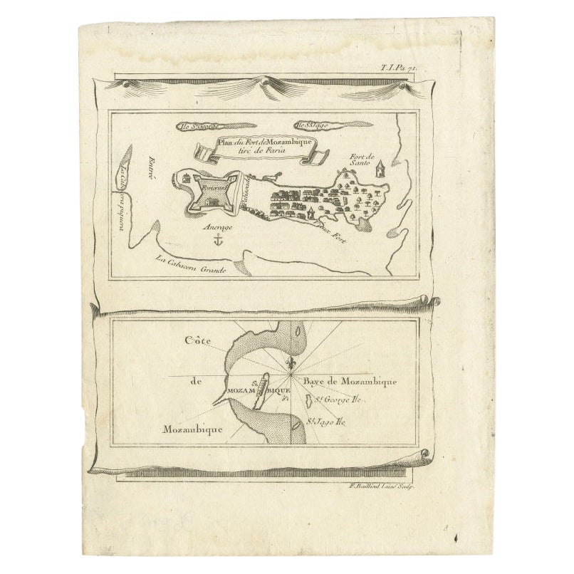
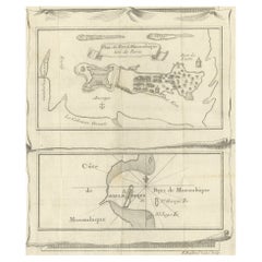
- Antique Map of Fort Mozambique and Mozambique Bay in Africa, c.1759Located in Langweer, NLTwo antique maps on one sheet. The upper antique map is titled 'Plan du Fort de Mozambique tiré de Faria' and depicts the island of Mozambique with its fort, settlement, harbor and i...Category
Antique 18th Century Maps
MaterialsPaper
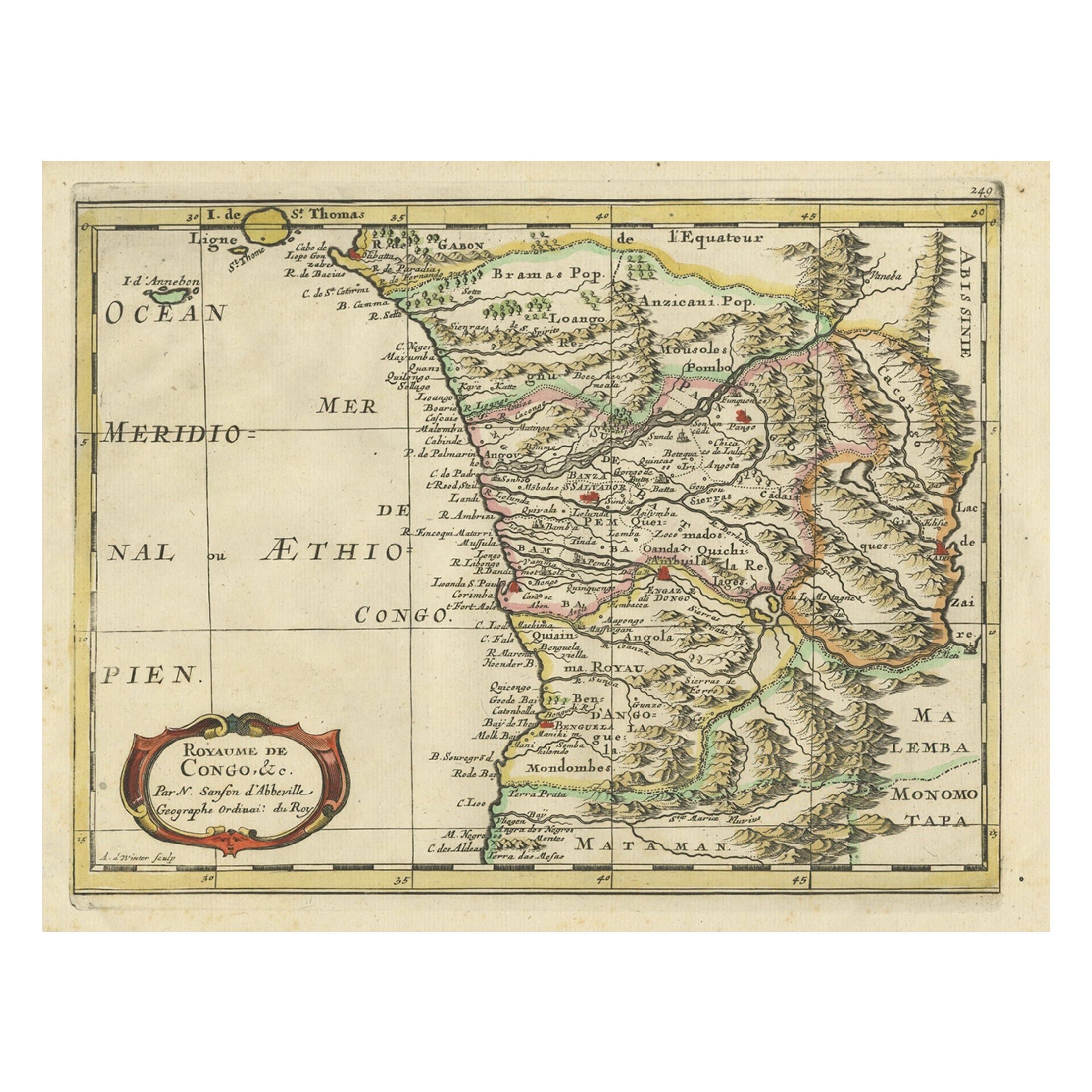
- Antique Map of Gabon, Angola and the Congo Region in Africa c.1680Located in Langweer, NLAntique map titled 'Royaume de Congo'. Map of Gabon, the Congo and Angola from Cape Lopez and Sao Tomé to approximately the border with present-day Namibia. The map is fully engrav...Category
Antique 17th Century Maps
MaterialsPaper
- Antique Map of Mozambique Bay and a Map Fort de Mozambique, c.1759Located in Langweer, NLTwo antique maps on one sheet. The upper antique map is titled 'Plan du Fort de Mozambique tiré de Faria' and depicts the island of Mozambique with its fort, settlement, harbor and i...Category
Antique 18th Century Maps
MaterialsPaper
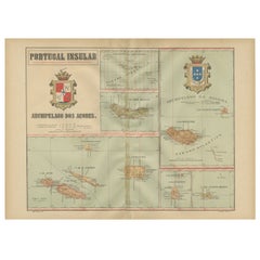
- Atlantic Eden: The Azores and Madeira Archipelagos in 1903Located in Langweer, NLThis original antique print is a historical map titled "PORTUGAL INSULAR," which translates to "Insular Portugal." It shows the Portuguese archipelagos of the Azores and Madeira, wit...Category
Antique Early 1900s Maps
MaterialsPaper
You May Also Like
- Jean-Michel Basquiat CrossroadsBy Rizzoli International PublicationsLocated in New York, NYAuthor Lee Jaffe, Foreword by Franklin Sirmans, Contributions by J. Faith Almiron A rare and poignant compilation of photography and written anecdotes by American photographer and...Category
21st Century and Contemporary Books
MaterialsPaper
- 1903 Happy EnglandBy Helen AllinghamLocated in Bath, GBA beautiful, signed, limited edition work showcasing Helen Allingham's watercolour paintings of England. The Deluxe Edition. Limited to 750 copies, this being number 396. Signed by ...Category
Antique Early 1900s British Books
MaterialsPaper
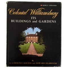
- Colonial Williamsburg Its Buildings and GardensLocated in valatie, NYColonial Williamsburg : Its Buildings And Gardens; A Descriptive Tour Of The Restored Capital Of The British Colony Of Virginia. Distributed by Holt, Rinehart and Winston, New York, ...Category
Vintage 1970s American Books
MaterialsPaper
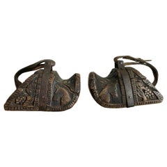
- Spanish Colonial Carved Wood and Iron StirrupsLocated in Stamford, CTFantastic pair of 18th-19th century South American carved wooden stirrups. Known as estribos, each are carved from a solid block of wood. Decorated with wonderful carvings of horse heads and grape vines, these are truly charming pieces of Folk Art. With wrought iron stirrup rings and the original leather straps. Rich chocolate patina that only comes from age and use. Worn by Chilean huasos, highly skilled horsemen akin to America's cowboys. Prized by collectors of horse memorabilia...Category
Antique Early 19th Century Chilean Spanish Colonial Sculptures and Carvings
MaterialsWood
- 1903 The Works of Arthur Conan DoyleLocated in Bath, GBA limited edition set of the collected works of Sir Arthur Conan Doyle, an illustrated set signed by Conan Doyle. A limited edition of one-thousand copies, of which this is numbered...Category
Antique Early 1900s British Books
MaterialsPaper
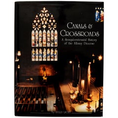
- Canals & Crossroads An illustrated History of Albany, NY Roman Catholic DioceseLocated in valatie, NYCanals & Crossroads: An illustrated History of Albany, New York Roman Catholic Diocese. Albany Catholic Press Association, Incorporated, 1997. Stated fi...Category
1990s American Books
MaterialsPaper

Recently Viewed
View AllMore Ways To Browse
Map Of Old Armenia
Teak Wood Sphere
Nova Guinea Maps
Antique Map Of Illinois
Petite Point Hand Bag
Antique Map Of Southeastern Us
Antique Map Alabama
Antique Map Of Sydney
Malay Archipelago Map
Gambia Antique Map
Uruguay Antique Map
Guyana Antique Map
Ruscelli Map
Masque Theatre No
Nova Scotia Map
Antique Map Tuscany
Berkshire Antique Map
Cornwall Map