Items Similar to Atlantic Eden: The Azores and Madeira Archipelagos in 1903
Want more images or videos?
Request additional images or videos from the seller
1 of 9
Atlantic Eden: The Azores and Madeira Archipelagos in 1903
About the Item
This original antique print is a historical map titled "PORTUGAL INSULAR," which translates to "Insular Portugal." It shows the Portuguese archipelagos of the Azores and Madeira, with detailed insets for each major island such as São Miguel, Terceira, Faial, Pico, São Jorge, Graciosa, Flores, Corvo, Madeira, and Porto Santo.
These archipelagos are special for various reasons:
**The Azores (Arquipélago dos Açores):**
1. **Geothermal and Volcanic Activity**: The Azores are situated over the meeting point of three tectonic plates, leading to notable geothermal and volcanic activity, with hot springs and geysers, especially on São Miguel.
2. **Biodiversity and Nature**: The islands are known for their lush, green landscapes, dramatic cliffs, and diverse marine life, which makes it a popular spot for whale watching.
3. **Cultural Heritage**: The Azores have a rich history, reflected in the architecture, festivals, and traditions that are unique to the islands.
4. **Agriculture**: The islands are also known for dairy farming and the production of the famous São Jorge cheese.
**Madeira Archipelago (Arquipélago da Madeira):**
1. **Subtropical Climate**: Madeira enjoys a year-round mild climate, which has made it a popular destination for tourists seeking a temperate getaway.
2. **Levadas and Hiking**: The network of levadas (irrigation channels) provides unique hiking trails through stunning landscapes and ancient laurel forests.
3. **Flora and Fauna**: Madeira is famous for its rich botanical gardens, exotic flowers, and birdlife.
4. **Madeira Wine**: The island is renowned for its namesake wine, a fortified wine that has been produced there for centuries.
- Dimensions:Height: 14.77 in (37.5 cm)Width: 20.08 in (51 cm)Depth: 0 in (0.02 mm)
- Materials and Techniques:
- Period:1900-1909
- Date of Manufacture:1903
- Condition:Good condition. Central vertical folding lines as issued. Aged paper with typically warm, yellowish-brown hue, especially around the edges and folding lines, adding to its patina. Check the images carefully.
- Seller Location:Langweer, NL
- Reference Number:
About the Seller
5.0
Platinum Seller
These expertly vetted sellers are 1stDibs' most experienced sellers and are rated highest by our customers.
Established in 2009
1stDibs seller since 2017
1,928 sales on 1stDibs
Typical response time: <1 hour
- ShippingRetrieving quote...Ships From: Langweer, Netherlands
- Return PolicyA return for this item may be initiated within 14 days of delivery.
More From This SellerView All
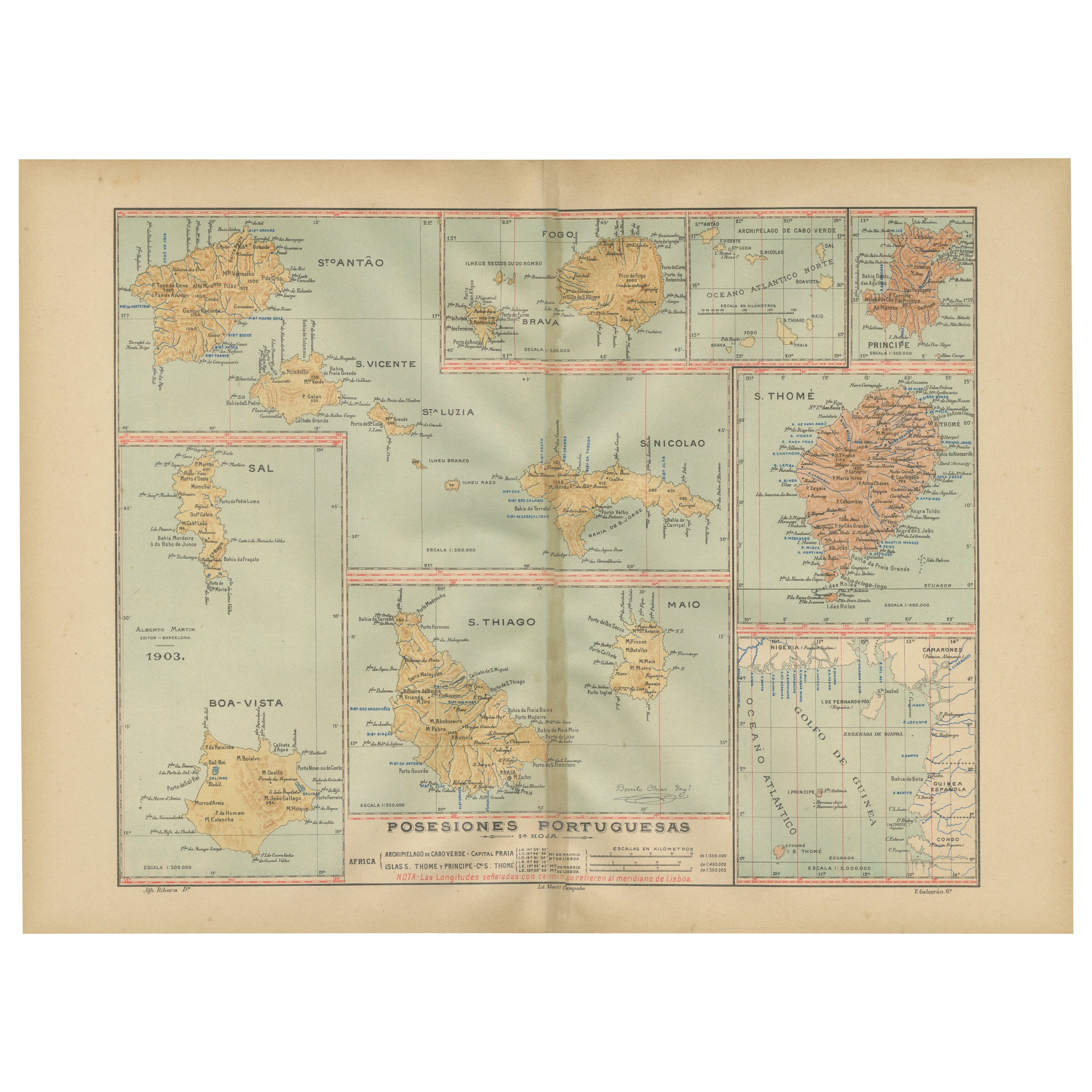
- Islands of Diversity: Portugal's Atlantic Archipelagos in 1903Located in Langweer, NLThe image is an original historical map from 1903 depicting Portuguese possessions in the Atlantic Ocean, specifically the islands of Cape Verde and the islands of São Tomé and Prínc...Category
Antique Early 1900s Maps
MaterialsPaper
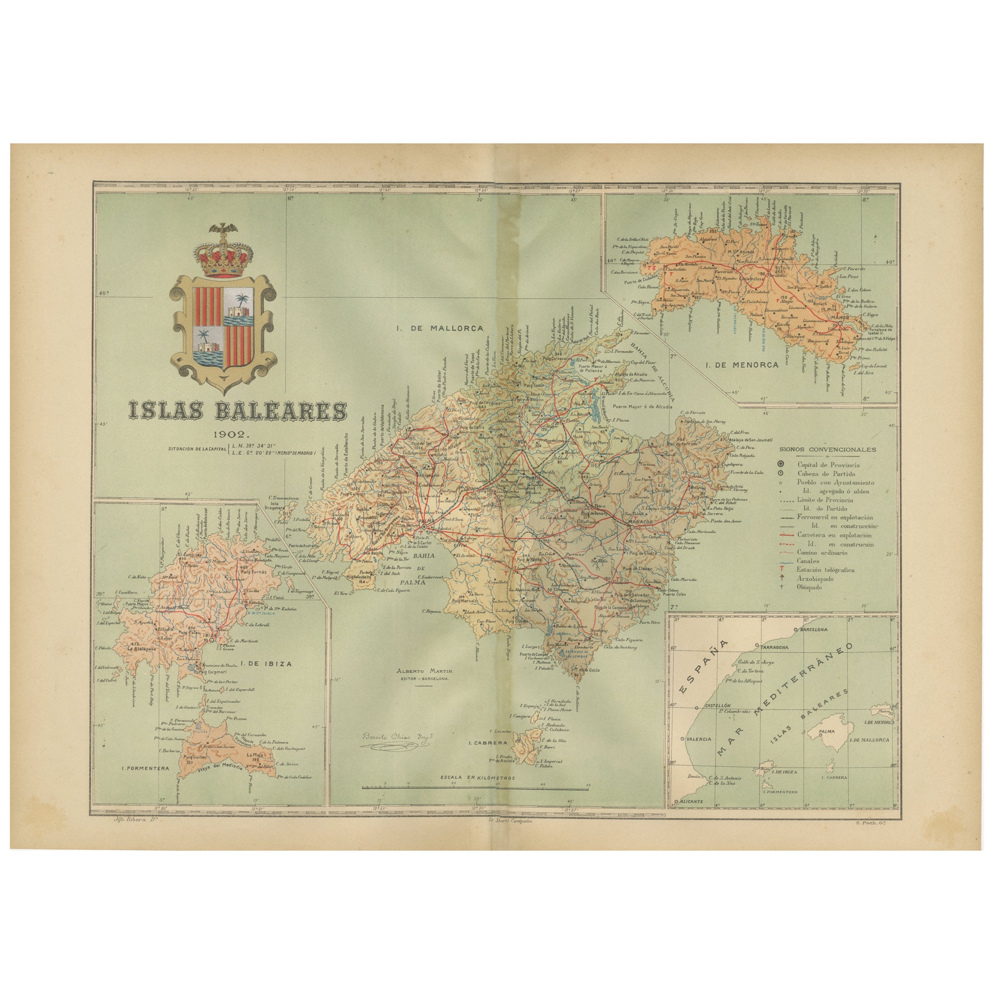
- Isles of Enchantment: The Balearic Archipelago in 1902Located in Langweer, NLThe Balearic Islands, Spain, from the year 1902. The title on the map is "ISLAS BALEARES 1902." This map illustrates the Balearic archipelago in the Mediterranean Sea, highlighting t...Category
Antique Early 1900s Maps
MaterialsPaper
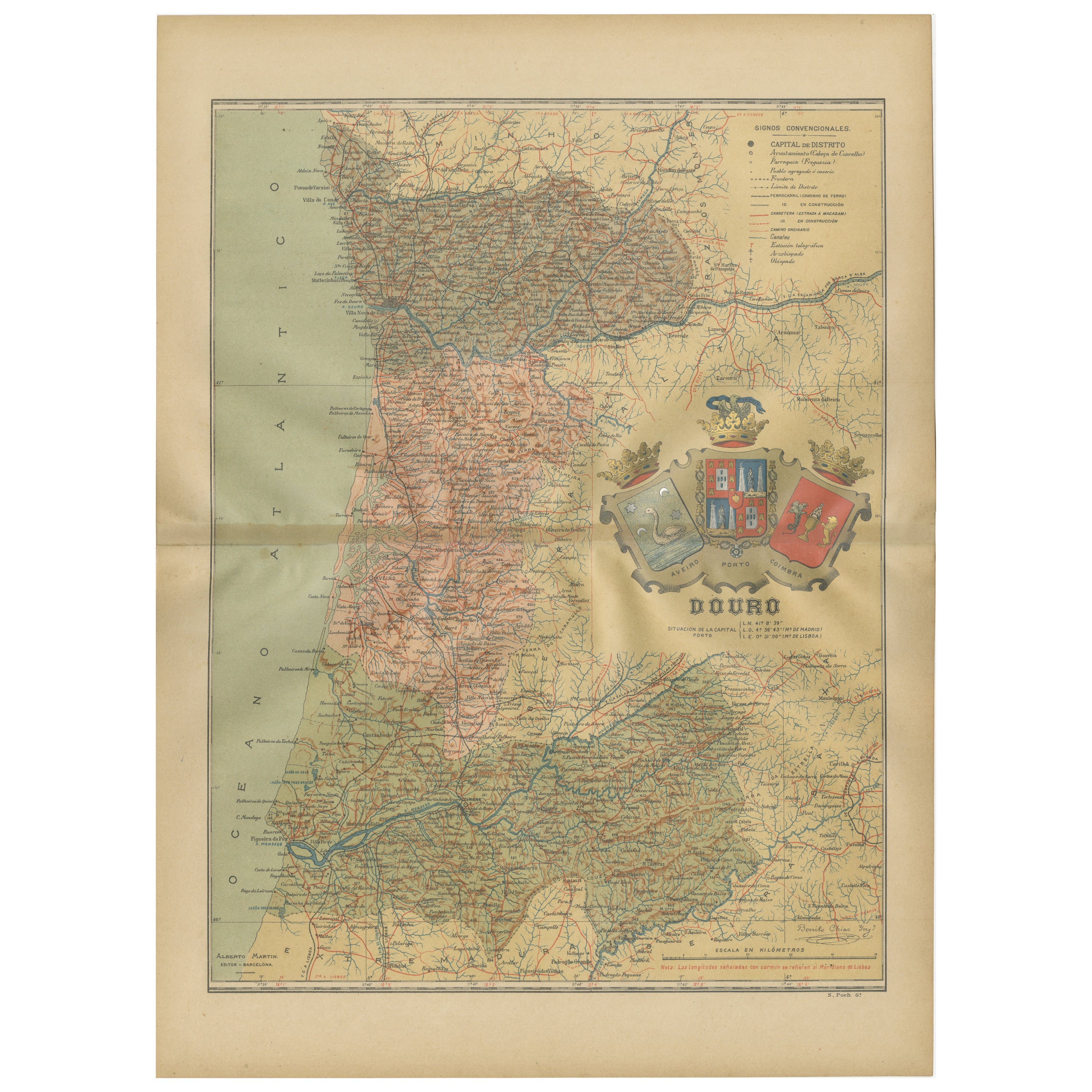
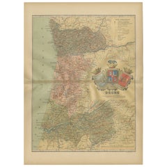
- Douro: The River of Tradition and Wine in Portugal, 1903Located in Langweer, NLThe uploaded image is a historical map of the Beira Baixa region in Portugal. The map details the topography, including mountain ranges and river systems, as well as the transportati...Category
Antique Early 1900s Maps
MaterialsPaper
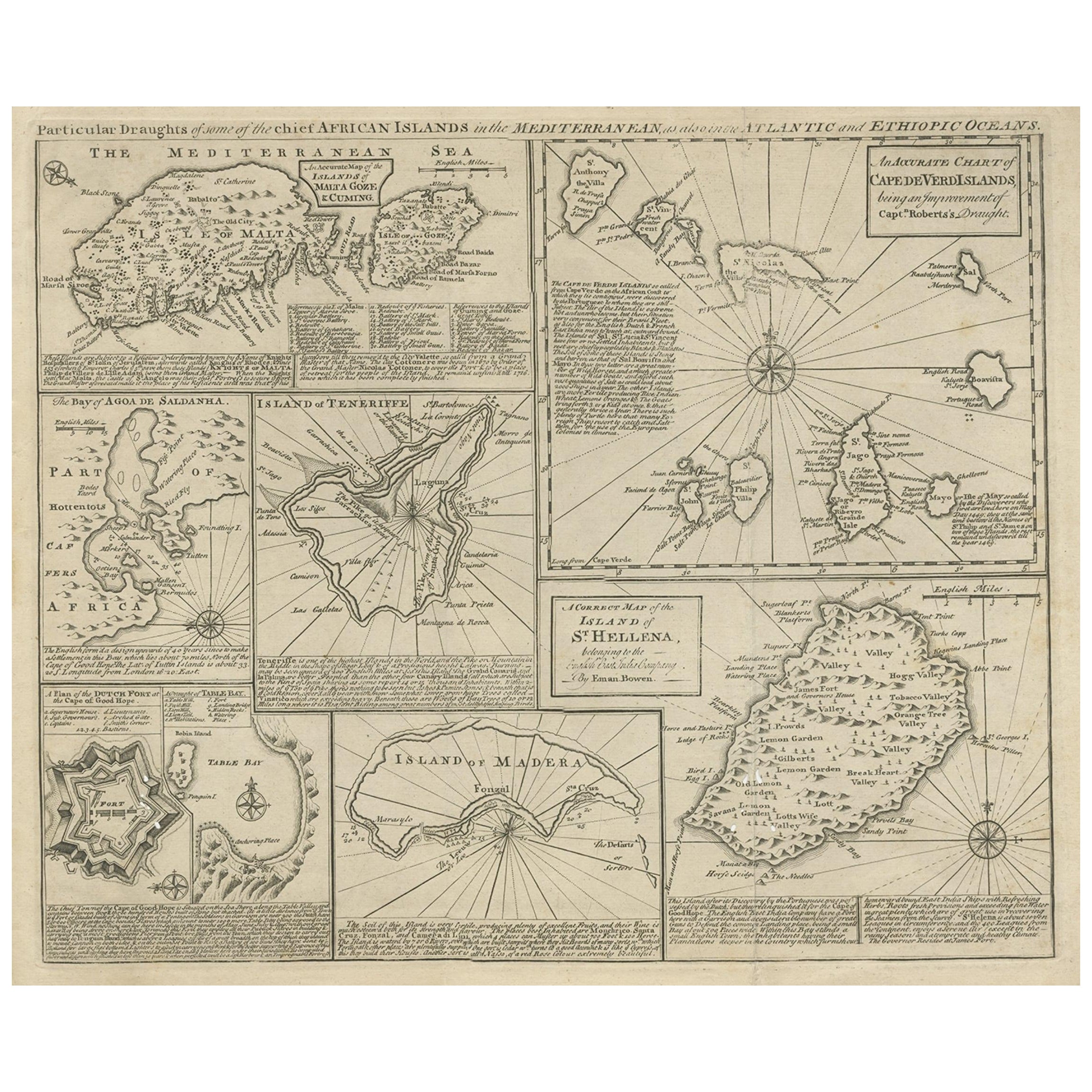
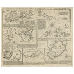
- Antique Map of 'African' Islands in the Mediterranean Sea and The Atlantic, 1747Located in Langweer, NLAntique map titled 'Particular draughts of some of the chief African Islands in the Mediterranean (..)'. Detailed set of eight maps, including a large and detailed Malta, the Bay of Agoa de Saldanha, Tenerife, the Dutch Fortress at the Cape of Good Hope, Table Bay...Category
Antique 18th Century Maps
MaterialsPaper
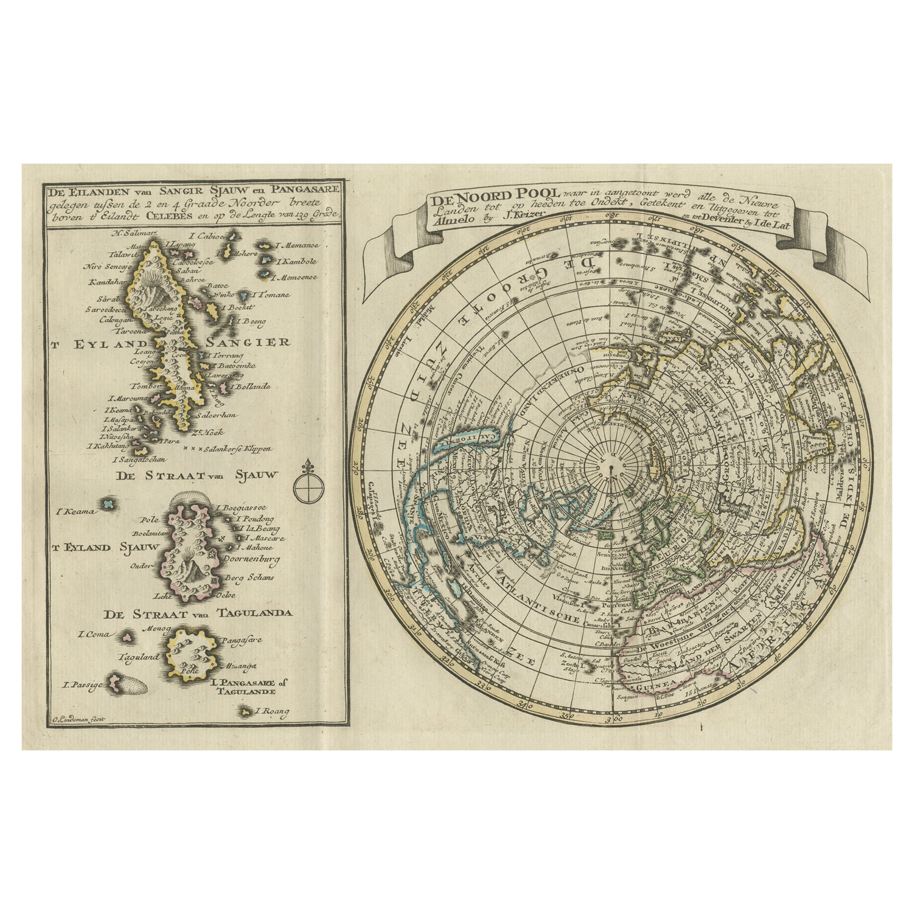
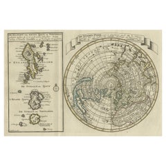
- Nice Sheet of the Sangihe Archipelago in Indonesia & California Island, 1788Located in Langweer, NLAntique map titled 'De Noord Pool waar in aangetoont werd alle de Nieuwe Landen (..) De Eilanden van Sangir Sjauw en Pangasare (..)'. Interesting map that includes a map of the N...Category
Antique 1780s Maps
MaterialsPaper
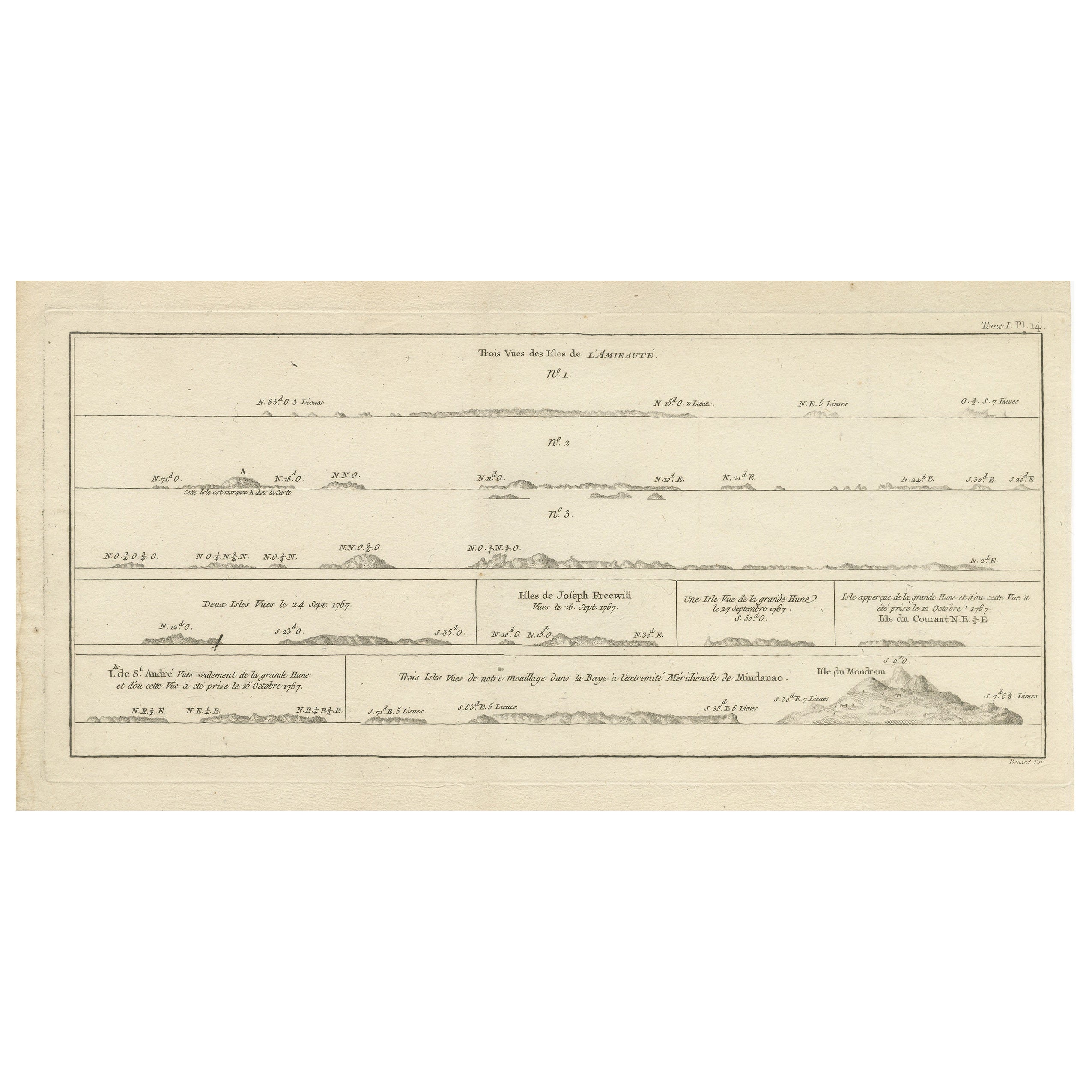
- Antique Map of the Admiralty Islands, Bismarck ArchipelagoLocated in Langweer, NLAntique map titled 'Trois Vues des Isles de l'Amirauté'. Several coastal views of the Admiralty Islands, Bismarck Archipelago, to the north of New Guinea in the South Pacific Ocean. ...Category
Antique Late 18th Century Maps
MaterialsPaper

You May Also Like
- 1865 Chart of the Islands of MadeiraLocated in Norwell, MARare James Imray chart from 1865 titled "Chart of the Islands of Madeira, Porto Santo and Dezerea" drawn from the survey made by Captain Ate Vidal Royal Navy, London. Published by Ja...Category
Antique 1860s European Maps
MaterialsPaper
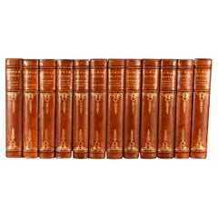
- 1903 The Works of Arthur Conan DoyleLocated in Bath, GBA limited edition set of the collected works of Sir Arthur Conan Doyle, an illustrated set signed by Conan Doyle. A limited edition of one-thousand copies, of which this is numbered...Category
Antique Early 1900s British Books
MaterialsPaper
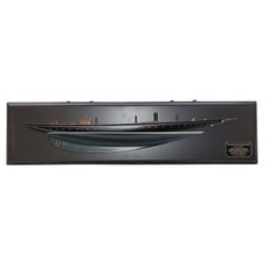
- Fine Half Model of the Racing Yacht AtlanticLocated in Norwell, MAThis s a highly detailed “half model”, not just a “half hull”. The deck detail is extensive with planked deck, skylights with brass bars, row of turned brass portholes, stubbed masts...Category
2010s North American Models and Miniatures
MaterialsWood
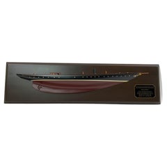
- Racing Yacht AtlanticLocated in Norwell, MAThis s a highly detailed “half model”, not just a “half hull”. The deck detail is extensive with planked deck, skylights with brass bars, row of turned brass portholes, stubbed masts...Category
21st Century and Contemporary North American Models and Miniatures
MaterialsWood
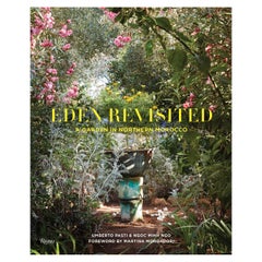
- Eden Revisited, A Garden in Northern MoroccoBy Rizzoli International PublicationsLocated in New York, NYAuthor Umberto Pasti and Ngoc Minh Ngo, Foreword by Martina Mondadori Sartogo A lovingly photographed tour of internationally renowned writer Umberto Pasti's famous hillside garden in Morocco. Italian writer and horticulturist Umberto Pasti's passion for the wild flora of Tangier and its surrounding region led him to create his world-famous garden, Rohuna, where he has transplanted thousands of plants rescued from construction sites with the aid of men from the village. Planted between two small houses is the Garden of Consolation: a series of rooms and terraces with lush vegetation, some rendering homage to the paintings of Henri Rousseau, others inspired by invented characters. Surrounding the Garden of Consolation are the Wild Garden and a hillside devoted to the wild flowering bulbs of northern Morocco, where indigenous species of narcissus, iris, crocus, scilla, gladiolus, and others bloom. With its stunning vistas and verdant fields, Rohuna is a garden of incomparable beauty with the mission to preserve the botanical richness of the region. Captured here in detail by celebrated photographer Ngoc Minh Ngo, the poetic beauty of this special and unique place is lovingly rendered for all the world to see and share. About The Author Ngoc Minh Ngo is a celebrated photographer and the author of two books. Ngoc's images have been published in publications such as T Magazine, Architectural Digest, Cabana, and House & Garden UK. Umberto Pasti is a well-known Italian writer and horticulturalist. Martina Mondadori Sartogo is the founder of Cabana magazine...Category
21st Century and Contemporary Books
MaterialsPaper
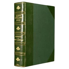
- 1903 Happy EnglandBy Helen AllinghamLocated in Bath, GBA beautiful, signed, limited edition work showcasing Helen Allingham's watercolour paintings of England. The Deluxe Edition. Limited to 750 copies, this being number 396. Signed by ...Category
Antique Early 1900s British Books
MaterialsPaper

Recently Viewed
View AllMore Ways To Browse
La Syrie Antique
Laos Antique Map
Moravia Map
Nova Totius
Antique Indiana Map
Antique Map Delaware
Antique Maps Rhode Island
Antique Map Of North And East Asia 1751
Republic Of Texas Map
Vintage Road Maps Collectables
Astrological Map
Astrology Map
Atlas Indu
English County Maps By Blaeu
Kiels Antiques
Mauritius Antique Map
Old Cypriot Maps
Tanzania Antique Map