Items Similar to Islands of Diversity: Portugal's Atlantic Archipelagos in 1903


Want more images or videos?
Request additional images or videos from the seller
1 of 12
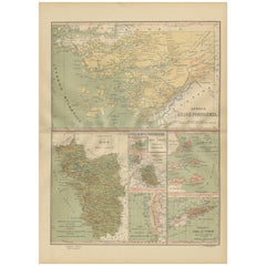
Islands of Diversity: Portugal's Atlantic Archipelagos in 1903
About the Item
The image is an original historical map from 1903 depicting Portuguese possessions in the Atlantic Ocean, specifically the islands of Cape Verde and the islands of São Tomé and Príncipe. The map is divided into multiple panels, each showing a different island, including São Vicente, Santo Antão, Sal, Boa Vista, Maio, São Nicolau, Santiago, Fogo, Brava, and the islands of São Tomé and Príncipe.
Cape Verde is an archipelago located off the west coast of Africa known for its Creole Portuguese-African culture, morna music (closely associated with Cesária Évora), and its significant role in the Atlantic slave trade. The islands of São Tomé and Príncipe, situated near the equator in the Gulf of Guinea, are known for their biodiversity, cocoa production, and colonial architecture.
Each island is detailed with its topographical features such as mountain ranges, valleys, and coastlines, as well as human-made features including towns and roadways. The maps utilize a color-coding system to indicate elevation, and maritime details are also provided, suggesting their importance in navigation and trade during that time.
The islands depicted on the historical map you provided, particularly the Cape Verde archipelago and São Tomé and Príncipe, are remarkable for several reasons:
**Cape Verde:**
1. **Cultural Fusion**: Cape Verde is a melting pot of African, Portuguese, and Brazilian cultures, reflected in its music, dance, and customs. Morna, a genre of music symbolized by Cesária Évora, is especially emblematic of the nation's rich cultural heritage.
2. **Strategic Location**: Historically, Cape Verde's location made it an essential stopover point for transatlantic shipping and the slave trade, which has deeply influenced its demographics and culture.
3. **Volcanic Landscapes**: The islands are known for their striking volcanic landscapes, particularly the active volcano on Fogo island.
4. **Maritime Climate**: The archipelago enjoys a temperate maritime climate with a warm, dry summer and a moderate rainy season, making it a year-round destination.
5. **Economic Development**: Despite its limited natural resources, Cape Verde has one of the more stable and developed economies in Africa, due in part to its tourism industry.
**São Tomé and Príncipe:**
1. **Biodiversity Hotspot**: These islands are part of the Gulf of Guinea biodiversity hotspot and boast a large number of endemic species, particularly birds and plants.
2. **Colonial History**: São Tomé and Príncipe were uninhabited prior to being discovered by the Portuguese in the 15th century and subsequently became important centers for sugar and then cocoa production.
3. **Chocolate Production**: The islands are known for high-quality cocoa production, which is still a significant part of their economy.
4. **Natural Beauty**: The lush rainforests, stunning beaches, and clear waters are ideal for eco-tourism, with activities like bird watching, hiking, and diving.
5. **Cultural Identity**: The São Toméan culture is unique, with a blend of Portuguese and African influences, seen in the São Toméan Creole language, traditional dances, and music.
These islands' unique combination of cultural richness, natural beauty, and historical significance makes them special and fascinating to both visitors and scholars alike.
- Dimensions:Height: 14.77 in (37.5 cm)Width: 20.08 in (51 cm)Depth: 0 in (0.02 mm)
- Materials and Techniques:
- Period:1900-1909
- Date of Manufacture:1903
- Condition:Good condition. Central vertical folding lines as issued. Aged paper with typically warm, yellowish-brown hue, especially around the edges and folding lines, adding to its patina. Check the images carefully.
- Seller Location:Langweer, NL
- Reference Number:
About the Seller
5.0
Platinum Seller
These expertly vetted sellers are 1stDibs' most experienced sellers and are rated highest by our customers.
Established in 2009
1stDibs seller since 2017
1,922 sales on 1stDibs
Typical response time: <1 hour
- ShippingRetrieving quote...Ships From: Langweer, Netherlands
- Return PolicyA return for this item may be initiated within 14 days of delivery.
More From This SellerView All
- Empire's Tapestry: Mapping Portugal's Global Legacy in 1903Located in Langweer, NLThis map is an original antique map that showcases Portuguese possessions around the turn of the 20th century, with a focus on Guinea-Bissau (referred to on the map as "Guiné Portugu...Category
Antique Early 1900s Maps
MaterialsPaper
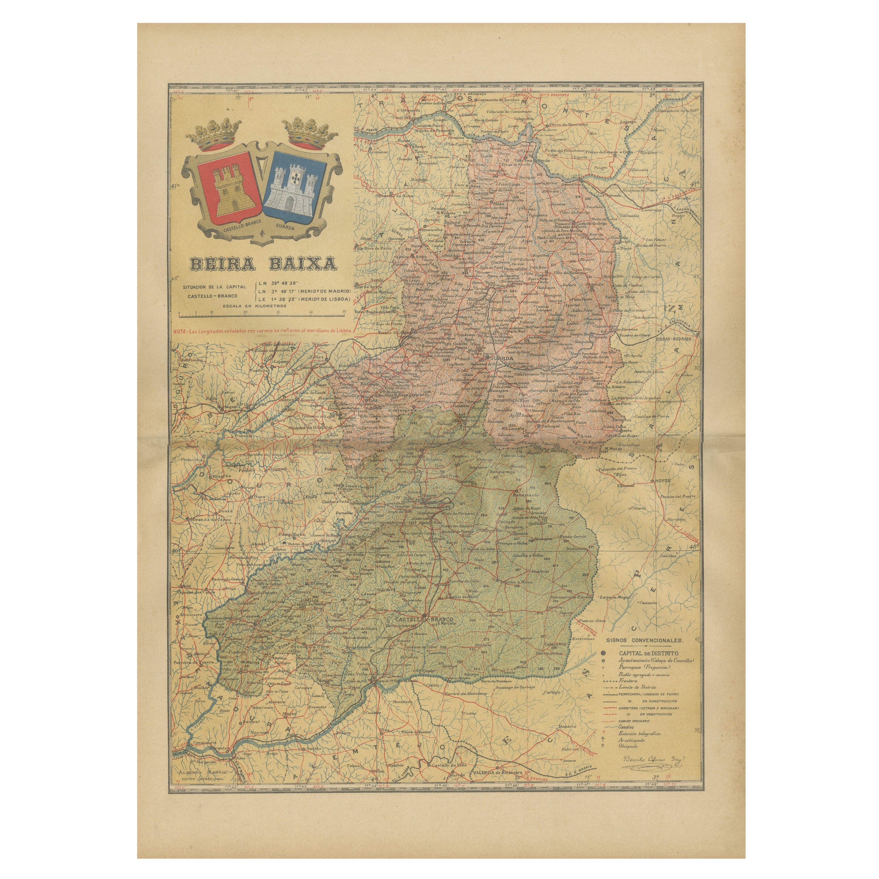
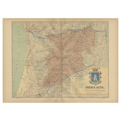
- Beira Baixa: A Cartographic Portrait of Portugal's Historic Frontier in 1903Located in Langweer, NLThe uploaded image is a historical map of the Beira Baixa region in Portugal. The map details the topography, including mountain ranges and river systems, as well as the transportati...Category
Antique Early 1900s Maps
MaterialsPaper
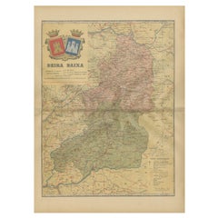
- Beira Alta: A Cartographic Journey Through Portugal's Heartland in 1903Located in Langweer, NLThe uploaded image is a historical map of the Beira Alta region in Portugal. The map is detailed, showing the topography, hydrography, and transportation networks of the region, incl...Category
Antique Early 1900s Maps
MaterialsPaper
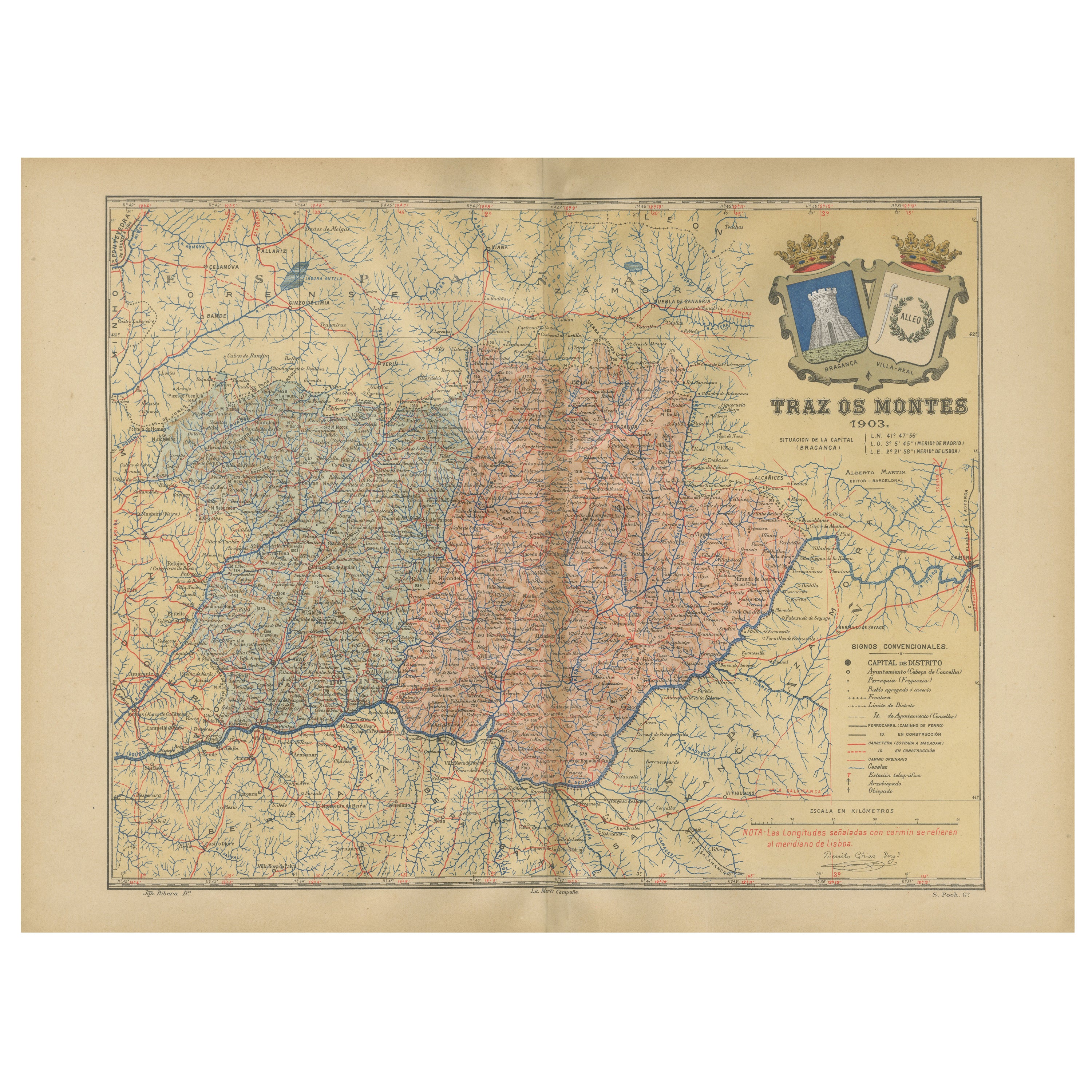
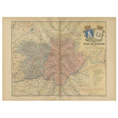
- Trás-os-Montes: A Cartographic Exploration of Portugal's Hidden Province in 1903Located in Langweer, NLThis print is an original historical map of the Trás-os-Montes region in the northeastern part of Portugal, dated 1903. Trás-os-Montes is often translated as "behind the mountains," ...Category
Antique Early 1900s Maps
MaterialsPaper
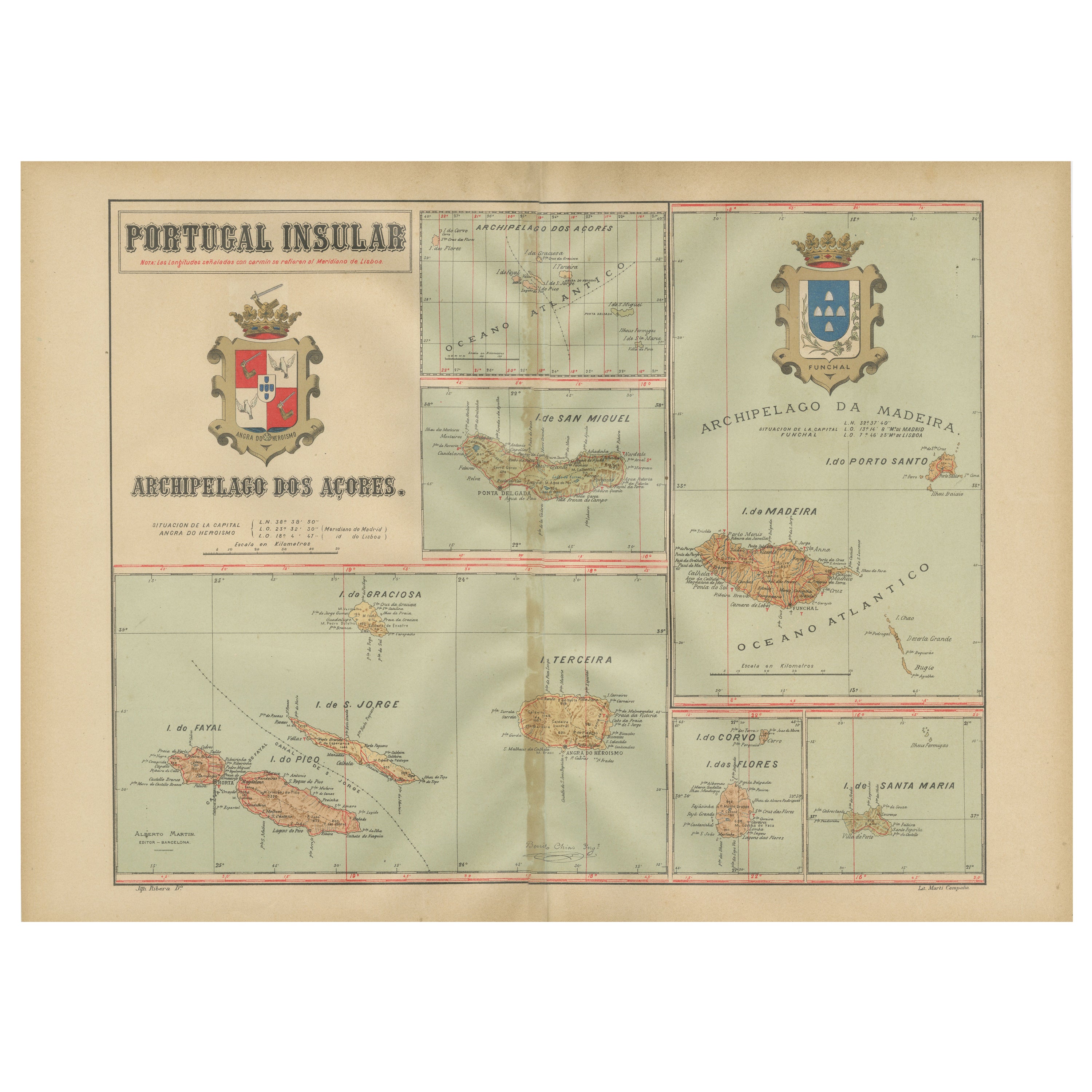
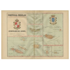
- Atlantic Eden: The Azores and Madeira Archipelagos in 1903Located in Langweer, NLThis original antique print is a historical map titled "PORTUGAL INSULAR," which translates to "Insular Portugal." It shows the Portuguese archipelagos of the Azores and Madeira, wit...Category
Antique Early 1900s Maps
MaterialsPaper
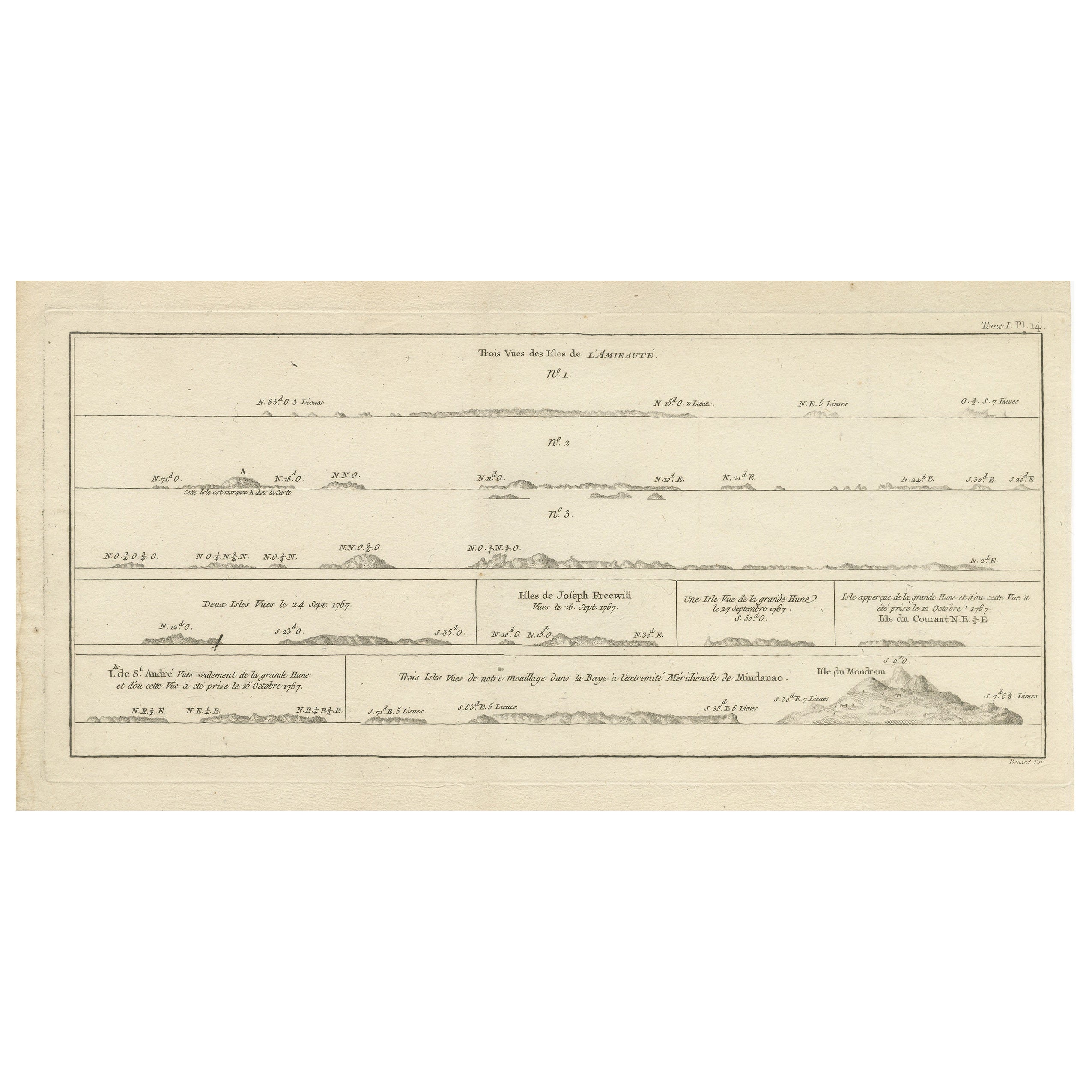
- Antique Map of the Admiralty Islands, Bismarck ArchipelagoLocated in Langweer, NLAntique map titled 'Trois Vues des Isles de l'Amirauté'. Several coastal views of the Admiralty Islands, Bismarck Archipelago, to the north of New Guinea in the South Pacific Ocean. ...Category
Antique Late 18th Century Maps
MaterialsPaper

You May Also Like
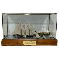
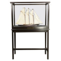
- Maritime Diorama of Schooner Yacht AtlanticLocated in Norwell, MAOutstanding deep water diorama by noted ship model builder William Hitchcock. Titled "Breezing up in Bermuda", auxiliary schooner yacht Atlantic cruises into St. George's harbor, Ber...Category
Early 2000s North American Models and Miniatures
MaterialsWood
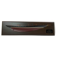
- Racing Yacht AtlanticLocated in Norwell, MAThis s a highly detailed “half model”, not just a “half hull”. The deck detail is extensive with planked deck, skylights with brass bars, row of turned brass portholes, stubbed masts...Category
21st Century and Contemporary North American Models and Miniatures
MaterialsWood
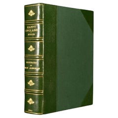
- 1903 Happy EnglandBy Helen AllinghamLocated in Bath, GBA beautiful, signed, limited edition work showcasing Helen Allingham's watercolour paintings of England. The Deluxe Edition. Limited to 750 copies, this being number 396. Signed by ...Category
Antique Early 1900s British Books
MaterialsPaper
- 1903 The Works of Arthur Conan DoyleLocated in Bath, GBA limited edition set of the collected works of Sir Arthur Conan Doyle, an illustrated set signed by Conan Doyle. A limited edition of one-thousand copies, of which this is numbered...Category
Antique Early 1900s British Books
MaterialsPaper
- Schooner Yacht Atlantic DioramaLocated in Norwell, MANAUTICAL DIORAMA showing the schooner yacht Atlantic set into water. A gracious diorama with exceptional detail. Rigged with a full set of sails. Atlantic is an amazing yacht with an...Category
2010s Nautical Objects
MaterialsWood
- Original Imray & Son Chart of North Atlantic, 1876Located in Norwell, MANautical chart of the North Atlantic showing the Eastern United States coast, Caribbean Islands, South America (Venezuela and ), British Possessions (Canada - Gulf of Lawrence, Newfo...Category
Antique 1870s Nautical Objects
MaterialsPaper

Recently Viewed
View AllMore Ways To Browse
Map Of Old Armenia
Teak Wood Sphere
Nova Guinea Maps
Antique Map Of Illinois
Petite Point Hand Bag
Antique Map Of Southeastern Us
Antique Map Alabama
Antique Map Of Sydney
Malay Archipelago Map
Gambia Antique Map
Uruguay Antique Map
Guyana Antique Map
Ruscelli Map
Masque Theatre No
Nova Scotia Map
Antique Map Tuscany
Berkshire Antique Map
Cornwall Map