Items Similar to Original Imray & Son Chart of North Atlantic, 1876


Want more images or videos?
Request additional images or videos from the seller
1 of 7
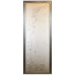
Original Imray & Son Chart of North Atlantic, 1876
About the Item
Nautical chart of the North Atlantic showing the Eastern United States coast, Caribbean Islands, South America (Venezuela and ), British Possessions (Canada - Gulf of Lawrence, Newfoundland, Nova Scotia), Europe (England, Ireland, Norway, Denmark, France and Spain), African coast (including Morocco and Cape Verde Islands), and a sketch of Bermuda. Discoloring and staining to map and blue paper. Unframed and mounted to blue paper. Overall Dimensions: 45" H x 55" W.
- Dimensions:Height: 45 in (114.3 cm)Width: 55 in (139.7 cm)Depth: 3 in (7.62 cm)
- Materials and Techniques:
- Period:
- Date of Manufacture:1876
- Condition:
- Seller Location:Norwell, MA
- Reference Number:
About the Seller
5.0
Vetted Seller
These experienced sellers undergo a comprehensive evaluation by our team of in-house experts.
Established in 1967
1stDibs seller since 2015
346 sales on 1stDibs
Typical response time: 2 hours
- ShippingRetrieving quote...Ships From: Norwell, MA
- Return PolicyThis item cannot be returned.
More From This SellerView All
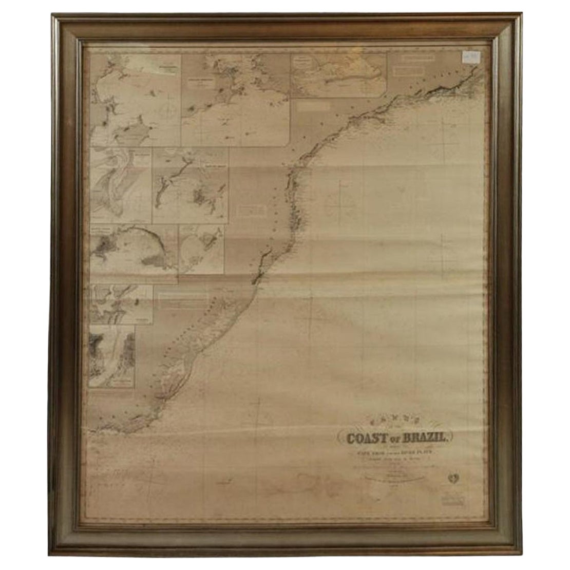
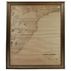
- Imray Ocean Chart of the Coast of Brazil 1876Located in Norwell, MAImray & Son 1876 Nautical chart of the Coast of Brazil between Cape Frio and the River Plate. Nicely framed. Overall Dimensions: 46" H x 56" W.Category
Antique 1870s Nautical Objects
MaterialsPaper
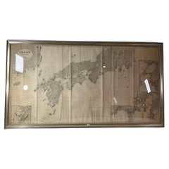
- Chart of Japan by James Imray and SonLocated in Norwell, MAChart of southern Japan compiled by James F. Imray and published in 1870. The chart captures the coast and islands. Includes Nagasaki, Kii Channel, Gulf of Yed...Category
Antique 1870s English Nautical Objects
MaterialsPaper
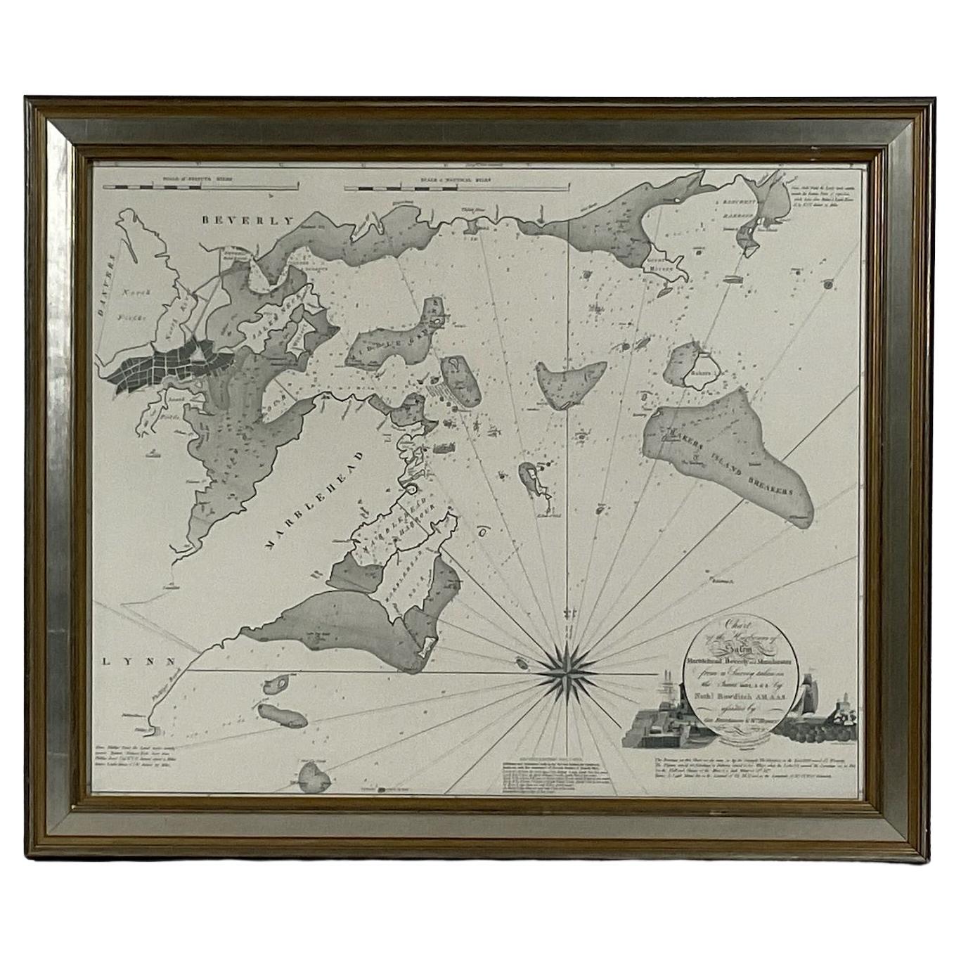
- Chart of Boston's North ShoreLocated in Norwell, MARarely found restrike of an 1804 chart by Nathanael Bowditch of the Harbors of Salem, Marblehead, Beverly, and Manchester. Showing the Islands of Great Misery, Satan, Cuney, Winter,...Category
Vintage 1980s North American Maps
MaterialsPaper
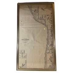
- Chart of West Coast of South America by James Imray and SonLocated in Norwell, MAChart of West Coast of South America compiled by James F. Imray and published in 1880. The chart captures the west coast from Valparaiso to Truxillo. Includes ...Category
Antique 1880s English Nautical Objects
MaterialsPaper
- Original 1910 George Eldridge ChartLocated in Norwell, MAOriginal framed 1910 George Eldridge chart "E" showing Gloucester to the Kennebec river. Showing the coast of Maine in great detail. Towns include Bath, Camden, Portland, the Coastal...Category
20th Century Unknown Maps
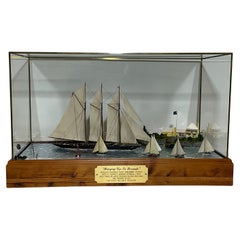
- Maritime Diorama of Schooner Yacht AtlanticLocated in Norwell, MAOutstanding deep water diorama by noted ship model builder William Hitchcock. Titled "Breezing up in Bermuda", auxiliary schooner yacht Atlantic cruises into St. George's harbor, Ber...Category
Early 2000s North American Models and Miniatures
MaterialsWood

You May Also Like
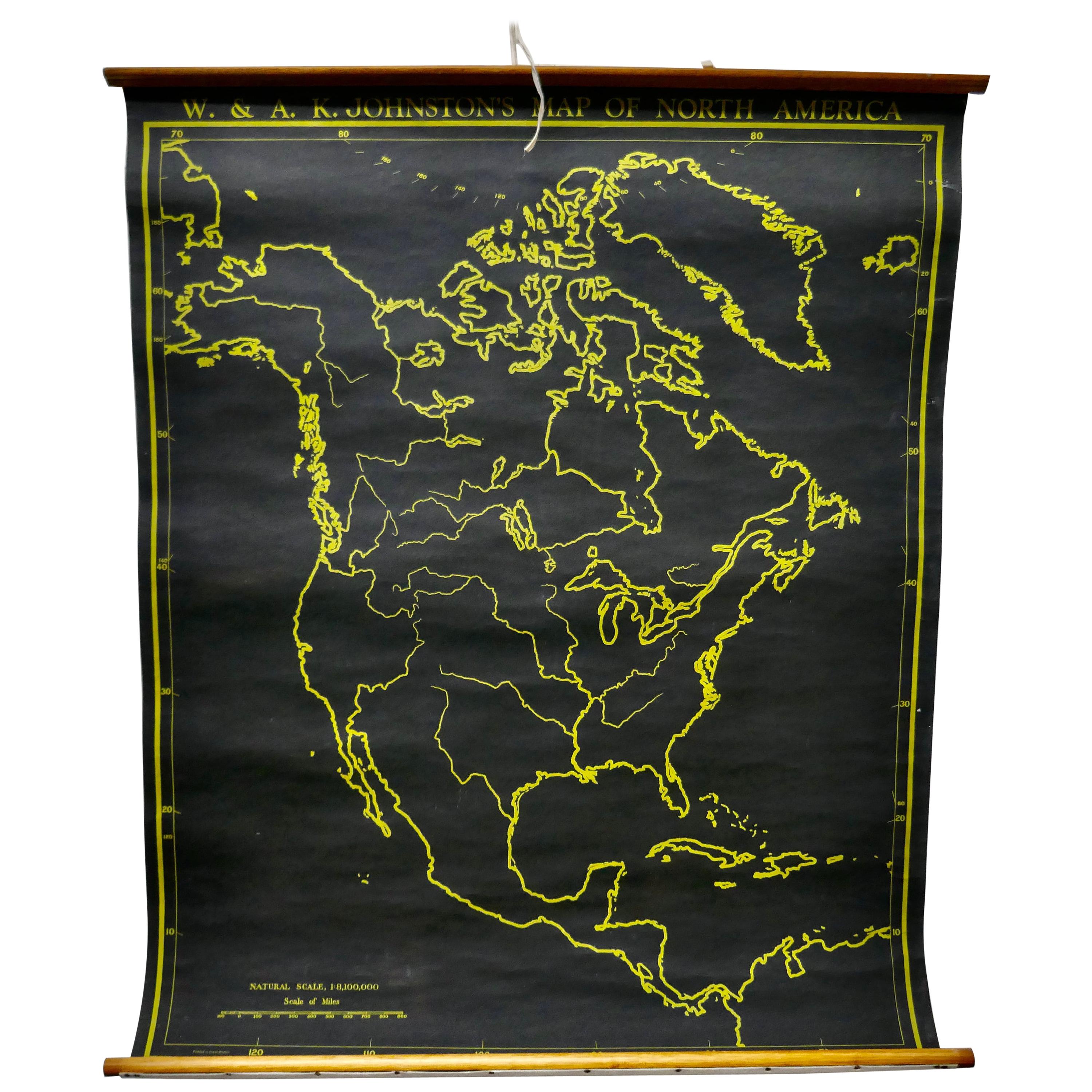
- University Chart “Black Map of North AmericaLocated in Chillerton, Isle of WightUniversity Chart “Black Map of North America W&A K Johnston’s Charts of Physical Maps By G W Bacon, This is a Black Physical map of North A...Category
Early 20th Century Industrial Maps
MaterialsLinen
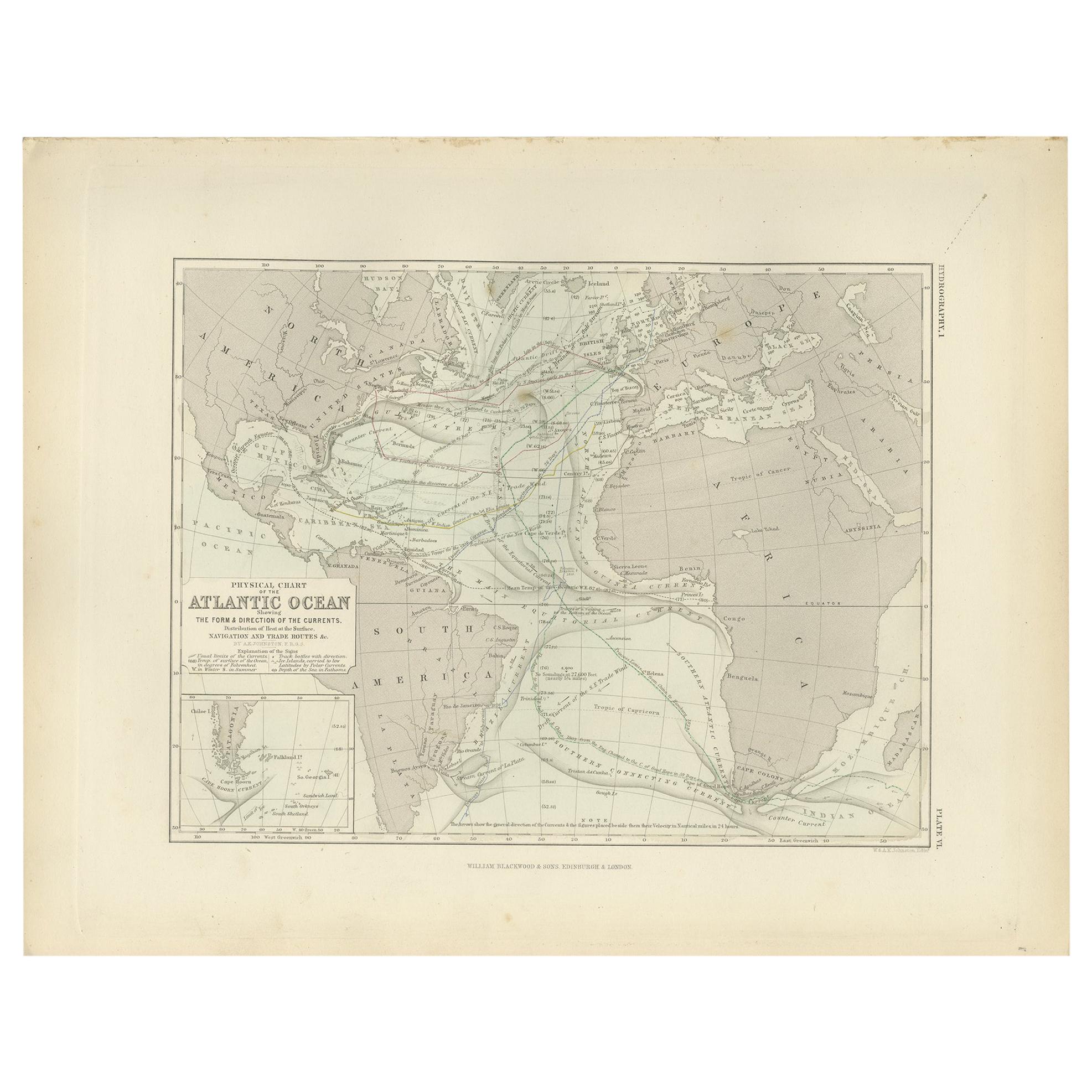
- Antique Physical Chart of the Atlantic Ocean by Johnston '1850'Located in Langweer, NLAntique map titled 'Physical Chart of the Atlantic Ocean showing the form and direction of the currents'. Original antique chart of the Atlantic Ocean. This map originates from 'The ...Category
Antique Mid-19th Century Maps
MaterialsPaper
- Antique Sea Chart of North America by Ottens, circa 1745Located in Langweer, NLAntique map titled 'Septemtrionaliora Americae a Groenlandia (..)'. Sea chart of the northern waters of North America, including the coast of Labrador and pa...Category
Antique Mid-18th Century Maps
MaterialsPaper
- Large University Chart “Political Map of North America” by BaconLocated in Chillerton, Isle of WightLarge University Chart “Political Map of North America” by Bacon W&A K Johnston’s Charts of Physical Maps By G W Bacon, This is colourful Physical map ...Category
Early 20th Century American Empire Posters
MaterialsLinen
- Large University Chart “Political Map of North America” by BaconLocated in Chillerton, Isle of WightLarge University chart “Political Map of North America” by Bacon W&A K Johnston’s Charts of Political Maps by G W Bacon, This is colorful Physical ...Category
Early 20th Century American Empire Posters
MaterialsLinen
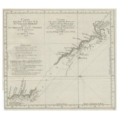
- Old Chart of the North-Eastern Coast of Australia Discovered by Cook, 1774Located in Langweer, NLAntique print titled Carte d'une Partie de la Cote de la N.le Galles Merid etc. An interesting chart of the north-eastern coast of Australia discovered by Cook in 1770, showing th...Category
Antique 1770s Maps
MaterialsPaper