Items Similar to Trás-os-Montes: A Cartographic Exploration of Portugal's Hidden Province in 1903


Want more images or videos?
Request additional images or videos from the seller
1 of 7
Trás-os-Montes: A Cartographic Exploration of Portugal's Hidden Province in 1903
About the Item
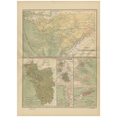
This print is an original historical map of the Trás-os-Montes region in the northeastern part of Portugal, dated 1903. Trás-os-Montes is often translated as "behind the mountains," reflecting its location relative to the rest of Portugal. This area is known for its rugged landscapes, including the mountainous terrain and the valleys of the Douro River and its tributaries.
Trás-os-Montes is special for a number of reasons:
1. **Natural Beauty**: The region is characterized by its natural beauty, with the Douro International Natural Park and Montesinho Natural Park being two of its highlights.
2. **Heritage**: It has a rich historical heritage, with ancient castles, Roman bridges, and Paleolithic engravings found in the Côa Valley Archaeological Park, which is a UNESCO World Heritage Site.
3. **Isolation and Tradition**: Trás-os-Montes is one of the most remote and least developed regions in Portugal, which has helped preserve many traditional ways of life.
4. **Cuisine**: The area is known for its distinctive cuisine, including smoked meats (like alheira and chouriço), hearty stews, and unique breads.
5. **Agriculture**: It is a region of agriculture, particularly known for its olive oil, almonds, and wine.
- Dimensions:Height: 20.08 in (51 cm)Width: 14.77 in (37.5 cm)Depth: 0 in (0.02 mm)
- Materials and Techniques:
- Period:1900-1909
- Date of Manufacture:1903
- Condition:Good condition. Central vertical folding lines as issued. Aged paper with typically warm, yellowish-brown hue, especially around the edges and folding lines, adding to its patina. Check the images carefully.
- Seller Location:Langweer, NL
- Reference Number:
About the Seller
5.0
Platinum Seller
These expertly vetted sellers are 1stDibs' most experienced sellers and are rated highest by our customers.
Established in 2009
1stDibs seller since 2017
1,932 sales on 1stDibs
Typical response time: <1 hour
- ShippingRetrieving quote...Ships From: Langweer, Netherlands
- Return PolicyA return for this item may be initiated within 14 days of delivery.
More From This SellerView All
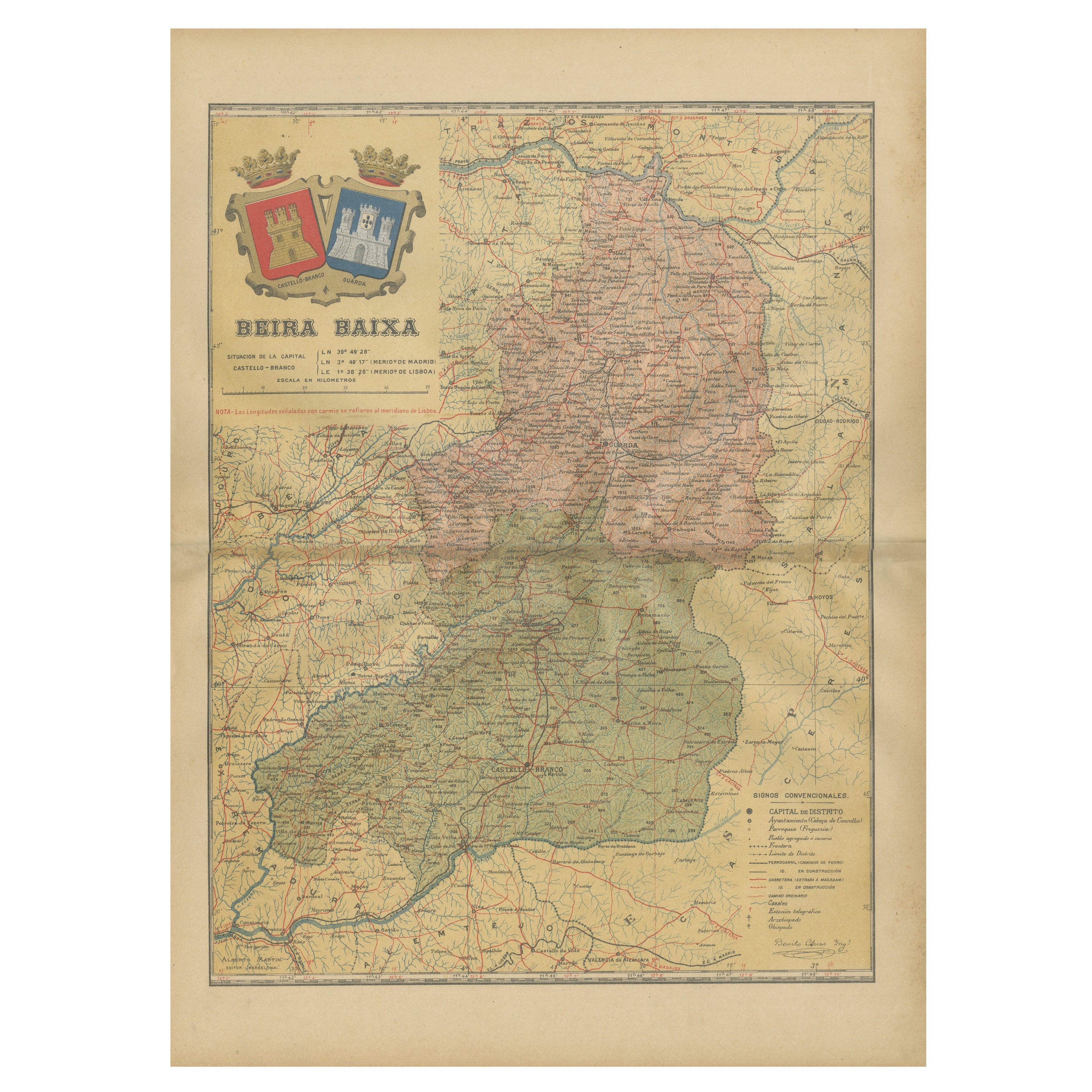
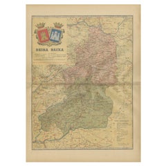
- Beira Baixa: A Cartographic Portrait of Portugal's Historic Frontier in 1903Located in Langweer, NLThe uploaded image is a historical map of the Beira Baixa region in Portugal. The map details the topography, including mountain ranges and river systems, as well as the transportati...Category
Antique Early 1900s Maps
MaterialsPaper
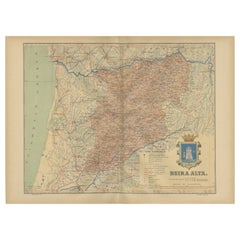
- Beira Alta: A Cartographic Journey Through Portugal's Heartland in 1903Located in Langweer, NLThe uploaded image is a historical map of the Beira Alta region in Portugal. The map is detailed, showing the topography, hydrography, and transportation networks of the region, incl...Category
Antique Early 1900s Maps
MaterialsPaper
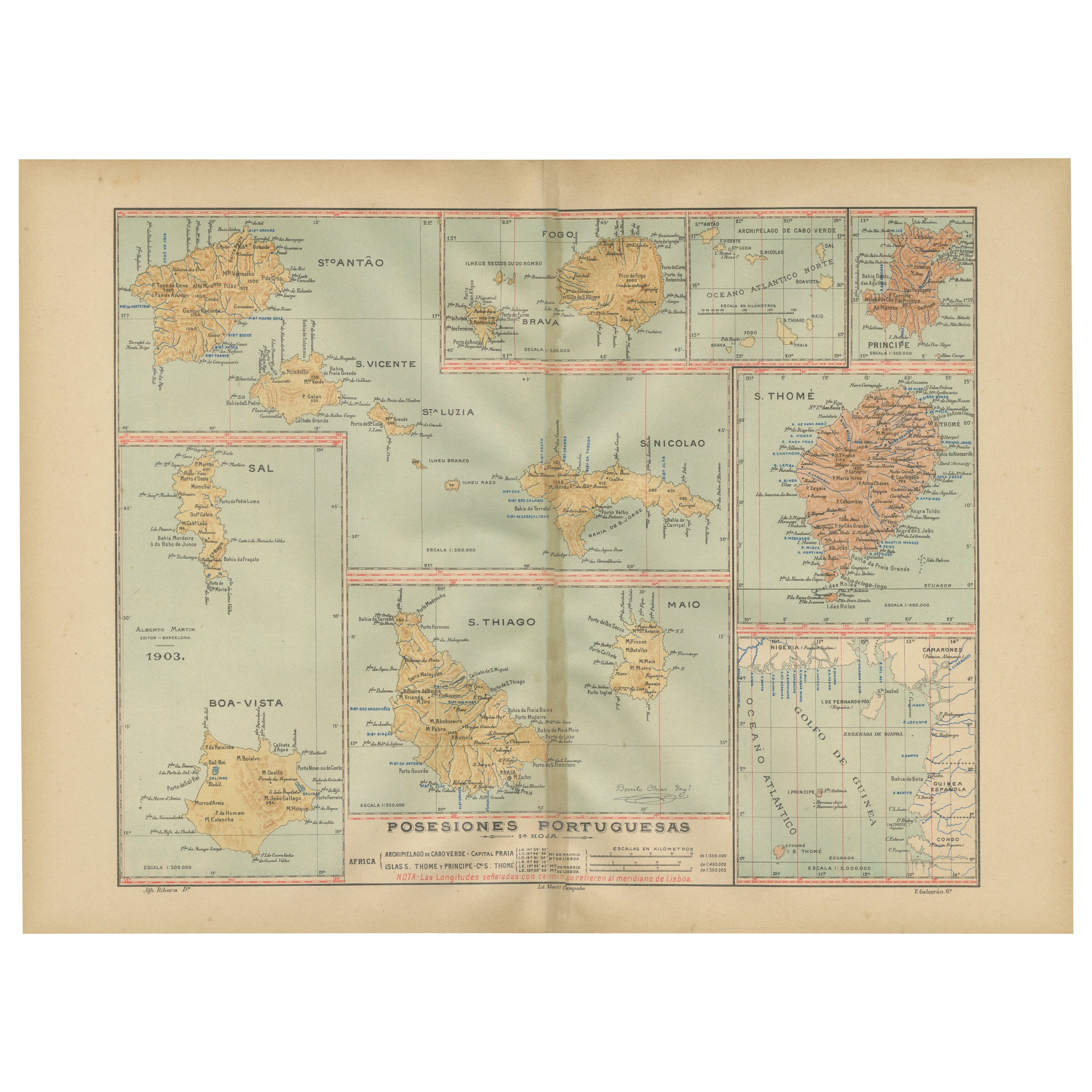
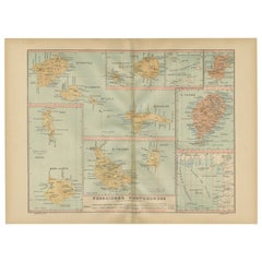
- Islands of Diversity: Portugal's Atlantic Archipelagos in 1903Located in Langweer, NLThe image is an original historical map from 1903 depicting Portuguese possessions in the Atlantic Ocean, specifically the islands of Cape Verde and the islands of São Tomé and Prínc...Category
Antique Early 1900s Maps
MaterialsPaper
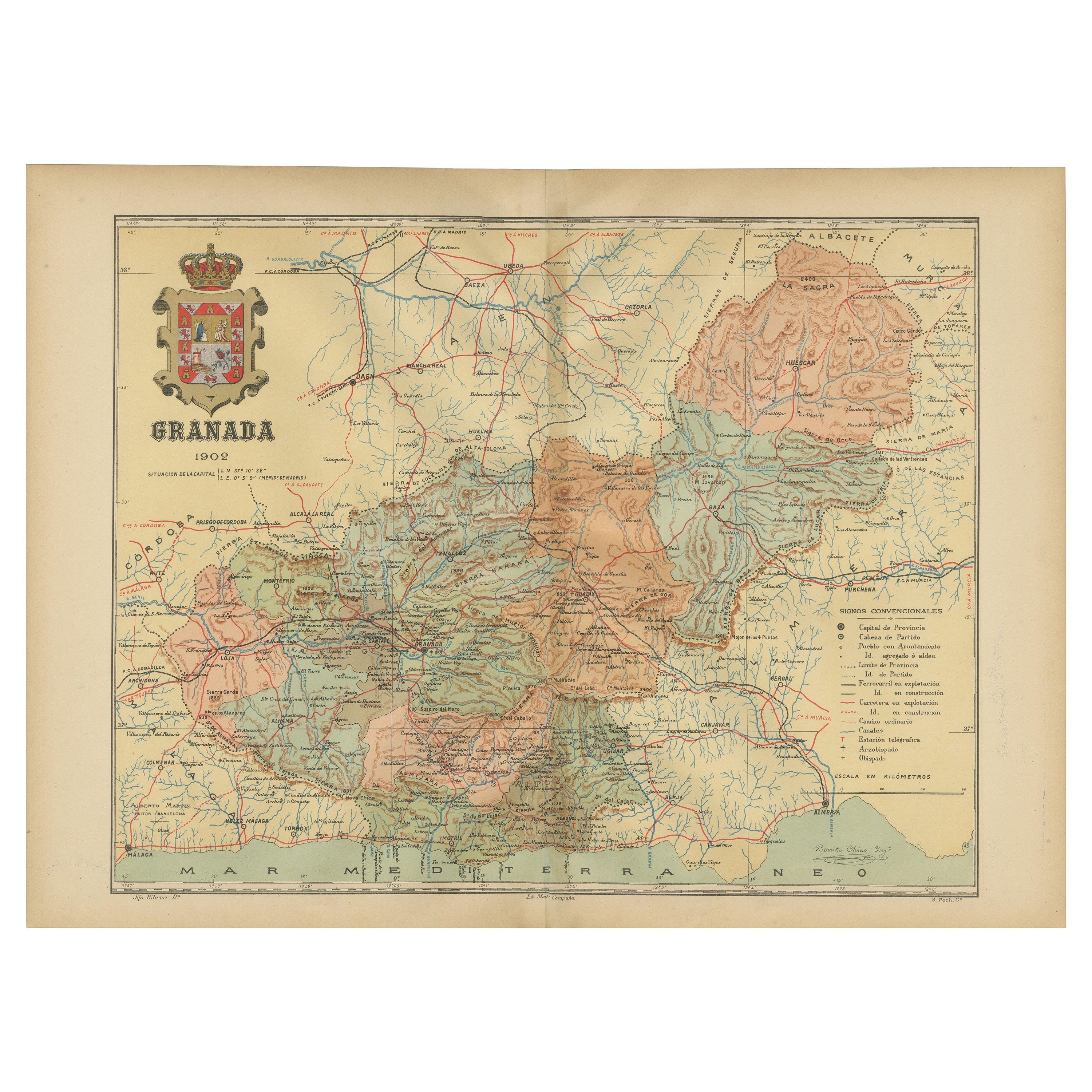
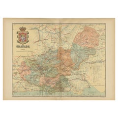
- Granada 1902: A Cartographic Exploration of Andalusia's Mountainous ProvinceLocated in Langweer, NLThis original antique map depicts the province of Granada, part of the autonomous community of Andalusia in southern Spain, as of 1902. The map features several important details: I...Category
Antique Early 1900s Maps
MaterialsPaper
- Empire's Tapestry: Mapping Portugal's Global Legacy in 1903Located in Langweer, NLThis map is an original antique map that showcases Portuguese possessions around the turn of the 20th century, with a focus on Guinea-Bissau (referred to on the map as "Guiné Portugu...Category
Antique Early 1900s Maps
MaterialsPaper
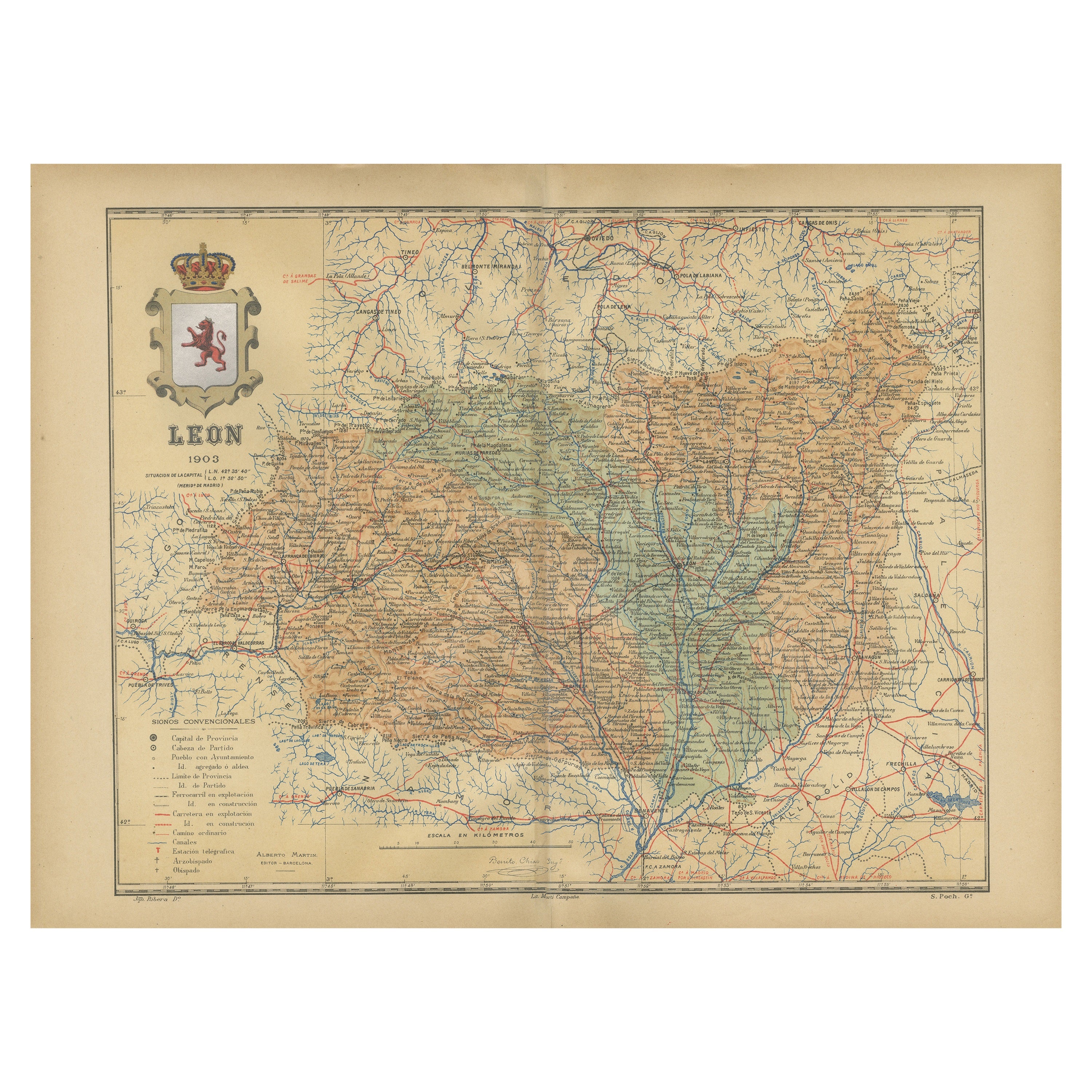
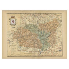
- León 1903: A Cartographic Detailing of Castilla y León's Mountainous ProvinceLocated in Langweer, NLThe map depicts the province of León, which is located in the northwest of Spain and forms part of the autonomous community of Castilla y León, as of 1903. Notable features of the ma...Category
Antique Early 1900s Maps
MaterialsPaper
You May Also Like
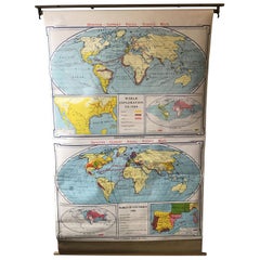
- 1967 World Exploration School MapLocated in Tarrytown, NYPull down world exploration map from 1967.Category
Vintage 1960s Maps
MaterialsPaper
- Sun and Moon a Story of Astronomy, Photography and CartographyLocated in New York City, NYA unique pictorial history of astronomical exploration from the earliest Prehistoric observatories to the latest satellite images with 280 spectacular images and an inspiring story i...Category
21st Century and Contemporary European Books
MaterialsPaper
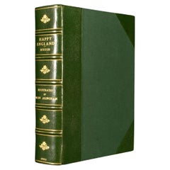
- 1903 Happy EnglandBy Helen AllinghamLocated in Bath, GBA beautiful, signed, limited edition work showcasing Helen Allingham's watercolour paintings of England. The Deluxe Edition. Limited to 750 copies, this being number 396. Signed by ...Category
Antique Early 1900s British Books
MaterialsPaper
- Antique Lithography Map, Isle of Wight, English, Framed, Engraving, CartographyLocated in Hele, Devon, GBThis is an antique lithography map of the Isle of Wight. An English, framed atlas engraving of cartographic interest, dating to the early 19th century and later. Superb lithography ...Category
Antique Early 19th Century British Regency Maps
MaterialsWood
- Antique Lithography Map, Isle of Thanet, Kent, English, Cartography, VictorianLocated in Hele, Devon, GBThis is an antique lithography map of The Isle of Thanet in Kent. An English, framed atlas engraving of cartographic interest, dating to the mid 19th century and later. Superb litho...Category
Antique Mid-19th Century British Victorian Maps
MaterialsWood
- Very Large Vintage Map of Canada, German, Education, Institution, CartographyLocated in Hele, Devon, GBThis is a very large vintage map of Canada. A German, quality printed educational or institution map, dating to the mid 20th century, circa 1965....Category
Mid-20th Century German Maps
MaterialsPaper


Recently Viewed
View AllMore Ways To Browse
La Syrie Antique
Laos Antique Map
Moravia Map
Nova Totius
Antique Indiana Map
Antique Map Delaware
Antique Maps Rhode Island
Antique Map Of North And East Asia 1751
Republic Of Texas Map
Vintage Road Maps Collectables
Astrological Map
Astrology Map
Atlas Indu
English County Maps By Blaeu
Kiels Antiques
Mauritius Antique Map
Old Cypriot Maps
Tanzania Antique Map