
Want more images or videos?
Request additional images or videos from the seller
1 of 8
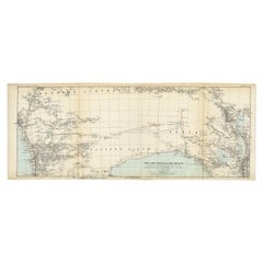
1967 World Exploration School Map
About the Item
Pull down world exploration map from 1967.
- Dimensions:Height: 48 in (121.92 cm)Width: 3 in (7.62 cm)Depth: 3.5 in (8.89 cm)
- Materials and Techniques:
- Period:
- Date of Manufacture:1967
- Condition:Wear consistent with age and use. D1 W48 H73 are measurements of map unrolled.
- Seller Location:Tarrytown, NY
- Reference Number:1stDibs: LU1078218502082
About the Seller
4.9
Vetted Seller
These experienced sellers undergo a comprehensive evaluation by our team of in-house experts.
Established in 1993
1stDibs seller since 2014
1,591 sales on 1stDibs
Typical response time: 1 hour
- ShippingRetrieving quote...Ships From: Tarrytown, NY
- Return PolicyThis item cannot be returned.
More From This SellerView All
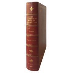
- The Clarance H. Mackay Collection, Italian Schools, by William R. ValentinerLocated in Tarrytown, NY56 Photogravure plates. Privately printed in 1926 by Witherspoon & Co. Cover bound in Moroccan crimson leather with gilt flower motifs. Privately printed catalogue limited to 100 nu...Category
Vintage 1920s Books
MaterialsPaper
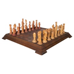
- Hand Carved Wood and Leather Chess SetLocated in Tarrytown, NYIntricately hand-carved wooden chess with leather game board. King piece measures 4.25" high.Category
Vintage 1940s Italian Mid-Century Modern Games
MaterialsLeather, Wood
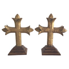
- Pair of 1880s Carved Gilt Crosses On A Wood Step BaseLocated in Tarrytown, NYPair of 1880s Carved Gilt Crosses On A Wood Step Base Loss of gilt on crosses PRICE PER ITEM (each)Category
Antique Late 19th Century Religious Items
MaterialsWood
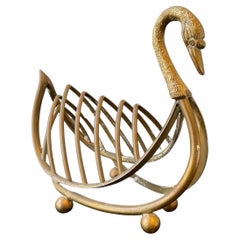
- Miniature Maison Jansen Style Italian Brass Swan RackLocated in Tarrytown, NY1960s Brass Italian miniature Maison Jansen style swann rack. Good for napkins, papers, mail, etc.Category
Vintage 1960s Models and Miniatures
MaterialsBrass
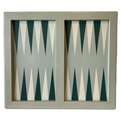
- Isabel Mitchell Green Leather Backgammon BoardLocated in Tarrytown, NYIsabel Mitchell leather backgammon board. No pieces.Category
2010s Games
MaterialsLeather
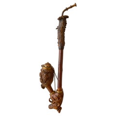
- 1930s German Black Forest Hand Carved Wood PipeLocated in Tarrytown, NY1930s German Black Forest Hand carved wood pipe with antler top.Category
Vintage 1930s Tobacco Accessories
MaterialsWood
You May Also Like
- World Relief MapLocated in Antwerp, BELarge world relief map. Measures: Width 232 cm. Height 158 cm.Category
Mid-20th Century German Mid-Century Modern Maps
MaterialsAcrylic
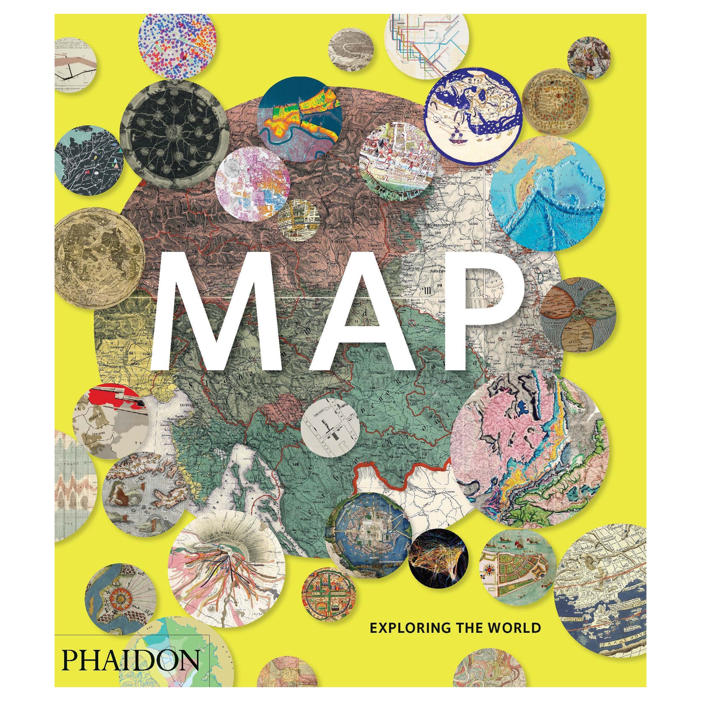
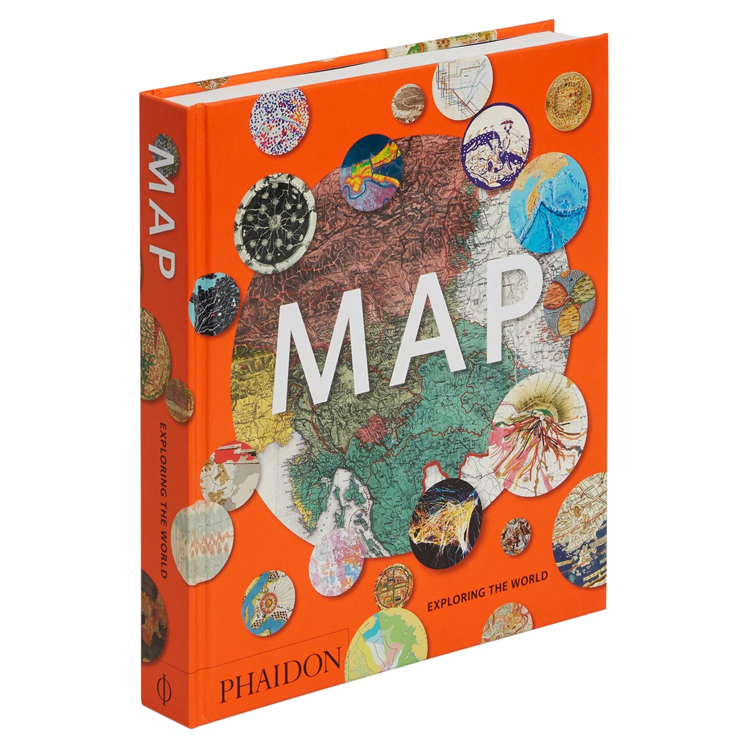
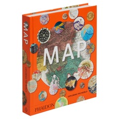
- Map, Exploring The WorldLocated in New York City, NY300 stunning maps from all periods and from all around the world, exploring and revealing what maps tell us about history and ourselves. Selected by an international panel of cartographers, academics, map dealers and collectors, the maps represent over 5,000 years of cartographic innovation drawing on a range of cultures and traditions. Comprehensive in scope, this book features all types of map from navigation and surveys to astronomical maps, satellite and digital maps, as well as works of art inspired by cartography. Unique curated sequence presents maps in thought-provoking juxtapositions for lively, stimulating reading. Features some of the most influential mapmakers and institutions in history, including Gerardus Mercator, Abraham Ortelius, Phyllis Pearson, Heinrich Berann...Category
21st Century and Contemporary Hong Kong Books
MaterialsPaper
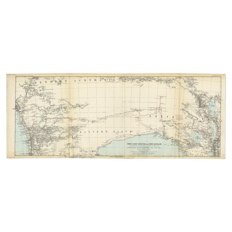
- Antique Exploration Map of Australia from Beltana to Perth, 1876Located in Langweer, NLAntique map titled 'Thomas Elders' Expedition durch Inner-Australien von Beltana im Osten bis Perth im Western ausgefuhrt durch E. Giles (..)'. Old map of Australia from Bunbury to A...Category
Antique 19th Century Maps
MaterialsPaper
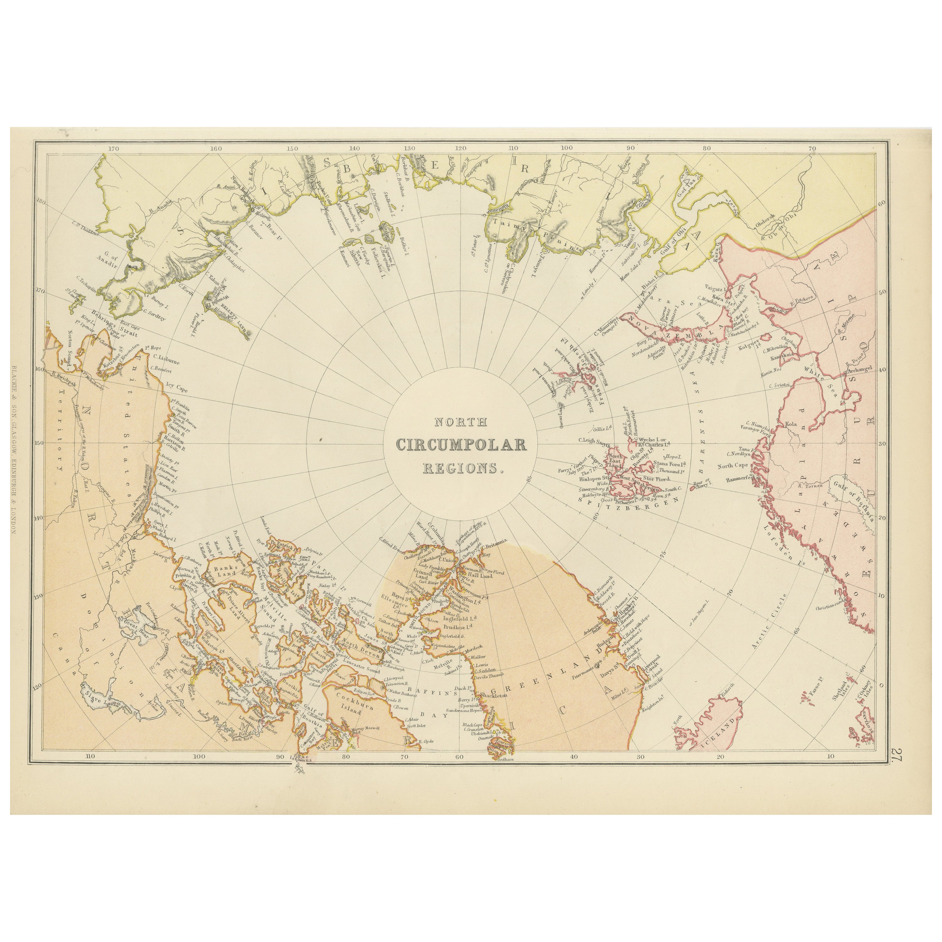
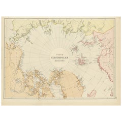
- Arctic Exploration: An Original Map of the North Circumpolar Regions, 1882Located in Langweer, NLThis map, extracted from the 1882 atlas by Blackie & Son, presents the North Circumpolar Regions in a projection centered on the North Pole, offering a unique view of the Arctic territories. The map's radial lines emanate from the pole, focusing on the northernmost parts of continents and the intricate archipelagos that are scattered across the Arctic Ocean. The territories of Canada, Greenland, Northern Europe, Russia, and the northern extremities of Asia are portrayed with careful detail, highlighting the geography known to Victorian explorers. Notably, the map's color palette is subdued, with the cold regions depicted in pale hues, while coastlines and political boundaries are traced in warmer tones, providing a stark contrast that emphasizes the frigid environment. The map likely served purposes both educational and navigational, capturing the extent of polar exploration at the time. Names of seas, straits, and islands honor explorers and patrons of the age of Arctic exploration, and the map also hints at the incomplete knowledge of the era, with some areas less detailed than others, reflecting the limits of exploration and cartographic knowledge of the Arctic region at that time. Moreover, the map includes longitudinal and latitudinal markers, which would have been crucial for navigation and expedition planning. The inclusion of such detail illustrates the growing interest in polar exploration during the late 19th century...Category
Antique 1880s Maps
MaterialsPaper
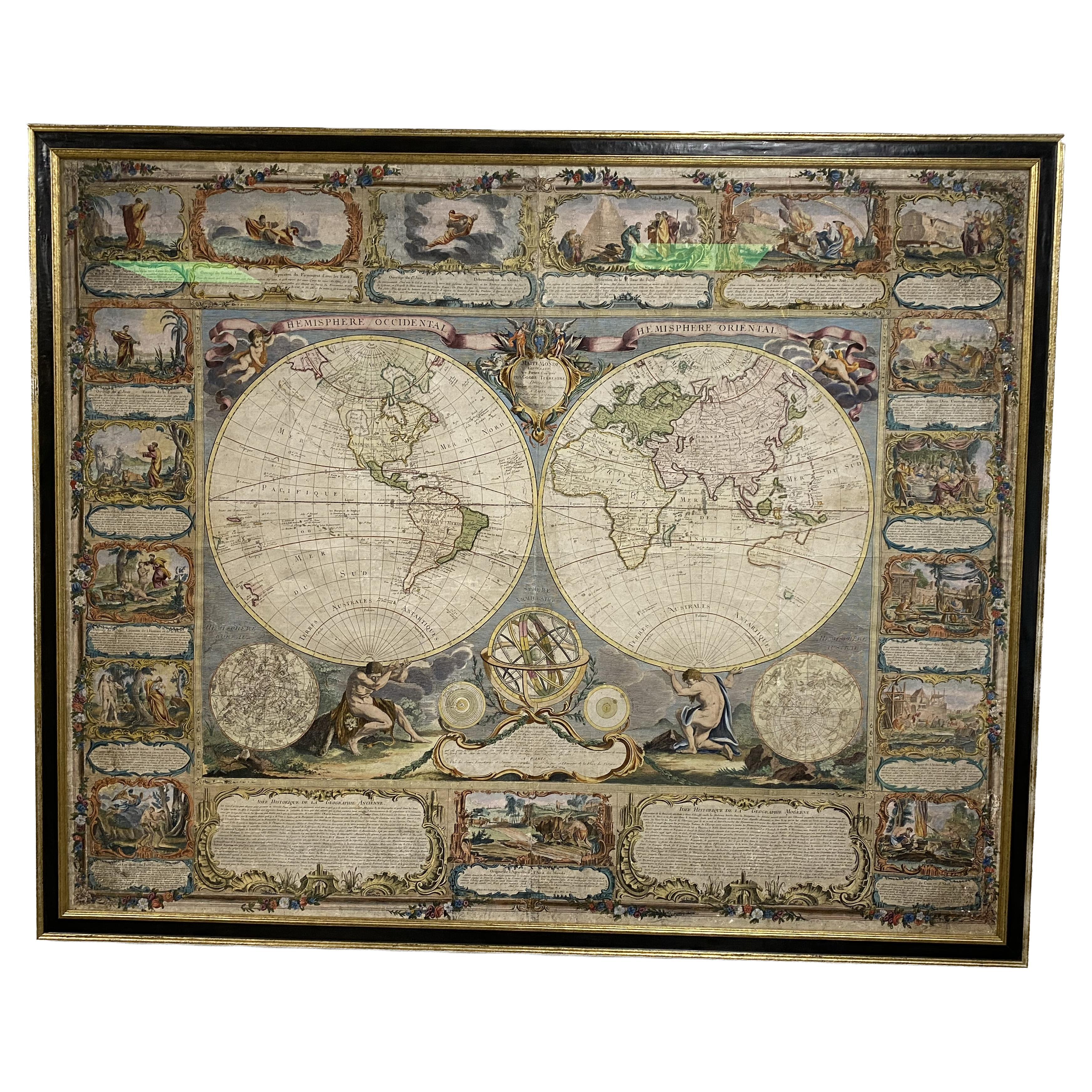
- Colored wall map of the WORLDBy ChambonLocated in ZWIJNDRECHT, NL“Mappe Monde, contenant les Parties Connues du Globe Terrestre” CHAMBON, Gobert-Denis (France, 17.. - 1781) Paris, Longchamps et Janvier, 1754 Size H. 115 x W. 145 cm. Gobert-Denis Chambon made copper engraving after the work of Guillaume De L’Isle, published in 1754 by Jean Janvier and S.G. Longschamps. A huge wall map of the world in two hemispheres printed on two sheets, depicting the Eastern and Western hemispheres supported by two male figures, decorated at the bottom right and left with two celestial hemispheres (boreal and southern) and at the bottom in the middle with an armillary sphere, in addition. This map is most notable for its depiction of the Sea of Japan labeled "Mer de Corée" and of "Mer de L'Ouest" or Sea of the West - a great sea, easily the size of the Mediterranean, to flow from the then-known Strait of Juan de Fuca...Category
Antique Mid-18th Century French French Provincial Maps
MaterialsWood, Paper

- Map Exploring The World, Midi FormatLocated in New York City, NYA compelling exploration of the ways that humans have mapped the world throughout history - now in a compact new edition Map: Exploring the World brings together more than 250...Category
21st Century and Contemporary Books
MaterialsPaper


Recently Viewed
View AllMore Ways To Browse
Vintage World Furniture
1967 Furniture
Office World Map
World Map Vintage Maps
World Map Vintage Map
Retro World Map
Retro World Maps
School Maps
School Map
Pull Down Maps
Pull Down Map
Retro Pull Down Maps
Pull Down School Maps
Pull Down School Map Vintage
Pull Down World Map
Russian Collectable
Office World Map
Sea Collectables