Items Similar to Antique Exploration Map of Australia from Beltana to Perth, 1876

Want more images or videos?
Request additional images or videos from the seller
1 of 5
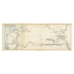
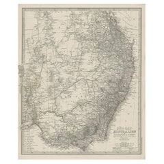
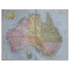
Antique Exploration Map of Australia from Beltana to Perth, 1876
About the Item
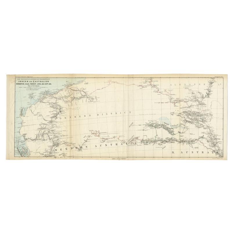
Antique map titled 'Thomas Elders' Expedition durch Inner-Australien von Beltana im Osten bis Perth im Western ausgefuhrt durch E. Giles (..)'. Old map of Australia from Bunbury to Adelaide in the south, upper Murchison to north of Lake Eyre in the north. This map originates from Petermann's 'Geographische Mittheilungen'.
Artists and Engravers: Lithograph by C. Helifarth in Gotha.
Condition: Good, general age-related toning. Some creasing and wear, please study image carefully.
Date: 1876
Overall size: 69 x 27.5 cm.
Image size: 65 x 25 cm.
We sell original antique maps to collectors, historians, educators and interior decorators all over the world. Our collection includes a wide range of authentic antique maps from the 16th to the 20th centuries. Buying and collecting antique maps is a tradition that goes back hundreds of years. Antique maps have proved a richly rewarding investment over the past decade, thanks to a growing appreciation of their unique historical appeal. Today the decorative qualities of antique maps are widely recognized by interior designers who appreciate their beauty and design flexibility. Depending on the individual map, presentation, and context, a rare or antique map can be modern, traditional, abstract, figurative, serious or whimsical. We offer a wide range of authentic antique maps for any budget.
- Dimensions:Height: 10.83 in (27.5 cm)Width: 27.17 in (69 cm)Depth: 0 in (0.01 mm)
- Materials and Techniques:
- Period:
- Date of Manufacture:1876
- Condition:
- Seller Location:Langweer, NL
- Reference Number:
About the Seller
5.0
Platinum Seller
These expertly vetted sellers are 1stDibs' most experienced sellers and are rated highest by our customers.
Established in 2009
1stDibs seller since 2017
1,919 sales on 1stDibs
Typical response time: <1 hour
- ShippingRetrieving quote...Ships From: Langweer, Netherlands
- Return PolicyA return for this item may be initiated within 14 days of delivery.
More From This SellerView All
- Antique Exploration Map of Australia from Sharks Bay to Alice Springs, 1876Located in Langweer, NLAntique map titled 'Die neuesten Entdeckungsreisen Innern von Australien von Warburton, Giles, Forrest (..)'. Old map of Australia from Sharks Bay to 90 Mile Beach over to Alice Springs...Category
Antique 19th Century Maps
MaterialsPaper
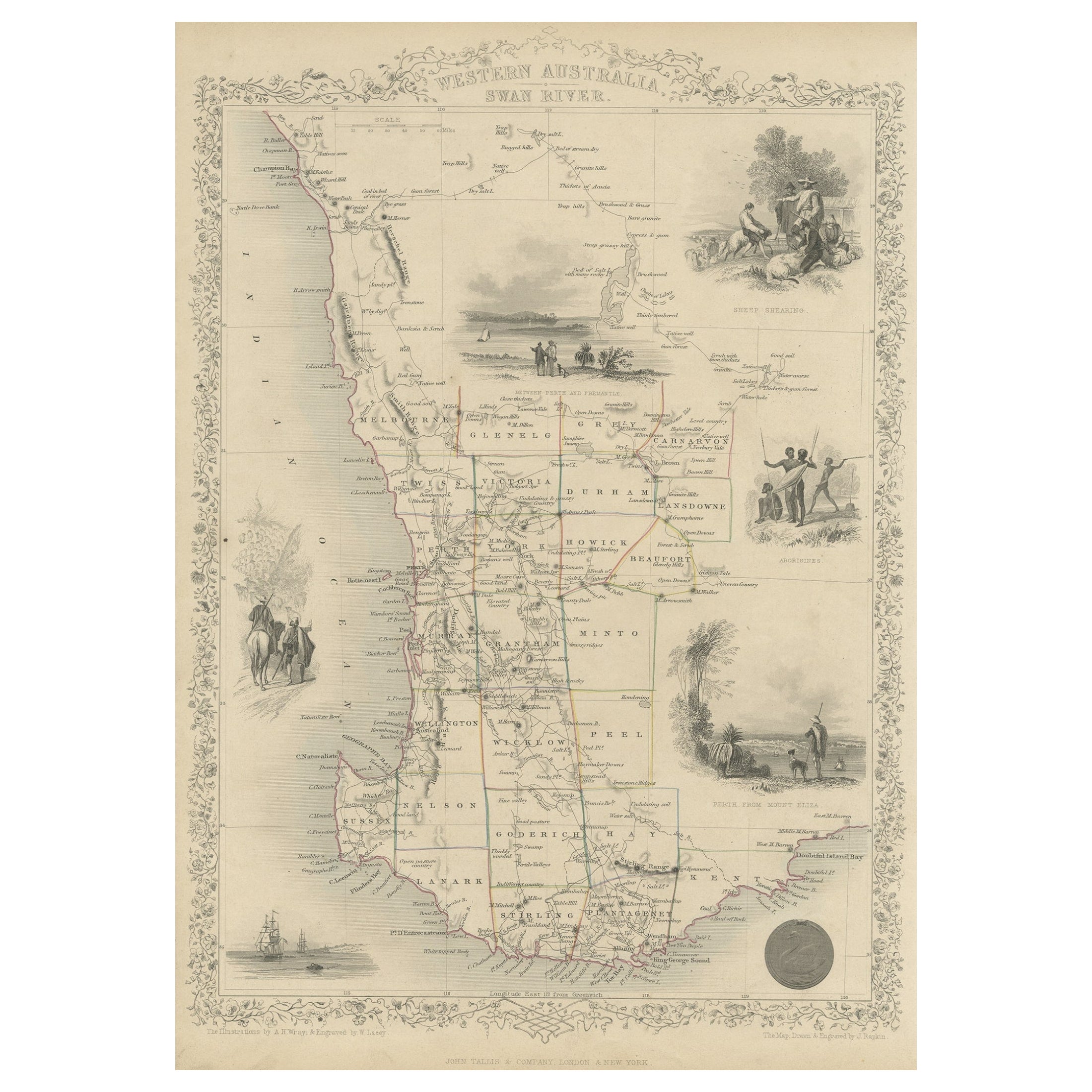
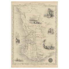
- Map of Western Australia & Swan River, insets of Perth, Aboriginals, Sheep, 1851Located in Langweer, NLAntique map titled 'Western Australia, Swan River'. Map of Western Australia and Swan River, surrounded by illustrations of Perth, Aborigines and sheep shea...Category
Antique 1850s Maps
MaterialsPaper
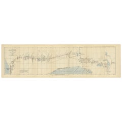
- The 4000km Exploration of Ernest Giles from Beltena to Perth, Australia in 1875Located in Langweer, NLThe map shows the route of the 1875 exploration led by Ernest Giles from Beltana Station in South Australia to the city of Perth in Western Australia. This was Giles' fourth and most...Category
Antique 1870s Prints
MaterialsPaper
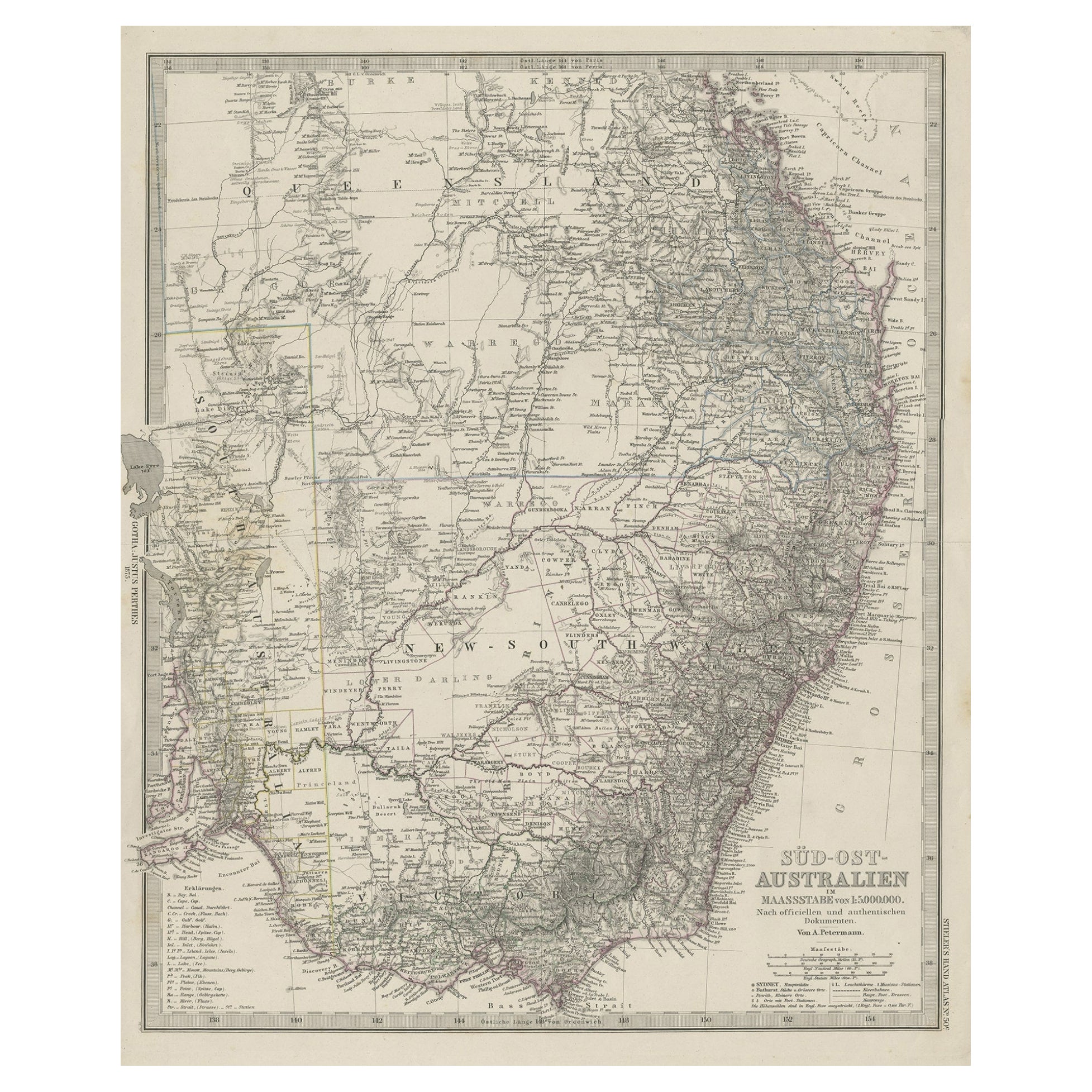
- Antique Engraved Map of South East Australia from a German Atlas, 1848Located in Langweer, NLAntique map Australia titled 'Süd-Ost Australien'. Detailed map of South East Australia. Orginates from 'Stieler's Hand Atlas', published in Ge...Category
Antique 19th Century Maps
MaterialsPaper
- German Antique Map of Southeastern Australia, 1904Located in Langweer, NLThis large antique map is taken from; 'Andrees Allgemeiner Handatlas in 126 Haupt-Und 139 Nebenkarten', Bielefeld; Leipzig: Velhagen & Klasing 1899. Andrees Allgemeiner Handatlas was...Category
20th Century Maps
MaterialsPaper
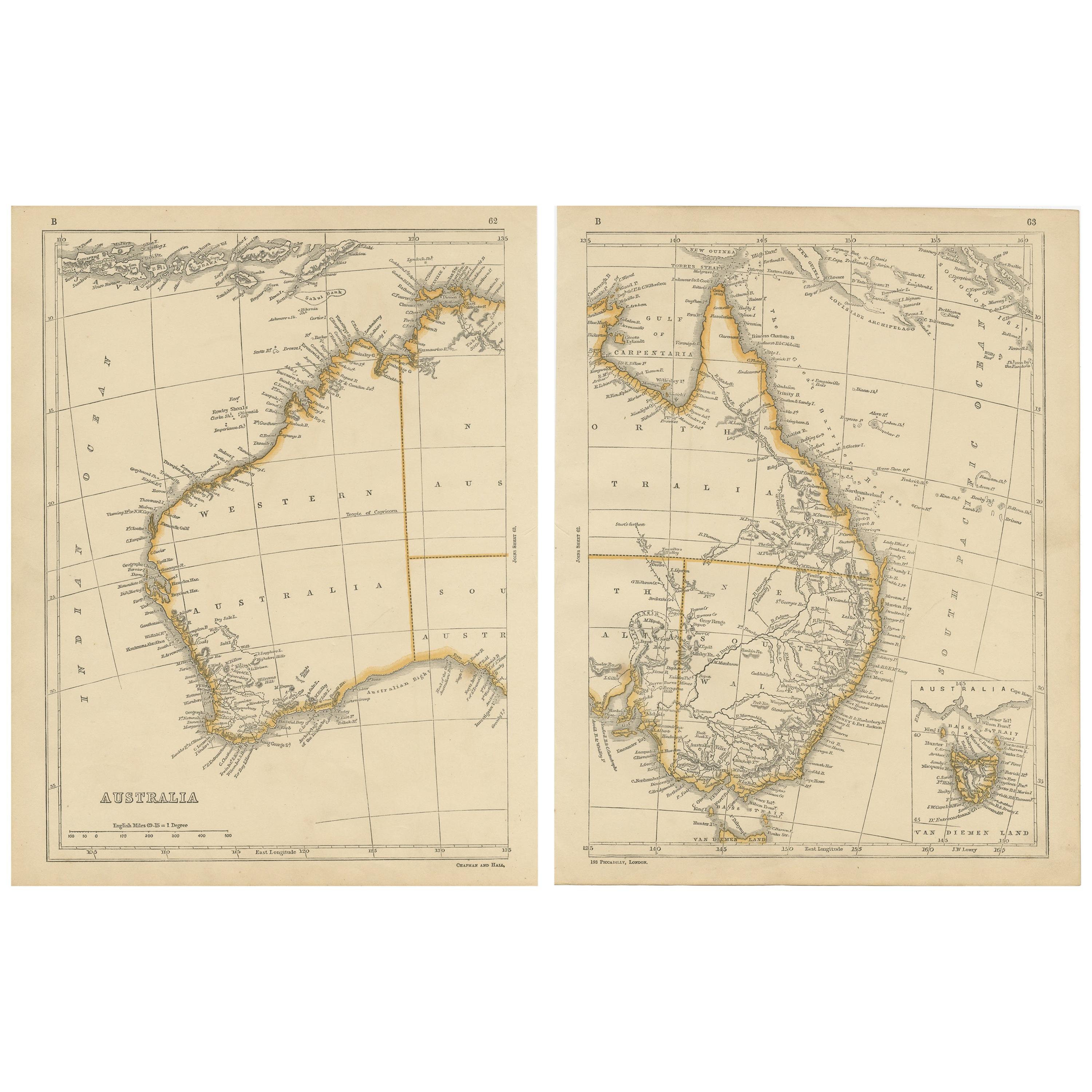
- Antique Map of Australia by Lowry, 1852Located in Langweer, NLAntique map titled 'Australia'. Two individual sheets of Australia. This map originates from 'Lowry's table Atlas constructed and engraved from the most recent authorities' by J.W. L...Category
Antique Mid-19th Century Maps
MaterialsPaper
You May Also Like
- 1967 World Exploration School MapLocated in Tarrytown, NYPull down world exploration map from 1967.Category
Vintage 1960s Maps
MaterialsPaper
- Large Original Antique Map of Australia, Fullarton, C.1870Located in St Annes, LancashireGreat map of Australia From the celebrated Royal Illustrated Atlas Engraved by Swanston after the drawing by Augustus Petermann Lithograph. Original color. Published by ...Category
Antique 1870s Scottish Maps
MaterialsPaper
- Large Original Antique Map of Australia by Sidney Hall, 1847Located in St Annes, LancashireGreat map of Australia Drawn and engraved by Sidney Hall Steel engraving Original colour outline Published by A & C Black. 1847 Unframed Free shipping.Category
Antique 1840s Scottish Maps
MaterialsPaper
- Captain Cook's Exploration of Tahiti 18th C. Hand-Colored Map by BellinBy Jacques-Nicolas BellinLocated in Alamo, CAThis beautiful 18th century hand-colored copper plate engraved map is entitled "Carte de l'Isle de Taiti, par le Lieutenant J. Cook" was created by Jacques Nicolas Bellin and publish...Category
Antique Mid-18th Century French Maps
MaterialsPaper
- Large Original Vintage Map of Australia, circa 1920Located in St Annes, LancashireGreat map of Australia Original color. Good condition Published by Alexander Gross Unframed.Category
Vintage 1920s English Maps
MaterialsPaper
- 1880s Map of The Italian Alps from Milan to Lake GardaLocated in Roma, ITGeographical Map of the Profile and Elevation of the Italian Alps from Milano to Lake Garda. The map features the name of each peak and key cities including Monza, Brescia and Bergam...Category
Antique 1880s Italian Maps
MaterialsParchment Paper


Recently Viewed
View AllMore Ways To Browse
Furniture To Sell
Antique Australia
Australian Designer Furniture
Australian Antiques
Australia 19th Century
Australian Antique Furniture
Antique Western Collectibles
Antique Furniture In Australia
Australia Antique Furniture
Map Australia
Maps Of Australia
19th Century Australian Furniture
South Western Antiques
Antique Collectables Australia
Antique Maps Australia
Antique Map Australia
Australia Antique Map
Antique Australian Maps