Antique Maps Australia

22
to
69
215
27
131
97
76
41
30
24
22
22
22
18
18
12
9
8
8
8
7
7
6
5
5
5
5
4
4
4
3
3
3
3
2
1
1
1
1
1
1
4
4
2
2
2
Sort By
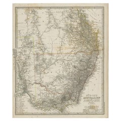
Antique Map of South East Australia by Stieler, c.1848
By Thomas Kitchin
Located in Langweer, NL
Antique map Australia titled 'Süd-Ost Australien'. Detailed map of South East Australia. Orginates
Category

19th Century Antique Maps Australia

Materials

Paper

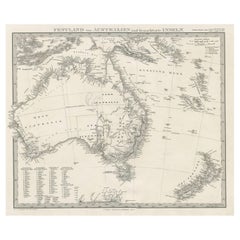
German Antique Map of Australia and New Zealand, 1857
Located in Langweer, NL
Antique map Australia titled 'Festland von Australien und benachbarte Inseln'. Detailed map of
Category

19th Century Antique Maps Australia

Materials

Paper

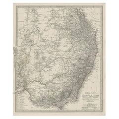
Antique Engraved Map of South East Australia from a German Atlas, 1848
Located in Langweer, NL
Antique map Australia titled 'Süd-Ost Australien'. Detailed map of South East Australia
Category

19th Century Antique Maps Australia

Materials

Paper

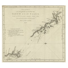
Original Copper Engraving of the Northeast Coast of Australia, 1803
Located in Langweer, NL
Antique map Australia titled 'Kaart van een gedeelte van de Kust van Nieuw Zuid Wales van Kwelling
Category

Early 1800s Antique Maps Australia

Materials

Paper

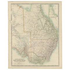
Antique Detailed Map of New South Wales, Queensland & Victoria, Australia, 1865
Located in Langweer, NL
Antique map Australia titled 'South Australia, New South Wales, Victoria & Queensland'. Old map
Category

19th Century Antique Maps Australia

Materials

Paper

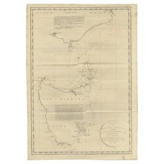
Large Antique Map of Bass Strait, Tasmania, Australia by Cook, 1803
Located in Langweer, NL
Antique map Australia titled 'Kaart van Basses Straat tusschen Nieuw Zuid Wales en van Diemensland
Category

19th Century Antique Maps Australia

Materials

Paper

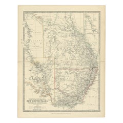
Antique Map of South Australia, Victoria, Queensland and New South Wales, c.1860
Located in Langweer, NL
Antique map Australia titled 'South Australia, New South Wales, Victoria & Queensland'. Old map
Category

19th Century Antique Maps Australia

Materials

Paper

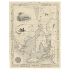
Decorative Map of part of South Australia with Illustrations of Adelaide, 1851
Located in Langweer, NL
Antique map Australia titled 'Part of South Australia'. Decorative map of part of South
Category

1850s Antique Maps Australia

Materials

Paper

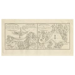
Antique Map of Endeavour River and Botany Bay, New South Wales, Australia, 1803
Located in Langweer, NL
Antique map Australia titled 'Mond van de Endeavour Rivier in Nieuw Zuid Wales' and 'Botanie Baai
Category

19th Century Antique Maps Australia

Materials

Paper

Antique Map of Suffren Island by Cook, 1803
Located in Langweer, NL
Antique map Australia titled 'Gezigt van het Eil. Suffren'. Antique map of Suffren Island
Category

19th Century Antique Maps Australia

Materials

Paper

Antique Map of South Australia by Tallis, 1851
By Thomas Kitchin
Located in Langweer, NL
Antique map Australia titled 'Part of South Australia'. Decorative map of part of South Australia
Category

19th Century Antique Maps Australia

Materials

Paper

Antique Map of Australia by Johnston '1909'
Located in Langweer, NL
Antique map titled 'Australia'. Original antique map of Australia. With inset maps of Melbourne
Category

Early 20th Century Antique Maps Australia

Materials

Paper

Antique Map of Australia by Johnston '1909'
H 19.49 in W 24.41 in D 0.02 in
Antique Map of Australia by Lowry, 1852
Located in Langweer, NL
Antique map titled 'Australia'. Two individual sheets of Australia. This map originates from
Category

Mid-19th Century Antique Maps Australia

Materials

Paper

Antique Map of Australia by Lowry, 1852
H 12.21 in W 9.65 in D 0.02 in
Antique Map of Australia by Levasseur, '1875'
Located in Langweer, NL
Antique map titled 'Carte générale de l'Australie'. Large map of Australia. This map originates
Category

Late 19th Century Antique Maps Australia

Materials

Paper

Antique Map of Australia by Levasseur, '1875'
H 18.71 in W 24.02 in D 0.02 in
German Antique Map of Australia, Meyers, 1885
Located in Langweer, NL
Australien.' (Map of Australia. With inset maps of the large cities and Tasmania.) This attractive
Category

19th Century Antique Maps Australia

Materials

Paper

Large Original Vintage Map of Australia, circa 1920
Located in St Annes, Lancashire
Great map of Australia Original color. Good condition Published by Alexander Gross
Category

1920s English Antique Maps Australia

Materials

Paper

Large Original Vintage Map of Australia, circa 1920
No Reserve
H 19.5 in W 25 in D 0.07 in
Antique Map of Australia by H. Kiepert, 1875
Located in Langweer, NL
Antique map titled 'Australien'. Large and detailed map of Australia and New Zealand. With color
Category

Late 19th Century Antique Maps Australia

Materials

Paper

Antique Map of Australia by H. Kiepert, 1875
H 19.1 in W 23.63 in D 0.02 in
Antique Map of South Australia by Johnston, 1882
By Thomas Kitchin
Located in Langweer, NL
Antique map titled 'South Australia, New South Wales, Victoria & Queensland'. Old map of Southern
Category

19th Century Antique Maps Australia

Materials

Paper

Antique Map of Australia and New Zealand, c.1860
Located in Langweer, NL
Antique map titled 'Australia and New Zealand'. Unusual edition of this map of Australia and New
Category

19th Century Antique Maps Australia

Materials

Paper

Large Original Vintage Map of Western Australia, circa 1920
Located in St Annes, Lancashire
Great map of Western Australia with a vignette of Tasmania. Original color. Good condition
Category

1920s English Edwardian Antique Maps Australia

Materials

Paper

Large Original Antique Map of Australia, Fullarton, C.1870
Located in St Annes, Lancashire
Great map of Australia From the celebrated Royal Illustrated Atlas Engraved by Swanston after
Category

1870s Scottish Antique Maps Australia

Materials

Paper

Large Original Antique Map of Australia, Fullarton, C.1870
No Reserve
H 18.5 in W 22.5 in D 0.07 in
German Antique Map of Australia and Polynesia, c.1870
Located in Langweer, NL
Antique map titled 'Inseln des Grossen Oceans, Australien und Polynesien'. Old map of Australia and
Category

19th Century Antique Maps Australia

Materials

Paper

Old Map of Southern Australia, with an Inset Map of Cape York Peninsula, 1882
Located in Langweer, NL
Antique map titled 'South Australia, New South Wales, Victoria & Queensland'. Old map of
Category

1880s Antique Maps Australia

Materials

Paper

Large Original Vintage Map of Queensland, Australia, circa 1920
Located in St Annes, Lancashire
Great map of Queensland Original color. Good condition Published by Alexander Gross
Category

1920s English Edwardian Antique Maps Australia

Materials

Paper

Antique Map of Southeastern Australia by F. von Stülpnagel, 1850
Located in Langweer, NL
Antique map titled 'Süd-Östlichen Australien'. Map of southeastern Australia with inset maps of
Category

Mid-19th Century Antique Maps Australia

Materials

Paper

Antique Map of New South Wales with Inset Maps of Australia and Swan River, 1854
Located in Langweer, NL
Antique map titled 'Colony of New South Wales'. Map of New South Wales with inset maps of Australia
Category

19th Century Antique Maps Australia

Materials

Paper

Large Original Antique Map of Australia by Sidney Hall, 1847
Located in St Annes, Lancashire
Great map of Australia Drawn and engraved by Sidney Hall Steel engraving Original colour
Category

1840s Scottish Antique Maps Australia

Materials

Paper

Large Original Antique Map of Australia by Sidney Hall, 1847
No Reserve
H 12.25 in W 17.25 in D 0.07 in
Antique Map of New South Wales 'Australia' by Wyld '1845'
Located in Langweer, NL
Wales, Australia. This map originates from 'An Atlas of the World, Comprehending Separate Maps of its
Category

Mid-19th Century Antique Maps Australia

Materials

Paper

Antique Map of South Australia by A.K. Johnston, 1865
Located in Langweer, NL
Antique map titled 'South Australia, New South Wales, Victoria & Queensland'. This map originates
Category

Mid-19th Century Antique Maps Australia

Materials

Paper

Antique Map of Victoria ‘Australia’ by J. Tallis, circa 1855
Located in Langweer, NL
A highly decorative and finely engraved mid-19th century map of Victoria, Australia which appeared
Category

Mid-19th Century Antique Maps Australia

Materials

Paper

Antique Exploration Map of Australia from Beltana to Perth, 1876
Located in Langweer, NL
im Western ausgefuhrt durch E. Giles (..)'. Old map of Australia from Bunbury to Adelaide in the
Category

19th Century Antique Maps Australia

Materials

Paper

Antique Map of Asia Depicting Asia and Australia, c.1814
Located in Langweer, NL
Antique map titled 'Asia'. This map depicts Asia and Australia. Engraved by J. and G. Menzies and
Category

19th Century Antique Maps Australia

Materials

Paper

Antique Map of New South Wales in Australia, ca. 1850
Located in Langweer, NL
Antique map of Victoria, or Port Phillip (12.7 x 10.0") in Australia. Superb map of Victoria
Category

Mid-19th Century European Antique Maps Australia

Materials

Paper

Antique Map of New South Wales in Australia, ca. 1850
Free Shipping
H 13.4 in W 9.8 in D 0.002 in
Antique Map of Australia and Polynesia, inset of Tasmania c.1860
Located in Langweer, NL
German antique map titled 'Australien und Polynesien'. Old map of Australia (New Holland) and
Category

19th Century Antique Maps Australia

Materials

Paper

Antique Map of Asia and Australia with a Speculative Coastline, 1777
Located in Langweer, NL
Antique map titled 'A New & Accurate Map of Asia'. Detailed map of Asia and Australia, shows a
Category

18th Century Antique Maps Australia

Materials

Paper

Old Antique Map of the Banda Islands (Southeast), Indonesia & Northern Australia
By F. Valentijn
Located in Langweer, NL
Original antique map titled 'Kaart van de Zuyd-Ooster Eylanden van Banda'. Important map of the
Category

Early 18th Century Antique Maps Australia

Materials

Paper

Antique Map of Victoria, or Port Phillip in Australia, ca. 1850
Located in Langweer, NL
centered around Melbourne, Australia. Crafted by John Tallis around 1850, this map is part of the
Category

Mid-19th Century European Antique Maps Australia

Materials

Paper

Large Original Vintage Map of New South Wales, Australia, circa 1920
Located in St Annes, Lancashire
Great map of New South Wales Original color. Good condition Published by Alexander Gross
Category

1920s English Edwardian Antique Maps Australia

Materials

Paper

Detailed German Map of Australia Including Statistics of 1841, Published in 1854
Located in Langweer, NL
geography of the time. The map also honors the history of exploration and discovery in Australia, with
Category

1850s Antique Maps Australia

Materials

Paper

Antique Map of Australia and New Zealand by W. G. Blackie, 1859
Located in Langweer, NL
Antique map titled 'Australia and New Zealand'. Original antique map of Australia and New Zealand
Category

Mid-19th Century Antique Maps Australia

Materials

Paper

Antique Map of Western Australia and Van Diemen's Land or Tasmania, 1833
Located in Langweer, NL
Antique map of Australia titled 'Western Australia - Van-Diemen Island'. Two maps on one sheet
Category

19th Century Antique Maps Australia

Materials

Paper

Antique Map of Australia and surrounding Islands by F. von Stülpnagel, 1850
Located in Langweer, NL
Antique map titled 'Festland von Asutralien und benachbarte Inseln'. Map showing Australia, New
Category

Mid-19th Century Antique Maps Australia

Materials

Paper

Antique Map of South East Asia, Australia and the Indian Ocean, 1726
By F. Valentijn
Located in Langweer, NL
Antique map titled 'Tabula Indiae Orientalis'. Beautiful detailed map of Australia, Southeast
Category

Mid-18th Century Dutch Antique Maps Australia

Materials

Paper

Old Map of the Oceans Around Australia, Indonesia and New Zealand, 1880
Located in Langweer, NL
Antique map titled 'Océanie'. Old map of the oceans around Australia, Indonesia and New Zealand
Category

1880s Antique Maps Australia

Materials

Paper

Map of Western Australia & Swan River, insets of Perth, Aboriginals, Sheep, 1851
Located in Langweer, NL
Antique map titled 'Western Australia, Swan River'. Map of Western Australia and Swan River
Category

1850s Antique Maps Australia

Materials

Paper

Northern Australia Map with The Routes of Explorers Ringwood and McMinn, 1878
Located in Langweer, NL
Antique map titled 'Neue Aufnahmen in Nord-Australien'. Old map of Northern Australia showing
Category

1870s Antique Maps Australia

Materials

Paper

Antique Exploration Map of Australia from Sharks Bay to Alice Springs, 1876
Located in Langweer, NL
, Forrest (..)'. Old map of Australia from Sharks Bay to 90 Mile Beach over to Alice Springs. It shows much
Category

19th Century Antique Maps Australia

Materials

Paper

Old Map of the Pacific, Incl Australia, Polynesia, Melanesia and Malaysia, 1872
Located in Langweer, NL
'. Map of the Pacific, including Australia, Polynesia, Melanesia and Malaysia. Covers the region in
Category

1870s Antique Maps Australia

Materials

Paper

Antique Map of Asia with Northern Portion of Australia “Hollandia Nova", 1727
Located in Langweer, NL
antique map of the continent of Asia with a northern portion of Australia “Hollandia Nova”. The map is
Category

18th Century Antique Maps Australia

Materials

Paper

Antique French Map of the Pacific Ocean with Australia and Polynesia, 1806
Located in Langweer, NL
Antique map titled 'Australasie et Polynesie'. Old map of Oceania and the Pacific Ocean. Originates
Category

19th Century Antique Maps Australia

Materials

Paper

Antique Map of New South Wales with an Inset of Sydney, Australia, 1833
Located in Langweer, NL
Antique map of Australia titled 'New South Wales'. Old map of New South Wales, Australia. With an
Category

19th Century Antique Maps Australia

Materials

Paper

Antique Map of Oceania and the Pacific Ocean, Australia and New Zealand, 1826
Located in Langweer, NL
Antique map of Australia titled 'Karte von Australien'. Old map of Australia and New Zealand
Category

19th Century Antique Maps Australia

Materials

Paper

Map of Australia, New Zealand, Part of China, Japan and Southeast Asia, 1857
Located in Langweer, NL
German Antique map titled 'Australien'. Map of Australia, New Zealand, part of China, Japan and
Category

19th Century Antique Maps Australia

Materials

Paper

Antique Map of Australia, New Zealand and Oceania by F. von Stülpnagel, 1850
Located in Langweer, NL
Antique map titled 'Australien und Polynesien in Mercators Projection'. A map of Australia, New
Category

Mid-19th Century Antique Maps Australia

Materials

Paper

Map of Winter Harbour on Melville Island, Australia by Parry's Expedition, 1821
Located in Langweer, NL
Antique print titled 'Survey of Winter Harbour Melville Island, June 1820'. Chart of the bay or harbor on Melville Island where William Parry's expedition spent the winter of 1819-...
Category

1820s Antique Maps Australia

Materials

Paper

Old Map of Australia Showing The Routes of the Main Explorers, ca.1900
Located in Langweer, NL
Antique print, untitled. This map shows Australia with the routes of explorers in the continent and
Category

Early 1900s Antique Maps Australia

Materials

Paper

Early Map of Sydney with Botany Bay, Port Jackson & Broken Bay, Australia, 1802
Located in Langweer, NL
ground cultivated by the colonists. In the early days of the settlement in Australia there was a prime
Category

Early 1800s Antique Maps Australia

Materials

Paper

French Antique Map of Oceania with Details of the Australian Colonies, c.1840
Located in Langweer, NL
Antique map Oceania titled 'Océanie par C.V. Monin'. Old map of Oceania with an inset of New South
Category

19th Century Antique Maps Australia

Materials

Paper

Map of the Southeastern Part of the Banda Islands, Incl Northern Australia, 1726
Located in Langweer, NL
Antique map titled 'Kaart van de Zuyd-Ooster Eylanden van Banda.' Map of the southeastern part
Category

1720s Antique Maps Australia

Materials

Paper

Antique Coastal Views and a Map of Van Diemens Land (Tasmania), Australia, 1803
Located in Langweer, NL
Antique map Tasmania titled 'Kaart van Diemens Land'. Coastal views and a map of van Diemens
Category

Early 1800s Antique Maps Australia

Materials

Paper

  • 1
Get Updated with New Arrivals
Save "Antique Maps Australia", and we’ll notify you when there are new listings in this category.

Antique Maps Australia For Sale on 1stDibs

With a vast inventory of beautiful furniture at 1stDibs, we’ve got just the antique maps Australia you’re looking for. Each antique maps Australia for sale was constructed with extraordinary care, often using paper. You’ve searched high and low for the perfect antique maps Australia — we have versions that date back to the 18th Century alongside those produced as recently as the 20th Century are available. An antique maps Australia is a generally popular piece of furniture, but those created in Victorian styles are sought with frequency. Many designers have produced at least one well-made antique maps Australia over the years, but those crafted by F. Valentijn and Pierre Larousse are often thought to be among the most beautiful.

How Much is a Antique Maps Australia?

Prices for an antique maps Australia can differ depending upon size, time period and other attributes — at 1stDibs, they begin at $25 and can go as high as $5,212, while the average can fetch as much as $278.

Read More

Pamela Shamshiri Shares the Secrets behind Her First-Ever Book and Its Effortlessly Cool Interiors

The sought-after designer worked with the team at Hoffman Creative to produce a monograph that beautifully showcases some of Studio Shamshiri's most inspiring projects.

Moroccan Artworks and Objects Take Center Stage in an Extraordinary Villa in Tangier

Italian writer and collector Umberto Pasti opens the doors to his remarkable cave of wonders in North Africa.

Montecito Has Drawn Royalty and Celebrities, and These Homes Are Proof of Its Allure

Hollywood A-listers, ex-pat aristocrats and art collectors and style setters of all stripes appreciate the allure of the coastal California hamlet — much on our minds after recent winter floods.

Whaam! Blam! Pow! — a New Book on Pop Art Packs a Punch

Publishing house Assouline and writer Julie Belcove have teamed up to trace the history of the genre, from Roy Lichtenstein, Andy Warhol and Yayoi Kusama to Mickalene Thomas and Jeff Koons.

The Sparkling Legacy of Tiffany & Co. Explained, One Jewel at a Time

A gorgeous new book celebrates — and memorializes — the iconic jeweler’s rich heritage.

What Makes a Gem-Encrusted Chess Set Worth $4 Million?

The world’s most opulent chess set, weighing in at 513 carats, is literally fit for a king and queen.

Tauba Auerbach’s Geometric Pop-Up Book Is Mighty Rare, Thanks to a Hurricane

This sculptural art book has an epic backstory of its own.

Step inside the Storied Mansions of Palm Beach’s Most Effervescent Architect

From Spanish-style courtyards to fanciful fountains, these acclaimed structures abound in surprising and elegant details.