Items Similar to Antique Exploration Map of Australia from Sharks Bay to Alice Springs, 1876
Want more images or videos?
Request additional images or videos from the seller
1 of 5
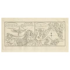
Antique Exploration Map of Australia from Sharks Bay to Alice Springs, 1876
About the Item
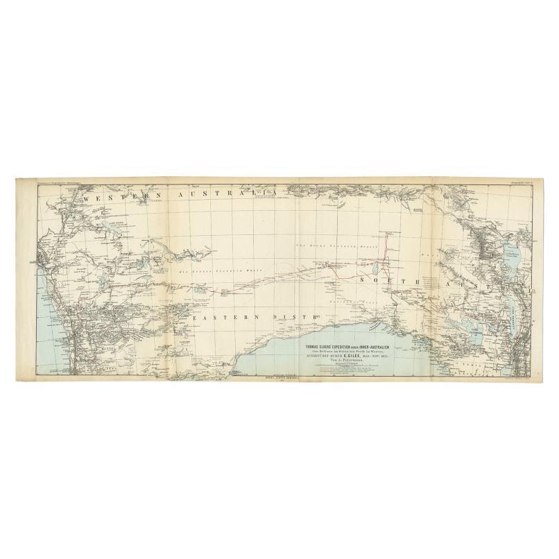
Antique map titled 'Die neuesten Entdeckungsreisen Innern von Australien von Warburton, Giles, Forrest (..)'. Old map of Australia from Sharks Bay to 90 Mile Beach over to Alice Springs. It shows much geographical detail on the inland exploration. This map originates from Petermann's 'Geographische Mittheilungen'.
Artists and Engravers: Lithograph by C. Helifarth in Gotha.
Condition: Good, general age-related toning. Some creasing and wear, please study image carefully.
Date: 1876
Overall size: 69 x 27.5 cm.
Image size: 0.001 x 65 x 25 cm.
We sell original antique maps to collectors, historians, educators and interior decorators all over the world. Our collection includes a wide range of authentic antique maps from the 16th to the 20th centuries. Buying and collecting antique maps is a tradition that goes back hundreds of years. Antique maps have proved a richly rewarding investment over the past decade, thanks to a growing appreciation of their unique historical appeal. Today the decorative qualities of antique maps are widely recognized by interior designers who appreciate their beauty and design flexibility. Depending on the individual map, presentation, and context, a rare or antique map can be modern, traditional, abstract, figurative, serious or whimsical. We offer a wide range of authentic antique maps for any budget.
- Dimensions:Height: 10.83 in (27.5 cm)Width: 27.17 in (69 cm)Depth: 0 in (0.01 mm)
- Materials and Techniques:
- Period:
- Date of Manufacture:1876
- Condition:
- Seller Location:Langweer, NL
- Reference Number:
About the Seller
5.0
Platinum Seller
These expertly vetted sellers are 1stDibs' most experienced sellers and are rated highest by our customers.
Established in 2009
1stDibs seller since 2017
1,933 sales on 1stDibs
Typical response time: <1 hour
- ShippingRetrieving quote...Ships From: Langweer, Netherlands
- Return PolicyA return for this item may be initiated within 14 days of delivery.
More From This SellerView All
- Antique Exploration Map of Australia from Beltana to Perth, 1876Located in Langweer, NLAntique map titled 'Thomas Elders' Expedition durch Inner-Australien von Beltana im Osten bis Perth im Western ausgefuhrt durch E. Giles (..)'. Old map of Australia from Bunbury to A...Category
Antique 19th Century Maps
MaterialsPaper
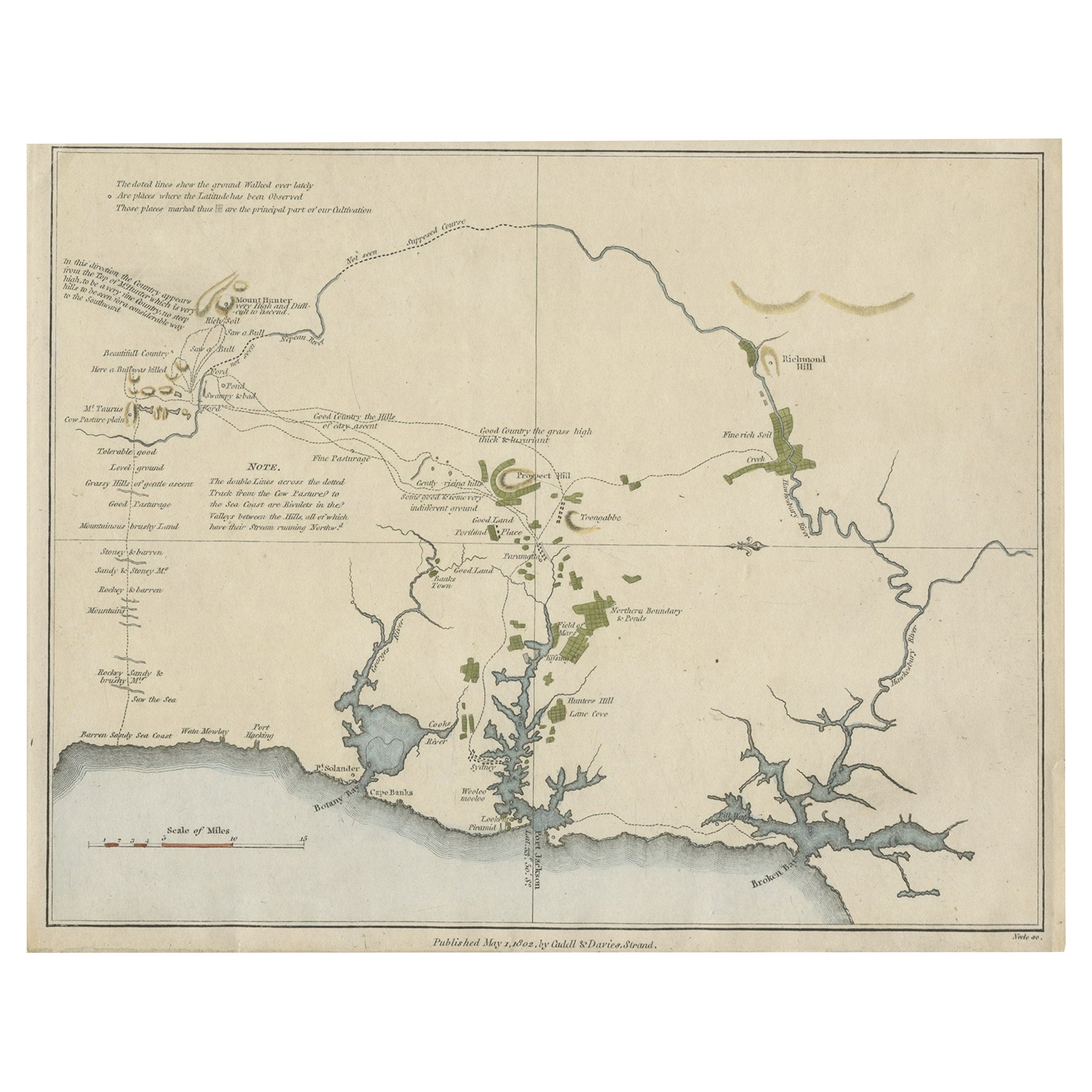
- Early Map of Sydney with Botany Bay, Port Jackson & Broken Bay, Australia, 1802Located in Langweer, NLInteresting chart of the three harbours of Botany Bay, Port Jackson, and Broken Bay showing the ground cultivated by the colonists. In the early days of the settlement in Australia t...Category
Antique Early 1800s Maps
MaterialsPaper
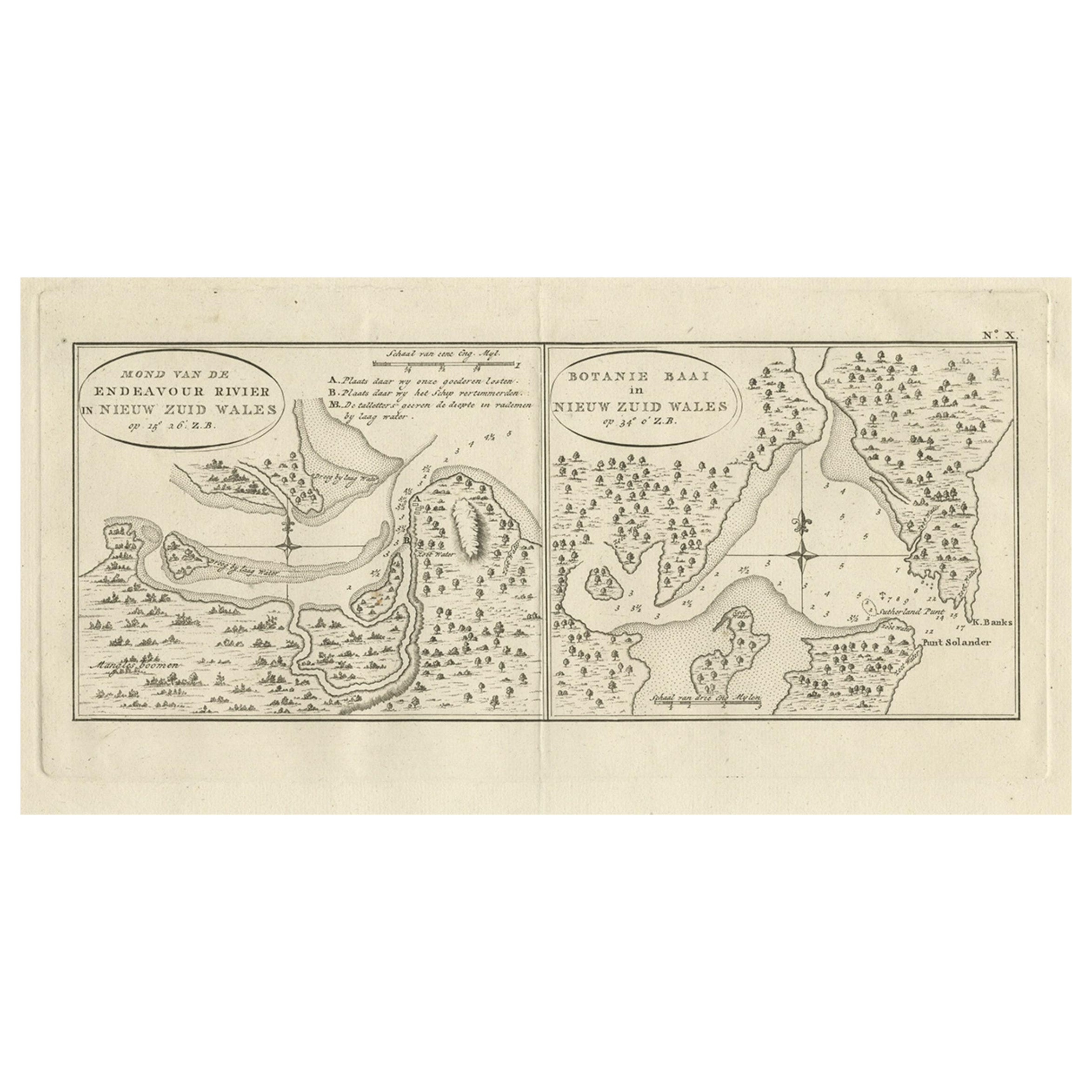
- Antique Map of Endeavour River and Botany Bay, New South Wales, Australia, 1803Located in Langweer, NLAntique map Australia titled 'Mond van de Endeavour Rivier in Nieuw Zuid Wales' and 'Botanie Baai in Nieuw Zuid Wales'. Antique map of the Endeav...Category
Antique 19th Century Maps
MaterialsPaper
- Antique Engraved Map of South East Australia from a German Atlas, 1848Located in Langweer, NLAntique map Australia titled 'Süd-Ost Australien'. Detailed map of South East Australia. Orginates from 'Stieler's Hand Atlas', published in Ge...Category
Antique 19th Century Maps
MaterialsPaper
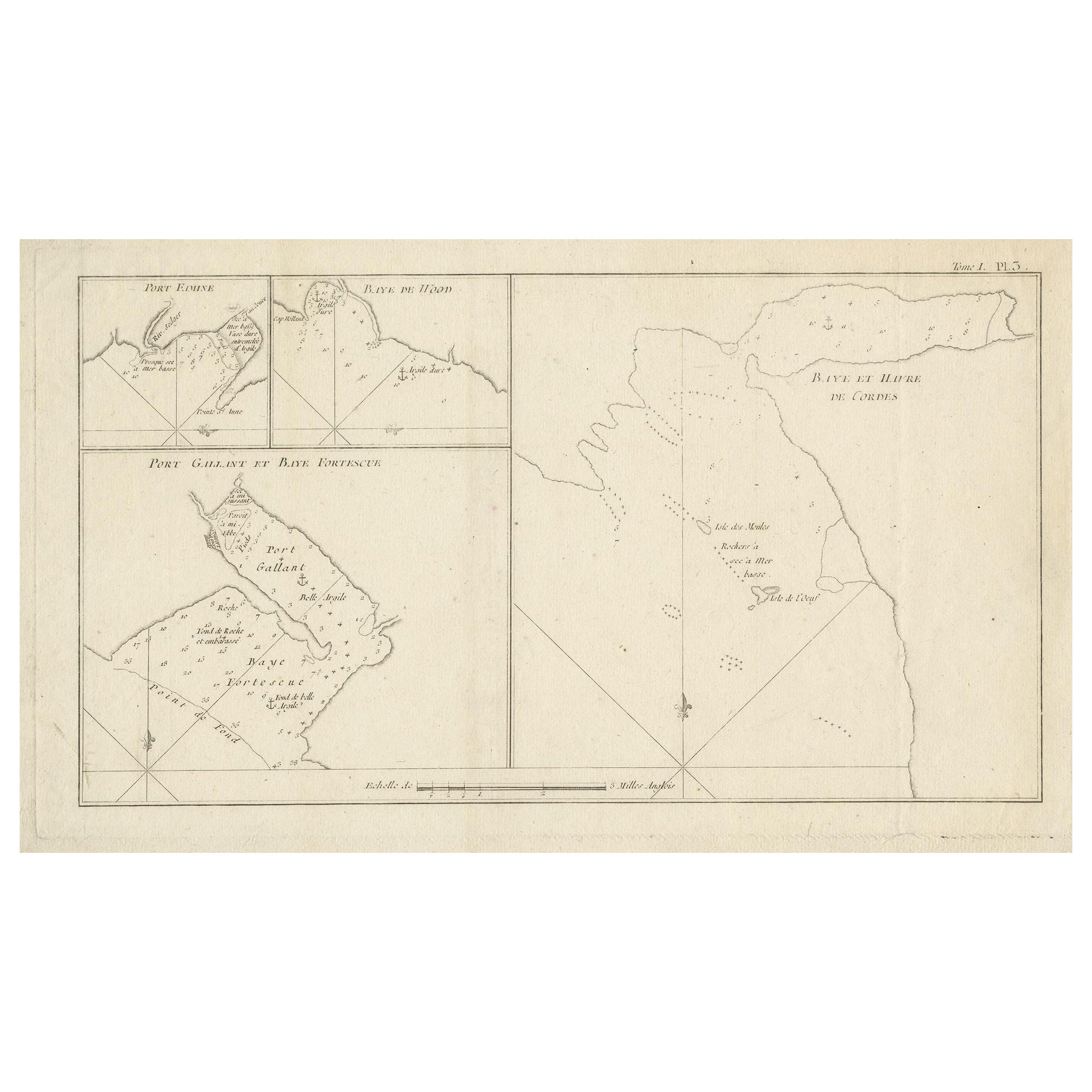
- Antique Map of Cordes Bay and SurroundingsLocated in Langweer, NLAntique map titled 'Baye et Havre de Cordes (..)'. Four maps on the one sheet of; Cordes Bay, Port Famine, Woods Pay, Port Gallant, Fortescue Bay, Chile based on the voyage of John B...Category
Antique Late 18th Century Maps
MaterialsPaper
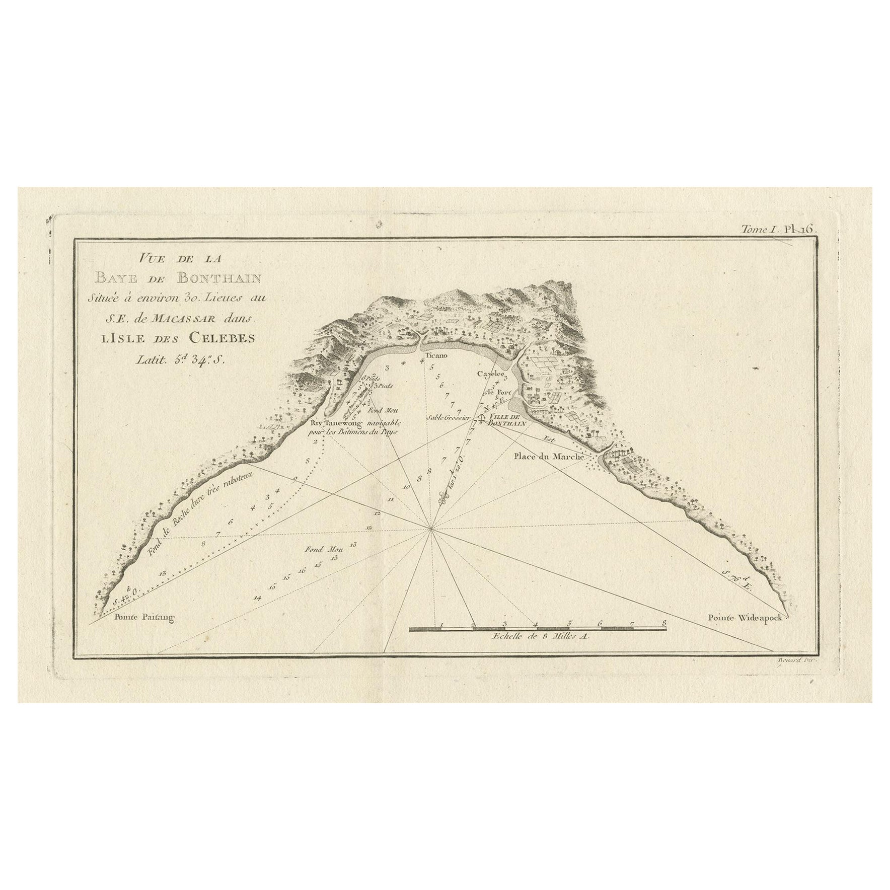
- Antique Map of Bonthain Bay, Sulawesi, CelebesLocated in Langweer, NLAntique map titled 'Vue de la Baye de Bonthain (..)'. Map of the island Sulawesi (Celebes), Indonesia that Philip Carteret rested his crew and made repairs to his ship the Swallow fo...Category
Antique Late 18th Century Maps
MaterialsPaper
You May Also Like
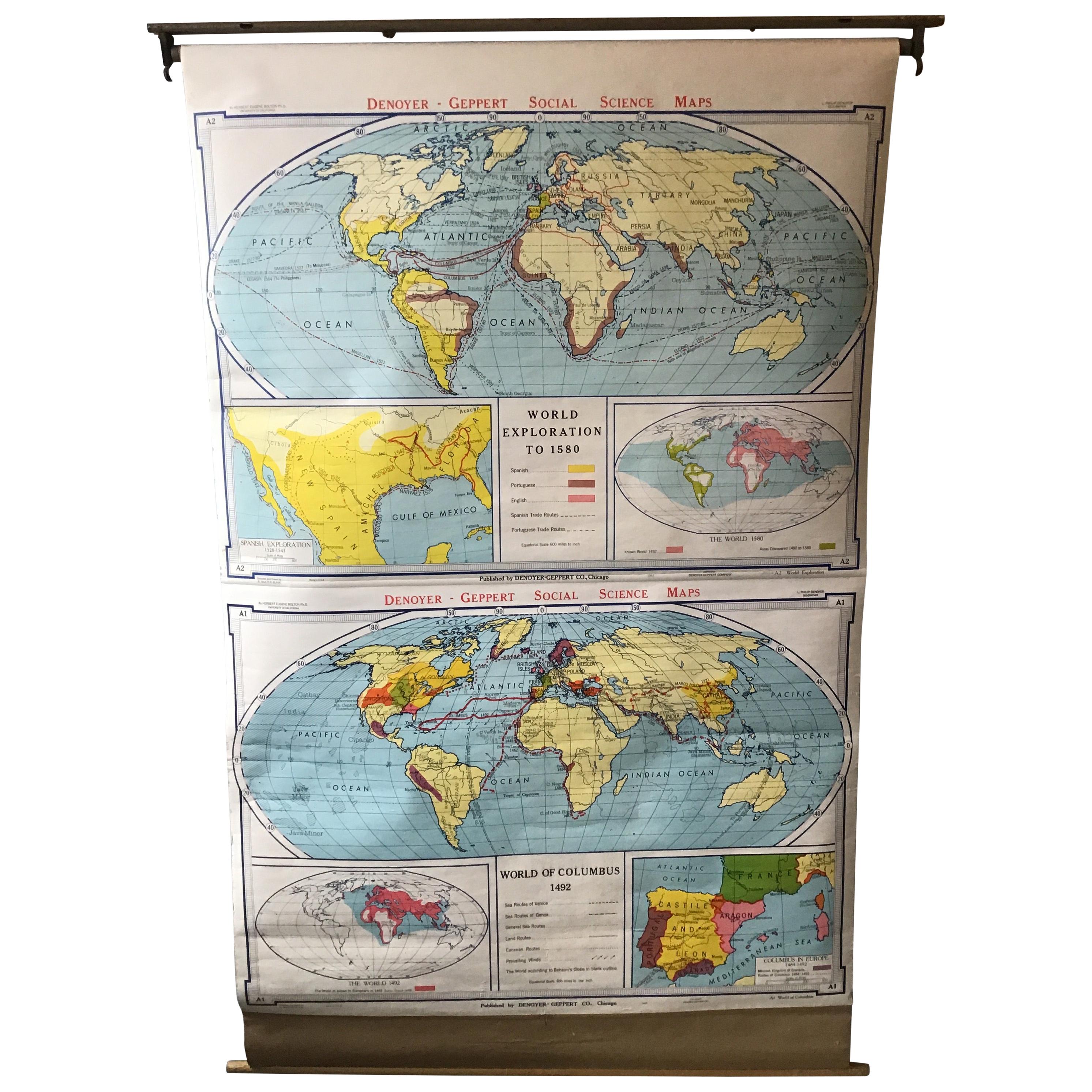
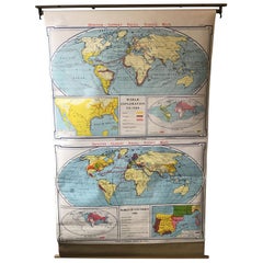
- 1967 World Exploration School MapLocated in Tarrytown, NYPull down world exploration map from 1967.Category
Vintage 1960s Maps
MaterialsPaper
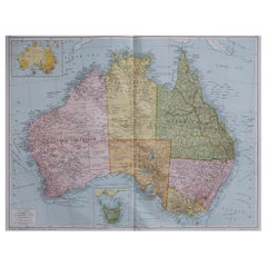
- Large Original Antique Map of Australia, Fullarton, C.1870Located in St Annes, LancashireGreat map of Australia From the celebrated Royal Illustrated Atlas Engraved by Swanston after the drawing by Augustus Petermann Lithograph. Original color. Published by ...Category
Antique 1870s Scottish Maps
MaterialsPaper
- Large Original Antique Map of Australia by Sidney Hall, 1847Located in St Annes, LancashireGreat map of Australia Drawn and engraved by Sidney Hall Steel engraving Original colour outline Published by A & C Black. 1847 Unframed Free shipping.Category
Antique 1840s Scottish Maps
MaterialsPaper
- 1856 U.S. Coast Survey Map of Chesapeake Bay and Delaware BayLocated in Colorado Springs, COPresented is U.S. Coast Survey nautical chart or maritime map of Chesapeake Bay and Delaware Bay from 1856. The map depicts the region from Susquehanna, Maryland to the northern Outer Banks in North Carolina. It also shows from Richmond and Petersburg, Virginia to the Atlantic Ocean. The map is highly detailed with many cities and towns labeled throughout. Rivers, inlets, and bays are also labeled. Various charts illustrating more specific parts of the region are marked on the map using dotted lines. The lines form boxes, and the corresponding chart number and publication date are given. Extensive triangulation surveys were conducted the length of Chesapeake Bay and are illustrated here. Hampton Roads, Virginia is labeled, along with the James, York, and Rappahannock Rivers, which were all extensively surveyed. The chart was published under the supervision of A. D. Bache, one of the most influential and prolific figures in the early history of the U.S. Coast Survey, for the 1856 Report of the Superintendent of the U.S. Coast Survey. Alexander Dallas Bache (1806-1867) was an American physicist, scientist, and surveyor. Bache served as the Superintendent of the U.S. Coast Survey from 1843 to 1865. Born in Philadelphia, Bache toured Europe and composed an important treatise on European Education. He also served as president of Philadelphia's Central High School and was a professor of natural history and chemistry at the University of Pennsylvania. Upon the death of Ferdinand Rudolph Hassler, Bache was appointed Superintendent of the United States Coast Survey. The Office of the Coast Survey, founded in 1807 by President Thomas Jefferson and Secretary of Commerce Albert Gallatin...Category
Antique 1850s American Maps
MaterialsPaper
- Captain Cook's Exploration of Tahiti 18th C. Hand-Colored Map by BellinBy Jacques-Nicolas BellinLocated in Alamo, CAThis beautiful 18th century hand-colored copper plate engraved map is entitled "Carte de l'Isle de Taiti, par le Lieutenant J. Cook" was created by Jacques Nicolas Bellin and publish...Category
Antique Mid-18th Century French Maps
MaterialsPaper
- Large Original Vintage Map of Australia, circa 1920Located in St Annes, LancashireGreat map of Australia Original color. Good condition Published by Alexander Gross Unframed.Category
Vintage 1920s English Maps
MaterialsPaper


Recently Viewed
View AllMore Ways To Browse
Furniture To Sell
Antique Furniture Springs
Antique Spring
Australian Designer Furniture
Australian Antiques
Bay Antique Furniture
Australia 19th Century
Australian Antique Furniture
Antique Furniture In Australia
Antique Bay
Australia Antique Furniture
Map Australia
Maps Of Australia
19th Century Australian Furniture
Antique Collectables Australia
Antique Maps Australia
Antique Map Australia
Australia Antique Map