Items Similar to Early Map of Sydney with Botany Bay, Port Jackson & Broken Bay, Australia, 1802
Want more images or videos?
Request additional images or videos from the seller
1 of 5
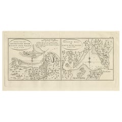
Early Map of Sydney with Botany Bay, Port Jackson & Broken Bay, Australia, 1802
About the Item
Interesting chart of the three harbours of Botany Bay, Port Jackson, and Broken Bay showing the ground cultivated by the colonists. In the early days of the settlement in Australia there was a prime importance to establish sufficient even abundent food supplies so that the colony could not only sustain itself but continue to grow. There are many interesting notes on the map such as "Good country the grass high thick and luxuriant" and "Fine rich soil". This map originates from 'An account of the English colony in New South Wales' by David Collins.
Artists and Engravers: Published by Cadell & Davies, Strand.
Condition: Good, general age-related toning. Please study image carefully.
- Dimensions:Height: 10.24 in (26 cm)Width: 12.01 in (30.5 cm)Depth: 0 in (0.02 mm)
- Materials and Techniques:
- Period:
- Date of Manufacture:1802
- Condition:Wear consistent with age and use.
- Seller Location:Langweer, NL
- Reference Number:
About the Seller
5.0
Platinum Seller
These expertly vetted sellers are 1stDibs' most experienced sellers and are rated highest by our customers.
Established in 2009
1stDibs seller since 2017
1,932 sales on 1stDibs
Typical response time: <1 hour
- ShippingRetrieving quote...Ships From: Langweer, Netherlands
- Return PolicyA return for this item may be initiated within 14 days of delivery.
More From This SellerView All
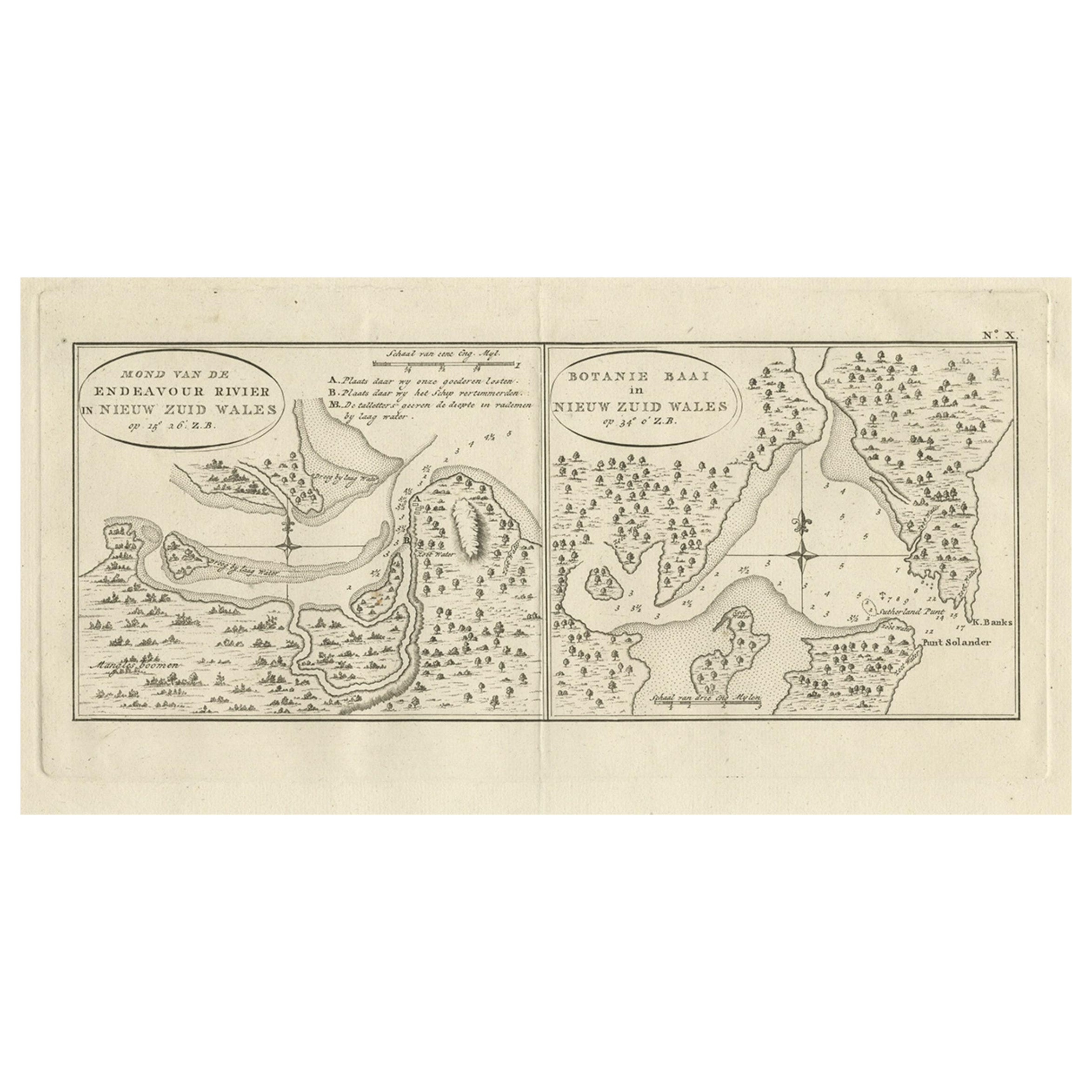
- Antique Map of Endeavour River and Botany Bay, New South Wales, Australia, 1803Located in Langweer, NLAntique map Australia titled 'Mond van de Endeavour Rivier in Nieuw Zuid Wales' and 'Botanie Baai in Nieuw Zuid Wales'. Antique map of the Endeav...Category
Antique 19th Century Maps
MaterialsPaper
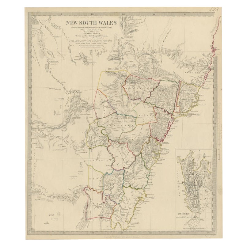
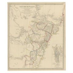
- Antique Map of New South Wales with an Inset of Sydney, Australia, 1833Located in Langweer, NLAntique map of Australia titled 'New South Wales'. Old map of New South Wales, Australia. With an inset map of Sydney. Arists and Engravers: Engraved by J. & C. Walker. Published by ...Category
Antique 19th Century Maps
MaterialsPaper
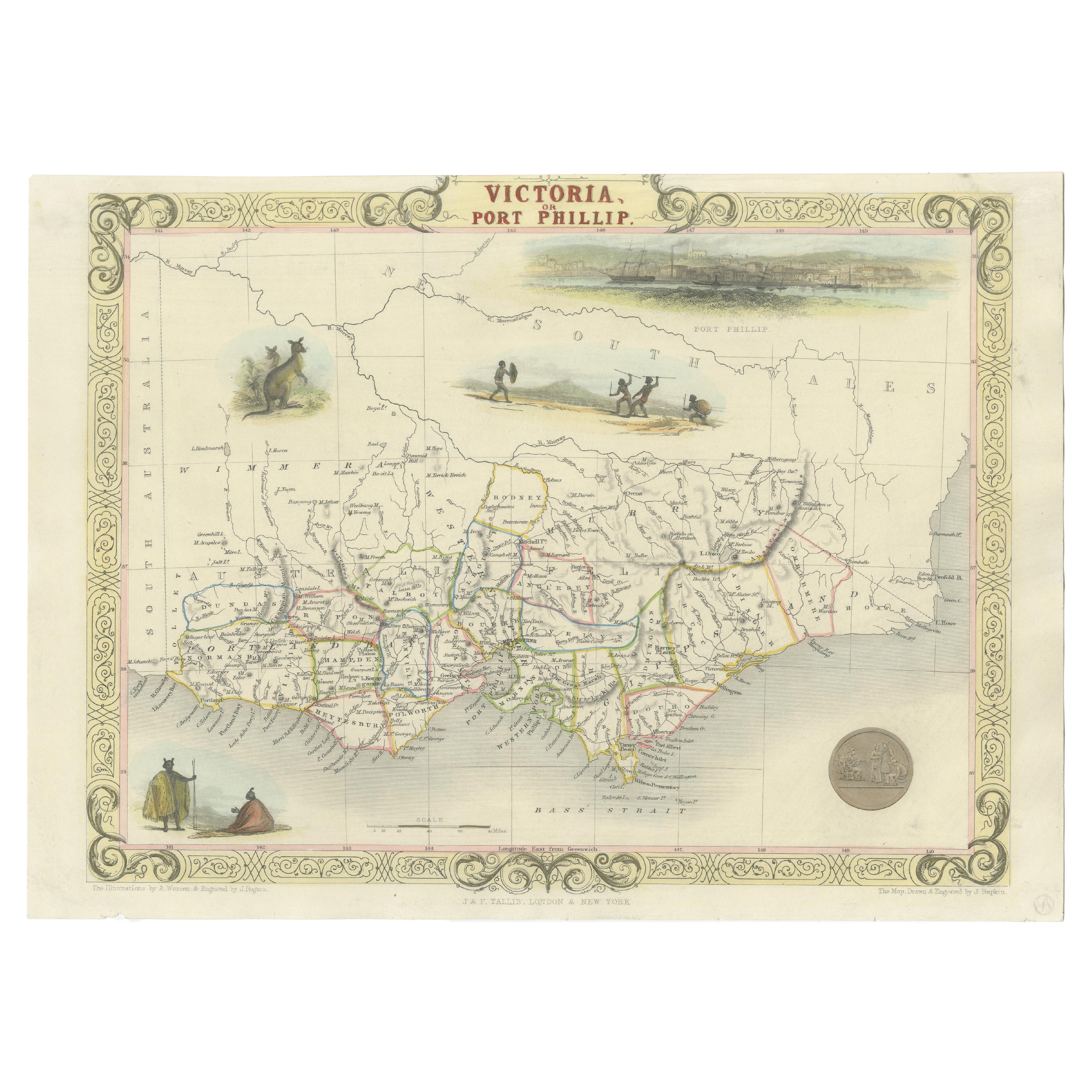
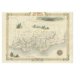
- Antique Map of Victoria, or Port Phillip in Australia, ca. 1850Located in Langweer, NLThis antique map, measuring approximately 12.7 x 10.0 inches, showcases Victoria, specifically centered around Melbourne, Australia. Crafted by John Tallis around 1850, this map is p...Category
Antique Mid-19th Century European Maps
MaterialsPaper
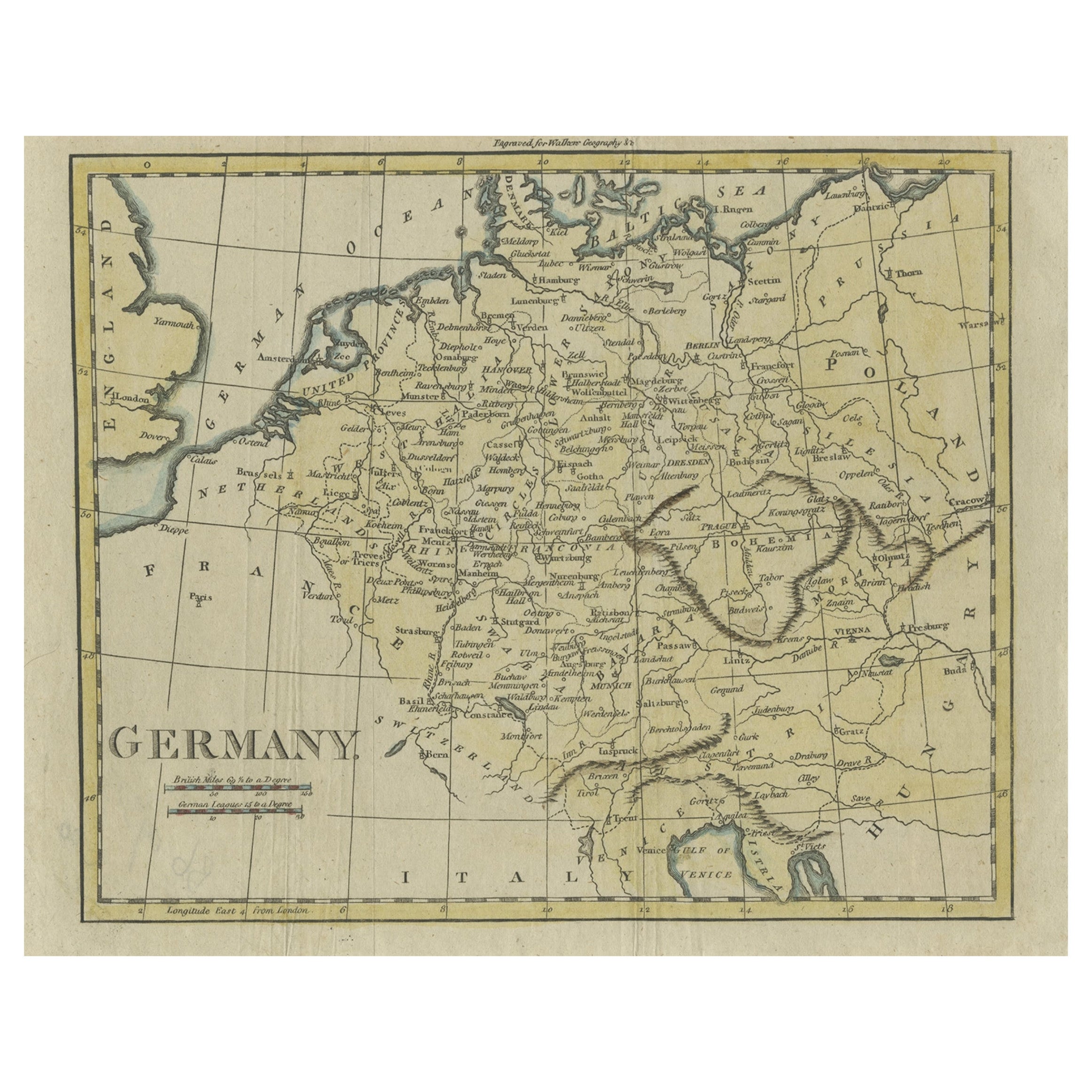
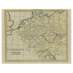
- Antique Map of Germany from an Old English Atlas, c.1802Located in Langweer, NLAntique map titled 'Germany'. Antique map of Germany engraved for 'Atlas to Walker's Geography'. Artists and Engravers: Engraved by W. Darton. Artist: Engraved by W. Darton. Co...Category
Antique 19th Century Maps
MaterialsPaper
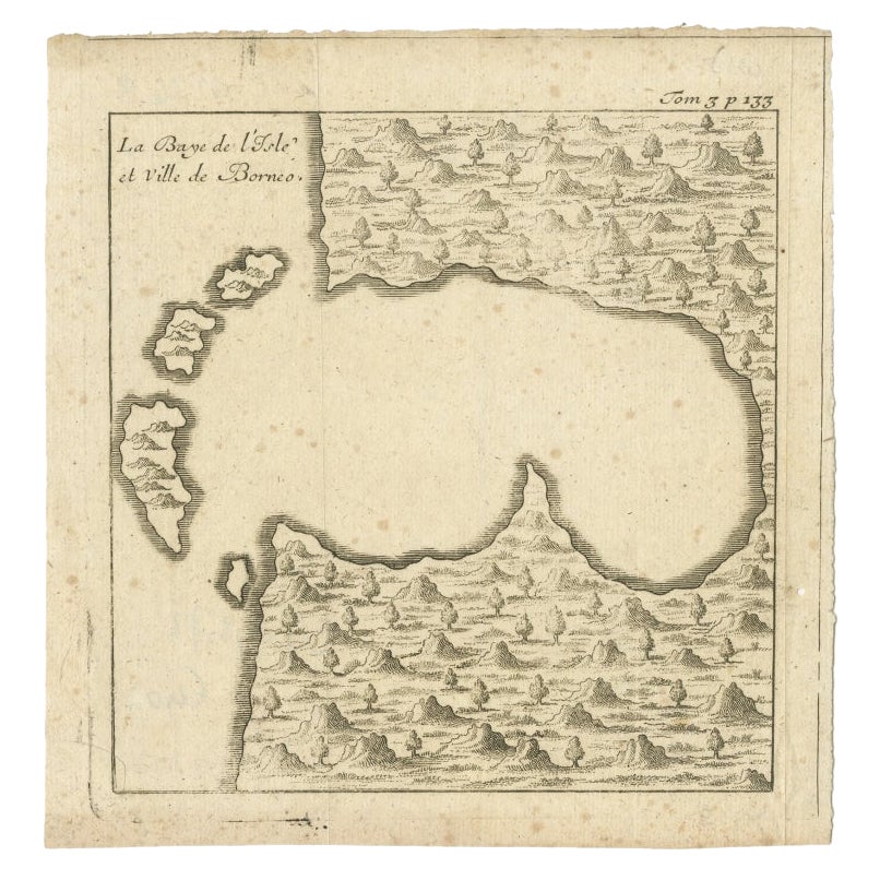
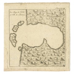
- Antique Map of a Bay of Borneo, Indonesia, c.1760Located in Langweer, NLAntique map titled 'La Baye de l'isle et Ville de Borneo'. Small map depicting a Bay of Borneo. Artists and Engravers: Anonymous. Condition: Good, general age-related toning. ...Category
Antique 18th Century Maps
MaterialsPaper
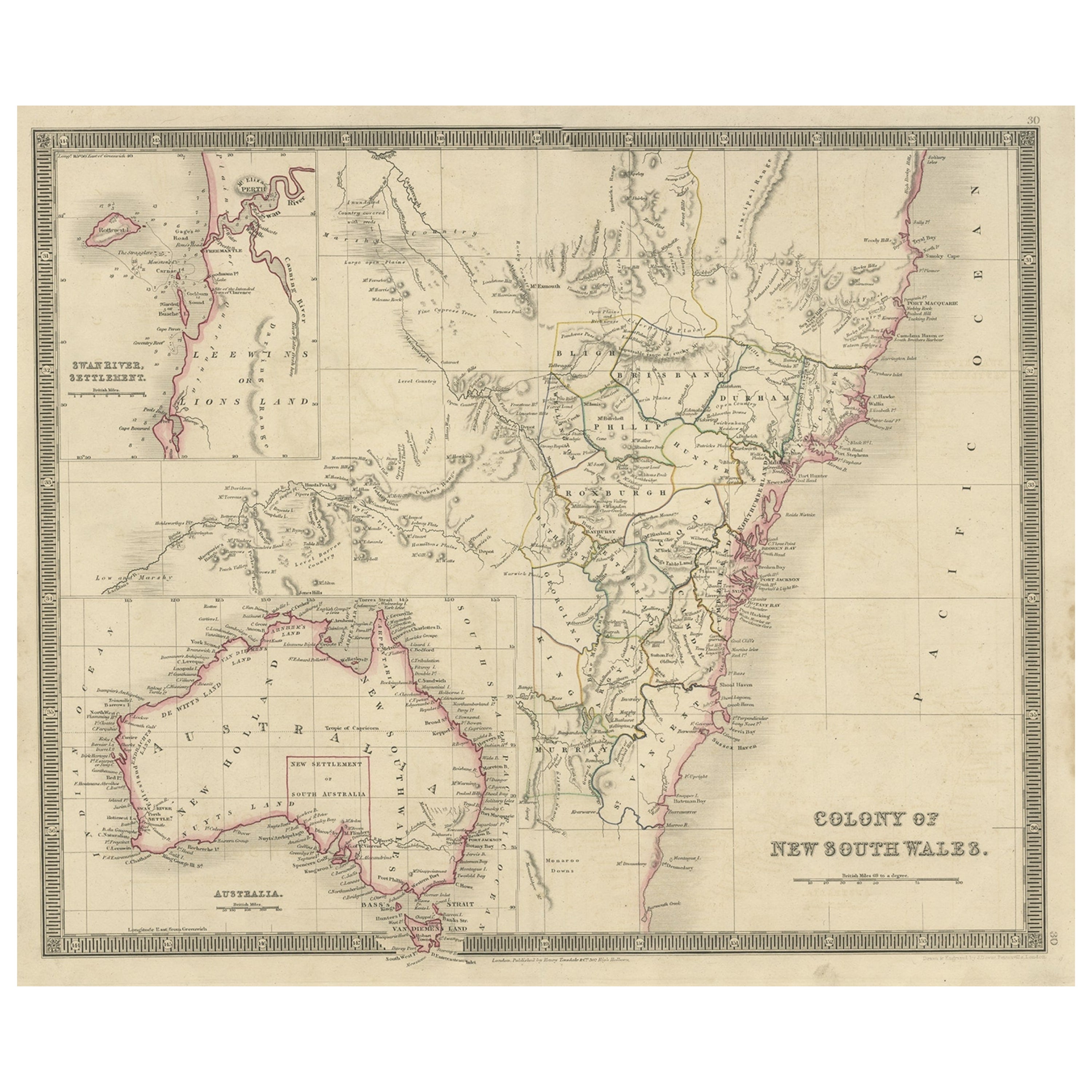
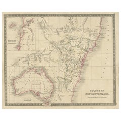
- Antique Map of New South Wales with Inset Maps of Australia and Swan River, 1854Located in Langweer, NLAntique map titled 'Colony of New South Wales'. Map of New South Wales with inset maps of Australia and Swan River. Artists and Engravers: Drawn and engrave...Category
Antique 19th Century Maps
MaterialsPaper
You May Also Like
- Map of the Republic of GenoaLocated in New York, NYFramed antique hand-coloured map of the Republic of Genoa including the duchies of Mantua, Modena, and Parma. Europe, late 18th century. Dimension: 25...Category
Antique Late 18th Century European Maps
- Antique Map of Principality of MonacoBy Antonio Vallardi EditoreLocated in Alessandria, PiemonteST/619 - "Old Geographical Atlas of Italy - Topographic map of ex-Principality of Monaco" - ediz Vallardi - Milano - A somewhat special edition ---Category
Antique Late 19th Century Italian Other Prints
MaterialsPaper
- Old Nautical Map of CorsicaLocated in Alessandria, PiemonteST/556/1 - Old map of Corsica isle, surveyed by Captain Hell, of the French Royal Navy in 1824, engraved and published on 1874, with additions and corre...Category
Antique Early 19th Century English Other Prints
MaterialsPaper
- Old Horizontal Map of EnglandBy TassoLocated in Alessandria, PiemonteST/520 - Old rare Italian map of England, dated 1826-1827 - by Girolamo Tasso, editor in Venise, for the atlas of M.r Le-Sage.Category
Antique Early 19th Century Italian Other Prints
MaterialsPaper
- Map "Estuary- Mouth of the Thames"Located in Alessandria, PiemonteST/426 - Antique French Map of the estuary of the Thames, map dated 1769 - "Mape of the entrance of the Thames. Designed by filing of Navy cards fo...Category
Antique Mid-18th Century French Other Prints
MaterialsPaper
- Original Antique Map of Italy. C.1780Located in St Annes, LancashireGreat map of Italy Copper-plate engraving Published C.1780 Unframed.Category
Antique Early 1800s English Georgian Maps
MaterialsPaper


Recently Viewed
View AllMore Ways To Browse
Broken Antique Furniture
Toner Chart
Bay Antique Furniture
Australian Antique Furniture
Broken English
Antique Furniture In Australia
Antique Jackson
Sydney Used Furniture
Office Supplies
Used Furniture South Wales
Antique Furniture Jackson
Antique Supplies
Botany Study
Antique Collectables Australia
Antique Furniture South Wales
Maps Wales
Map Of Wales
Antique Maps Australia