Items Similar to Antique Map of Anjouan or Ndzuani Island, Part of The Comoros, 1749
Want more images or videos?
Request additional images or videos from the seller
1 of 5
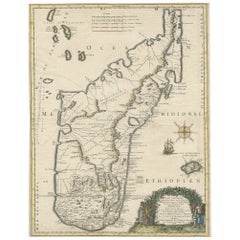
Antique Map of Anjouan or Ndzuani Island, Part of The Comoros, 1749
About the Item
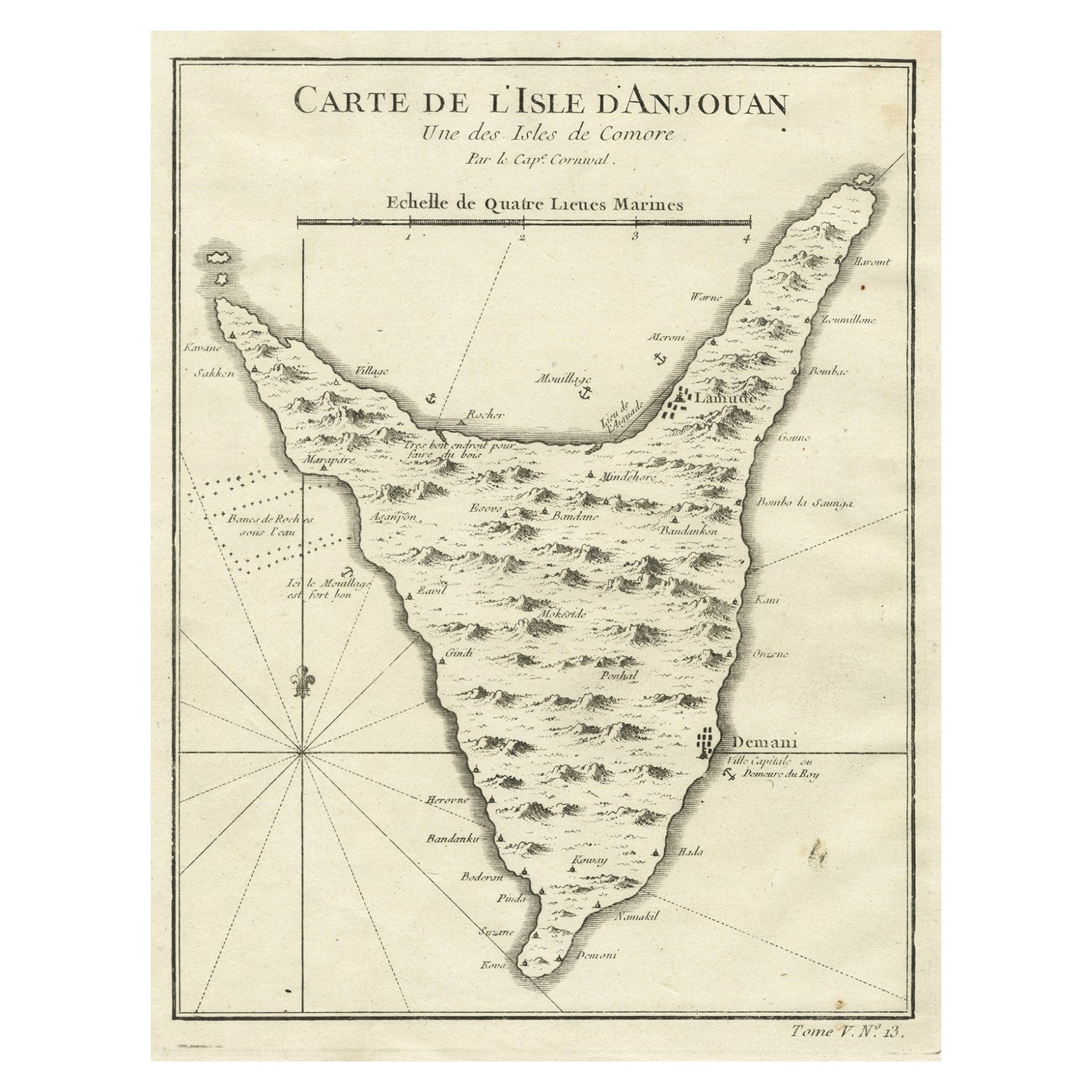
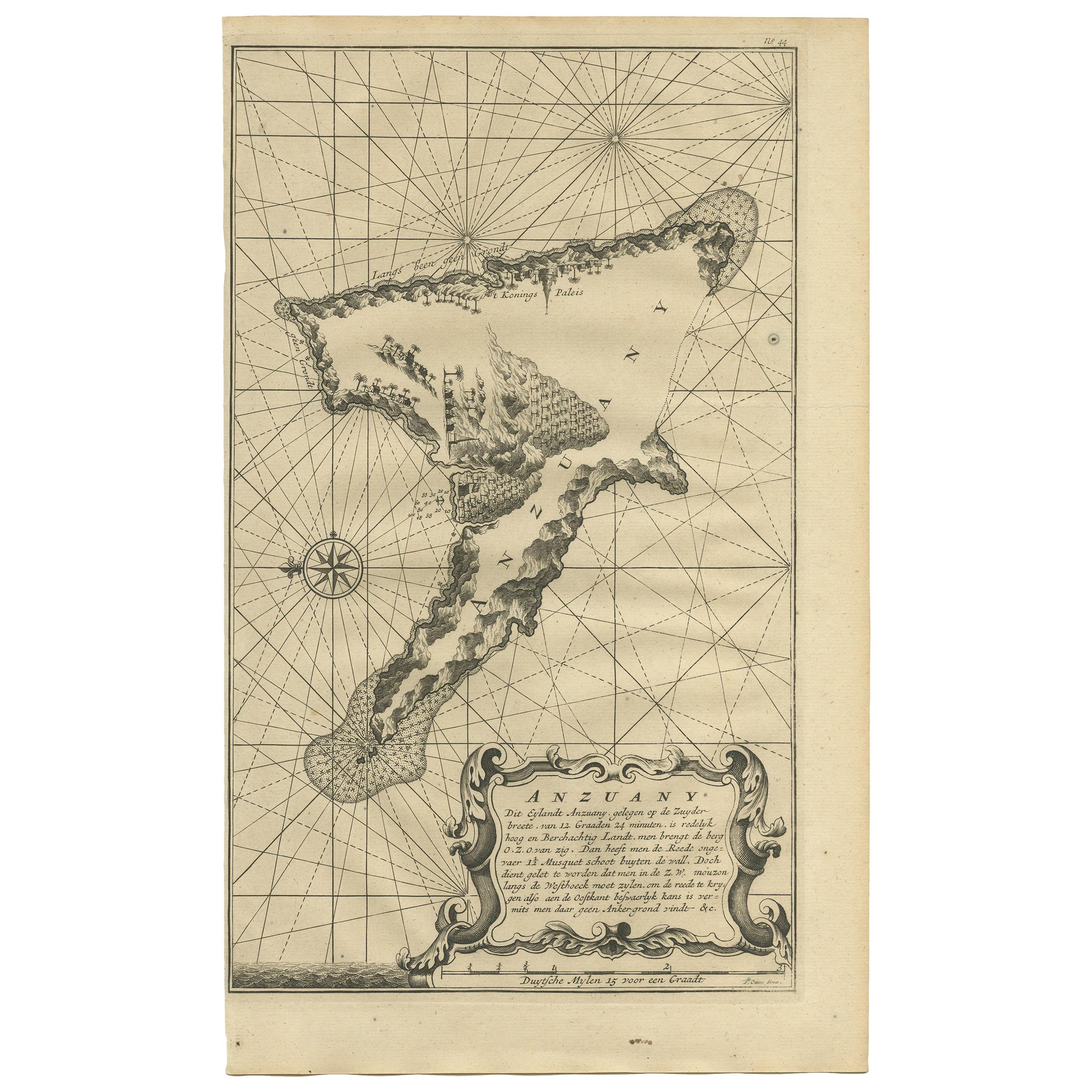
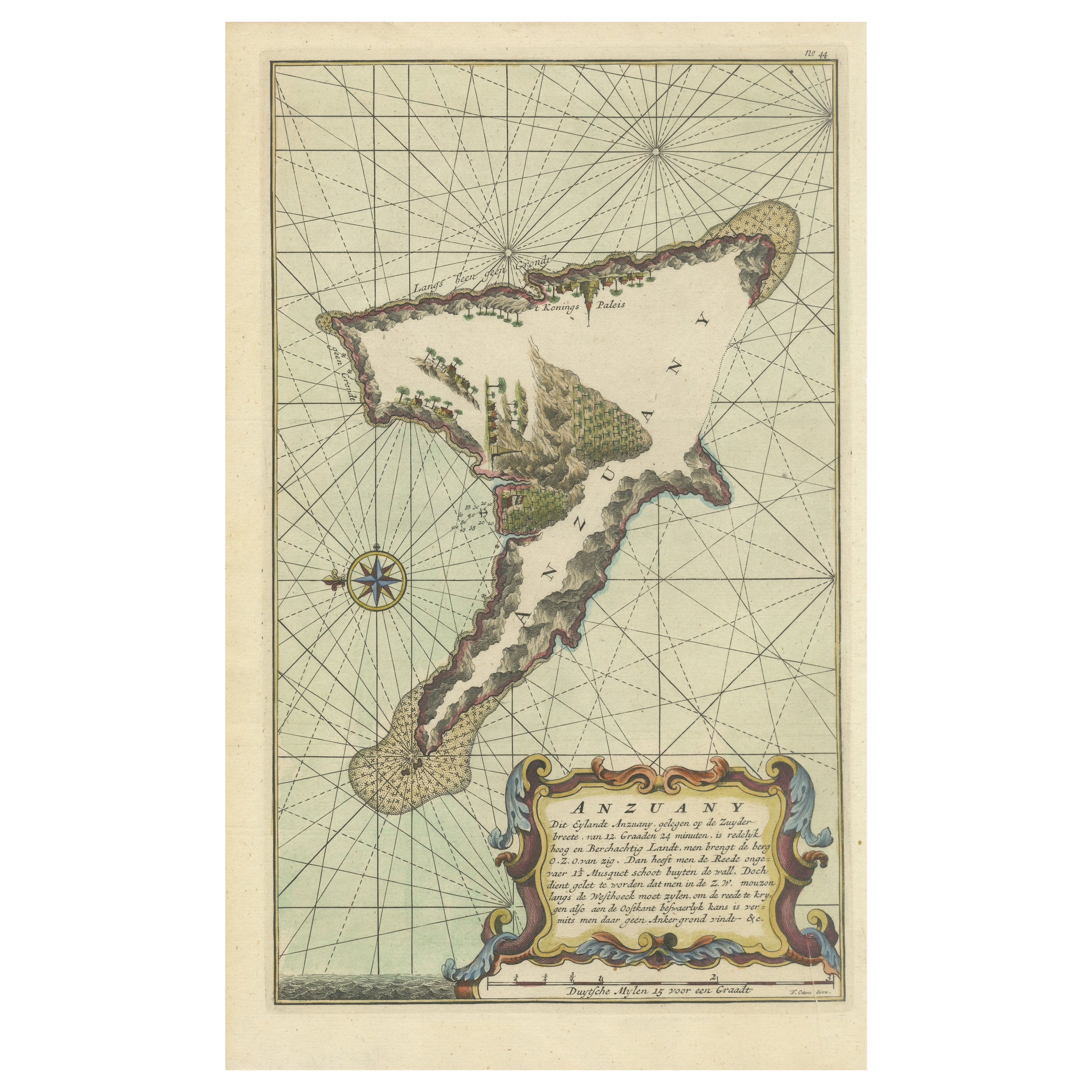
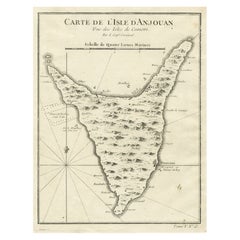
Antique map titled ‘Carte de L’Isle D’Anjouan - Kaart van 't Eiland Anjouan’. Original antique map of Anjouan, also known as Ndzuwani or Nzwani, or, historically, as Johanna, an autonomous island in the Indian Ocean that forms part of the Union of the Comoros. This map originates from 'Historische beschryving der Reizen (..)' published by P. de Hondt, 1749.
The Comoros, officially the Union of the Comoros, is an island country in the Indian Ocean, at the northern end of the Mozambique Channel off the eastern coast of Africa. It shares maritime borders with Madagascar and Mayotte to the southeast, Tanzania to the northwest, Mozambique to the west, and the Seychelles to the northeast. Its capital and largest city is Moroni. The official state religion is Sunni Islam. As a member of the Arab League, it is the only country in the Arab world which is entirely in the Southern Hemisphere. The country has three official languages: Comorian, French and Arabic.
It has the worst income inequality of any nation, with a Gini coefficient over 60%, and ranks in the worst quartile on the Human Development Index. As of 2008, about half the population lived below the international poverty line of US$1.25 a day.
Artists and Engravers: Jakob van der Schley (1715-1779) was a Dutch draughtsman and engraver, who studied under Bernard Picart.
Condition: Good, general age-related toning. Original plate mark visible. Please study image carefully.
Date: 1749
Overall size: 19.4 x 25 cm
Image size: 16 x 21.8 cm
We sell original antique maps to collectors, historians, educators and interior decorators all over the world. Our collection includes a wide range of authentic antique maps from the 16th to the 20th centuries. Buying and collecting antique maps is a tradition that goes back hundreds of years. Antique maps have proved a richly rewarding investment over the past decade, thanks to a growing appreciation of their unique historical appeal. Today the decorative qualities of antique maps are widely recognized by interior designers who appreciate their beauty and design flexibility. Depending on the individual map, presentation, and context, a rare or antique map can be modern, traditional, abstract, figurative, serious or whimsical. We offer a wide range of authentic antique maps for any budget.
- Dimensions:Height: 9.85 in (25 cm)Width: 7.64 in (19.4 cm)Depth: 0 in (0.01 mm)
- Materials and Techniques:
- Period:
- Date of Manufacture:1749
- Condition:
- Seller Location:Langweer, NL
- Reference Number:
About the Seller
5.0
Platinum Seller
These expertly vetted sellers are 1stDibs' most experienced sellers and are rated highest by our customers.
Established in 2009
1stDibs seller since 2017
1,928 sales on 1stDibs
Typical response time: <1 hour
- ShippingRetrieving quote...Ships From: Langweer, Netherlands
- Return PolicyA return for this item may be initiated within 14 days of delivery.
More From This SellerView All
- Antique Map of Anjouan or Ndzuani, Island of The Comoros, 1748Located in Langweer, NLAntique map titled ‘Carte de L’Isle D’Anjouan’. Original antique map of Anjouan, also known as Ndzuwani or Nzwani, or, historically, as Johanna, an autonomous island in the Indian Oc...Category
Antique 18th Century Maps
MaterialsPaper
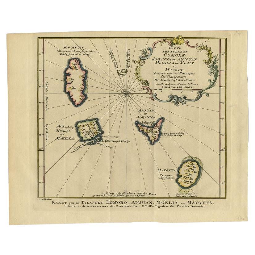
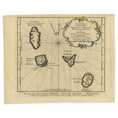
- Antique Map of the Main Comoro Islands by Van Schley, 1749By Jakob van der SchleyLocated in Langweer, NLAntique map titled ‘Carte des Isles de Comore (..) - Kaart van de Eilanden Komoro (..)’. Original antique map of the main Comoro Islands or Comoros including Comore, Mohéli, Anjouan ...Category
Antique 18th Century Maps
MaterialsPaper
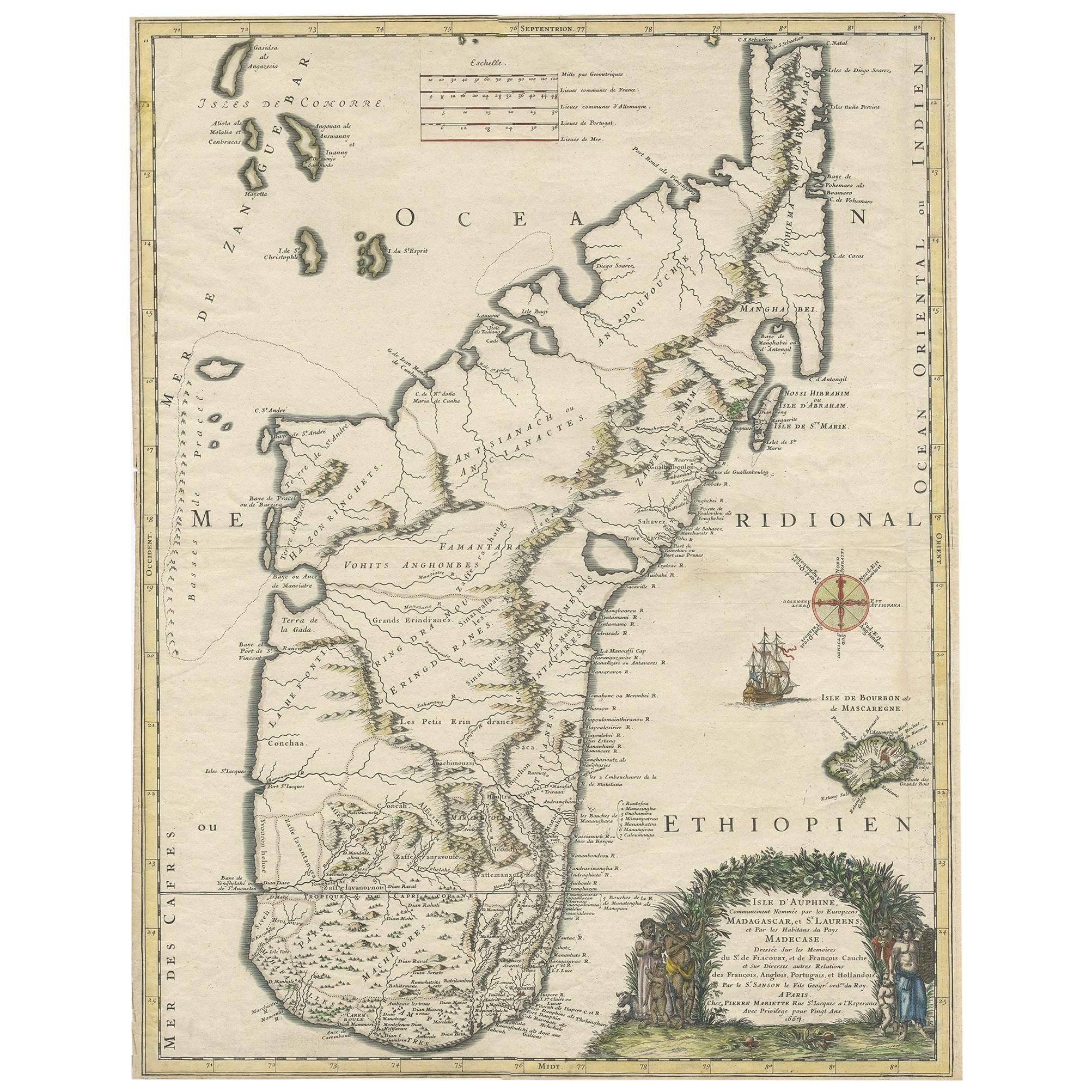
- Beautiful Antique Map of Madagascar, The Comoros Islands & Reunion Island, 1667Located in Langweer, NLAntique map titled 'Isle d'Auphine, communement Nommée par les Europeens Madagascar, et St. Laurens, et par les Habitans du pays Madecase'. Beautiful map of Madagascar...Category
Antique 1660s Maps
MaterialsPaper
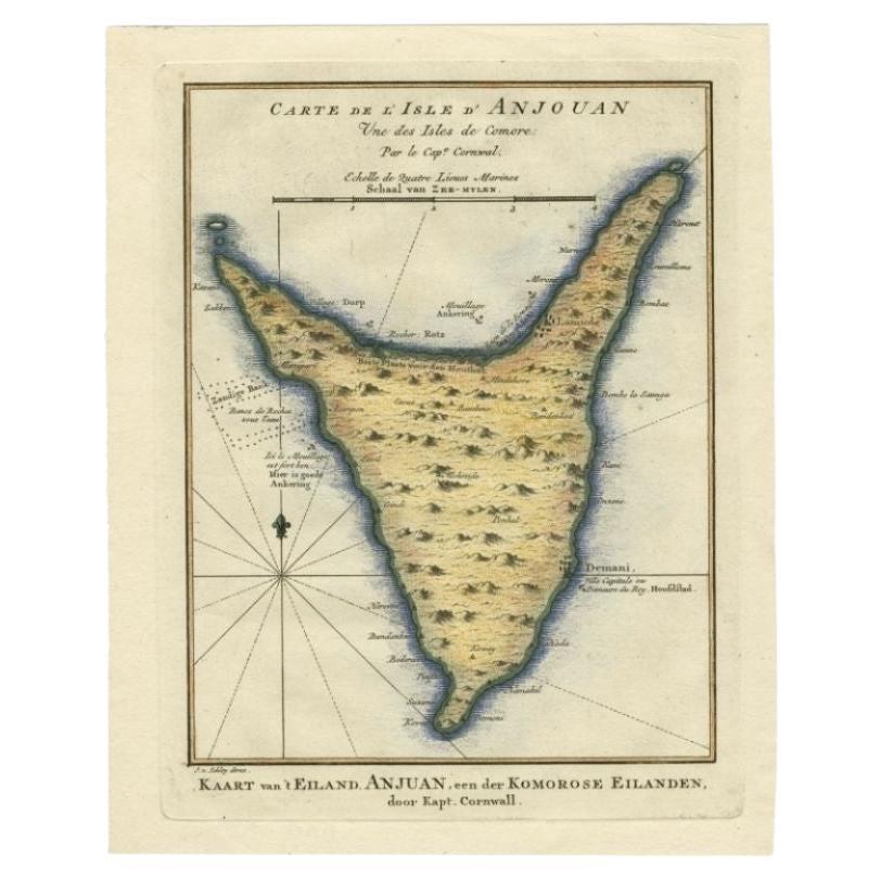
- Antique Map of the Island Anjouan by Van Schley, c.1750Located in Langweer, NLAntique map titled 'Carte de l'Isle d'Anjouan une des Isles de Comore'. Striking map of the Island Anjouan, part of the Comoros in the Indian Ocean by Nicolas Bellin. Source unknown,...Category
Antique 18th Century Maps
MaterialsPaper
- Antique Map of Anjouan Island by Valentijn, 1726By F. ValentijnLocated in Langweer, NLAntique map titled 'Anzuany'. This map depicts the island of Anjouan, one of the Comoros islands situated between Madagascar and Africa. The map is oriented with north to the left wi...Category
Antique Early 18th Century Dutch Maps
- Antique Engraving of the Island Nzwani or Anzuany of the Comoros Islands, 1726Located in Langweer, NLHistorical titles: Ansjouan, Ansuany, Anjouan, Anzuani, Anzuany Country: Comoros The map is taken from: 'Oud en Nieuw Oost-Indiën' van François Valentyn. 1) Ottens, Frederik (engra...Category
Antique 1720s Maps
MaterialsPaper


You May Also Like
- 1868 Map of the Upper Part of the Island of Manhattan Above 86th StreetBy Wm. Rogers Mfg. Co.Located in San Francisco, CAThis wonderful piece of New York City history is over 150 years old. It depicts 86th street and above. It was lithographed by WC Rogers and company. It was made to show what was the Battle of Harlem during the Revolutionary war...Category
Antique 1860s American American Colonial Maps
MaterialsPaper
- 1854 Map of Massachusetts, Connecticut and Rhode Island, Antique Wall MapLocated in Colorado Springs, COThis striking wall map was published in 1854 by Ensign, Bridgman & Fanning and has both full original hand-coloring and original hardware. This impression is both informative and highly decorative. The states are divided into counties, outlined in red, green, and black, and subdivided into towns. Roads, canals, and railroad lines are prominently depicted, although they are not all labeled. The mapmakers also marked lighthouses, banks, churches, and prominent buildings, with a key at right. The map is an informative and comprehensive overview of the infrastructural development of New England prior to the Civil War. Physical geographies depicted include elevation, conveyed with hachure marks, rivers and lakes. The impression features an inset map of Boston...Category
Antique 19th Century American Maps
MaterialsPaper
- Map Kyle Carrick Aireshire Thomas Kitchen 1749By Thomas KitchinLocated in BUNGAY, SUFFOLKA Map of Kyle & Carrick Aireshire Thomas Kitchen 1749 In original black and gold frame Just purchased more information to follow MAKER Thomas Kitchin (1718-1784) English engrave...Category
Antique 18th Century English Georgian Maps
MaterialsPaper
- Large Original Antique Map of Rhode Island, USA, C.1900Located in St Annes, LancashireFabulous map of Rhode Island Original color Engraved and printed by the George F. Cram Company, Indianapolis. Published, C.1900 Unframed Free ...Category
Antique 1890s American Maps
MaterialsPaper
- Map of the Kingdom of Sardinia and Part of the Kingdom of Genoa, RomeBy Giovanni Maria CassiniLocated in Hamilton, Ontario18th century map by Italian engraver Giovanni Maria Cassini (Italy 1745-1824). Map of Part of the Kingdom of Sardinia and Part of the Kingdom of Genoa: Rome. This is a hand colored a...Category
Antique 18th Century Italian Maps
MaterialsPaper
- Large Original Vintage Map of The Pacific Islands Including HawaiiLocated in St Annes, LancashireGreat map of The Pacific Islands Unframed Original color By John Bartholomew and Co. Edinburgh Geographical Institute Published, circa 1...Category
Vintage 1920s British Maps
MaterialsPaper


Recently Viewed
View AllMore Ways To Browse
French Antique Island
French Country Island
Ocean Map
Ocean Maps
Antique State Maps
18th Century Southern Antiques
Antique Map Border
West African Antiques
Map Of Us
West Indian Antique Furniture
French Line Ocean
Antique Ocean Map
African P
Bernard T
Northern France Map
Islamic Engraved
Dutch Maritime
Hemispheres Map