Northern France Map
2
to
30
213
62
129
102
85
68
55
37
26
23
22
18
17
16
15
10
10
10
9
9
8
7
7
6
5
5
5
4
4
4
4
4
4
3
3
3
3
2
2
2
2
2
2
1
1
1
1
1
1
1
42
42
7
7
7
Sort By
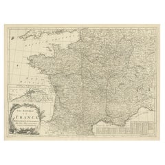
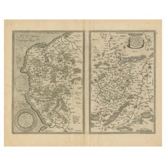
Antique Map of France with Inset showing the Northern Departments
Located in Langweer, NL
map of France. Includes a large cartouche and an inset, showing the northern Departments. Engraved by
Category
Antique Late 18th Century Maps
Materials
Paper
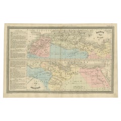
French Antique Map of Northern Africa and Libya, c.1840
Located in Langweer, NL
Antique map titled 'Marok, Alger et Tunis - Etat de Tripoli'. Map of Northern Africa and Libya
Category
Antique 19th Century Maps
Materials
Paper
1635 Willem Blaeu Map of Northern France"Comitatvs Bellovacvm" Ric.a08
Located in Norton, MA
1635 Willem Blaeu map of northern France, entitled.
"Comitatvs Bellovacvm Vernacule Beavvais
Category
Antique 17th Century Unknown Maps
Materials
Paper
H 18.12 in W 22.25 in D 0.4 in
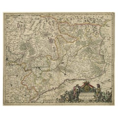
Striking Antique Map of Luxembourg and Northern France 'Lotharingen', c.1680
Located in Langweer, NL
.' -
Striking map of Luxembourg and Northern France. Includes the cities of Toul, Nancy, Metz and Trier
Category
Antique 1680s Maps
Materials
Paper
H 18.71 in W 22.25 in D 0 in
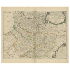
Original Antique Map of the Picardy Region in Northern France, 1694
Located in Langweer, NL
Antique map titled 'La Province de Picardie (..)'. Large map of the Picardy region of France. Shows
Category
Antique 17th Century Maps
Materials
Paper
Antique Map of the Coastline Between Calais and Estaples and Northern France
Located in Langweer, NL
covers a small region surrounding Saint-Quentin in northern France. Each is covered with tiny forests and
Category
Antique Early 17th Century Maps
Materials
Paper
H 19.02 in W 22.96 in D 0.02 in
Antique Map of Northern Italy by Migeon, 1880
Located in Langweer, NL
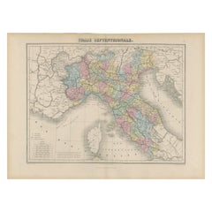
Antique map titled 'Italie Septentrionale'. Old map of the northern part of Italy. This map
Category
Antique 19th Century Maps
Materials
Paper
Antique Map of Northern India by Bonne, 1780
Located in Langweer, NL
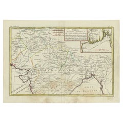
and Guilleme Raynal?s 1780 map of northern India. Covers the northern part of India from Kandahar
Category
Antique 18th Century Maps
Materials
Paper
Antique Map of Northern Asia by Mallet, 1719
Located in Langweer, NL
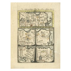
describes the northern part of Asia in classical times, perhaps circa 150 AD. At the top, an overview map
Category
Antique 18th Century Maps
Materials
Paper
Antique Map of Belgium and Northern France by F. de Wit, circa 1680
Located in Langweer, NL
Belgium and Northern France. Published by F. de Wit, circa 1680.
Category
Antique Late 17th Century Maps
Materials
Paper
Engraved Map of Northern England, Focusing on Northumberland, 1658
Located in Langweer, NL
(..)'.
Engraved map of northern England, focusing on Northumberland.
Artists and Engravers: Nicholas Sanson
Category
Antique 1650s Maps
Materials
Paper
Antique Map of Northern Brazil by Bonne, c.1780
Located in Langweer, NL
Antique map titled 'Carte de la Partie Septentrionale du Bresil.' Detailed map of the northern
Category
Antique 18th Century Maps
Materials
Paper
Antique Map of Northern Europe by Bonne, c.1780
Located in Langweer, NL
avec la Majeure Partie de al Russie Europeenne.' Map of Northern Europe and European Russia. Covers the
Category
Antique 18th Century Maps
Materials
Paper
Rare Antique Map of 'Barbarie' or Northern Africa, 1655
Located in Langweer, NL
corpus of some three hundred maps initiated the golden age of French Cartography.
Condition: Good
Category
Antique 17th Century Maps
Materials
Paper
Antique Map of Northern Germany, Including Schleswig-Holstein and Hamburg
Located in Langweer, NL
, Meckelenbourg et Lauvenbourg (..)'. Original old map of northern Germany, including Schleswig-Holstein, Hamburg
Category
Antique Mid-17th Century Maps
Materials
Paper
H 17.6 in W 22.45 in D 0.02 in
Northern Scotland: A 17th Century Hand-colored Map by Mercator
By Gerard Mercator
Located in Alamo, CA
This is a framed hand-colored 17th century map of Northern Scotland by Gerard Mercator entitled
Category
Antique 1630s Dutch Maps
Materials
Paper
Northern Scotland: A 16th Century Hand-colored Map by Mercator
By Gerard Mercator
Located in Alamo, CA
A framed hand-colored 16th century map of Northern Scotland by Gerard Mercator entitled "Scotiae
Category
Antique 16th Century Dutch Maps
Materials
Paper
Antique Map of Northern Europe and European Russia, ca.1780
Located in Langweer, NL
avec la Majeure Partie de al Russie Europeenne.'
Map of Northern Europe and European Russia. Covers
Category
Antique 1780s Maps
Materials
Paper
Interesting Map of Great Britain and Northern Europe with various Illustrations
Located in Langweer, NL
Antique map titled 'Itinera Varia Auctoris'. Very interesting map of Great Britain and Northern
Category
Antique Mid-18th Century Maps
Materials
Paper
H 11.23 in W 8.9 in D 0.02 in
Original Antique Map showing Southern India, Northern Sri Lanka & Malabar, 1652
Located in Langweer, NL
part of India, including the northern part of Sri Lanka. With inset map of Southern India (Malabar
Category
Antique 1650s Maps
Materials
Paper
H 9.65 in W 13.19 in D 0 in
Detailed Antique Map of Northern Spanish Region of Aragon, c.1650
Located in Langweer, NL
Antique map titled 'Arragonia Regnum'.
Detailed map of northern Spanish region of Aragon. The
Category
Antique 1650s Maps
Materials
Paper
Antique Map of Tunis and Tripoli in Northern Africa, circa 1880
By J. Migeon
Located in Langweer, NL
Antique map titled 'Tunis et Tripoli & Empire de Maroc'. Old map of Tunis and Tripoli and the
Category
Antique 19th Century Maps
Materials
Paper
Original Antique Map of Tartary 'Northern China & Far Eastern Russia', 1757
Located in Langweer, NL
Antique map titled 'Carte de la Tartarie Orientale (..)'.
Original antique map of what is
Category
Antique 1750s Maps
Materials
Paper
H 9.61 in W 13.47 in D 0 in
Antique Map of Northern China and Eastern Russia by Bellin, 1757
Located in Langweer, NL
Antique map titled 'Carte de la Tartarie Orientale (..)'. Original antique map of what is present
Category
Antique 18th Century Maps
Materials
Paper
Antique Map of Northern China and Eastern Russia by Bellin, 1754
Located in Langweer, NL
Antique map titled 'Carte De La Tartarie Orientale (..)'. A map for this far eastern portion of
Category
Antique 18th Century Maps
Materials
Paper
Ancient World Map of Europe, Asia & Northern Africa with Ancient Names, 1725
Located in Langweer, NL
ancient world depicting Europe, Asia, and northern Africa with ancient place names. This map originates
Category
Antique 1720s Maps
Materials
Paper
H 15.75 in W 18.51 in D 0 in
Antique Map of Brazil of Southern Brazil, Uruguay, and Northern Argentina, c1780
Located in Langweer, NL
Antique map titled 'Carte de la Partie Méridionale du Bresil (..)'. This antique map of Brazil
Category
Antique 1780s Maps
Materials
Paper
H 9.85 in W 15.16 in D 0 in
Antique Map of Northern India and the Bengal Gulf by Mallet, 1686
Located in Langweer, NL
the northern part of India and the Bengal Gulf. This map originates from Alain Manesson Mallet's
Category
Antique 17th Century Maps
Materials
Paper
Antique Map of the Night Skies of the Northern and Southern Hemispheres, 1880
Located in Langweer, NL
northern and southern hemispheres. This map originates from 'Géographie Universelle Atlas-Migeon' by J
Category
Antique 1880s Maps
Materials
Paper
H 13.59 in W 18.71 in D 0 in
Navarra in Cartographic Detail: A 1902 Map of the Crossroads of Northern Spain
Located in Langweer, NL
, demarcating it from neighboring provinces and France to the north.
- The map includes a scale of kilometers
Category
Antique Early 1900s Maps
Materials
Paper
Free Shipping
H 14.77 in W 20.08 in D 0 in
Antique Map of Europe Stretching from Northern Africa to the Baltic Sea, 1719
Located in Langweer, NL
conquestes'. Original antique map of Europe stretching from northern Africa to the Baltic Sea. It shows the
Category
Antique 18th Century Maps
Materials
Paper
H 17.52 in W 20.28 in D 0 in
Antique Map of the City of Algiers and Surroundings in Northern Africa, 1773
Located in Langweer, NL
Antique print titled 'Plan van de Stad Algiers'. Old map of Algiers, also depicting surrounding
Category
Antique 18th Century Maps
Materials
Paper
H 10.44 in W 8.08 in D 0 in
Old Map of the Great Lakes and Upper Mississippi Valley, Northern America, c1780
Located in Langweer, NL
Antique map titled 'Partie Occidentale du Canada'.
A fine example of Rigobert Bonne and
Category
Antique 1780s Maps
Materials
Paper
H 10.32 in W 14.85 in D 0 in
Antique Map of the Northern Part of South America by J. Tallis, circa 1851
Located in Langweer, NL
A decorative and detailed mid-19th century map of the northern part of South America (including
Category
Antique Mid-19th Century Maps
Materials
Paper
H 10.6 in W 14.41 in D 0.02 in
Antique Map of Northern China and Far Eastern Russia Around the Amur River, 1754
Located in Langweer, NL
Antique map titled 'Carte De La Tartarie Orientale (..)'. A map for this far eastern portion of
Category
Antique 1750s Maps
Materials
Paper
H 10.63 in W 15.16 in D 0 in
Antique Map of the Coast of France, 1710
By Jacobus Harrewijn
Located in Langweer, NL
Antique map titled 'Les Embouchures de la Somme et de Bresle'.
Map of the coast of Northern
Category
Antique Early 18th Century Maps
Materials
Paper
Antique Map of Lot ‘France’ by V. Levasseur, 1854
Located in Langweer, NL
northern part of this region. This map originates from ‘Atlas National de la France Illustré’. Published by
Category
Antique Mid-19th Century Maps
Materials
Paper
Antique Map of Lozère ‘France’ by V. Levasseur, 1854
Located in Langweer, NL
the northern part of this region. This map originates from ‘Atlas National de la France Illustré
Category
Antique Mid-19th Century Maps
Materials
Paper
Antique Map of Aveyron ‘France’ by v. Levasseur, 1854
By Victor Levasseur
Located in Langweer, NL
Antique map titled 'Dépt. de 'l'Aveyron'. Map of the French department of Aveyron, France. This
Category
Antique Mid-19th Century Maps
Materials
Paper
Antique Map of Hondarribia Near the Bidasoa River, France & Spain
Located in Langweer, NL
near the Bidasoa river, a river in the Basque Country of northern Spain and southern France. This map
Category
Antique Mid-18th Century Maps
Materials
Paper
Hand Colored Antique Map of the department of Lozere, France
By Victor Levasseur
Located in Langweer, NL
Antique map titled 'Dept. de la Lozère'. Map of the French department of Lozere, France. This
Category
Antique Mid-19th Century Maps
Materials
Paper
Hand Colored Antique Map of the department of Aveyron, France
By Victor Levasseur
Located in Langweer, NL
Antique map titled 'Dépt. de l'Aveyron'. Map of the French department of Aveyron, France. This area
Category
Antique Mid-19th Century Maps
Materials
Paper
Antique Map of the French Province of Quercy, ca.1625
Located in Langweer, NL
Antique map titled 'Quercy Cadurcium'. Old map of the region of Quercy, France. Quercy is a former
Category
Antique 17th Century Maps
Materials
Paper
Antique Map of Lot et Garonne ‘France’ by V. Levasseur, 1854
Located in Langweer, NL
the northern part of this region. This map originates from ‘Atlas National de la France Illustré
Category
Antique Mid-19th Century Maps
Materials
Paper
1864 Map of North America, Antique Hand-Colored Map, by Adolphe Hippolyte Dufour
Located in Colorado Springs, CO
.
Adolphe Hippolyte Dufour (1795-1865) was a French-based map and atlas publisher active in the middle to
Category
Antique 1860s French Maps
Materials
Paper
H 44.5 in W 33 in D 1.5 in
Early French Nautical Chart of the Northern Coast of of Java, Indonesia, C.1850
Located in Langweer, NL
Antique map titled Carte de la côte Nord de Java.
Early French nautical chart of the northern
Category
Antique 1850s Maps
Materials
Paper
H 26.38 in W 38.59 in D 0 in
1590 Ortelius Map of Calais and Vermandois, France and Vicinity Ric.a014
Located in Norton, MA
northern France. This map is based upon the cartographic work of Jean de Surhon who was commissioned by the
Category
Antique 16th Century Dutch Maps
Materials
Paper
H 20.08 in W 15.48 in D 0.4 in
Antique Map Centered on Turkestan
Located in Langweer, NL
Antique map titled 'Carte de Karazm, Turkestan et Grande Bukarie'. Engraved map centered on
Category
Antique Mid-18th Century Maps
Materials
Paper
1752 Vaugoundy Map of Flanders : Belgium, France, and the Netherlands, Ric.a002
Located in Norton, MA
Large Vaugoundy Map of Flanders:
Belgium, France, and the Netherlands
Colored -1752
Ric.a002
Category
Antique 17th Century Unknown Maps
Materials
Paper
H 51.5 in W 66 in D 1 in
Authentique Map by Pilon of The French Colonies in The West Indies, 1876
Located in Langweer, NL
This map is a significant representation of the French colonies in the West Indies during the late 19th
Category
Antique Late 19th Century Maps
Materials
Paper
H 14.38 in W 16.54 in D 0 in
Antique Map of the Vermandois Region 'Picardy' in France by Janssonius, C.1640
Located in Langweer, NL
Antique map titled 'Vermandois'. Old map of the Vermandois region, France. Vermandois was a French
Category
Antique 17th Century Maps
Materials
Paper
H 14.77 in W 19.69 in D 0 in
Antique Map of the Region of Beauce in France by Janssonius, c.1650
Located in Langweer, NL
Antique map of France titled 'La Beauce'. Decorative map of the region of Beauce, a natural region
Category
Antique 17th Century Maps
Materials
Paper
Antique Map of the Lower Alsace Region of France by Mapmaker Hondius, c.1630
Located in Langweer, NL
Antique map titled 'Alsatia Inferior'. Original antique map of the northern Alsace (Elzas) region
Category
Antique 17th Century Maps
Materials
Paper
H 16.34 in W 21.26 in D 0 in
Antique Map of Beauce by Janssonius, 1657
By Johannes Janssonius
Located in Langweer, NL
northern France, located between the Seine and Loire rivers. This map originates from 'Atlas Novus, Sive
Category
Antique Mid-17th Century Maps
Materials
Paper
Huesca 1901: A Geographic Overview of Aragon's Northern Frontier in Spain
Located in Langweer, NL
the northern border with France. Blue lines represent rivers and lakes, likely including the Ebro
Category
Antique Early 1900s Maps
Materials
Paper
Free Shipping
H 20.08 in W 14.77 in D 0 in
Antique Map of Novaya Zemlya by Bellin, 1758
Located in Langweer, NL
'. This map features Novaya Zemlya, the island off northern Russia in the Barents Sea, and extends to
Category
Antique 18th Century Maps
Materials
Paper
Antique Map of North and East Asia, 1751
Located in Langweer, NL
Map 2: 'Carte des parties nord et est de L'Asie'. (Map of the Northern parts and East Asia.) Five
Category
Antique 18th Century Maps
Materials
Paper
Antique Map of Southeast Asia by J. Ottens, 1710
Located in Langweer, NL
Antique map titled 'Le Royaume de Siam avec Les Royaumes Qui Luy sont Tributaries'. Influential map
Category
Antique Early 18th Century Maps
Materials
Paper
Antique Miniature Map of Java by Bertius/Hondius '1618'
Located in Langweer, NL
Rare antique miniature map titled 'Iava Maior'. This map shows the northern coastline of Java
Category
Antique Early 17th Century Maps
Materials
Paper
Original Antique Sea Chart of the Northern Part of Hispaniola, Western Cuba
Located in Langweer, NL
northern part of Hispaniola, western Cuba. The map includes the Turks & Caicos Islands and southern part of
Category
Antique Late 17th Century Maps
Materials
Paper
H 21.26 in W 24.02 in D 0.02 in
- 1
Get Updated with New Arrivals
Save "Northern France Map", and we’ll notify you when there are new listings in this category.
More Ways To Browse
Antique Map Vietnam
Antique Map Argentina
Magellan Map
Jan Luyken
Antique Map Of Argentina
Sierra Leone Antique Map
Elephant Bird Egg
Antique Montana Map
Antique Montana Maps
Bolivia Antique Map
Guyana Antique Map
Antique Mormon
Antique Ornamental Map
Uruguay Antique Map
Victor Levasseur On Sale
Colombia Map Antique
Giant Antique Maps
Ecuador Antique Map
