Giant Antique Maps
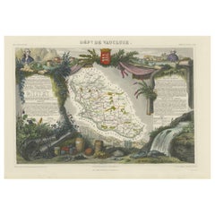
Old Map of Vaucluse, France: A Cartographic Celebration of Viticulture, 1852
Located in Langweer, NL
This original hand-colored map is from the "Atlas National Illustré," a work by Victor Levasseur, a
Category
1850s Giant Antique Maps
Materials
Paper
H 14.18 in W 20.99 in D 0 in
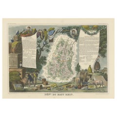
1852 Map of Haut-Rhin: An Illustrated Gateway to Alsace's Viticultural Splendors
Located in Langweer, NL
This original hand-colored map is from the "Atlas National Illustré," a work by Victor Levasseur, a
Category
1850s Giant Antique Maps
Materials
Paper
H 14.18 in W 20.75 in D 0 in
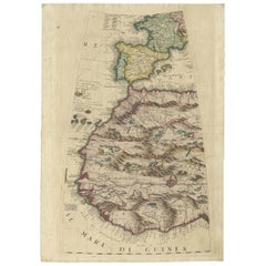
Rare Antique Map of Southwestern Europe and West Africa by V.M. Coronelli, 1692
By Vincenzo Coronelli
Located in Langweer, NL
mountain ranges and exotic animals such as giraffes, elephants, lions and strange giant birds. The Gambia
Category
Late 17th Century Giant Antique Maps
Materials
Paper
H 19.3 in W 13.59 in D 0.02 in
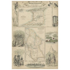
British Possessions on the North West Coast of South America, 1860
Located in Langweer, NL
British possessions on the northwest coast of South America during that time. It features a detailed map
Category
1860s Giant Antique Maps
Materials
Paper
Free Shipping
H 18.51 in W 12.41 in D 0 in
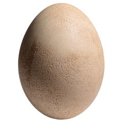
Giant Egg of the Extinct 'Elephant Bird'
Located in London, GB
An exceptionally well preserved, unhatched egg of the Giant elephant bird, Aepyornis maximus
Category
15th Century and Earlier Malagasy Giant Antique Maps
Materials
Eggshell
A truly delightful miniature terrestrial pocket globe
By Nathaniel Mills
Located in ZWIJNDRECHT, NL
. The stars were thought to sit on the surface of a giant sphere around the earth, and the constant
Category
Mid-18th Century British Dutch Colonial Giant Antique Maps
Materials
Other
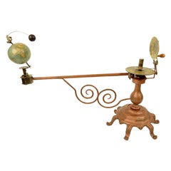
Antique Brass Czech Orrery Astronomical Instruments Made by Jan Felkl in 1870
By Jan Felkl
Located in Milan, IT
the nineteenth century. Cast iron base, papier mâché´ globe, with detailed territorial map and oceanic
Category
1860s Czech Giant Antique Maps
Materials
Iron
H 18.9 in W 29.53 in D 11.03 in
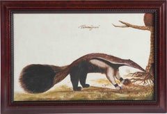
Animal painting of a 'Tamanuâguacû (Ant-eater)' late 17th/18th century, Brazil
Located in Amsterdam, NL
Follower of Zacharias Wagener (1614-1688)
Tamanuâguasû (Giant Anteater)
On Italian 17th or
Category
Early 18th Century Old Masters Giant Antique Maps
Materials
Paper, India Ink, Gouache
Free Shipping
H 10.83 in W 17.13 in D 0.04 in
People Also Browsed
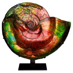
Extraordinary Iridescent Ammonite Fossil
Located in London, GB
A magnificent example of one of the most spectacular fossils. A large and intensely vibrant ammonite, Placenticeras costatum, from the Bearpaw formation, Alberta, Canada, dating to t...
Category
15th Century and Earlier Canadian Giant Antique Maps
Materials
Other
Antique Coromandel Three Crystal Decanter Tantalus & Games Drawer 19th C
Located in London, GB
This is a superb antique Victorian coromandel, brass mounted and cased three decanter tantalus and games compendium, Circa 1880 in date.
It was skillfully crafted in rare coromande...
Category
1880s Late Victorian Giant Antique Maps
Materials
Brass
H 13 in W 14.97 in D 4.34 in
Large Goldscheider Art Deco Odalisque 'Aida' by Josef Lorenzl, Around 1925
By Josef Lorenzl, Goldscheider Manufactory of Vienna
Located in Vienna, AT
Very exceptional decorated Goldscheider Art Deco ceramic figure of the 1920's:
Depiction of a standing lady proudly looking to the side in oriental garb, wrapped in a large blue-gree...
Category
1920s Austrian Art Deco Giant Antique Maps
Materials
Ceramic
H 18.51 in W 7.88 in D 5.91 in
Antique Map of the Ancient Greek Colonization
Located in Langweer, NL
Antique map titled 'Map I containing the Western Division of the Grecian Colonies & Conquests'. Original antique map of the ancient Greek colonization. Frontispiece map of 'The Histo...
Category
Late 18th Century Giant Antique Maps
Materials
Paper
Original Antique Map of Ancient Greece, Phocis, Gulf of Corinth, 1787
Located in St Annes, Lancashire
Great map of Ancient Greece. Showing the region of Phocis, including the Gulf of Corinth
Drawn by J.D. Barbie Du Bocage
Copper plate engraving by P.F Tardieu
Original hand c...
Category
1780s French Other Giant Antique Maps
Materials
Paper
No Reserve
H 10 in W 14 in D 0.07 in
Antique Engraved Map of Italy in Roman Times, ca.1730
Located in Langweer, NL
Plain engr. map of Italy according to the division of Emperor Augustus by G. Delisle.
Title: "Tabula Italiae Antiquae In Regiones XI Ab Augusto Divisae Et Tum Ad Mensuras Itinerari...
Category
1730s Giant Antique Maps
Materials
Paper
A Hand-Carved Wabi Sabi Wooden Mortar, Africa, c. Early 20th Century
Located in Hønefoss, 30
Beautiful Hand-Carved Wabi Sabi Mortar that works perfectly for a planter. By unknown designer in Africa, c. early 20th Century.
Wear consistent with age and use showing wonderful ...
Category
Early 20th Century Ethiopian Folk Art Giant Antique Maps
Materials
Wood
19th Century African Wood and Leather Chair
Located in Rochester, NY
19th century African hand carved wood chair w/ leather goatskin hide woven webbing in original as found antique condition with no restorations. Overall beautifully aged color patina....
Category
Late 19th Century Ethiopian Giant Antique Maps
Materials
Leather, Hide, Goatskin, Wood
Antique Print of the Battle of Romans near the River Sicoris or Segre in France
Located in Langweer, NL
Antique battle map of the Segre river. With detailed legend explaining the various elements of the print. This print most likely originates from an edition of 'The Commentaries of Ca...
Category
18th Century Giant Antique Maps
Materials
Paper
H 16.15 in W 18.43 in D 0 in
Antique Map of Britain in Roman Times
Located in Langweer, NL
Antique map titled 'Britannia Romana collected from Ptolemy (..)'. Map of Britain in Roman times drawn from several sources, including the works of Ptolemy and The Itinerary of the E...
Category
Early 19th Century Giant Antique Maps
Materials
Paper
Lotus - Cubist Abstract Original Artwork
By Heny Steinberg
Located in Los Angeles, CA
Mexican artist Heny Steinberg’s abstracted landscapes invite us to travel from the map to the localized event. The shapes within Steinberg’s work transcend two dimensional representa...
Category
21st Century and Contemporary Abstract Giant Antique Maps
Materials
Acrylic, Canvas, Mixed Media
Rare Antique Map of Friesland in Roman Times, Published 1778
Located in Langweer, NL
Antique map titled 'Carte de la Frise, entre les Embouchures du Rhin & de l'Eems, ij compris l'isle Bataves, dressée selon leur ancienne position le Gouvernement des Romains & des Fr...
Category
18th Century Giant Antique Maps
Materials
Paper
Free Shipping
H 13.86 in W 16.54 in D 0 in
Amapola (polyptych) - Cubist Abstract Original Artwork
By Heny Steinberg
Located in Los Angeles, CA
Mexican artist Heny Steinberg’s abstracted landscapes invite us to travel from the map to the localized event. The shapes within Steinberg’s work transcend two-dimensional representa...
Category
21st Century and Contemporary Abstract Giant Antique Maps
Materials
Canvas, Mixed Media, Acrylic
Oromo Igbo African Gourd
Located in Chicago, IL
This African piece was made by the oromo igbo people of ethiopia
It is a gourd with weaved fiber and metal covering it with intricate design and patterns
It has a lid with it whi...
Category
Early 20th Century Ethiopian Giant Antique Maps
Materials
Metallic Thread
Antique Map of Southern Greece, 1892
Located in Langweer, NL
Antique map of Greece titled 'Griechenland. Südlicher Theil'. Old map of Southern Greece with inset maps of the Acropolis of Athens, the region of Athens, Thermopylae and Olympia. So...
Category
19th Century Giant Antique Maps
Materials
Paper
Sweden & Adjacent Portions of Scandinavia: A Hand-Colored 18th C. Map by Homann
By Johann Baptist Homann
Located in Alamo, CA
This hand-colored map of Sweden and adjacent portions of Scandinavia entitled "Regni Sueciae in Omnes suas Subjacentes Provincias accurate divisi Tabula Generalis" was created by Joh...
Category
1720s German Giant Antique Maps
Materials
Paper
H 21 in W 23.38 in D 0.07 in
Recent Sales
Map of Hell Gate and East River, New York City
Located in New York, NY
Original, extremely rare first edition map (1887), full title "Hell Gate and East River from S. End
Category
1880s Realist Giant Antique Maps
Materials
Lithograph
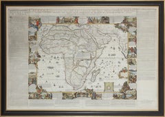
Important giant Map of Africa, for the King of France, 1698
By Nicolas de Fer
Located in Amsterdam, NL
copperplates, later hand colouring, 109.5 x 163 cm
(Find our Giant map of Africa by the same artist in our
Category
Late 17th Century Old Masters Giant Antique Maps
Materials
Watercolor, Engraving
H 43.12 in W 64.18 in D 1.58 in
Important giant Map of Asia, for the King of France, 1696
By Nicolas de Fer
Located in Amsterdam, NL
le Quay de l’Horloge, à la Sphere Royal. Avec le Privilege du Roy, 1696
(See also his Giant Map of
Category
Late 17th Century Old Masters Giant Antique Maps
Materials
Watercolor, Engraving
Giant Framed Map of Massachusetts, circa 1903
By Scarborough Company
Located in Essex, MA
A giant framed map of the Commonwealth of Massachusetts, measuring 62" wide x 44" high and
Category
Early 20th Century American Giant Antique Maps
Materials
Paper, Plexiglass, Wood
Giuseppe Agostino Vasi Giant Engraved Map of Rome
By Giuseppe Vasi
Located in Kastrup, DK
Giuseppe Agostino Vasi (b. Corleone 1710, d. Rome 1782), Italian printmaker and archaeologist.
Important large scale panorama view of Rome, by Giuseppe Vasi, 1765.
"Prospetto del...
Category
Mid-18th Century Italian Other Giant Antique Maps
Materials
Glass, Wood, Paper
Imperial Map Desk of the Habsburg Empire
Located in New Orleans, LA
This monumental, one-of-a-kind map desk hails from the Imperial Palace of the Habsburg Emperor
Category
19th Century Austrian Other Giant Antique Maps
Materials
Wood, Satinwood, Walnut
Cassini World Map “Planisphere Representant Toute L’etendue Du Monde” circa 1792
By J.B. Elwe
Located in Shippensburg, PA
A rich and interesting world map derived from Jacques Cassini's North Polar projection first
Category
1790s Dutch Giant Antique Maps
Materials
Copper
H 28 in W 21.6 in D 0.88 in
An English Sailor's Woolie of H.M.S. Tribune,
Located in Downingtown, PA
about the geography of the region. The most commonly available maps were those of George Vancouver
Category
19th Century English Giant Antique Maps
Materials
Wool
Oil Painting Portrait of Lord Edward Grenfell, 1st Baron St Just (1870-1941)
By Oswald Birley
Located in London, GB
Battle of the Somme). Birley focussed on making maps and models of positions to be assaulted by First
Category
Early 20th Century Victorian Giant Antique Maps
Materials
Oil
Giant Antique English Map/Library Magnifying Glass
Located in Chicago, IL
Giant antique magnifying glass with brass base.
Category
Early 20th Century British Giant Antique Maps
Materials
Brass
He Sure Thinks He's Hiding
By Edward Vincent Brewer
Located in Minneapolis, MN
works the artist created for the cereal giant. Titled "He Sho' Thinks he's Hiding" the work
Category
1910s American Realist Giant Antique Maps
Materials
Mixed Media, Oil
Get Updated with New Arrivals
Save "Giant Antique Maps", and we’ll notify you when there are new listings in this category.
More Ways To Browse
Italian Kiwi
P Renard
Pencil Post Bed Queen
J Henderson Painting
Antique Royal Crown Derby Bowl
Charles Davies
Richard Hutton
Taiwan Antique Map
John Lavery
Antique Planetarium
Antique Map Of Uk
6 Board Chest Antique
Mantle Screen
William Skilling Dog Paintings
Antique Uk Map
Wedding After Party Dress
Cow Door Stop
Field Jacket Mens
