Items Similar to 1852 Map of Haut-Rhin: An Illustrated Gateway to Alsace's Viticultural Splendors

Want more images or videos?
Request additional images or videos from the seller
1 of 8
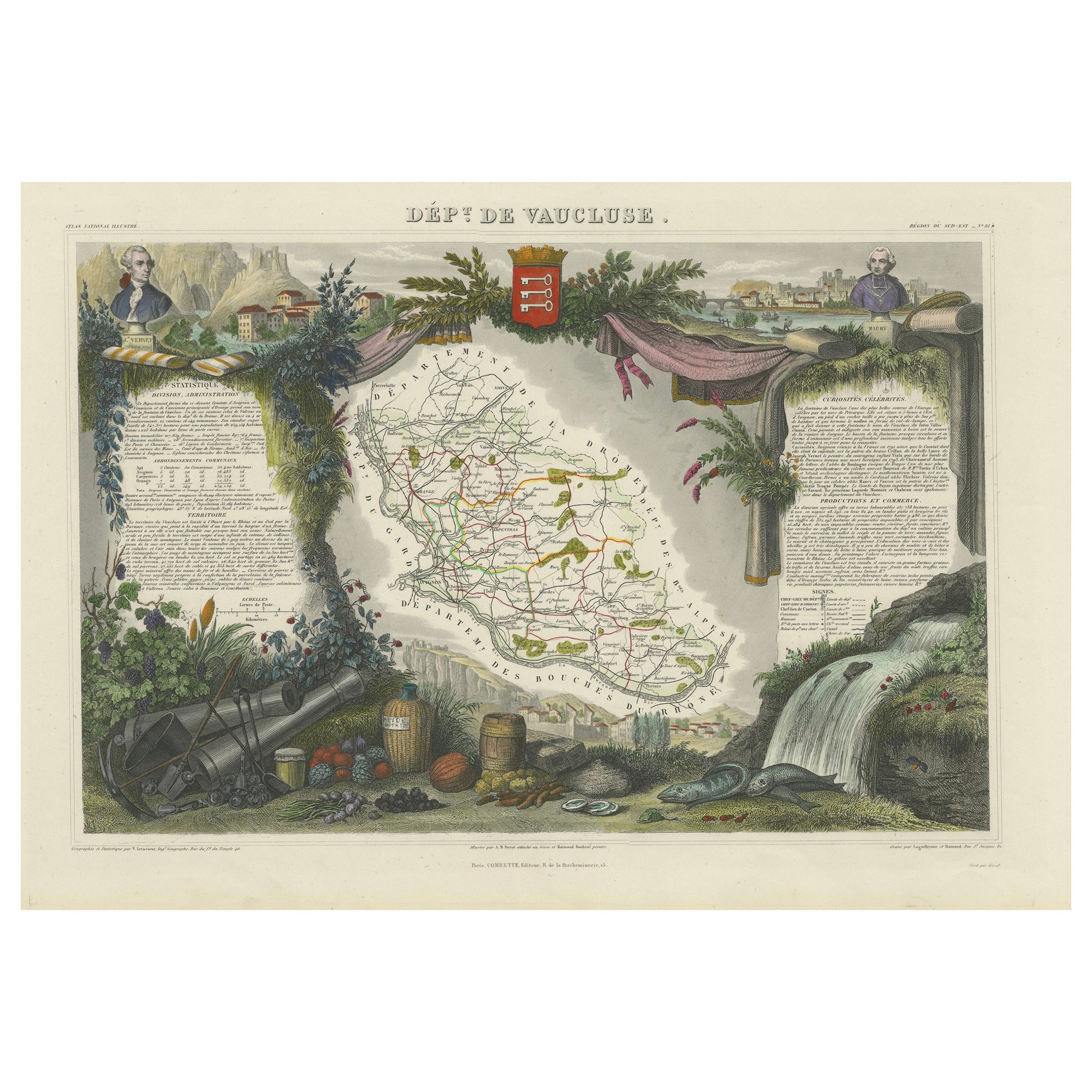
1852 Map of Haut-Rhin: An Illustrated Gateway to Alsace's Viticultural Splendors
About the Item
This original hand-colored map is from the "Atlas National Illustré," a work by Victor Levasseur, a French geographer and cartographer known for his richly illustrated maps.
The map is a steel engraving, which was a common and precise method for creating maps at the time. The inclusion of the publisher's name, A. Combette from Paris, and the addresses of the various contributors to the map's creation, like the engravers Laguillermie and Rainaud, adds to the historical context of the piece.
The margins of the map are adorned with detailed illustrations that serve as a visual encyclopedic reference to the region's geography, economy, and notable figures. The use of color along the boundaries makes the map not only a tool for navigation but also an educational resource, providing insights into the department's landscape, economy, and cultural significance.
The text included in the map's design provides statistical information, a map legend, and discussions about the land, local curiosities, notable personalities, products, and commerce, which would have been invaluable for education and reference at the time.
The 'Atlas National Illustré' is celebrated for its combination of cartographic detail and artistic embellishment, making it a valuable cultural artifact. It represents the height of decorative map-making in the 19th century, alongside the works of John Tallis and Archibald Fullarton.
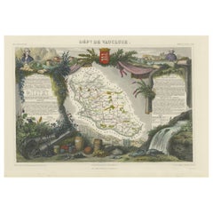
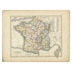
This particular map is an illustrated map of the 'Département de Vaucluse,' located in the Provence-Alpes-Côte d'Azur region of southeastern France.
The title 'Dépt. de Vaucluse' is displayed at the top of the map. The map itself is surrounded by elaborate margin illustrations that likely represent the local heritage, economy, and cultural symbols of Vaucluse. These typically include images of local produce, historical figures, landscapes, traditional clothing, and the coat of arms.
Key places and features of the Vaucluse department that are historically significant and may be highlighted on the map include:
1. **Avignon**: Known for the Palais des Papes (Papal Palace), where several popes and antipopes lived during the 14th century, and its well-preserved medieval city center.
2. **Orange**: Famous for its Roman theatre and the Triumphal Arch, both of which are UNESCO World Heritage Sites.
3. **Mont Ventoux**: A prominent mountain in the region, known as the "Giant of Provence" and famed for its challenging stage in the Tour de France bicycle race.
4. **Fontaine-de-Vaucluse**: The source of the Sorgue river, a spring that is the largest in France and the fifth largest in the world.
5. **The Luberon**: A massif in central Vaucluse that is part of the Parc Naturel Régional du Luberon, known for its picturesque villages like Gordes and Roussillon.
6. **Carpentras**: This town is known for its historical sites and as the former capital of the Comtat Venaissin.
7. **The Côtes du Rhône wine region**: Vaucluse is home to famous vineyards, including Châteauneuf-du-Pape.
8. **The Ochre of Roussillon**: The ochre sands and cliffs around the village of Roussillon are a notable tourist attraction.
The map would have served both as a practical guide to the department and as an educational tool, showcasing the riches and points of interest of the Vaucluse area. The inclusion of local statistics and discussions about the land, curiosities, personages, products, and commerce in the text around the map would have provided 19th-century map readers with a comprehensive view of the region.
- Dimensions:Height: 14.18 in (36 cm)Width: 20.75 in (52.7 cm)Depth: 0 in (0.02 mm)
- Materials and Techniques:
- Period:
- Date of Manufacture:1852
- Condition:Good. Very decoartive and in excellent hand-coloring. A very light brown hue around the edges, adding to its patina. Study the images carefully.
- Seller Location:Langweer, NL
- Reference Number:
About the Seller
5.0
Platinum Seller
These expertly vetted sellers are 1stDibs' most experienced sellers and are rated highest by our customers.
Established in 2009
1stDibs seller since 2017
1,919 sales on 1stDibs
Typical response time: <1 hour
- ShippingRetrieving quote...Ships From: Langweer, Netherlands
- Return PolicyA return for this item may be initiated within 14 days of delivery.
More From This SellerView All
- Old Map of Vaucluse, France: A Cartographic Celebration of Viticulture, 1852Located in Langweer, NLThis original hand-colored map is from the "Atlas National Illustré," a work by Victor Levasseur, a French geographer and cartographer known for his richly illustrated maps. The map...Category
Antique 1850s Maps
MaterialsPaper
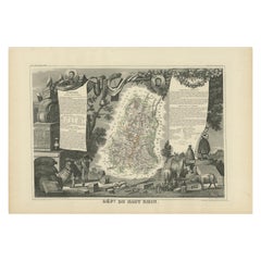
- Antique Map of Haut-Rhin, France by V. Levasseur, 1854By Victor LevasseurLocated in Langweer, NLAntique map titled 'Dépt. du Haut Rhin'. Map of the French department of Haut-Rhin, France. This mountainous area is part of the Alsace wine region and is known for its production of...Category
Antique Mid-19th Century Maps
MaterialsPaper
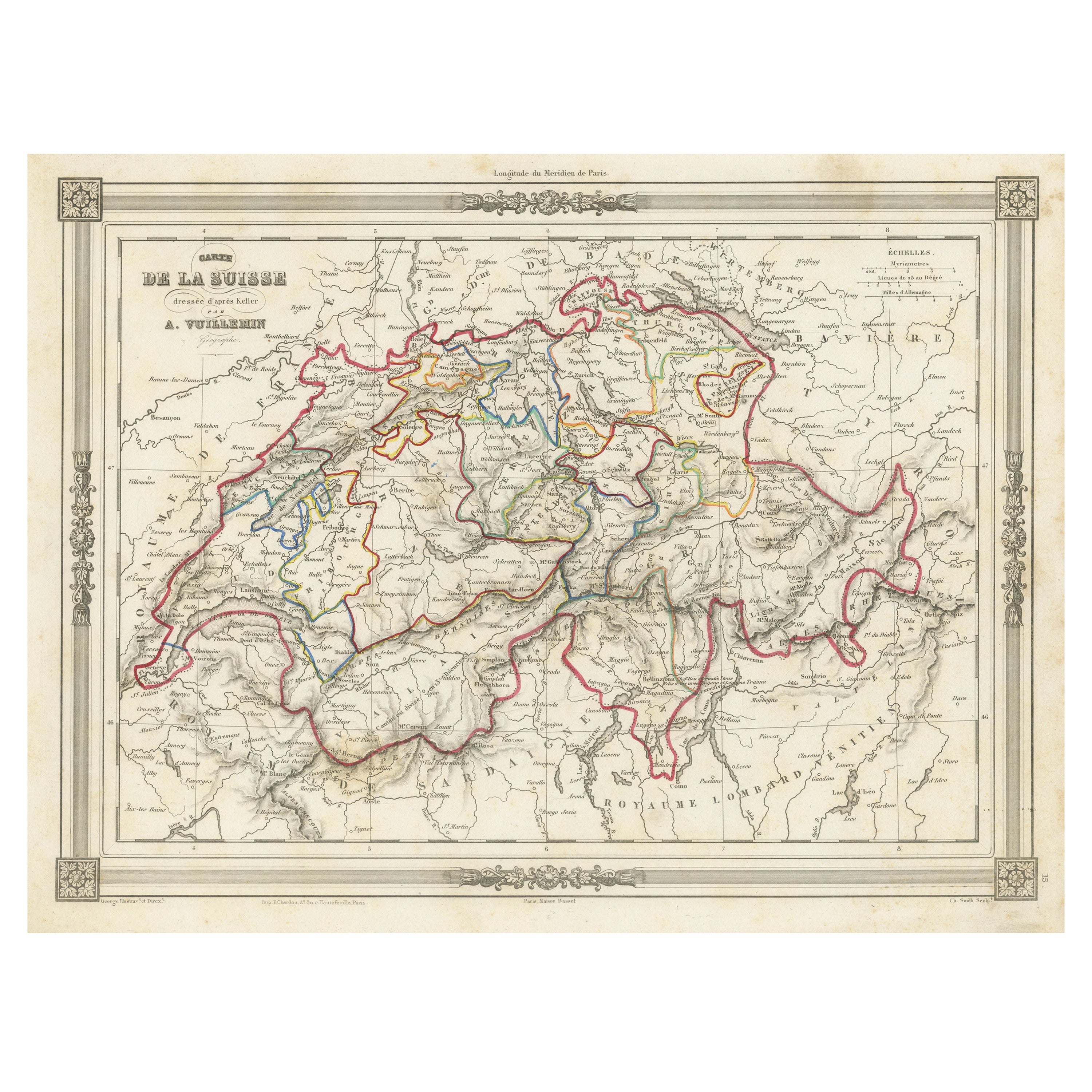
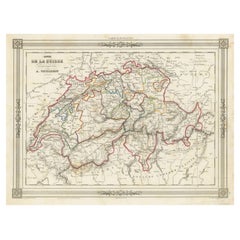
- Swiss Splendor: Antique Map of Switzerland and Its Cantons, 1852Located in Langweer, NLThe antique map titled 'Carte de la Suisse' is an attractive map of Switzerland. Here are the key details and features of the map: 1. **Geographic Coverage**: - The map provides comprehensive coverage of Switzerland, depicting the entire country. - It showcases the division of Switzerland by Cantons, including regions from Vaud to Grisons. - Additionally, the map includes parts of adjacent countries, such as France, Germany, and Italy, providing context for Switzerland's geographical location. 2. **Cartographic Details**: - The map offers detailed cartographic information, including the delineation of geographic features, rivers, mountains, and the names of Cantons and towns. - It presents a clear and informative representation of Switzerland's topography. 3. **Origin**: - This map originates from Maison Basset's 1852 edition of 'Atlas Illustre Destine a l'enseignement de la Geographie elementaire,' indicating its use for educational purposes, particularly in the teaching of geography. 4. **Educational Significance**: - As part of an educational atlas, the map likely played a role in instructing students about the geography of Switzerland and its political subdivisions. - It may have been employed as a visual aid to enhance students' understanding of Switzerland's Cantonal divisions. 5. **Aesthetic Appeal**: - The map is described as attractive, suggesting that it possesses not only educational value but also visual appeal. - Maps of this era often featured decorative elements that added to their aesthetic charm. 6. **Historical and Geopolitical Significance**: - Switzerland's unique position in Europe, as a country surrounded...Category
Antique Mid-19th Century Maps
MaterialsPaper
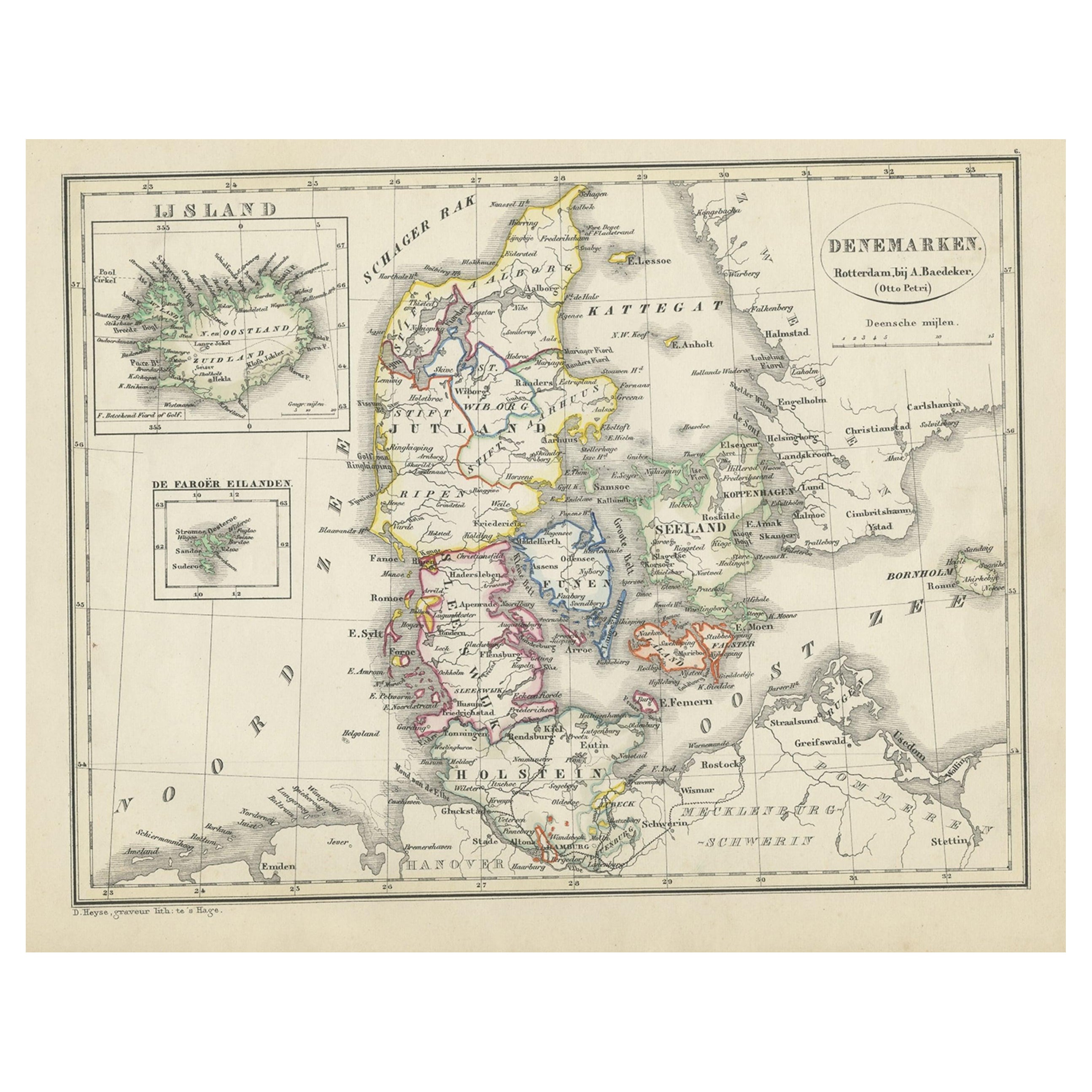
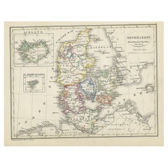
- Antique Map of Denmark with An Inset of Iceland, 1852Located in Langweer, NLAntique map titled 'Denemarken'. Map of Denmark, with a small inset map of Iceland. This map originates from 'School-Atlas van alle deelen der Aarde' by Otto Petri...Category
Antique 19th Century Maps
MaterialsPaper
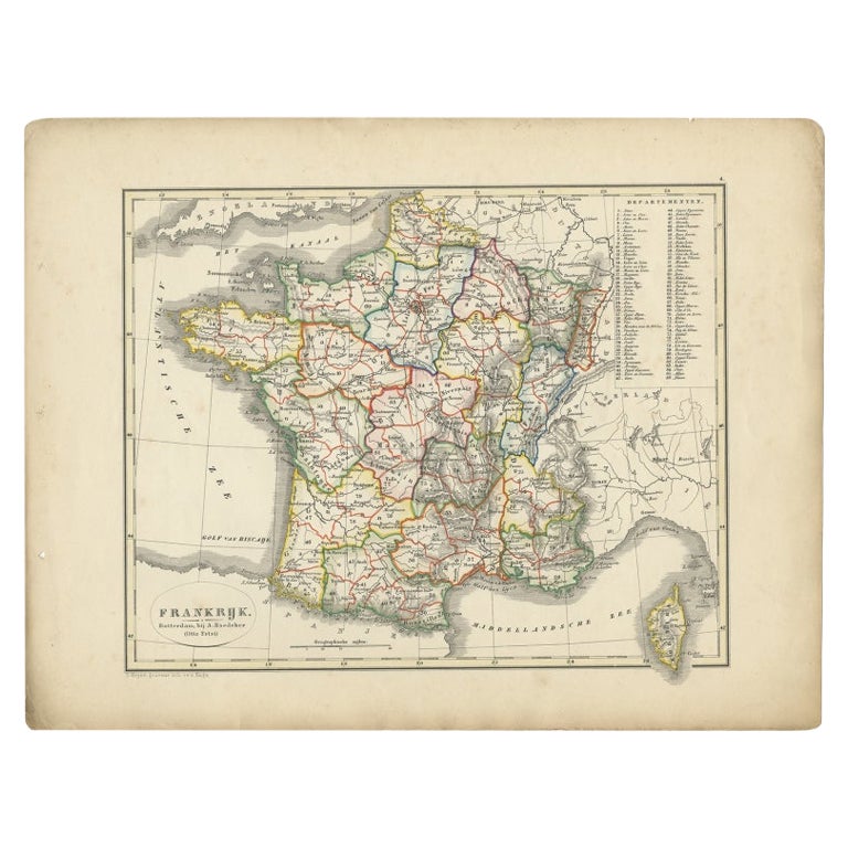
- Antique Map of France from an Old Dutch School Atlas, 1852Located in Langweer, NLAntique map titled 'Frankrijk'. Map of France. This map originates from 'School-Atlas van alle deelen der Aarde' by Otto Petri. Artists and Engravers: Published by A. Baedeker (Otto ...Category
Antique 19th Century Maps
MaterialsPaper
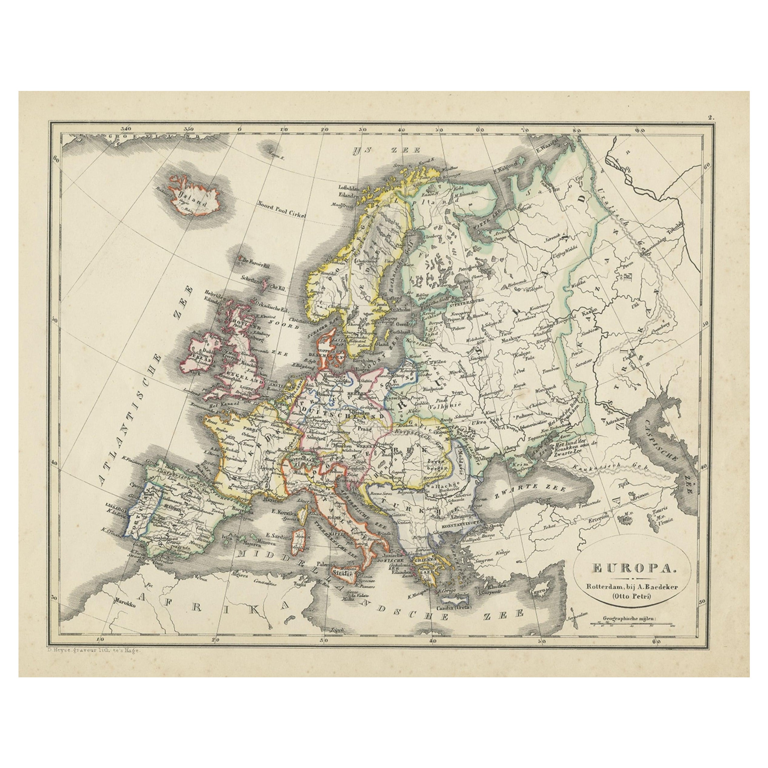
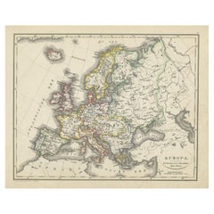
- Antique Map of Europe from an Old Dutch School-Atlas, 1852Located in Langweer, NLAntique map titled 'Europa'. Map of Europe. This map originates from 'School-Atlas van alle deelen der Aarde' by Otto Petri. Artists and Engravers: Published by A. Baedeker (Otto...Category
Antique 19th Century Maps
MaterialsPaper
You May Also Like
- Illustrated Map of London from ExhibtionLocated in Alton, GBDetailed illustrated map of London from the great exhibition of industry of all nations 1851.Category
Antique 19th Century Maps
MaterialsPaper
- Large1852 Map "Russian Empire" Ric.r0011Located in Norton, MALarge 1852 map "Russian Empire" George Phillips & Son 1852 Ric.r0011 Dimension: Paper: 67 cm W x 52 cm H ; Sight: 60cm W x 50 cm H Condition: Good Condition with aged tonin...Category
Antique 19th Century Unknown Maps
MaterialsPaper
- Gold, An Illustrated History, First EditionBy Vincent BuranelliLocated in valatie, NYGold, An Illustrated History by Vincent Buranelli. Maplewood: Hammond Incorporated, 1979. First edition hardcover with dust jacket. 221 pp. A book on the history and the love of gold. Illustrated are the masterworks of the Egyptians, Thracians, and Roman and Greek treasures along with masterpieces from the Renaissance. Described are the smugglers, grave robbers, sunken treasures...Category
20th Century American Books
MaterialsPaper
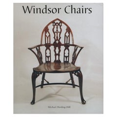
- Windsor Chairs, An Illustrated Celebration, Michael Harding-HillLocated in London, GBWindsor chairs By Michael Harding-Hill Published by Antique Collectors Club, 2007. Hardback in dust jacket. The Windsor Chair, whether simple or complicated in construction, plain or ornate in appearance, has always served its purpose - to be utilitarian, durable, comfortable and even handsome. Many excellent academic works have been written on the subject, but this book does not attempt to improve on their expertise. The intention rather is to complement them by showing the finest designs in greater detail. The form and construction of the chairs speak for themselves. All the chairs illustrated, although made in different centuries, are in use today. More than 150 colour plates illustrate the very best Windsor chairs from the earliest stick-backs - literally stools with a few sticks added to the back - of the 18th century to those mass-produced for offices, schools, public institutions and the armed forces in the 19th century. There is a special section on American Windsors and an epilogue outlines the story of the Windsor chair through the 20th century and concludes by illustrating a 2002 Golden Jubilee chair...Category
Early 2000s British Modern Books
MaterialsPaper
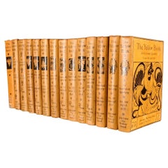
- 1894-1949 The Yellow Book: An Illustrated QuarterlyBy Aubrey BeardsleyLocated in Bath, GBA lovely set of all thirteen volumes of 'The Yellow Book' literary quarterly, published at the end of the nineteenth century, with numerous plates throughout each volume. Complete a...Category
Early 20th Century British Books
MaterialsPaper
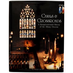
- Canals & Crossroads An illustrated History of Albany, NY Roman Catholic DioceseLocated in valatie, NYCanals & Crossroads: An illustrated History of Albany, New York Roman Catholic Diocese. Albany Catholic Press Association, Incorporated, 1997. Stated fi...Category
1990s American Books
MaterialsPaper


Recently Viewed
View AllMore Ways To Browse
Georg Barque
F V Hayden
Dirk Hartog
De Nile Antiques
Serbia Map
Siam Map
Marthas Vineyard Map
Native American Mountie
Nicolaes Visscher II On Sale
Pierre Fran�ois Tardieu On Sale
Union Pacific Map
Vintage Marthas Vineyard Map
Yemen 1789
Old French Map
Levasseur A
Antique Map Copenhagen
Map Prussia Germany
Frontier Map