Old French Map
8
to
67
574
146
357
227
167
141
124
107
60
60
48
41
33
29
23
23
22
21
19
19
17
16
15
15
15
12
11
9
8
7
7
7
6
5
5
5
5
5
5
5
5
5
4
4
4
3
3
3
2
2
2
2
2
1
1
1
1
1
42
42
16
16
13
Sort By
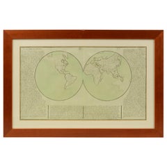
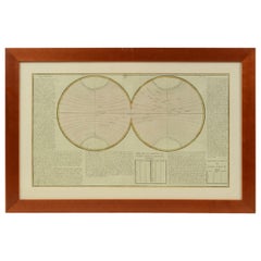
1850 Old French Map Depicting the Entire Earth's Surface Divided into Two Parts
Located in Milan, IT
two hemispheres or globes, the map deals with the earth in general. Detailed explanation in French
Category
Antique Mid-19th Century French Maps
Materials
Glass, Wood, Paper
H 18.31 in W 27.45 in D 0.79 in
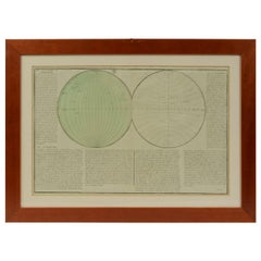
1850 Old French Map Depicting the Entire Earth's Surface Divided into Two Parts
Located in Milan, IT
Geographical map depicting the entire earth’s surface divided into two parts that correspond to the
Category
Antique Mid-19th Century French Maps
Materials
Glass, Wood, Paper
H 18.19 in W 25.87 in D 0.79 in
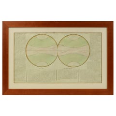
1850 Old French Map Depicting the Entire Earth's Surface Divided into Two Parts
Located in Milan, IT
Map depicting the entire earth's surface divided into two parts corresponding to the two
Category
Antique Mid-19th Century French Maps
Materials
Glass, Wood, Paper
H 18.51 in W 27.76 in D 0.79 in
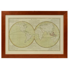
1850 Old French Map Depicting the Entire Earth's Surface Divided into Two Parts
Located in Milan, IT
Geographical map depicting the entire earth's surface divided into two parts that correspond to the
Category
Antique Mid-19th Century French Maps
Materials
Glass, Wood, Paper
H 18.51 in W 25.99 in D 0.79 in
1850 Old French Map Depicting the Entire Earth's Surface Divided into Two Parts
Located in Milan, IT
Geographical map depicting the entire earth's surface divided into two parts that correspond to the
Category
Antique Mid-19th Century French Scientific Instruments
Materials
Glass, Wood, Paper
H 18.51 in W 27.76 in D 0.79 in
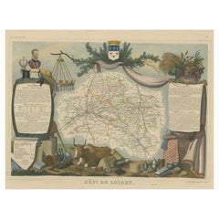
Old Map of the French Department of Loiret, France
By Victor Levasseur
Located in Langweer, NL
Antique map titled 'Dépt. du Loiret'. Map of the French department of Loiret, France. Surrounding
Category
Antique Mid-19th Century Maps
Materials
Paper
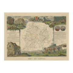
Old Map of the French Department of Cantal, France
By Victor Levasseur
Located in Langweer, NL
Antique map titled 'Dépt. du Cantal'. Map of the French department of Cantal, France. This area of
Category
Antique Mid-19th Century Maps
Materials
Paper
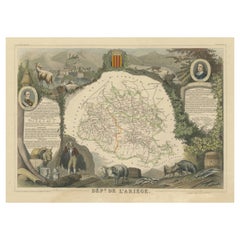
Old Map of the French department of Ariège, France
By Victor Levasseur
Located in Langweer, NL
Antique map titled 'Dépt. de l'Ariège'. Map of the French department of Ariege, France. This area
Category
Antique Mid-19th Century Maps
Materials
Paper
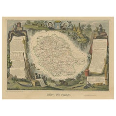
Old Map of the French department of Tarn, France
By Victor Levasseur
Located in Langweer, NL
Antique map titled 'Dépt. du Tarn'. Map of the French department of Tarn, France. This area
Category
Antique Mid-19th Century Maps
Materials
Paper
Old Map of the French Department of Nièvre, France
By Victor Levasseur
Located in Langweer, NL
Antique map titled 'Dept. de la Nièvre'. Map of the French department of Nievre, France. Part of
Category
Antique Mid-19th Century Maps
Materials
Paper
Old Map of the French department of Creuse, France
By Victor Levasseur
Located in Langweer, NL
Antique map titled 'Dépt. de la Creuse'. Map of the French department of Creuse, France. This
Category
Antique Mid-19th Century Maps
Materials
Paper
Old Map of the French Department of Ardèche, France
By Victor Levasseur
Located in Langweer, NL
Antique map titled 'Dépt. de l'Ardèche'. Map of the Department of Ardèche, France. This region is
Category
Antique Mid-19th Century Maps
Materials
Paper
Old Map of the French Department of Indre, France
By Victor Levasseur
Located in Langweer, NL
Antique map titled 'Dept. de l'Indre'. Map of the French department of Indre, France. Part of the
Category
Antique Mid-19th Century Maps
Materials
Paper
Old Map of the French department of l'Aisne, France
By Victor Levasseur
Located in Langweer, NL
Antique map titled 'Dépt. de l'Aisne'. Map of the French department of l'Aisne, France. The whole
Category
Antique Mid-19th Century Maps
Materials
Paper
Old Map of the French Department of L'ain, France
By Victor Levasseur
Located in Langweer, NL
Antique map titled 'Dépt. de l'Ain'. Map of the French department of l'Ain, France. This area of
Category
Antique Mid-19th Century Maps
Materials
Paper
Old Map of the French Department of Eure-et-loir, France
By Victor Levasseur
Located in Langweer, NL
Antique map titled 'Dépt. d'Eure et Loir'. Map of the French department of Eure-et-Loir, France
Category
Antique Mid-19th Century Maps
Materials
Paper
Old Map of the French Department of Loir-et-cher, France
By Victor Levasseur
Located in Langweer, NL
Antique map titled 'Dépt. de Loir et Cher'. Map of the French department Loir-et-Cher, France. This
Category
Antique Mid-19th Century Maps
Materials
Paper
Antique Map of Italy from an Old French Atlas, 1842
Located in Langweer, NL
Antique map titled 'Carte de l'Italie'. Map of Italy.
This map originates from 'Atlas universel
Category
Antique 19th Century Maps
Materials
Paper
Old Map of the Bourbonnais Region of France, ca.1630
Located in Langweer, NL
Antique map titled 'Bourbonois - Borbonium Ducatus'.
Old map of the Bourbonnais region of
Category
Antique 1630s Maps
Materials
Paper
Old Map of Vaucluse, France: A Cartographic Celebration of Viticulture, 1852
Located in Langweer, NL
French geographer and cartographer known for his richly illustrated maps.
The map is a steel engraving
Category
Antique 1850s Maps
Materials
Paper
H 14.18 in W 20.99 in D 0 in
Antique Map of Greece from an Old French School Atlas, 1880
Located in Langweer, NL
Antique map titled 'Grèce Moderne '. Old map of Greece and surroundings. This map originates from
Category
Antique 19th Century Maps
Materials
Paper
Antique Map of France from an Old Dutch School Atlas, 1852
Located in Langweer, NL
Antique map titled 'Frankrijk'. Map of France. This map originates from 'School-Atlas van alle
Category
Antique 19th Century Maps
Materials
Paper
Old Map of the Alsace 'Elzas' Region with Lotharingen 'Lorraine', France, c1650
Located in Langweer, NL
Antique map titled 'Alsatia superior cum Suntgoia et Brisgoia'.
Old map of the Alsace (or Elzas
Category
Antique 1650s Maps
Materials
Paper
H 19.69 in W 23.04 in D 0 in
Old Map Depicting the Entire Earth's Surface Divided into Six Parts France 1850
Located in Milan, IT
Map depicting the entire earth's surface divided into six parts which depicts the position of
Category
Antique Mid-19th Century French Maps
Materials
Paper, Glass, Wood
H 18.51 in W 27.76 in D 0.79 in
Old Map of Part of France: Poitou, Berry, Bourbonnais, and Nivernais in 1768
Located in Langweer, NL
The map with text neatly mounted on both sides of the map on the plate, is a section of an old map
Category
Antique 1760s Maps
Materials
Paper
H 13.19 in W 20.28 in D 0 in
Antique Miniature Map of the Old World and France by Mallet, circa 1683
Located in Langweer, NL
shows a hemisphere of the Old World. The lower map shows France. This map originates from 'Description
Category
Antique Late 17th Century Maps
Materials
Paper
H 11.03 in W 8.86 in D 0.6 in
Old Original Handcoloured Map of the Former Province of Perche, France, ca.1640
Located in Langweer, NL
Antique map titled 'Perchensis Comitatus - La Perche compte'.
Old map of the former province of
Category
Antique 1640s Maps
Materials
Paper
H 14.77 in W 23.04 in D 0 in
Old Handcolored Antique Map of Pays De Caux in Normandy, France, ca.1640
Located in Langweer, NL
Antique map titled 'Le Pais de Caux'.
Old map of Pays de Caux, France. Pays de Caux is an area
Category
Antique 1640s Maps
Materials
Paper
H 19.49 in W 23.04 in D 0 in
Old Map of Guyana, Suriname and French Guiana with Paramaribo and Cayenne, c1760
Located in Langweer, NL
Description: Antique map titled 'Carte de la Guiane.'
Antique map of the Guianas - present day
Category
Antique 1760s Maps
Materials
Paper
H 9.93 in W 14.65 in D 0 in
Old Map of Region Champagne-Ardenne with Reims, Troyes & Épernay in France, 1759
Located in Langweer, NL
France by J. B. Homann, covering the region Champagne-Ardenne with Reims, Troyes and Épernay. The map
Category
Antique 1750s Maps
Materials
Paper
H 24.93 in W 21.07 in D 0 in
Original Old Copper Engraved Map of the Region of Albi, Southern France, 1663
Located in Langweer, NL
Southern France. This map originates from 'Topographia Galliae dat is eene algemeene en bysondere
Category
Antique 1660s Maps
Materials
Paper
H 12.6 in W 15.16 in D 0 in
Original Very Old Hand-Colored Map of Limousin or Limoges, France, ca.1600
Located in Langweer, NL
Antique map titled 'Totius Lemovici et Confinium (..).' -
A handsome and detailed map of Limousin
Category
Antique Early 1600s Maps
Materials
Paper
H 15.75 in W 21.07 in D 0 in
Authentic Old Map of Sumatra, Malaysia and Singapore, 1745
Located in Langweer, NL
L'Isle" translates to "Map of the Island of Sumatra and the Malayan Coast based on the work of G. de
Category
Antique 1740s Maps
Materials
Paper
Very Old Original Antique Map of The City of Douai in France, ca.1575
Located in Langweer, NL
Antique Map of Douai (France) titled 'Duacum, Catuacorum Urbs, tam situ, quam incolis, et
Category
Antique 16th Century Maps
Materials
Paper
Old Map of Turkmenistan, Uzbekistan, Afghanistan, Tajikistan, Kyrgyzstan, 1757
Located in Langweer, NL
Antique map titled 'Kort over det Lille Bukarie og de naest graensende Lande. af Engelske
Category
Antique 1750s Maps
Materials
Paper
H 9.06 in W 13.78 in D 0 in
Old Map Focusing on the Wine Region of Metz, the Moselle Region of France, 1657
Located in Langweer, NL
Antique map of France titled 'Territorium Metense'.
Old map focusing on the wine region
Category
Antique 1650s Maps
Materials
Paper
H 19.69 in W 23.63 in D 0 in
Authentic Old Map of Arabia with Original Border Coloring, 1745
Located in Langweer, NL
Title: "Kaartje van Arabië na de stelling van den Heer Guillaume de L'Isle"
Translates to "Map of
Category
Antique 1740s Maps
Materials
Paper
Antique Political Map of France, 1880
By J. Migeon
Located in Langweer, NL
Antique map titled 'France Féodale'. Old map of France with a decorative vignette of Castle de
Category
Antique 19th Century Maps
Materials
Paper
Authentic Old Map of Persia with Original Border Coloring, 1745
Located in Langweer, NL
Title: "Kaartje van Persien na de stelling van den Heer Guillaume de L'Isle"
Translates to "Map
Category
Antique 1740s Maps
Materials
Paper
Authentic Old Map of Southeast Asia with Original Border Coloring, 1745
Located in Langweer, NL
prominent French cartographer known for his influential maps during the 18th century.
Published by Jacob
Category
Antique 1740s Maps
Materials
Paper
French Antique Map of France and Western Europe, 1765
By G. A. Rizzi-zannoni
Located in Langweer, NL
Antique map titled 'Carte de tous les Lieux, célébres dans l'Histoire (..)'. Beautiful old map of
Category
Antique 18th Century Maps
Materials
Paper
Antique Map of France by Migeon, 1880
Located in Langweer, NL
Antique map titled 'France Physique'. Old map of France. This map originates from 'Géographie
Category
Antique 19th Century Maps
Materials
Paper
Antique Map of France by Zannoni, 1765
Located in Langweer, NL
Antique map titled 'La France divisée en ses LVIII Provinces (..)'. Beautiful old map of France
Category
Antique 18th Century Maps
Materials
Paper
Antique Map of France with Inset Map of the Island of Corsica, 1820
Located in Langweer, NL
Antique map titled 'France in Departments'. Old map of France, with small inset map of the island
Category
Antique 19th Century Maps
Materials
Paper
Old Map of the Oceans Around Australia, Indonesia and New Zealand, 1880
Located in Langweer, NL
Antique map titled 'Océanie'.
Old map of the oceans around Australia, Indonesia and New Zealand
Category
Antique 1880s Maps
Materials
Paper
Old Map of the Austrian Empire with Decorative Vignette of Vienna, 1880
Located in Langweer, NL
Antique map titled 'Empire d'Autriche'.
Old map of the Austrian Empire. With decorative
Category
Antique 1880s Maps
Materials
Paper
Old Antique Map of the East Indies and Southeast Asia, ca.1644
Located in Langweer, NL
Antique map titled 'India quae Orientalis dicitur, et Insulae adiacentes'.
Old map of the East
Category
Antique 1640s Maps
Materials
Paper
Old Engraving of Batavia 'Jakarta, Indonesia' with Map and Harbour View, 1750
Located in Langweer, NL
Antique map titled 'Carte des environs de Batavia '. French map of the Batavia area (Jakarta) in
Category
Antique 1750s Maps
Materials
Paper
H 11.82 in W 15.75 in D 0 in
Antique Map of France with Decorative Title Cartouche
Located in Langweer, NL
Antique map titled 'Carte de la France'. Original old map of France. This map originates from 'Le
Category
Antique Mid-18th Century Maps
Materials
Paper
Antique Map of Guyenne, Gascony and Béarn, France
Located in Langweer, NL
Antique map titled 'Guyenne et Gascogne et Bearn'. Original old map of Guyenne (or Guienne
Category
Antique Mid-18th Century Maps
Materials
Paper
Antique Map of ancient France by Zannoni, 1765
Located in Langweer, NL
Antique map France titled 'Galliae Veteris (..)'. Beautiful old map of France. This map originates
Category
Antique 18th Century Maps
Materials
Paper
Antique Map of England with French Title, 1806
Located in Langweer, NL
Antique map titled 'L'Angleterre.' Map of England by Robert de Vaugondy, revised and published by
Category
Antique 19th Century Maps
Materials
Paper
Very Old Original Hand-Colored Map of the Basel Region, Switzerland, Ca.1578
Located in Langweer, NL
Antique print titled 'Basiliensis territorii descriptio nova'.
Old map of the Basel region
Category
Antique 16th Century Maps
Materials
Paper
H 39 in W 27.3 in D 0.002 in
Decorative Original Old Map of Nova Zembla and the Russian Mainland, ca.1760
Located in Langweer, NL
Antique map titled 'Carte Des Pais Habites par les Samojedes et Ostiacs.'
Map of Novaya Zemlya
Category
Antique 1760s Maps
Materials
Paper
H 9.65 in W 12.21 in D 0 in
Old Map of Indian Ocean & Sumatra, Java, Borneo, India, Arabia, Africa, c.1783
Located in Langweer, NL
Antique map titled 'Carte des Declinaisons et Inclinaisons de L'Aiguille Aimantée redigée d'après
Category
Antique 1780s Maps
Materials
Paper
H 20.87 in W 25.4 in D 0 in
Old Map of the Great Lakes and Upper Mississippi Valley, Northern America, c1780
Located in Langweer, NL
Antique map titled 'Partie Occidentale du Canada'.
A fine example of Rigobert Bonne and
Category
Antique 1780s Maps
Materials
Paper
H 10.32 in W 14.85 in D 0 in
Old Map of the British Isles with the Faroes and Shetlands, Showing Cock Fights
Located in Langweer, NL
Antique map titled 'Les Isles Britaniques ou sont les Royaumes d'Angleterre (..)'. Original old map
Category
Antique Early 18th Century Maps
Materials
Paper
H 10.36 in W 14.57 in D 0.02 in
Antique Map of the Adour River, Near Bayonne, France
Located in Langweer, NL
Antique map titled 'Cours de la riviere de l'Adour depuis la mer jusqua Bayonne'. Original old map
Category
Antique Mid-18th Century Maps
Materials
Paper
Antique Map of France in Ancient Roman Times, 1880
Located in Langweer, NL
Antique map titled 'Gaule indépendante et Romaine'.
Old map of Gaul or France in ancient Roman
Category
Antique 19th Century Maps
Materials
Paper
Antique Map of France by Covens & Mortier, c.1730
Located in Langweer, NL
Antique map titled 'Nova regni Galliae (..) La France'. Old map of France with large decorative
Category
Antique 18th Century Maps
Materials
Paper
- 1
- ...
Get Updated with New Arrivals
Save "Old French Map", and we’ll notify you when there are new listings in this category.
Old French Map For Sale on 1stDibs
Choose from an assortment of styles, material and more with respect to the old French map you’re looking for at 1stDibs. Frequently made of paper, metal and wood, every old French map was constructed with great care. There are 440 variations of the antique or vintage old French map you’re looking for, while we also have 5 modern editions of this piece to choose from as well. You’ve searched high and low for the perfect old French map — we have versions that date back to the 18th Century alongside those produced as recently as the 21st Century are available. An old French map, designed in the mid-century modern, modern or Art Deco style, is generally a popular piece of furniture. A well-made old French map has long been a part of the offerings for many furniture designers and manufacturers, but those produced by Victor Levasseur, G. A. Rizzi-zannoni and Johannes Janssonius are consistently popular.
How Much is an Old French Map?
An old French map can differ in price owing to various characteristics — the average selling price 1stDibs is $608, while the lowest priced sells for $59 and the highest can go for as much as $929,103.
More Ways To Browse
1840 French
Used Office Furniture Winnipeg
Antique Map Coats Of Arms
Shetland Map
Antique Illinois Map
Congo Antique Map
Dolphin Anchor
Guyana Antique Map
Antique Map Dordogne
Pacific Nw
Antique Map Copenhagen
Antique Detroit Map
Antique Map Of Detroit
Epernay France
Royal Picardie
Italian Maps
Paris Antique Map
Large Old Map
