Items Similar to Authentic Old Map of Arabia with Original Border Coloring, 1745


Want more images or videos?
Request additional images or videos from the seller
1 of 6
Authentic Old Map of Arabia with Original Border Coloring, 1745
About the Item
Title: "Kaartje van Arabië na de stelling van den Heer Guillaume de L'Isle"
Translates to "Map of Arabia based on the work of Mr. Guillaume de L'Isle." Guillaume de L'Isle was a prominent French cartographer known for his influential maps during the 18th century.
Published by Jacob Keizer and by Jan de Lat
Creator: Keizer, Jacob, active 1706-1750
Map of Arabia with parts of Persia, Egypt and Abyssinia. Scale: Duitsche Mylen 15 in een Graad,75. Fransche mylen 20 in een graad,100.
Size: 17.10 x 24.20cm.
Description:
This map of Arabia likely reflects de L'Isle's cartographic expertise and showcases the geographical accuracy and attention to detail characteristic of his maps. It provides a comprehensive depiction of the Arabian Peninsula, featuring its geographical features, cities and rivers.
Maps based on de L'Isle's work were esteemed for their precision and were considered some of the most accurate of their time. They were often used by scholars, explorers, and governments for their reliability and attention to detail.
This original map would serve as a valuable historical and geographical reference, illustrating the Arabian Peninsula as understood and mapped during that period, showcasing the advancements in cartography and geographic knowledge of the time.
Fun fact on this Dutch map: Arabia is named 'Gelukkig Arabia', which is Dutch for Happy Arabia .
- Dimensions:Height: 6.7 in (17 cm)Width: 9.45 in (24 cm)Depth: 0 in (0.02 mm)
- Materials and Techniques:Paper,Engraved
- Period:1740-1749
- Date of Manufacture:1745
- Condition:Very Good. Two folding lines. Study the image carefully.
- Seller Location:Langweer, NL
- Reference Number:
About the Seller
5.0
Platinum Seller
These expertly vetted sellers are 1stDibs' most experienced sellers and are rated highest by our customers.
Established in 2009
1stDibs seller since 2017
1,922 sales on 1stDibs
Typical response time: <1 hour
- ShippingRetrieving quote...Ships From: Langweer, Netherlands
- Return PolicyA return for this item may be initiated within 14 days of delivery.
More From This SellerView All
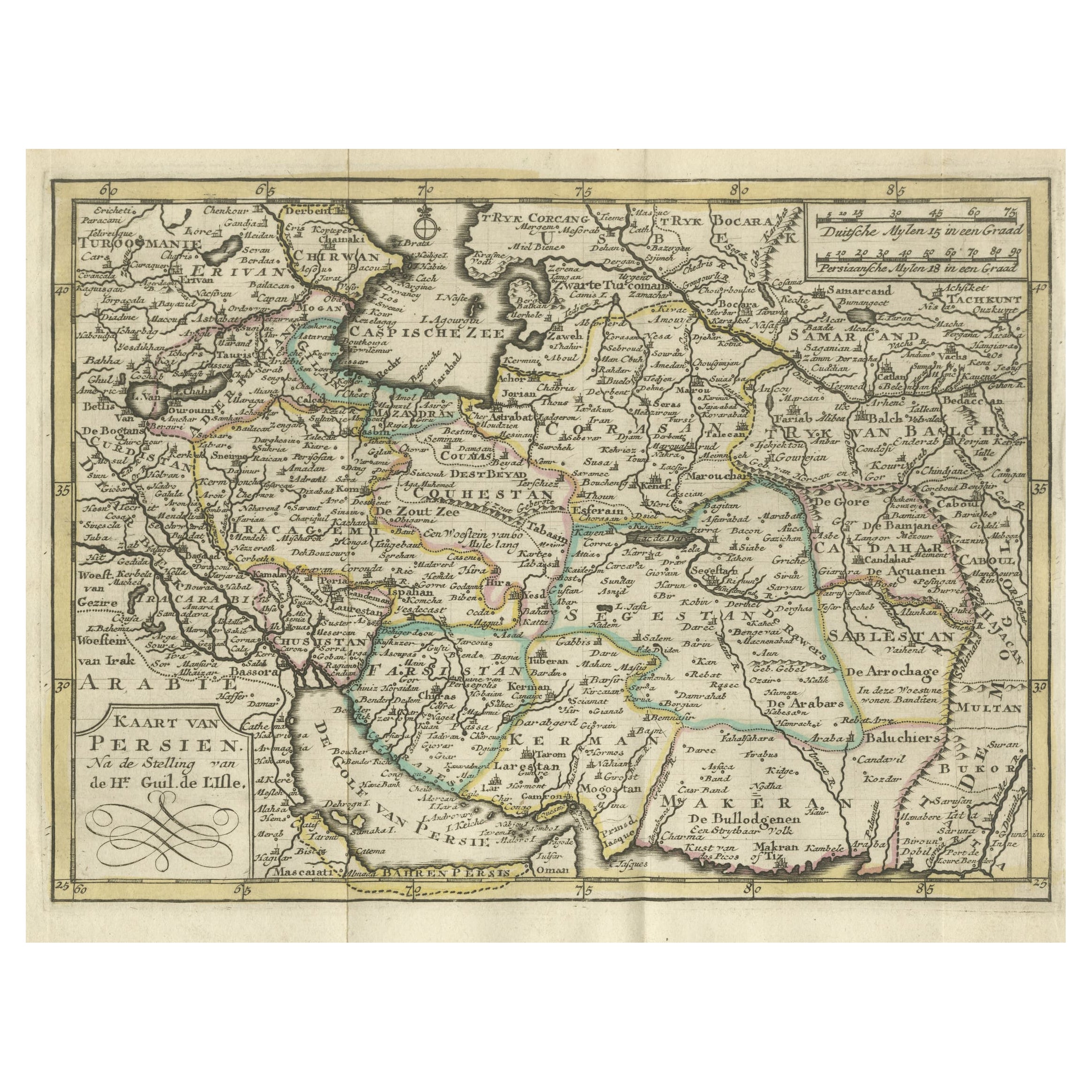
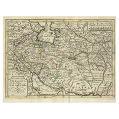
- Authentic Old Map of Persia with Original Border Coloring, 1745Located in Langweer, NLTitle: "Kaartje van Persien na de stelling van den Heer Guillaume de L'Isle" Translates to "Map of Persia based on the work of Mr. Guillaume de L'Isle." Guillaume de L'Isle was a p...Category
Antique 1740s Maps
MaterialsPaper
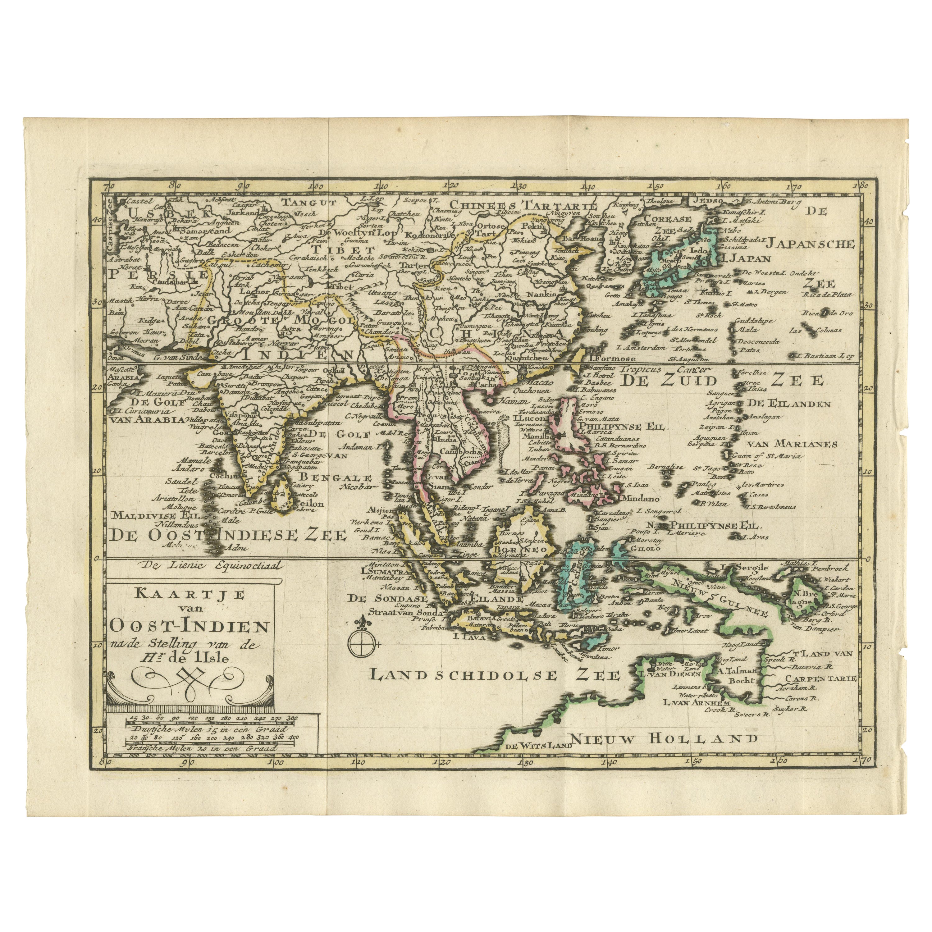
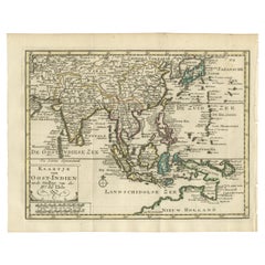
- Authentic Old Map of Southeast Asia with Original Border Coloring, 1745Located in Langweer, NLTitle: "Kaartje van Oost-Indien na de stelling van den Heer Guillaume de L'Isle" Translates to "Map of the East-Indies based on the work of Mr. Guillaume de L'Isle." Guillaume de L...Category
Antique 1740s Maps
MaterialsPaper
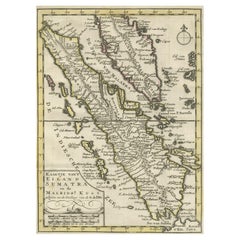
- Authentic Old Map of Sumatra, Malaysia and Singapore, 1745Located in Langweer, NLTitle: "Kaartje van't Eiland Sumatra en de Maleidse Kust gelegen na de stelling van de G. de L'Isle" Published by Jacob Keizer and by Jan de Lat Creator: Keizer, Jacob, active 1706...Category
Antique 1740s Maps
MaterialsPaper
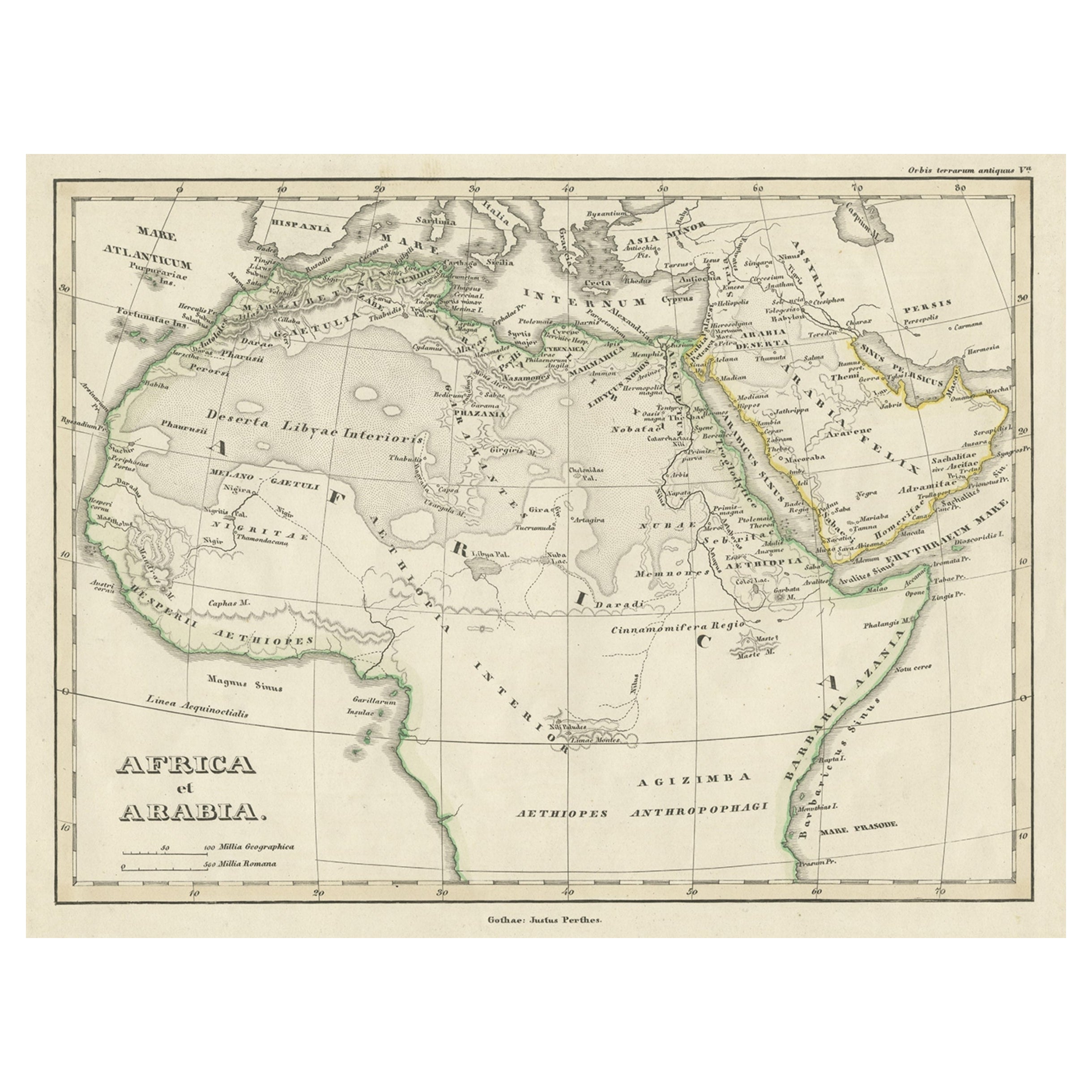
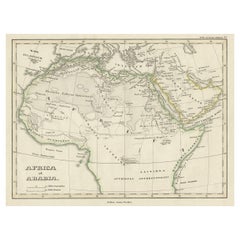
- Old Original Map of Africa and Arabia, 1848Located in Langweer, NLAntique map titled 'Africa et Arabia'. Old map of Africa and Arabia originating from 'Orbis Terrarum Antiquus in usum Scholarum'. Artists and Engravers: Published by Justus P...Category
Antique 1840s Maps
MaterialsPaper
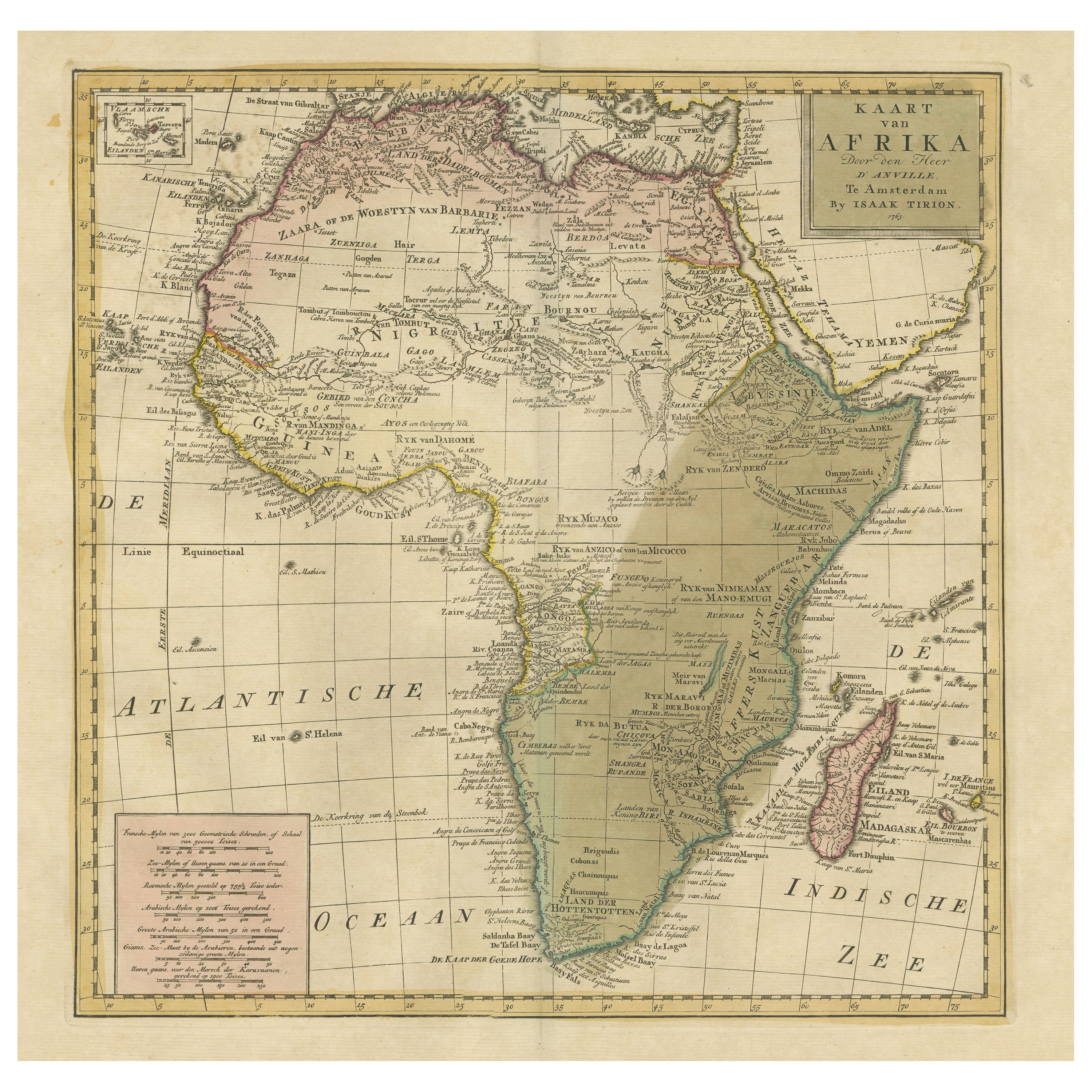
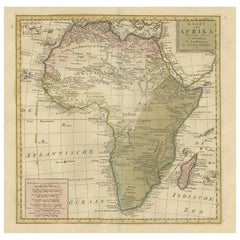
- Antique Map of Africa with Original Hand ColoringLocated in Langweer, NLAntique map titled 'Kaart van Afrika door den Heer d'Anville'. Detailed original old map of Africa, with very small inset map titled 'Vlaamsche Eilanden', which shows the Azores. Pub...Category
Antique Mid-18th Century Maps
MaterialsPaper
- Original Antique Map of England with Hand ColoringLocated in Langweer, NLAntique map titled 'Engand'. Original old map of England. Engraved by W. Milton. Published by John Mc. Gowan, circa 1829.Category
Antique Mid-19th Century Maps
MaterialsPaper

You May Also Like
- Old Nautical Map of CorsicaLocated in Alessandria, PiemonteST/556/1 - Old map of Corsica isle, surveyed by Captain Hell, of the French Royal Navy in 1824, engraved and published on 1874, with additions and corre...Category
Antique Early 19th Century English Other Prints
MaterialsPaper
- Old Horizontal Map of EnglandBy TassoLocated in Alessandria, PiemonteST/520 - Old rare Italian map of England, dated 1826-1827 - by Girolamo Tasso, editor in Venise, for the atlas of M.r Le-Sage.Category
Antique Early 19th Century Italian Other Prints
MaterialsPaper
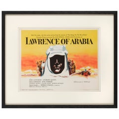
- Lawrence of ArabiaBy Saverio PavoneLocated in London, GBOriginal American Title lobby card for the films US release in 1962. This epic British film is based on the life of T. E. Lawrence. It was directed by David Lean and produced by Sam ...Category
Vintage 1960s American Posters
MaterialsPaper
- Original Antique Map of Italy. C.1780Located in St Annes, LancashireGreat map of Italy Copper-plate engraving Published C.1780 Unframed.Category
Antique Early 1800s English Georgian Maps
MaterialsPaper

- Original Antique Map of Asia. C.1780Located in St Annes, LancashireGreat map of Asia Copper-plate engraving Published C.1780 Two small worm holes to right side of map Unframed.Category
Antique Early 1800s English Georgian Maps
MaterialsPaper

- Original Antique Map of India. C.1780Located in St Annes, LancashireGreat map of India Copper-plate engraving Published C.1780 Three small worm holes to right side of map and one bottom left corner Unframed.Category
Antique Early 1800s English Georgian Maps
MaterialsPaper


Recently Viewed
View AllMore Ways To Browse
Old French Map
Map Of Ceylon
Old French Map
John Tallis Map
Australia Captain Cook
Map Zanzibar
Topographical Globe
Dan Rizzi
Formosa Vintage Map
Vincenzo Coronelli On Sale
Willem Blaeu On Sale
Antique Map Of Republic Of Texas
Antique Maps Denver
Cartier 1730
Collectible Barbies
Devonia Antique
J Karte
Map Cleveland