Items Similar to Decorative Original Old Map of Nova Zembla and the Russian Mainland, ca.1760


Want more images or videos?
Request additional images or videos from the seller
1 of 5
Decorative Original Old Map of Nova Zembla and the Russian Mainland, ca.1760
About the Item
Antique map titled 'Carte Des Pais Habites par les Samojedes et Ostiacs.'
Map of Novaya Zemlya and the Russian mainland. Source unknown, to be determined.
Artists and Engravers: Made by 'Nicolas Bellin' after an anonymous artist. Jacques-Nicolas Bellin (1703-1772) was a French hydrographer, geographer and member of The Philosophes. His career, spanning over 50 years, caused an enormous outut in maps, particular of maritime interest. He was appointed the first Ingenieur Hydrographe de la Marine, and also Official Hydrographer to the French King. In smaller format, he issued the Petit Atlas Maritime (1764), which contained 580 charts, as well as maps to illustrate l' Abbe Prevost's Histoire Generale des Voyages (1746-1757). Bellin also produced a substantial number of important separately issued maps.
Condition: Good, given age. Some spots in the margins. A few minor creases. Original folds as issued. General age-related toning and/or occasional minor defects from handling. Please study image carefully.
- Dimensions:Height: 9.65 in (24.5 cm)Width: 12.21 in (31 cm)Depth: 0 in (0.02 mm)
- Materials and Techniques:
- Period:1760-1769
- Date of Manufacture:circa 1760
- Condition:
- Seller Location:Langweer, NL
- Reference Number:
About the Seller
5.0
Platinum Seller
These expertly vetted sellers are 1stDibs' most experienced sellers and are rated highest by our customers.
Established in 2009
1stDibs seller since 2017
1,933 sales on 1stDibs
Typical response time: <1 hour
- ShippingRetrieving quote...Ships From: Langweer, Netherlands
- Return PolicyA return for this item may be initiated within 14 days of delivery.
More From This SellerView All
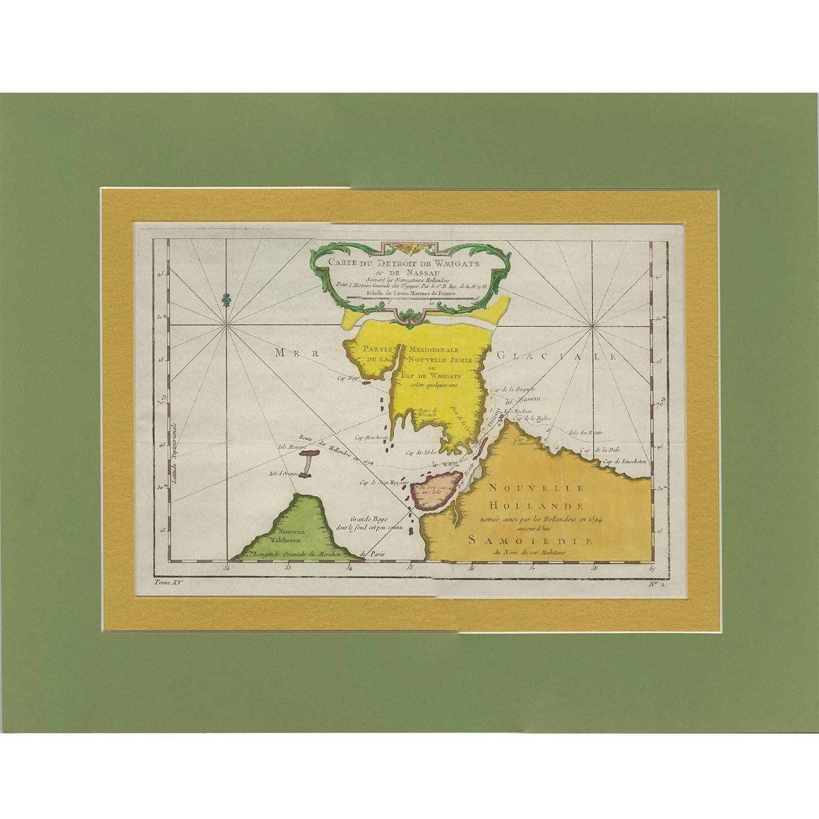
- Antique Map of the Strait Between Nova Zembla and the Mainland of RussiaLocated in Langweer, NLAntique map titled 'Carte du Detroit de Waeigats ou de Nassau'. Detailed regional map of the Strait of Waeigats in the Arctic Sea. Includes a decorative title cartouche. One of the m...Category
Antique Mid-18th Century Maps
MaterialsPaper
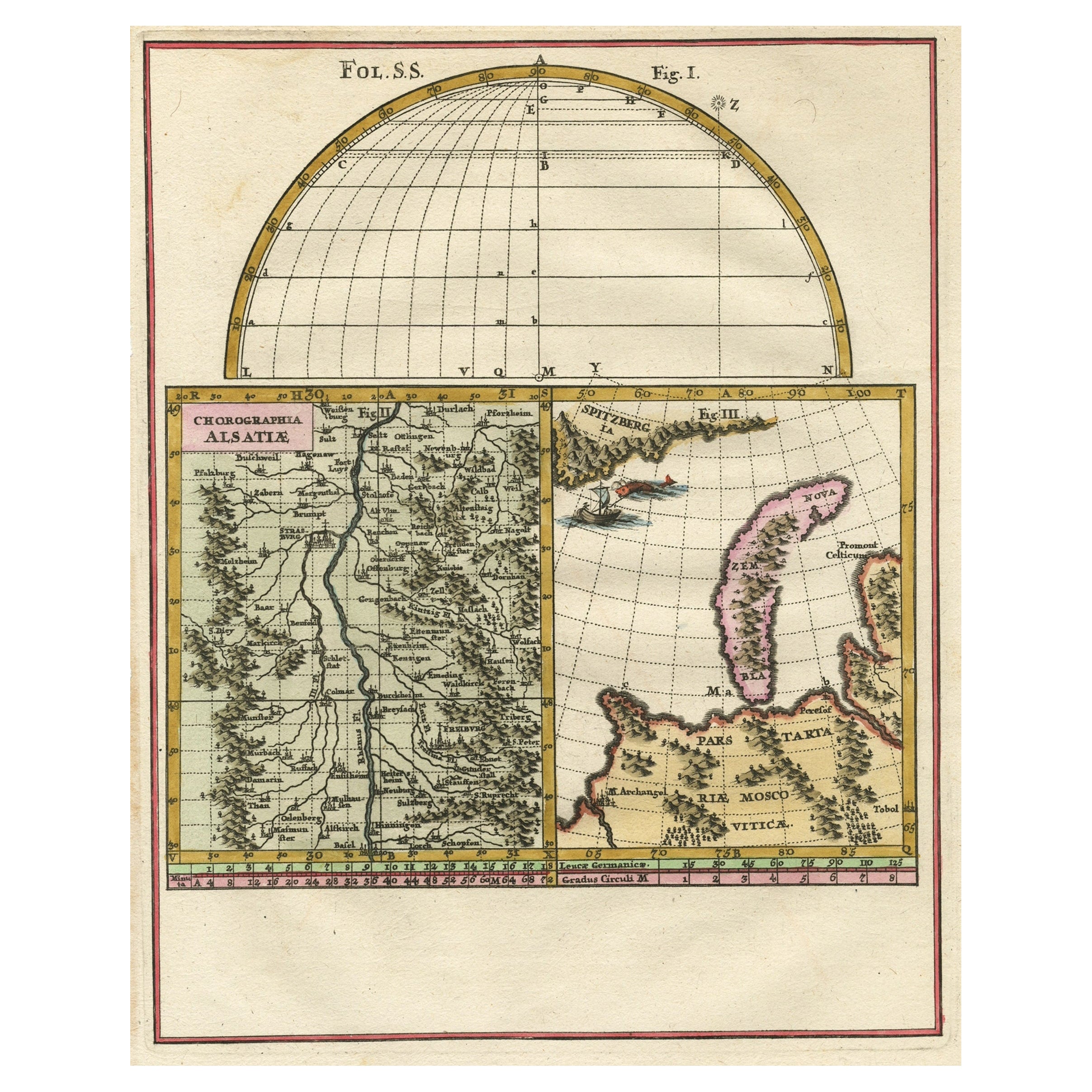
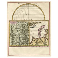
- Remarkable Map of the Alsace Region and Nova Zembla, Russia, ca.1700Located in Langweer, NLAntique map titled 'Chorographia Alsatiae.' Map of the Alsace region and Nova Zembla, printed for Scherer's 'Atlas Novus' (1702-1710). Scherer's 'Atlas Novus' forms an important ...Category
Antique Early 1700s Maps
MaterialsPaper
- Antique Map of Nova Zembla ‘Russia’ by J.N. Bellin, 1758Located in Langweer, NLAn interesting map of Nova Zembla and surrounding areas. With details on the eastern tip of Nova Zembla of the place where the stranded Dutch sailors under Willem Barentsz spent the ...Category
Antique Mid-18th Century Maps
MaterialsPaper
- Antique Map of Nova Zembla 'Russia' by J.N. Bellin, 1757Located in Langweer, NLDecorative map of Nova Zembla and environs in the Arctic Sea. Includes a large decorative title cartouche. One of the maps produced by Jacques-Nicolas Bellin for Prevost d'Exiles inf...Category
Antique Mid-18th Century Maps
MaterialsPaper
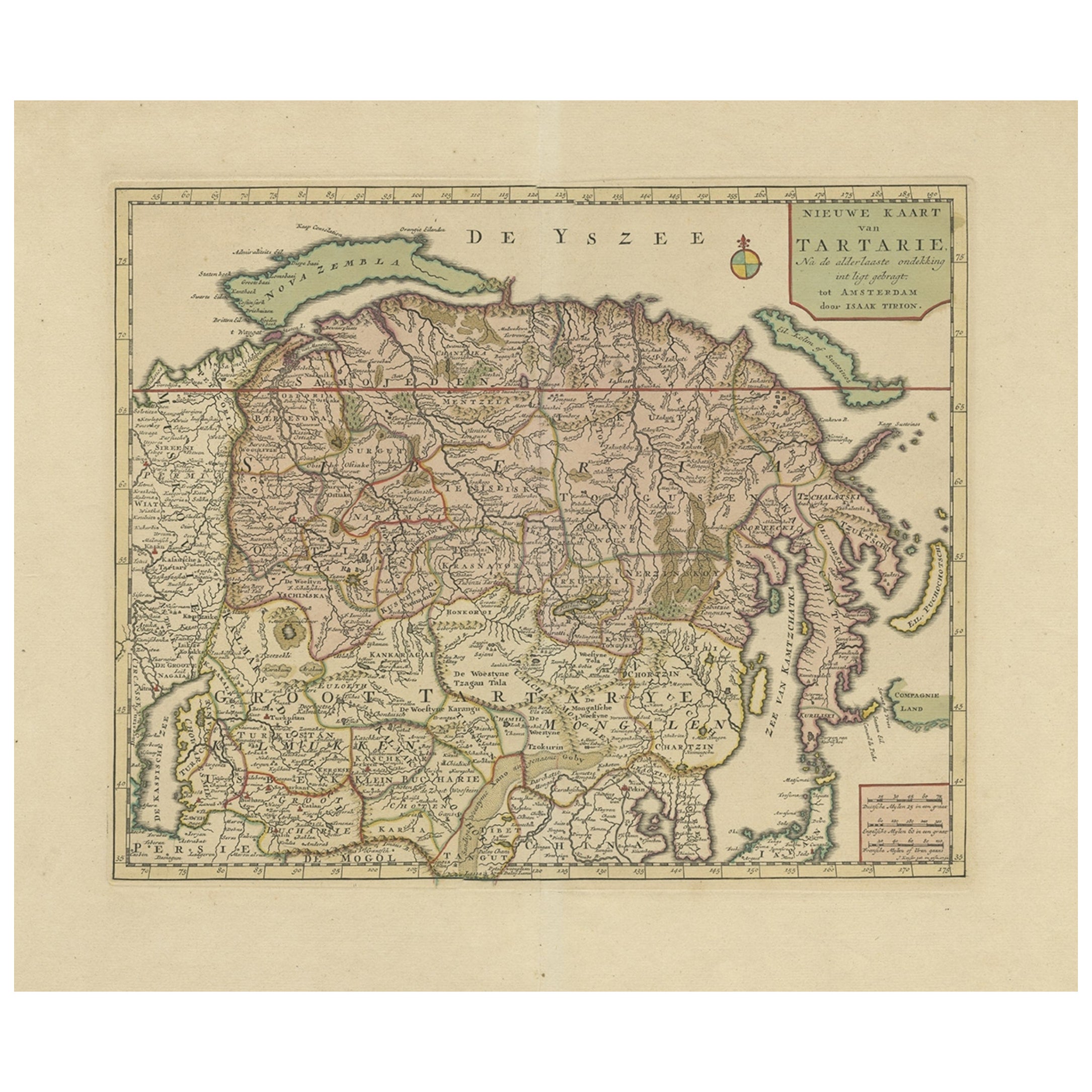
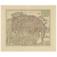
- Antique Map of Siberia and Chinese Tartary, Incl Nova Zembla, ca.1732Located in Langweer, NLAntique map of Tartary titled 'Nieuwe Kaart van Tartarie na de alderlaatste ondekking int ligt gebracht tot Amsterdam door Isaak Tirion'. Map op Siberia and Chinese tartary. In t...Category
Antique 1730s Maps
MaterialsPaper
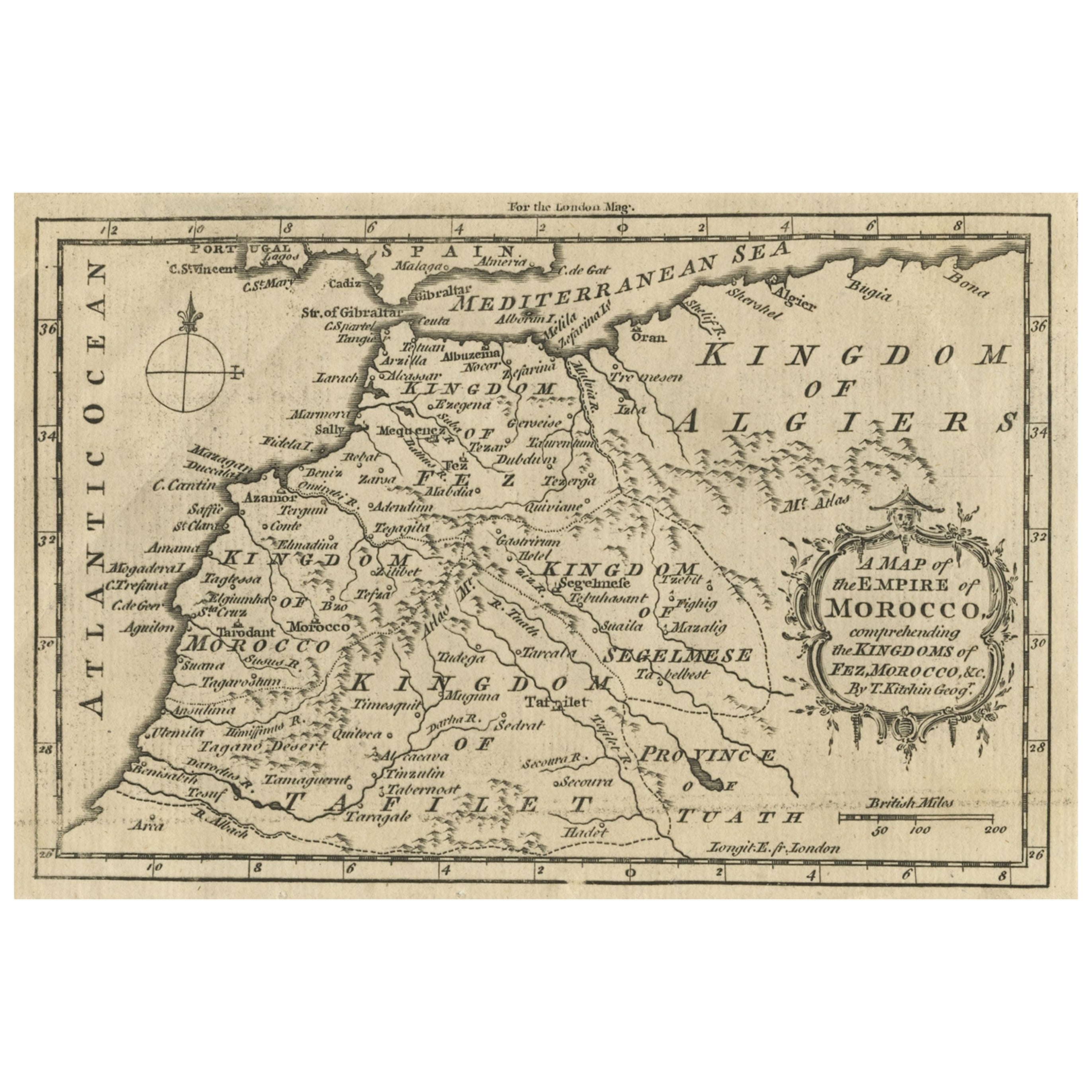
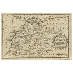
- Old Map of the Kingdoms of Fez, Algiers, Segelmese, Tafilet and Morocco, ca.1760Located in Langweer, NLAntique map titled 'A Map of the Empire of Morocco Comprehending the Kingdoms of Fez, Morocco'. Original antique map of the kingdoms of Fez, Algiers, Segelmese, Tafilet and Moroc...Category
Antique 1760s Maps
MaterialsPaper


You May Also Like
- Original Antique Map of Russia By Arrowsmith. 1820Located in St Annes, LancashireGreat map of Russia Drawn under the direction of Arrowsmith Copper-plate engraving Published by Longman, Hurst, Rees, Orme and Brown, 1820 Unframed.Category
Antique 1820s English Maps
MaterialsPaper
- Old Nautical Map of CorsicaLocated in Alessandria, PiemonteST/556/1 - Old map of Corsica isle, surveyed by Captain Hell, of the French Royal Navy in 1824, engraved and published on 1874, with additions and corre...Category
Antique Early 19th Century English Other Prints
MaterialsPaper
- Old Horizontal Map of EnglandBy TassoLocated in Alessandria, PiemonteST/520 - Old rare Italian map of England, dated 1826-1827 - by Girolamo Tasso, editor in Venise, for the atlas of M.r Le-Sage.Category
Antique Early 19th Century Italian Other Prints
MaterialsPaper
- Map of the Republic of GenoaLocated in New York, NYFramed antique hand-coloured map of the Republic of Genoa including the duchies of Mantua, Modena, and Parma. Europe, late 18th century. Dimension: 25...Category
Antique Late 18th Century European Maps
- Original Antique Map of The World by Thomas Clerk, 1817Located in St Annes, LancashireGreat map of The Eastern and Western Hemispheres On 2 sheets Copper-plate engraving Drawn and engraved by Thomas Clerk, Edinburgh. Published by Mackenzie And Dent, 1817 ...Category
Antique 1810s English Maps
MaterialsPaper
- "Nova Barbariae Descriptio", a 17th Century Hand-Colored Map of North AfricaBy Johannes JanssoniusLocated in Alamo, CAThis original attractive 17th century hand-colored map of North Africa entitled "Nova Barbariae Descriptio" by Johannes Janssonius was published in Paris in 1635. It includes the Med...Category
Antique Mid-17th Century Dutch Maps
MaterialsPaper


Recently Viewed
View AllMore Ways To Browse
Marine Collectibles
Antique Maps And Charts
Map Russia
Russian Map
Map Of Russia
Maps Of Russia
La Marine Antique
A La Carte
Antique Russian Map
Antique Marine Maritime
Marine Maritime Antique Marine Maritime
Antique Maritime Marine Maritime
Antique Map Russia
Antique Map Of Russia
Antique Maps Of Russia
Pai Pai
Nicolas Russian
Pai Of