Items Similar to Old Map of the Kingdoms of Fez, Algiers, Segelmese, Tafilet and Morocco, ca.1760


Want more images or videos?
Request additional images or videos from the seller
1 of 5
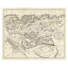
Old Map of the Kingdoms of Fez, Algiers, Segelmese, Tafilet and Morocco, ca.1760
About the Item
Antique map titled 'A Map of the Empire of Morocco Comprehending the Kingdoms of Fez, Morocco'.
Original antique map of the kingdoms of Fez, Algiers, Segelmese, Tafilet and Morocco. Towns, rivers and mountains are indicated. This map originates from the 'London Magazine' circa 1760.
Artists and Engravers: Thomas Kitchin (or Thomas Kitchen (1718 - 1784) was an English engraver and cartographer, who became hydrographer to the king. He was also an author, who wrote about the history of the West Indies.
Condition: Good, some age related toning. Original plate mark visible. Please study scan carefully.
- Dimensions:Height: 5.12 in (13 cm)Width: 8.08 in (20.5 cm)Depth: 0 in (0.02 mm)
- Materials and Techniques:
- Period:1760-1769
- Date of Manufacture:circa 1760
- Condition:
- Seller Location:Langweer, NL
- Reference Number:
About the Seller
5.0
Platinum Seller
These expertly vetted sellers are 1stDibs' most experienced sellers and are rated highest by our customers.
Established in 2009
1stDibs seller since 2017
1,938 sales on 1stDibs
Typical response time: <1 hour
- ShippingRetrieving quote...Ships From: Langweer, Netherlands
- Return PolicyA return for this item may be initiated within 14 days of delivery.
More From This SellerView All
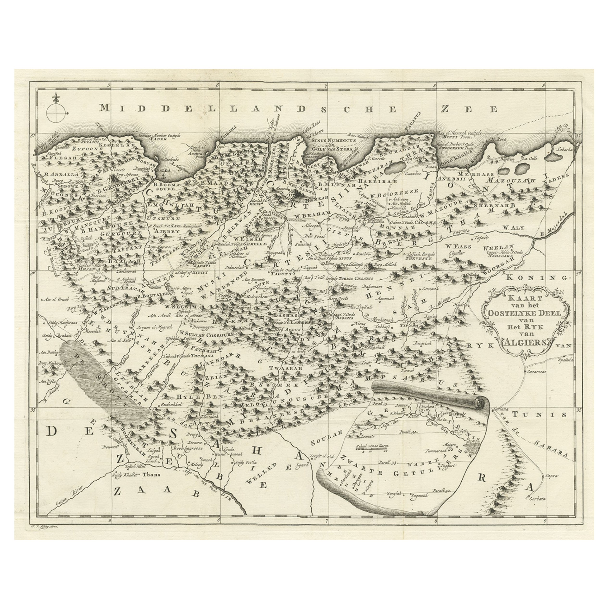
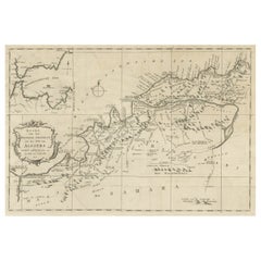
- Old Map of the Eastern Region of the Kingdom of Algiers, Algeria, 1773Located in Langweer, NLAntique map titled 'Kaart van het Oostelyke Deel van het Ryk van Algiers'. Old map of the eastern region of the Kingdom of Algiers, Algeria. Originates from the first Dutch edito...Category
Antique 1770s Maps
MaterialsPaper
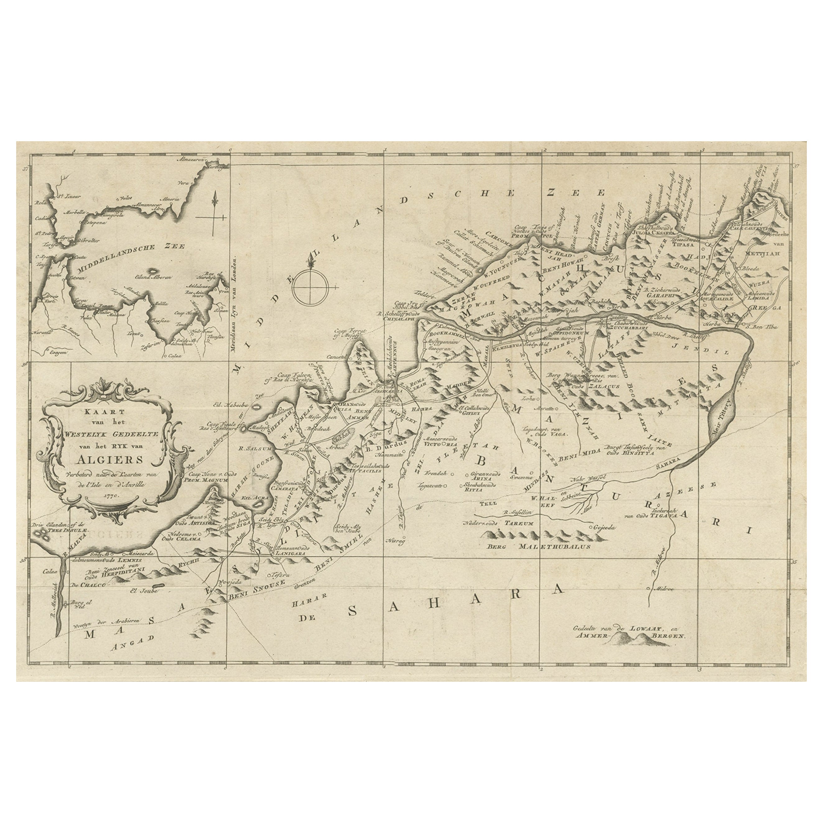
- Old Map of the Western Region of the Kingdom of Algiers, Algeria, 1773Located in Langweer, NLAntique map titled 'Kaart van het Westelyk Gedeelte van het Ryk van Algiers'. Old map of the western region of the Kingdom of Algiers, Algeria. Originates from the first Dutch ed...Category
Antique 1770s Maps
MaterialsPaper
- Detailed Original Old Map of the Southern Region of the Kingdom of Algiers 1773Located in Langweer, NLAntique map titled 'Kaart van het Zuidelyk Gedeelte van het Ryk Algiers'. Old map of the southern region of the Kingdom of Algiers, Algeria. Originates from the first Dutch edito...Category
Antique 18th Century Maps
MaterialsPaper
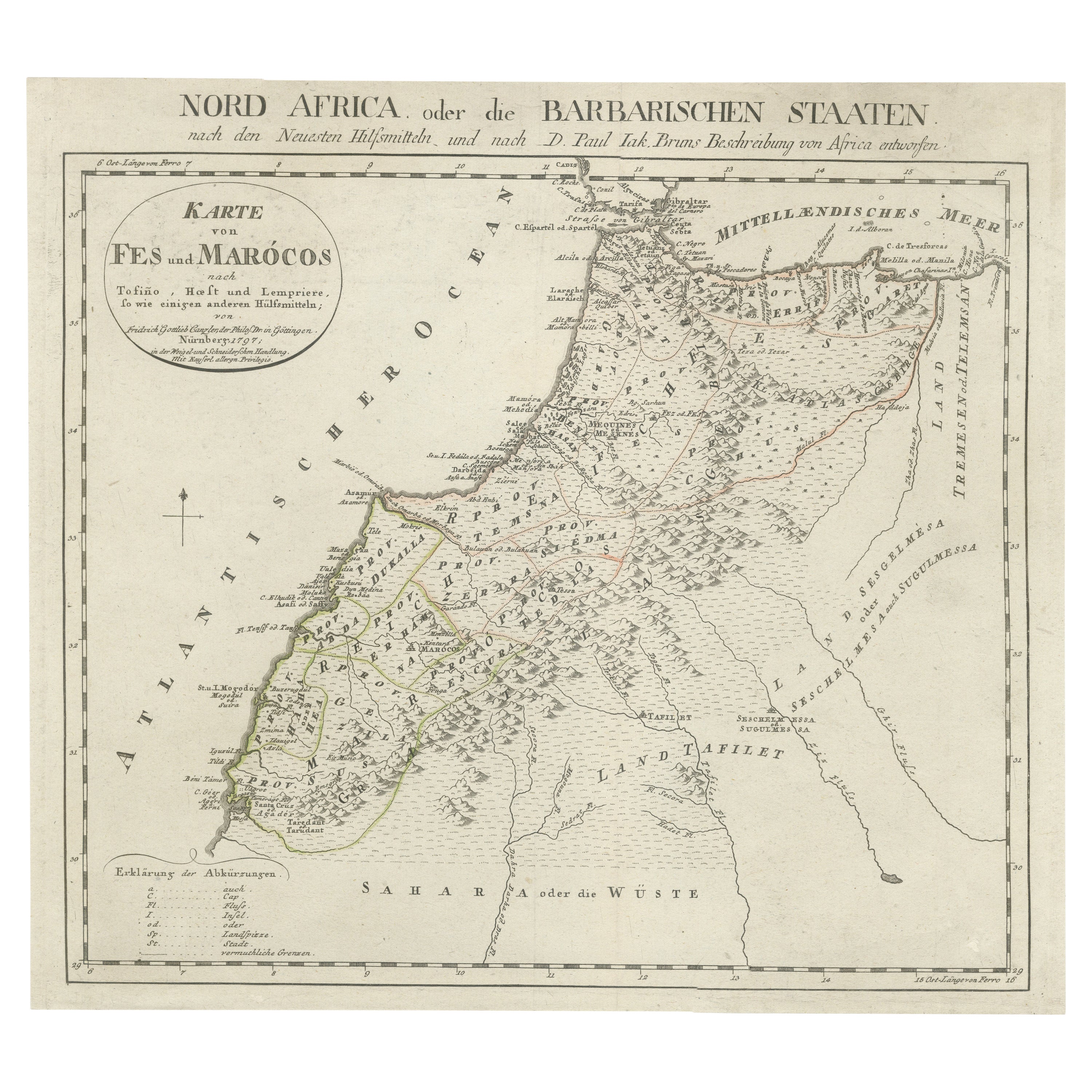
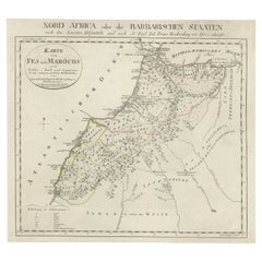
- Original Antique Map of Fez and MoroccoLocated in Langweer, NLAntique map titled 'Karte von Fes und Marócos (..)'. Original old map of Fez (or Fes) and Morocco. Also shows the Strait of Gibraltar. By Friedrich Gottlieb Canzler, published 1799.Category
Antique Late 18th Century Maps
MaterialsPaper
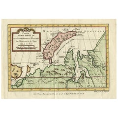
- Decorative Original Old Map of Nova Zembla and the Russian Mainland, ca.1760Located in Langweer, NLAntique map titled 'Carte Des Pais Habites par les Samojedes et Ostiacs.' Map of Novaya Zemlya and the Russian mainland. Source unknown, to be determined. Artists and Engraver...Category
Antique 1760s Maps
MaterialsPaper
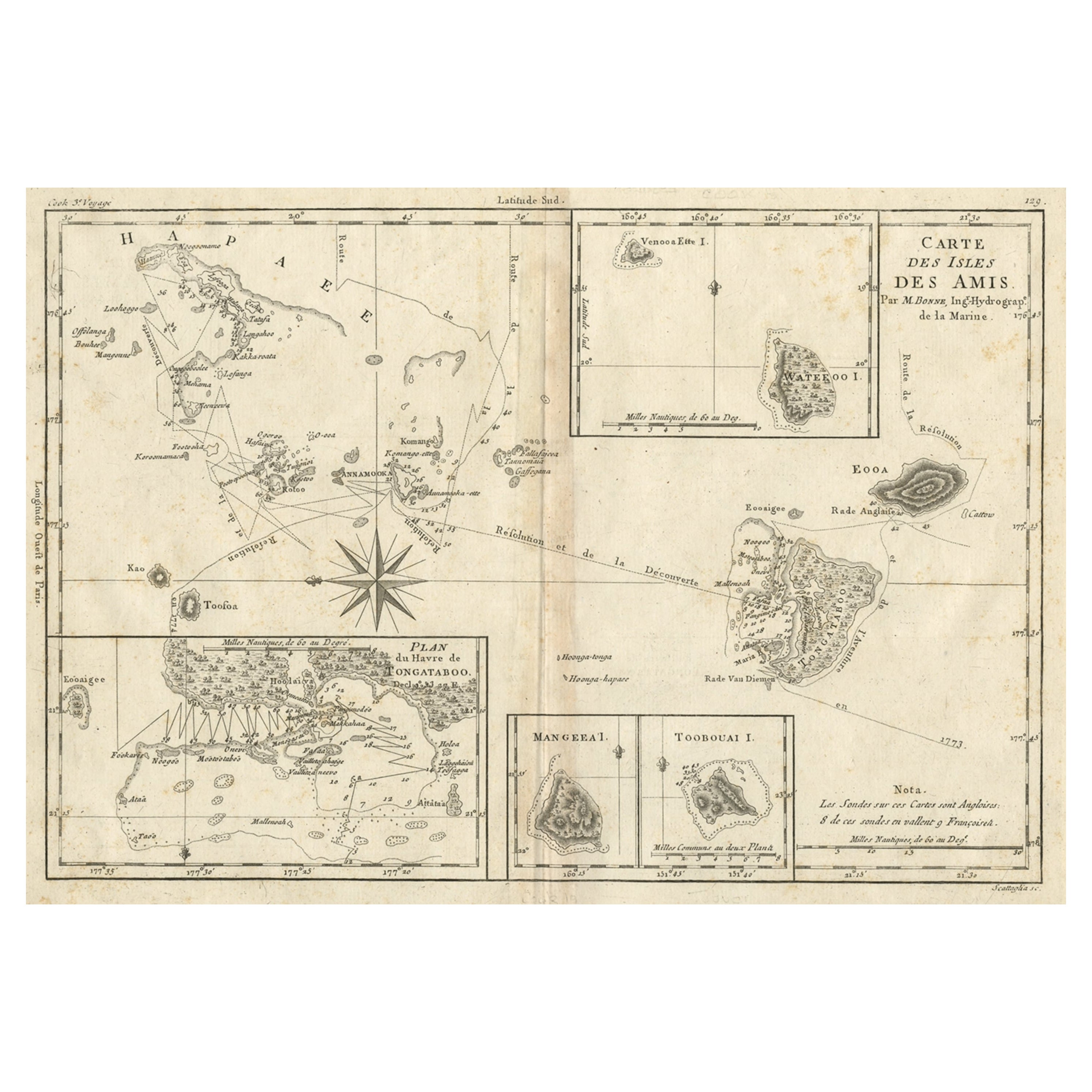
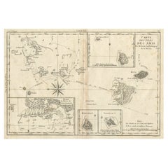
- Old Map of the Kingdom of Tonga, Also Known as the Friendly Islands, ca.1780Located in Langweer, NLAntique print, titled: 'Carte des Isles des Amis.' Map of the Kingdom of Tonga, also known as the Friendly Islands, and one of the last hereditary monarchies. Cook named this gro...Category
Antique 1780s Maps
MaterialsPaper

You May Also Like
- The Kingdom of Naples and Southern Italy: A Hand-Colored 18th Century Homann MapBy Johann Baptist HomannLocated in Alamo, CA"Novissima & exactissimus Totius Regni Neapolis Tabula Presentis Belli Satui Accommo Data" is a hand colored map of southern Italy and the ancient Kingdom of Naples created by Johann...Category
Antique Early 18th Century German Maps
MaterialsPaper
- Old Nautical Map of CorsicaLocated in Alessandria, PiemonteST/556/1 - Old map of Corsica isle, surveyed by Captain Hell, of the French Royal Navy in 1824, engraved and published on 1874, with additions and corre...Category
Antique Early 19th Century English Other Prints
MaterialsPaper
- Old Horizontal Map of EnglandBy TassoLocated in Alessandria, PiemonteST/520 - Old rare Italian map of England, dated 1826-1827 - by Girolamo Tasso, editor in Venise, for the atlas of M.r Le-Sage.Category
Antique Early 19th Century Italian Other Prints
MaterialsPaper
- Map of the Republic of GenoaLocated in New York, NYFramed antique hand-coloured map of the Republic of Genoa including the duchies of Mantua, Modena, and Parma. Europe, late 18th century. Dimension: 25...Category
Antique Late 18th Century European Maps
- Map "Estuary- Mouth of the Thames"Located in Alessandria, PiemonteST/426 - Antique French Map of the estuary of the Thames, map dated 1769 - "Mape of the entrance of the Thames. Designed by filing of Navy cards fo...Category
Antique Mid-18th Century French Other Prints
MaterialsPaper
- Map of the Kingdom of Sardinia and Part of the Kingdom of Genoa, RomeBy Giovanni Maria CassiniLocated in Hamilton, Ontario18th century map by Italian engraver Giovanni Maria Cassini (Italy 1745-1824). Map of Part of the Kingdom of Sardinia and Part of the Kingdom of Genoa: Rome. This is a hand colored a...Category
Antique 18th Century Italian Maps
MaterialsPaper


Recently Viewed
View AllMore Ways To Browse
Old Kingdom
Kitchen Collectibles
Antique Kitchen Collectibles
West Indies
Old English Antique Plate
Circa 1760 English
Moroccan Fez
Morrocan Fez
Fez Morocco
English Empire Antiques
Thomas Toner
West Indies Antiques
King Of The Mountain
Morocco Map
Antique Fez
West Indies Map
Map Of West Indies
West Indies Antique Map