Items Similar to Old Map of Guyana, Suriname and French Guiana with Paramaribo and Cayenne, c1760
Want more images or videos?
Request additional images or videos from the seller
1 of 5
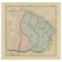
Old Map of Guyana, Suriname and French Guiana with Paramaribo and Cayenne, c1760
About the Item
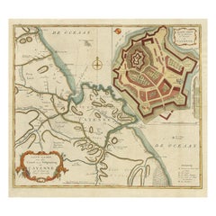
Description: Antique map titled 'Carte de la Guiane.'
Antique map of the Guianas - present day Guyana, Suriname and French Guiana, including Paramaribo and Cayenne. Source unknown, to be determined.
Artists and Engravers: Made by 'Jacques-Nicholas Bellin ' after an anonymous artist. Jacques-Nicolas Bellin (1703-1772) was a French hydrographer, geographer and member of The Philosophes. His career, spanning over 50 years, caused an enormous outpt in maps, particular of maritime interest.
Condition: Very good, given age. Original middle fold as issued. Remains of attachment to carrier on the rear (top edge). General age-related toning and/or occasional minor defects from handling. Please study image carefully.
- Dimensions:Height: 9.93 in (25.2 cm)Width: 14.65 in (37.2 cm)Depth: 0 in (0.02 mm)
- Materials and Techniques:
- Period:1760-1769
- Date of Manufacture:circa 1760
- Condition:
- Seller Location:Langweer, NL
- Reference Number:
About the Seller
5.0
Platinum Seller
These expertly vetted sellers are 1stDibs' most experienced sellers and are rated highest by our customers.
Established in 2009
1stDibs seller since 2017
1,933 sales on 1stDibs
Typical response time: <1 hour
- ShippingRetrieving quote...Ships From: Langweer, Netherlands
- Return PolicyA return for this item may be initiated within 14 days of delivery.
More From This SellerView All
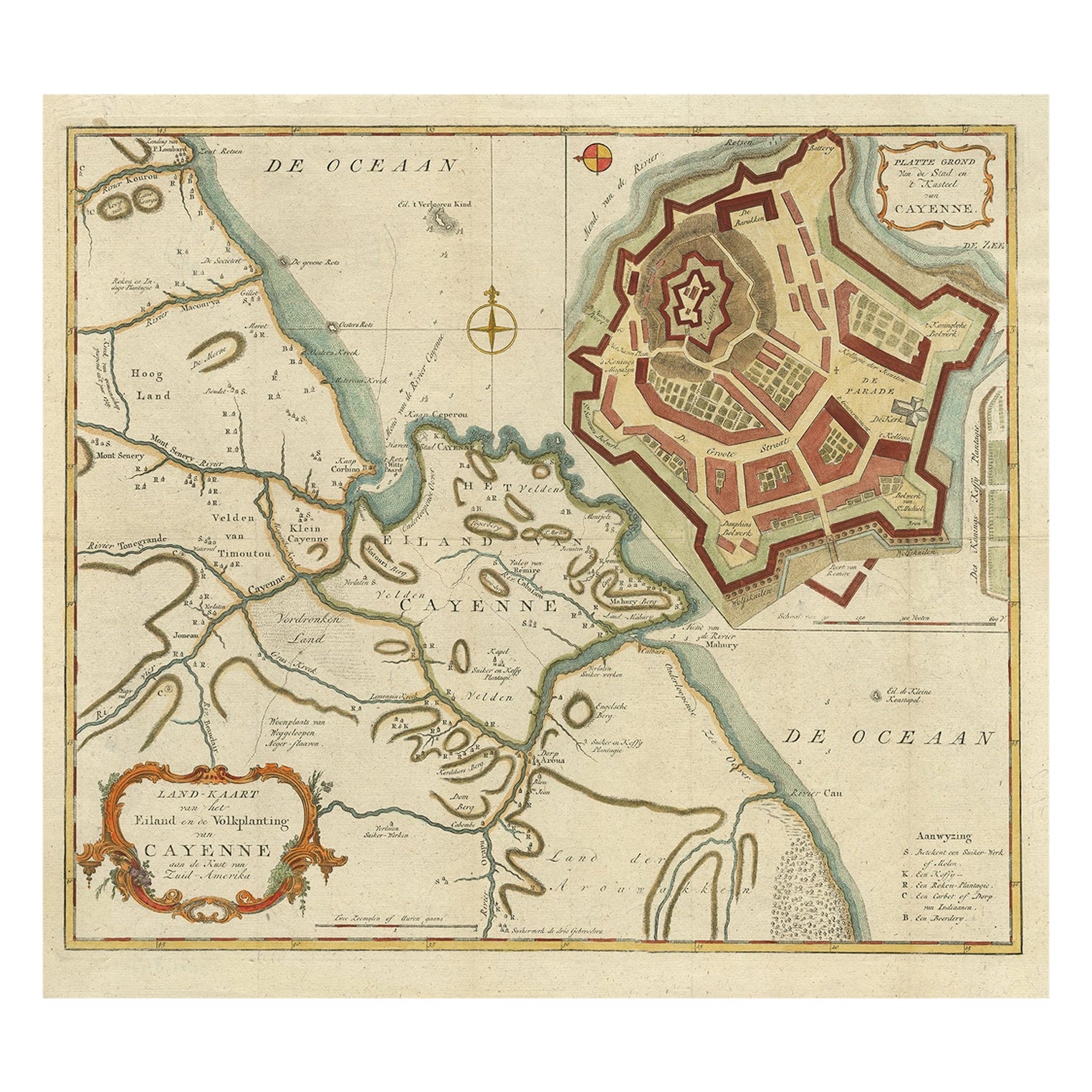
- Striking Antique Map of Cayenne in French Guyana, South America, ca.1760Located in Langweer, NLDescription: Antique map titled 'Land-kaart van het Eiland en de Volkplanting van Cayenne aan de Kust van Zuid-Amerika'. Striking map of the island and settlement of Cayenne in F...Category
Antique 1760s Maps
MaterialsPaper
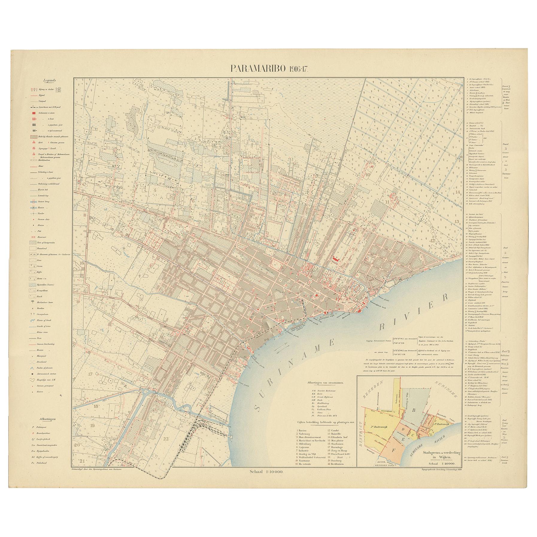
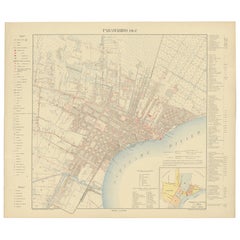
- Antique Plan of Paramaribo 'Suriname' Published 1920Located in Langweer, NLLarge lithographed plan of Paramaribo, capital city of Suriname, showing the situation, circa 1916-1917. With small inset plan. Published in 1920.Category
Early 20th Century Maps
MaterialsPaper
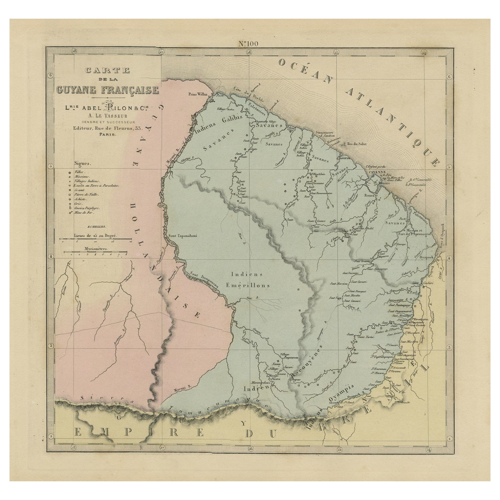
- Antique Engraved Map with Original Hand Colour of French Guiana, 1876Located in Langweer, NLThe 1876 map of French Guiana from the "Grand Atlas Départemental de la France de L'Algérie et des colonies" by H. Fisquet, published by A. Le Vasseur in Paris, is a significant piec...Category
Antique Late 19th Century Maps
MaterialsPaper
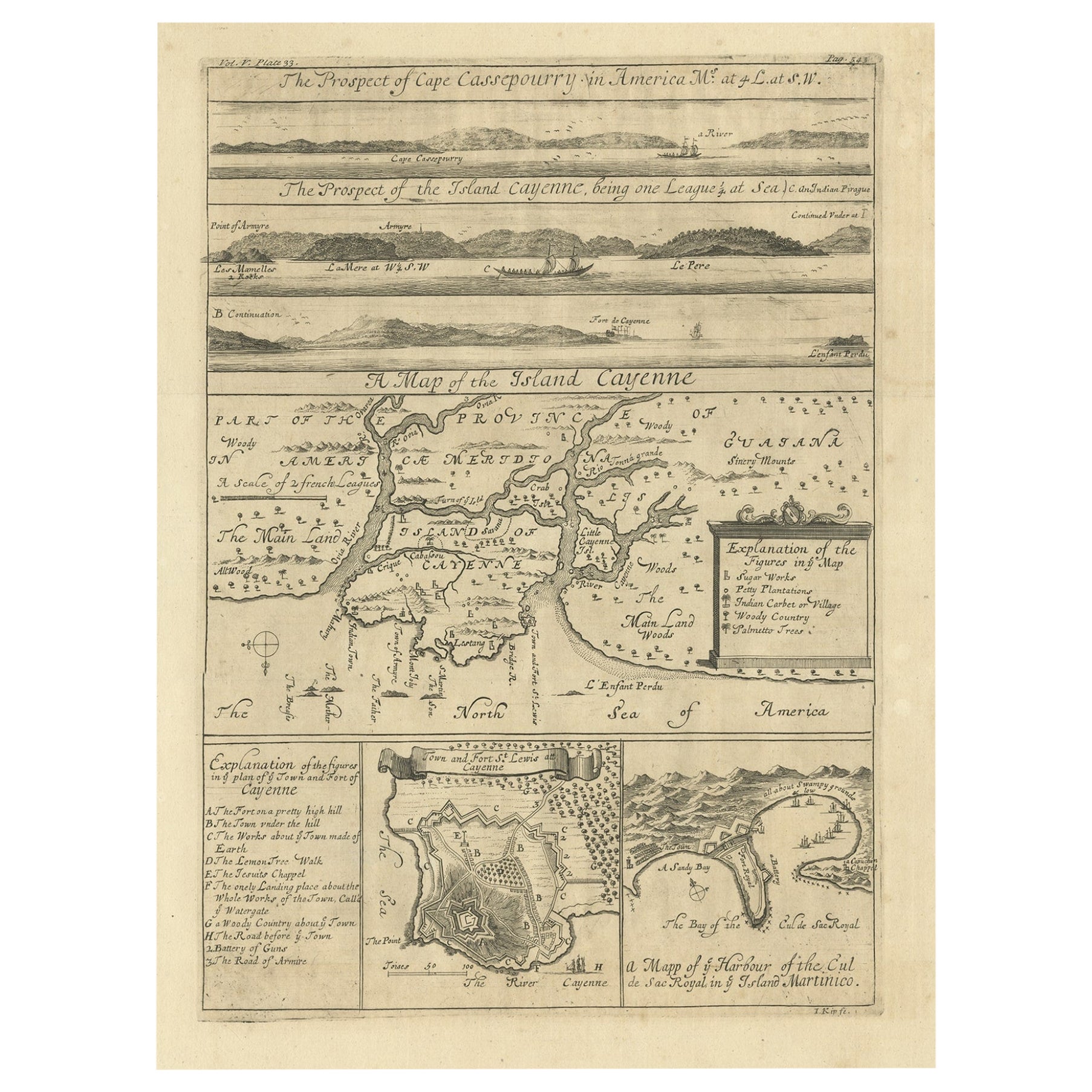
- Antique Map of Cayenne and Cassepouri, French Guinea, South America, c.1730Located in Langweer, NLAntique map titled 'A Map of the Island Cayenne (..)’. A set of interesting copper engravings of Cayenne and Cassepouri, French Guinea, South America, and Martinique in the West Indies. The map of Cayenne, home of Cayenne pepper, has a key of symbols identifying the sugar works, petty plantations, indian carbet or village, woody country and palmetto trees. The plan of Fort Lewis, Cayenne also has a lettered key including; A. the fort on a pretty high hill...Category
Antique 18th Century Maps
MaterialsPaper
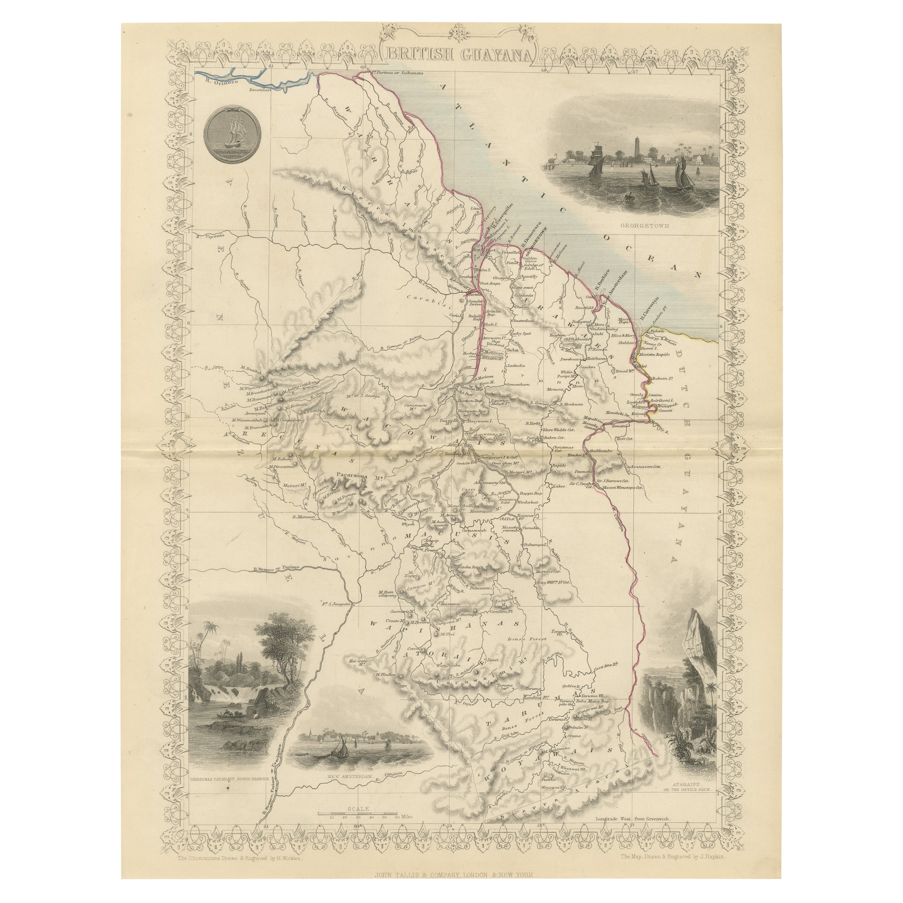
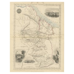
- A Tallis Map of British Guiana with Colonial Vignettes and Other Landmarks, 1851Located in Langweer, NLThis Tallis map of British Guiana (now known as Guyana) is a richly decorated document, much like other maps from the esteemed cartographic publisher John Tallis & Company. The firm,...Category
Antique 1850s Maps
MaterialsPaper
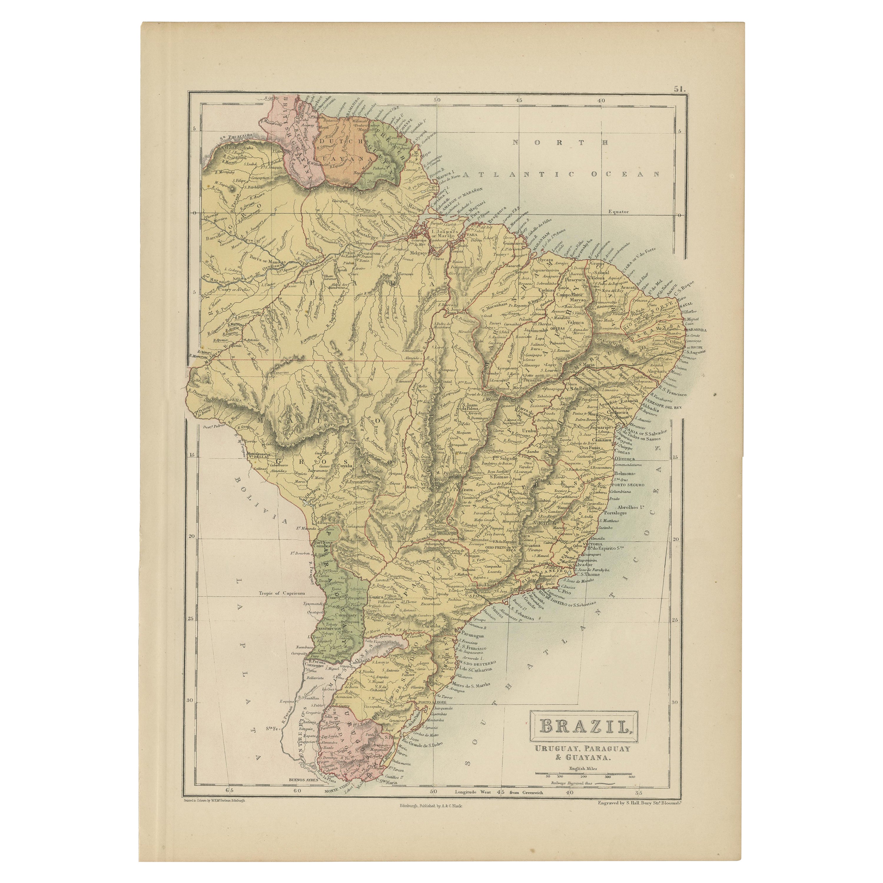
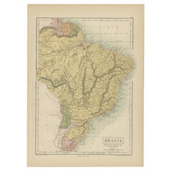
- Antique Map of Brazil, Uruguay, Paraguay and Guyana by A & C. Black, 1870Located in Langweer, NLAntique map titled 'Brazil'. Original antique map of Brazil, Uruguay, Paraguay and Guyana. This map originates from ‘Black's General Atlas of The...Category
Antique Late 19th Century Maps
MaterialsPaper
You May Also Like
- Old Nautical Map of CorsicaLocated in Alessandria, PiemonteST/556/1 - Old map of Corsica isle, surveyed by Captain Hell, of the French Royal Navy in 1824, engraved and published on 1874, with additions and corre...Category
Antique Early 19th Century English Other Prints
MaterialsPaper
- Old Horizontal Map of EnglandBy TassoLocated in Alessandria, PiemonteST/520 - Old rare Italian map of England, dated 1826-1827 - by Girolamo Tasso, editor in Venise, for the atlas of M.r Le-Sage.Category
Antique Early 19th Century Italian Other Prints
MaterialsPaper
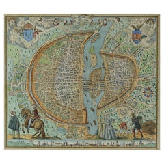
- French Map of Paris, Musuem Carnavalet Rossingol University Map, 1576Located in Gardena, CAFrench Map of Paris, Musuem Carnavalet Rossingol University Map, 1576. Map of Paris, France - English: Map of Paris (1576) / museum Carnavalet Rossignol, it is the true fortrict o...Category
Antique 16th Century French Maps
MaterialsPaper
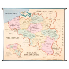
- XL Old School Map of Belgium 'Printed by Procure', 1950sLocated in Oostende, BEXL Old school map of Belgium (Printed by Procure). Presumably from around 1950-1960.Category
Vintage 1950s Belgian Mid-Century Modern Maps
MaterialsMetal
- 1771 Bonne Map of Poitou, Touraine and Anjou, France, Ric.a015Located in Norton, MA1771 Bonne Map of Poitou, Touraine and Anjou, France Ric.a015 1771 Bonne map of Potiou, Touraine and Anjou entitled "Carte des Gouvernements D'Anjou et du Saumurois, de la Touraine, du Poitou,du Pays d'aunis, Saintonge?Angoumois," Carte des gouvernements d'Anjou et du Saumurois, de la Touraine, du Poitou, du Pays d'Aunis, Saintonge-Angoumois. Projettee et assujettie au ciel par M. Bonne, Hyd. du Roi. A Paris, Chez Lattre, rue St. Jacques a la Ville de Bord(ea)ux. Avec priv. du Roi. 1771. Arrivet inv. & sculp., Atlas moderne ou collection de cartes sur toutes...Category
Antique 17th Century Unknown Maps
MaterialsPaper
- Antique Puzzle of Colored Cardboard Depicting World Map, Europe and FranceLocated in Milan, ITEducational puzzle of colored cardboard composed of three folders depicting world map, Europe and France. The world map in addition to the territorial map of the continents depicts t...Category
Antique 1850s French Games
MaterialsPaper


Recently Viewed
View AllMore Ways To Browse
A La Carte
Maritime Map
Guyana Antique Map
Antique Map Of The United States
Antique Maps Of The United States
Antique African American
African American Antique
Antique Furniture East London
Antique Eastern European Furniture
Vintage Map Of The United States
Antique House Plans
Antique Metal Window
Antique Metal Windows
Antique Furniture Rollers
Antiques Compasses
India Map
Antique Map Book
Antique Maps Book