Items Similar to 1771 Bonne Map of Poitou, Touraine and Anjou, France, Ric.a015

Want more images or videos?
Request additional images or videos from the seller
1 of 6
1771 Bonne Map of Poitou, Touraine and Anjou, France, Ric.a015
About the Item
1771 Bonne Map of Poitou,
Touraine and Anjou, France
Ric.a015
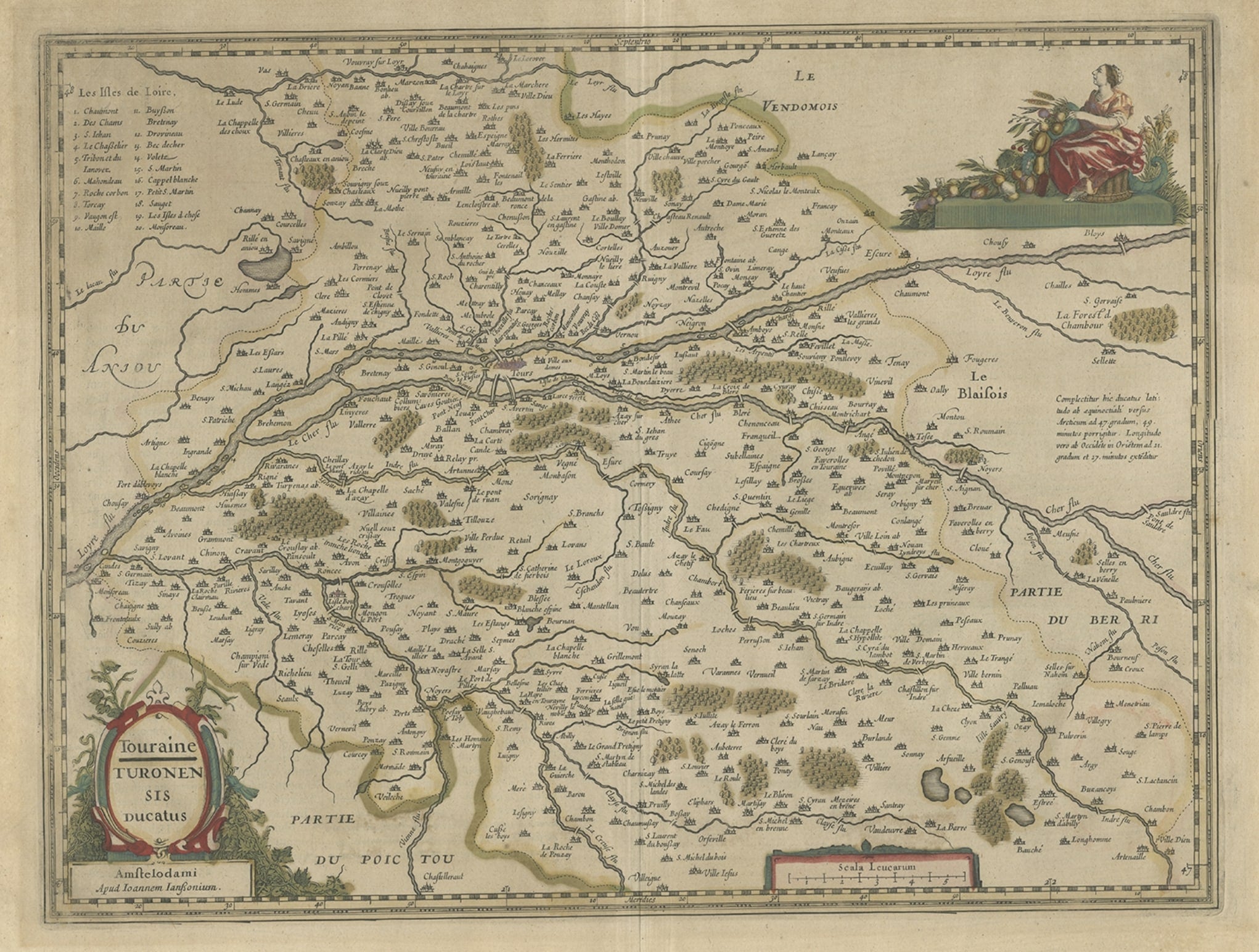
1771 Bonne map of Potiou, Touraine and Anjou entitled "Carte des Gouvernements D'Anjou et du Saumurois, de la Touraine, du Poitou,du Pays d'aunis, Saintonge?Angoumois,"
Carte des gouvernements d'Anjou et du Saumurois, de la Touraine, du Poitou, du Pays d'Aunis, Saintonge-Angoumois. Projettee et assujettie au ciel par M. Bonne, Hyd. du Roi. A Paris, Chez Lattre, rue St. Jacques a la Ville de Bord(ea)ux. Avec priv. du Roi. 1771. Arrivet inv. & sculp., Atlas moderne ou collection de cartes sur toutes les parties du globe terrestre ar plusieurs auteurs. Avec approbation & privilege du Roy. A Paris, Chez Lattre Graveur Ordinaire du Roy, de Mgr. Le Duc d'Orleans et de la Ville Rue St. Jacques No. 20. et Delalain, Libraire, rue de la Comedie Francoise. (title page only) Monnet del. 1762. Prevost Sculp.
Dimension: Paper Size: 15 1/2" W x 20 1/8" H (39.3 cm W x 51 cm H)
Date: 18th Century
Condition: Good Condition with age, please see photos.
; Image Size: 11 3/8" W x 16" H (28.7 cm W x 40.7 cm H).
- Dimensions:Height: 51 in (129.54 cm)Width: 39.3 in (99.83 cm)Depth: 1 in (2.54 cm)
- Materials and Techniques:
- Place of Origin:
- Period:
- Date of Manufacture:1771
- Condition:
- Seller Location:Norton, MA
- Reference Number:1stDibs: LU5848230268532
About the Seller
5.0
Platinum Seller
These expertly vetted sellers are 1stDibs' most experienced sellers and are rated highest by our customers.
Established in 2000
1stDibs seller since 2021
85 sales on 1stDibs
Typical response time: <1 hour
- ShippingRetrieving quote...Ships From: Norton, MA
- Return PolicyA return for this item may be initiated within 3 days of delivery.
More From This SellerView All
- 1590 Ortelius Map of Calais and Vermandois, France and Vicinity Ric.a014Located in Norton, MA1590 Ortelius map of Calais and Vermandois, France and Vicinity Ric.a014 Two rare regional Abraham Ortelius maps on a single folio sheet. Left map, entitled Caletensium, depic...Category
Antique 16th Century Dutch Maps
MaterialsPaper
- 1657 Janssonius Map of Vermandois and Cappelle, Ric. A-004Located in Norton, MA1657 Janssonius map of Vermandois and Cappelle Ric.a004 Description: Antique map of France titled 'Descriptio Veromanduorum - Gouvernement de la Cappelle'. Two detailed maps o...Category
Antique 17th Century Unknown Maps
MaterialsPaper
- 1752 Vaugoundy Map of Flanders : Belgium, France, and the Netherlands, Ric.a002Located in Norton, MALarge Vaugoundy Map of Flanders: Belgium, France, and the Netherlands Colored -1752 Ric.a002 Description: This is a 1752 Didier Robert de Vaugondy map of Flanders. The map de...Category
Antique 17th Century Unknown Maps
MaterialsPaper
- 1814 Map of "Russian Empire" Ric.r032Located in Norton, MA1814 Map of "Russian Empire" Ric.r032 Russian Empire. Description: This is an 1814 John Thomson map of the Russian Empire. The map depicts the region from the Baltic Sea, Prussia, and Sweden to the Aleutian Islands and from the Arctic Ocean to the Yellow River. Highly detailed, myriad cities, towns, and villages are labeled throughout, including St. Petersburg, Moscow, Minsk, Kiev, and Kharkov. Rivers and mountain ranges are also identified, as are islands and numerous locations along the coastlines. It is important to note that the long-disputed sea between Korea and Japan is identified as the 'Sea of Japan. Historical Context: In 1815, Tsarist Russia emerged from the Napoleonic Wars economically insolvent and politically fearful of the Revolutionary fervor that had just swept through Europe. In order to shore up Russia's economic position, the Tsars began an aggressive series of expansions into the Caucuses and Central Asia that would vastly increase the landmass of the Russian Empire. Publication History Thomson maps are known for their stunning color, awe inspiring size, and magnificent detail. Thomson's work, including this map, represents some of the finest cartographic art...Category
Antique 19th Century Unknown Maps
MaterialsPaper
- 1635 Willem Blaeu Map of Northern France"Comitatvs Bellovacvm" Ric.a08Located in Norton, MA1635 Willem Blaeu map of northern France, entitled. "Comitatvs Bellovacvm Vernacule Beavvais," Colored Ric.a008 “COMITATVS BELLOVACVM…” Amsterdam: W...Category
Antique 17th Century Unknown Maps
MaterialsPaper
- 1594 Maurice Bouguereau Map of the Region Limoges, France, Ric0015Located in Norton, MA1594 Maurice Bouguereau map of the region Limoges, France, entitled "Totivs Lemovici et Confinium Pro Uinciarum Quantum ad Dioecefin Lemo Uicenfen Fpectant," Hand Colored Ric0015 Jean IV Le Clerc...Category
Antique 16th Century Dutch Maps
MaterialsPaper


You May Also Like
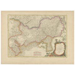
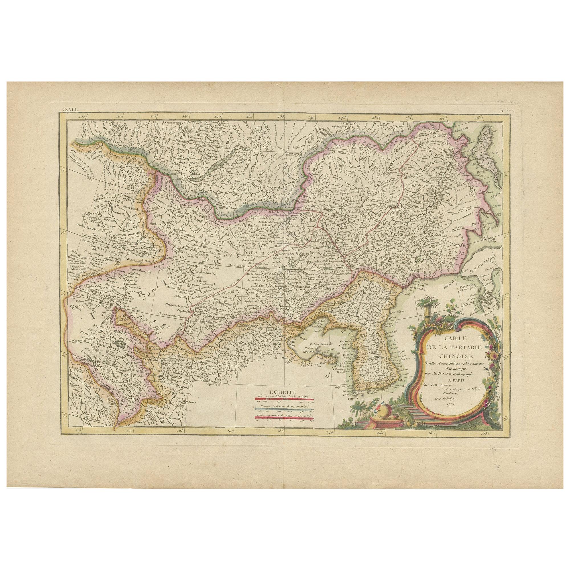
- Antique Map of Korea and Southern China by Bonne '1771'Located in Langweer, NLAntique map titled 'Carte de la Tartarie Chinoise'. Original antique map of Korea and Southern China. Covers from the Lop Nor region eastward to K...Category
Antique Mid-18th Century Maps
MaterialsPaper
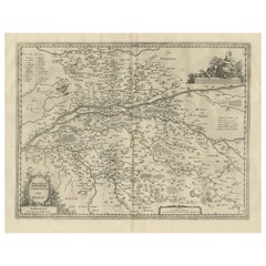
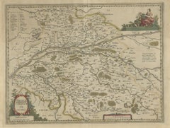
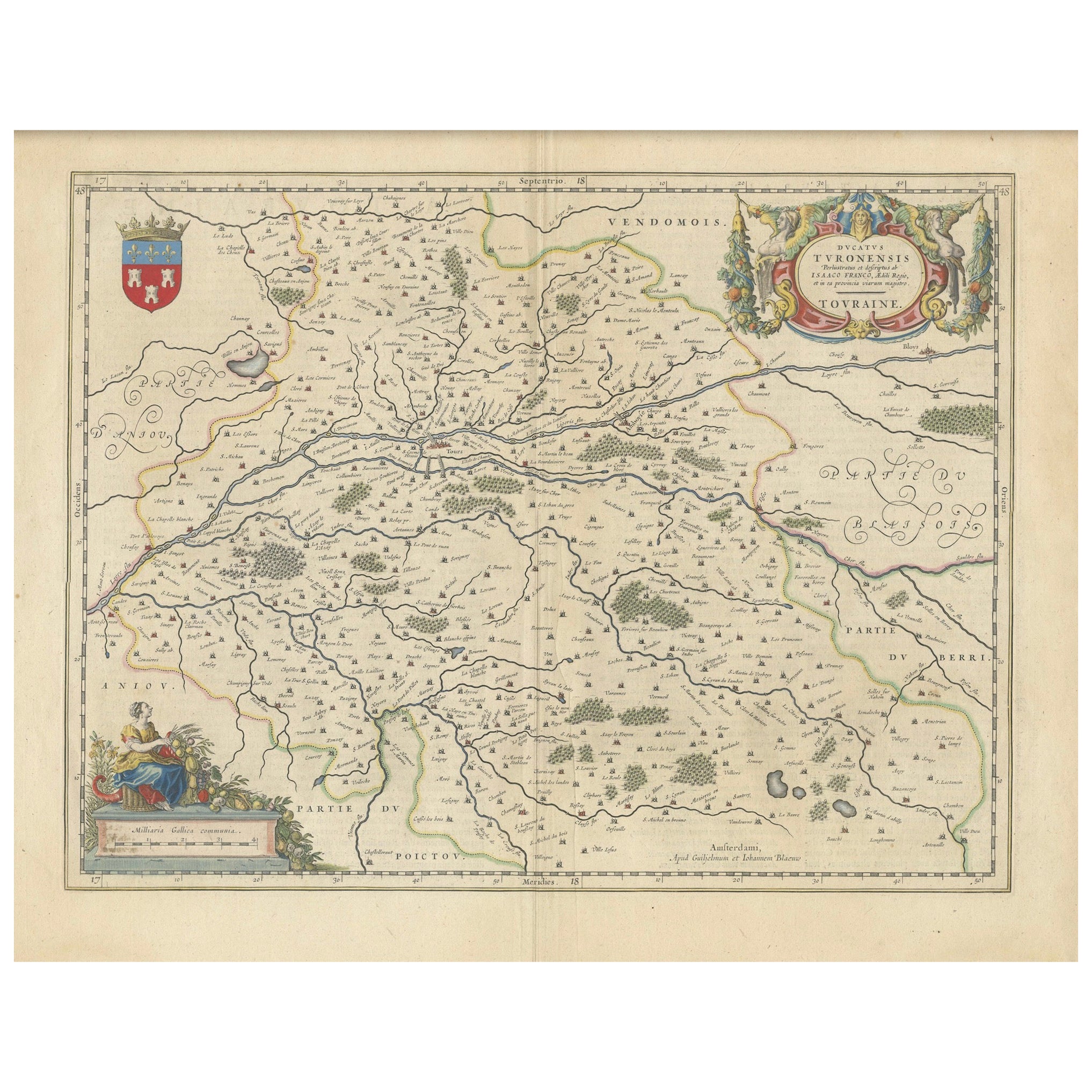
- Antique Map of the Region of Touraine, France by Janssonius, 1657By Johannes JanssoniusLocated in Langweer, NLAntique map of France titled 'Touraine - Turonensis Ducatus'. Decorative map of the Touraine region. This map originates from 'Atlas Novus, Sive Theatrum Orbis Orbis Terrarum: In quo...Category
Antique 17th Century Maps
MaterialsPaper
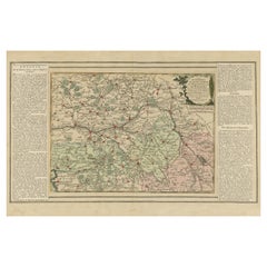
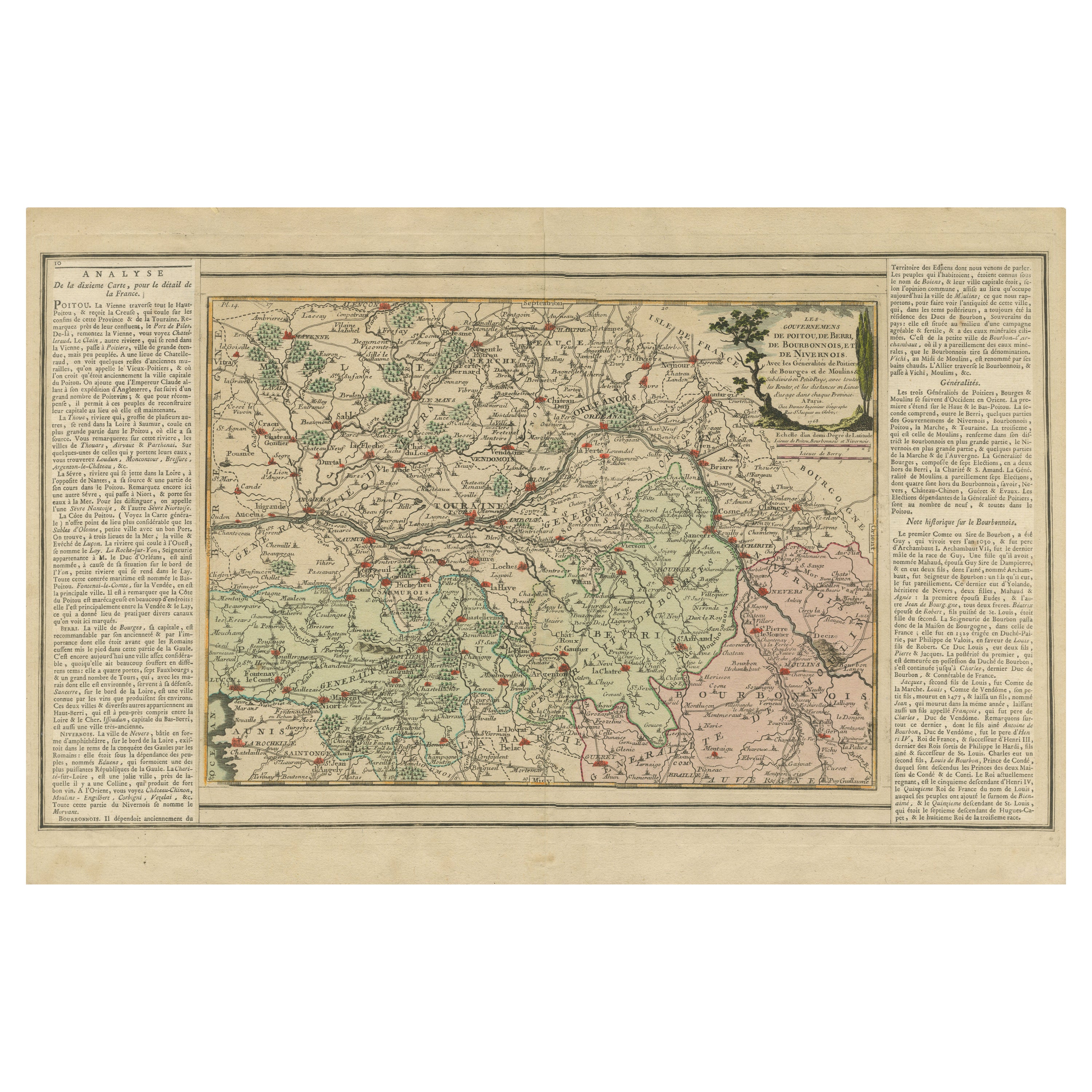
- Old Map of Part of France: Poitou, Berry, Bourbonnais, and Nivernais in 1768Located in Langweer, NLThe map with text neatly mounted on both sides of the map on the plate, is a section of an old map with accompanying French text. The map mentions several historical French provinces...Category
Antique 1760s Maps
MaterialsPaper
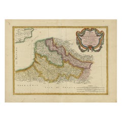
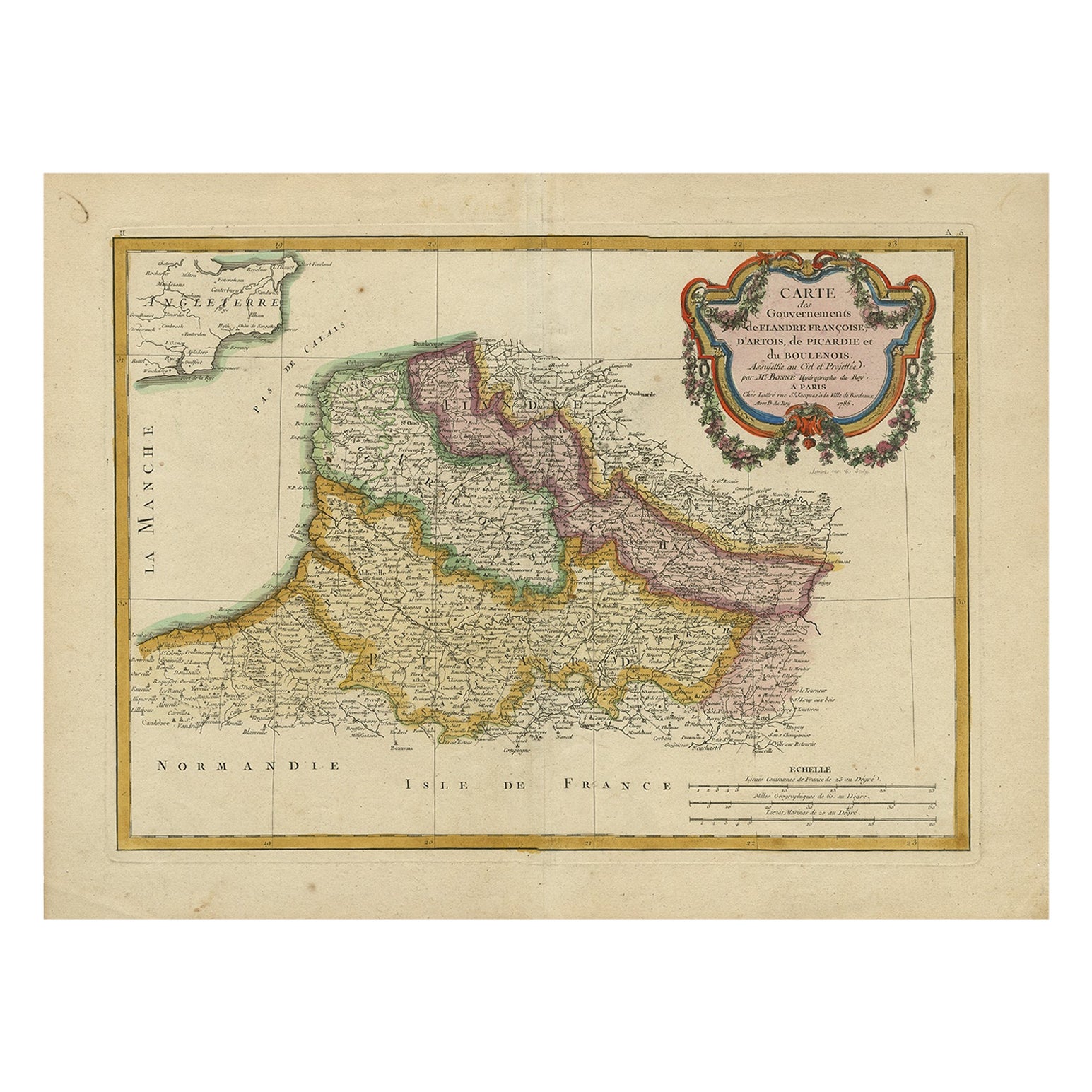
- Antique Map of Picardy, Aroits and French Flanders by Bonne, c.1780Located in Langweer, NLAntique map titled 'Carte des Gouvernements de Flandre Francoise, d'Artois, de Picardie et du Boulenois.' An attractive example of Rigobert Bonne's 1771 decorative map of the French regions of Picardy, Artois, and French Flanders. Covers the region in full from the English Chanel to Normandy. A large decorative title cartouche appears in the upper right. Source unknown, to be determined. Artists and Engravers: Rigobert Bonne (1727-1795 ) was one of the most important cartographers of the late 18th century. In 1773 he succeeded Jacques Bellin as Royal Cartographer to France in the office of the Hydrographer at the Depôt de la Marine. Working in his official capacity Bonne compiled some of the most detailed and accurate maps of the period. Bonne's work represents an important step in the evolution of the cartographic ideology away from the decorative work of the 17th and early 18th century towards a more detail oriented and practical aesthetic. With regard to the rendering of terrain Bonne maps...Category
Antique 18th Century Maps
MaterialsPaper
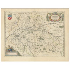
- Cartographic Elegance of Touraine: A 17th-Century Map Showing French HeritageLocated in Langweer, NL"Ducatus Turonensis - Touraine," is a original antique historical map of the Touraine region, which is located in the heart of France, centered...Category
Antique 1630s Maps
MaterialsPaper
- Antique Map of the Region of Touraine in France by Janssonius, 1657By Johannes JanssoniusLocated in Langweer, NLAntique map titled 'Touraine - Turonensis Ducatus'. Decorative map of the Touraine region. This map originates from 'Atlas Novus, Sive Theatrum Orbis Orbis Terrarum: In quo Galli...Category
Antique 17th Century Maps
MaterialsPaper