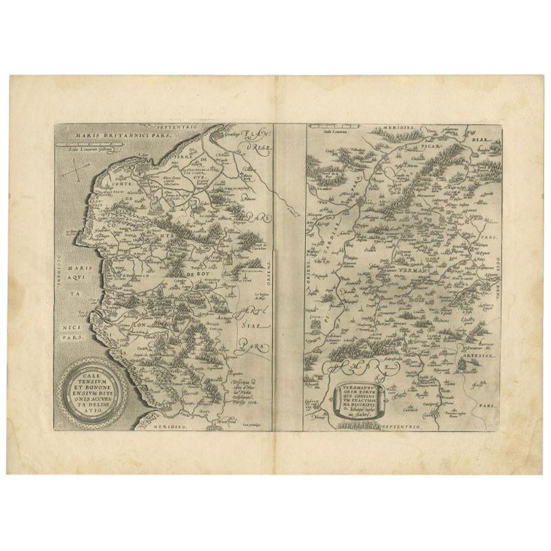
Items Similar to 1590 Ortelius Map of Calais and Vermandois, France and Vicinity Ric.a014


Want more images or videos?
Request additional images or videos from the seller
1 of 9
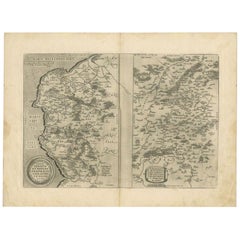
1590 Ortelius Map of Calais and Vermandois, France and Vicinity Ric.a014
About the Item
1590 Ortelius map of
Calais and Vermandois, France and Vicinity
Ric.a014
Two rare regional Abraham Ortelius maps on a single folio sheet. Left map, entitled Caletensium, depicts the French and Belgian coastline from Estables to Calais. Cartographically based upon a four-sheet map issued by Nicholas de Nicolay. The right map, entitled Veromandorum, depicts the immediate vicinity of Saint-Quentin in northern France. This map is based upon the cartographic work of Jean de Surhon who was commissioned by the crown to map the region in 1557. Each map features a decorative title cartouche in the lower left quadrant. Both maps show their respective regions in wonderful detail with attention to forest cities, roads, rivers, and villages. Published in Antwerp by A. Ortelius in 1579 for issue in his seminal atlas Theatrum Orbis Terrarum.
Dimension: Paper Size: 15 1/2" W x 20 1/8" H (39.3 cm W x 51 cm H)
Date: 18th century
Condition: Good Condition with age, please see photos.
; Image Size: 11 3/8" W x 16" H (28.7 cm W x 40.7 cm H).
- Dimensions:Height: 20.08 in (51 cm)Width: 15.48 in (39.3 cm)Depth: 0.4 in (1 cm)
- Materials and Techniques:
- Place of Origin:
- Period:
- Date of Manufacture:1590
- Condition:
- Seller Location:Norton, MA
- Reference Number:1stDibs: LU5848230191712
About the Seller
5.0
Platinum Seller
These expertly vetted sellers are 1stDibs' most experienced sellers and are rated highest by our customers.
Established in 2000
1stDibs seller since 2021
85 sales on 1stDibs
Typical response time: <1 hour
- ShippingRetrieving quote...Ships From: Norton, MA
- Return PolicyA return for this item may be initiated within 3 days of delivery.
More From This SellerView All
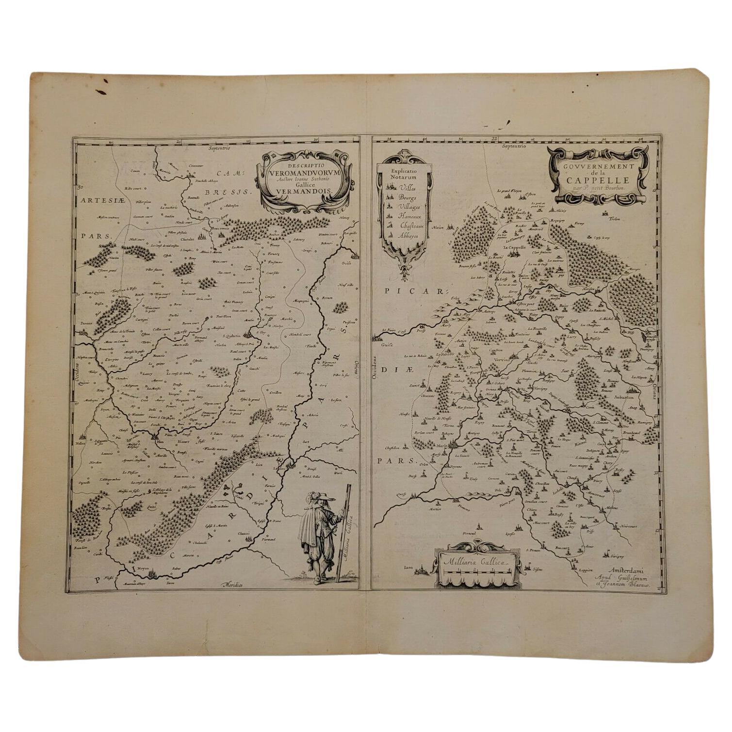
- 1657 Janssonius Map of Vermandois and Cappelle, Ric. A-004Located in Norton, MA1657 Janssonius map of Vermandois and Cappelle Ric.a004 Description: Antique map of France titled 'Descriptio Veromanduorum - Gouvernement de la Cappelle'. Two detailed maps o...Category
Antique 17th Century Unknown Maps
MaterialsPaper
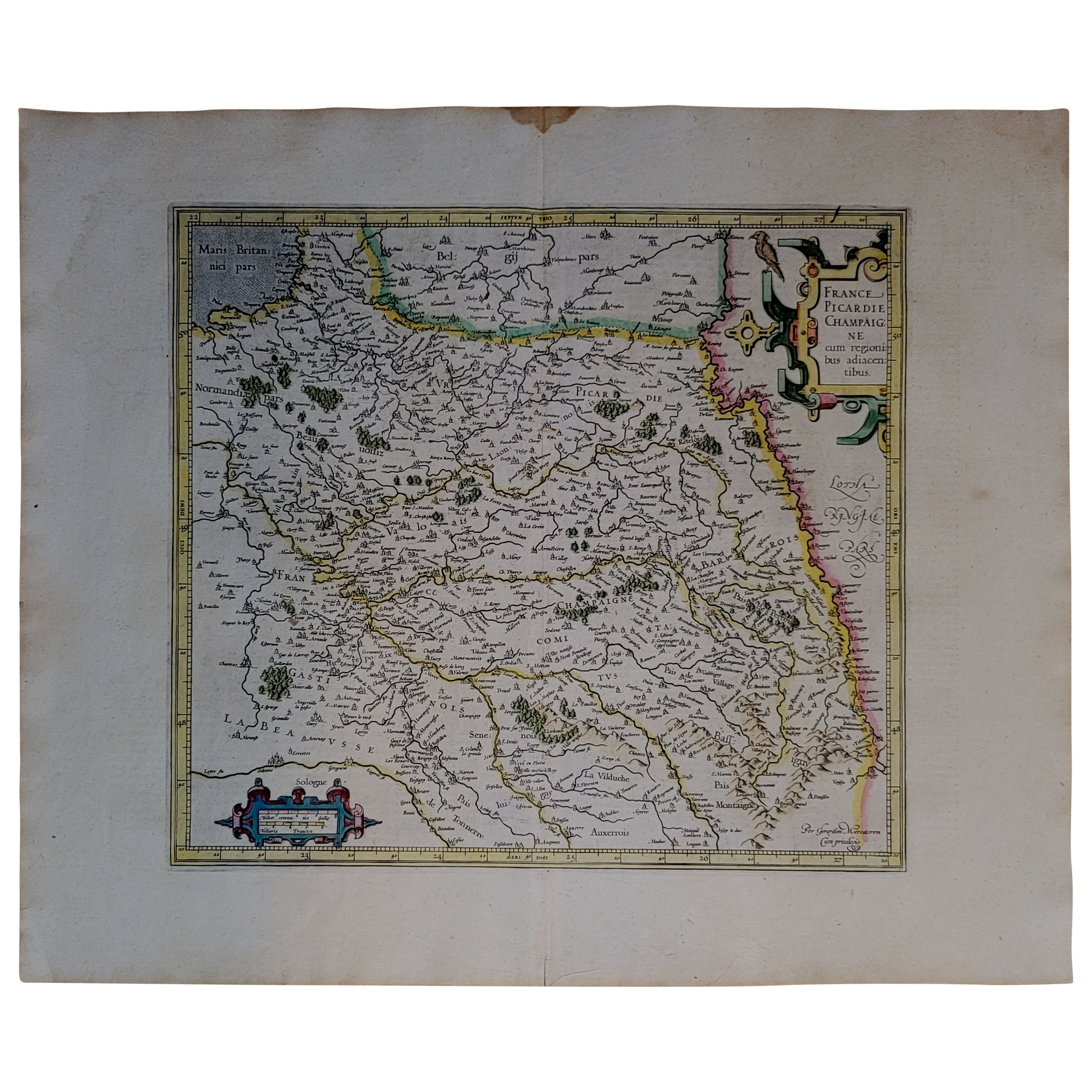
- 1590 Mercator Map Entitled "France Picardie Champaigne, Ric.0001Located in Norton, MADescription: Published in Amsterdam by Mercator/Hondius ca. 1590. Ric.0001 Artists and Engravers: Map : 'France Picardie Champaigne cum regionibus adiacentibus'. (Map of the french provinces of Picardie and Champagne.) Copper engraved map of the french provinces of Picardie and Champagne, showing the cities of Caen, Paris, Melun, Auxerre, Verdun, etc. Copperplate engraving on verge type hand laid paper with watermark. Description: Published in Amsterdam by Mercator/Hondius ca. 1600.Artists and Engravers: Mercator was born in Rupelmonde in Flanders and studied in Louvain under Gemma Frisius, Dutch writer, astronomer and mathematician. The excellence of his work brought him the patronage of Charles V, but in spite of his favor with the Emperor he was caught up in the persecution of Lutheran protestants and charged with heresy, fortunately without serious consequences. No doubt the fear of further persecution influenced his move in 1552 to Duisburg, where he continued the production of maps, globes and instruments. Mercator's sons and grandsons, were all cartographers and made their contributions in various ways to his atlas. Rumold, in particular, was responsible for the complete edition in 1595. The map plates...Category
Antique 16th Century Dutch Maps
MaterialsPaper
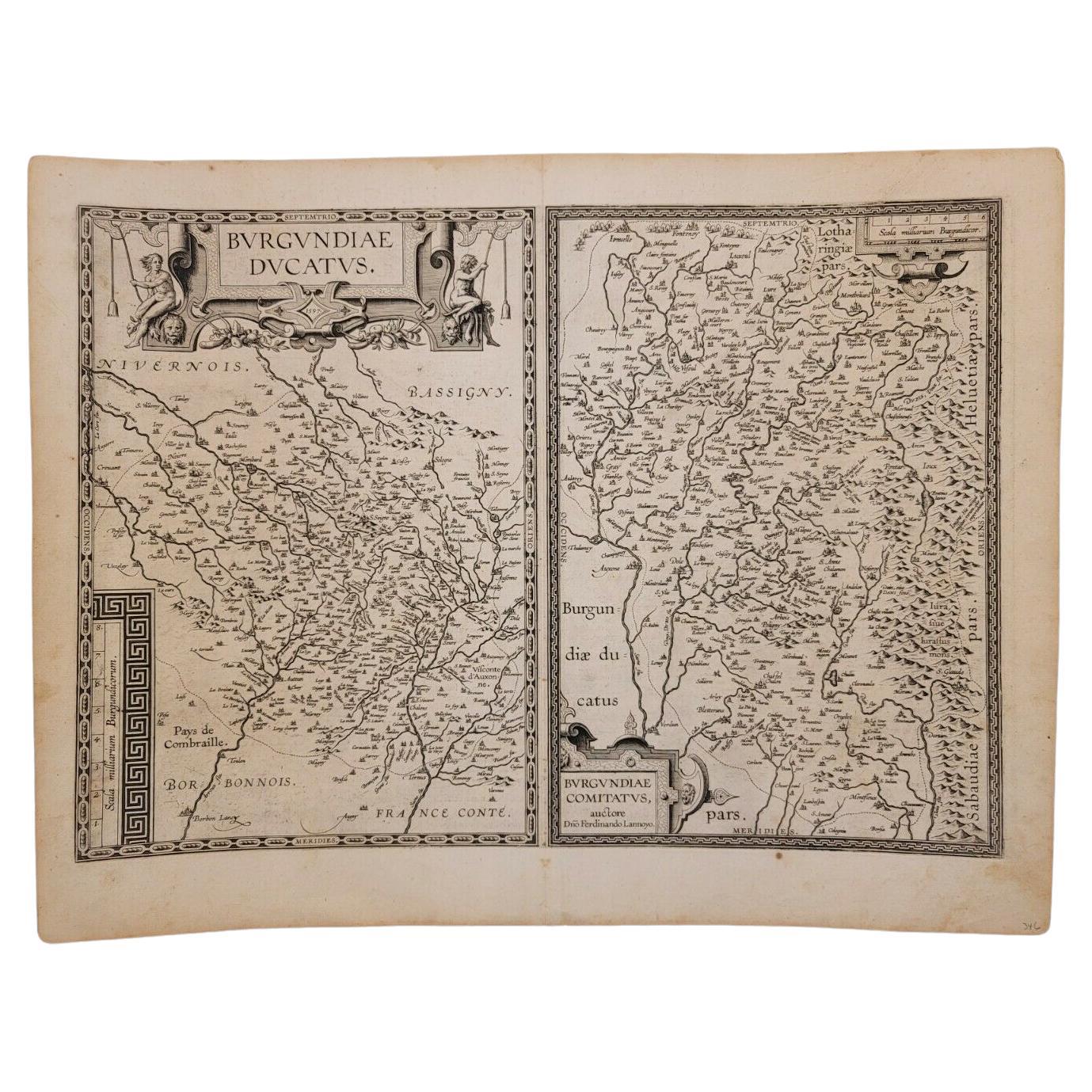
- 1597 Abraham Ortelius Map Burgundy, France Entitled "Bvrgvndiae dvcatvs Ric.a010Located in Norton, MA1597 Abraham Ortelius map of Burgundy, France entitled "Bvrgvndiae dvcatvs Ric.a010 Description: Ortelius is best known for producing the atla...Category
Antique 16th Century Dutch Maps
MaterialsPaper
- 1592 Abraham Ortelius Map "Lorraine: Lotharingiae Nova Descripti, Ric.A005Located in Norton, MA1592 Abraham Ortelius map entitled "Lorraine: Lotharingiae Nova Descripti Ric.a005 Description: Ortelius is best known for producing the atlas from which this map comes from, "...Category
Antique 16th Century Dutch Maps
MaterialsPaper
- 1771 Bonne Map of Poitou, Touraine and Anjou, France, Ric.a015Located in Norton, MA1771 Bonne Map of Poitou, Touraine and Anjou, France Ric.a015 1771 Bonne map of Potiou, Touraine and Anjou entitled "Carte des Gouvernements D'Anjou et du Saumurois, de la Touraine, du Poitou,du Pays d'aunis, Saintonge?Angoumois," Carte des gouvernements d'Anjou et du Saumurois, de la Touraine, du Poitou, du Pays d'Aunis, Saintonge-Angoumois. Projettee et assujettie au ciel par M. Bonne, Hyd. du Roi. A Paris, Chez Lattre, rue St. Jacques a la Ville de Bord(ea)ux. Avec priv. du Roi. 1771. Arrivet inv. & sculp., Atlas moderne ou collection de cartes sur toutes...Category
Antique 17th Century Unknown Maps
MaterialsPaper
- 1752 Vaugoundy Map of Flanders : Belgium, France, and the Netherlands, Ric.a002Located in Norton, MALarge Vaugoundy Map of Flanders: Belgium, France, and the Netherlands Colored -1752 Ric.a002 Description: This is a 1752 Didier Robert de Vaugondy map of Flanders. The map de...Category
Antique 17th Century Unknown Maps
MaterialsPaper


You May Also Like
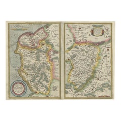
- Antique Map of the Region of Calais and The Vermandois Region by OrteliusLocated in Langweer, NLAntique map titled 'Caletensium et Bononiensium (..) - Veromandorum eorum que confinium (..)'. Two detailed regional maps by Ortelius. The first map shows Belgian and French Coastal ...Category
Antique 17th Century Maps
MaterialsPaper
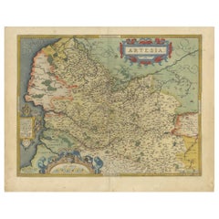
- Antique Map of the Artois Region of France by Ortelius, 'circa 1590'Located in Langweer, NLAntique map titled 'Artesia'. Original antique map of the Artois region, France. Published by A. Ortelius, circa 1590.Category
Antique 16th Century Maps
MaterialsPaper
- Antique Map of the Picardy Region of France by Ortelius, 'circa 1590'Located in Langweer, NLAntique map titled 'Picardiae Belgicae regionis descriptio'. Original antique map of the Picardy region, France. Published by A. Ortelius, circa 1590.Category
Antique 16th Century Maps
MaterialsPaper
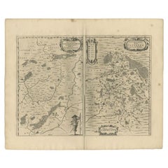
- Antique Map of the Region of Boulogne and Peronne, France 'C.1590'Located in Langweer, NLAntique map titled 'Caletensium et Bononiensium (..)'. Two detailed regional maps on one sheet. The first map shows Belgian and French Coastal region, from Estaples to Gruerlinge...Category
Antique 16th Century Maps
MaterialsPaper
- Antique Map of the Region of Vermandois and Cappelle, France by Janssonius, 1657By Johannes JanssoniusLocated in Langweer, NLAntique map of France titled 'Descriptio Veromanduorum - Gouvernement de la Cappelle'. Two detailed maps of France on one sheet. The Vermandois map is centered on the Oyse and So...Category
Antique 17th Century Maps
MaterialsPaper
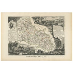
- Antique Map of Calais ‘France’ by V. Levasseur, 1854By Victor LevasseurLocated in Langweer, NLAntique map titled 'Dépt. du Pas de Calais'. Map of the French department of Calais, France. This area is known for producing Maroilles, a soft cheese made from cow’s milk and with a...Category
Antique Mid-19th Century Maps
MaterialsPaper