Items Similar to 1635 Willem Blaeu Map of Northern France"Comitatvs Bellovacvm" Ric.a08


Want more images or videos?
Request additional images or videos from the seller
1 of 6
1635 Willem Blaeu Map of Northern France"Comitatvs Bellovacvm" Ric.a08
About the Item
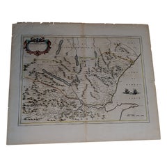
1635 Willem Blaeu map of northern France, entitled.
"Comitatvs Bellovacvm Vernacule Beavvais,"
Colored
Ric.a008
“COMITATVS BELLOVACVM…” Amsterdam: Willem J. Blaeu, c. 1635. Fine engraved map with original hand-coloring. Verso text: Latin.
This very attractive early 17th-century map depicts the Beauvais Region in northern France. Beauvais is probably best known for its tapestry factory, which in the17th and 18th centuries produced tapestries of exceptionally high quality.
Most towns, cities, forests, and waterways are identified. The colorful title cartouche and gentleman holding a stadia rod (lower left), further enhances the map.
Blaeu was the founder of the leading 17th-century Dutch cartographic firm. “The achievements of the firms of Blaeu were remarkable, & the palm for supremacy in map production in any age must be awarded to the Blaeu” (Tooley: Maps & Map-Makers, p. 33).
Dimension: Paper Size: 22 1/4" W x 18" H (56.5 cm W x 46cm H)
Date: 17th Century
Condition: Good Condition with age, please see photos.
; Image Size: 19 5/8" W x 15" H (50 cm W x 38 cm H).
- Dimensions:Height: 18.12 in (46 cm)Width: 22.25 in (56.5 cm)Depth: 0.4 in (1 cm)
- Sold As:Set of 2
- Materials and Techniques:
- Place of Origin:
- Period:
- Date of Manufacture:1635
- Condition:
- Seller Location:Norton, MA
- Reference Number:1stDibs: LU5848230268542
About the Seller
5.0
Platinum Seller
These expertly vetted sellers are 1stDibs' most experienced sellers and are rated highest by our customers.
Established in 2000
1stDibs seller since 2021
85 sales on 1stDibs
Typical response time: <1 hour
- ShippingRetrieving quote...Ships From: Norton, MA
- Return PolicyA return for this item may be initiated within 3 days of delivery.
More From This SellerView All
- 1571-1638 Willem Blaeu map entitled, "Ilcadorino, " Hand Colored Ric0009Located in Norton, MAWillem Blaeu map entitled, "Ilcadorino,". Hand colored. Description: large, unusual, and nice antique copper engraved map of Ilcadorino, by Willem BL...Category
Antique 16th Century Dutch Maps
MaterialsPaper
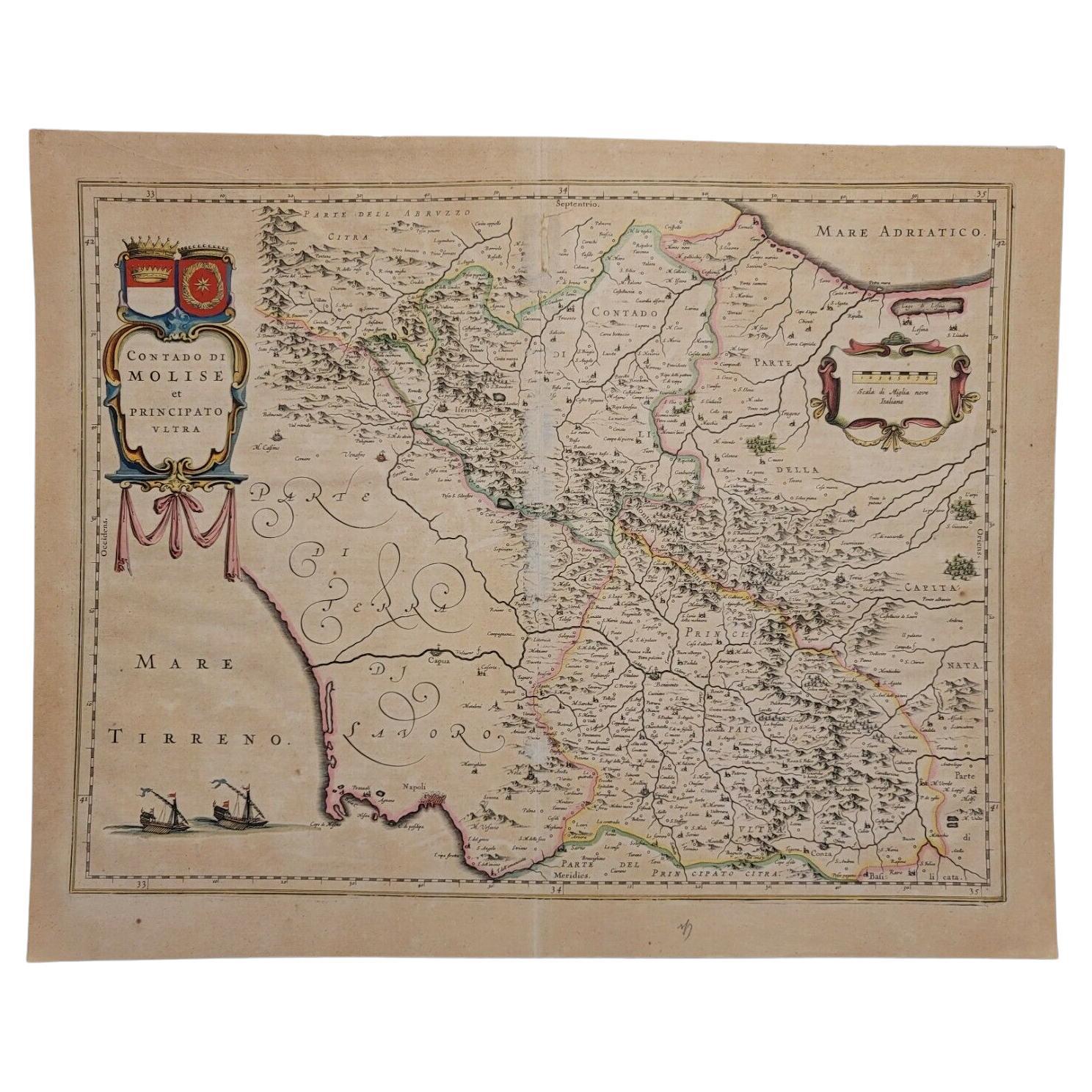
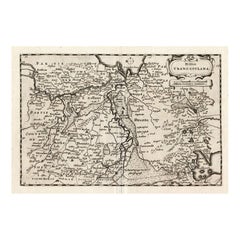
- 1640 Willem Blaeu Map Entitled "Contado di molise et principato vltra, " Ric.a003By Willem BlaeuLocated in Norton, MA1640 Willem Blaeu map entitled "Contado di molise et principato vltra," Colored Ric. a003 Measures: 38 x 49.6 cm and wide margins DBLAEU. Cou...Category
Antique 17th Century Dutch Maps
MaterialsPaper
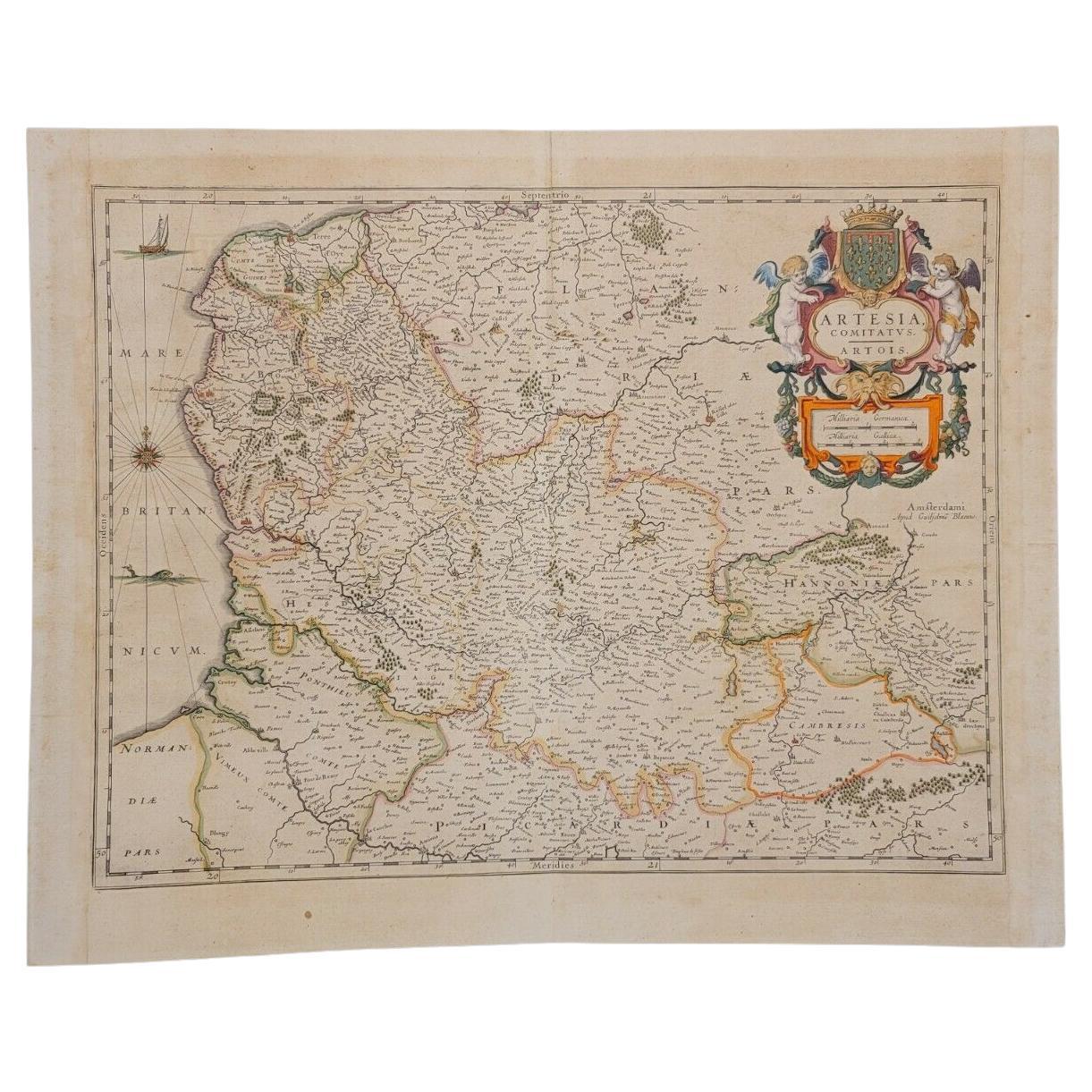
- 1620 Map of Artois Entitled "Artesia Comitatvs Artois, " by Bleau, Ric.a012Located in Norton, MA1640 map of Artois entitled "Artesia Comitatvs Artois," by Bleau Colored A-012. Detailed map of the northern province of Artois, France on the border with Belgium. Feature...Category
Antique 17th Century Dutch Maps
MaterialsPaper
- 1654 Joan Blaeu Map the Sutherland, Scotland, Entitled "Southerlandia, "Ric0007Located in Norton, MA1654 Joan Blaeu map of the Sutherland, Scotland, entitled "Southerlandia," Hand Colored Ric0007 Description: Lovely map centered on Sedan and D...Category
Antique 17th Century Dutch Maps
MaterialsPaper
- 1643 Willem&Joan Blaeu Map NW Flanders "Flandriae Teutonicae Pars PrientaliorLocated in Norton, MA1643 Willem and Joan Blaeu map of northwest Flanders, entitled "Flandriae Teutonicae Pars Prientalior," Ric0012 " Authentic" - Map of the northwest Fl...Category
Antique 17th Century Dutch Maps
MaterialsPaper
- 1814 Map of "Russian Empire" Ric.r032Located in Norton, MA1814 Map of "Russian Empire" Ric.r032 Russian Empire. Description: This is an 1814 John Thomson map of the Russian Empire. The map depicts the region from the Baltic Sea, Prussia, and Sweden to the Aleutian Islands and from the Arctic Ocean to the Yellow River. Highly detailed, myriad cities, towns, and villages are labeled throughout, including St. Petersburg, Moscow, Minsk, Kiev, and Kharkov. Rivers and mountain ranges are also identified, as are islands and numerous locations along the coastlines. It is important to note that the long-disputed sea between Korea and Japan is identified as the 'Sea of Japan. Historical Context: In 1815, Tsarist Russia emerged from the Napoleonic Wars economically insolvent and politically fearful of the Revolutionary fervor that had just swept through Europe. In order to shore up Russia's economic position, the Tsars began an aggressive series of expansions into the Caucuses and Central Asia that would vastly increase the landmass of the Russian Empire. Publication History Thomson maps are known for their stunning color, awe inspiring size, and magnificent detail. Thomson's work, including this map, represents some of the finest cartographic art...Category
Antique 19th Century Unknown Maps
MaterialsPaper


You May Also Like
- Antique Map of Prussia by Blaeu, circa 1635By Willem BlaeuLocated in Langweer, NLAntique map titled 'Prussiae Nova Tabula'. Rare early edition of Blaeu's map of Prussia, embellished with a gorgeous large format cartouche, compass ros...Category
Antique Mid-17th Century Maps
MaterialsPaper
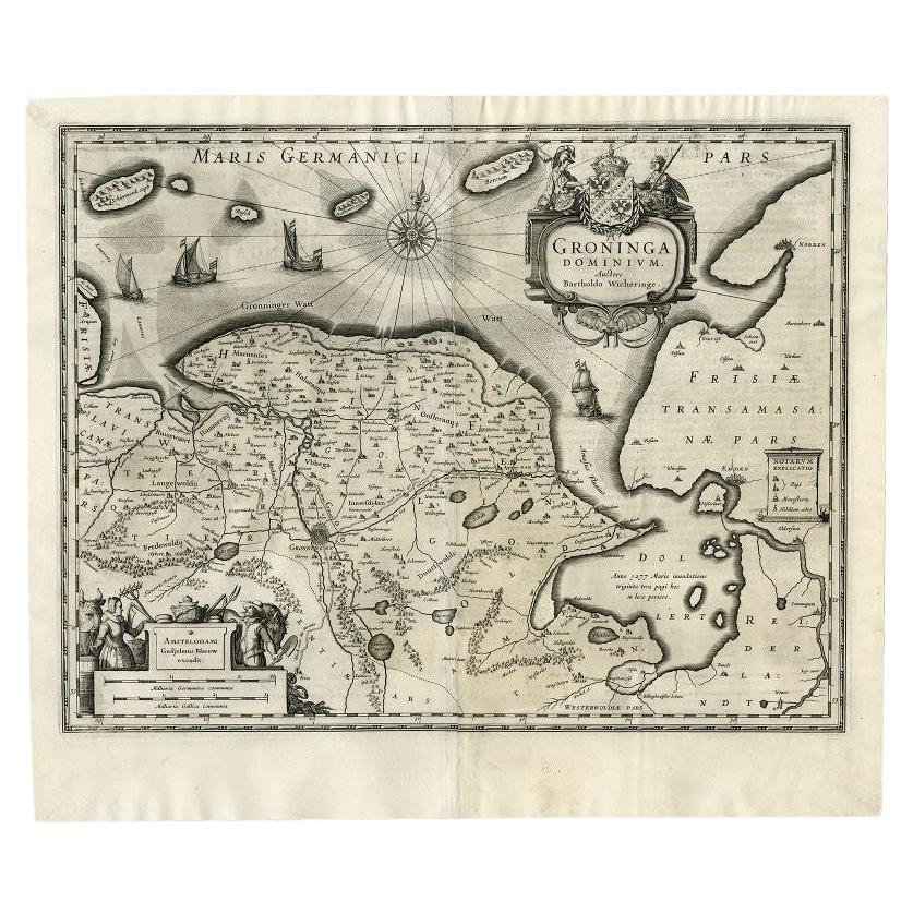
- Antique Map of the Province of Groningen by Blaeu, 1635Located in Langweer, NLAntique map titled 'Groninga Dominium.' A map of the Dutch province Groningen. This includes the Wadden islands Schiermonnikoog, Rottumeroog (Rottumerplaat) and Borkum. With compass ...Category
Antique 17th Century Maps
MaterialsPaper
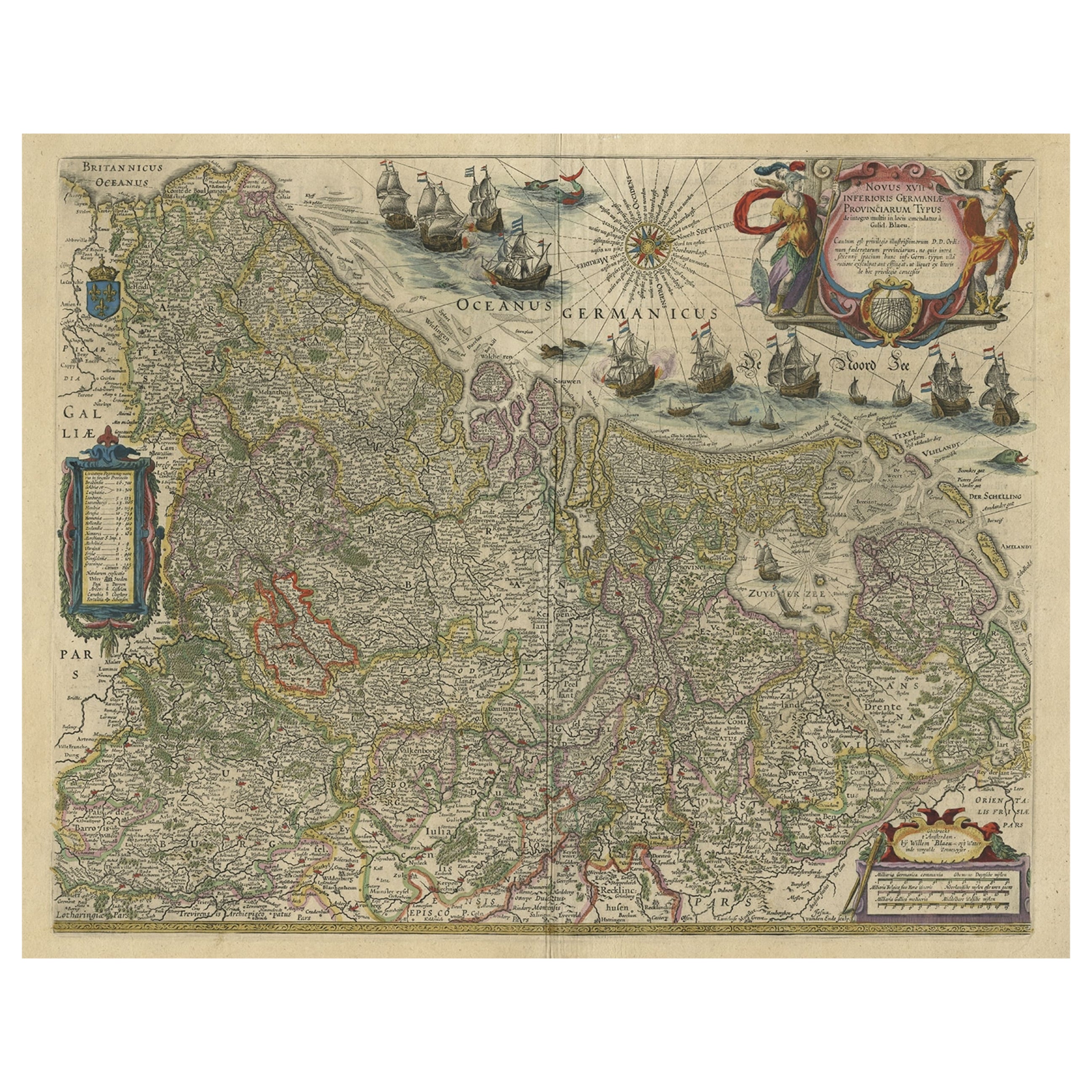
- Handsome Old Detailed Map of the Low Countries by Famous Mapmaker Blaeu, ca.1635Located in Langweer, NLAntique map titled 'Novus XVII Inferioris Germaniae Provinciarum Typus'. Handsome - and much sought after- detailed map of the Low Countries by the world most famous map maker Bla...Category
Antique 1630s Maps
MaterialsPaper
- World Map Silver Leaf Print Based on Original Willem Blaeu Wall Map 1571-1638Located in GBWe are delighted to offer for sale this lovely Antique style pictorial plan map of the globe based on the original Willem Blaeu 1571-1638 engraved in silver leaf foil This is a v...Category
20th Century English Campaign Maps
MaterialsSilver Leaf
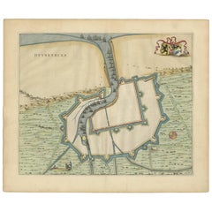
- Antique Map of Dunkirk 'France' by J. Blaeu, 1649Located in Langweer, NLAntique map titled 'Duynkercka'. Published by J. Blaeu, 1649. Dutch text on verso.Category
Antique Mid-17th Century Maps
MaterialsPaper
- Antique Map of Overijssel by Colom, 1635Located in Langweer, NLAntique map titled 'Ditio Trans-Isulana'. Original antique map of the province of Overijssel, the Netherlands. This map originates from 'Vyerige Colom verthonende de 17 Nederlandsche...Category
Antique 17th Century Maps
MaterialsPaper


Recently Viewed
View AllMore Ways To Browse
Northern French Furniture
French 19c
Dutch Willem
French Painted 18th C
18c French Furniture
18c Painted Furniture
17th 18th Century Tapestries
Tapestries 17th And 18th Century
Dutch Tapestry
18th C Tapestry
Tapestry 19
Northern France Map
Tapestry France 18
Tapestry 18 French
Beauvais Tapestry
Willem Blaeu
18h Century Tapestries
17th C Tapestries