Items Similar to Antique Map of England with French Title, 1806


Want more images or videos?
Request additional images or videos from the seller
1 of 5
Antique Map of England with French Title, 1806
About the Item
Antique map titled 'L'Angleterre.' Map of England by Robert de Vaugondy, revised and published by Delamarche in 1806. Source unknown, to be determined.
Artists and Engravers: Made by 'Gilles Robert de Vaugondy' after an anonymous artist. Gilles Robert de Vaugondy (1688 - 1766), also known as Le Sieur or Monsieur Robert, and his son, Didier Robert de Vaugondy (c.1723 - 1786), were leading mapmakers in France during the 18th century. In 1757, they published The Atlas Universel, one of the most important atlases of the 18th century. To produce the atlas, the Vaugondys integrated older sources with more modern surveyed maps. They verified and corrected the latitude and longitude of many regional maps in the atlas with astronomical observations. The older material was revised with the addition of many new place names. In 1760, Didier Robert de Vaugondy was appointed geographer to Louis XV.
Condition: Good, given age. A few minor spots. Original middle fold as issued. General age-related toning and/or occasional minor defects from handling. Please study image carefully.
Date: 1806
Overall size: 30.8 x 29.4 cm.
Image size: 22.4 x 24 cm.
- Dimensions:Height: 11.58 in (29.4 cm)Width: 12.13 in (30.8 cm)Depth: 0 in (0.01 mm)
- Materials and Techniques:
- Period:
- Date of Manufacture:1806
- Condition:
- Seller Location:Langweer, NL
- Reference Number:
About the Seller
5.0
Platinum Seller
These expertly vetted sellers are 1stDibs' most experienced sellers and are rated highest by our customers.
Established in 2009
1stDibs seller since 2017
1,916 sales on 1stDibs
Typical response time: <1 hour
- ShippingRetrieving quote...Ships From: Langweer, Netherlands
- Return PolicyA return for this item may be initiated within 14 days of delivery.
More From This SellerView All
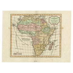
- Antique Map of Africa by Delamarche, 1806Located in Langweer, NLAntique map titled 'L'Afrique'. Decorative map of Africa by Robert de Vaugondy, revised and published by Delamarche. Source unknown, to be determined. Artists and Engravers: Charl...Category
Antique 19th Century Maps
MaterialsPaper
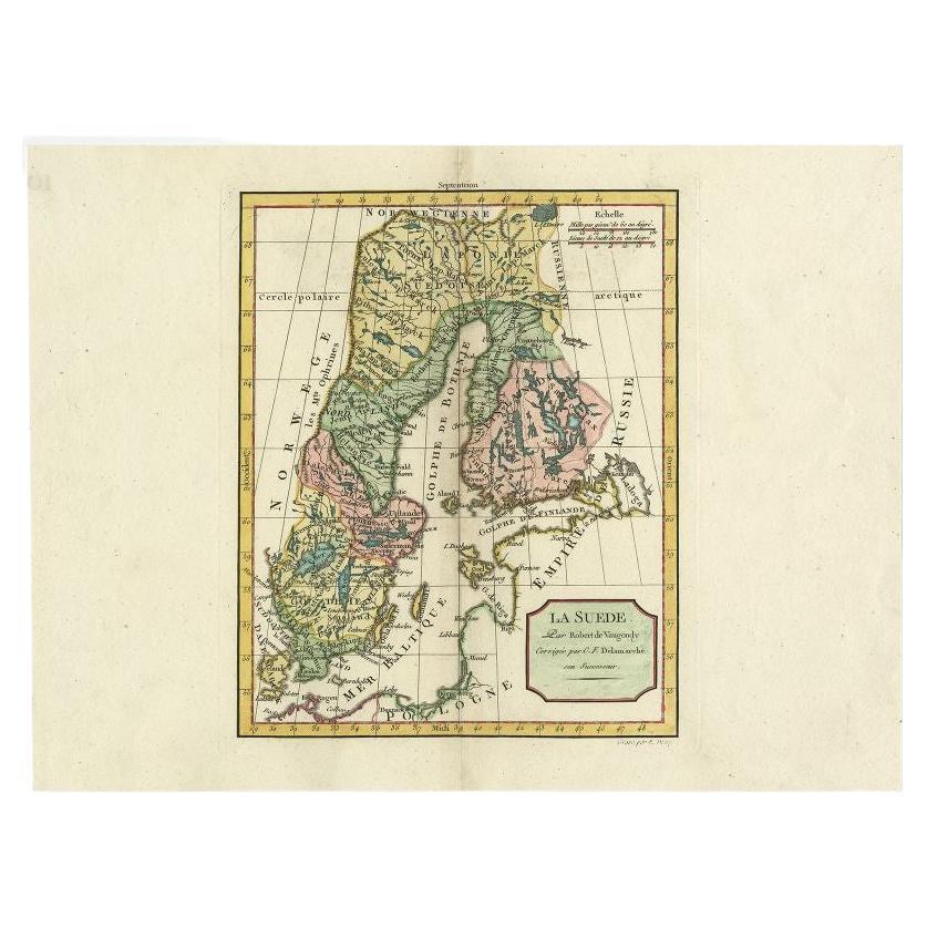
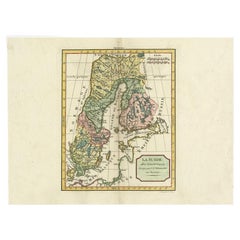
- Antique Map of Sweden by Delamarche, 1806Located in Langweer, NLAntique map titled 'La Suede.' Decorative map of Sweden and part of Finland by Robert de Vaugondy, revised and published by Delamarche. Source unknown, t...Category
Antique 19th Century Maps
MaterialsPaper
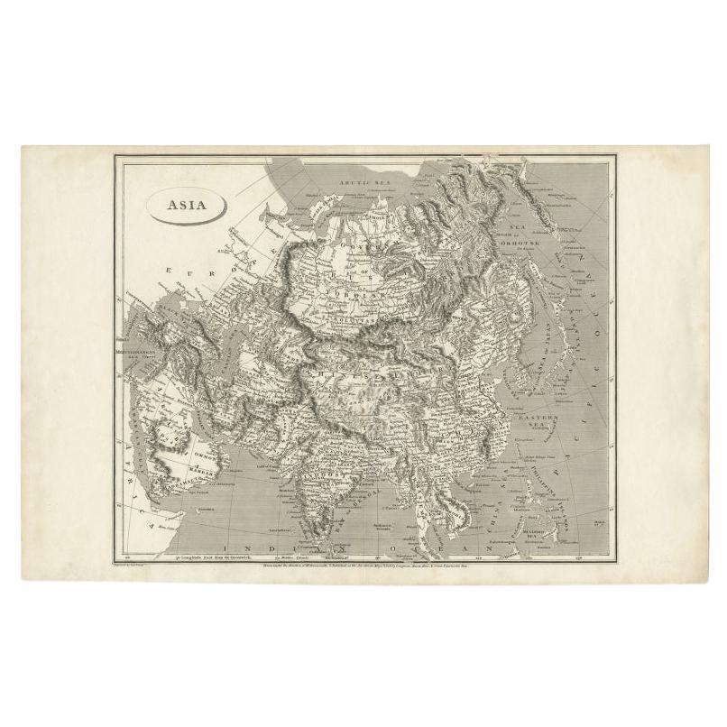
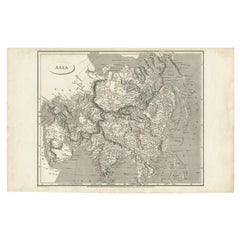
- Antique Map of Asia including Arabia, 1806Located in Langweer, NLAntique map titled 'Asia'. Original antique map of the Asian continent engraved by E. Jones. Artists and Engravers: Drawn under the direction of Mr. Arrowsmith. Published in 1806...Category
Antique 19th Century Maps
MaterialsPaper
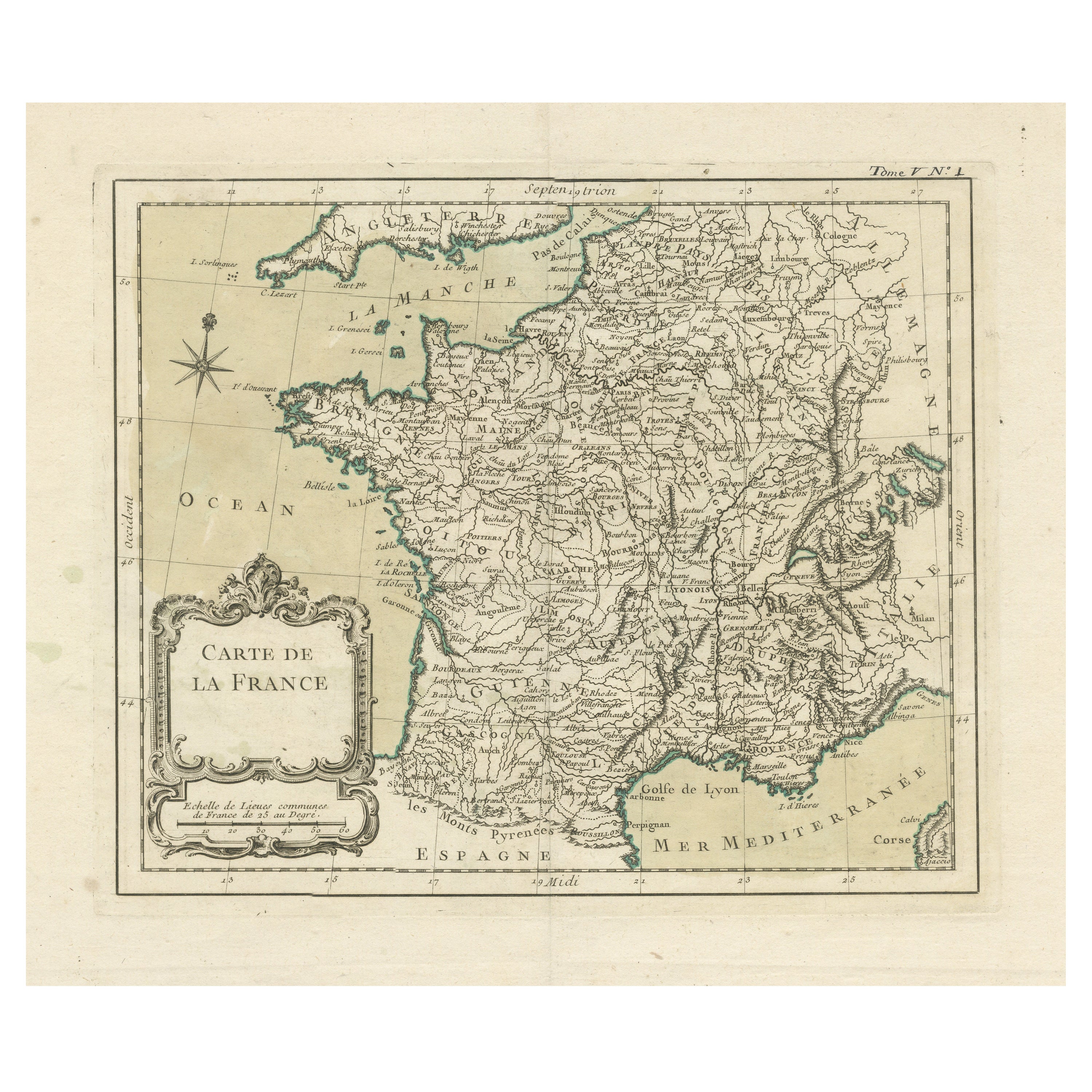
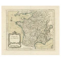
- Antique Map of France with Decorative Title CartoucheLocated in Langweer, NLAntique map titled 'Carte de la France'. Original old map of France. This map originates from 'Le Petit Atlas Maritime Recueil De Cartes et Plans Des Quatre Parties Du Monde (..) by ...Category
Antique Mid-18th Century Maps
MaterialsPaper
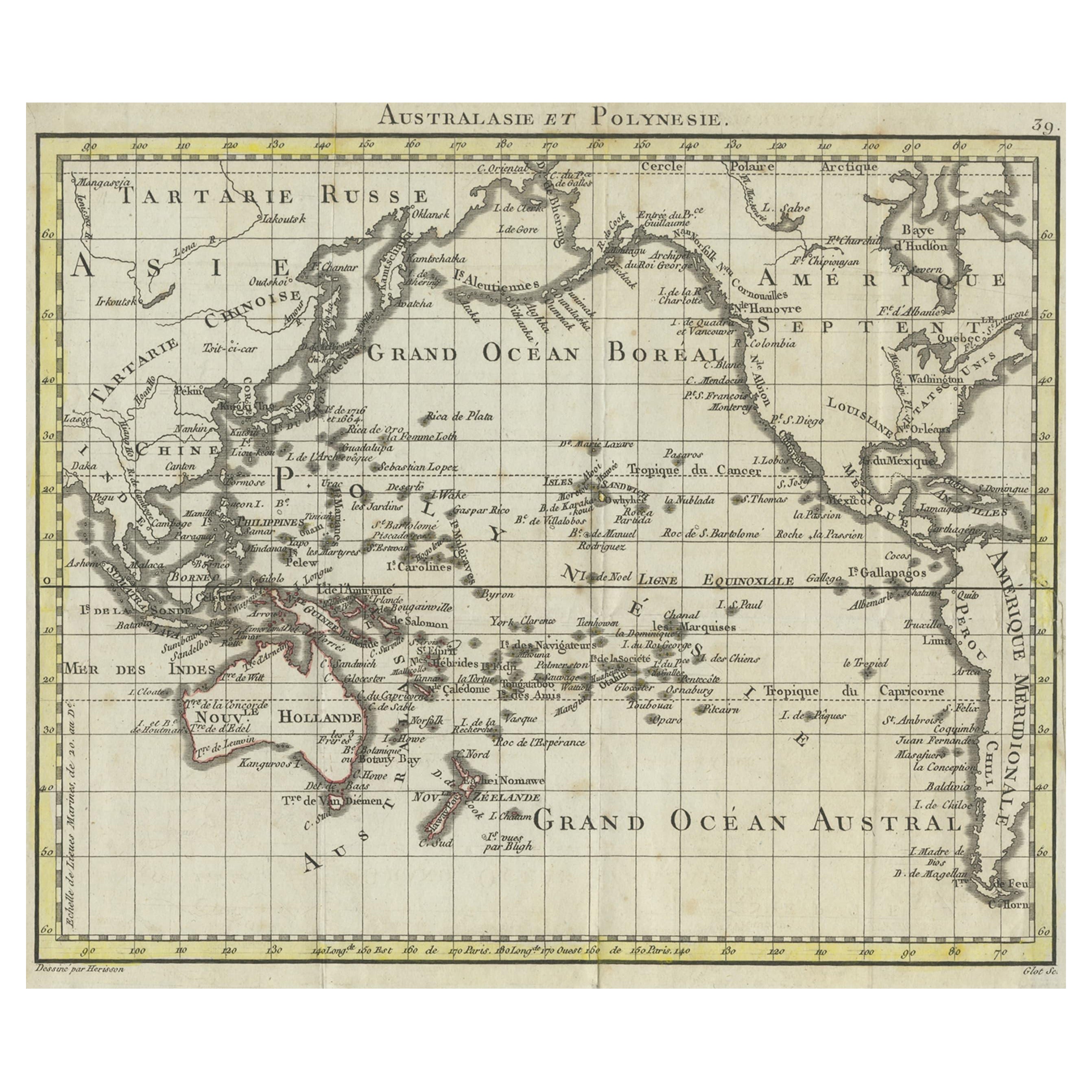
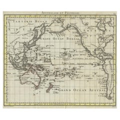
- Antique French Map of the Pacific Ocean with Australia and Polynesia, 1806Located in Langweer, NLAntique map titled 'Australasie et Polynesie'. Old map of Oceania and the Pacific Ocean. Originates from 'Atlas Portatif contenant la Géographie Universelle Ancienne et Moderne' by H...Category
Antique 19th Century Maps
MaterialsPaper
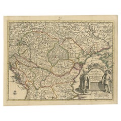
- Antique French Map of Hungary with Decorative Title Cartouche, c.1730Located in Langweer, NLAntique map titled 'La Hongrie suivant les Nouvelles Observations (..)'. Antique map of Hungary with decorative title cartouche. Artists and Engravers: ...Category
Antique 18th Century Maps
MaterialsPaper
You May Also Like
- Original Antique Map of Sweden, Engraved by Barlow, 1806Located in St Annes, LancashireGreat map of Sweden Copper-plate engraving by Barlow Published by Brightly & Kinnersly, Bungay, Suffolk. 1806 Unframed.Category
Antique Early 1800s English Maps
MaterialsPaper
- Original Antique Map of Spain and Portugal, Engraved By Barlow, 1806Located in St Annes, LancashireGreat map of Spain And Portugal Copper-plate engraving by Barlow Published by Brightly & Kinnersly, Bungay, Suffolk. 1806 Unframed.Category
Antique Early 1800s English Maps
MaterialsPaper
- Old Horizontal Map of EnglandBy TassoLocated in Alessandria, PiemonteST/520 - Old rare Italian map of England, dated 1826-1827 - by Girolamo Tasso, editor in Venise, for the atlas of M.r Le-Sage.Category
Antique Early 19th Century Italian Other Prints
MaterialsPaper
- Large Scale Antique Scroll Map of Lincolnshire, England, Dated 1778Located in St Annes, LancashireWonderful scroll map of Lincolnshire By Captain Armstrong, 1778 Copper plate engraving on paper laid on canvas Original ebonized wood frame with lo...Category
Antique 1770s English Georgian Maps
MaterialsWood, Paper
- Large Original Antique Folding Map of Manchester, England, Dated 1793Located in St Annes, LancashireSuperb map of Manchester and Salford Folding map. Printed on paper laid on to the original canvas Unframed. Published by C. Laurent, 1793. ...Category
Antique 1790s English Georgian Maps
MaterialsCanvas, Paper
- Original Antique Map of France, Arrowsmith, 1820Located in St Annes, LancashireGreat map of France Drawn under the direction of Arrowsmith. Copper-plate engraving. Published by Longman, Hurst, Rees, Orme and Brown, 1820 Unframed.Category
Antique 1820s English Maps
MaterialsPaper


Recently Viewed
View AllMore Ways To Browse
New England Antiques
New England Made Furniture
New England Used Office Furniture
Antique Furniture From New England
Antique Map England
Antique Maps England
Antique England Map
Antique Map Of England
Antique Maps Of England
France 1786
Antique French 18th Century Map
18th C New England
Antique Surveying
Survey Map
Antique Astronomical
New England Maps
New England Map
Louis Atlas