Items Similar to Old Original Handcoloured Map of the Former Province of Perche, France, ca.1640
Want more images or videos?
Request additional images or videos from the seller
1 of 5
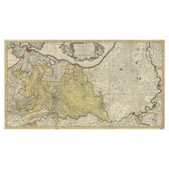
Old Original Handcoloured Map of the Former Province of Perche, France, ca.1640
About the Item
Antique map titled 'Perchensis Comitatus - La Perche compte'.
Old map of the former province of Perche, France. Until the French Revolution, Perche was bounded by four ancient territories of northwestern France: the provinces of Maine, Normandy, and Orléanais, and the region of Beauce. Afterwards it was absorbed into the present-day departments of Orne and Eure-et-Loir, with small parts in the neighboring departments of Eure, Loir-et-Cher, and Sarthe. This map originates from a composite atlas.
Artists and Engravers: Johannes Janssonius also known as Jan Jansson (1588-1664) was born in Arnhem, Netherlands. His father was a bookseller and publisher (Jan Janszoon the Elder). When he married the daughter of the cartographer Jodocus Hondius he also set up a business as book publisher in Amsterdam. His first map was published in 1616. Around 15 years later he set up a partnership with his brother in law Hondius add issued further editions of the Mercator/Hondius atlas. After his death his heirs still have published several maps. Many of his plates have been acquired by Pieter Schenk and Gerard Valk.
Condition: Good, original/contemporary hand coloring. The old color has made the paper fragile and caused a small tear on the left title cartouche. Latin text on verso, please study image carefully.
- Dimensions:Height: 14.77 in (37.5 cm)Width: 23.04 in (58.5 cm)Depth: 0 in (0.02 mm)
- Materials and Techniques:
- Period:1640-1649
- Date of Manufacture:circa 1640
- Condition:Wear consistent with age and use. Contemporary hand coloring. The old color has made the paper fragile and caused a small tear on the left title cartouche. Latin text on verso, please study image carefully.
- Seller Location:Langweer, NL
- Reference Number:
About the Seller
5.0
Platinum Seller
These expertly vetted sellers are 1stDibs' most experienced sellers and are rated highest by our customers.
Established in 2009
1stDibs seller since 2017
1,933 sales on 1stDibs
Typical response time: <1 hour
- ShippingRetrieving quote...Ships From: Langweer, Netherlands
- Return PolicyA return for this item may be initiated within 14 days of delivery.
More From This SellerView All
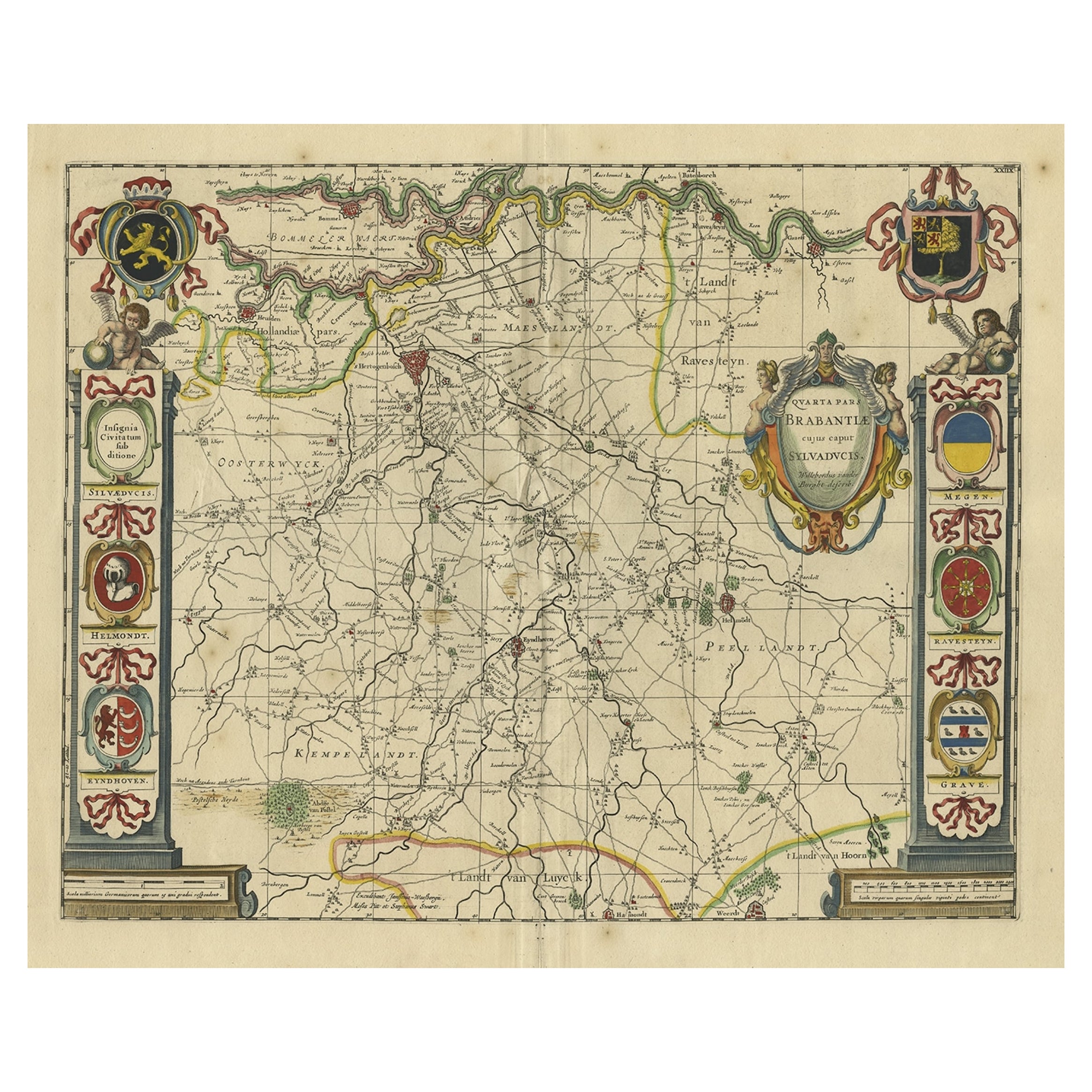
- Decorative Antique Map of the Dutch Province of Noord-Brabant, ca.1640Located in Langweer, NLAntique map titled 'Quarta pars Brabantiae cujus Sylvaducis Willebordus vanderBurgt desrib'. Highly detailed original antique map of the province of Noord-Brabant, the Netherlands. It shows the cities of 's-Hertogenbosch, Eindhoven and surroundings. Includes a decorative cartouche, 6 coats of arms, topped by winged cherubs and two larger coats of arms...Category
Antique 1640s Maps
MaterialsPaper
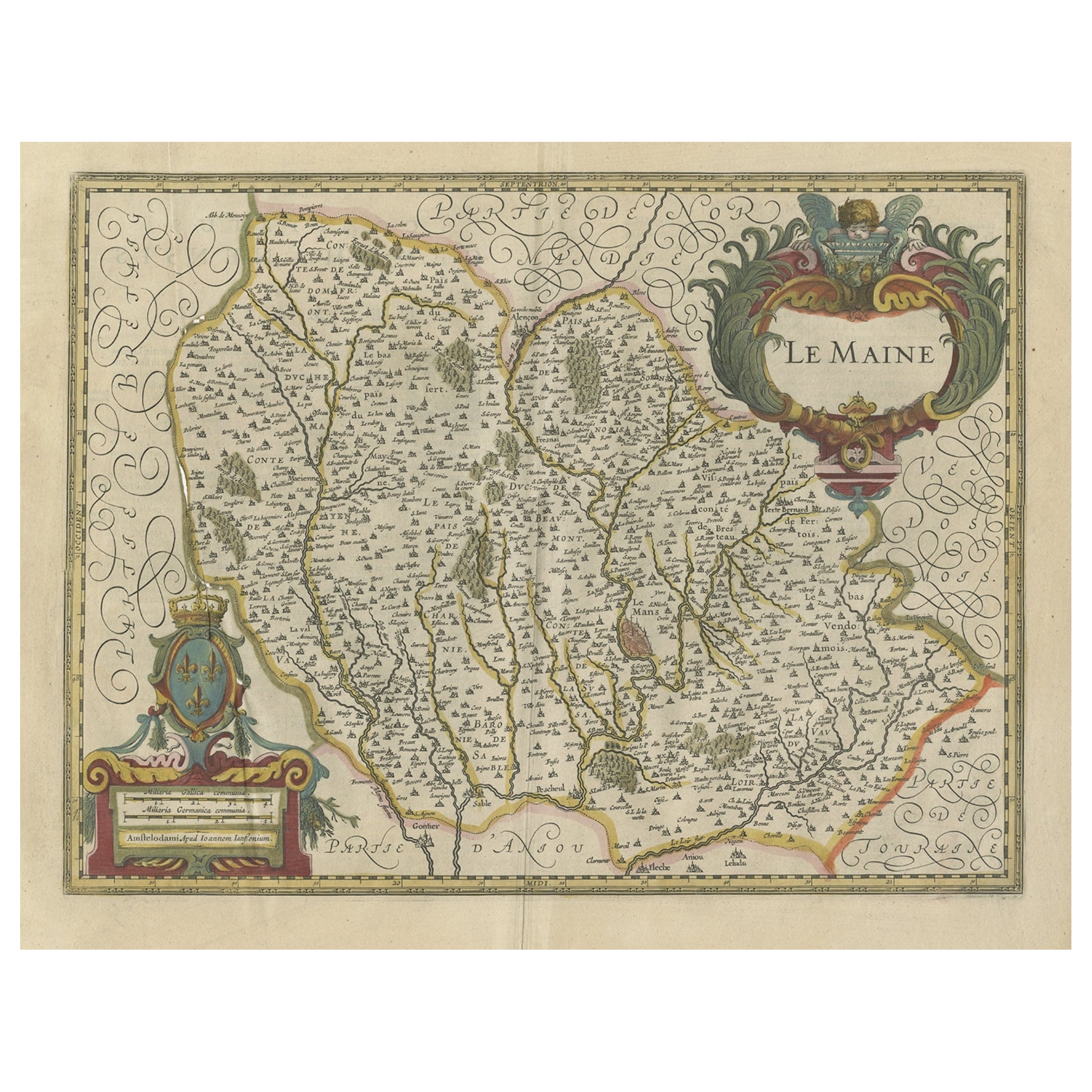
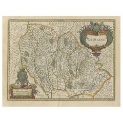
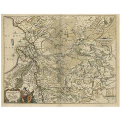
- Antique Map of the French Province Maine, Showing Le Mans, Alencon Etc., Ca1640Located in Langweer, NLAntique map titled 'Le Maine'. Old map of the province of Maine, France. It shows the cities of Le Mans, Alencon and others. This map originates from a composite atlas. Artis...Category
Antique 1640s Maps
MaterialsPaper
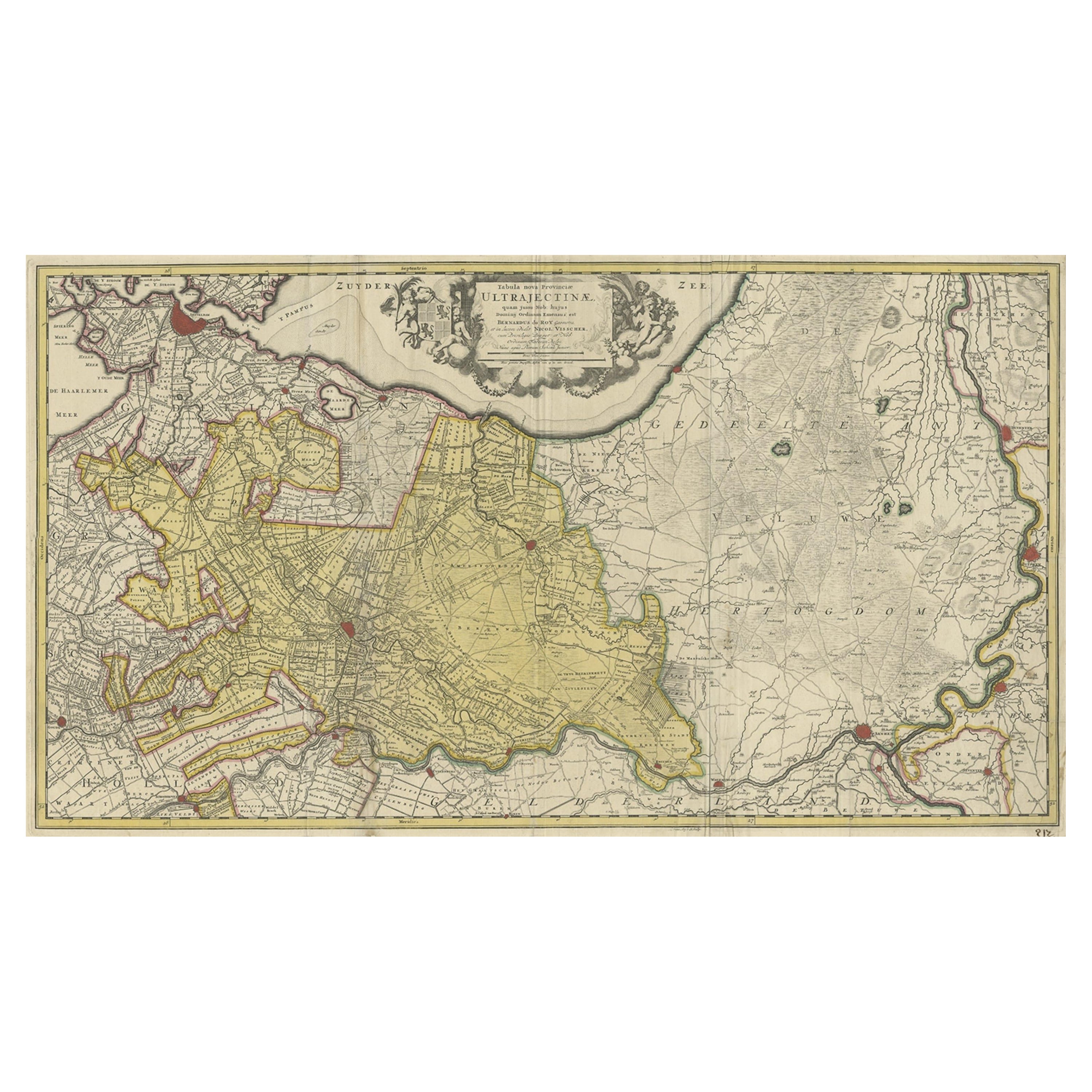
- Original Antique Map of the Province of Utrecht, the Netherlands, ca.1720Located in Langweer, NLAntique map titled ‘Tabula Nova Provinciae Ultrajectinae (..)’. Original antique map of the province of Utrecht, the Netherlands. It shows the region of Amsterdam, Utrecht, Gouda, ...Category
Antique 1720s Maps
MaterialsPaper
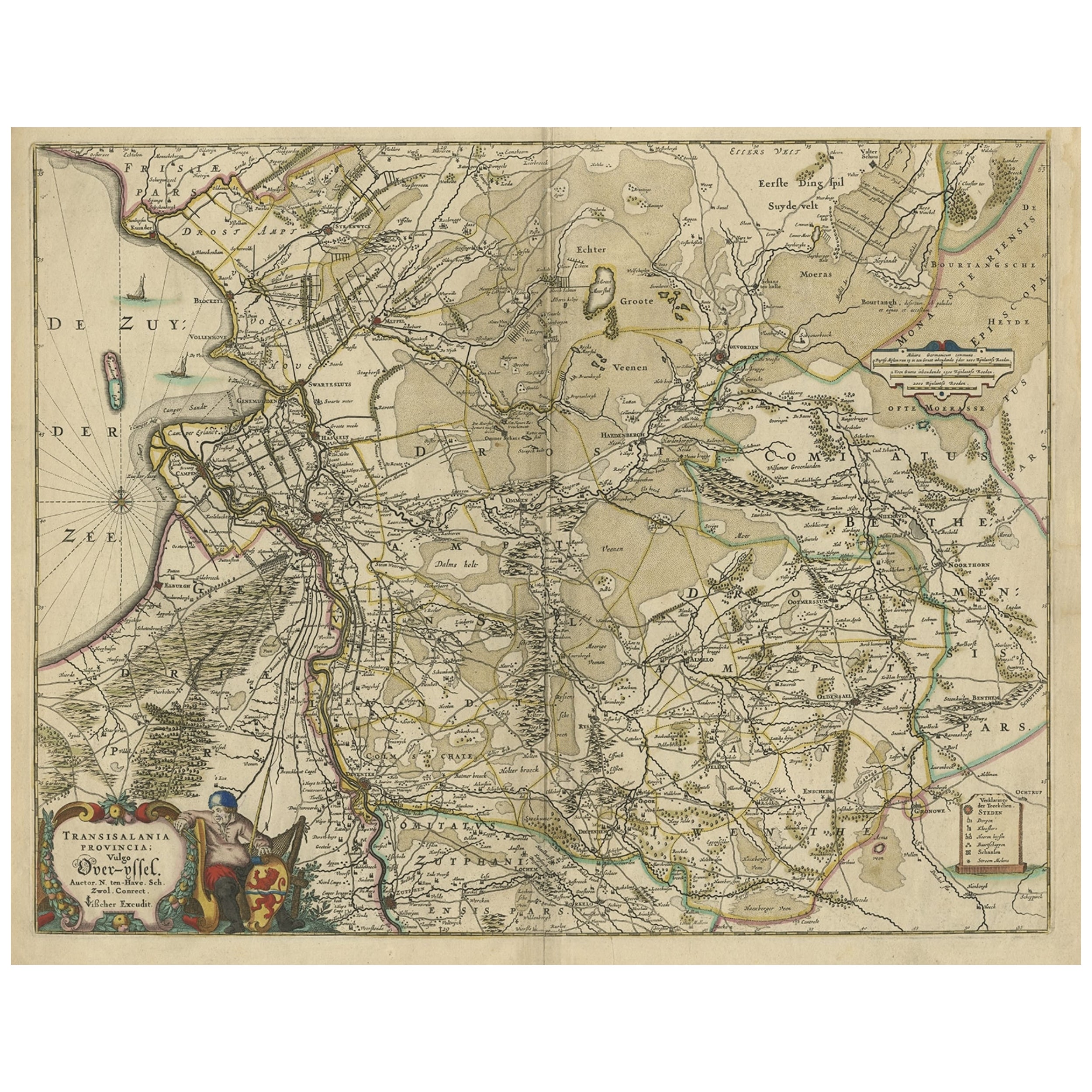
- Attractive Original Map of the Province of Overijssel, the Netherlands, Ca.1700Located in Langweer, NLAntique print, titled: 'Transisalania Provincia vulgo Over-yssel.' Attractive original handcoloured map of the province of Overijssel, The Netherlands. With beautiful title carto...Category
Antique Early 1700s Maps
MaterialsPaper
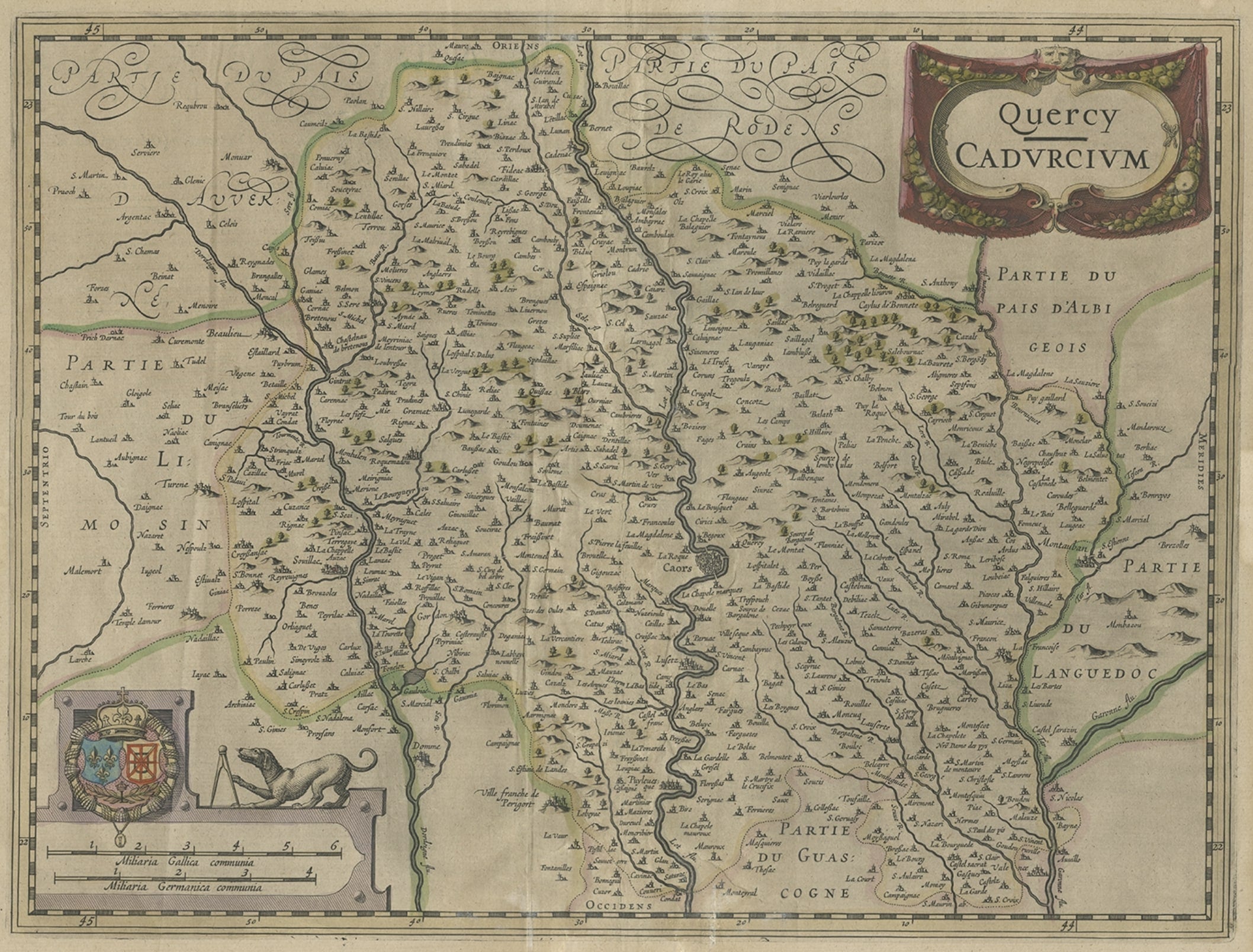
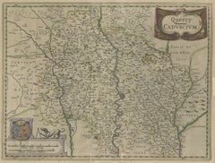
- Antique Map of the French Province of Quercy, ca.1625Located in Langweer, NLAntique map titled 'Quercy Cadurcium'. Old map of the region of Quercy, France. Quercy is a former province of France, the present-day department of Lot, the northern half of the dep...Category
Antique 17th Century Maps
MaterialsPaper
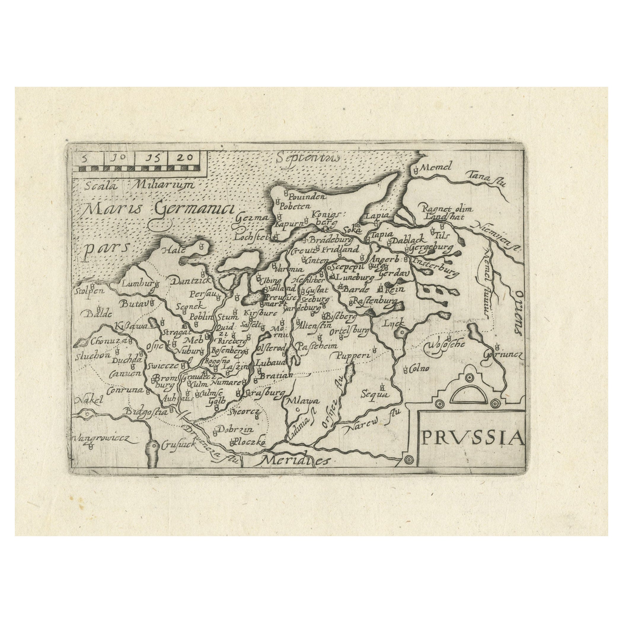
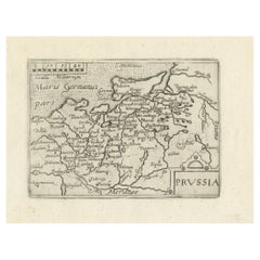
- Extremele Rare, Original Miniature Map of Prussia, ca.1640Located in Langweer, NLAntique map titled 'Prussia'. Extremele rare, original miniature map of Prussia, a historically prominent German state that originated in 1525 with a du...Category
Antique 1640s Maps
MaterialsPaper
You May Also Like
- Italian Parchment Map of the City of Lucca Dated 1640By Matthäus Merian the ElderLocated in Roma, ITAn antique map of the Tuscan city of Lucca engraved for The 'Itinerarium Italiæ Nov-antiquæ' by Matthäus Merian the Elder and printed in 1640...Category
Antique 1640s Italian Maps
MaterialsParchment Paper, Paper
- Italian Parchment Map of the City of Pisa Dated, 1640By Matthäus Merian the ElderLocated in Roma, ITAn antique map of the Tuscan city of Pisa engraved for The 'Itinerarium Italiæ Nov-antiquæ' by Matthäus Merian the Elder and printed in 1640....Category
Antique 1640s Italian Maps
MaterialsPaper
- Antique 18th Century Map of the Province of Pensilvania 'Pennsylvania State'Located in Philadelphia, PAA fine antique of the colony of Pennsylvania. Noted at the top of the sheet as a 'Map of the province of Pensilvania'. This undated and anonymous map is thought to be from the Gentleman's Magazine, London, circa 1775, although the general appearance could date it to the 1760's. The southern boundary reflects the Mason-Dixon survey (1768), the western boundary is placed just west of Pittsburgh, and the northern boundary is not marked. The map has a number of reference points that likely refer to companion text and appear to be connected to boundaries. The western and southern boundaries are marked Q, R, S, for example. A diagonal line runs from the Susquehanna R to the Lake Erie P. A broken line marked by many letters A, B, N, O, etc., appears in the east. There are no latitude or longitude markings, blank verso. Framed in a shaped contemporary gilt wooden frame and matted under a cream colored matte. Bearing an old Graham Arader Gallery...Category
Antique 18th Century British American Colonial Maps
MaterialsPaper
- Old Nautical Map of CorsicaLocated in Alessandria, PiemonteST/556/1 - Old map of Corsica isle, surveyed by Captain Hell, of the French Royal Navy in 1824, engraved and published on 1874, with additions and corre...Category
Antique Early 19th Century English Other Prints
MaterialsPaper
- Old Horizontal Map of EnglandBy TassoLocated in Alessandria, PiemonteST/520 - Old rare Italian map of England, dated 1826-1827 - by Girolamo Tasso, editor in Venise, for the atlas of M.r Le-Sage.Category
Antique Early 19th Century Italian Other Prints
MaterialsPaper
- Original Antique Map of the American State of Oregon, 1889Located in St Annes, LancashireGreat map of Oregon Drawn and Engraved by W. & A.K. Johnston Published By A & C Black, Edinburgh. Original colour Unframed.Category
Antique 1880s Scottish Victorian Maps
MaterialsPaper


