Items Similar to Original Very Old Hand-Colored Map of Limousin or Limoges, France, ca.1600

Want more images or videos?
Request additional images or videos from the seller
1 of 5
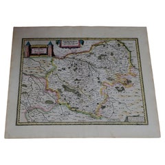
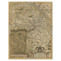
Original Very Old Hand-Colored Map of Limousin or Limoges, France, ca.1600
About the Item
Antique map titled 'Totius Lemovici et Confinium (..).' -
A handsome and detailed map of Limousin/Limoges, prepared by the well-known engraver, Petrus Kaerius. With an insert view of Limoges at top right. Two strapwork cartouches and scale. Source unknown, to be determined.
Artists and Engravers: Made by 'Jodocus Hondius' after an anonymous artist. Jodocus Hondius (1563-1612) was the founder of the famous 17th century Dutch map publishing family. Hondius, along with sons Jodocus II and Henricus and son-in-law Jan Janssonius, was prominent in Dutch cartography and competed with the emerging Blaeu family map business. When Jodocus Hondius acquired the copperplates of the Mercator atlas and decided to re-issue them in 1606, he prepared this map for inclusion in his Atlas sive Cosmographicae.
Condition: Good, given age. Edges slightly browned. A few minor small creases. Some miniscule holes near middle fold, hardly visible. Original middle fold as issued. General age-related toning and/or occasional minor defects from handling. Please study image carefully.
- Dimensions:Height: 15.75 in (40 cm)Width: 21.07 in (53.5 cm)Depth: 0 in (0.02 mm)
- Materials and Techniques:
- Period:1600-1609
- Date of Manufacture:circa 1600
- Condition:Wear consistent with age and use. Condition: Good, given age. Edges slightly browned. A few minor small creases. Some miniscule holes near middle fold, hardly visible. Original middle fold as issued. General age-related toning and/or occasional minor defects from handling.
- Seller Location:Langweer, NL
- Reference Number:
About the Seller
5.0
Platinum Seller
These expertly vetted sellers are 1stDibs' most experienced sellers and are rated highest by our customers.
Established in 2009
1stDibs seller since 2017
1,916 sales on 1stDibs
Typical response time: <1 hour
- ShippingRetrieving quote...Ships From: Langweer, Netherlands
- Return PolicyA return for this item may be initiated within 14 days of delivery.
More From This SellerView All
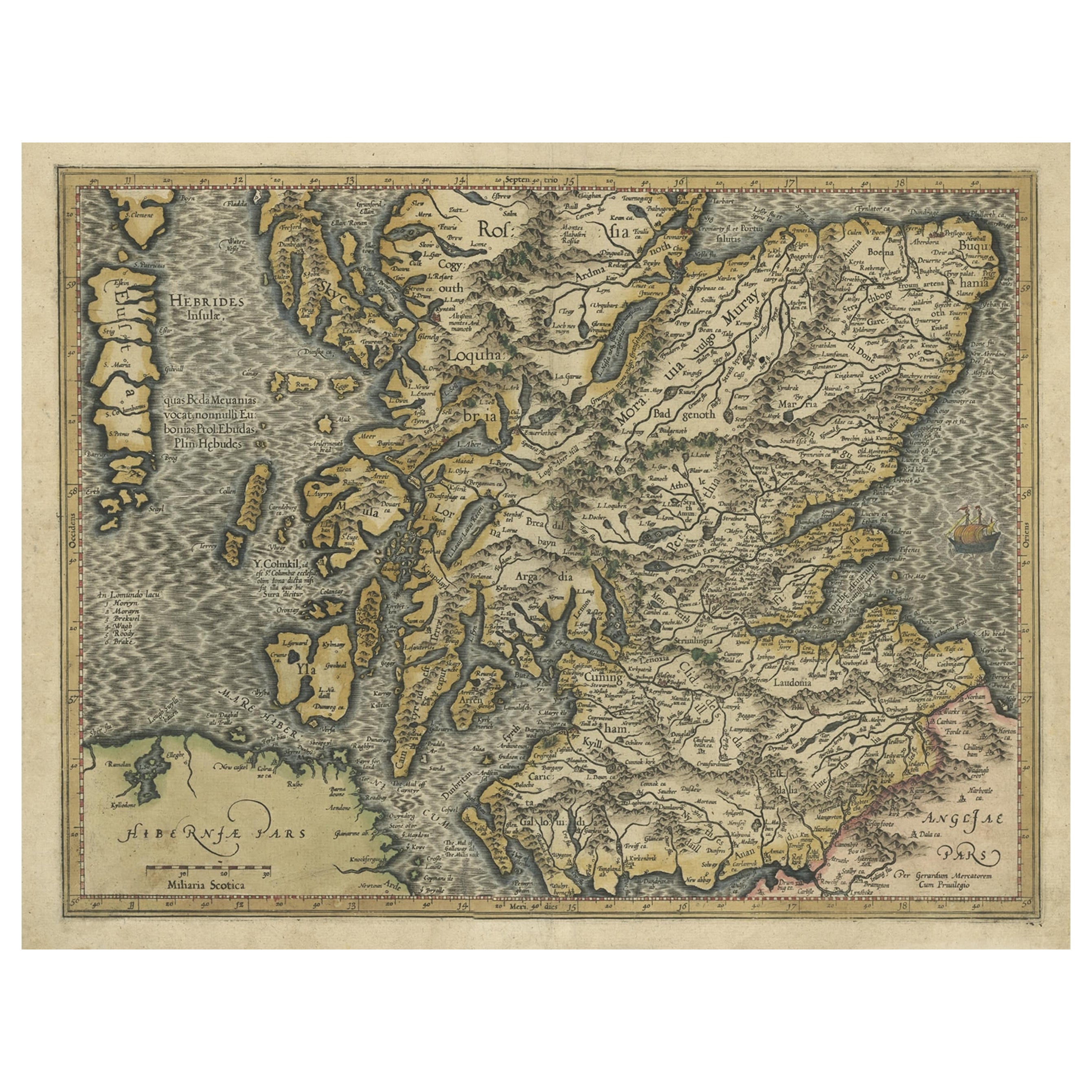
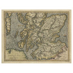
- Original Antique Hand-Colored Map of Southern Scotland, ca.1600Located in Langweer, NLAntique map of Southern Scotland. This map was published by G. Mercator, he also published a map of Northern Scotland titled 'Scotiae Regnum'. Both maps were published on individual sheets. Artists and Engravers: Gerard Mercator (1512 - 1594) originally a student of philosophy was one of the most renowned cosmographers and geographers of the 16th century, as well as an accomplished scientific instrument maker. He is most famous for introducing Mercators Projection, a system which allowed navigators to plot the same constant compass bearing on a flat map...Category
Antique Early 1600s Maps
MaterialsPaper
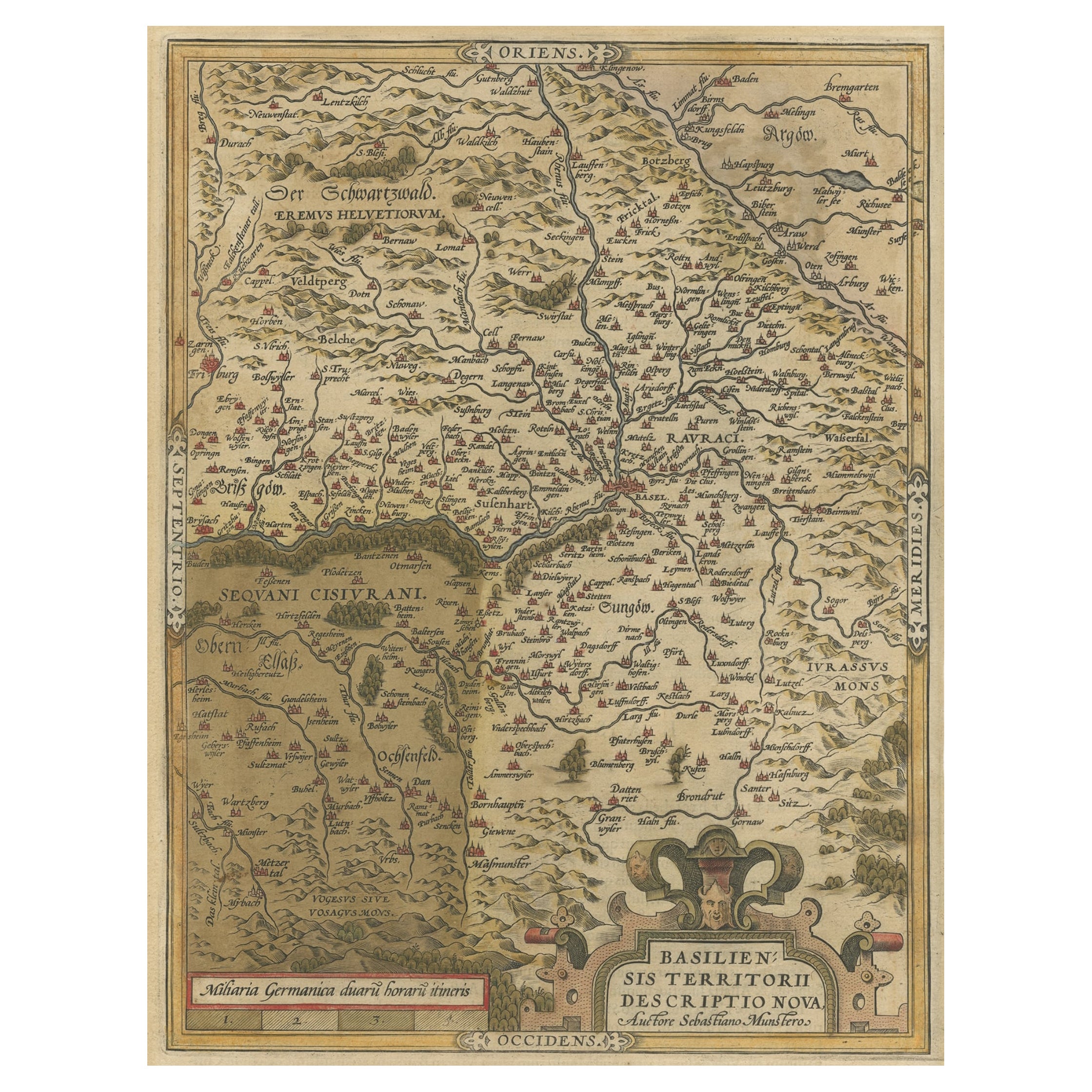
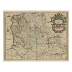
- Very Old Original Hand-Colored Map of the Basel Region, Switzerland, Ca.1578Located in Langweer, NLAntique print titled 'Basiliensis territorii descriptio nova'. Old map of the Basel region, Switzerland. Originates from 'Theatrum Orbis Terrarum' by A. Ortelius. Artists and...Category
Antique 16th Century Maps
MaterialsPaper
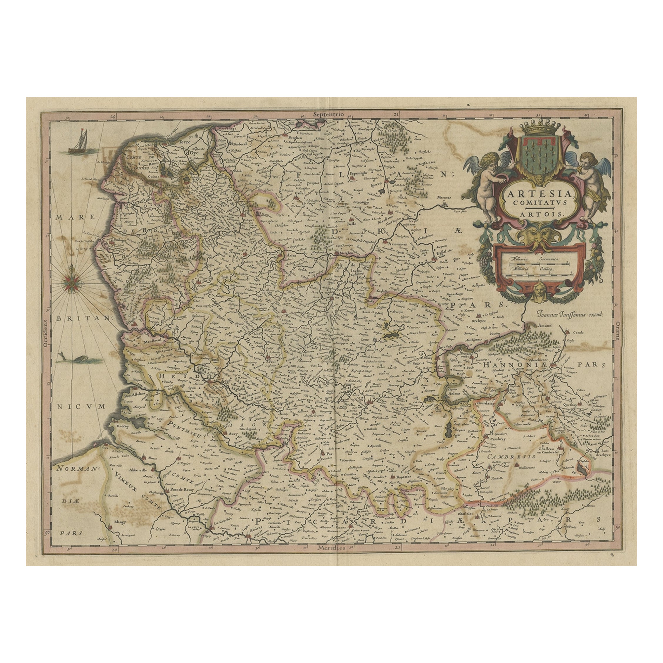
- Original Hand-Colored Antique Map of Artois or Artesia, France, ca.1650Located in Langweer, NLAntique map titled 'Artesia Comitatus Artois'. Map of Artois or Artesia, France. Artois is former province located in the northwestern part of France, boarding Belgium (Flanders)...Category
Antique 1650s Maps
MaterialsPaper
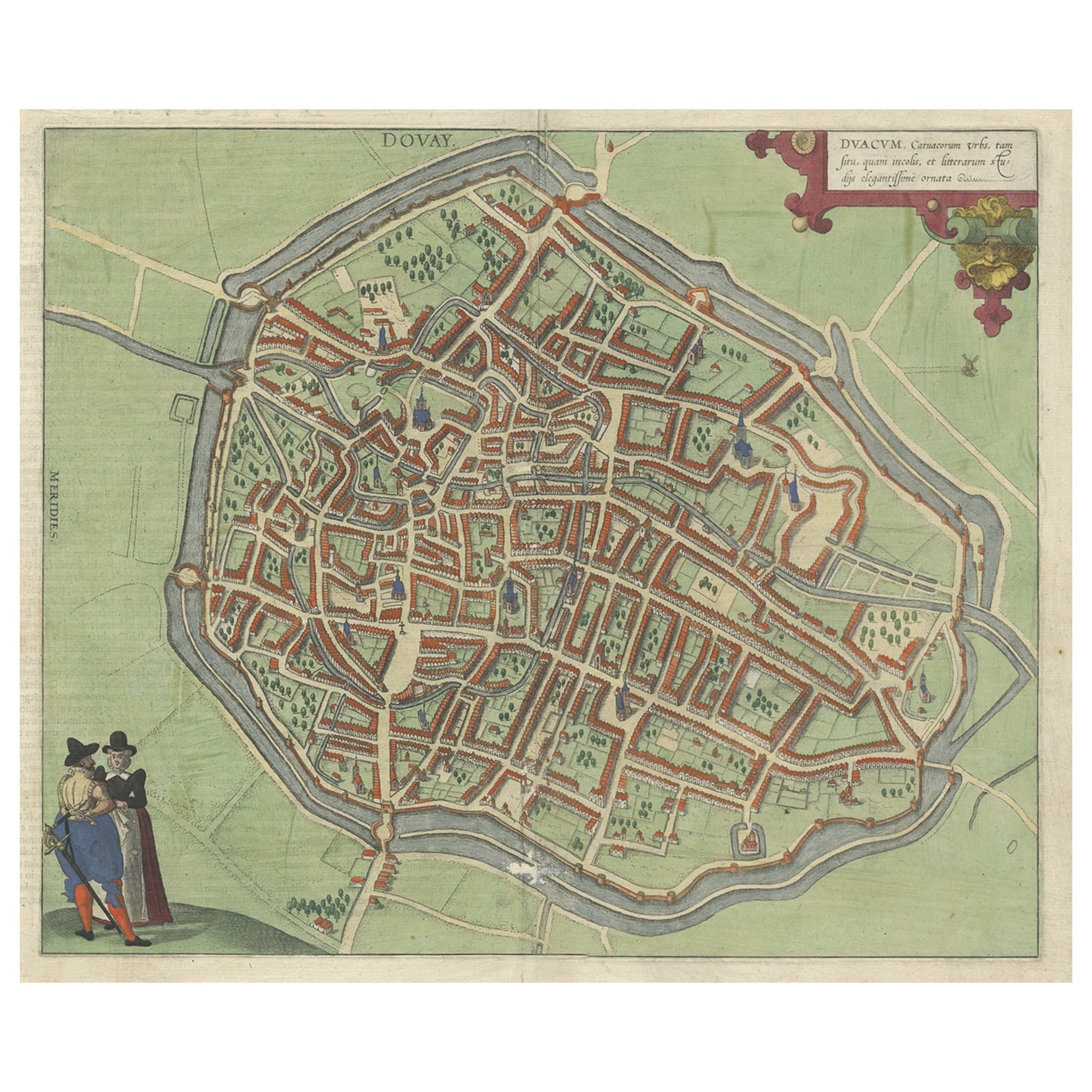
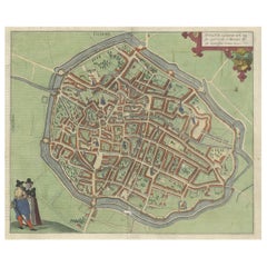
- Very Old Original Antique Map of The City of Douai in France, ca.1575Located in Langweer, NLAntique Map of Douai (France) titled 'Duacum, Catuacorum Urbs, tam situ, quam incolis, et litterarum studijs elegantissime ornata'. This map depicts the city of Douai (France) an...Category
Antique 16th Century Maps
MaterialsPaper
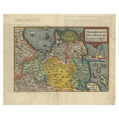
- Original Antique Map of Friesland in Decorative Hand-Colouring, 1600Located in Langweer, NLAntique map titled 'Frisiae antiquissima trans rhenu provinc et adiacentium regionum nova et exacta descriptio'. Original antique map of the province of Friesland, the Netherlands. T...Category
Antique 17th Century Maps
MaterialsPaper
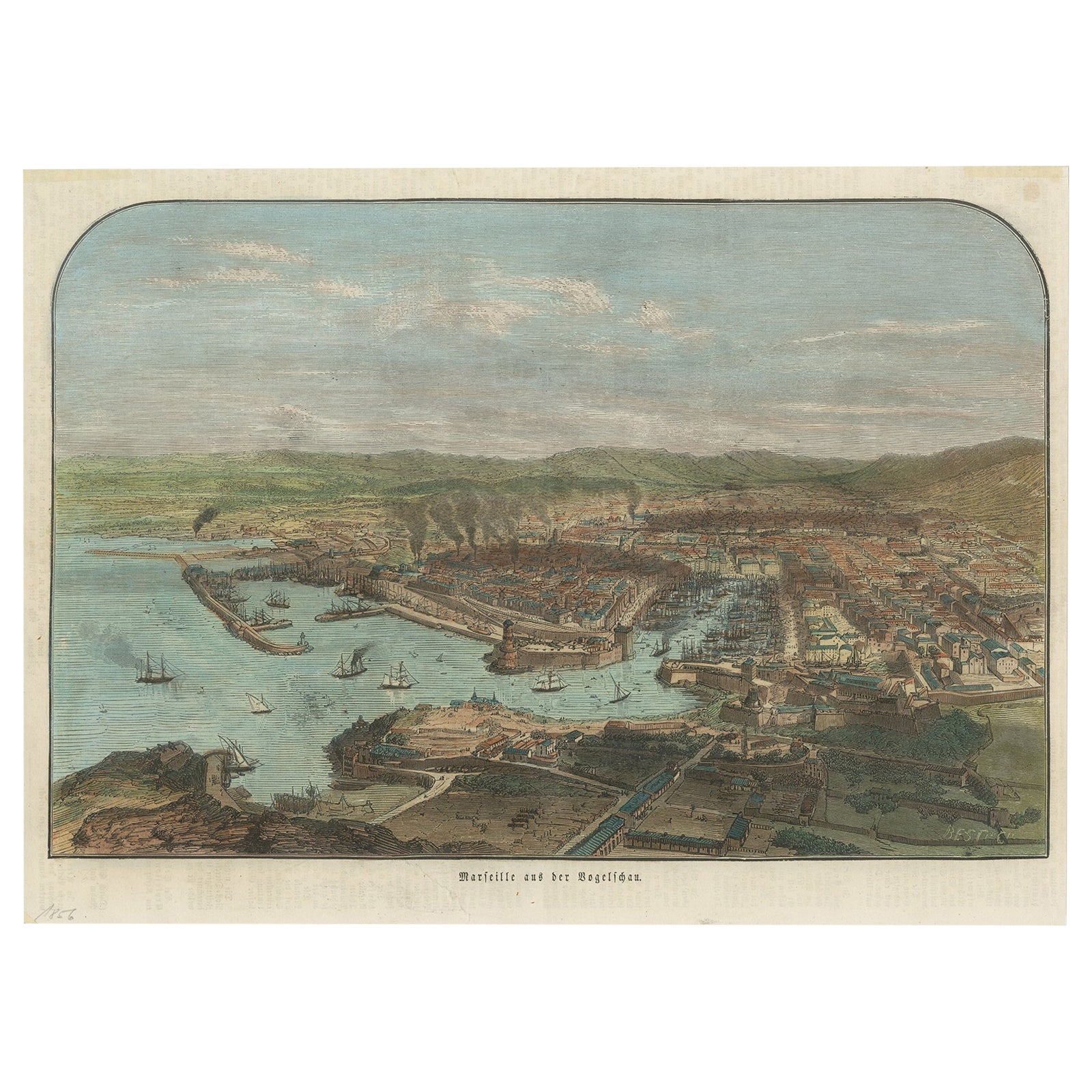
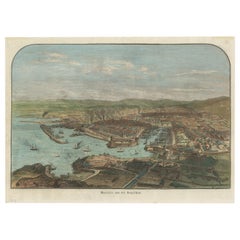
- Old Hand-Colored Print with a View of Marseille, France, ca.1885Located in Langweer, NLAntique print titled 'Marseille aus der Vogelschau'. Old print with a view of Marseille, France. This print originates from a German illustrated newsletter, published circa 1885. ...Category
Antique 1850s Maps
MaterialsPaper
You May Also Like
- Antique Hand Colored Framed Map of EuropeLocated in West Palm Beach, FLAntique reproduction copied from an edition dated 1595 by Ortelius.Category
Antique Late 19th Century Maps
- French Framed Copper Engraved Hand Colored Map of Carolina & Georgia, Circa 1757Located in Hollywood, SCFrench copper engraved hand colored map of Carolina & Georgia matted under glass with a painted frame, mid-18th centuryCategory
Antique 1750s French Louis XV Maps
MaterialsGlass, Wood, Paint, Paper
- Framed 1820s Hand Colored Map of the United StatesLocated in Stamford, CTFramed 1820s hand colored map photos of North America and South America. As found framed in giltwood frame.Category
Antique 1820s American Spanish Colonial Maps
MaterialsGiltwood, Paper, Glass
- Framed 1839 Hand Colored Map of the United StatesLocated in Stamford, CTFramed hand colored map of the United States of America from 1839. Newly framed in a giltwood frame.Category
Antique 1830s American American Classical Maps
MaterialsGiltwood, Paper, Glass
- 1864 Map of North America, Antique Hand-Colored Map, by Adolphe Hippolyte DufourLocated in Colorado Springs, COOffered is a map of North America entitled Amerique du Nord from 1864. This rare, separately published wall map was produced by Adolphe Hippolyte Dufour. This map includes vibrant an...Category
Antique 1860s French Maps
MaterialsPaper
- 1633 map, entitled "La douche de Berry, " Original Hand Colored Ric.0005Located in Norton, MA1633 map, entitled "La douche de Berry," Hand Colored Ric.0005 Description: 1633 map, entitled "La douche de Berry," Dimension: Paper: 23.3" W x 20.3" H (59 cm W x 51.7 cm H) ; ...Category
Antique 17th Century Dutch Maps
MaterialsPaper