Map Hondius

5
to
33
199
46
243
230
75
36
28
23
13
13
6
6
6
5
5
4
4
4
3
2
2
1
1
1
1
1
42
33
3
3
2
Sort By
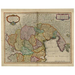
Antique Map of the Area Around Venice in Italy by H. Hondius, circa 1606
By Gerard Mercator, Jodocus Hondius
Located in Langweer, NL
Attractive and early map of the area around Venice, Italy. With South-Tirol in the North, areas of
Category

Antique Early 17th Century Maps

Materials

Paper

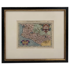
Framed Mercator Hondius Hispania Nova Atlas Minor Map
Located in Stamford, CT
a copy of the original german text on verso. The miniature version of the Mercator Hondius map of
Category

Antique 17th Century Dutch Spanish Colonial Maps

Materials

Glass, Wood, Paper

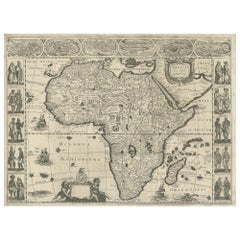
Antique Map of Africa Made after Hondius, circa 1655
Located in Langweer, NL
, Based Upon Hondius' map. The first derivative of the map was issued separately by Hondius in 1618. This
Category

Antique Mid-17th Century Maps

Materials

Paper

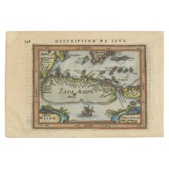
Antique Miniature Map of Java by Bertius/Hondius '1618'
Located in Langweer, NL
Rare antique miniature map titled 'Iava Maior'. This map shows the northern coastline of Java
Category

Antique Early 17th Century Maps

Materials

Paper

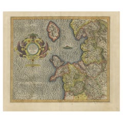
Antique Map of England by Mercator/Hondius, circa 1600
Located in Langweer, NL
Antique map titled 'Westmorlandia, Lancastria, Caernvan, Denbigh, Flint, Merionidh, Dalopia cum
Category

Antique 16th Century Maps

Materials

Paper

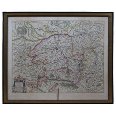
Antique 1630 Colored Belgium Map Flandria Gallica Flanders Henricus Hondius
Located in Dayton, OH
"Antique hand colored map of Flanders, Belgium, circa 1630, engraved by Henricus Hondius. “Henricus
Category

Antique Early 17th Century Renaissance Maps

Materials

Paper

1627 Hendrik Hondius Map Entitled "Vltoniae Orientalis Pars, " Ric.a009
Located in Norton, MA
1627 Hendrik Hondius map entitled "Vltoniae orientalis pars," Ric.a009 Title: Vltoniae
Category

Antique 17th Century Dutch Maps

Materials

Paper

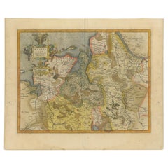
Antique Map of Westfalia, Germany by Mercator/Hondius, circa '1620'
Located in Langweer, NL
by Mercator/Hondius, circa '1620' 17th Century antique detailled map of Westphalia, East Friesland
Category

Antique 16th Century Maps

Materials

Paper

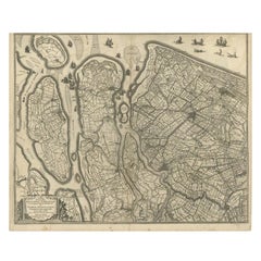
Antique Map of Delfland and Schieland by Hondius, c.1630
Located in Langweer, NL
, the son of the famous cartographer Jodocus Hondius who had started a map-making business in the city
Category

Antique 17th Century Maps

Materials

Paper

Antique Map of the Region of Beauvais by Hondius, circa 1630
Located in Langweer, NL
. This map originates from a composite atlas and is signed by J. Hondius.
Category

Antique Mid-17th Century Maps

Materials

Paper

Antique Map of the Region of Lyon by Hondius, circa 1630
Located in Langweer, NL
Antique map titled 'Lionnois, Forest et Beauiolois'. Old map of the former region of Lyon, Vienne
Category

Antique Mid-17th Century Maps

Materials

Paper

Antique Map of Northern Ireland by Mercator/Hondius, Early 1600's
Located in Langweer, NL
by Mercator/Hondius, ca. 1600. Superb early map of the eastern part of Ulster, featuring Down and
Category

Antique 16th Century Maps

Materials

Paper

Antique Map of the Region of Bresse by Hondius, circa 1630
Located in Langweer, NL
Antique map titled 'Bresse'. Old map of the former region of Bresse, France. It is located in the
Category

Antique Mid-17th Century Maps

Materials

Paper

Antique Map of the Region of Valois by Hondius, circa 1630
Located in Langweer, NL
. This map originates from a composite atlas and most likely published by Hondius.
Category

Antique Mid-17th Century Maps

Materials

Paper

17th Century Hand-Colored Map of West Africa by Mercator/Hondius
Located in Alamo, CA
published the English edition of the Mercator and Hondius Atlas Minor in 1635 that contained this map.
Category

Antique Mid-17th Century Dutch Maps

Materials

Paper

Antique Map of the County of Bentheim by Hondius, c.1630
Located in Langweer, NL
Antique map titled 'Comitatus Bentheimensis nova descriptio'. Engraved map of the County of
Category

Antique 17th Century Maps

Materials

Paper

Antique Map of the Alsace Region of France by Hondius, c.1630
Located in Langweer, NL
Antique map titled 'Alsatia Superior (..)'. Original antique map of the Alsace (Elzas) region of
Category

Antique 17th Century Maps

Materials

Paper

Southeastern Ireland: A 17th Century Hand Colored Map by Mercator and Hondius
By Gerard Mercator
Located in Alamo, CA
death by his heirs. Jodocus Hondius (1563-1612) was a prominent globe maker and map engraver from
Category

Antique Mid-17th Century Dutch Maps

Materials

Paper

17th Century Hand-Colored Map of Southeastern England by Mercator and Hondius
By Gerard Mercator
Located in Alamo, CA
A 17th century copperplate hand-colored map entitled "The Sixt Table of England" by Gerard Mercator
Category

Antique Mid-17th Century Dutch Maps

Materials

Paper

Antique Map of the Region of Hauts-de-France by Hondius, circa 1630
Located in Langweer, NL
Antique map titled 'Description du Gouvernement de la Cappelle'. Old map of the region of Hauts-de
Category

Antique Mid-17th Century Maps

Materials

Paper

Antique Map of the Region of Étampes and Sens by Hondius, circa 1630
Located in Langweer, NL
Antique map titled 'Gastinois et Senonois'. Old map of the region of Étampes and Sens, France. It
Category

Antique Mid-17th Century Maps

Materials

Paper

1627 Hondius Map "La Principaute d'Orange et Comtat de Ve", Ric.0003
Located in Norton, MA
1627 Hondius map entitled "La Principaute d'Orange et Comtat de Venaissin," Original Hand
Category

Antique 17th Century Unknown Maps

Materials

Paper

Antique Map of the Region of Île-de-France by Hondius, circa 1630
Located in Langweer, NL
Antique map titled Gouvernement de l'Isle de France'. Old map of the region of Île-de-France
Category

Antique Mid-17th Century Maps

Materials

Paper

17th Century Hand-Colored Map of Valencia and Murcia, Spain by Mercator/Hondius
By Gerard Mercator
Located in Alamo, CA
. Jodocus Hondius (1563-1612) was a prominent globe maker and map engraver from Ghent (Flanders). After
Category

Antique Mid-17th Century Dutch Maps

Materials

Paper

Antique Map of the Lower Alsace Region of France by Mapmaker Hondius, c.1630
Located in Langweer, NL
Antique map titled 'Alsatia Inferior'. Original antique map of the northern Alsace (Elzas) region
Category

Antique 17th Century Maps

Materials

Paper

Bermuda: An Early 17th Century Hand-colored Map by Henricus Hondius
By Henricus Hondius
Located in Alamo, CA
This attractive and interesting map of Bermuda by Henricus Hondius in 1633 is entitled "Mappa
Category

Early 17th Century Old Masters Landscape Prints

Materials

Engraving

Antique Hand-colored Map of Brandenburg, Germany
Located in Langweer, NL
Jodocus Hondius, who was also a prominent mapmaker and seller. Jonssonius’ first maps date from 1616. In
Category

Antique Mid-17th Century Maps

Materials

Paper

Antique Map of Normandy by Janssonius, 1657
Located in Langweer, NL
cartographer Jodocus Hondius he also set up a business as book publisher in Amsterdam. His first map was
Category

Antique 17th Century Maps

Materials

Paper

Antique Map of Switzerland by Janssonius, 1657
Located in Langweer, NL
Antique map of Switzerland titled 'Helvetiae Rhetiae & Valesiae'. Decorative and detailed map of
Category

Antique 17th Century Maps

Materials

Paper

Antique Map of Friesland, The Netherlands, 1638
Located in Langweer, NL
Antique map titled 'Frisia Occidentalis'. Original antique map of Friesland, the Netherlands
Category

Antique 17th Century Maps

Materials

Paper

Antique Miniature Map of Java by Bertius '1618'
Located in Langweer, NL
Antique miniature map titled 'Iava Maior'. Rare miniature map of Java, Indonesia. This map
Category

Antique Early 17th Century Maps

Materials

Paper

1646 Jansson Map Entitled "Procinvia Connactiae, " Ric.a006
Located in Norton, MA
1646 Jansson map entitled "Procinvia connactiae," Ric.a006 Description: The PROVINCE of
Category

Antique 17th Century Unknown Maps

Materials

Paper

Antique Map of France by Janssonius, c.1650
Located in Langweer, NL
Hondius he also set up a business as book publisher in Amsterdam. His first map was published in 1616
Category

Antique 17th Century Maps

Materials

Paper

Antique Map of France by Janssonius, c.1650
Located in Langweer, NL
Hondius he also set up a business as book publisher in Amsterdam. His first map was published in 1616
Category

Antique 17th Century Maps

Materials

Paper

1633 Map Entitled "Beauvaisis Comitatus Belova Cium, Ric.0002
Located in Norton, MA
. To meet this competition Hondius added about 40 maps to Mercator\\\\\\\\\\\\\\\'s original number and
Category

Antique 17th Century Dutch Maps

Materials

Paper

Antique Map of the Province of Overijssel, the Netherlands
Located in Langweer, NL
Hondius he also set up a business as book publisher in Amsterdam. His first map was published in 1616
Category

Antique Mid-17th Century Maps

Materials

Paper

17th Century Nicolas Visscher Map of Southeastern Europe
Located in Hamilton, Ontario
A beautiful, highly detailed map of southeastern Europe by Nicolas Visscher. Includes regions of
Category

Antique 17th Century Dutch Maps

Materials

Paper

Antique Miniature Map of New Guinea by Bertius, '1618'
Located in Langweer, NL
Antique miniature map titled 'Nova Guinea et Ins. Salomonis'. Rare miniature map of New Guinea
Category

Antique Early 17th Century Maps

Materials

Paper

Decorative and Detailed Original Antique Map of Switzerland, 1657
Located in Langweer, NL
Mercator/Hondius atlas. After his death his heirs still have published several maps. Many of his plates
Category

Antique 1650s Maps

Materials

Paper

Decorative Antique Map of the Berry Region, France, 1657
Located in Langweer, NL
Hondius he also set up a business as book publisher in Amsterdam. His first map was published in 1616
Category

Antique 1650s Maps

Materials

Paper

Antique Map of Nova Zembla by Janssonius, c.1650
Located in Langweer, NL
Hondius he also set up a business as book publisher in Amsterdam. His first map was published in 1616
Category

Antique 17th Century Maps

Materials

Paper

Antique Map of the Maine Region by Janssonius, 1657
By Johannes Janssonius
Located in Langweer, NL
Antique map of France titled 'Diocese du Mans vulgo le Mains'. Decorative map of the region of
Category

Antique 17th Century Maps

Materials

Paper

1590 Mercator Map Entitled "France Picardie Champaigne, Ric.0001
Located in Norton, MA
Description: Published in Amsterdam by Mercator/Hondius ca. 1590. Ric.0001 Artists and
Category

Antique 16th Century Dutch Maps

Materials

Paper

Antique Map of the Island Java, Indonesia, c.1650
Located in Langweer, NL
Hondius, who was also a prominent mapmaker and seller. Jonssonius? first maps date from 1616. Condition
Category

Antique 17th Century Maps

Materials

Paper

Antique Map of the Duchy of Lüneburg, Lower Saxony, Germany
Located in Langweer, NL
1595, and added 36 additional maps. After Hondius died in 1612, Henricus took over publication
Category

Antique Mid-17th Century Maps

Materials

Paper

Antique Map of Drenthe, the Netherlands, with Original Hand Coloring
Located in Langweer, NL
Original antique map titled 'Illustribus ac Potentibus Comitatus Drentiae (..)'. Old map of the
Category

Antique Mid-17th Century Maps

Materials

Paper

Antique Miniature Map of the Turkish Empire by Bertius '1618'
Located in Langweer, NL
Antique miniature map titled 'Turcicum Imperium'. Rare miniature map of the Turkish Empire. This
Category

Antique Early 17th Century Maps

Materials

Paper

1657 Janssonius Map of Vermandois and Cappelle, Ric. A-004
Located in Norton, MA
1657 Janssonius map of Vermandois and Cappelle Ric.a004 Description: Antique map of France
Category

Antique 17th Century Unknown Maps

Materials

Paper

Decorative Antique Map of the Quercy Region in France, 1657
Located in Langweer, NL
Mercator/Hondius atlas. After his death his heirs still have published several maps. Many of his plates
Category

Antique 1650s Maps

Materials

Paper

Antique Map of the City of Franeker by Janssonius, 1657
By Johannes Janssonius
Located in Langweer, NL
Antique map titled ‘Franekera‘. This map depicts the city of Franeker (Friesland, The Netherlands
Category

Antique 17th Century Maps

Materials

Paper

Antique Map of the Region of Lyon by Janssonius, 1657
By Johannes Janssonius
Located in Langweer, NL
Antique map of France titled 'La Principaute de Dombes'. Detailed map of the area above Lyon. This
Category

Antique 17th Century Maps

Materials

Paper

Antique Map of the Region of Nivernais by Janssonius, 1657
By Johannes Janssonius
Located in Langweer, NL
Hondius he also set up a business as book publisher in Amsterdam. His first map was published in 1616
Category

Antique 17th Century Maps

Materials

Paper

Antique Map of the Region of Beauvais by Janssonius, 1657
Located in Langweer, NL
Mercator/Hondius atlas. After his death his heirs still have published several maps. Many of his plates
Category

Antique 17th Century Maps

Materials

Paper

Antique Map of the Region of Bresse by Janssonius, 1657
Located in Langweer, NL
Mercator/Hondius atlas. After his death his heirs still have published several maps. Many of his plates
Category

Antique 17th Century Maps

Materials

Paper

Antique Map of the Region of Rethel by Janssonius, 1657
By Johannes Janssonius
Located in Langweer, NL
Antique map of France titled 'Carte du Pais de Retelois'. Detailed map of the region of Rethel in
Category

Antique 17th Century Maps

Materials

Paper

Antique Map of the Region of Brie by Janssonius, 1657
Located in Langweer, NL
Hondius he also set up a business as book publisher in Amsterdam. His first map was published in 1616
Category

Antique 17th Century Maps

Materials

Paper

Antique Map of the Region of Bourbon by Janssonius, 1657
Located in Langweer, NL
Mercator/Hondius atlas. After his death his heirs still have published several maps. Many of his plates
Category

Antique 17th Century Maps

Materials

Paper

Antique Map of Brabant, the Netherlands, with Original Hand Coloring
Located in Langweer, NL
Original antique map titled 'Novissima et Accuratissima Brabantiae Ducatus Tabula'. Old map of
Category

Antique Mid-17th Century Maps

Materials

Paper

1636 Jansson Map of Ireland Entitled "Comitatus Lageniae, " Ric.a007
Located in Norton, MA
1646 Jansson map entitled "Procinvia connactiae," Ric.a006 Description: The PROVINCE of
Category

Antique 17th Century Unknown Maps

Materials

Paper

Antique Map of Drenthe, a Province in The Netherlands, 1658
Located in Langweer, NL
Antique map titled 'Drentia comitatus (..)'. Copper engraved contemp. hand coloured map of Drenthe
Category

Antique 17th Century Maps

Materials

Paper

  • 1
Get Updated with New Arrivals
Save "Map Hondius", and we’ll notify you when there are new listings in this category.

Map Hondius For Sale on 1stDibs

With a vast inventory of beautiful furniture at 1stDibs, we’ve got just the map hondius you’re looking for. A map hondius — often made from paper — can elevate any home. You’ve searched high and low for the perfect map hondius — we have versions that date back to the 18th Century alongside those produced as recently as the 20th Century are available. Gerard Mercator and Jodocus Hondius each produced at least one beautiful map hondius that is worth considering.

How Much is a Map Hondius?

Prices for a map hondius can differ depending upon size, time period and other attributes — at 1stDibs, they begin at $126 and can go as high as $3,027, while the average can fetch as much as $575.

Read More

Pamela Shamshiri Shares the Secrets behind Her First-Ever Book and Its Effortlessly Cool Interiors

The sought-after designer worked with the team at Hoffman Creative to produce a monograph that beautifully showcases some of Studio Shamshiri's most inspiring projects.

Moroccan Artworks and Objects Take Center Stage in an Extraordinary Villa in Tangier

Italian writer and collector Umberto Pasti opens the doors to his remarkable cave of wonders in North Africa.

Montecito Has Drawn Royalty and Celebrities, and These Homes Are Proof of Its Allure

Hollywood A-listers, ex-pat aristocrats and art collectors and style setters of all stripes appreciate the allure of the coastal California hamlet — much on our minds after recent winter floods.

Whaam! Blam! Pow! — a New Book on Pop Art Packs a Punch

Publishing house Assouline and writer Julie Belcove have teamed up to trace the history of the genre, from Roy Lichtenstein, Andy Warhol and Yayoi Kusama to Mickalene Thomas and Jeff Koons.

The Sparkling Legacy of Tiffany & Co. Explained, One Jewel at a Time

A gorgeous new book celebrates — and memorializes — the iconic jeweler’s rich heritage.

What Makes a Gem-Encrusted Chess Set Worth $4 Million?

The world’s most opulent chess set, weighing in at 513 carats, is literally fit for a king and queen.

Tauba Auerbach’s Geometric Pop-Up Book Is Mighty Rare, Thanks to a Hurricane

This sculptural art book has an epic backstory of its own.

Step inside the Storied Mansions of Palm Beach’s Most Effervescent Architect

From Spanish-style courtyards to fanciful fountains, these acclaimed structures abound in surprising and elegant details.