Items Similar to Antique Map of Delfland and Schieland by Hondius, c.1630


Want more images or videos?
Request additional images or videos from the seller
1 of 5
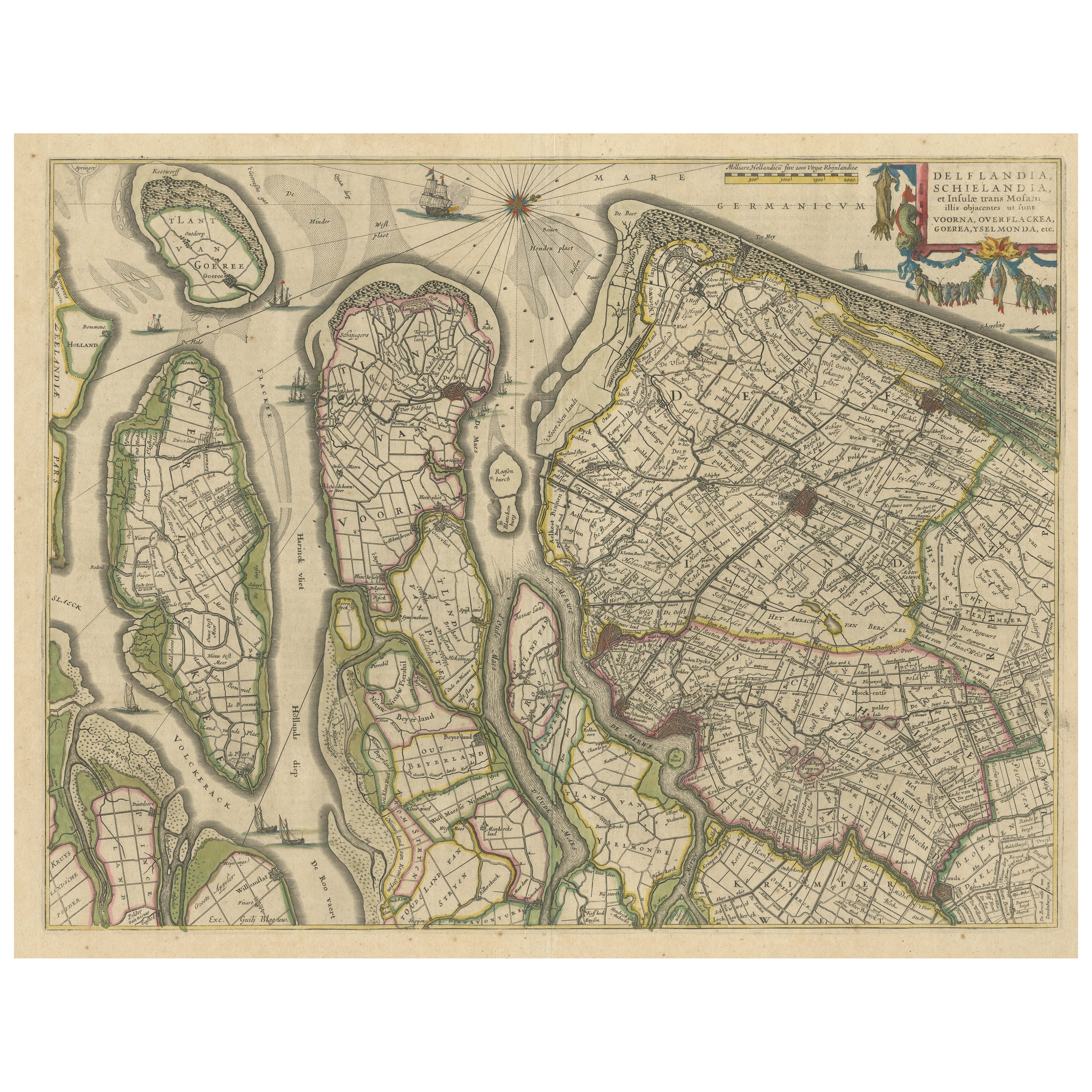
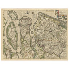
Antique Map of Delfland and Schieland by Hondius, c.1630
About the Item
Antique map titled ‘Novissima Delflandiae, Schielandiae et circumiacentium insularum ut Voornae, Overflackeae, Goereae, Iselmondae (..)’. Engraving of Delfland and Schieland. Designed by the cartographer Balthasar Florisz. Van Berckenrode.
Artists and Engravers: Henricus Hondius II or Hendrik Hondius the Younger (1597 – 16 August 1651) was a Dutch engraver, cartographer and publisher. He was born in Amsterdam, the son of the famous cartographer Jodocus Hondius who had started a map-making business in the city. Henricus obtained the original plates of the Mercator 1569 world map, and published a 1606 version of it. After his father died in 1612 Henricus co-ran the business with his brother-in-law. In 1621 opened his own company in his hometown. The first time his name was mentioned in an atlas was in 1623 when he published the fifth edition of the Mercator-Hondius atlas. After 1628 Henricus partnered with the cartographer Jan Janssonius and together they continued the business.
Condition: Good. General age-related toning. Some marginal tears. French text on verso. Please study image carefully.
Date: c.1730
Overall size: 57.5 x 47 cm.
Image size: 55.5 x 45 cm.
- Dimensions:Height: 18.51 in (47 cm)Width: 22.64 in (57.5 cm)Depth: 0 in (0.01 mm)
- Materials and Techniques:
- Period:
- Date of Manufacture:circa 1630
- Condition:
- Seller Location:Langweer, NL
- Reference Number:
About the Seller
5.0
Platinum Seller
These expertly vetted sellers are 1stDibs' most experienced sellers and are rated highest by our customers.
Established in 2009
1stDibs seller since 2017
1,933 sales on 1stDibs
Typical response time: <1 hour
- ShippingRetrieving quote...Ships From: Langweer, Netherlands
- Return PolicyA return for this item may be initiated within 14 days of delivery.
More From This SellerView All
- Antique Map of Delfland, Schieland and Islands of Zuid-Holland, the NetherlandsLocated in Langweer, NLAntique map titled 'Delflandia, Schielandia, et Insulae (..)'. Original antique map of Delfland, Schieland and islands of Zuid-Holland, the Netherlands. The 'Zuid-Hollandse Eilanden'...Category
Antique Mid-17th Century Maps
MaterialsPaper
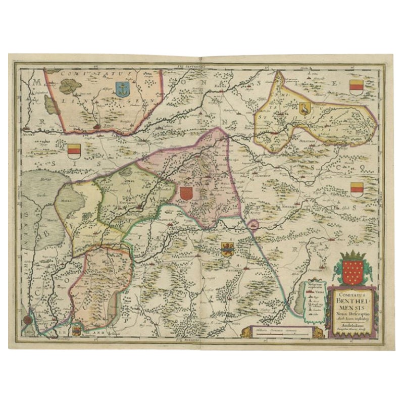
- Antique Map of the County of Bentheim by Hondius, c.1630Located in Langweer, NLAntique map titled 'Comitatus Bentheimensis nova descriptio'. Engraved map of the County of Bentheim, showing Linge, Enschede, Bad Bentheim, Coevorden, Ne...Category
Antique 17th Century Maps
MaterialsPaper
- Antique Map of the Region of Beauvais by Hondius, circa 1630Located in Langweer, NLAntique map titled 'Beauvaisis - Comitatus Belovacium'. Old map of the region of Beauvais, France. This map originates from a composite atlas and is signed by J. Hondius.Category
Antique Mid-17th Century Maps
MaterialsPaper
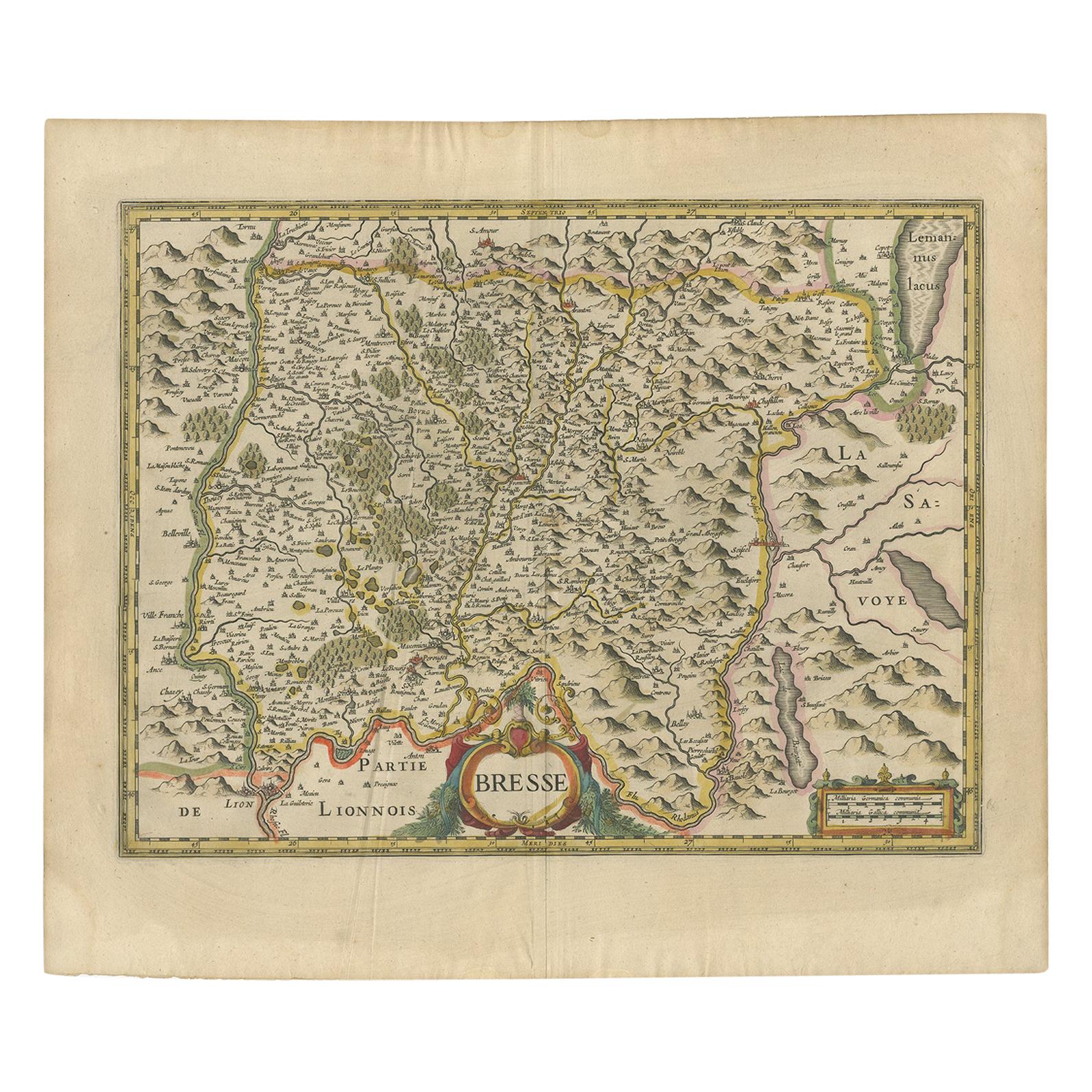
- Antique Map of the Region of Bresse by Hondius, circa 1630Located in Langweer, NLAntique map titled 'Bresse'. Old map of the former region of Bresse, France. It is located in the regions of Auvergne-Rhône-Alpes and Bourgogne-Franche-Comté of eastern France. This ...Category
Antique Mid-17th Century Maps
MaterialsPaper
- Antique Map of the Region of Lyon by Hondius, circa 1630Located in Langweer, NLAntique map titled 'Lionnois, Forest et Beauiolois'. Old map of the former region of Lyon, Vienne, Bresse, Rohan and the Rhône River. This map originates f...Category
Antique Mid-17th Century Maps
MaterialsPaper
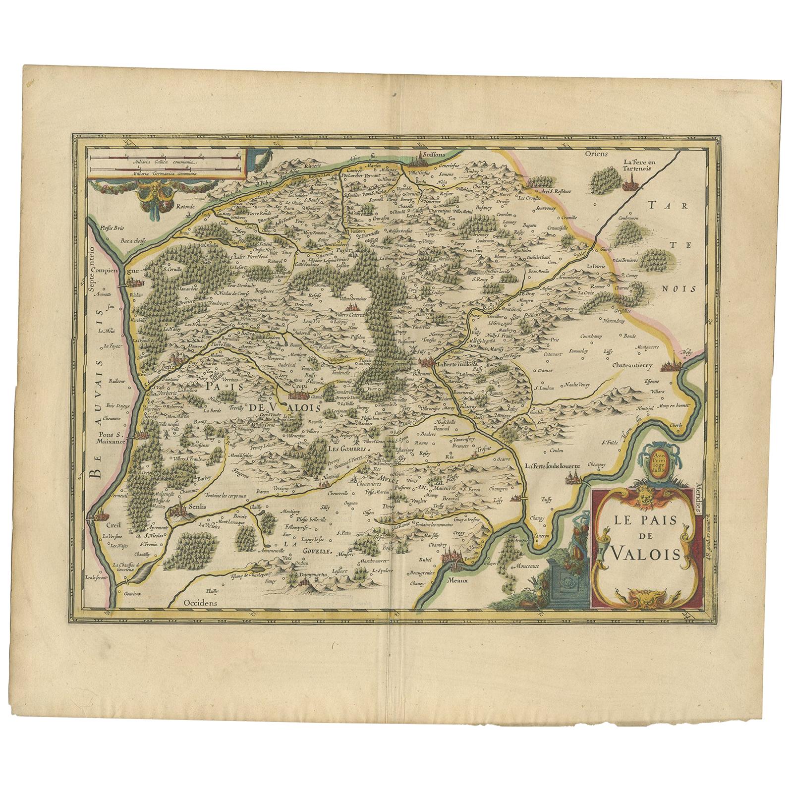
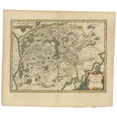
- Antique Map of the Region of Valois by Hondius, circa 1630Located in Langweer, NLAntique map titled 'Le Pais de Valois'. Old map of the historic region of Valois, France. It corresponds to the southeastern quarter of the modern département of Oise, with an adjace...Category
Antique Mid-17th Century Maps
MaterialsPaper


You May Also Like
- Antique 1630 Colored Belgium Map Flandria Gallica Flanders Henricus HondiusLocated in Dayton, OH"Antique hand colored map of Flanders, Belgium, circa 1630, engraved by Henricus Hondius. “Henricus Hondius II (1597 – 16 August 1651) was a Dutch eng...Category
Antique Early 17th Century Renaissance Maps
MaterialsPaper
- 17th Century Hand-Colored Map of Southeastern England by Mercator and HondiusBy Gerard MercatorLocated in Alamo, CAA 17th century copperplate hand-colored map entitled "The Sixt Table of England" by Gerard Mercator and Jodocus Hondius, published in Amsterdam in 1635 in 'Cosmographicall Descriptio...Category
Antique Mid-17th Century Dutch Maps
MaterialsPaper
- 17th Century Hand-Colored Map of Valencia and Murcia, Spain by Mercator/HondiusBy Gerard MercatorLocated in Alamo, CAA 17th century hand-colored map entitled "Regni Valentiae Typus, Valentia and Murcia" by Gerard Mercator and Joducus Hondius, published in Amsterdam in 1635 in 'Cosmographicall Descr...Category
Antique Mid-17th Century Dutch Maps
MaterialsPaper
- Southeastern Ireland: A 17th Century Hand Colored Map by Mercator and HondiusBy Gerard MercatorLocated in Alamo, CAA 17th century copperplate hand-colored map entitled "The Second Table of Ireland, Udrone" by Gerard Mercator and Jodocus Hondius, published in Amsterdam in 1635 in 'Cosmographicall ...Category
Antique Mid-17th Century Dutch Maps
MaterialsPaper
- 17th Century Hand-Colored Map of West Africa by Mercator/HondiusLocated in Alamo, CAA 17th century hand-colored map entitled "Guineae Nova Descriptio" by Gerard Mercator and Jodocus Hondius, published in their 'Atlas Minor' in Amsterdam in 1635. It is focused on the...Category
Antique Mid-17th Century Dutch Maps
MaterialsPaper
- Framed Mercator Hondius Hispania Nova Atlas Minor MapLocated in Stamford, CTFramed colored example of this decorative and important minature map. Newly framed in brown wood frame with gold trim. Mercator Hondius “Atlas Minor” pu...Category
Antique 17th Century Dutch Spanish Colonial Maps
MaterialsGlass, Wood, Paper


