Items Similar to Antique Map of Delfland, Schieland and Islands of Zuid-Holland, the Netherlands

Want more images or videos?
Request additional images or videos from the seller
1 of 6
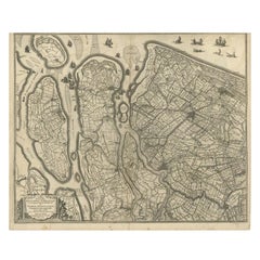
Antique Map of Delfland, Schieland and Islands of Zuid-Holland, the Netherlands
About the Item
Antique map titled 'Delflandia, Schielandia, et Insulae (..)'. Original antique map of Delfland, Schieland and islands of Zuid-Holland, the Netherlands. The 'Zuid-Hollandse Eilanden' include Rozenburg, IJsselmonde, Goeree, Overflakke and others. Published by W. Blaeu, circa 1635.
Willem Janszoon Blaeu (1571-1638) was a prominent Dutch geographer and publisher. Born the son of a herring merchant, Blaeu chose not fish but mathematics and astronomy for his focus. He studied with the famous Danish astronomer Tycho Brahe, with whom he honed his instrument and globe making skills. Blaeu set up shop in Amsterdam, where he sold instruments and globes, published maps, and edited the works of intellectuals like Descartes and Hugo Grotius. In 1635, he released his atlas, Theatrum Orbis Terrarum, sive, Atlas novus.
- Dimensions:Height: 19.49 in (49.5 cm)Width: 23.12 in (58.7 cm)Depth: 0.02 in (0.5 mm)
- Materials and Techniques:
- Period:Mid-17th Century
- Date of Manufacture:c.1635
- Condition:Original/contemporary hand coloring. Original folding line. Shows some wear and soiling. Light staining in margins. French text on verso. Please study image carefully.
- Seller Location:Langweer, NL
- Reference Number:
About the Seller
5.0
Platinum Seller
These expertly vetted sellers are 1stDibs' most experienced sellers and are rated highest by our customers.
Established in 2009
1stDibs seller since 2017
1,933 sales on 1stDibs
Typical response time: <1 hour
- ShippingRetrieving quote...Ships From: Langweer, Netherlands
- Return PolicyA return for this item may be initiated within 14 days of delivery.
More From This SellerView All
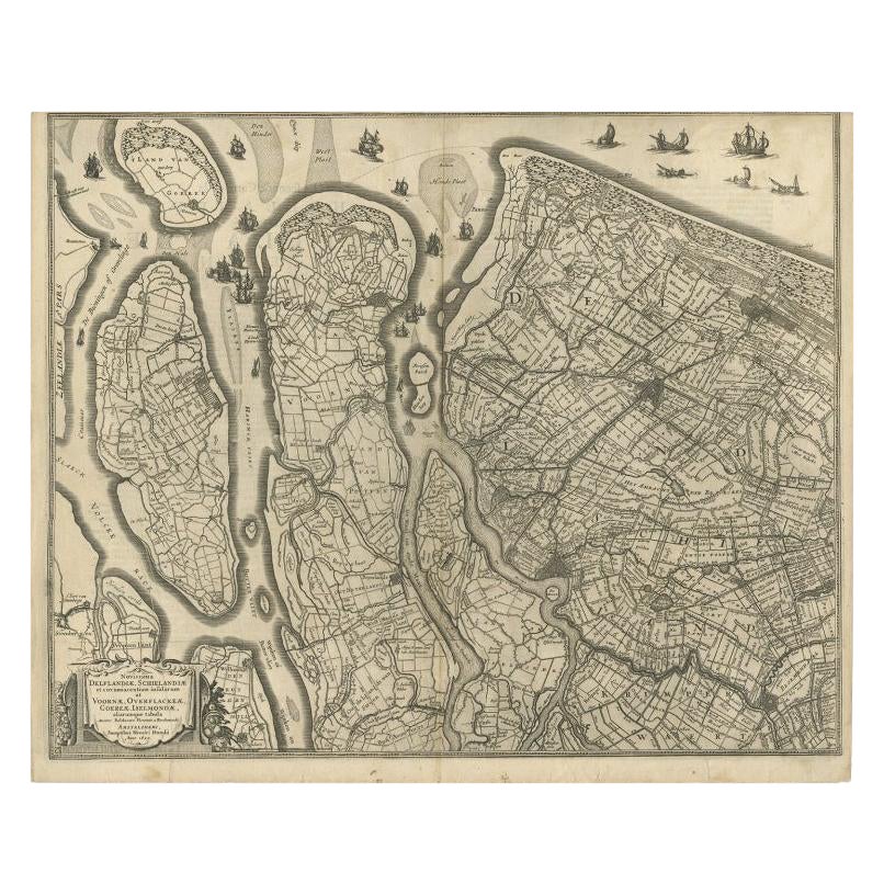
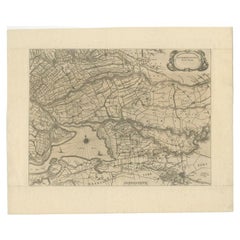
- Antique Map of Delfland and Schieland by Hondius, c.1630Located in Langweer, NLAntique map titled ‘Novissima Delflandiae, Schielandiae et circumiacentium insularum ut Voornae, Overflackeae, Goereae, Iselmondae (..)’. Engraving of Delfland and Schieland. Designe...Category
Antique 17th Century Maps
MaterialsPaper
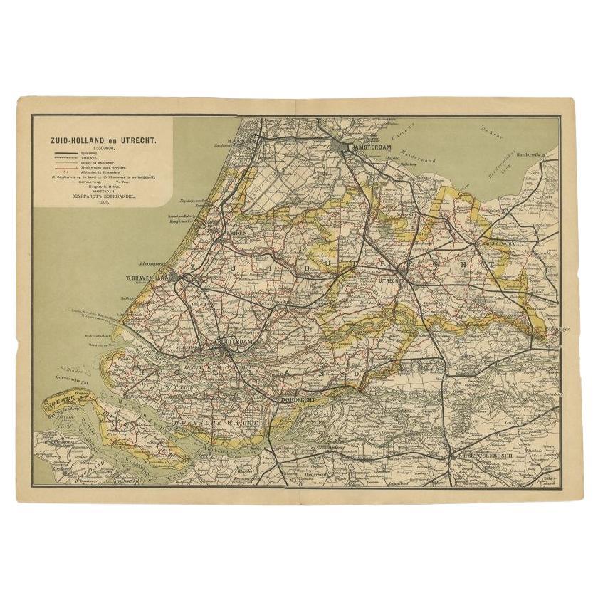
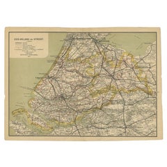
- Antique Map of Zuid-Holland and Utrecht in The Netherlands, 1902Located in Langweer, NLAntique map titled 'Zuid-Holland en Utrecht'. Lithographed map of the provinces of Zuid-Holland and Utrecht, the Netherlands. This map originates from 'Atlas van Nederland'. Artist...Category
20th Century Maps
MaterialsPaper
- Original Antique Map of Zuid-Holland in the Netherlands by Blaeu, C.1645Located in Langweer, NLAntique map titled 'Zuydhollandia stricte sumta'. Old map of the province of Zuid-Holland, the Netherlands. This map originates from 'Theatrum Orbis Terrarum (..)'. Artists and E...Category
Antique 17th Century Maps
MaterialsPaper
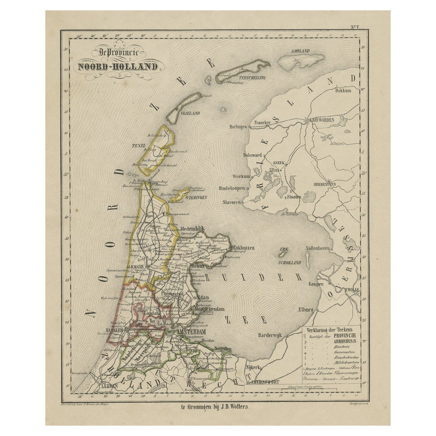
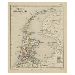
- Antique Map of Noord-Holland and the Island Texel in The Netherlands, c.1870Located in Langweer, NLAntique map titled 'De Provincie Noord-Holland'. Map of the province of Noord-Holland, the Netherlands. This map originates from 'F. C. Brugsma's Atlas van het Koninkrijk der Nederla...Category
Antique 19th Century Maps
MaterialsPaper
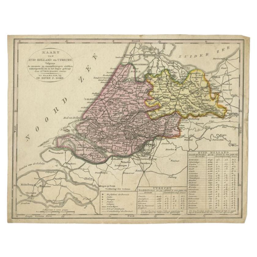
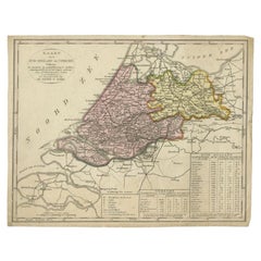
- Antique Map of the Province of Zuid-Holland and Utrecht by Veelwaard, c.1840Located in Langweer, NLAntique map titled 'Kaart van Zuid-Holland en Utrecht (..).' Uncommon map showing the province of Zuid-Holland and Utrecht in the Netherlands. Source unknown, to be determined. Ar...Category
Antique 19th Century Maps
MaterialsPaper
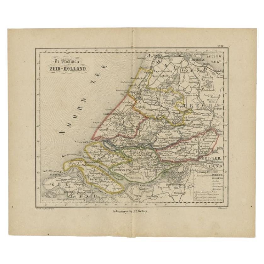
- Original Antique Map of Zuid-Holland by Brugsma, 1864Located in Langweer, NLAntique map titled 'De Provincie Zuid-Holland'. Map of the province of Zuid-Holland, the Netherlands. This map originates from 'F. C. Brugsma's Atlas van het Koninkrijk der Nederland...Category
Antique 19th Century Maps
MaterialsPaper

You May Also Like
- 1854 Map of Massachusetts, Connecticut and Rhode Island, Antique Wall MapLocated in Colorado Springs, COThis striking wall map was published in 1854 by Ensign, Bridgman & Fanning and has both full original hand-coloring and original hardware. This impression is both informative and highly decorative. The states are divided into counties, outlined in red, green, and black, and subdivided into towns. Roads, canals, and railroad lines are prominently depicted, although they are not all labeled. The mapmakers also marked lighthouses, banks, churches, and prominent buildings, with a key at right. The map is an informative and comprehensive overview of the infrastructural development of New England prior to the Civil War. Physical geographies depicted include elevation, conveyed with hachure marks, rivers and lakes. The impression features an inset map of Boston...Category
Antique 19th Century American Maps
MaterialsPaper
- Original Antique Map of The Netherlands, Sherwood, Neely & Jones, Dated 1809Located in St Annes, LancashireGreat map of The Netherlands Copper-plate engraving by Cooper Published by Sherwood, Neely & Jones. Dated 1809 Unframed.Category
Antique Early 1800s English Maps
MaterialsPaper
- Original Antique Map of The Netherlands, Engraved by Barlow, Dated 1807Located in St Annes, LancashireGreat map of Netherlands Copper-plate engraving by Barlow Published by Brightly & Kinnersly, Bungay, Suffolk. Dated 1807 Unframed.Category
Antique Early 1800s English Maps
MaterialsPaper
- Large Original Antique Map of Rhode Island, USA, C.1900Located in St Annes, LancashireFabulous map of Rhode Island Original color Engraved and printed by the George F. Cram Company, Indianapolis. Published, C.1900 Unframed Free ...Category
Antique 1890s American Maps
MaterialsPaper
- 1752 Vaugoundy Map of Flanders : Belgium, France, and the Netherlands, Ric.a002Located in Norton, MALarge Vaugoundy Map of Flanders: Belgium, France, and the Netherlands Colored -1752 Ric.a002 Description: This is a 1752 Didier Robert de Vaugondy map of Flanders. The map de...Category
Antique 17th Century Unknown Maps
MaterialsPaper
- Large Original Vintage Map of The Pacific Islands Including HawaiiLocated in St Annes, LancashireGreat map of The Pacific Islands Unframed Original color By John Bartholomew and Co. Edinburgh Geographical Institute Published, circa 1...Category
Vintage 1920s British Maps
MaterialsPaper


Recently Viewed
View AllMore Ways To Browse
Map Of Charlevoix
Antique Map Of Shanghai
Britton And Rey Lithograph
Map Of German
Map Of The Netherlands
Italian Maps
Antique Old World Maps
St Thomas Cross
Antique Map Copenhagen
Antique Detroit Map
Antique Map Of Detroit
Ethiopia Antique Map
Maps Balkans
Antique Maine Map
Antique Maine Maps
Antique Map Louisiana
Maps Oregon
Antique Louisiana Map