Henricus Hondius
3
to
10
63
30
91
85
31
22
21
17
10
6
4
3
2
2
2
1
1
1
1
1
1
1
1
1
30
11
3
1
1
Sort By
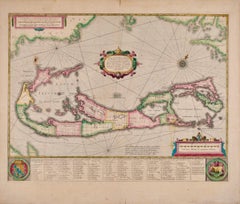
Bermuda: An Early 17th Century Hand-colored Map by Henricus Hondius
By Henricus Hondius
Located in Alamo, CA
This attractive and interesting map of Bermuda by Henricus Hondius in 1633 is entitled "Mappa
Category
Early 17th Century Old Masters Landscape Prints
Materials
Engraving
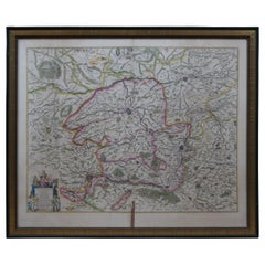
Antique 1630 Colored Belgium Map Flandria Gallica Flanders Henricus Hondius
Located in Dayton, OH
"Antique hand colored map of Flanders, Belgium, circa 1630, engraved by Henricus Hondius. “Henricus
Category
Antique Early 17th Century Renaissance Maps
Materials
Paper
H 20 in W 0.625 in D 23.375 in
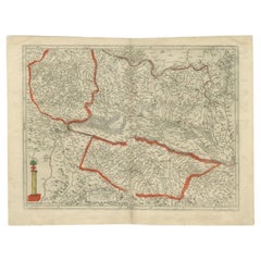
Antique Map of the Alsace Region of France by Hondius, c.1630
Located in Langweer, NL
. Artists and Engravers: Published by H. Hondius. Henricus Hondius (1597-1651) was a Dutch engraver and
Category
Antique 17th Century Maps
Materials
Paper
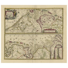
Antique Engraving of Dutch and German North Sea Coast of Friesland, ca.1680
Located in Langweer, NL
Hamburg. With title and a scale cartouche. Map by Henricus Hondius, first published by J. Janssonius (1634
Category
Antique 1680s Maps
Materials
Paper
No Reserve
H 23.43 in W 27.96 in D 0 in
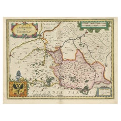
Decorative Antique Map of the Region of Cambrai, France, ca.1630
Located in Langweer, NL
. Includes the cities of Cambrai, Valencienes, Douai, and Bouchain.
Artists and Engravers: Henricus
Category
Antique 1630s Maps
Materials
Paper
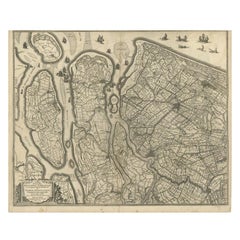
Antique Map of Delfland and Schieland by Hondius, c.1630
Located in Langweer, NL
Balthasar Florisz. Van Berckenrode.
Artists and Engravers: Henricus Hondius II or Hendrik Hondius the
Category
Antique 17th Century Maps
Materials
Paper
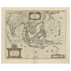
Old Antique Map of the East Indies and Southeast Asia, ca.1644
Located in Langweer, NL
New Guinea/Australia in the East. This map is dedicated to D. Christophorus Thisius by Henricus
Category
Antique 1640s Maps
Materials
Paper
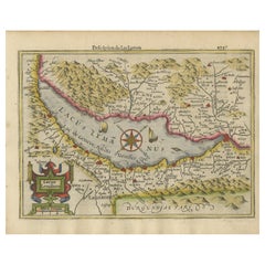
Beautiful Original Copper Engraved Map of Lake Geneva in Switzerland, 1613
Located in Langweer, NL
in the lake. Originates from 'Atlas Minor'.
Artists and Engravers: Henricus Hondius II or Hendrik
Category
Antique 1610s Maps
Materials
Paper
Antique Map of the Lower Alsace Region of France by Mapmaker Hondius, c.1630
Located in Langweer, NL
and Engravers: Published by H. Hondius. Henricus Hondius (1597-1651) was a Dutch engraver and mapmaker
Category
Antique 17th Century Maps
Materials
Paper
H 16.34 in W 21.26 in D 0 in
Original Antique Hand-Colored Map of The East Indies and Southeast Asia, c.1644
Located in Langweer, NL
by Henricus Hondius. Published by J. Janssonius, c.1644.
Artists and Engravers: Johannes
Category
Antique 1640s Maps
Materials
Paper
H 19.69 in W 23.23 in D 0 in
Original Antique Map of the English counties Cornwall, Devon, Dorset, etc, 1633
Located in Langweer, NL
Henricus Hondius and Jan Jansson under the title: 'Atlas: das ist Abbildung der gantzen Welt, mit allen
Category
Antique 1630s Maps
Materials
Paper
H 16.15 in W 21.26 in D 0 in
Original Old Map of South East England Incl London, Oxford, Cambridge, Etc, 1633
Located in Langweer, NL
, published by Henricus Hondius and Jan Jansson under the title: 'Atlas: das ist Abbildung der gantzen Welt
Category
Antique 1630s Maps
Materials
Paper
H 16.15 in W 21.26 in D 0 in
Antique Map of Northern Ireland by Mercator/Hondius, Early 1600's
Located in Langweer, NL
. Latin text on verso.
Henricus Hondius (1597-1651) was a Dutch engraver and mapmaker, a member of a
Category
Antique 16th Century Maps
Materials
Paper
Old Eastern Balkans Map, with Dalmatia, Croatia, Slavonia, Bosnia, Serbia, 1633
Located in Langweer, NL
edition of the Mercator-Hondius Atlas Major, published by Henricus Hondius and Jan Jansson under the title
Category
Antique 1630s Maps
Materials
Paper
H 16.15 in W 20.87 in D 0 in
Antique Map of Friesland, The Netherlands, 1638
Located in Langweer, NL
. First state, originating from 'Atlantis novi pars secunda' published 1638.
Artist: Henricus Hondius
Category
Antique 17th Century Maps
Materials
Paper
Antique Map of the Holy Land, showing the travels of Abraham, Isaac and Jacob
Located in Langweer, NL
Hondius died in 1612, Henricus took over publication; Janssonius joined the venture in 1633. Eventually
Category
Antique Mid-17th Century Maps
Materials
Paper
No Reserve
H 20.2 in W 23.9 in D 0.02 in
Antique Hand-colored Map of Brandenburg, Germany
Located in Langweer, NL
the 1630s, Janssonius worked with his brother-in-law, Henricus Hondius. Their most successful venture
Category
Antique Mid-17th Century Maps
Materials
Paper
Antique Map of the Duchy of Lüneburg, Lower Saxony, Germany
Located in Langweer, NL
worked with his brother-in-law, Henricus Hondius. Their most successful venture was to reissue the
Category
Antique Mid-17th Century Maps
Materials
Paper
Antique Map of the Region of Cambrai in France, c.1630
Located in Langweer, NL
. Includes the cities of Cambrai, Valencienes, Douai, and Bouchain.
Artists and Engravers: Henricus Hondius
Category
Antique 17th Century Maps
Materials
Paper
Antique Map of the East Indies by Janssonius, c.1644
By Johannes Janssonius
Located in Langweer, NL
New Guinea/Australia in the East. This map is dedicated to D. Christophorus Thisius by Henricus
Category
Antique 17th Century Maps
Materials
Paper
Original Antique Map of the East Indies (Indonesia) by Janssonius, c.1644
By Johannes Janssonius
Located in Langweer, NL
New Guinea/Australia in the East. This map is dedicated to D. Christophorus Thisius by Henricus
Category
Antique 17th Century Maps
Materials
Paper
H 18.51 in W 23.43 in D 0 in
1633 Map Entitled "Beauvaisis Comitatus Belova Cium, Ric.0002
Located in Norton, MA
: Cartographer : - Hondius, Henricus 1587-1638
Artists and Engravers:Jodocus Hondius, one of the most
Category
Antique 17th Century Dutch Maps
Materials
Paper
"Nova Barbariae Descriptio", a 17th Century Hand-Colored Map of North Africa
By Johannes Janssonius
Located in Alamo, CA
and map publishing business with his brother-in-law Henricus Hondius. In addition to their own maps
Category
Antique Mid-17th Century Dutch Maps
Materials
Paper
H 22.38 in W 29 in D 0.13 in
Original Antique Bird's Eye View Plan of Hoorn, The Netherlands by Blaeu, c.1700
Located in Langweer, NL
formed a partnership with his brother in law Henricus Hondius, and together they published atlases as
Category
Antique Early 1700s Maps
Materials
Paper
H 17.92 in W 22.52 in D 0 in
Original Antique Engraving of a Sea Chart of the Western Mediterranean, ca.1650
Located in Langweer, NL
Henricus Hondius, and together they published atlases as Mercator/Hondius/Janssonius. Under the leadership
Category
Antique 1650s Maps
Materials
Paper
No Reserve
H 18.71 in W 22.64 in D 0 in
A Hand Colored 17th Century Janssonius Map of Prussia: Poland, N. Germany, etc.
By Johannes Janssonius
Located in Alamo, CA
the book and map publishing business with his brother-in-law Henricus Hondius. In addition to their
Category
Mid-17th Century Old Masters Landscape Prints
Materials
Engraving
17th Century Hand-Colored Map of a Region in West Germany by Janssonius
By Johannes Janssonius
Located in Alamo, CA
Henricus Hondius. In addition to their own maps, they published several editions of the famous Mercator
Category
Antique Mid-17th Century Dutch Maps
Materials
Paper
West Germany: Original Hand Colored 17th Century Map by Johannes Janssonius
By Johannes Janssonius
Located in Alamo, CA
with his brother-in-law Henricus Hondius and published more editions of the Mercator/Hondius atlases
Category
Mid-17th Century Old Masters More Prints
Materials
Engraving
Prussia, Poland, N. Germany, Etc: A Hand-colored 17th Century Map by Janssonius
By Johannes Janssonius
Located in Alamo, CA
the book and map publishing business with his brother-in-law Henricus Hondius. In addition to their
Category
Antique Mid-17th Century Dutch Maps
Materials
Paper
H 21.25 in W 24.63 in D 0.07 in
Old Map of Ancient Times covering Egypt Towards Arabia and India to Java, c.1660
Located in Langweer, NL
, Geneva and Lyon. In the 1630s he formed a partnership with his brother in law Henricus Hondius, and
Category
Antique 1660s Maps
Materials
Paper
H 19.49 in W 22.45 in D 0 in
North & South America: A 17th Century Hand-colored Map by Jansson & Goos
By Johannes Jansson
Located in Alamo, CA
) was born in Arnhem, Holland. His father was a printer and bookseller. In 1612 he married a Hondius
Category
1620s Landscape Prints
Materials
Engraving
North & South America: A 17th Century Hand-colored Map by Jansson & Goos
By Johannes Janssonius
Located in Alamo, CA
) was born in Arnhem, Holland. His father was a printer and bookseller. In 1612 he married a Hondius
Category
Antique 1620s Dutch Maps
Materials
Paper
West Africa: A 17th Century Hand-Colored Map by Mercator/Hondius
By Gerard Mercator
Located in Alamo, CA
Hondius, published in their 'Atlas Minor' in Amsterdam in 1635. It is focused on the modern day African
Category
1630s Landscape Prints
Materials
Engraving
17th Century Hand-Colored Map of West Africa by Mercator/Hondius
Located in Alamo, CA
Hondius, published in their 'Atlas Minor' in Amsterdam in 1635. It is focused on the modern day African
Category
Antique Mid-17th Century Dutch Maps
Materials
Paper
Rugen Island, Germany: An Early 17th Century Map by Mercator and Hondius
By Gerard Mercator
Located in Alamo, CA
" (Map of Rugen Island, Germany) by Gerard Mercator and Henricus and Joducus Hondius, published in
Category
Early 17th Century Old Masters Landscape Prints
Materials
Engraving
Southeastern Ireland: A 17th Century Hand Colored Map by Mercator and Hondius
By Gerard Mercator
Located in Alamo, CA
his sons Jodocus II and Henricus, who published the English edition of the Mercator and Hondius Atlas
Category
1630s Landscape Prints
Materials
Engraving
Southeastern Ireland: A 17th Century Hand Colored Map by Mercator and Hondius
By Gerard Mercator
Located in Alamo, CA
Gerard Mercator and Jodocus Hondius, published in Amsterdam in 1635 in 'Cosmographicall Description of
Category
Antique Mid-17th Century Dutch Maps
Materials
Paper
H 12 in W 14 in D 0.13 in
1627 Hondius Map "La Principaute d'Orange et Comtat de Ve", Ric.0003
Located in Norton, MA
reveals that it was published by both Hondius brothers, Jodocus and Henricus, and the inscription in the
Category
Antique 17th Century Unknown Maps
Materials
Paper
17th Century Hand-Colored Map of Valencia and Murcia, Spain by Mercator/Hondius
By Gerard Mercator
Located in Alamo, CA
his sons Jodocus II and Henricus, who published the English edition of the Mercator and Hondius Atlas
Category
Antique Mid-17th Century Dutch Maps
Materials
Paper
H 12 in W 16 in D 0.13 in
Original Very Old Hand-Colored Map of Limousin or Limoges, France, ca.1600
Located in Langweer, NL
century Dutch map publishing family. Hondius, along with sons Jodocus II and Henricus and son-in-law Jan
Category
Antique Early 1600s Maps
Materials
Paper
H 15.75 in W 21.07 in D 0 in
Early Antique Map of the Dutch Provinces of Friesland and Groningen, 1604
Located in Langweer, NL
sive cosmographicae meditationes …', by Jodocus Hondius, published after 1604.
Artists and Engravers
Category
Antique Early 1600s Maps
Materials
Paper
H 16.93 in W 21.07 in D 0 in
Old Map of the Dutch Provinces of Friesland and Groningen, The Netherlands, 1604
Located in Langweer, NL
Hondius acquired the plates and published several editions together with his sons Jodocus II and Henricus
Category
Antique Early 1600s Maps
Materials
Paper
H 17.05 in W 21.15 in D 0 in
Original Antique Map the Imperial States of the Habsburg Netherlands, 1609
Located in Langweer, NL
(French Flanders and French Hainaut) and Pas-de-Calais (Artois). Originates from the Mercator-Hondius
Category
Antique Early 1600s Maps
Materials
Paper
H 20.08 in W 25.2 in D 0 in
1585 Mercator Map of Ireland, Entitled "Irlandiae Regnvm, " Hand Colored Ric0006
Located in Norton, MA
Hondius who, with his sons, Jodocus II and Henricus, published enlarged editions which dominated the map
Category
Antique 16th Century Dutch Maps
Materials
Paper
H 18.51 in W 22.84 in D 0.4 in
One of the Earliest Maps of Gelderland and Overijssel in the Netherlands, 1623
Located in Langweer, NL
of all three parts was published 1602. 1604 Jodocus Hondius acquired the plates and published several
Category
Antique 1620s Maps
Materials
Paper
H 18.31 in W 22.05 in D 0 in
1590 Mercator Map Entitled "France Picardie Champaigne, Ric.0001
Located in Norton, MA
bought in 1604 by Jodocus Hondius who, with his sons, Jodocus II and Henricus, published enlarged
Category
Antique 16th Century Dutch Maps
Materials
Paper
Old Map of the Bourbonnais Region of France, ca.1630
Located in Langweer, NL
edition of all three parts was published 1602. 1604 Jodocus Hondius acquired the plates and published
Category
Antique 1630s Maps
Materials
Paper
Early Antique Map of Gelderland and Overijssel in the Netherlands, c.1625
Located in Langweer, NL
of all three parts was published 1602. 1604 Jodocus Hondius acquired the plates and published several
Category
Antique 17th Century Maps
Materials
Paper
H 15.75 in W 21.46 in D 0 in
Antique Map of The Dutch Provinces of Gelderland and Overijssel, 1623
Located in Langweer, NL
of all three parts was published 1602. 1604 Jodocus Hondius acquired the plates and published several
Category
Antique 17th Century Maps
Materials
Paper
1625 Mercator Map of the Provenience of Quercy, "Quercy Cadvrcivm Ric.0013
Located in Norton, MA
was published 1602. 1604 Jodocus Hondius acquired the plates and published several edition together
Category
Antique 17th Century French Maps
Materials
Paper
H 18.9 in W 22.45 in D 0.4 in
Old Decorative Map of the West African Coast & St. Thomae Island, c.1600
Located in Langweer, NL
plates were bought in 1604 by Jodocus Hondius who, with his sons, Jodocus II and Henricus, published
Category
Antique Early 1600s Maps
Materials
Paper
H 15.63 in W 20.48 in D 0 in
Antique Map of the French Province of Quercy, ca.1625
Located in Langweer, NL
son Rumold. A second edition of all three parts was published 1602. 1604 Jodocus Hondius acquired the
Category
Antique 17th Century Maps
Materials
Paper
Antique Map of the Southern Lorraine Region by Mercator, c.1625
By Gerard Mercator
Located in Langweer, NL
1595 by his son Rumold. A second edition of all three parts was published 1602. 1604 Jodocus Hondius
Category
Antique 17th Century Maps
Materials
Paper
Antique map of Brabant (Brabantiae) by Hondius - Handcol. engraving - 17th c.
By Henricus Hondius
Located in Zeeland, Noord-Brabant
Description: Published in Amsterdam by Henricus Hondius ca. 1629.
Artists and Engravers: Made by
Category
1620s Old Masters More Prints
Materials
Engraving
Ducatus Limburg.
By Hendrik Hondius the Elder
Located in Zeeland, Noord-Brabant
Liege/Luik.
Published in Amsterdam by Henricus Hondius ca. 1636.
Made by Hendrik Hondius after an
Category
1630s More Prints
Materials
Engraving
c 1930 French Table Lamp Made With Old Leather Books, Manner of Jansen
Located in New Orleans, LA
, with label, " Nova Totivs Terrarvm," is copied from a 17th century map by a Dutch cartographer Henricus
Category
Vintage 1930s French Table Lamps
Materials
Leather
Paskaerte van 't in comen Van 't Canaal, hoemen dat sal aen doen, [...].
By Pieter Goos
Located in Zeeland, Noord-Brabant
Atlas ofte Water-Weereld, a highly regarded maritime atlas. His father Abraham Goos worked with Henricus
Category
17th Century More Prints
Materials
Engraving
Trasisalania vulgo Overyssel.
Located in Zeeland, Noord-Brabant
, Geneva and Lyon. In the 1630s he formed a partnership with his brother in law Henricus Hondius, and
Category
Mid-17th Century More Prints
Materials
Engraving, Etching
Ducatus Gelriae pars quarta quae est Arnhemiensis, sive Velavia.
By Johannes Janssonius
Located in Zeeland, Noord-Brabant
1630s he formed a partnership with his brother in law Henricus Hondius, and together they published
Category
Mid-17th Century More Prints
Materials
Engraving, Etching
Tabula Castelli ad Sandflitam, qua simul inundati agri, alluviones, [...].
By Johannes Janssonius
Located in Zeeland, Noord-Brabant
brother in law Henricus Hondius, and together they published atlases as Mercator/Hondius/Janssonius
Category
Mid-17th Century More Prints
Materials
Engraving, Etching
- 1
Get Updated with New Arrivals
Save "Henricus Hondius", and we’ll notify you when there are new listings in this category.
More Ways To Browse
Middle Eastern Antiques
Map Of India
Eastern Germany
Antique Maps Africa
Antique African Map
Antique Africa Map
Antique Africa Maps
Africa Map Antique
Antique African Maps
Ostrich Pair
Java Antiques
Antique India Map
Antique Furniture Northern Ireland
Antique Glass Light Globes
West Indies Antiques
Indonesia Map
Antique Map Compass
Antique County Maps
