Items Similar to Old Decorative Map of the West African Coast & St. Thomae Island, c.1600


Want more images or videos?
Request additional images or videos from the seller
1 of 5
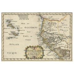
Old Decorative Map of the West African Coast & St. Thomae Island, c.1600
About the Item
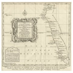
Antique map titled 'Guineae Nova Descriptio.'
This very decorative map shows the West African coast from Senegal (the 'Rio Senega' is the Senegal River) to Cape Lopez on the Gulf of Guinea just below the equator. The island of St. Thomae, which today forms a Portuguese province, is shown in detail in the small inset bottom left. Part of Libya is also depicted. The ocean is rendered in the typical moire style of Mercator, and the several strapwork designs are simple yet imposing. The map is one of six new maps of Africa to be included in Hondius' first edition of Mercator's Atlas.
Artists and engravers: Mercator was born in Rupelmonde in Flanders and studied in Louvain under Gemma Frisius, Dutch writer, astronomer and mathematician. The excellence of his work brought him the patronage of Charles V, but in spite of his favor with the Emperor he was caught up in the persecution of Lutheran protestants and charged with heresy, fortunately without serious consequences. No doubt the fear of further persecution influenced his move in 1552 to Duisburg, where he continued the production of maps, globes and instruments. Mercator's sons and grandsons, were all cartographers and made their contributions in various ways to his atlas. Rumold, in particular, was responsible for the complete edition in 1595. The map plates were bought in 1604 by Jodocus Hondius who, with his sons, Jodocus II and Henricus, published enlarged editions which dominated the map market for the following twenty to thirty years.
- Dimensions:Height: 15.63 in (39.7 cm)Width: 20.48 in (52 cm)Depth: 0 in (0.02 mm)
- Materials and Techniques:
- Period:1600-1609
- Date of Manufacture:circa 1600
- Condition:Wear consistent with age and use. Condition: Good, given age. Very small tear upper middle fold, hardly visible. Light vertical crease left and right of middle fold. A few small unobtrusive creases. Original middle fold as issued. General age-related toning, occasional minor defects.
- Seller Location:Langweer, NL
- Reference Number:
About the Seller
5.0
Platinum Seller
These expertly vetted sellers are 1stDibs' most experienced sellers and are rated highest by our customers.
Established in 2009
1stDibs seller since 2017
1,916 sales on 1stDibs
Typical response time: <1 hour
- ShippingRetrieving quote...Ships From: Langweer, Netherlands
- Return PolicyA return for this item may be initiated within 14 days of delivery.
More From This SellerView All
- Antique Map of the West African Coast and the Cape Verde Islands, c.1680Located in Langweer, NLAntique map Africa titled 'Isles du Cap Verd Coste et Pays des Negres'. Antique map of the coast of Africa and the Cape Verde islands. Artists a...Category
Antique 17th Century Maps
MaterialsPaper
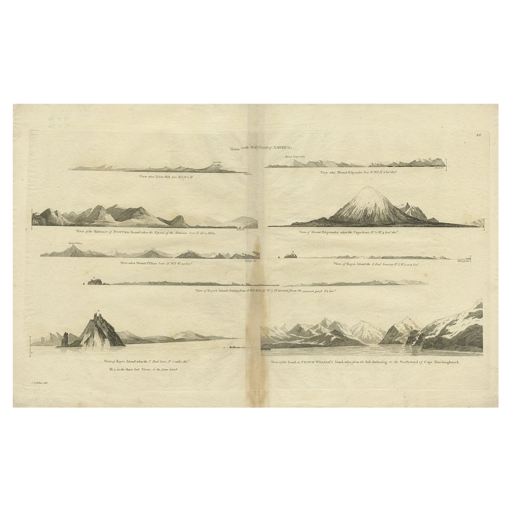
- Antique Map of the West Coast of America with Island Views, ca.1784Located in Langweer, NLAntique print titled 'Views on the West Coast of America (..)'. Coastal views of various islands of the American coast. Originates from an edition of Cook's Voyages. Artists ...Category
Antique 1780s Maps
MaterialsPaper
- Antique Map of the Coast of Africa and the Cape Verde Islands, ca.1680Located in Langweer, NLAntique map Africa titled 'Isles du Cap Verd Coste et Pays des Negres'. Antique map of the coast of Africa and the Cape Verde islands. Artis...Category
Antique 1680s Maps
MaterialsPaper
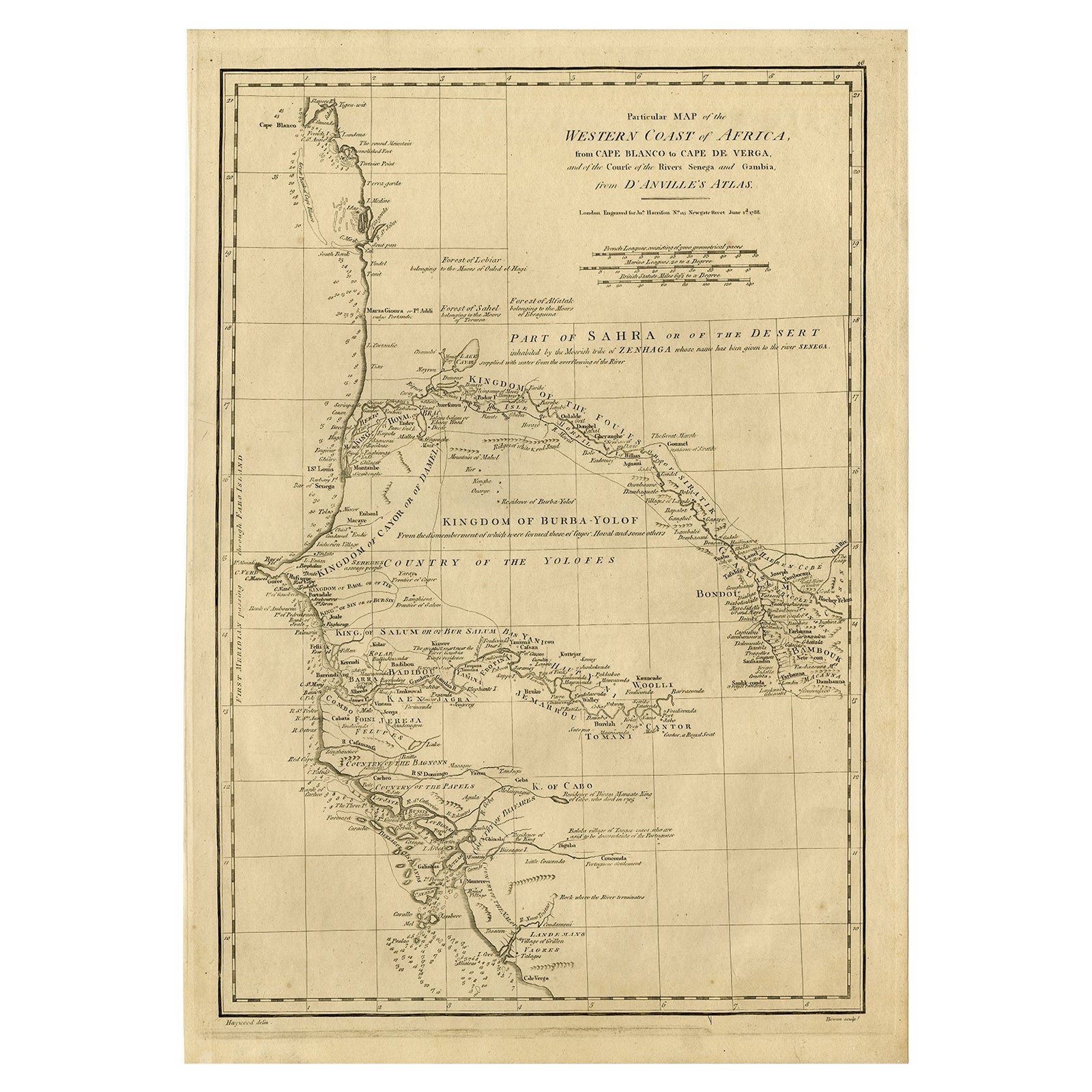
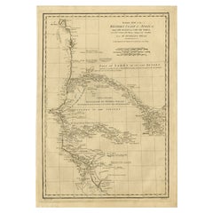
- Map of the West African coast from the North of Mauretania to Guinee, 1788Located in Langweer, NLAntique map titled 'Particular Map of the Western Coast of Africa, from Cape Blanco to Cape de Verga, and of the Course of the Rivers Senega and Gambia.' Map of the African coast...Category
Antique 1780s Maps
MaterialsPaper
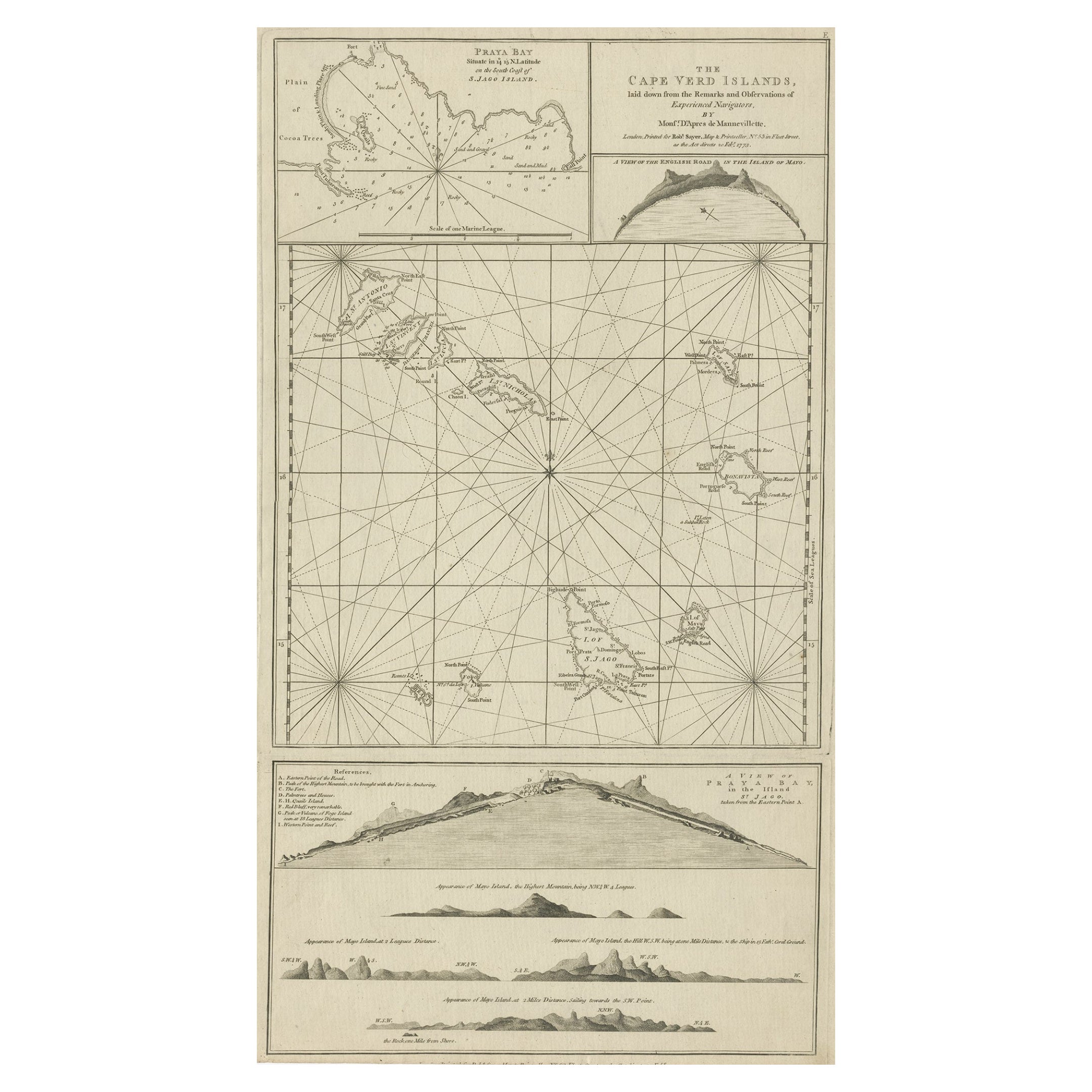
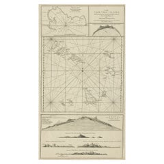
- Map & Views of the Cape Verde Islands, in the Atlantic Ocean, West-Africa, 1775Located in Langweer, NLVarious maps and views on one plate titled 'Praya Bay (..)', 'The Cape Verd Islands (..)' and 'A view of Praya Bay (..)'. Map and views of the Cape Verde islands, in the Atlantic Ocean west of Africa. Printed from two copper plates, published for Robert Sayer...Category
Antique 1770s Maps
MaterialsPaper
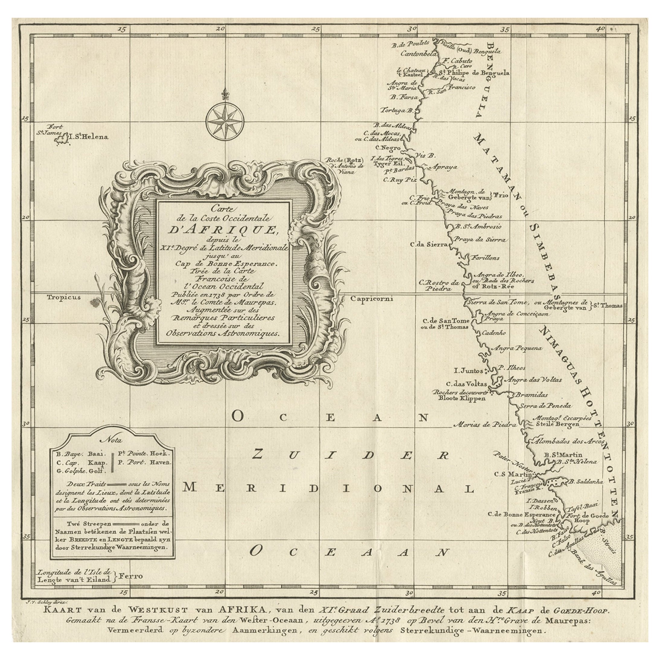
- Dutch Antique Map of the West Coast of Africa, to the Cape of Good Hope, 1747Located in Langweer, NLAntique map of the Coast of Africa titled 'Kaart van de West Kust van Afrika (..)'. Map of the west coast of Africa, from 11 degrees south latitude to the Cape of Good Hope. This...Category
Antique 1740s Maps
MaterialsPaper

You May Also Like
- West Coast of Africa, Guinea & Sierra Leone: An 18th Century Map by BellinBy Jacques-Nicolas BellinLocated in Alamo, CAJacques Bellin's copper-plate map entitled "Partie de la Coste de Guinee Dupuis la Riviere de Sierra Leona Jusquau Cap das Palmas", depicting the coast of Guinea and Sierra Leone in ...Category
Antique Mid-18th Century French Maps
MaterialsPaper
- 17th Century Hand-Colored Map of West Africa by Mercator/HondiusLocated in Alamo, CAA 17th century hand-colored map entitled "Guineae Nova Descriptio" by Gerard Mercator and Jodocus Hondius, published in their 'Atlas Minor' in Amsterdam in 1635. It is focused on the...Category
Antique Mid-17th Century Dutch Maps
MaterialsPaper
- Old Nautical Map of CorsicaLocated in Alessandria, PiemonteST/556/1 - Old map of Corsica isle, surveyed by Captain Hell, of the French Royal Navy in 1824, engraved and published on 1874, with additions and corre...Category
Antique Early 19th Century English Other Prints
MaterialsPaper
- Old Horizontal Map of EnglandBy TassoLocated in Alessandria, PiemonteST/520 - Old rare Italian map of England, dated 1826-1827 - by Girolamo Tasso, editor in Venise, for the atlas of M.r Le-Sage.Category
Antique Early 19th Century Italian Other Prints
MaterialsPaper
- St. Christophe 'St. Kitts' Island: An 18th Century Hand-colored Map by BellinBy Jacques-Nicolas BellinLocated in Alamo, CAJacques Bellin's copper-plate map of the Caribbean island of Saint Kitts entitled "Carte De De l'Isle St. Christophe Pour servir á l'Histoire Genle. des V...Category
Antique Mid-18th Century French Maps
MaterialsPaper
- West Africa Entitled "Guinea Propria": An 18th Century Hand Colored Homann MapBy Johann Baptist HomannLocated in Alamo, CAThis is a scarce richly hand colored copper plate engraved map of Africa entitled "Guinea Propria, nec non Nigritiae vel Terrae Nigrorum Maxima Pars" by Johann Baptist Homann (1664-1...Category
Antique Mid-18th Century German Maps
MaterialsPaper


Recently Viewed
View AllMore Ways To Browse
New West Furniture
Old West Furniture
West African Furniture
St Charles Used Furniture
African Plate
Africa Antique Map
Antique Map Africa
Antique Map Of Africa
Antique Maps Of Africa
Small Antique Globes
Old Antique Globes
Nova Stylings
West African Antiques
Cape Charles
Moire Antique
Antique Ocean Map
Mercator Antique
Cape Dutch