Items Similar to Old Map of the Dutch Provinces of Friesland and Groningen, The Netherlands, 1604
Want more images or videos?
Request additional images or videos from the seller
1 of 5
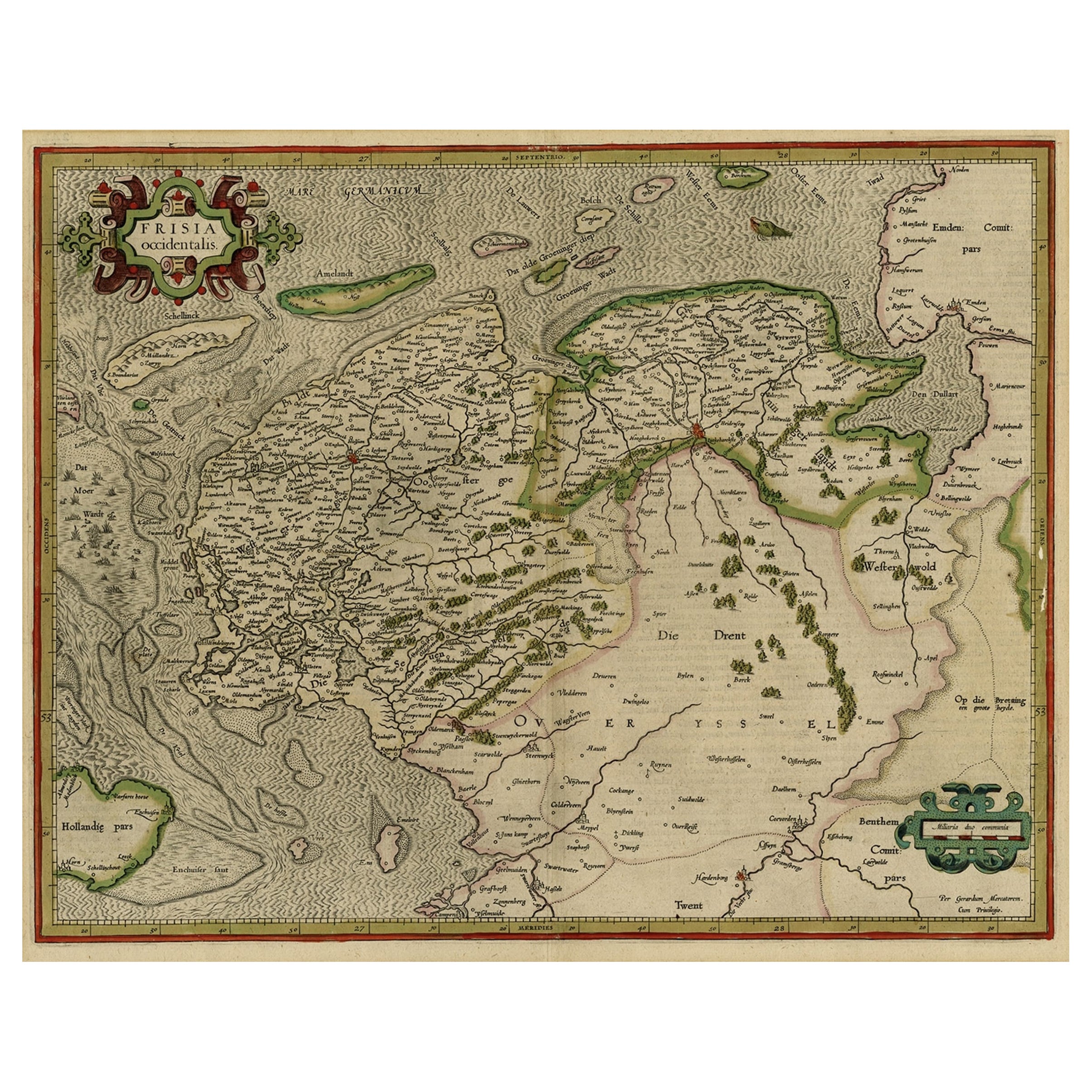
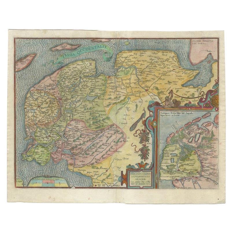
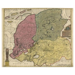
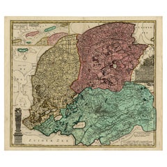
Old Map of the Dutch Provinces of Friesland and Groningen, The Netherlands, 1604
About the Item
Antique print, titled: 'Frisiae Occidentalis.'
Handsome map of the Dutch Provinces of Friesland and Groningen. Embellished with strapwork title-cartouches. Latin tekst on verso. Probably from an early ed. of 'Atlas sive cosmographicae meditationes …', by Jodocus Hondius, published after 1604.
Artists and engravers: Made by 'Gerard Mercator' after an anonymous artist. Engraved by 'Gerard Mercator' and published by Hondius. Gerard Mercator (Kremer) was born in Rupelmonde in Flanders and studied in Louvain. He made his first map in 1537 and became a cartographer and globe maker. In 1552 he moved to Duisburg, Germany where he published his famous 18-sheet world map in 1569 with his own new projection, today called Mercator projection. Later he decided to publish a new edition of Ptolemy's Geographia. Followed by his major work, a 3 volume collection of maps to which the word "Atlas" was applied the first time. The first volume was published 1585, followed by the second in 1589 and the third one after his death in 1595 by his son Rumold. A second edition of all three parts was published 1602. In 1604 Jodocus Hondius acquired the plates and published several editions together with his sons Jodocus II and Henricus until 1633. More editions followed until 1666 by Janssonius who was in partnership with Henricus. Some of the plated where also used in W.J. Blaeu in 1630.
- Dimensions:Height: 17.05 in (43.3 cm)Width: 21.15 in (53.7 cm)Depth: 0 in (0.02 mm)
- Materials and Techniques:
- Period:1600-1609
- Date of Manufacture:circa 1604
- Condition:Wear consistent with age and use. Condition: Good, given age. Paper separation lower middle fold; backed. A few minor spots, mainly in the margins. Original middle fold as issued. General age-related toning and/or occasional minor defects from handling. Please study scan carefully.
- Seller Location:Langweer, NL
- Reference Number:
About the Seller
5.0
Platinum Seller
These expertly vetted sellers are 1stDibs' most experienced sellers and are rated highest by our customers.
Established in 2009
1stDibs seller since 2017
1,916 sales on 1stDibs
Typical response time: <1 hour
- ShippingRetrieving quote...Ships From: Langweer, Netherlands
- Return PolicyA return for this item may be initiated within 14 days of delivery.
More From This SellerView All
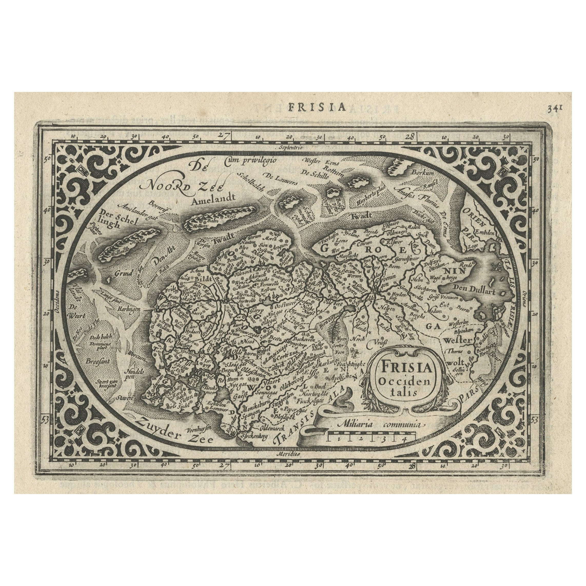
- Early Antique Map of the Dutch Provinces of Friesland and Groningen, 1604Located in Langweer, NLAntique map titled 'Frisiae Occidentalis.' This attractive map shows the Dutch Provinces of Friesland and Groningen. Embellished with strapwork tit...Category
Antique Early 1600s Maps
MaterialsPaper
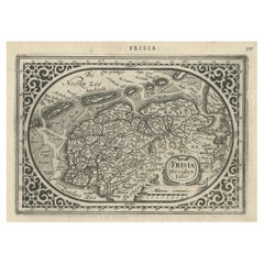
- Antique Map of Friesland and Groningen, Provinces of the Netherlands, 1628Located in Langweer, NLAntique map Friesland titled 'Frisia Occidentalis'. Small, decorative map of the province of Friesland, the Netherlands. Second state, out of three, originating from 'Atlas Minor' by...Category
Antique 17th Century Maps
MaterialsPaper
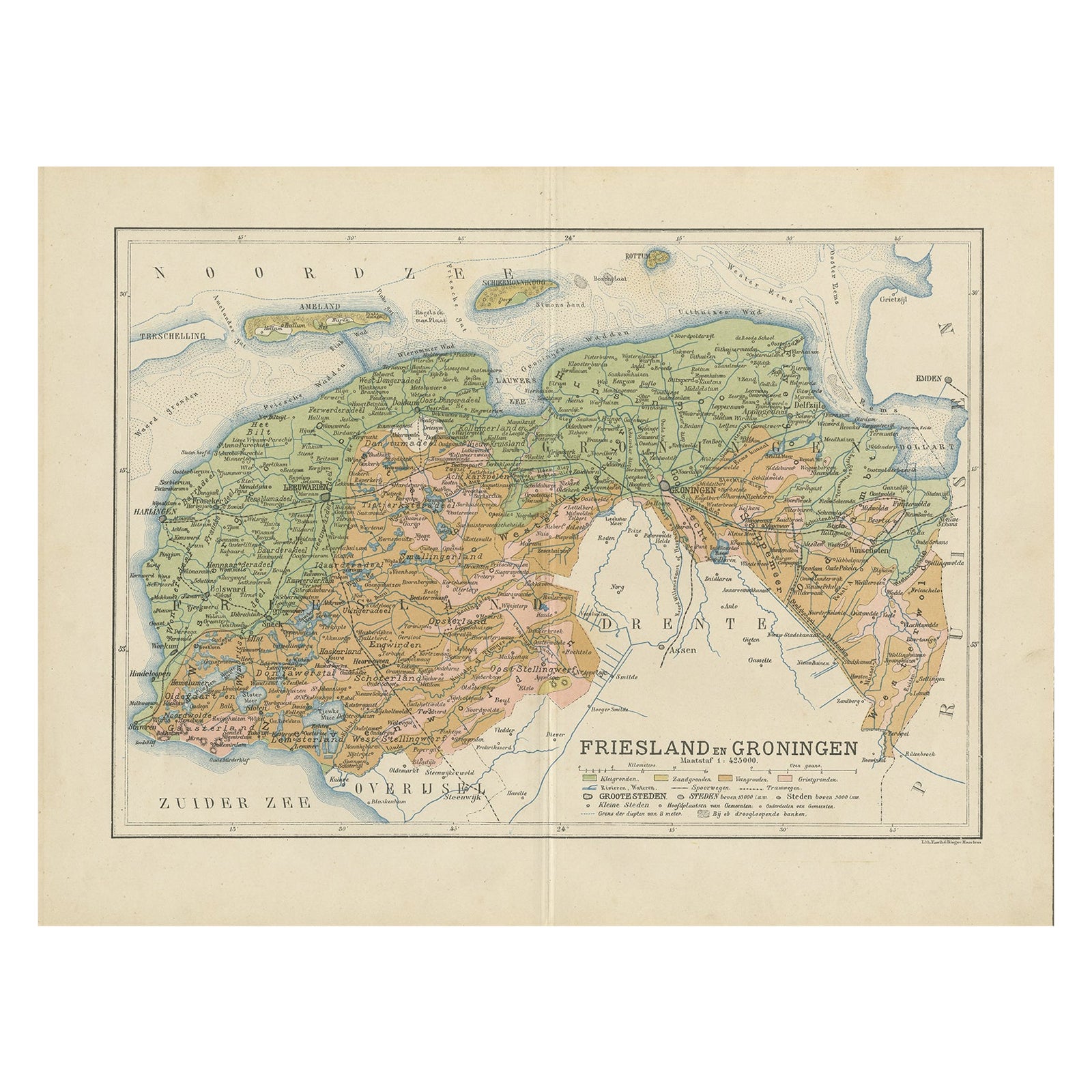
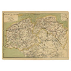
- Antique Map of the Dutch Most Northern Provinces Friesland and Groningen, 1883Located in Langweer, NLAntique map titled 'Friesland en Groningen'. Map of Friesland and Groningen, provinces of the Netherlands. This map originates from 'Atlas van Nederland volgens de nieuwe spelregels'...Category
Antique 19th Century Maps
MaterialsPaper
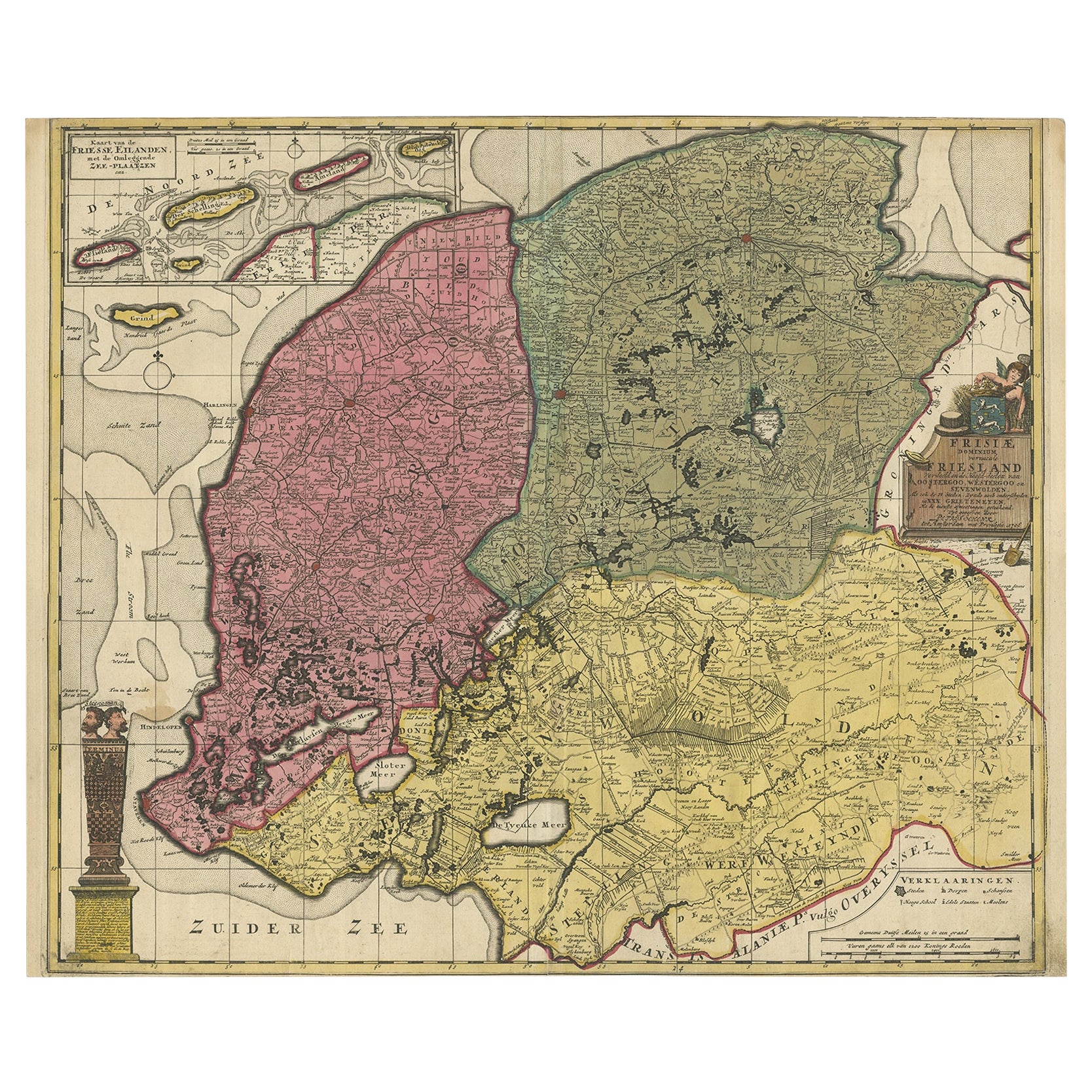
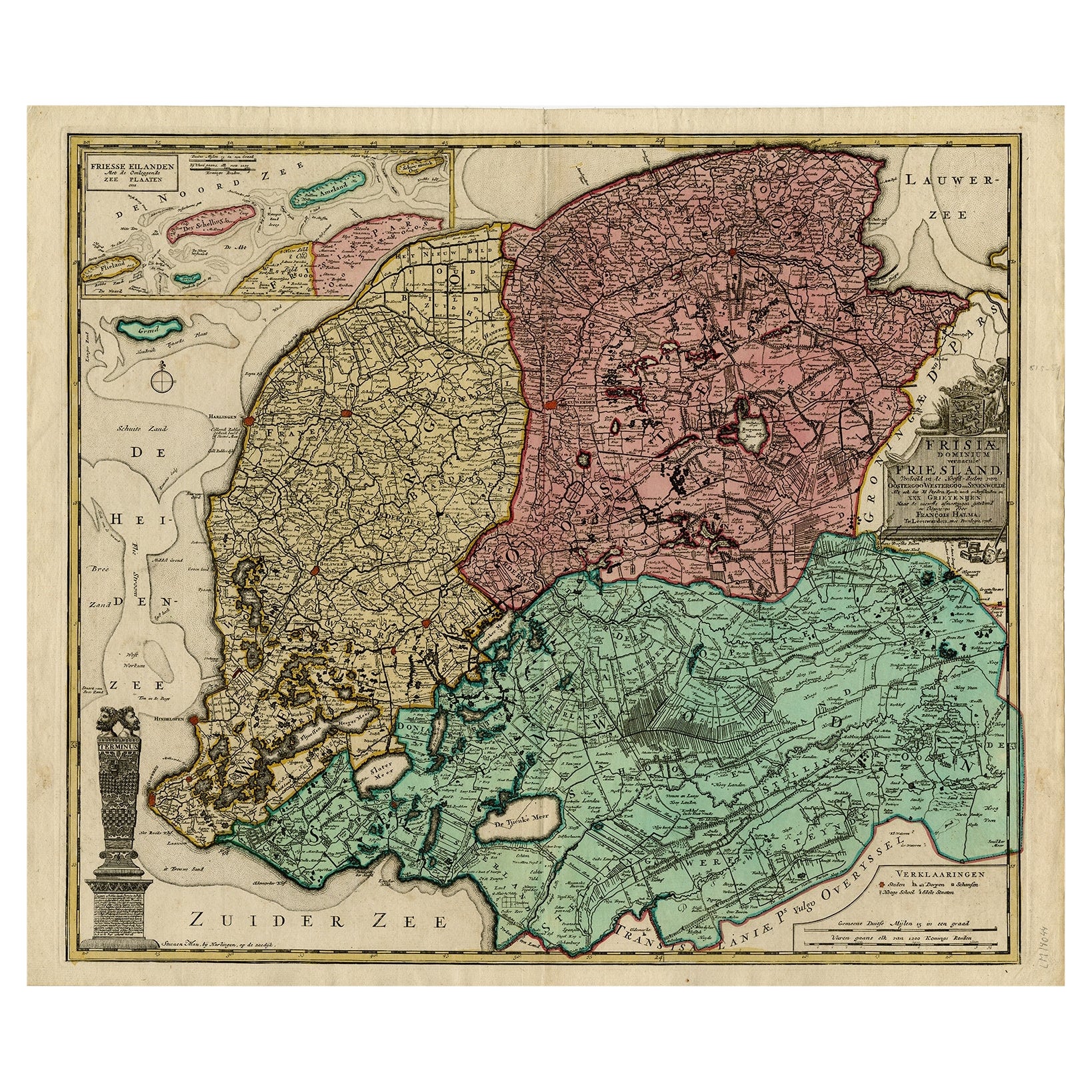
- Detailed Map of Friesland, Groningen and Drenthe, The Netherlands, 1706Located in Langweer, NLAntique map tited 'Frisiae Dominium vernacule Friesland verdeeld met de hoofd-deelen van Oostergoo, Westergoo en Sevenwolden (..)'. Detailed map of Friesland, Groningen and Drenthe, ...Category
Antique 18th Century Maps
MaterialsPaper
- Antique Map of the Dutch Provinces Groningen and Friesland, 1902Located in Langweer, NLAntique map titled 'Groningen en Friesland'. Lithographed map of the provinces of Groningen and Friesland, the Netherlands. This map originates from 'Atlas van Nederland'. Artists an...Category
20th Century Maps
MaterialsPaper
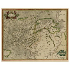
- Detailed Antique Map of Friesland, Groningen and Drenthe, The Netherlands, c1735Located in Langweer, NLAntique map titled 'Frisia Dominum (?) Friesland, verdeeld in de hoof-delen van Oostergoo, Westergoo en Sevenwolde (?) XXX Grietenijen.' Detailed map of Friesland, Groningen and Dren...Category
Antique 18th Century Maps
MaterialsPaper

You May Also Like
- Original Antique Map of The Netherlands, Engraved by Barlow, Dated 1807Located in St Annes, LancashireGreat map of Netherlands Copper-plate engraving by Barlow Published by Brightly & Kinnersly, Bungay, Suffolk. Dated 1807 Unframed.Category
Antique Early 1800s English Maps
MaterialsPaper
- Old Nautical Map of CorsicaLocated in Alessandria, PiemonteST/556/1 - Old map of Corsica isle, surveyed by Captain Hell, of the French Royal Navy in 1824, engraved and published on 1874, with additions and corre...Category
Antique Early 19th Century English Other Prints
MaterialsPaper
- Old Horizontal Map of EnglandBy TassoLocated in Alessandria, PiemonteST/520 - Old rare Italian map of England, dated 1826-1827 - by Girolamo Tasso, editor in Venise, for the atlas of M.r Le-Sage.Category
Antique Early 19th Century Italian Other Prints
MaterialsPaper
- The Holy Land at the Time of Jesus: A 17th Century Dutch Map by VisscherBy Nicolaes Visscher IILocated in Alamo, CAThis detailed Dutch map entitled "Het Beloofe de Landt Canaan door wandelt van onsen Salichmaecker Iesu Christo, nessens syne Apostelen" by Nicolaes Visscher was published in Amsterd...Category
Antique Mid-17th Century Dutch Maps
MaterialsPaper
- Map of the Republic of GenoaLocated in New York, NYFramed antique hand-coloured map of the Republic of Genoa including the duchies of Mantua, Modena, and Parma. Europe, late 18th century. Dimension: 25...Category
Antique Late 18th Century European Maps
- Map "Estuary- Mouth of the Thames"Located in Alessandria, PiemonteST/426 - Antique French Map of the estuary of the Thames, map dated 1769 - "Mape of the entrance of the Thames. Designed by filing of Navy cards fo...Category
Antique Mid-18th Century French Other Prints
MaterialsPaper


Recently Viewed
View AllMore Ways To Browse
Antique Globes Of The World
Holland And Sons Furniture
Holland And Son
Holland And Sons
Antique Maps And Globes
Antique Globes And Maps
World Map Globe
Old Antique Globes
Meditation Antique
Mercator Antique
Atlas Globe
Antique Old World Globe
Antique World Globe Map
Map New Holland
Blaeu World Map
Henricus Hondius
Ptolemy Map
Wood Carvings Of Ships