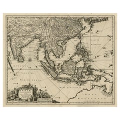
Map New Holland

2
150
4
to
25
134
20
154
151
152
7
4
2
1
1
1
114
30
6
4
2
4
1
1
2
143
12
10
8
5
44
22
17
15
6
19
3
2
2
1
Sort By
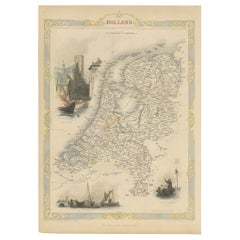
Antique Map of Holland with Colorful Vignettes, 1851
Located in Langweer, NL
Antique map titled 'Holland'. Decorative map of Holland. Includes vignettes of Rotterdam, Dutch
Category

Antique 19th Century Maps

Materials

Paper

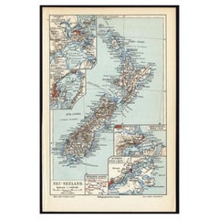
Antique Map of New Zealand, 1895
Located in Langweer, NL
Antique map titled 'Neu-Seeland.' Map of New Zealand. With inset maps of the large cities. This
Category

Antique 19th Century Maps

Materials

Paper

Antique Map of New Zealand, 1895
H 9.65 in W 6.3 in D 0 in
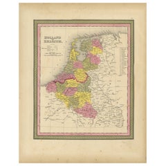
Antique Nicely Colored Map of Holland and Belgium, 1846
Located in Langweer, NL
Antique map titled 'Holland and Belgium'. Old map of the Netherlands and Belgium. This map
Category

Antique 19th Century Maps

Materials

Paper

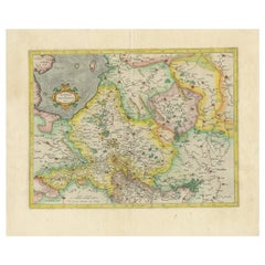
Antique Map of The Dutch Provinces of Gelderland and Overijssel, 1623
Located in Langweer, NL
world map in 1569 with his own new projection, today called Mercator projection. Later he decided to
Category

Antique 17th Century Maps

Materials

Paper

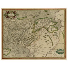
Early Antique Map of the Dutch Provinces of Friesland and Groningen, 1604
Located in Langweer, NL
Antique map titled 'Frisiae Occidentalis.' This attractive map shows the Dutch Provinces of
Category

Antique Early 1600s Maps

Materials

Paper

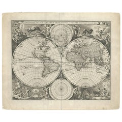
Gorgeous Antique World Map by the Dutch Mapmaker Visscher, published circa 1679
Located in Langweer, NL
Antique map titled 'Novissima Totius Terrarum Orbis Tabula, Auctore Nicolao Visscher'. Gorgeous
Category

Antique Late 17th Century Maps

Materials

Paper

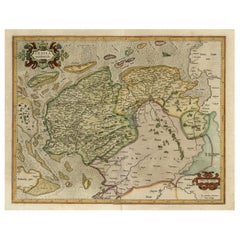
Old Map of the Dutch Provinces of Friesland and Groningen, The Netherlands, 1604
Located in Langweer, NL
Antique print, titled: 'Frisiae Occidentalis.' Handsome map of the Dutch Provinces of Friesland
Category

Antique Early 1600s Maps

Materials

Paper

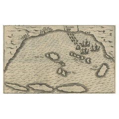
Small Map of Bantam with Dutch Ships and an Engraving of Portugese, 1614
Located in Langweer, NL
discovered a new sea route from Europe to Indonesia and managed to begin the Dutch spice trade. From the
Category

Antique Early 17th Century Maps

Materials

Paper

Antique Map of the Strait of Malacca, Malay Peninsula & Dutch Indies, c.1670
Located in Langweer, NL
Antique map titled 'Indiae Orientalis, nec non Insularum Adiacentium Nova Descriptio.' Map of
Category

Antique 1670s Maps

Materials

Paper

Original Antique Map of the Western Part of NEW MEXICO & CALIFORNIA
Located in Langweer, NL
Title: "Map of the Western Part of NEW MEXICO and CALIFORNIA According to the Latest Discoveries by
Category

Antique 1760s Maps

Materials

Paper

The Holy Land at the Time of Jesus: A 17th Century Dutch Map by Visscher
By Nicolaes Visscher II
Located in Alamo, CA
This detailed Dutch map entitled "Het Beloofe de Landt Canaan door wandelt van onsen Salichmaecker
Category

Antique Mid-17th Century Dutch Maps

Materials

Paper

Map of Southeast Asia, Extending from India to Tibet & Japan to New Guinea, 1640
Located in Langweer, NL
, extending from India to Tibet to Japan to New Guinea. This map is one of the first to show a number of the
Category

Antique 1640s Maps

Materials

Paper

Antique Map of Mar del Sur, Chile, Peru, New Guinea and Tierra del Fuego, 1621
Located in Langweer, NL
Uncommon and rare map of Mar del Sur and the coast of Peru. With inset maps of part of New Guinea
Category

Antique 17th Century Maps

Materials

Paper

Original Blaeu Map of Southeast Asia from India to Tibet and Japan to New Guinea
Located in Langweer, NL
Southeast Asia, extending from India to Tibet to Japan to New Guinea. It was the first popular map to depict
Category

Antique 1640s Maps

Materials

Paper

Colored wall map of the WORLD
By Chambon
Located in ZWIJNDRECHT, NL
. Early Dutch discoveries are noted in Australia and New Zealand, as are other recent discoveries
Category

Antique Mid-18th Century French French Provincial Maps

Materials

Wood, Paper

Colored wall map of the WORLD
Free Shipping
H 45 in W 57 in D 0.8 in
Antique Map of East Asia by Coronelli, circa 1690
Located in Langweer, NL
Antique map of East Asia showing New Holland and parts of Van Diemens Land and New Zealand. This
Category

Antique Late 17th Century Maps

Materials

Paper

Antique Map of Polynesia and Australasia by Neele, 1825
Located in Langweer, NL
Antique map titled 'Polynesia and Australasia'. It shows Australia (New Holland), part of Asia, New
Category

Antique Early 19th Century Maps

Materials

Paper

Antique Detailed World Map Drawn on Mercator's Projection, 1700
Located in Langweer, NL
. He was born in Leiden. In 1690 he was granted a privilege to publish French maps in Dutch lands. In
Category

Antique 17th Century Maps

Materials

Paper

Antique Map of the Low Countries by Cary, 1813
Located in Langweer, NL
Antique map of the Netherlands titled 'A New Map of the United Provinces comprehending Holland
Category

Antique 19th Century Maps

Materials

Paper

Antique Map of the Eastern Part of the World
Located in Langweer, NL
extreme south. As was conventional of the era, present day Western Australia is labelled New Holland, and
Category

Antique Mid-18th Century Maps

Materials

Paper

Antique Map of the Eastern Part of the World
Free Shipping
H 16.15 in W 17.96 in D 0.02 in
Antique Map of Southeast Asia by Blaeu, c.1640
Located in Langweer, NL
, extending from India to Tibet to Japan to New Guinea. This map is one of the first to show a number of the
Category

Antique 17th Century Maps

Materials

Paper

Road Map, John Ogilby, No 54, London, Yarmouth, Britannia
By John Ogilby
Located in BUNGAY, SUFFOLK
-sixth year, as a publisher of maps and geographical accounts. Ogilby was born outside Dundee, in
Category

Antique 1670s English Baroque Maps

Materials

Paper

Antique Map of Westfalia, Germany by Mercator/Hondius, circa '1620'
Located in Langweer, NL
known for his early maps of the New World and Europe, for re-establishing the reputation of the work of
Category

Antique 16th Century Maps

Materials

Paper

Authentic Old Map of Southeast Asia with Original Border Coloring, 1745
Located in Langweer, NL
Australia's western coast in the 17th century, hence the naming of the landmass as 'New Holland' on some maps
Category

Antique 1740s Maps

Materials

Paper

Antique Map of the World on Mercator Projection by Anson, 1749
Located in Langweer, NL
'. Original antique map of the world on Mercator's Projection from a Dutch edition of Anson's voyages. The map
Category

Antique 18th Century Maps

Materials

Paper

Antique Map of Australia and Polynesia, inset of Tasmania c.1860
Located in Langweer, NL
German antique map titled 'Australien und Polynesien'. Old map of Australia (New Holland) and
Category

Antique 19th Century Maps

Materials

Paper

Antique Map of the Malay Archipelago with Images of Indigenous People, 1851
Located in Langweer, NL
, but at the time of the map's creation, the region was known as the Dutch East Indies, a collection of
Category

Antique 1850s Maps

Materials

Paper

Antique Map of Northern Ireland by Mercator/Hondius, Early 1600's
Located in Langweer, NL
Antique map titled 'Ultoniae Orientalis Pars'. Original antique map of Northern Ireland. Published
Category

Antique 16th Century Maps

Materials

Paper

Antique Map of the Sunda Islands Including Sumatra, Java, and Borneo, 1705
Located in Langweer, NL
also published copies in 1682 and 1683, introducing new maps engraved by Antoine d'Winter. The
Category

Antique Early 1700s Maps

Materials

Paper

Extremely Large Hand-Drawn Manuscript Map of Surinam, 1830, History of Slavery
Located in Amsterdam, NL
Dutch, becoming the most prominent surveyor of the colony. The large map shown here is arguably the
Category

Antique Mid-19th Century Surinamer Maps

Materials

Paper

North & South America: A 17th Century Hand-colored Map by Jansson & Goos
By Johannes Janssonius
Located in Alamo, CA
the new world depicted on this fascination map. Among them is the bulging shape of the Northwest coast
Category

Antique 1620s Dutch Maps

Materials

Paper

Antique Map of the Eastern Part of the World by Tirion, 1755
By Isaak Tirion
Located in Langweer, NL
Antique map titled 'Nieuwe Kaart van het Oostelykste Deel der Weereld, dienende tot Aanwyzing van
Category

Antique Mid-18th Century Dutch Maps

Materials

Paper

Antique Map of the Eastern Part of the World by Tirion, 1755
Free Shipping
H 15.56 in W 15.56 in D 0.02 in
Important and Scarce Antique Map of Asia from Jesuit Sources, C.1713
Located in Langweer, NL
Engravers: Pieter van der Aa (Leiden 1659-1733) was a Dutch publisher best known for preparing maps and
Category

Antique 18th Century Maps

Materials

Paper

A Tallis Map of British Guiana with Colonial Vignettes and Other Landmarks, 1851
Located in Langweer, NL
This Tallis map of British Guiana (now known as Guyana) is a richly decorated document, much like
Category

Antique 1850s Maps

Materials

Paper

Cartographic Elegance of the Mughal Dominion in a Hand-Colored Antique Map, 1705
Located in Langweer, NL
Simon de Vries published copies in 1682 and 1683, with new maps engraved by Antoine d'Winter. The plates
Category

Antique Early 1700s Maps

Materials

Paper

Map Road John Ogilby Britannia No 74 Ipswich to Norwich Cromer Framed
By John Ogilby
Located in BUNGAY, SUFFOLK
his sixty-sixth year, as a publisher of maps and geographical accounts. Ogilby was born outside
Category

Antique 1670s English Baroque Maps

Materials

Paper

Road Map John Ogilby No 75 Kings Lyn Harwich, Britannia Framed Wallhanging
By John Ogilby
Located in BUNGAY, SUFFOLK
, as a publisher of maps and geographical accounts. Ogilby was born outside Dundee, in 1600, the
Category

Antique 1670s European Baroque Maps

Materials

Paper

Map Road Strip Britannia Sheet 2 John Ogilby London Aberistwith Islip Bramyard
By John Ogilby
Located in BUNGAY, SUFFOLK
of England and Wales. Strip map Islip to Bramyard, on a scale of approximately one inch to the mile
Category

Antique 17th Century English Baroque Maps

Materials

Paper

Antique Map of the Region of Osaka and Hirado Island in Japan, 1725
By Pieter Van Der Aa
Located in Langweer, NL
Antique map titled 'Description exacte et fidele des villes, bourgs et villages qui les
Category

Antique 18th Century Maps

Materials

Paper

Antique Map of the Passage Between the Atlantic and Pacific Oceans, circa 1753
Located in Langweer, NL
trade route for the Dutch. The map is adorned with a fine compass rose.Source unknown, to be determined
Category

Antique 18th Century Maps

Materials

Paper

Old Decorative Map of the West African Coast & St. Thomae Island, c.1600
Located in Langweer, NL
six new maps of Africa to be included in Hondius' first edition of Mercator's Atlas. Artists and
Category

Antique Early 1600s Maps

Materials

Paper

West Coast of Africa, Guinea & Sierra Leone: An 18th Century Map by Bellin
By Jacques-Nicolas Bellin
Located in Alamo, CA
expansive work that mapped China, the East Indies, Asia, the Americas, early voyages to Australia, New
Category

Antique Mid-18th Century French Maps

Materials

Paper

Road Map No43 London to Kings Lynn, Royston to Downham, John Ogilby, Britannia
By John Ogilby
Located in BUNGAY, SUFFOLK
John Ogilby (British 1600-1676) Cosmographer and Geographick Printer to Charles II. A road map
Category

Antique Late 17th Century British Charles II Maps

Materials

Paper

Road Map John Ogilby London St David's Britannia No 15 Abingdon Monmouth Framed
By John Ogilby
Located in BUNGAY, SUFFOLK
John Ogilby (British 1600-1676) Cosmographer and Geographick Printer to Charles II. A road map from
Category

Antique 1670s English Baroque Maps

Materials

Paper

Old Map of Cook's Discovery and Charting of the East Coast of Australia, 1803
Located in Langweer, NL
Antique map titled 'Kaart van Nieuw Zuid Wales of de Oostlyke Kust van Nieuw Holland ontdekt en
Category

Antique Early 1800s Maps

Materials

Paper

Map of The East Indies with the Route of Capt. William Dampier's Voyage, 1698
Located in Langweer, NL
, gathering important data on the flora and fauna of Australia and New Guinea. This map originates from the
Category

Antique 1690s Maps

Materials

Paper

Rare Unusual Antique Map of Asia with a Landbridge from Korea to America, 1717
Located in Langweer, NL
map of the Asian continent. The map is based primarily on Dutch sources, particularly the outlines of
Category

Antique 18th Century Maps

Materials

Paper

Antique Map of the Northern Part of South America by J. Tallis, circa 1851
Located in Langweer, NL
the last decorative world atlas. The 'Venezuela, New Granada...' map was typical of the many Fine ones
Category

Antique Mid-19th Century Maps

Materials

Paper

Attractive Antique Map of Western Africa with Lots of Details on the Coast, 1655
Located in Langweer, NL
veües jusques a present". Handsome map of Western Africa filled with information, much of it
Category

Antique 1650s Maps

Materials

Paper

Road Map Britannia No 32 the Road from London to Barnstable John Ogilby Framed
By John Ogilby
Located in BUNGAY, SUFFOLK
A road map from Britannia, by John Ogilby Esq., Cosmographer and Geographick Printer to Charles II
Category

Antique Late 17th Century English Charles II Maps

Materials

Paper

Road Map Britannia No 15 London to St Davids John Ogilby Brown Gilt Frame
By John Ogilby
Located in BUNGAY, SUFFOLK
Lechlade, to Fairford, to Barnsley to Gloucester showing Monmouth as the destination. A road map from
Category

Antique Late 17th Century British Charles II Maps

Materials

Paper

Flanders, Holland & Norfolk: Hand-Colored 17th Century Sea Chart by Collins
By Captain Greenvile Collins
Located in Alamo, CA
This hand-colored chart of the seas about Flanders, Holland, Frisia, and Norfolk is from "Great
Category

Antique Late 17th Century English Maps

Materials

Paper

Road Map Britannia No 25 London to the Lands End, John Ogilby Brown Gilded Frame
By John Ogilby
Located in BUNGAY, SUFFOLK
Senan in Cornwall. By John Ogilby His Majesties Cosmographer. A road map from Britannia, 1675/6. No 25
Category

Antique Late 17th Century British Charles II Maps

Materials

Paper

Road Map Britannia 1675/6 No 5 Road London to Barwick, London Stilton Grey Frame
By John Ogilby
Located in BUNGAY, SUFFOLK
John Ogilby (British 1600-1676) cosmographer and geographick printer to Charles II. A road map from
Category

Antique Late 17th Century British Charles II Maps

Materials

Paper

Rare Engraving of Dutch and Danish Forts on the West African Gold Coast, 1744
Located in Langweer, NL
Antique print, titled: 'The Dutch Fort Croevecoeur (…).' A four panel plate showing forts on
Category

Antique 1740s Maps

Materials

Paper

VOC Ships, Native People & Coastal Views of Islands near Papua New Guinea, 1726
Located in Langweer, NL
sheet showing the native boats and peoples and coastal views of islands near New Guinea. Dutch (V.O.C
Category

Antique 1720s Maps

Materials

Paper

Loudun and Mirebeau: A Cartographic Masterpiece of 17th Century France by Blaeu
Located in Langweer, NL
renowned Dutch cartographer and publisher. This map was produced between 1642 and 1661. The map is a
Category

Antique 1650s Maps

Materials

Paper

Antique Chart of the Straits of Makassar, Indonesia with Borneo and Celebes-1820
Located in Langweer, NL
Description: Antique map titled 'A New Chart of the Straits of Macassar with various additions
Category

Antique 1820s Maps

Materials

Paper

Original Antique Sea Chart of the Northern Part of Hispaniola, Western Cuba
Located in Langweer, NL
Antique map titled 'Pas kaart van de Noord Kust van Espaniola (..)'. Beautiful sea chart of the
Category

Antique Late 17th Century Maps

Materials

Paper

Old Copper Engraving of the Port City Dabhol in India, 1757
Located in Langweer, NL
centuries, Dabul was an opulent Muslim trade center. Around 1660 it was annexed to the new Maratha kingdom
Category

Antique 1750s Maps

Materials

Paper

  • 1
Get Updated with New Arrivals
Save "Map New Holland", and we’ll notify you when there are new listings in this category.

Map New Holland For Sale on 1stDibs

At 1stDibs, there are many versions of the ideal map new holland for your home. A map new holland — often made from paper, animal skin and wood — can elevate any home. If you’re shopping for a map new holland, we have 126 options in-stock, while there are 4 modern editions to choose from as well. You’ve searched high and low for the perfect map new holland — we have versions that date back to the 18th Century alongside those produced as recently as the 21st Century are available. A map new holland is a generally popular piece of furniture, but those created in Baroque, Georgian and Victorian styles are sought with frequency. F. Valentijn, Jacques-Nicolas Bellin and Herman Moll each produced at least one beautiful map new holland that is worth considering.

How Much is a Map New Holland?

A map new holland can differ in price owing to various characteristics — the average selling price 1stDibs is $1,029, while the lowest priced sells for $93 and the highest can go for as much as $65,000.

Read More

Pamela Shamshiri Shares the Secrets behind Her First-Ever Book and Its Effortlessly Cool Interiors

The sought-after designer worked with the team at Hoffman Creative to produce a monograph that beautifully showcases some of Studio Shamshiri's most inspiring projects.

Moroccan Artworks and Objects Take Center Stage in an Extraordinary Villa in Tangier

Italian writer and collector Umberto Pasti opens the doors to his remarkable cave of wonders in North Africa.

Montecito Has Drawn Royalty and Celebrities, and These Homes Are Proof of Its Allure

Hollywood A-listers, ex-pat aristocrats and art collectors and style setters of all stripes appreciate the allure of the coastal California hamlet — much on our minds after recent winter floods.

Whaam! Blam! Pow! — a New Book on Pop Art Packs a Punch

Publishing house Assouline and writer Julie Belcove have teamed up to trace the history of the genre, from Roy Lichtenstein, Andy Warhol and Yayoi Kusama to Mickalene Thomas and Jeff Koons.

The Sparkling Legacy of Tiffany & Co. Explained, One Jewel at a Time

A gorgeous new book celebrates — and memorializes — the iconic jeweler’s rich heritage.

What Makes a Gem-Encrusted Chess Set Worth $4 Million?

The world’s most opulent chess set, weighing in at 513 carats, is literally fit for a king and queen.

Tauba Auerbach’s Geometric Pop-Up Book Is Mighty Rare, Thanks to a Hurricane

This sculptural art book has an epic backstory of its own.

Step inside the Storied Mansions of Palm Beach’s Most Effervescent Architect

From Spanish-style courtyards to fanciful fountains, these acclaimed structures abound in surprising and elegant details.