Items Similar to Rare Unusual Antique Map of Asia with a Landbridge from Korea to America, 1717


Want more images or videos?
Request additional images or videos from the seller
1 of 6
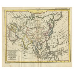
Rare Unusual Antique Map of Asia with a Landbridge from Korea to America, 1717
About the Item
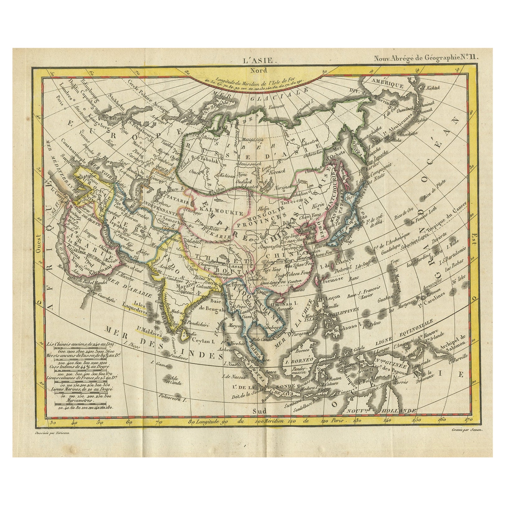
Antique map titled 'L'Asie Suivant les Nouvelles Decouvertes (..).' Interesting and very unusual map of the Asian continent. The map is based primarily on Dutch sources, particularly the outlines of Siberia and the East Indies. However, the most striking feature, which is original to De Fer, is a continuous landbridge extending from northern Korea and eastern Siberia across to America. A note acknowledges Portuguese sources for this new portrayal of the region. Hokkaido (Ieso) appears as a small circular island north of Japan. The northern coastline of Asia is based on Witsen's explorations including Cap Tabin and Cap Glace. The interior is filled with details, including what appears to be a road from Moscow to Peking, and the Great Wall of China. The Caspian Sea is presented in an unusual shape. The coastline of a portion of New Guinea is incorrectly named as Nouvelle Zeelande. Graced with three beautifully designed cartouches.
This scarse map originates from: 'Introduction a la geographie - avec unde description historique sur toutes les parties de la terre.', by N. De Fer Geographe de sa Majeste Catholique. A Paris chez le Sieur Danet, gendre de l'auteur, published in 1717, 2nd ed. with several maps first published in this ed.
Artists and Engravers: Nicholas de Fer (1646-1720) was the youngest son of Parisian print and map seller, Antoine de Fer [d.1673]. He became an official geographer to both French and Spanish kings. Nicholas de Fer was one of the most prolific and influential French geographers and cartographers of the late 17th and early 18th Century.
Condition: Good, given age. Neatly restored split of one of the original folds lower left; partly short-cut left margin. Original folds as issued. General age-related toning and/or occasional minor defects from handling. Please study image carefully.
Date: 1717
Overall size: 35.4 x 24.5 cm.
Image size: 0.001 x 32 x 23 cm.
We sell original antique maps to collectors, historians, educators and interior decorators all over the world. Our collection includes a wide range of authentic antique maps from the 16th to the 20th centuries. Buying and collecting antique maps is a tradition that goes back hundreds of years. Antique maps have proved a richly rewarding investment over the past decade, thanks to a growing appreciation of their unique historical appeal. Today the decorative qualities of antique maps are widely recognized by interior designers who appreciate their beauty and design flexibility. Depending on the individual map, presentation, and context, a rare or antique map can be modern, traditional, abstract, figurative, serious or whimsical. We offer a wide range of authentic antique maps for any budget.
- Dimensions:Height: 9.65 in (24.5 cm)Width: 13.94 in (35.4 cm)Depth: 0 in (0.01 mm)
- Sold As:Set of 2
- Materials and Techniques:
- Period:
- Date of Manufacture:1717
- Condition:Good, given age. Neatly restored split of one of the original folds lower left; partly short-cut left margin. Original folds as issued. General age-related toning and/or occasional minor defects from handling. Please study image carefully.
- Seller Location:Langweer, NL
- Reference Number:
About the Seller
5.0
Platinum Seller
These expertly vetted sellers are 1stDibs' most experienced sellers and are rated highest by our customers.
Established in 2009
1stDibs seller since 2017
1,928 sales on 1stDibs
Typical response time: <1 hour
- ShippingRetrieving quote...Ships From: Langweer, Netherlands
- Return PolicyA return for this item may be initiated within 14 days of delivery.
More From This SellerView All
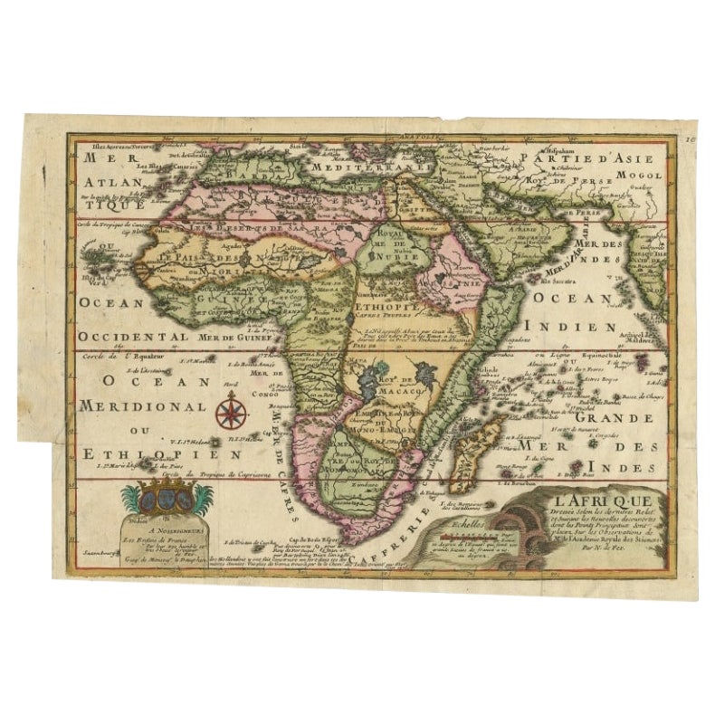
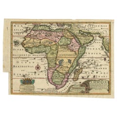
- Antique Map of Africa with a Decorative Dedication to the Dauphin, 1717Located in Langweer, NLAntique map titled 'L'Afrique, Dressée Selon les Dernieres Relat. et Suivant les Nouvelles Decouvertes (..).' This map is a reduced derivative of De Fer's wall map of Africa (1696-98) with its characteristic thickened west coast. Unusual islands appear in the Atlantic and Indian Oceans including a mythical second island of St. Helena. Monomotapa is shown in the south and the southwest coastline is distorted and there is an incorrect placement and shape of the Cape of Good Hope. In Central Africa is a paragraph concerning the origin of the Nile in Abyssinia, however, the two sub-equatorial Ptolemaic lakes are still shown on the map. The map is graced with a decorative dedication to the Dauphin and a title cartouche featuring lime kilns. The map was first published in 1700. This scarse map originates from: 'Introduction a la geographie - avec unde description historique sur toutes...Category
Antique 18th Century Maps
MaterialsPaper
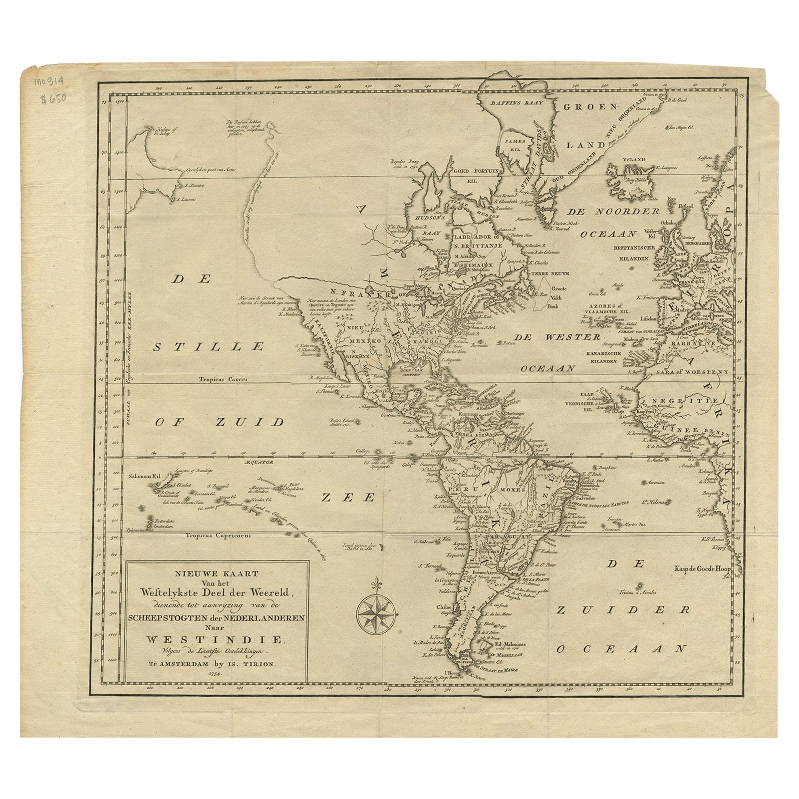
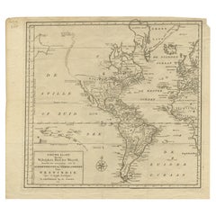
- Excellent Antique Map of America with Unusual Northwest Coast of America, c.1754Located in Langweer, NLDescription: Antique map titled 'Nieuwe Kaart Van het Westelykste Deel Der Weereld, dienende tot aanwyzing an de Scheepstogten der Nederlanderne Naar West Indie.' Excellent map of America, featuring an unusual northwest coast of America, which includes Martin d'Aguilar's strait which provides for a Northwest Passage via the Great Lakes. The rest of the NW coast...Category
Antique 1750s Maps
MaterialsPaper
- Antique Map of India to Southeast AsiaLocated in Langweer, NLAntique map titled 'Indes en-decà et au-delà du Gange'. Original old map of India to Southeast Asia, showing India, Nepal, Bhutan, Sri Lanka (Ceylon), Myanmar (Birma), part of Indone...Category
Antique Mid-19th Century Maps
MaterialsPaper
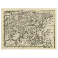
- Rare Hand-Colored Antique Map of Asia, 1788Located in Langweer, NLAntique map titled 'Kaartje van Asia'. Original antique map of Asia. This map originates from 'Nieuwe Natuur- Geschied- en Handelkundige Zak- en Reisatlas' by N.T. Gravius, 1788....Category
Antique 1780s Maps
MaterialsPaper
- Antique Map of Asia from the Middle East to the Coast of Alaska, 1816Located in Langweer, NLAntique map titled ‘L’Asie‘. This is an original antique map of Asia, by Hérisson, taken from atlas ""Nouv. Abrége de Géographie"". An engraved map with coloring of Asia from the Mid...Category
Antique 19th Century Maps
MaterialsPaper
- Antique Map of Asia by with an Inset Map of Turkey in Asia, 1868Located in Langweer, NLAntique map Asia titled 'Carte Politique et Ethnographique d'Asie'. Old map of Asia with an inset map of Turkey in Asia. Includes descriptive text box...Category
Antique 19th Century Maps
MaterialsPaper


You May Also Like
- Original Antique Map of Asia. C.1780Located in St Annes, LancashireGreat map of Asia Copper-plate engraving Published C.1780 Two small worm holes to right side of map Unframed.Category
Antique Early 1800s English Georgian Maps
MaterialsPaper

- Large Antique 1859 Map of North AmericaLocated in Sag Harbor, NYThis Map was made by Augustus Mitchell in 1859 It is in amazing condition for being 163 years old. This price is for the rolled up easy to ship version of this piece. I will be Frami...Category
Antique Mid-19th Century American Maps
MaterialsCanvas, Paper

- Original Antique Map of South America. C.1780Located in St Annes, LancashireGreat map of South America Copper-plate engraving Published C.1780 Two small worm holes to left side of map Unframed.Category
Antique Early 1800s English Georgian Maps
MaterialsPaper
- Original Antique Map of South East Asia, Arrowsmith, 1820Located in St Annes, LancashireGreat map of South East Asia Drawn under the direction of Arrowsmith Copper-plate engraving Published by Longman, Hurst, Rees, Orme and Brown, 1820 Unframed.Category
Antique 1820s English Maps
MaterialsPaper
- Original Antique Map of South America, circa 1830Located in St Annes, LancashireGreat map of South America Copper plate engraving Published by Butterworth, Livesey & Co., circa 1830 Unframed.Category
Antique Early 1800s English Other Maps
MaterialsPaper
- New Map of North America from the Latest Discoveries, 1763Located in Philadelphia, PAA fine antique 18th century map of the North American seaboard. Entitled "A New Map of North America from the Latest Discoveries 1763". By the Cartographer/Engraver - John Spil...Category
Antique Mid-18th Century English Georgian Maps
MaterialsPaper


Recently Viewed
View AllMore Ways To Browse
Map Wall
Antique American 18th Century Furniture
18th Century American Antiques
Antique Wall Map
Antique Wall Maps
World Map Wall
17th Century American Furniture
Korean Japanese
Map North America
Road Maps
Road Map
Shorter And Sons
Map Of North America
Map Spain
Maps Spain
Map Of Spain
Late 18th Century Antique American
France And Son Extending