Vineyard Map
to
6
71
22
58
44
24
22
17
14
11
9
8
6
5
5
5
4
4
3
3
3
3
2
2
2
2
1
1
1
1
1
1
1
10
2
2
1
1
Sort By
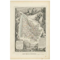
Antique Map of Gironde ‘France’ by V. Levasseur, 1854
By Victor Levasseur
Located in Langweer, NL
Antique map titled 'Dépt. de la Gironde'. Map of the French department of Gironde. This coastal
Category
Antique Mid-19th Century Maps
Materials
Paper
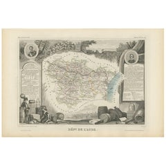
Antique Map of Aude ‘France’ by V. Levasseur, 1854
By Victor Levasseur
Located in Langweer, NL
Antique map titled 'Dépt. de 'l'Aude'. Map of the French department of Aude, France. This area of
Category
Antique Mid-19th Century Maps
Materials
Paper
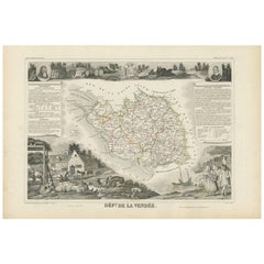
Antique Map of Vendée ‘France’ by V. Levasseur, 1854
By Victor Levasseur
Located in Langweer, NL
Antique map titled 'Dépt. de la Vendée'. Map of the French department of Vendee, France. Vendee is
Category
Antique Mid-19th Century Maps
Materials
Paper
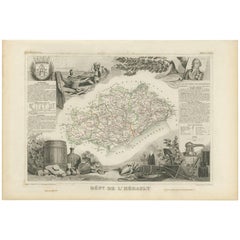
Antique Map of Hérault ‘France’ by V. Levasseur, 1854
Located in Langweer, NL
Antique map titled 'Dépt. de l'Hérault'. Map of the French department of Herault, France. This area
Category
Antique Mid-19th Century Maps
Materials
Paper
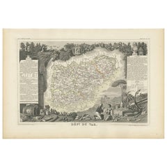
Antique Map of Var 'France' by V. Levasseur, 1854
By Victor Levasseur
Located in Langweer, NL
Antique map titled 'Dépt. du Var'. Map of the French department of Var, the heart of the French
Category
Antique Mid-19th Century Maps
Materials
Paper
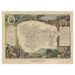
Hand Colored Antique Map of the Department of Aude, France
By Victor Levasseur
Located in Langweer, NL
Antique map titled 'Dépt. de l'Aude'. Map of the French department of Aude, France. This area of
Category
Antique Mid-19th Century Maps
Materials
Paper
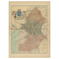
Antique Map of Alentejo: Land of Tradition and Tranquility, 1903
Located in Langweer, NL
The image is a historical original antique map of the Alentejo region in Portugal. This map
Category
Antique Early 1900s Maps
Materials
Paper
Free Shipping
H 20.08 in W 14.77 in D 0 in
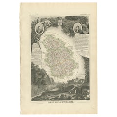
Antique Map of Haute Marne ‘France’ by V. Levasseur, 1854
Located in Langweer, NL
Antique map titled 'Dépt. de la Hte. Marne'. Map of the French department of Haute Marne, France
Category
Antique Mid-19th Century Maps
Materials
Paper
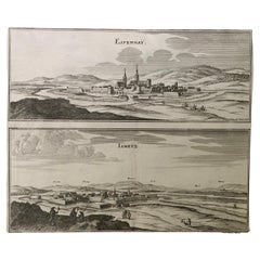
17th Century Topographical Map, French Champagne Region, Epernay, Iohan Peeters
Located in New York, NY
Fine topographical 17th century map by Iohan Peeters of the towns of Epernay and Lametz in the
Category
Antique 17th Century Dutch Maps
Materials
Paper
H 12.38 in W 15.5 in D 0 in
1644 Janssonius Original Wine Regions Map: The Ducal and Comital Burgundy
Located in Langweer, NL
This authentic handcolored map is a detailed 17th-century depiction of the Burgundy region
Category
Antique 1640s Maps
Materials
Paper
Free Shipping
H 19.1 in W 22.84 in D 0 in
Cartographic Elegance of Touraine: A 17th-Century Map Showing French Heritage
Located in Langweer, NL
"Ducatus Turonensis - Touraine," is a original antique historical map of the Touraine region, which
Category
Antique 1630s Maps
Materials
Paper
Free Shipping
H 20.08 in W 23.82 in D 0 in
Orense in Depth: A 1902 Topographical Map of Galicia's Mountainous Province
Located in Langweer, NL
The map is a detailed cartographic representation of the province of Orense (Ourense in Galician
Category
Antique Early 1900s Maps
Materials
Paper
Free Shipping
H 14.77 in W 20.08 in D 0 in
Old Map of Vaucluse, France: A Cartographic Celebration of Viticulture, 1852
Located in Langweer, NL
This original hand-colored map is from the "Atlas National Illustré," a work by Victor Levasseur, a
Category
Antique 1850s Maps
Materials
Paper
H 14.18 in W 20.99 in D 0 in
Hand Colored Antique Map of the Department of Haute Marne, France
By Victor Levasseur
Located in Langweer, NL
Antique map titled 'Dépt. de la Hte Marne'. Map of the French department of Haute Marne, France
Category
Antique Mid-19th Century Maps
Materials
Paper
Antique Map of Maine et Loire ‘France’ by V. Levasseur, 1854
Located in Langweer, NL
Antique map titled 'Dépt. de Maine et Loire'. Map of the French department of Maine et Loire
Category
Antique Mid-19th Century Maps
Materials
Paper
Authentic 1644 Janssonius Map of the Champagne Region (Campania) in France
Located in Langweer, NL
"1644 Janssonius Map of Champagne, France"
This meticulously detailed original antique map
Category
Antique 1640s Maps
Materials
Paper
Free Shipping
H 21.86 in W 25.99 in D 0 in
1852 Map of Haut-Rhin: An Illustrated Gateway to Alsace's Viticultural Splendors
Located in Langweer, NL
This original hand-colored map is from the "Atlas National Illustré," a work by Victor Levasseur, a
Category
Antique 1850s Maps
Materials
Paper
H 14.18 in W 20.75 in D 0 in
The Illustrated Map of the Var Department from the Atlas National Illustré, 1856
Located in Langweer, NL
This original hand-colored map is from the "Atlas National Illustré," a work by Victor Levasseur, a
Category
Antique 1850s Maps
Materials
Paper
H 14.18 in W 20.87 in D 0 in
Map of Rhône: Culture and Commerce in Lyon's Silk and Wine Legacy, 1852
Located in Langweer, NL
This original hand-colored map is from the "Atlas National Illustré," a work by Victor Levasseur, a
Category
Antique 1850s Maps
Materials
Paper
Navarra in Cartographic Detail: A 1902 Map of the Crossroads of Northern Spain
Located in Langweer, NL
The original antique map for sale shows the Spanish province of Navarra as it was in 1902. Here's a
Category
Antique Early 1900s Maps
Materials
Paper
Free Shipping
H 14.77 in W 20.08 in D 0 in
Mapping History: The Decorative Cartography of Indre-et-Loire by Levasseur, 1856
Located in Langweer, NL
An original hand-colored map of the Département d'Indre-et-Loire created by Victor Levasseur in
Category
Antique 1850s Maps
Materials
Paper
H 20.67 in W 14.34 in D 0 in
Levasseur's 1852 Cartographic Portrait of Gironde: Celebrating the Bordeaux Wine
Located in Langweer, NL
This original hand-colored map is from the "Atlas National Illustré," a work by Victor Levasseur, a
Category
Antique 1850s Maps
Materials
Paper
H 20.67 in W 14.06 in D 0 in
Burgundy's Viticultural Landscape: A 1640 Cartographic Engraving by Willem Blaeu
Located in Langweer, NL
monks who were very skilled in identifying the best terroirs for vineyards.
The map is dating back to
Category
Antique 1640s Maps
Materials
Paper
Free Shipping
H 18.51 in W 23.43 in D 0 in
La Rioja 1901: A Cartographic Journey Through Spain's Renowned Wine Country
Located in Langweer, NL
The map for sale illustrates the province of La Rioja, with its capital Logroño, as of the year
Category
Antique Early 1900s Maps
Materials
Paper
Free Shipping
H 14.77 in W 20.08 in D 0 in
Cartographic Treasures: A Journey Through the Gascogne and Guyenne Regions, 1680
Located in Langweer, NL
in these regions, vineyards and wine-producing areas might be highlighted or labeled on the map.
5
Category
Antique Late 17th Century Maps
Materials
Paper
Free Shipping
H 20.08 in W 23.82 in D 0.02 in
Map of Edgartown, Martha's Vineyard
Located in New York, NY
Original map of Edgartown, Martha's Vineyard with recent hand-coloring, 1938. Light toning to edges
Category
1930s Prints and Multiples
Materials
Paper
Original Vintage Poster Vineyards Of Champagne Wine Map Les Vignobles De France
Located in London, GB
Original vintage advertising poster for Les Vignobles de France Vins de Champagne / The Vineyards
Category
Vintage 1960s French Posters
Materials
Paper
H 26.38 in W 37.01 in D 0.04 in
Original Vintage Poster Les Vignobles d'Alsace Vineyards French Wine Map Rhine
Located in London, GB
Centre d'information du vin d'Alsace Colmar-France / The Vineyards of Alsace Distributed by the Alsace
Category
Vintage 1950s French Posters
Materials
Paper
H 38.98 in W 24.02 in D 0.04 in
Original Vintage Poster Les Vignobles De France Vineyards Wine Map Cockerel Logo
Located in London, GB
Original vintage drink advertising poster for The Vineyards Of France / Les Vignobles De France
Category
Vintage 1960s French Posters
Materials
Paper
H 38.19 in W 24.81 in D 0.04 in
Original Vintage Poster Vineyards Of Bordeaux Wine Map Les Vignobles De France
Located in London, GB
Original vintage advertising poster for Les Vignobles de France Vins de Bordeaux / The Vineyards of
Category
Vintage 1960s French Posters
Materials
Paper
H 26.38 in W 37.01 in D 0.04 in
Original Vintage Poster Vignobles De France Vineyards Vins D'Alsace Wine Map Art
Located in London, GB
map of the Alsace region marking the river Rhine and the vineyards with bunches of grapes surrounded
Category
Vintage 1950s French Posters
Materials
Paper
H 26.78 in W 33.27 in D 0.04 in
"Vineyard Current" abstract of ocean
By Chase Langford
Located in Edgartown, MA
environment while embarking into uncharted territory. His impactful depictions recall maps and aerial
Category
2010s Figurative Paintings
Materials
Oil
Original Vintage Rail Travel Map Poster France Map SNCF National French Railway
Located in London, GB
Original vintage rail travel map poster - France Societe Nationale des Chemins de Fer Francais
Category
Vintage 1950s French Posters
Materials
Paper
H 39.38 in W 24.41 in D 0.04 in
Original Vintage World War Two French Wine Vineyard Copper Recycling WWII Design
By Rene Ravo
Located in London, GB
Original vintage World War Two era propaganda poster - French vineyards are in peril To sulfate our
Category
Vintage 1940s French Posters
Materials
Paper
H 59.85 in W 45.67 in D 0.04 in
Var, France. Antique map of a French department, 1856
By Victor Levasseur
Located in Melbourne, Victoria
cities of Cannes, Nice and San Tropez, among many others. This area also houses a number of vineyards
Category
19th Century Naturalistic Landscape Prints
Materials
Engraving
Aude, France. Antique map of a French department, 1856
By Victor Levasseur
Located in Melbourne, Victoria
'Atlas National Illustre'.
This area of France is famous for its wide variety of vineyards and wine
Category
19th Century Naturalistic Landscape Prints
Materials
Engraving
La Gironde, France. Antique map of a French department, 1856
By Victor Levasseur
Located in Melbourne, Victoria
the world's finest reds. Shows numerous vineyards and chateaux. The whole is surrounded by elaborate
Category
19th Century Naturalistic Landscape Prints
Materials
Engraving
L'Herault, France. Antique map of a French department, 1856
By Victor Levasseur
Located in Melbourne, Victoria
Levasseur's Atlas National Illustre.
This area is home to a wide variety of vineyards and is part of the
Category
19th Century Naturalistic Landscape Prints
Materials
Engraving
Original Vintage Wine Poster Champagne Trouillard & Co. Epernay Illustrated Map
Located in London, GB
Fondee en 1896 / Epernay (France) Marne House Founded in 1896. Colourful illustrated map depicting the
Category
Vintage 1950s French Posters
Materials
Paper
H 16.93 in W 25.2 in D 0.04 in
Original Vintage Poster Vignobles De France Vins De Bourgogne Burgundy Wine Map
Located in London, GB
decorative map of the Bourgogne region marking the river Rhine and the vineyards with bunches of grapes and
Category
Vintage 1950s French Posters
Materials
Paper
H 26.78 in W 33.27 in D 0.04 in
Original Vintage Poster Vignobles De France Vins Du Val De Loire Valley Wine Map
Located in London, GB
colourful decorative map of the Val de Loire region marking the river and the vineyards with bunches of
Category
Vintage 1950s French Posters
Materials
Paper
H 26.78 in W 33.27 in D 0.04 in
View of Meissen, Germany: A 16th Century Hand-colored Map by Braun & Hogenberg
By Franz Hogenberg
Located in Alamo, CA
This is a 16th century original hand-colored copperplate engraved map of View of View of Meissen
Category
16th Century Old Masters Landscape Prints
Materials
Engraving
View of Pisaro, Italy: A 16th Century Hand-colored Map by Braun & Hogenberg
By Franz Hogenberg
Located in Alamo, CA
This is a 16th century original hand-colored copperplate engraved map of View of Pezaro (Pisaro
Category
16th Century Old Masters Landscape Prints
Materials
Engraving
Les Vignobles De France - Vins De Bordeaux
Located in London, GB
HETRÉAU, Remy.
Les Vignobles De France - Vins De Bordeaux (The Vineyards of France - Wines of
Category
1950s Naturalistic Figurative Prints
Materials
Color
Original California Wine Country vintage wine and travel poster
Located in Spokane, WA
-growing regions of California to regions in Europe. (Vineyards near the towns of Napa, Santa Cruz, and
Category
1970s Abstract Expressionist Landscape Prints
Materials
Offset
H 36 in W 24 in D 0.05 in
Cindy Kane 1985 Original Painting on Plywood
By Cindy Kane
Located in Larchmont, NY
paintings of maps, birds, toys, and artifacts from nature, often collaging bits of newspaper headlines
Category
1980s American Modern Abstract Paintings
Materials
Plywood, Oil
Les Vignobles De France - Vins du Val de Loire
Located in London, GB
HETRÉAU, Remy.
Les Vignobles De France - Vins du Val de Loire (The Vineyards of France - Wines of
Category
1950s Naturalistic Figurative Prints
Materials
Color
Antique Print of Büdingenin Germany by Braun & Hogenberg, 1617
Located in Langweer, NL
Antique map titled 'Bingen'. Bird's eye-view of Büdingen, Germany. The view shows a city surrounded
Category
Antique 17th Century Prints
Materials
Paper
Tuscany and Its Wines By Hugh Johnson Hardcover Book 2000
Located in North Hollywood, CA
, cuisine, and above all, its wines and vineyards as he journeys through the sunbaked hillsides and moonlit
Category
Late 20th Century Italian Country Books
Materials
Paper
Original Vintage Poster Vineyards Of Champagne Wine Map Les Vignobles De France
Located in London, GB
Original vintage advertising poster for Les Vignobles de France Vins de Champagne / The Vineyards
Category
1960s More Prints
Materials
Paper
Original Vintage Poster Les Vignobles d'Alsace Vineyards French Wine Map Rhine
Located in London, GB
Centre d'information du vin d'Alsace Colmar-France / The Vineyards of Alsace Distributed by the Alsace
Category
1950s More Prints
Materials
Paper
Original Vintage Poster Les Vignobles De France Vineyards Wine Map Cockerel Logo
Located in London, GB
Original vintage drink advertising poster for The Vineyards Of France / Les Vignobles De France
Category
1960s More Prints
Materials
Paper
Original Vintage Poster Vineyards Of Bordeaux Wine Map Les Vignobles De France
Located in London, GB
Original vintage advertising poster for Les Vignobles de France Vins de Bordeaux / The Vineyards of
Category
1960s More Prints
Materials
Paper
Original Vintage Poster Vignobles De France Vineyards Vins D'Alsace Wine Map Art
Located in London, GB
map of the Alsace region marking the river Rhine and the vineyards with bunches of grapes surrounded
Category
1950s More Prints
Materials
Paper
Original Vintage Rail Travel Map Poster France Map SNCF National French Railway
Located in London, GB
Original vintage rail travel map poster - France Societe Nationale des Chemins de Fer Francais
Category
1950s More Prints
Materials
Paper
Original vintage World War Two French Wine Vineyard Copper Recycling WWII Design
Located in London, GB
Original vintage World War Two era propaganda poster - French vineyards are in peril To sulfate our
Category
1940s More Prints
Materials
Paper
Original Vintage Wine Poster Champagne Trouillard & Co Epernay Illustrated Map
Located in London, GB
Fondee en 1896 / Epernay (France) Marne House Founded in 1896. Colourful illustrated map depicting the
Category
1950s More Prints
Materials
Paper
Original Vintage Poster Vignobles De France Vins De Bourgogne Burgundy Wine Map
Located in London, GB
decorative map of the Bourgogne region marking the river Rhine and the vineyards with bunches of grapes and
Category
1950s More Prints
Materials
Paper
Original Vintage Poster Vignobles De France Vins Du Val De Loire Valley Wine Map
Located in London, GB
colourful decorative map of the Val de Loire region marking the river and the vineyards with bunches of
Category
1950s More Prints
Materials
Paper
Pair of Topographical Portraits of the Pavillion and Village of Vaux-Sur-Seine
Located in London, Middlesex
building beyond. To the right are extensive orchards, fields and vineyards all enclosed by stone walls
Category
Antique Early 18th Century French Louis XIV Paintings
Materials
Canvas
H 60.24 in W 60.24 in D 3.94 in
- 1
Get Updated with New Arrivals
Save "Vineyard Map", and we’ll notify you when there are new listings in this category.
Vineyard Map For Sale on 1stDibs
At 1stDibs, there are many versions of the ideal vineyard map for your home. A vineyard map — often made from paper, wood and canvas — can elevate any home. There are many kinds of the vineyard map you’re looking for, from those produced as long ago as the 18th Century to those made as recently as the 20th Century. Each vineyard map bearing Art Deco or modern hallmarks is very popular. Many designers have produced at least one well-made vineyard map over the years, but those crafted by Victor Levasseur, Arent Roggeveen and Hans Thöni are often thought to be among the most beautiful.
How Much is a Vineyard Map?
Prices for a vineyard map start at $59 and top out at $929,103 with the average selling for $619.
More Ways To Browse
Antique Caribbean Maps
Antique Caribbean Map
Antique Map Caribbean
Antique Maps Caribbean
Caribbean Map Antique
Caribbean Antique Maps
Nantucket Sound
Antique Map Of Caribbean
Antique Map Of The Caribbean
Antique Maps Of The Caribbean
San Diego Vintage Posters
San Diego Vintage Poster
Nancy Piers
Vintage Cadiz
Diffuser Bottle
Antique Wooden Wagon
Glass Bottle Burgundy
Vintage Wine 1961
