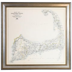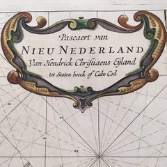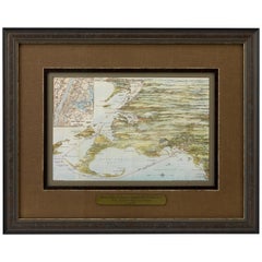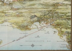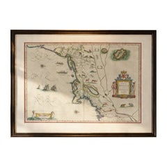

Antique New England Map Blaeu c.1642 – Nova Belgica & Anglia, Ships
$9,265
H 19.69 in W 23.23 in D 0.01 in
Antique New England Map Blaeu c.1642 – Nova Belgica & Anglia, Ships
Located in Langweer, NL
Keywords: Nova Belgica map, New Netherland map, New Amsterdam, Manhattan, Manhates, New York antique map, Hudson River, Long Island, Cape Cod, Virginia, New England map, early Americ...
Category
Antique Mid-17th Century Dutch Maps
Materials
Paper