Items Similar to Antique Print of Büdingenin Germany by Braun & Hogenberg, 1617

Want more images or videos?
Request additional images or videos from the seller
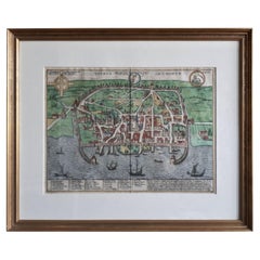
Antique Print of Büdingenin Germany by Braun & Hogenberg, 1617
About the Item
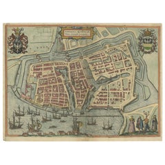
Antique map titled 'Bingen'. Bird's eye-view of Büdingen, Germany. The view shows a city surrounded by vineyards and well fortified with walls and moats. On the right is the castle with its keep. Seen from a high viewpoint in the south, the houses in the city are shown crowded together, with the late Gothic church of St Mary standing out in the middle. The figures in the foreground are a reference to the status of the city: the burgher woman with a hood is shown in accordance with her standing with ruff and full-length skirt, but her apron indicates that she is hard working. The maids, with their skirts tucked up for work and carrying the harvest on their heads, symbolize the fertility of the soil, while the men carrying a prong-hoe and an axe represent the toil in the fields. This print originates from 'Theatri praecipuarum Totius Mundi Urbium'.
Artists and Engravers: Georg Braun (1542-1622), a German publisher and Frans Hogenberg issued the famous six volume town book "Civitates Orbis Terrarum" between 1572 and 1618. The volumes originally published in Latin, follow by German and French translations. Franz Hogenberg (1533-1588) was the son of a Munich engraver who settled in Malines. He engraved most of the plates for Ortelius' Theatrum and the majority of those in the Civitates, and may have been responsible for originating the project. Worked and died in Cologne/Germany. He was a prolific copper engraver and etching artist of maps and town views. In cooperation with Georg Braun he created the first four volumes of the Civitates Orbis Terrarum in 1572.
Condition: Fair, age-related toning and soiling. Few marginal defects. Latin text on verso, please study image carefully.
Date: 1617
Overall size: 53 x 42 cm.
Image size: 48 x 30 cm.
We sell original antique maps to collectors, historians, educators and interior decorators all over the world. Our collection includes a wide range of authentic antique maps from the 16th to the 20th centuries. Buying and collecting antique maps is a tradition that goes back hundreds of years. Antique maps have proved a richly rewarding investment over the past decade, thanks to a growing appreciation of their unique historical appeal. Today the decorative qualities of antique maps are widely recognized by interior designers who appreciate their beauty and design flexibility. Depending on the individual map, presentation, and context, a rare or antique map can be modern, traditional, abstract, figurative, serious or whimsical.
- Dimensions:Height: 16.54 in (42 cm)Width: 20.87 in (53 cm)Depth: 0 in (0.01 mm)
- Materials and Techniques:
- Period:
- Date of Manufacture:1617
- Condition:Condition: Fair, age-related toning and soiling. Few marginal defects. Latin text on verso, please study image carefully.
- Seller Location:Langweer, NL
- Reference Number:
About the Seller
5.0
Platinum Seller
These expertly vetted sellers are 1stDibs' most experienced sellers and are rated highest by our customers.
Established in 2009
1stDibs seller since 2017
1,949 sales on 1stDibs
Typical response time: <1 hour
- ShippingRetrieving quote...Ships From: Langweer, Netherlands
- Return PolicyA return for this item may be initiated within 14 days of delivery.
More From This SellerView All
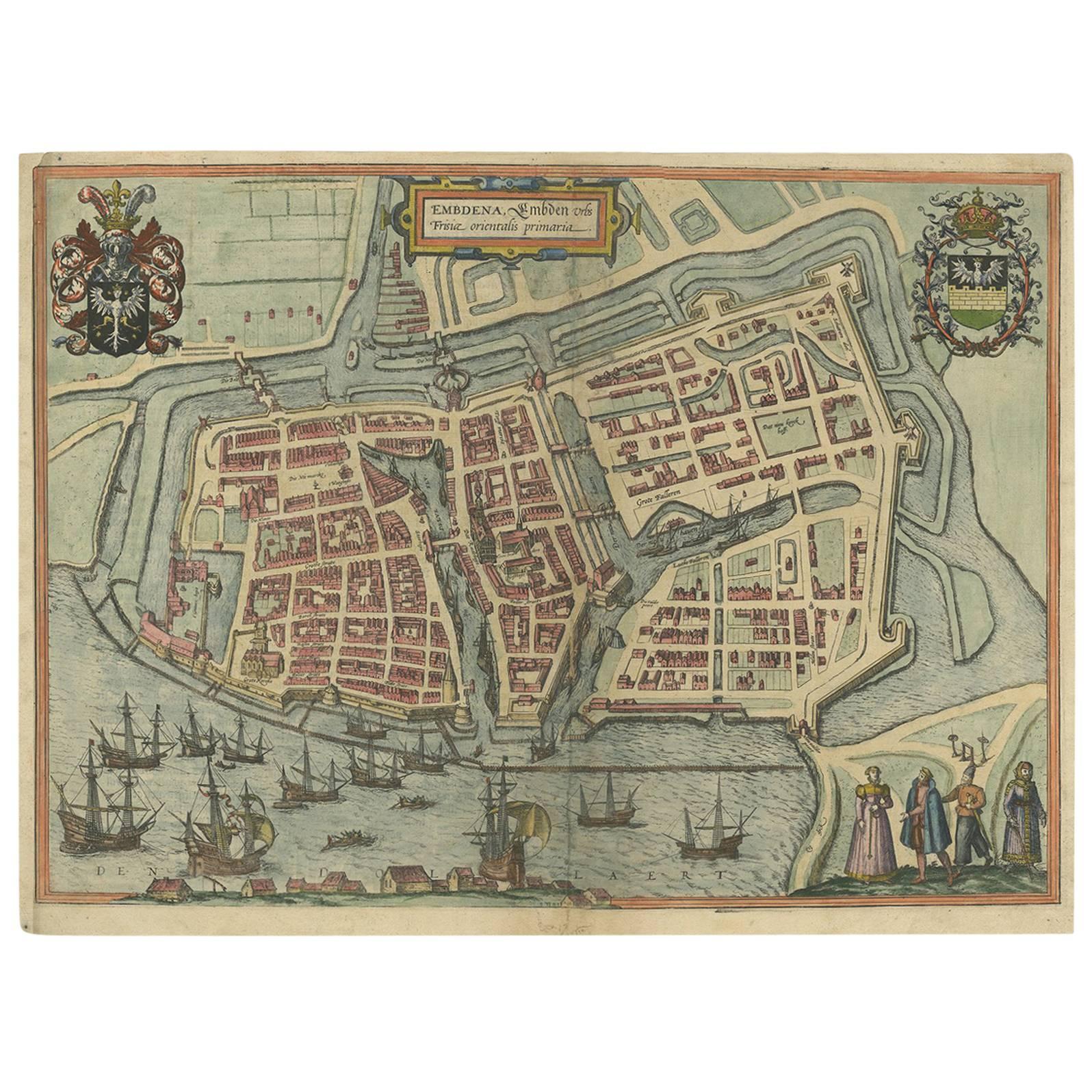
- Antique Town Plan of Emden ‘Germany’ by Braun & Hogenberg, 1597Located in Langweer, NLAntique map titled 'Embdena (..)'. Old, antique bird's-eye view plan of Emden, Germany. This bird's-eye view from the southwest over the Dollart shows Emden, which developed from a trading settlement in the 7th/8th centuries into a city as late as late 14th century. In 1494 it was granted staple rights, and in 1536 the harbour was extended. In the mid-16th century Emden's port was thought to have the most ships in Europe. Its population then was about 5,000, rising to 15,000 by the end of the 16th century. The Ems flowed directly under the city walls, but its course was changed in the 17th century by the construction of a canal. Emden has canals within its city limits, a typical feature of Dutch towns, which also enabled the extension of the harbour. Emden's first herring company was founded in 1553, and in 1595 Emden was created a Free Imperial City under the protection of Holland. Published by Braun...Category
Antique 16th Century Maps
MaterialsPaper
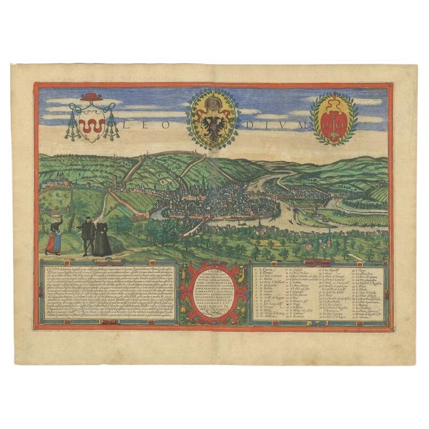
- Antique Print of Liège / Luik in Belgium by Braun & Hogenberg, 1575Located in Langweer, NLAntique print titled 'Leodium'. View of Liège / Luik, Belgium with surrounding hills and the city wall. With text explaining the origins of Liège, a cartouche expressing thanks to th...Category
Antique 16th Century Prints
MaterialsPaper
- Antique Map of Douai 'France' by Braun & Hogenberg, circa 1575Located in Langweer, NLBeautiful map in excellent condition. This map depicts the city of Douai (France) and originates from 'Civitates Orbis Terrarum'.Category
Antique 16th Century Maps
MaterialsPaper
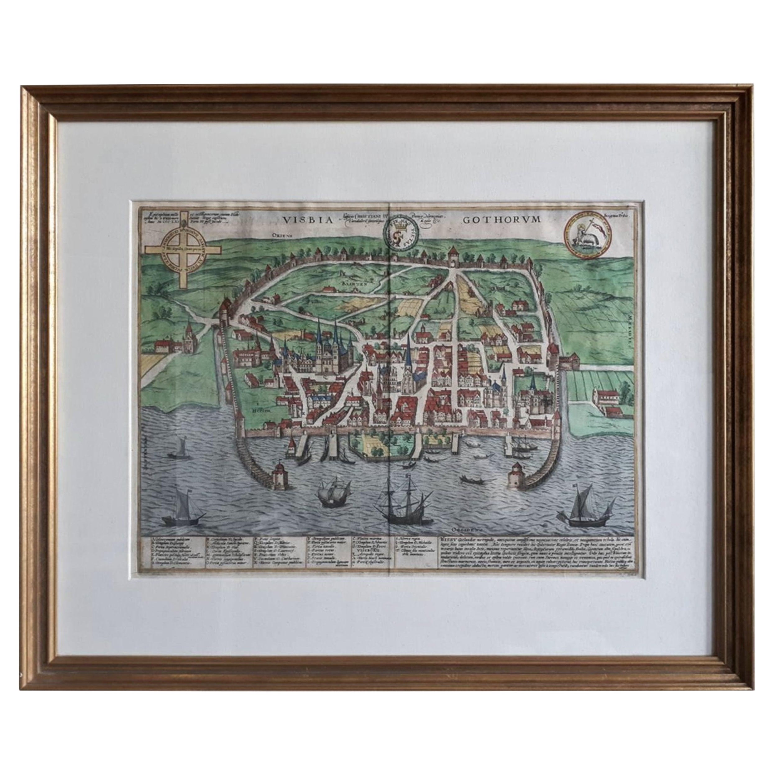
- Antique Map of the City of Visby 'Sweden' by F. Hogenberg, 1598Located in Langweer, NLThis is a wonderful bird's-eye plan/view of the oldest city in Sweden. Visby, the largest city on the island of Gotland was an important Viking city and the main centre of the Ha...Category
Antique 16th Century Maps
MaterialsPaper
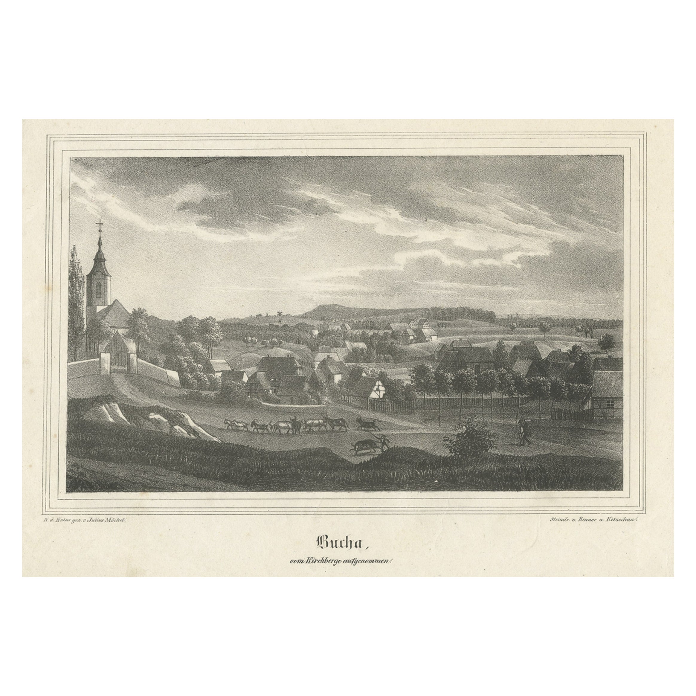
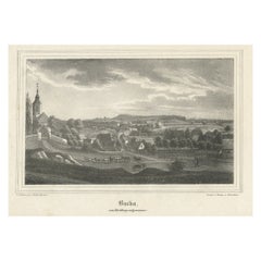
- Antique Print of Bucha in Germany, c.1840Located in Langweer, NLAntique print titled 'Bucha, vom Kirchberge aufgenommen'. View of Bucha, Germany. Source unknown, to be determined. Artists and Engravers: Published by Renner & Ketzschau. Cond...Category
Antique 19th Century Prints
MaterialsPaper
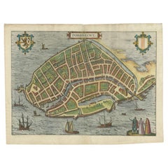
- Antique Map of the City of Dordrecht by Braun & Hogenberg, c.1581Located in Langweer, NLAntique map titled 'Dordrecht'. Map of the city of Dordrecht, the Netherlands. Bird's-eye plan view of the city, with many ships and two coats of arms in upper corners. This map orig...Category
Antique 16th Century Maps
MaterialsPaper

You May Also Like
- Antique Shooting Print by Archibald ThorburnBy Archibald ThorburnLocated in Oxfordshire, GBPartridge shooting picture by Archibald Thorburn. A game bird photogravure titled 'Coming Over The Guns (Partridge Driving)' by Archibald Thorburn. The partridge shooting picture is...Category
Antique Early 1900s English Sporting Art Sports Equipment and Memorabilia
MaterialsPaper
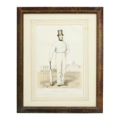
- Antique Cricket Print of Joseph Guy of NottinghamLocated in Oxfordshire, GBCricket print of Joseph Guy of Nottingham. A framed, tinted and hand colored lithographic portrait of the All- England cricketer Joseph Guy (1813 - 187...Category
Antique 1850s British Sporting Art Sports Equipment and Memorabilia
MaterialsPaper
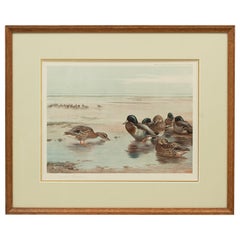
- Antique Wildfowl Print Mallards Feeding by Archibald ThorburnLocated in Oxfordshire, GBMallards by Archibald Thorburn. A framed wildfowl colotype print by Archibald Thorburn, signed in pencil by the artist and bearing fine Art Trade Guild blind stamp. Copyright Publis...Category
Vintage 1920s British Sporting Art Prints
MaterialsPaper
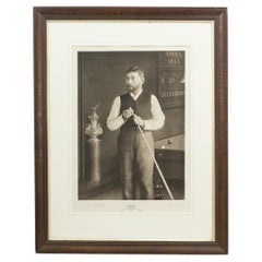
- Antique Billiard Print of a Player, John Roberts JuniorLocated in Oxfordshire, GBJohn Roberts Junior Photogravure. Late 19th century study of John Roberts Junior, billiards player, signed in pencil by John Roberts Junior and the artist Thomas Edward Gaunt. Robe...Category
Antique 1890s German Sporting Art Prints
MaterialsPaper
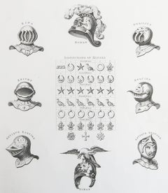
- Original Antique Print of Armour / Helmets, Circa 1820Located in St Annes, LancashireGreat image of helmets Copper-plate engraving Published C.1820 Unframed.Category
Antique 1820s English Georgian Prints
MaterialsPaper
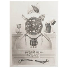
- Original Antique Print of Relics of Bonnie Prince Charlie. C.1880Located in St Annes, LancashireGreat image of relics belonging to Charles Edward Stuart, Bonnie Prince Charlie Fine steel engraving by Charles Lawrie Published by Blackie, Edinburgh,Circa 1880 Unframed.Category
Antique 1880s English Prints
MaterialsPaper