Items Similar to Cartographic Treasures: A Journey Through the Gascogne and Guyenne Regions, 1680

Want more images or videos?
Request additional images or videos from the seller
1 of 6
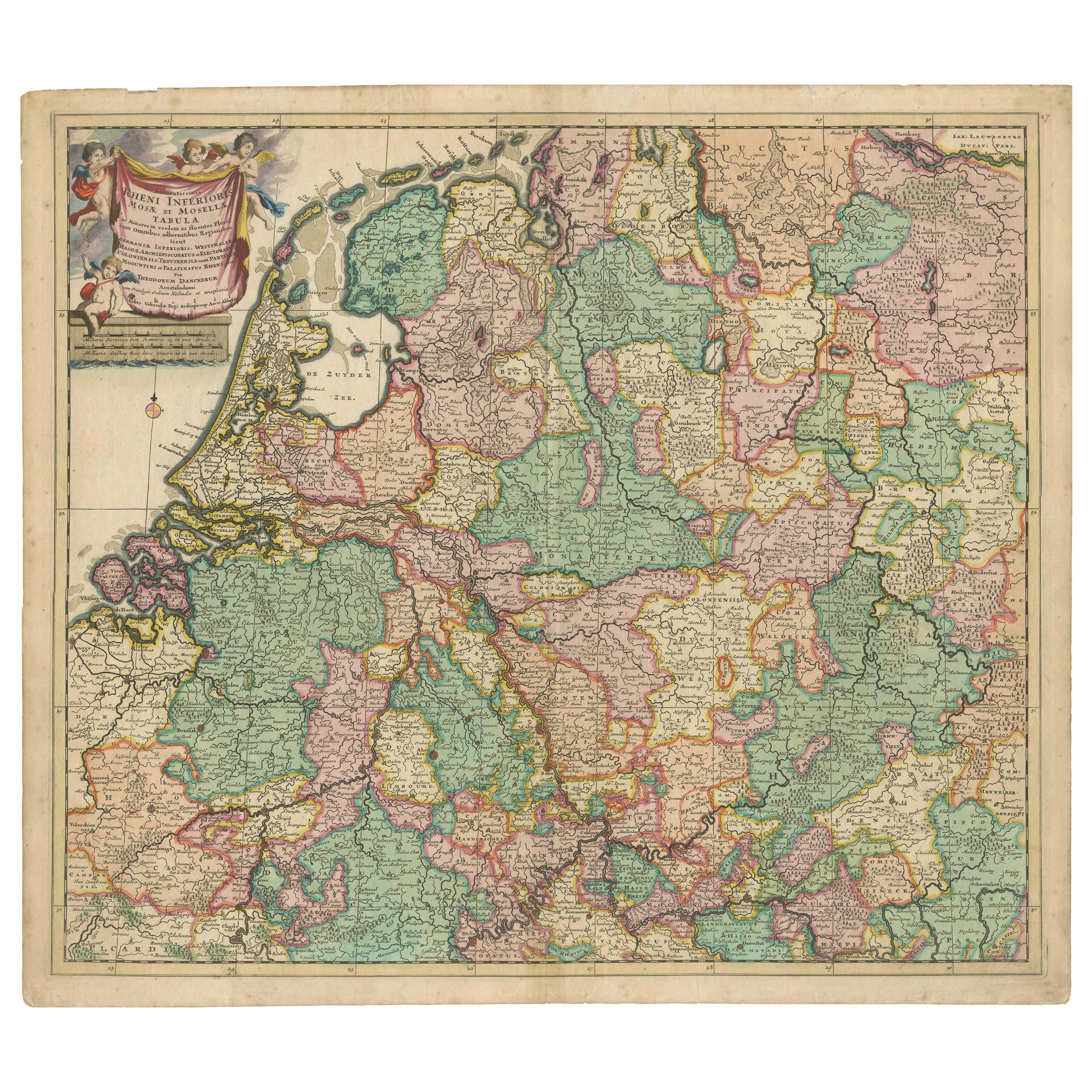
Cartographic Treasures: A Journey Through the Gascogne and Guyenne Regions, 1680
About the Item
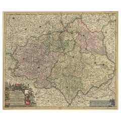
The antique map titled "Gouvernement de La Guienne & Gascogne" depicts the region of Gascogne and Guyenne, known for their wine production, in France.
This map is a rare edition, unsigned, and has a blank verso. It likely originated from a composite atlas. The map was published by or after Blaeu, a renowned Dutch cartographer who was active in the 17th century. Maps like these are highly sought after by collectors due to their historical significance and artistic quality.
On the antique map "Gouvernement de La Guienne & Gascogne," some of the highlights include:
1. **Cities and Towns:** Major cities and towns within the regions of Gascogne and Guyenne would be highlighted. These could include Bordeaux, Toulouse, Bayonne, and others.
2. **Rivers and Waterways:** Significant rivers such as the Garonne, Dordogne, and Adour, which are important for transportation and agriculture, depicted prominently.
3. **Topographical Features:** Mountains, hills, and other topographical features that characterize the landscape of Gascogne and Guyenne are depicted on the map.
4. **Wine Regions:** Given the importance of wine production in these regions, vineyards and wine-producing areas might be highlighted or labeled on the map.
5. **Political Boundaries:** Borders of provinces, counties, or other administrative divisions existing at the time the map was created are outlined.
6. **Cartouche:** Elaborate decorative elements, such as a cartouche, adorn the map, providing information about the mapmaker, the year of creation, or other relevant details.
7. **Coastlines:** The coastlines along the Bay of Biscay and the Atlantic Ocean are detailed, indicating ports and coastal features.
These highlights would provide valuable insights into the geography, culture, and history of the Gascogne and Guyenne regions during the time period when the map was created.
- Dimensions:Height: 20.08 in (51 cm)Width: 23.82 in (60.5 cm)Depth: 0.02 in (0.5 mm)
- Materials and Techniques:
- Period:Late 17th Century
- Date of Manufacture:circa 1680
- Condition:General age-related toning, blank verso. Minor wear, please study images carefully.
- Seller Location:Langweer, NL
- Reference Number:
About the Seller
5.0
Platinum Seller
These expertly vetted sellers are 1stDibs' most experienced sellers and are rated highest by our customers.
Established in 2009
1stDibs seller since 2017
1,929 sales on 1stDibs
Typical response time: <1 hour
- ShippingRetrieving quote...Ships From: Langweer, Netherlands
- Return PolicyA return for this item may be initiated within 14 days of delivery.
More From This SellerView All
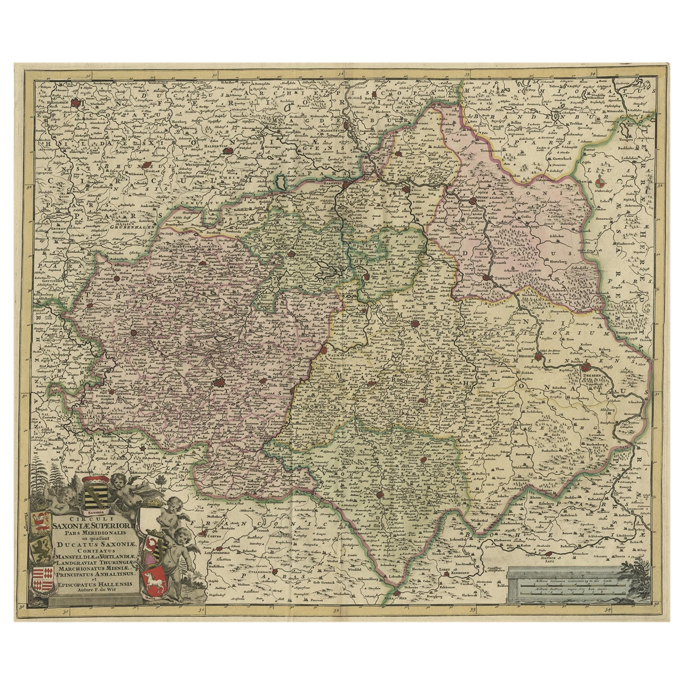
- Old Detailed Map of the Historical Regions of the Duchy of Saxony, Germany, 1680Located in Langweer, NLAntique map titled 'Circuli Saxoniae Superior Pars Meridionalis in qua sunt Ducatus Saxoniae, Comitatus Mansfeldiae, et Voitlandiae, Landgraviat Thuringiae, Marchionatus Misniae Prin...Category
Antique 1680s Maps
MaterialsPaper
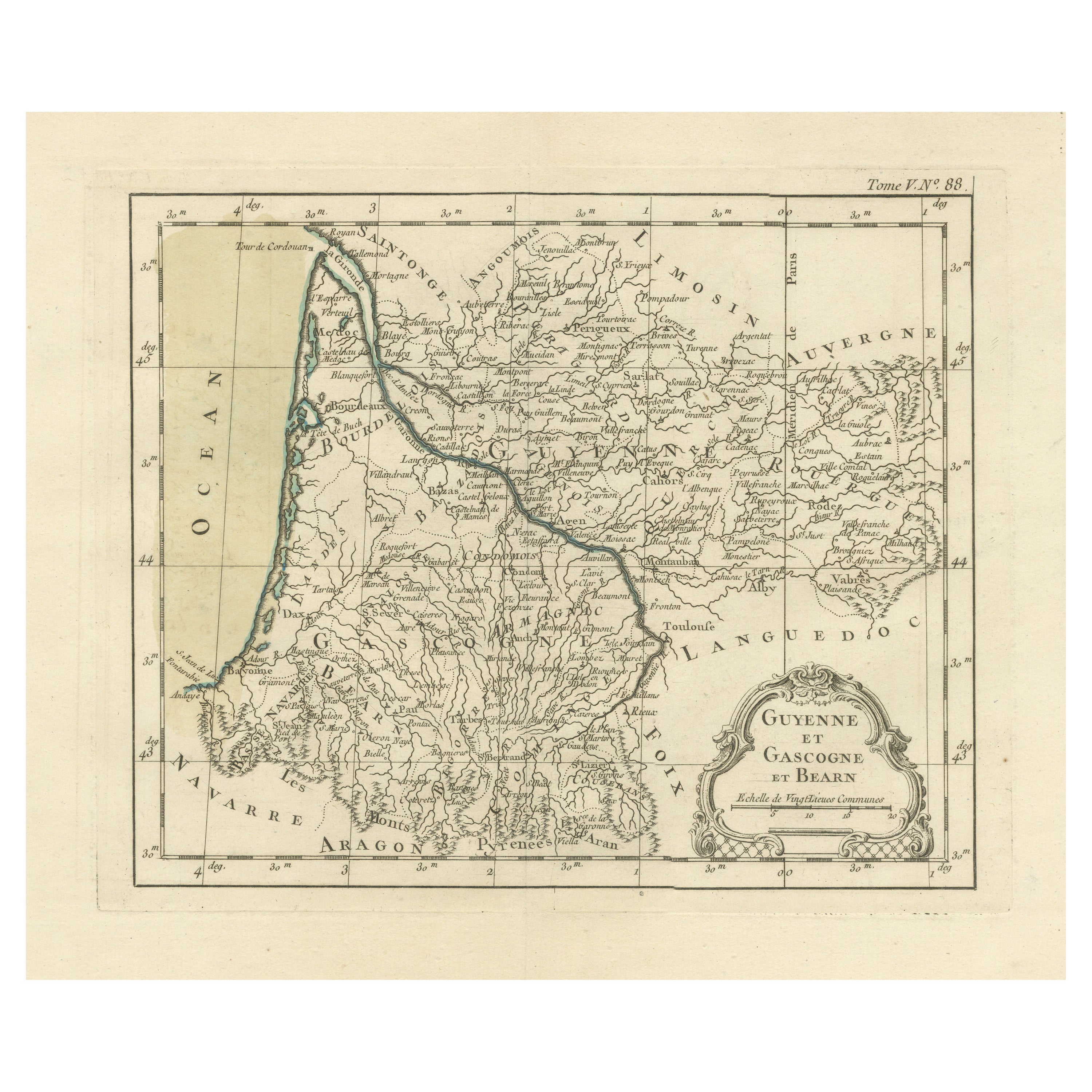
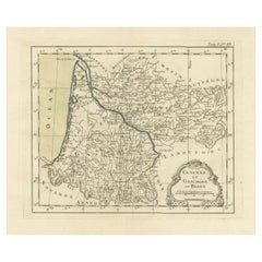
- Antique Map of Guyenne, Gascony and Béarn, FranceLocated in Langweer, NLAntique map titled 'Guyenne et Gascogne et Bearn'. Original old map of Guyenne (or Guienne), Gascony and Béarn, France. This map originates from 'Le Petit Atlas Maritime Recueil De C...Category
Antique Mid-18th Century Maps
MaterialsPaper
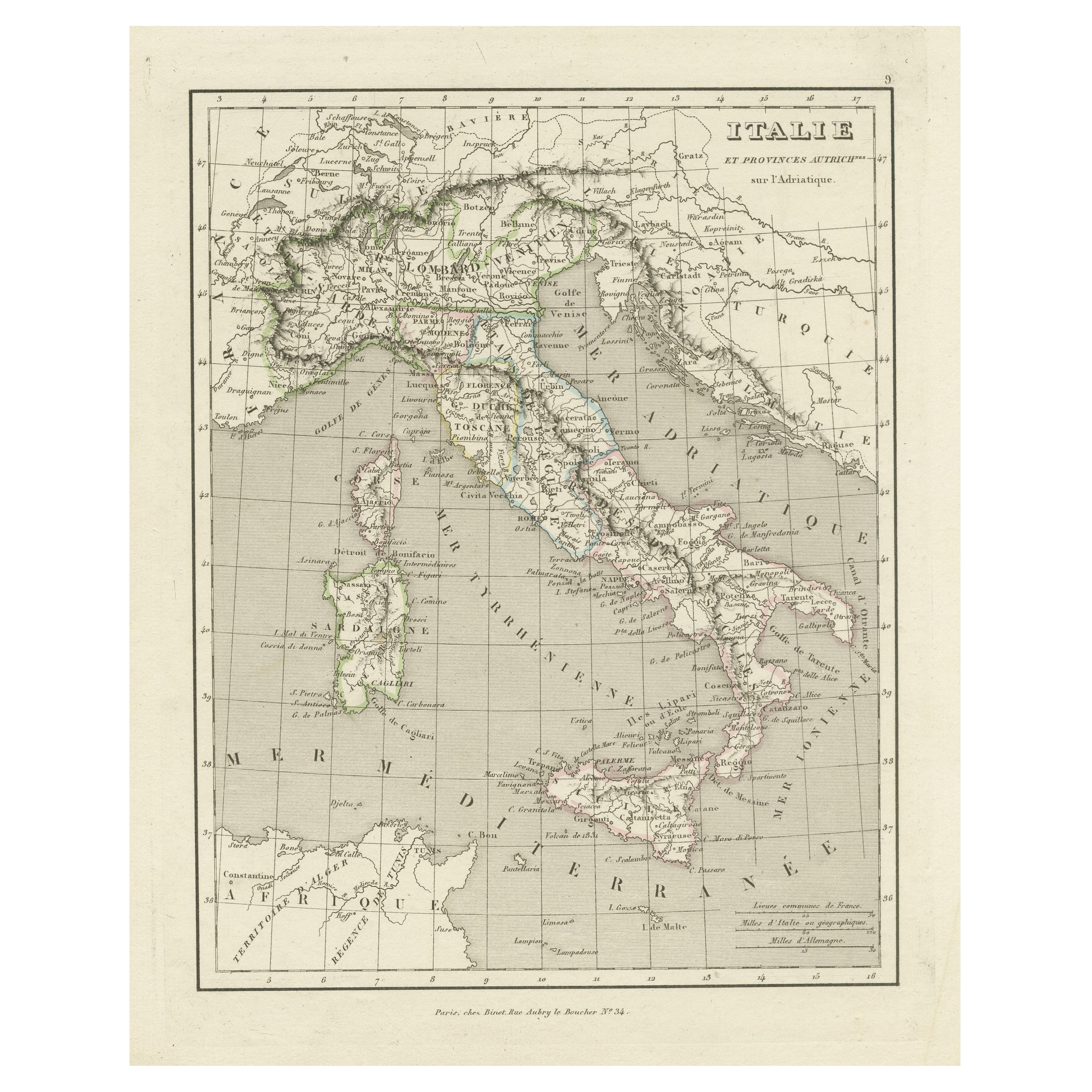
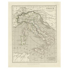
- Antique Map of Italy and Other Regions Near the Adriatic SeaLocated in Langweer, NLAntique map titled 'Italie et Provinces Autrichnes sur l'Adriatique'. Original old map of Italy and surroundings. Also shows Sicily and Sardinia. Ori...Category
Antique Mid-19th Century Maps
MaterialsPaper
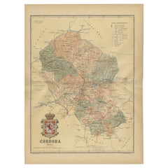
- Córdoba 1901: A Cartographic Journey Through Andalusia’s Heartland in SpainLocated in Langweer, NLThe map provided is of the province of Córdoba, part of the autonomous community of Andalusia in southern Spain, as of the year 1901. It details various elements: The map displays the varied terrain of Córdoba, including the Sierra Morena to the north and the beginning of the Subbaetic Range to the south. It shows blue lines indicating rivers, most likely including the Guadalquivir River, which runs through the province. Red lines represent the transportation network of roads and railways, detailing how the province is interconnected. Symbols on the map mark the locations of cities, towns, and villages, with the capital city of Córdoba highlighted. Dotted lines suggest the borders of the province within the region of Andalusia. A legend (Signos Convencionales) details the symbols used for provincial capitals, roads, railways, and other features. A scale in kilometers is included to assist in measuring distances between points on the map. The coat of arms of Córdoba is prominently featured, displaying a castle and a lion, which are common heraldic symbols with historical significance to the region. About the province of Córdoba: Córdoba is historically significant, known for its cultural heritage, particularly during the time when it was the capital of the Islamic Emirate and then Caliphate of Córdoba. This period left a lasting architectural mark, notably the Mezquita-Catedral (Mosque-Cathedral), which is a UNESCO World Heritage site. The province's geography is diverse, with fertile valleys in the Guadalquivir basin and extensive olive groves, making it one of the most important areas for olive oil production...Category
Antique Early 1900s Maps
MaterialsPaper
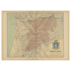
- Beira Alta: A Cartographic Journey Through Portugal's Heartland in 1903Located in Langweer, NLThe uploaded image is a historical map of the Beira Alta region in Portugal. The map is detailed, showing the topography, hydrography, and transportation networks of the region, incl...Category
Antique Early 1900s Maps
MaterialsPaper
- Antique Map of the Arctic Regions by Lowry '1852'Located in Langweer, NLAntique map titled 'Arctic Regions'. Original map of the Arctic Regions. This map originates from 'Lowry's Table Atlas constructed and engraved from the most recent Authorities' by J...Category
Antique Mid-19th Century Maps
MaterialsPaper

You May Also Like
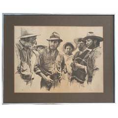
- American Western Movie Lithograph "The Treasure of the Sierra Madre", SignedLocated in Miami, FLA very nice Hollywood movie original lithograph for the film The Treasure of the Sierra Madre, directed by John Huston. Starring Humphrey Bogart, Walter H...Category
Early 20th Century American Prints
MaterialsPaper
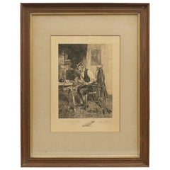
- Dendy Sadler, "The Royal and Ancient" Golf PrintLocated in Oxfordshire, GBGolf print 'The Royal and Ancient' after Dendy Sadler. A good oak framed artist proof golf etching by James Dobie after the painting by Dendy Sadler. The ...Category
Vintage 1910s English Sporting Art Sports Equipment and Memorabilia
MaterialsOak, Paper
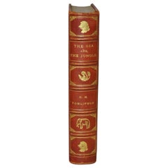
- H.M. Tomlinson "The Sea and The Jungle" 1st Edition Woodcuts by Clare LeightonBy TomlinsonLocated in San Francisco, CAH.M. Tomlinson "The Sea and The Jungle" First Edition with woodcuts by Clare Leighton, circa 1930 Rare First Edition. Very good condition. Fantastic woodcuts by noted artist Clare...Category
Early 20th Century American American Classical Books
MaterialsOther
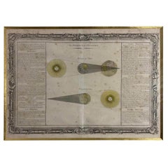
- "The Zodiac and Eclyptics" French Engraved 18th CenturyLocated in Beuzevillette, FRThis interesting and rare 18th Century astronomy print represents an eclipse of the Sun and one of the Moon. Entitled " The Zodiac and Eclyptics", it explains what the Zodiac is and its main uses. The french texts develop numerous observations on the Zodiac. In the centre we find the illustrations of the different eclipses. The text and the drawing are surrounded by an engraved frame made up of various plants and shell motifs but also of scientific objects...Category
Antique Early 18th Century French Louis XV Prints
MaterialsPaper
- Anatomical Wall Chart Depicting the Human Lymphatic and Blood VesselsLocated in Berghuelen, DEA rare 19-carat anatomical wall chart depicting the human lymphatic and blood vessels. On the sides with detailed description in German language. Print...Category
Early 20th Century German Victorian Prints
MaterialsPaper
- Hand-Colored 18th Century Homann Map of the Black Sea, Turkey and Asia MinorBy Johann Baptist HomannLocated in Alamo, CAAn attractive original early 18th century hand-colored map of the Black Sea and Turkey entitled "Carte de L'Asie Minevre ou de la Natolie et du Pont Evxin Tiree des Voyages et des Ob...Category
Antique Early 18th Century German Maps
MaterialsPaper