Wine Region Map
1
to
23
139
13
70
69
58
39
22
19
19
19
19
12
11
8
7
7
5
5
3
3
3
2
2
1
1
1
1
1
1
41
2
1
1
1
Sort By
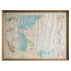
Gilt Framed Vintage Wine Regions of France Map
Located in Alton, GB
Framed French wine region map 1973. The print has been removed to clean the glass, the frame has
Category
Vintage 1970s French Posters
Materials
Paper
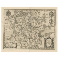
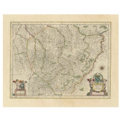
Old Map Focusing on the Wine Region of Metz, the Moselle Region of France, 1657
Located in Langweer, NL
Antique map of France titled 'Territorium Metense'.
Old map focusing on the wine region
Category
Antique 1650s Maps
Materials
Paper
H 19.69 in W 23.63 in D 0 in
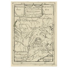
Nice Detailed Antique Miniature Map of the Burgundy Wine Region, France, ca.1683
Located in Langweer, NL
miniature map of the Burgundy region, France. Originates from Mallet's 'Description de l'Univers
Category
Antique 1680s Maps
Materials
Paper
H 7.49 in W 5.32 in D 0 in
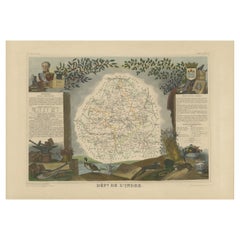
Antique Map of the Indre Region in France, ca. 1852
Located in Langweer, NL
the Loire Valley wine region, this area is known for its production of Chinon wines, typically red
Category
Antique Mid-19th Century Maps
Materials
Paper
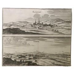
17th Century Topographical Map, French Champagne Region, Epernay, Iohan Peeters
Located in New York, NY
Champagne Region of North Eastern France.
Fabulous period engraving for a Wine Cellar, Bar, Dining Room
Category
Antique 17th Century Dutch Maps
Materials
Paper
H 12.38 in W 15.5 in D 0 in
Authentic 1644 Janssonius Map of the Champagne Region (Campania) in France
Located in Langweer, NL
viticultural heritage, being the birthplace of the eponymous Champagne sparkling wine. The region's unique
Category
Antique 1640s Maps
Materials
Paper
Free Shipping
H 21.86 in W 25.99 in D 0 in
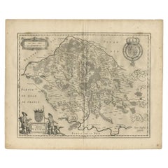
Antique Map of the Seine-et-Marne / Champagne Region by Janssonius, 1657
By Johannes Janssonius
Located in Langweer, NL
Antique map of France titled 'Valesium Ducatus Valois'. Oriented to the north of the Picardy region
Category
Antique 17th Century Maps
Materials
Paper
H 19.69 in W 23.63 in D 0 in
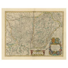
1644 Janssonius Original Wine Regions Map: The Ducal and Comital Burgundy
Located in Langweer, NL
This authentic handcolored map is a detailed 17th-century depiction of the Burgundy region
Category
Antique 1640s Maps
Materials
Paper
Free Shipping
H 19.1 in W 22.84 in D 0 in
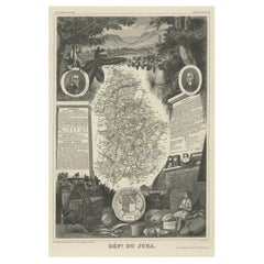
Antique Map of Jura, a Famous Wine Area in France, 1854
Located in Langweer, NL
Antique map titled 'Dépt. du Jura'. Map of the French department Jura, France.
Jura is a
Category
Antique 19th Century Maps
Materials
Paper
Map of Rhône: Culture and Commerce in Lyon's Silk and Wine Legacy, 1852
Located in Langweer, NL
region's geography, economy, and notable figures. The use of color along the boundaries makes the map not
Category
Antique 1850s Maps
Materials
Paper
Antique Map of Cher in France, 1854
By Victor Levasseur
Located in Langweer, NL
, France. This department includes the Jurancon wine region, famous for its production dry wines and sweet
Category
Antique Mid-19th Century Maps
Materials
Paper
Antique Map of Moselle ‘France’ by V. Levasseur, 1854
Located in Langweer, NL
area, part of the Alcase-Lorraine wine region, is known for its production of wines by the same name
Category
Antique Mid-19th Century Maps
Materials
Paper
Old Map of the French Department of Nièvre, France
By Victor Levasseur
Located in Langweer, NL
the prestiegous Burgundy or Bourgogne wine region this area is known for its production of Pouilly
Category
Antique Mid-19th Century Maps
Materials
Paper
Antique Map of Nièvre ‘France’ by V. Levasseur, 1854
Located in Langweer, NL
the prestiegous Burgundy or Bourgogne wine region this area is known for its production of Pouilly
Category
Antique Mid-19th Century Maps
Materials
Paper
Antique Map of Meurthe ‘France’ by V. Levasseur, 1854
Located in Langweer, NL
Lorraine and the Alsace-Lorraine wine region. This map originates from ‘Atlas National de la France
Category
Antique Mid-19th Century Maps
Materials
Paper
Antique Map of Lot ‘France’ by V. Levasseur, 1854
Located in Langweer, NL
northern part of this region. This map originates from ‘Atlas National de la France Illustré’. Published by
Category
Antique Mid-19th Century Maps
Materials
Paper
Antique Map of Loire ‘France’ by V. Levasseur, 1854
Located in Langweer, NL
France is part of the Loire Valley wine growing region. The area includes 87 appellations under the
Category
Antique Mid-19th Century Maps
Materials
Paper
Old Map of the French Department of Indre, France
By Victor Levasseur
Located in Langweer, NL
Loire Valley wine region, this area is known for its production of Chinon wines, typically red, and
Category
Antique Mid-19th Century Maps
Materials
Paper
Old Map of the French Department of Ardèche, France
By Victor Levasseur
Located in Langweer, NL
Antique map titled 'Dépt. de l'Ardèche'. Map of the Department of Ardèche, France. This region is
Category
Antique Mid-19th Century Maps
Materials
Paper
Antique Map of Loire ‘France’ by V. Levasseur, 1854
Located in Langweer, NL
France is part of the Loire Valley wine growing region. The area includes 87 appellations under the
Category
Antique Mid-19th Century Maps
Materials
Paper
Antique Map of Indre ‘France’ by V. Levasseur, 1854
Located in Langweer, NL
Loire Valley wine region, this area is known for its production of Chinon wines, typically red, and
Category
Antique Mid-19th Century Maps
Materials
Paper
Antique Map of Mayenne ‘France’ by V. Levasseur, 1854
Located in Langweer, NL
area is part of the Loire Valley wine region. The map is surrounded by elaborate decorative engravings
Category
Antique Mid-19th Century Maps
Materials
Paper
Antique Map of Hérault ‘France’ by V. Levasseur, 1854
Located in Langweer, NL
is home to a wide variety of vineyards and is part of the larger Languedoc wine-growing region, the
Category
Antique Mid-19th Century Maps
Materials
Paper
Antique Map of Meuse ‘France’ by V. Levasseur, 1854
Located in Langweer, NL
Meaux cheeses. In fact, more than 60% of Brie de Meaux production takes place in this region. This map
Category
Antique Mid-19th Century Maps
Materials
Paper
Antique Map of Marne ‘France’ by V. Levasseur, 1854
Located in Langweer, NL
department is home to the Champagne region where the world's finest sparkling wine is produced. The map is
Category
Antique Mid-19th Century Maps
Materials
Paper
Old Map of the French Department of Loiret, France
By Victor Levasseur
Located in Langweer, NL
Heritage Site. This area of France is also part of the Loire Valley wine region, and is especially known
Category
Antique Mid-19th Century Maps
Materials
Paper
Antique Map of Gironde ‘France’ by V. Levasseur, 1854
By Victor Levasseur
Located in Langweer, NL
department is the seat of the Bordeaux wine region and produces many of the world's finest reds. Shows
Category
Antique Mid-19th Century Maps
Materials
Paper
Antique Map of Loiret ‘France’ by V. Levasseur, 1854
Located in Langweer, NL
Heritage Site. This area of France is also part of the Loire Valley wine region, and is especially known
Category
Antique Mid-19th Century Maps
Materials
Paper
Antique Map of Tarn and Garonne in France, 1854
By Victor Levasseur
Located in Langweer, NL
, which has a reputation for producing supple and full-bodied wines. This region is also a historic
Category
Antique Mid-19th Century Maps
Materials
Paper
Antique Map of Basses Pyrénées ‘France’ by V. Levasseur, 1854
By Victor Levasseur
Located in Langweer, NL
, France. This department includes the Jurancon wine region, famous for its production dry wines and sweet
Category
Antique Mid-19th Century Maps
Materials
Paper
Hand Colored Antique Map of the Department of Nièvre, France
By Victor Levasseur
Located in Langweer, NL
the prestiegous Burgundy or Bourgogne wine region this area is known for its production of Pouilly
Category
Antique Mid-19th Century Maps
Materials
Paper
Hand Colored Antique Map of the Department of Indre, France
By Victor Levasseur
Located in Langweer, NL
Loire Valley wine region, this area is known for its production of Chinon wines, typically red, and
Category
Antique Mid-19th Century Maps
Materials
Paper
Hand Colored Antique Map of the Department of Ardèche, France
By Victor Levasseur
Located in Langweer, NL
Antique map titled 'Dépt. de l'Ardèche'. Map of the Department of Ardèche, France. This region is
Category
Antique Mid-19th Century Maps
Materials
Paper
Antique Map of Northeastern India, Nepal, Bhutan, Assam and Bangladesh
Located in Langweer, NL
'. Interesting map showing the region of northeastern India, Nepal, Bhutan, Assam and Bangladesh. At center is
Category
Antique Early 18th Century Maps
Materials
Paper
H 12.72 in W 17.21 in D 0.02 in
Antique Map of Haute Marne ‘France’ by V. Levasseur, 1854
Located in Langweer, NL
. This department is part of the Champagne region, where the world-famous sparkling wine of the same name
Category
Antique Mid-19th Century Maps
Materials
Paper
Antique Map of Loire Inferieure ‘France’ by V. Levasseur, 1854
Located in Langweer, NL
, France (currently known as Loire-Atlantique.) This area of France is part of the Loire Valley wine region
Category
Antique Mid-19th Century Maps
Materials
Paper
Hand Colored Antique Map of the Department of Marne, France
By Victor Levasseur
Located in Langweer, NL
department is home to the Champagne region where the world's finest sparkling wine is produced. The map is
Category
Antique Mid-19th Century Maps
Materials
Paper
Antique Map of Alentejo: Land of Tradition and Tranquility, 1903
Located in Langweer, NL
The image is a historical original antique map of the Alentejo region in Portugal. This map
Category
Antique Early 1900s Maps
Materials
Paper
Free Shipping
H 20.08 in W 14.77 in D 0 in
Antique Map of Bas-Rhin ‘France’ by V. Levasseur, 1854
By Victor Levasseur
Located in Langweer, NL
the Alsace wine region surrounding Strasbourg. This mountainous area on the west bank of the Rhine
Category
Antique Mid-19th Century Maps
Materials
Paper
Antique Map of Haute Loire ‘France’ by V. Levasseur, 1854
Located in Langweer, NL
. This area of France is part of the Loire Valley wine growing region. It is also known for its
Category
Antique Mid-19th Century Maps
Materials
Paper
Burgos 1902: Geographic Map of Castile's Historic Heartland in Spain
Located in Langweer, NL
fertile Ribera del Duero wine region to the southwest and scenic natural areas like the Sierra de la
Category
Antique Early 1900s Maps
Materials
Paper
Free Shipping
H 14.77 in W 20.08 in D 0 in
Antique Map of Haut-Rhin, France by V. Levasseur, 1854
By Victor Levasseur
Located in Langweer, NL
mountainous area is part of the Alsace wine region and is known for its production of both Pinot Noir and
Category
Antique Mid-19th Century Maps
Materials
Paper
Antique Map of Haute-Saone, France by V. Levasseur, 1854
By Victor Levasseur
Located in Langweer, NL
. Part of France's important Burgundy or Bourgogne Wine Region. This area is home to the Jean Roussey
Category
Antique Mid-19th Century Maps
Materials
Paper
Levasseur's 1852 Cartographic Portrait of Gironde: Celebrating the Bordeaux Wine
Located in Langweer, NL
region's geography, economy, and notable figures. The use of color along the boundaries makes the map not
Category
Antique 1850s Maps
Materials
Paper
H 20.67 in W 14.06 in D 0 in
Hand Colored Antique Map of the department of Loiret, France
By Victor Levasseur
Located in Langweer, NL
Heritage Site. This area of France is also part of the Loire Valley wine region, and is especially known
Category
Antique Mid-19th Century Maps
Materials
Paper
Anrtique Map of the Province of Valladolid, Central Spain, 1902
Located in Langweer, NL
, and the region is known for its wine production, particularly the Ribera del Duero DO (Denominación de
Category
Antique Early 1900s Maps
Materials
Paper
Free Shipping
H 14.77 in W 20.08 in D 0 in
17th Century Topographical Map, Champagne-Ardenne, Marsal, Maubert Iohan Peeters
Located in New York, NY
Champagne-Ardennes Region of North Eastern France.
Fabulous period engraving for a Wine Cellar, Bar, Dining
Category
Antique 17th Century Dutch Maps
Materials
Paper
H 12.5 in W 15.5 in D 0 in
Girona 1902: Geographic and Infrastructural Map of Catalonia’s Northern Province
Located in Langweer, NL
The map provided is of the province of Girona (in Catalan, Girona), located in the northeast of
Category
Antique Early 1900s Maps
Materials
Paper
Free Shipping
H 14.77 in W 20.08 in D 0 in
Antique Map of Côte d'Or ‘France’ by V. Levasseur, 1854
By Victor Levasseur
Located in Langweer, NL
of France's Burgundy or Bourgogne wine region, a premier wine-growing region of France. It produces
Category
Antique Mid-19th Century Maps
Materials
Paper
Antique Map of the Pyrenees Orientales 'France' by V. Levasseur, 1854
By Victor Levasseur
Located in Langweer, NL
, France. This area is a well-known wine producing region. A wide variety of wines come out of this region
Category
Antique Mid-19th Century Maps
Materials
Paper
H 13.98 in W 20.67 in D 0.02 in
Antique Map of Côte d'Or ‘France’ by V. Levasseur, 1854
By Victor Levasseur
Located in Langweer, NL
of France's Burgundy or Bourgogne wine region, a premier wine-growing region of France. It produces
Category
Antique Mid-19th Century Maps
Materials
Paper
Old Map of Vaucluse, France: A Cartographic Celebration of Viticulture, 1852
Located in Langweer, NL
region's geography, economy, and notable figures. The use of color along the boundaries makes the map not
Category
Antique 1850s Maps
Materials
Paper
H 14.18 in W 20.99 in D 0 in
Antique Map of Seine et Marne 'France' by V. Levasseur, 1854
By Victor Levasseur
Located in Langweer, NL
, France. This region produces a wide variety of wines and hosts an annual wine and cheese fair. This area
Category
Antique Mid-19th Century Maps
Materials
Paper
Antique Map of Maine et Loire ‘France’ by V. Levasseur, 1854
Located in Langweer, NL
, France. This area of France is part of the Loire Valley wine region, where nearly every wine imaginable
Category
Antique Mid-19th Century Maps
Materials
Paper
Hand Colored Antique Map of the Department of Haute Marne, France
By Victor Levasseur
Located in Langweer, NL
. This department is part of the Champagne region, where the world-famous sparkling wine of the same name
Category
Antique Mid-19th Century Maps
Materials
Paper
Antique Map of the Hautes Pyrenees 'France' by V. Levasseur, 1854
By Victor Levasseur
Located in Langweer, NL
, France. This area is home to the wine producing region, Madiran. Madrian is best known for producing a
Category
Antique Mid-19th Century Maps
Materials
Paper
Hand Colored Antique Map of the Department of Haute Loire, France
By Victor Levasseur
Located in Langweer, NL
. This area of France is part of the Loire Valley wine growing region. It is also known for its
Category
Antique Mid-19th Century Maps
Materials
Paper
Cartographic Heritage: The 1901 Map of the Vizcaya Province in Spain
Located in Langweer, NL
map is "VIZCAYA. 1901." It shows the topographical details of the region with contour lines and
Category
Antique Early 1900s Maps
Materials
Paper
Free Shipping
H 14.77 in W 20.08 in D 0 in
Antique Map of Lot et Garonne ‘France’ by V. Levasseur, 1854
Located in Langweer, NL
the northern part of this region. This map originates from ‘Atlas National de la France Illustré
Category
Antique Mid-19th Century Maps
Materials
Paper
Orense in Depth: A 1902 Topographical Map of Galicia's Mountainous Province
Located in Langweer, NL
The map is a detailed cartographic representation of the province of Orense (Ourense in Galician
Category
Antique Early 1900s Maps
Materials
Paper
Free Shipping
H 14.77 in W 20.08 in D 0 in
- 1
Get Updated with New Arrivals
Save "Wine Region Map", and we’ll notify you when there are new listings in this category.
Wine Region Map For Sale on 1stDibs
Find many varieties of an authentic wine region map available at 1stDibs. A wine region map — often made from paper — can elevate any home. There are many kinds of the wine region map you’re looking for, from those produced as long ago as the 18th Century to those made as recently as the 20th Century. Victor Levasseur and Johannes Janssonius each produced at least one beautiful wine region map that is worth considering.
How Much is a Wine Region Map?
Prices for a wine region map can differ depending upon size, time period and other attributes — at 1stDibs, they begin at $131 and can go as high as $1,973, while the average can fetch as much as $372.
