Items Similar to Levasseur's 1852 Cartographic Portrait of Gironde: Celebrating the Bordeaux Wine

Want more images or videos?
Request additional images or videos from the seller
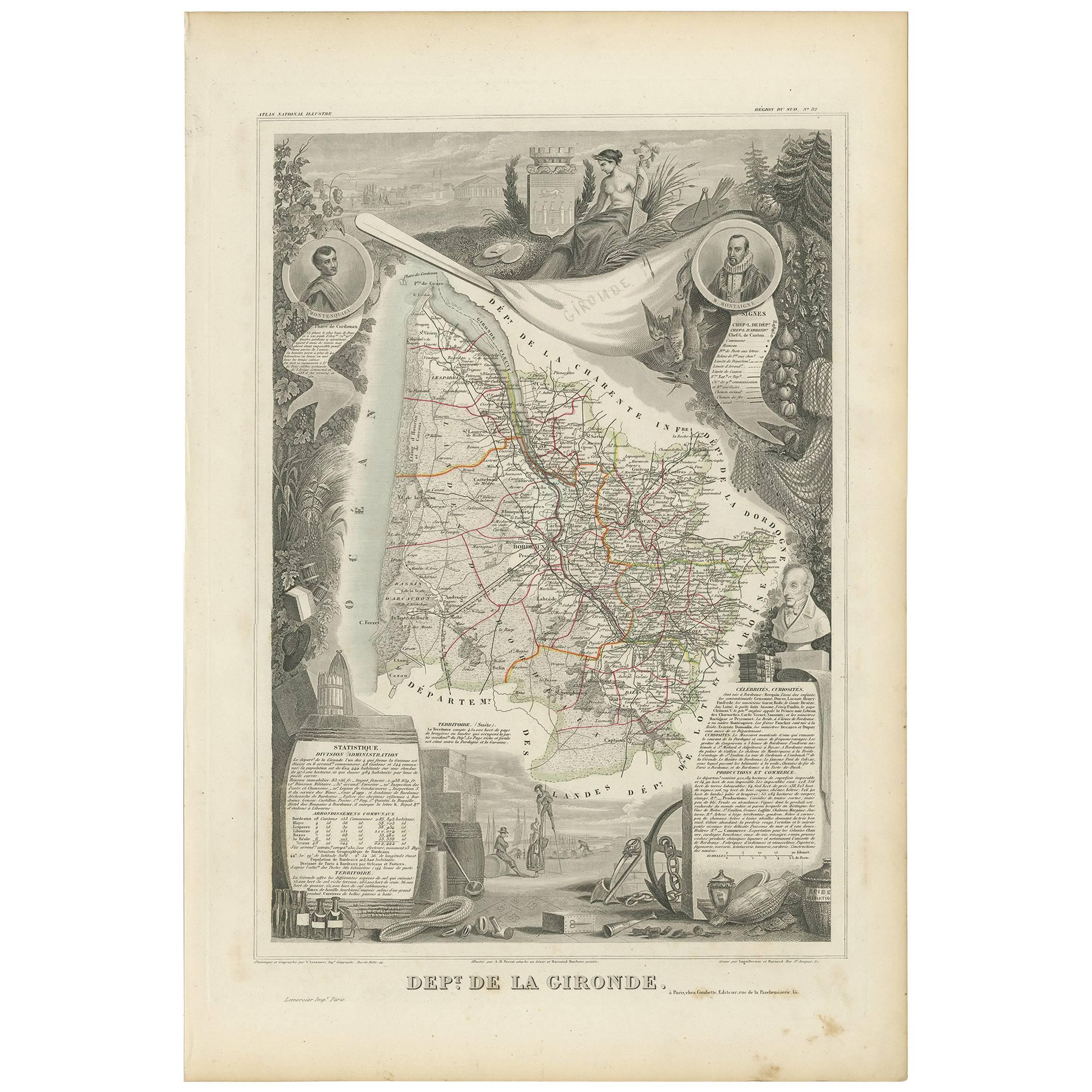
Levasseur's 1852 Cartographic Portrait of Gironde: Celebrating the Bordeaux Wine
About the Item
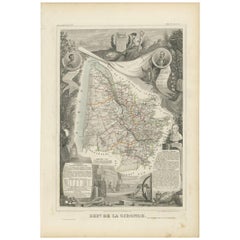
This original hand-colored map is from the "Atlas National Illustré," a work by Victor Levasseur, a French geographer and cartographer known for his richly illustrated maps.
The map is a steel engraving, which was a common and precise method for creating maps at the time. The inclusion of the publisher's name, A. Combette from Paris, and the addresses of the various contributors to the map's creation, like the engravers Laguillermie and Rainaud, adds to the historical context of the piece.
The margins of the map are adorned with detailed illustrations that serve as a visual encyclopedic reference to the region's geography, economy, and notable figures. The use of color along the boundaries makes the map not only a tool for navigation but also an educational resource, providing insights into the department's landscape, economy, and cultural significance.
The text included in the map's design provides statistical information, a map legend, and discussions about the land, local curiosities, notable personalities, products, and commerce, which would have been invaluable for education and reference at the time.
The 'Atlas National Illustré' is celebrated for its combination of cartographic detail and artistic embellishment, making it a valuable cultural artifact. It represents the height of decorative map-making in the 19th century, alongside the works of John Tallis and Archibald Fullarton.
This uploaded image is a detailed and colored map of the Département de la Gironde from Victor Levasseur's "Atlas National Illustré." Similar to the other maps from this series, it features a central map with the title 'Dépt. de la Gironde' at the bottom.
Surrounding the map are decorative vignettes and elements that bring to life the cultural and economic aspects of the Gironde department. On the left, there is likely statistical information about the department and its subdivisions, reflecting the population and administrative details. This is framed by images that may represent the local industries and natural resources, such as wine, which is a central feature of the Bordeaux region located within Gironde.
The right side of the map contains a textual history and descriptions of the region, coupled with portraits of notable figures, possibly historic personages or contributors to the region's cultural and economic development. The illustrations often include agricultural products, symbols of commerce, and scenes of daily life, as well as architectural landmarks.
The presence of wine bottles, barrels, and vineyards in the illustrations would be indicative of the Gironde's prominence in wine production, particularly Bordeaux wines, which are esteemed worldwide. These engravings serve to emphasize the richness of the land and the sophistication of its products.
Maps from this era, especially those by Levasseur, are notable for their combination of art and education, providing a snapshot not only of the geography but also of the societal and economic conditions of the time. The detailed engravings also suggest that this map was as much a decorative piece as it was a functional one, intended for display and reference by those interested in the illustrated region.
The Gironde department in France is renowned for its significant contribution to the wine industry, particularly through the Bordeaux wine region. A bit more about the important places within Gironde and the types of wine the area is known for:
1. **Bordeaux**: The capital city of the department and the heart of the wine region. It's not only an urban center but also a hub for the wine trade.
2. **Médoc**: North of Bordeaux, known for prestigious châteaux and wines like Margaux, Saint-Julien, Pauillac, and Saint-Estèphe.
3. **Saint-Émilion**: East of Bordeaux, recognized for its full-bodied red wines and the picturesque medieval town.
4. **Pomerol**: Also near Saint-Émilion, smaller than its neighbor but equally renowned, particularly for Château Pétrus.
5. **Graves**: South of Bordeaux, known for both red and white wines, including the sub-region of Pessac-Léognan.
6. **Sauternes**: A region within Graves known for its sweet white wines, including the highly celebrated Château d'Yquem.
7. **Entre-Deux-Mers**: Between the Garonne and Dordogne rivers, known for dry white wines.
The Gironde department is home to some of the most prestigious wine appellations in the world. The red wines from this region are typically blends, with Merlot and Cabernet Sauvignon being the most predominant grapes, followed by Cabernet Franc, Petit Verdot, and Malbec. The white wines often include Sauvignon Blanc, Sémillon, and Muscadelle grapes. These wines range from powerful and tannic reds capable of aging for decades to luscious and sweet whites that are coveted by collectors and wine enthusiasts alike.
- Dimensions:Height: 20.67 in (52.5 cm)Width: 14.06 in (35.7 cm)Depth: 0 in (0.02 mm)
- Materials and Techniques:
- Period:
- Date of Manufacture:1852
- Condition:Good. Some soiling around the edgesvand a brown spot outside the image. The image clean and decorative. Study the images carefully.
- Seller Location:Langweer, NL
- Reference Number:
About the Seller
5.0
Platinum Seller
These expertly vetted sellers are 1stDibs' most experienced sellers and are rated highest by our customers.
Established in 2009
1stDibs seller since 2017
1,949 sales on 1stDibs
Typical response time: <1 hour
- ShippingRetrieving quote...Ships From: Langweer, Netherlands
- Return PolicyA return for this item may be initiated within 14 days of delivery.
More From This SellerView All
- Antique Map of Gironde ‘France’ by V. Levasseur, 1854By Victor LevasseurLocated in Langweer, NLAntique map titled 'Dépt. de la Gironde'. Map of the French department of Gironde. This coastal department is the seat of the Bordeaux wine region and produces many of the world's fi...Category
Antique Mid-19th Century Maps
MaterialsPaper
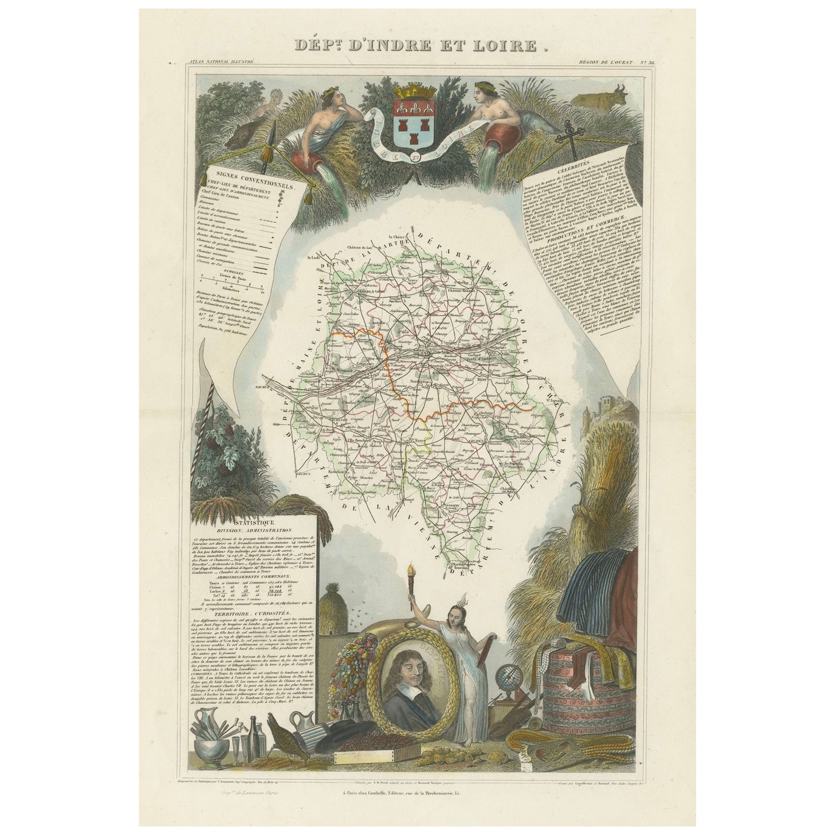
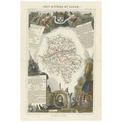
- Mapping History: The Decorative Cartography of Indre-et-Loire by Levasseur, 1856Located in Langweer, NLAn original hand-colored map of the Département d'Indre-et-Loire created by Victor Levasseur in 1856. As an antique steel engraved map, it showcases the detailed craftsmanship and technology of mid-19th century map making. The method of steel engraving allowed for precise and intricate details to be captured, making this map not only a navigational tool but also a work of art. The addition of outline hand colouring is particularly noteworthy. This technique, where colours are applied by hand to the engraved map, was a common practice at the time to highlight certain features such as boundaries, rivers, and cities. The hand colouring on this map would have been done meticulously, adding vibrancy and clarity to the engraved lines and making it easier to differentiate various geographical and political demarcations. The map's wide margins are characteristic of the period's presentation style, offering space for additional annotations or simply serving to frame the map aesthetically when displayed. Such margins also suggest that the map was intended for a discerning audience, possibly for educational or decorative purposes in a library or study. Victor Levasseur was renowned for his decorative maps, often embellished with artistic elements that went beyond mere geographical information. These elements could include vignettes, allegorical figures, and detailed illustrations surrounding the map itself, reflecting the cultural, historical, and economic aspects of the depicted area. While the description does not detail these decorative aspects, it's common for Levasseur's works to feature such embellishments, making his maps highly prized among collectors and historians for both their artistic value and cartographic accuracy. This map of Département d'Indre-et-Loire, with its combination of technical precision in steel engraving and the beauty of hand colouring, represents a fascinating intersection of art and science in the 19th century. It is a testament to the era's dedication to detail, craftsmanship, and the aesthetic presentation of information. The Département d'Indre-et-Loire, located in the central part of France within the region known as the Centre-Val de Loire, is rich in historical and cultural significance, with numerous important places highlighted on a map from 1856 by Victor Levasseur. Based on the region's known historical sites and cities, the following places are likely to be featured or of importance: 1. **Tours**: As the capital city of the Département d'Indre-et-Loire, Tours is a central hub of history, culture, and architecture. It is known for its old town, the Place Plumereau, Tours Cathedral, and its proximity to the Loire River, making it a likely focal point on the map. 2. **Amboise**: This town is famous for the Château d'Amboise, which is closely linked to French royal history and offers panoramic views of the Loire River. Leonardo da Vinci is buried here in the Chapel of Saint-Hubert, associated with the château. 3. **Chinon**: Known for its medieval fortress, the Château de Chinon, this town has deep historical roots, including connections to Joan of Arc and King Charles VII. The fortress and town would be significant landmarks. 4. **Villandry**: The Château de Villandry is renowned for its beautiful Renaissance gardens, which are some of the most impressive in France. While the château might be less emphasized in an 1856 map compared to cities and towns, it's an important site in the region. 5. **Loches**: This town features the Château de Loches, a medieval castle, and the Royal Lodge, noted for its Renaissance architecture. The town's history and architectural landmarks make it a place of interest. 6. **Azay-le-Rideau**: The Château d'Azay-le-Rideau is set on an island in the middle of the Indre River, showcasing the French Renaissance architectural...Category
Antique 1850s Maps
MaterialsPaper
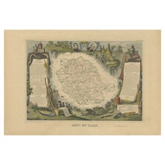
- Antique Map of the Department De Tarn, 'France' by v. Levasseur, c. 1852Located in Langweer, NLAntique map titled 'Dépt Du Tarn'. Map of the French department of Du tarn, France. This area produces a variety of traditional wines, including Cahors, Mauzac, Loin de l’Oeil an...Category
Antique Mid-19th Century French Maps
MaterialsPaper
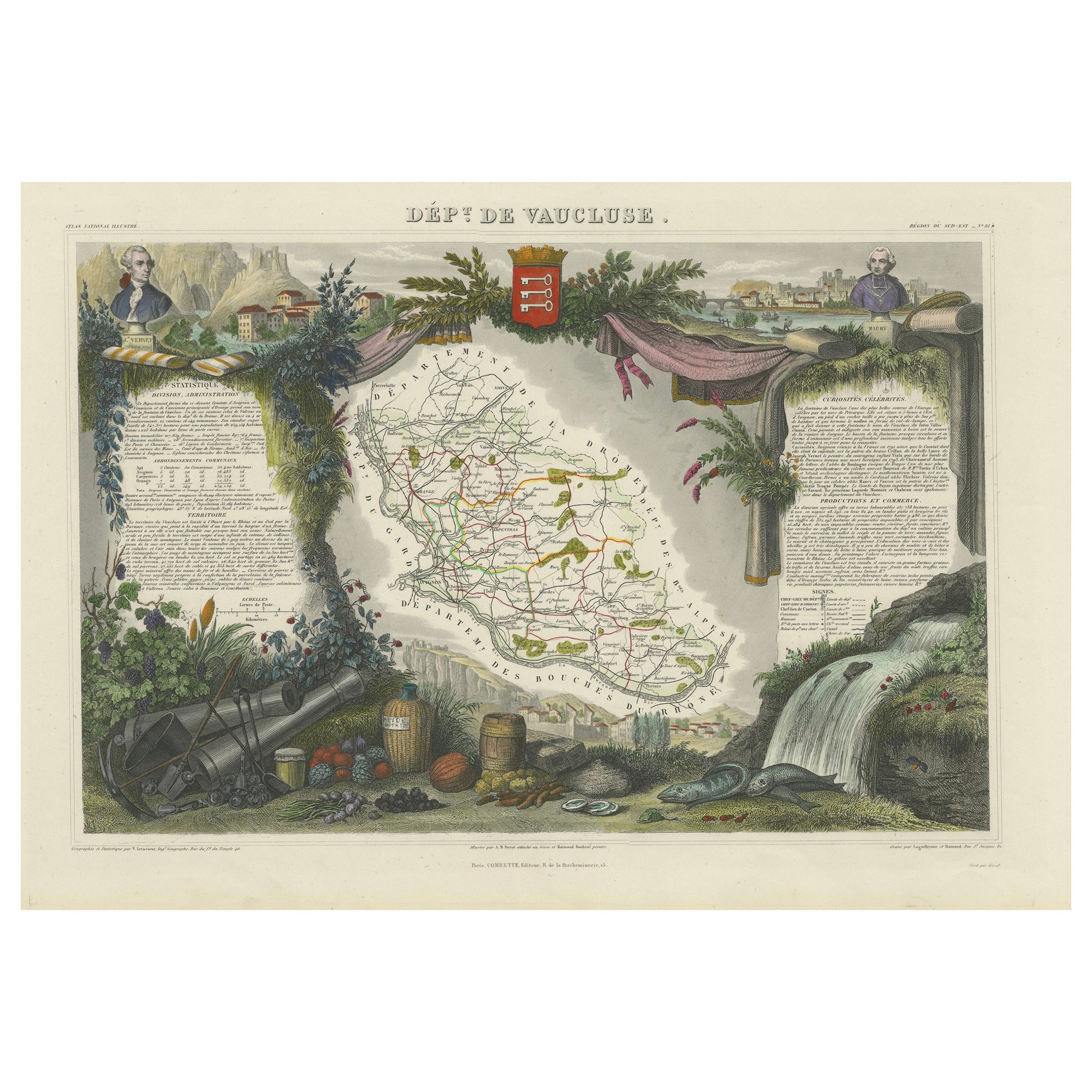
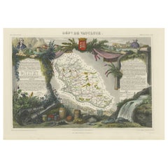
- Old Map of Vaucluse, France: A Cartographic Celebration of Viticulture, 1852Located in Langweer, NLThis original hand-colored map is from the "Atlas National Illustré," a work by Victor Levasseur, a French geographer and cartographer known for his richly illustrated maps. The map...Category
Antique 1850s Maps
MaterialsPaper
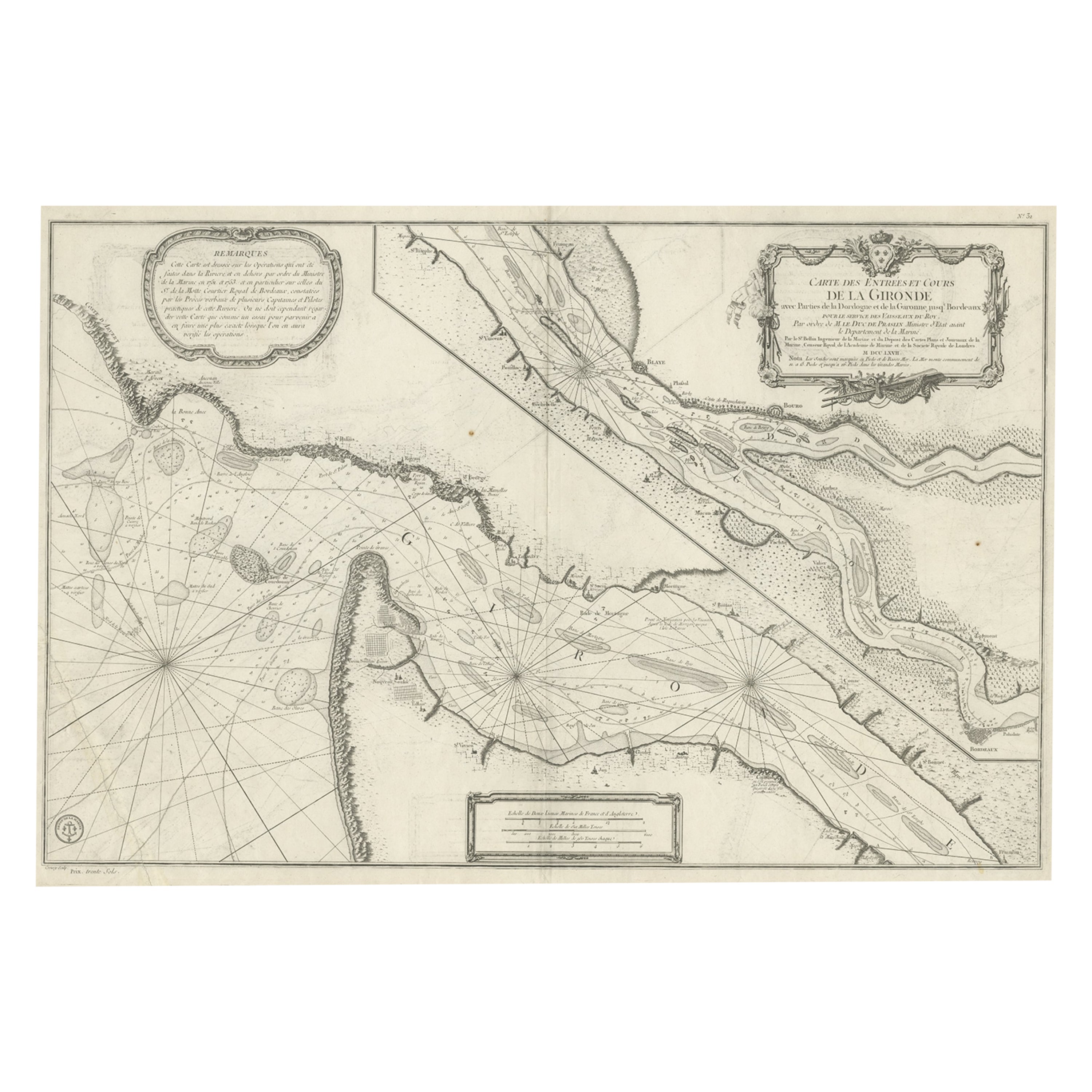
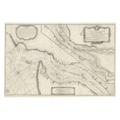
- Gironde, Where Rivers Dordogne & Garonne Meet Near Bordeaux, France, ca.1770Located in Langweer, NLAntique map titled 'Carte des Entrées et Cours de la Gironde'. Large map of the region of the Gironde estuary. It is formed from the meeting of the rivers Dordogne and Garonne ju...Category
Antique 1770s Maps
MaterialsPaper
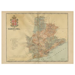
- Barcelona 1901: A Cartographic Portrait of Catalonia's Capital ProvinceLocated in Langweer, NLThis orignal antique map is a historical depiction of the province of Barcelona from 1901. It showcases the varied terrain of the province, with the Serra de Collserola ridge near the city of Barcelona and the Pyrenees to the north. The map includes the coastline along the Mediterranean Sea, indicating Barcelona's position as a coastal province. Blue lines indicate rivers, such as the Llobregat and Besòs, which are significant features in the province's geography. Dotted lines may signify the borders of the province within Catalonia. The coat of arms of Barcelona, highlighted with gold, is prominently displayed, featuring the Cross of Saint George (Cruz de Sant Jordi), the patron saint of Catalonia, and the red and yellow bars which are a symbol of the Aragonese and Catalan heritage. About the province of Barcelona: The province of Barcelona is part of the autonomous community of Catalonia in northeastern Spain. It is the most economically significant region of Catalonia, playing a crucial role in the country's economy due to its port, manufacturing, and service industries. The city of Barcelona is the capital and the second most populous city in Spain, known for its rich cultural heritage, architecture by Antoni Gaudí, such as the Sagrada Família, and its influential art scene. The province enjoys a Mediterranean climate and features diverse landscapes from the beaches along the coast to the mountains in the interior. Barcelona is also known for its vibrant festivals, cuisine, fashion, and sports, particularly football, being home to FC Barcelona...Category
Antique Early 1900s Maps
MaterialsPaper
You May Also Like
- Fine Antique 1856 Hand Watercolour Map of Dept Des Hautes Alpes by Levasseur'sLocated in GBWe are delighted to offer for sale this stunning 1856 hand watercolour map of the Austrian Alps titled Dept Des Hautes Alpes taken from the Atlas National...Category
Antique 1850s French Early Victorian Maps
MaterialsPaper
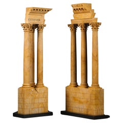
- A Pair of ‘Grand Tour’ Models of Ruins Celebrating the Corinthian OrderBy Benedetto BoschettiLocated in Brighton, West SussexA Large Pair of Giallo Antico Marble ‘Grand Tour’ Models of Ruins Celebrating the Corinthian Order, Attributed To The Workshop Of Benedetto Boschetti. The Temple of Castor and Pollu...Category
Antique 19th Century Italian Grand Tour Models and Miniatures
MaterialsMarble
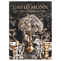
- David Monn The Art of Celebrating Book by David MonnLocated in New York, NYDavid Monn The Art of Celebrating By: David Monn Imagine seeing the world through event planner David Monn’s eyes for just one minute of your life. Imagine walking into a room and k...Category
21st Century and Contemporary Books
MaterialsPaper
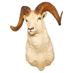
- Celebrating the Majesty of Alaskan Dall Rams: Large Taxidermy ShowcaseLocated in New York, NYMajestic Large Taxidermy Alaskan Dall Ram, an embodiment of the rugged mountain landscapes of Alaska. These magnificent creatures, scientifically known as Ovis dalli dalli, gracefull...Category
21st Century and Contemporary American American Colonial Taxidermy
MaterialsFur, Horn
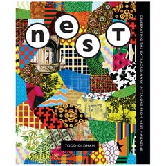
- Best of Nest Celebrating the Extraordinary Interiors from Nest MagazineLocated in New York City, NYThe first comprehensive collection of Nest, the magazine that revolutionized the way we look at interior space and decoration The brainchild of artist and designer Joe Holtzman, Nest magazine...Category
21st Century and Contemporary Books
MaterialsPaper
- Antique Oarsman's Map of the River Thames, English, Cartography, Published 1912Located in Hele, Devon, GBThis is an antique copy of The Oarsman's and Angler's Map of the River Thames - New Edition. An English, bound map book, published in English by Edward Stanford, London, this new edi...Category
Early 20th Century British Other Books
MaterialsPaper


Recently Viewed
View AllMore Ways To Browse
Georg Barque
F V Hayden
Dirk Hartog
De Nile Antiques
Serbia Map
Siam Map
Marthas Vineyard Map
Native American Mountie
Nicolaes Visscher II On Sale
Pierre Fran�ois Tardieu On Sale
Union Pacific Map
Vintage Marthas Vineyard Map
Yemen 1789
Old French Map
Levasseur A
Antique Map Copenhagen
Map Prussia Germany
Frontier Map