Items Similar to Antique Map of the Department De Tarn, 'France' by v. Levasseur, c. 1852

Want more images or videos?
Request additional images or videos from the seller
1 of 5
Antique Map of the Department De Tarn, 'France' by v. Levasseur, c. 1852
About the Item
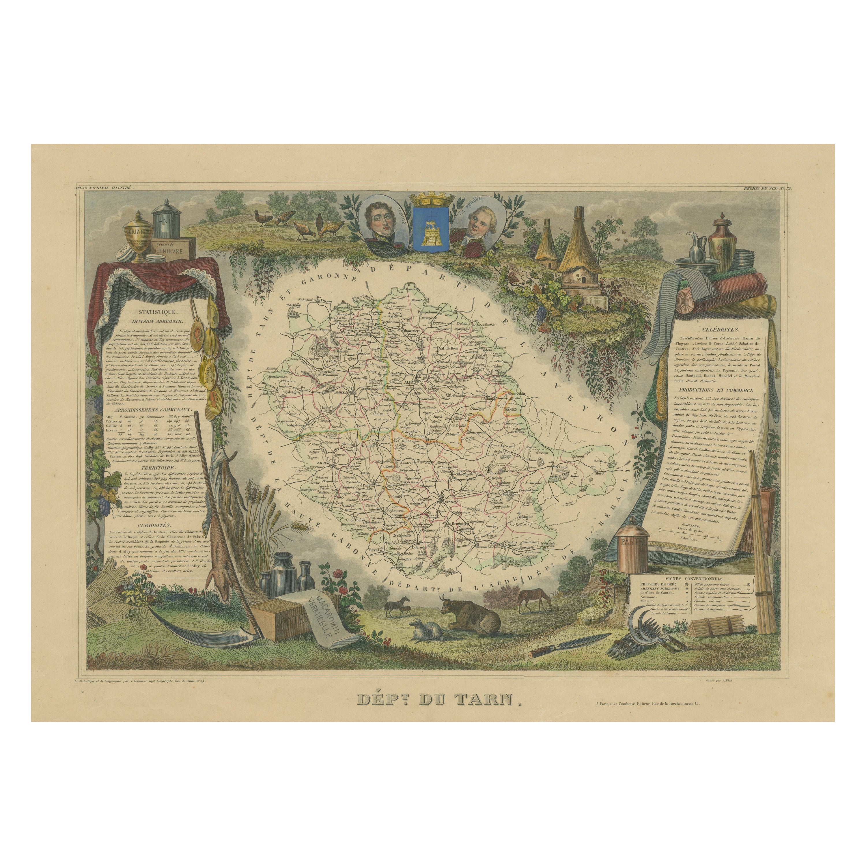
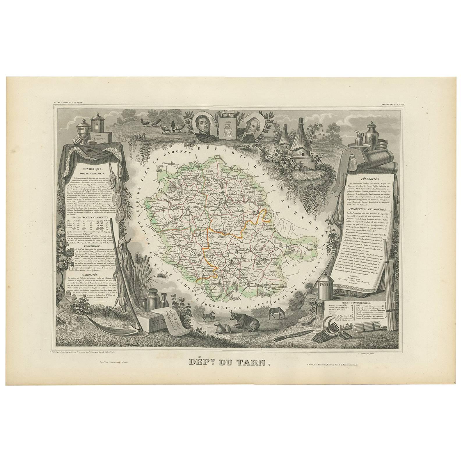
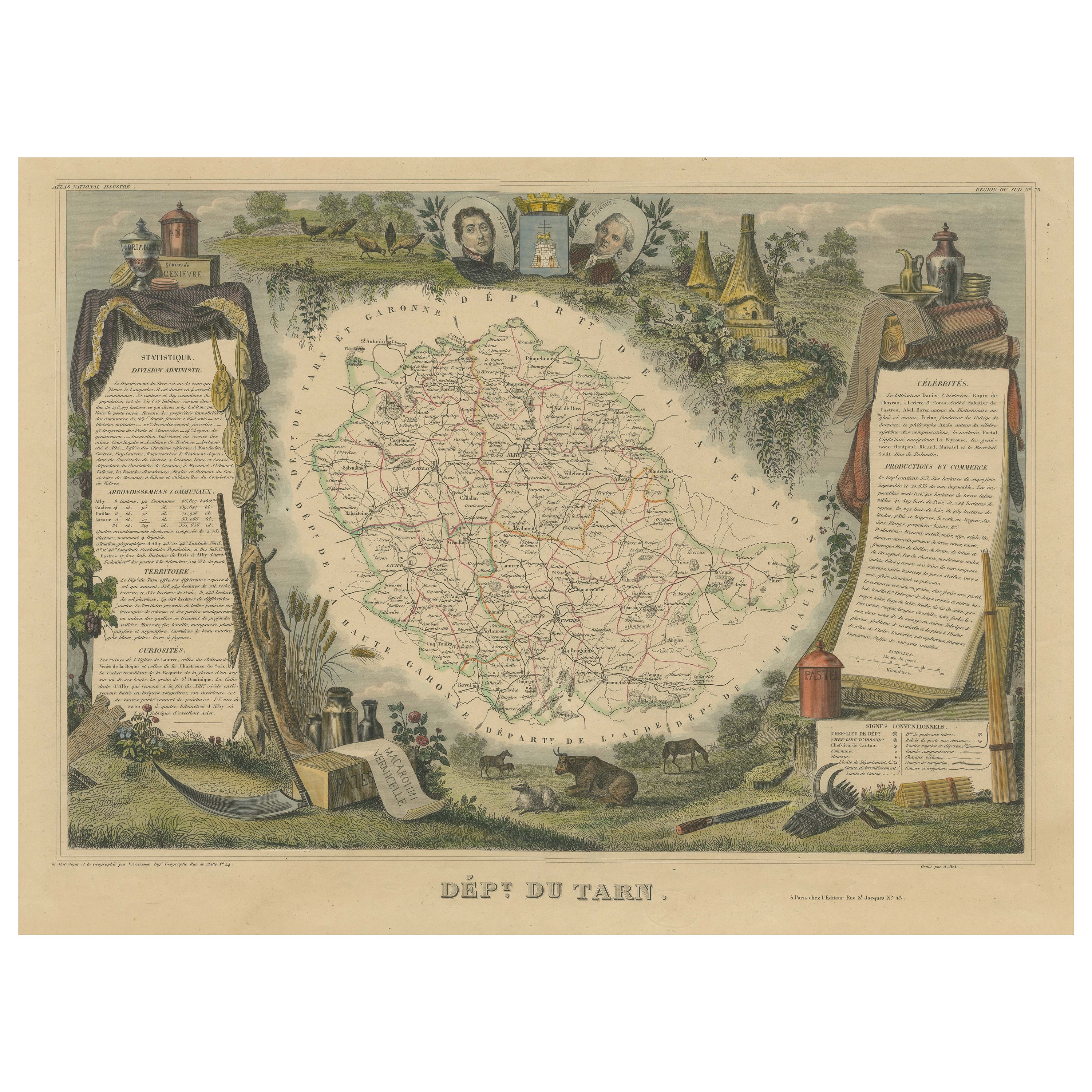
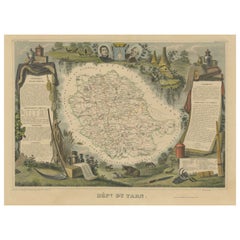
Antique map titled 'Dépt Du Tarn'. Map of the French department of Du tarn, France.
This area produces a variety of traditional wines, including Cahors, Mauzac, Loin de l’Oeil and Ondenc for the white varieties and Braucol, Duras and Prunelart for the reds. The map proper is surrounded by elaborate decorative engravings designed to illustrate both the natural beauty and trade richness of the land. There is a short textual history of the regions depicted on both the left and right sides of the map. Nicely hand-colored and very decorative.
This map originates from ‘Atlas National de la France Illustré’. Published by A. Combette, Paris.
- Dimensions:Height: 14.57 in (37 cm)Width: 21.66 in (55 cm)Depth: 0.01 in (0.2 mm)
- Materials and Techniques:
- Place of Origin:
- Period:
- Date of Manufacture:circa 1852
- Condition:Wear consistent with age and use. General age-related toning. Light crease in upper right corner, outside the image. A faint library stamp under the title. Nicely hand coloured and clean image. Please study image carefully.
- Seller Location:Langweer, NL
- Reference Number:
About the Seller
5.0
Platinum Seller
These expertly vetted sellers are 1stDibs' most experienced sellers and are rated highest by our customers.
Established in 2009
1stDibs seller since 2017
1,929 sales on 1stDibs
Typical response time: <1 hour
- ShippingRetrieving quote...Ships From: Langweer, Netherlands
- Return PolicyA return for this item may be initiated within 14 days of delivery.
More From This SellerView All
- Hand Colored Antique Map of the Department of Tarn, France, circa 1852By Victor LevasseurLocated in Langweer, NLAntique map titled 'Dépt. du Tarn'. Map of the French department of Tarn, France. This area produces a variety of traditional wines, including Cahors, Mauzac, Loin de l’Oeil and Onde...Category
Antique Mid-19th Century Maps
MaterialsPaper
- Antique Map of Tarn 'France' by V. Levasseur, 1854By Victor LevasseurLocated in Langweer, NLAntique map titled 'Dépt. du Tarn'. Map of the French department of Tarn, France. This area produces a variety of traditional wines, including Cahors, Mauzac, Loin de l'Oeil and Onde...Category
Antique Mid-19th Century Maps
MaterialsPaper
- Old Map of the French department of Tarn, FranceBy Victor LevasseurLocated in Langweer, NLAntique map titled 'Dépt. du Tarn'. Map of the French department of Tarn, France. This area produces a variety of traditional wines, including Cahors, Mauzac, Loin de l’Oeil and Onde...Category
Antique Mid-19th Century Maps
MaterialsPaper
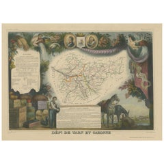
- Hand Colored Antique Map of the Department of Tarn Et Garonne, FranceBy Victor LevasseurLocated in Langweer, NLAntique map titled 'Dépt. de Tarn et Garonne'. map of the French department of Tarn et Garonne, France. This map is centered around the city of Moissac, which is known for its fine d...Category
Antique Mid-19th Century Maps
MaterialsPaper
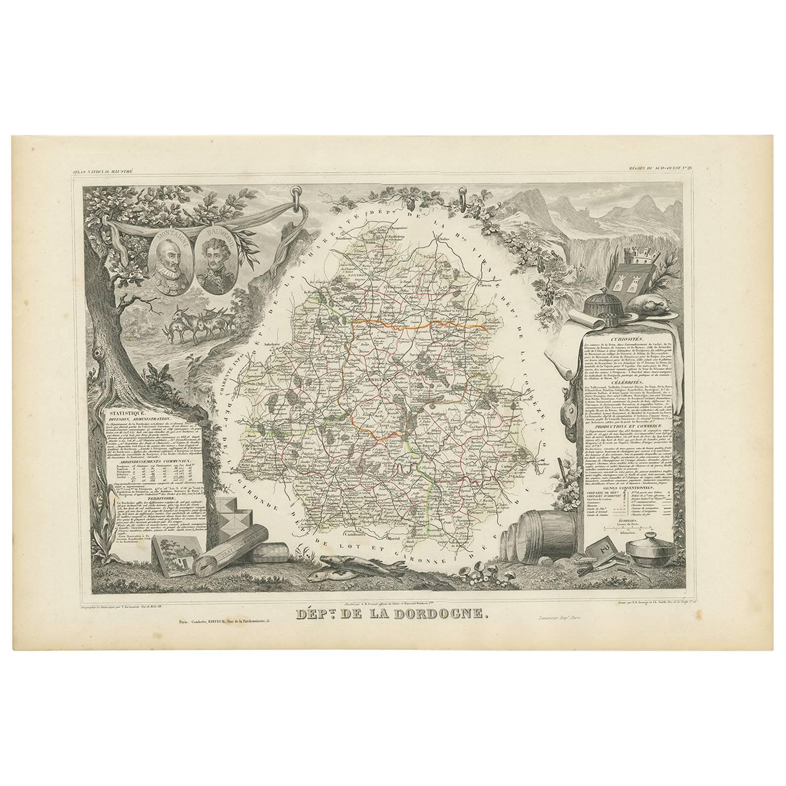
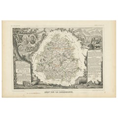
- Antique Map of the Dordogne ‘France’ by V. Levasseur, 1854Located in Langweer, NLAntique map titled 'Dépt. de la Dordogne'. Map of the French department of Dordogne, France. This area is best known for its production of Monbazillac, a sweet white wine, and Cabéco...Category
Antique Mid-19th Century Maps
MaterialsPaper
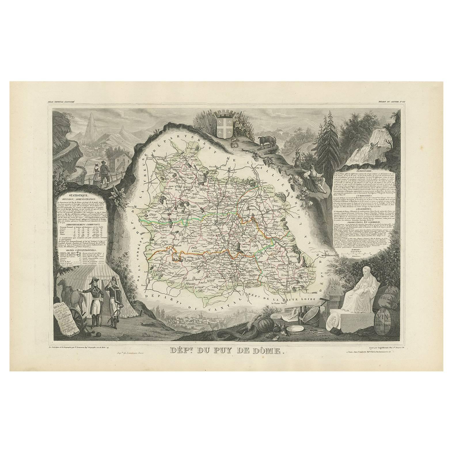
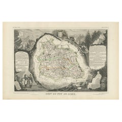
- Antique Map of Puy de Dôme ‘France’ by V. Levasseur, 1854By Victor LevasseurLocated in Langweer, NLAntique map titled 'Dépt. du Puy de Dôme'. Map of the French department of Puy De Dome, France. This mountainous department includes Auvergne, one of the l...Category
Antique Mid-19th Century Maps
MaterialsPaper


You May Also Like
- Original Antique Map of The World by Thomas Clerk, 1817Located in St Annes, LancashireGreat map of The Eastern and Western Hemispheres On 2 sheets Copper-plate engraving Drawn and engraved by Thomas Clerk, Edinburgh. Published by Mackenzie And Dent, 1817 ...Category
Antique 1810s English Maps
MaterialsPaper
- Original Antique Map of France, Arrowsmith, 1820Located in St Annes, LancashireGreat map of France Drawn under the direction of Arrowsmith. Copper-plate engraving. Published by Longman, Hurst, Rees, Orme and Brown, 1820 Unframed.Category
Antique 1820s English Maps
MaterialsPaper
- Original Antique Map of The Netherlands, Engraved by Barlow, Dated 1807Located in St Annes, LancashireGreat map of Netherlands Copper-plate engraving by Barlow Published by Brightly & Kinnersly, Bungay, Suffolk. Dated 1807 Unframed.Category
Antique Early 1800s English Maps
MaterialsPaper
- Map of the Holy Land "Carte de la Syrie et de l'Egypte" by Pierre M. LapieBy Pierre M. LapieLocated in Alamo, CAAn early 19th century map of ancient Syria and Egypt entitled "Carte de la Syrie et de l'Egypte anciennes/dressée par M. Lapie, Colonel d'Etat Major, et...Category
Antique Early 19th Century French Maps
MaterialsPaper
- Map of the Republic of GenoaLocated in New York, NYFramed antique hand-coloured map of the Republic of Genoa including the duchies of Mantua, Modena, and Parma. Europe, late 18th century. Dimension: 25...Category
Antique Late 18th Century European Maps
- Germany West of the Rhine: A Hand-colored 18th Century Map by de WitBy Frederick de WitLocated in Alamo, CAThis original 18th century hand-colored map of the county of Moers, Germany entitled "Illustrissimo Celsissmo Principi GUILIELMO HENRICO D.G. Arausionum Principi Domino suo Clementis...Category
Antique Early 18th Century Dutch Maps
MaterialsPaper


Recently Viewed
View AllMore Ways To Browse
Wine Map
Wine Maps
Right Proper
French Wine Map
Map Of France Wine
Wine Map France
Antique Wine Maps
Cahors France
Large Antique Compass
Antique New England Maps
Antique Map New England
Antique Map Of New England
Antique Maps New England
Antique Greek Map
Antique Greece Map
Antique Map Of Greece
Antique Maps Greece
Antique Map Greece