Antique Maps Of Greece

27
to
41
204
36
135
90
66
50
40
25
20
18
17
17
17
15
14
14
13
12
10
7
6
5
5
4
4
4
3
3
3
3
3
2
2
2
2
1
1
1
1
1
1
1
4
3
3
3
3
Sort By
Antique Map of Greece by Levasseur, '1875'
Located in Langweer, NL
Antique map titled 'Carte de la Grèce Modernde de l'Archipel'. Large map of Greece. This map
Category

Late 19th Century Antique Maps Of Greece

Materials

Paper

Antique Map of Greece by Levasseur, '1875'
H 24.02 in W 18.71 in D 0.02 in
Large Original Vintage Map of Greece, circa 1920
Located in St Annes, Lancashire
Great map of Greece Original color. Good condition Published by Alexander Gross Unframed.
Category

1920s English Antique Maps Of Greece

Materials

Paper

Large Original Antique Map of Greece, circa 1920
Large Original Vintage Map of Greece, circa 1920
1 bid
No Reserve
H 19.5 in W 25 in D 0.07 in
Antique Map of Greece by Lapie, 1842
Located in Langweer, NL
Antique map titled 'Carte de la Grèce Ancienne'. Map of Greece. This map originates from 'Atlas
Category

Mid-19th Century Antique Maps Of Greece

Materials

Paper

Antique Map of Greece by Lapie, 1842
H 19.89 in W 26.78 in D 0.02 in
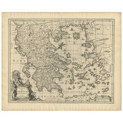
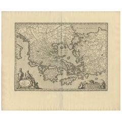
Antique Map of Greece by Allard (c.1698)
Located in Langweer, NL
Antique map titled 'Hellas seu Graecia Universa' Detailed map of Greece, with Crete, the Aegean
Category

Late 17th Century Antique Maps Of Greece

Materials

Paper

Antique Map of Greece by Allard (c.1698)
H 20.79 in W 25.36 in D 0.02 in
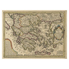
Original Antique Map of Greece and part of Turkey
Located in Langweer, NL
Greece and part of Turkey. This map originates from 'Le nouveau et curieux Atlas Geographique et
Category

Early 18th Century Antique Maps Of Greece

Materials

Paper

Antique Map of Greece by Keizer & de Lat, 1788
Located in Langweer, NL
antique map of Greece. This map originates from 'Nieuwe Natuur- Geschied- en Handelkundige Zak- en
Category

Late 18th Century Antique Maps Of Greece

Materials

Paper

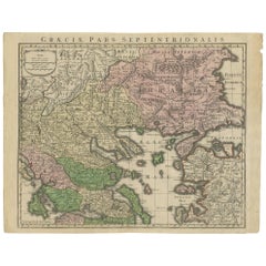
Antique Map of Greece by Seutter or Lotter, 'c.1740'
Located in Langweer, NL
Antique map titled 'Graecia pars Septentrionalis'. Original antique map of Greece, uncommon. Signed
Category

Mid-18th Century Antique Maps Of Greece

Materials

Paper

Rare Original 16th Century Antique Map of Greece, 1598
Located in Langweer, NL
Beautiful and rare antique map of Greece with Albania, Mecedonia, Romania, Dalmatia and the
Category

16th Century Antique Maps Of Greece

Materials

Paper

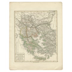
Antique Map of Greece and Macedonia, 1848
Located in Langweer, NL
Antique map titled 'Graecia Epirus Macedonia Moesia Thracia'. Old map of Greece originating from
Category

19th Century Antique Maps Of Greece

Materials

Paper

Antique Map of Greece and Macedonia, 1825
Located in Langweer, NL
Antique map titled 'Graecia, Macedonia Thracia et Jllyricum'. Old map of Greece and Macedonia
Category

19th Century Antique Maps Of Greece

Materials

Paper

Antique Map of Greece by J. Jansson, circa 1653
Located in Langweer, NL
This is an authentic antique map of the Greece by Jan Jansson. The map was published in Amsterdam
Category

Mid-17th Century Antique Maps Of Greece

Materials

Paper

Antique Map of Greece and Ionian Islands by A & C. Black, 1870
Located in Langweer, NL
Antique map titled 'Hellas or Greece'. Original antique map of Greece and Ionian Islands with inset
Category

Late 19th Century Antique Maps Of Greece

Materials

Paper

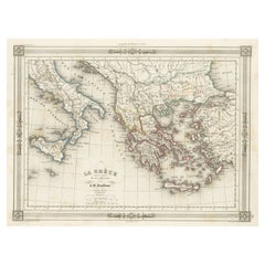
Antique Map of Greece and Its Colonies, with Frame Style Border
Located in Langweer, NL
Antique map titled 'La Grèce'. Attractive map of Greece and its Colonies. The map covers from the
Category

Mid-19th Century Antique Maps Of Greece

Materials

Paper

Antique Map of Greece, Turkey and surroundings with original coloring
Located in Langweer, NL
gebracht'. Antique map of Greece with Crete and Cyprus, Turkey and the Black Sea. Published by I. Tirion
Category

Mid-18th Century Antique Maps Of Greece

Materials

Paper

Charming 18th Century Miniature Map of Greece, 1685
Located in Langweer, NL
Antique map titled 'Graeciae Descriptio.' Charming miniature map of Greece from the pocket atlas
Category

17th Century Antique Maps Of Greece

Materials

Paper

Large Scale Map of Greece, Extending to Cythera with Inset of Macedonia, ca.1786
Located in Langweer, NL
Antique map titled 'Graeciae Antiquae'. Large scale map of Greece, extends south to the island
Category

1780s Antique Maps Of Greece

Materials

Paper

Antique Map of Greece with an Inset Map of Corfu, 1854
Located in Langweer, NL
Antique map titled 'Hellas or Greece'. Old map of Greece with an inset map of Corfu. This map
Category

19th Century Antique Maps Of Greece

Materials

Paper

Large Scale Map of Greece with Inset Map of Macedonia, c.1786
Located in Langweer, NL
Antique map titled 'Graeciae Antiquae'. Large scale map of Greece, extends south to the island of
Category

18th Century Antique Maps Of Greece

Materials

Paper

Antique Map of Greece from an Old French School Atlas, 1880
Located in Langweer, NL
Antique map titled 'Grèce Moderne '. Old map of Greece and surroundings. This map originates from
Category

19th Century Antique Maps Of Greece

Materials

Paper

Antique Map of Greece with Two Small Inset Maps of Athens, c.1870
Located in Langweer, NL
Antique map titled 'Graecia'. Old map of Greece with two small inset maps of Athens. This map
Category

19th Century Antique Maps Of Greece

Materials

Paper

Antique Map of Greece and the Mediterranean by Hachette & Cie, '1896'
Located in Langweer, NL
Antique map of Greece titled 'Grèce'. Old map of Greece and other parts of the Mediterranean
Category

Late 19th Century Antique Maps Of Greece

Materials

Paper

Antique Map of Greece and Crete, Rhodus and A Part of Asia Minor , ca. 1730
Located in Langweer, NL
Antique engraved map of Greece. Title: "GRÆCIÆ ANTIQUÆ Tabula Nova". Year: c. 1730. Coloured
Category

1720s Antique Maps Of Greece

Materials

Paper

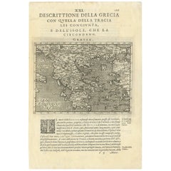
Decorative Original Antique Map of Greece by Ortelius, c.1609
Located in Langweer, NL
map of Greece and surrounding Islands and contiguous regions. Based on the work of Giacomo Gastaldi
Category

17th Century Antique Maps Of Greece

Materials

Paper

Map of Greece - Original Etching by Antonio Zatta - 18th Century
Located in Roma, IT
This Map of Greece is an etching realized by Antonio Zatta, Cartographer, publisher and typographer
Category

1780s Antique Maps Of Greece

Materials

Etching

Antique Map - Map of Greece - Etching by Johannes Janssonius - 1650s
By Johannes Janssonius
Located in Roma, IT
Antique Map of Greece - Graecia Vniversa is an antique map realized in 1650 by Johannes Janssonius
Category

1650s Modern Antique Maps Of Greece

Materials

Etching

Antique Map of Greece from Ortelius's Theatrum Orbis Terrarum, 1595
Located in Langweer, NL
atlases, with maps that were the most up-to-date of their time. The map depicts ancient Greece, and
Category

16th Century Antique Maps Of Greece

Materials

Paper

Antique Map of Greece, Albania, Macedonia and Parts of Turkey and Cyprus, c.1745
Located in Langweer, NL
Antique map titled 'Accurata Totius Archipelagi Et Graeciae Universae Tabula'. Detailed map of
Category

18th Century Antique Maps Of Greece

Materials

Paper

Antique Map of Greece with an Inset Map of the Upper Danube Region, c.1720
Located in Langweer, NL
of Greece, the Balkans and contiguous parts of the Adriatic and Aegean Seas. The map is decorated
Category

18th Century Antique Maps Of Greece

Materials

Paper

Scarce Antique Map of Greece, the Aegean, Crete and part of Asia Minor
Located in Langweer, NL
scarce map of the Greek Islands, the Aegean, Crete and part of Asia Minor. Published circa 1680
Category

Late 17th Century Antique Maps Of Greece

Materials

Paper

Original Antique Map of Greece and Epirus after the Persian Wars, Published 1880
Located in Langweer, NL
The map titled "GRAECIA, EPIRUS post bella Persica," translates to "Greece and Epirus after the
Category

1880s Antique Maps Of Greece

Materials

Paper

Original Map of Greece at the Time of the Dorian Migration, Published in 1880
Located in Langweer, NL
The map titled "GRAECIA TEMPORI MIGRATIONIS DORICAE," translates to "Greece at the Time of the
Category

1880s Antique Maps Of Greece

Materials

Paper

Map of Greece - Etching on Paper 19th Century
Located in Roma, IT
original print describes the geography of Greece with the great charisma of the antique maps. In very good
Category

19th Century Modern Antique Maps Of Greece

Materials

Etching

Original Antique Map in Frame of Greece by Smith '1818'
Located in Langweer, NL
Nicely framed map titled 'Greece'. Original antique map of Greece published by C. Smith, 1818
Category

Early 19th Century Antique Maps Of Greece

Materials

Paper

Antique Map of Southern Greece, 1892
Located in Langweer, NL
Antique map of Greece titled 'Griechenland. Südlicher Theil'. Old map of Southern Greece with inset
Category

19th Century Antique Maps Of Greece

Materials

Paper

Antique Map of Southern Greece, 1892
H 10.04 in W 12.01 in D 0.01 in
Greece, "Graeciae Antiquae"" A 17th Century Hand-colored Map by Sanson
By Nicolas Sanson
Located in Alamo, CA
This is an original 17th century hand colored copperplate engraved map of Greece entitled "Graeciae
Category

Mid-17th Century French Antique Maps Of Greece

Materials

Paper

Early, Rare and Small Hand-Coloured Copper Engraving of Greece, ca. 1602
Located in Langweer, NL
Attractive minature map of Greece or 'Graecia" Maker/Publisher: A. Ortelius/A. en F. Arsenius
Category

Early 17th Century Antique Maps Of Greece

Materials

Paper

Greece 1660 Jan Jansson Watercolour Map Peloponesus Sive Morea I Laurenbergio
Located in GB
We are delighted to offer for sale this Jan Jansson Date: 1660 (published) Amsterdam map of Greece
Category

1660s Danish Dutch Colonial Antique Maps Of Greece

Materials

Copper

Antique Map of the Ancient Greek Colonization
Located in Langweer, NL
'. Original antique map of the ancient Greek colonization. Frontispiece map of 'The History of Ancient Greece
Category

Late 18th Century Antique Maps Of Greece

Materials

Paper

Antique Map of the Ancient Greek Colonization
H 11.54 in W 17.33 in D 0.02 in
Antique Map of Turkey and Greece, 1852
Located in Langweer, NL
Antique map titled 'Europisch Turkije en Griekenland'. Map of Turkey in Europe and Greece. This map
Category

19th Century Antique Maps Of Greece

Materials

Paper

Antique Map of Turkey and Greece, 1852
H 13.59 in W 10.63 in D 0 in
Antique Map of Turkey and Greece, 1842
By Pierre M. Lapie
Located in Langweer, NL
Antique map titled 'Carte de la Turquie d'Europe et de la Grèce Moderne'. Map of Turkey and Greece
Category

19th Century Antique Maps Of Greece

Materials

Paper

Antique Map of Turkey and Greece, 1842
H 26.78 in W 19.89 in D 0 in
Original Antique Map of Ancient Greece- Boeotia, Thebes, 1787
Located in St Annes, Lancashire
Great map of Ancient Greece. Showing the region of Boeotia, including Thebes Drawn by J.D
Category

1780s French Other Antique Maps Of Greece

Materials

Paper

Original Antique Map of Ancient Greece, Achaia, Corinth, 1786
Located in St Annes, Lancashire
Great map of Ancient Greece. Showing the region of Thessaly, including Mount Olympus Drawn by
Category

1780s French Other Antique Maps Of Greece

Materials

Paper

Original Antique Map of Ancient Greece, Phocis, Gulf of Corinth, 1787
Located in St Annes, Lancashire
Great map of Ancient Greece. Showing the region of Phocis, including the Gulf of Corinth Drawn
Category

1780s French Other Antique Maps Of Greece

Materials

Paper

Antique Map of the Islands of Schiatti and Scopoli, Greece, 1687
Located in Langweer, NL
Antique map titled 'Schiatti - Scopoli.' This original antique map shows the islands Schiatti and
Category

17th Century Antique Maps Of Greece

Materials

Paper

Antique Map of European Turkey and Greece by Lowry '1852'
Located in Langweer, NL
Antique map titled 'European Turkey and Greece with the Ionian Islands'. Original map of European
Category

Mid-19th Century Antique Maps Of Greece

Materials

Paper

Antique Map of Turkey and Greece by Petri, c.1873
Located in Langweer, NL
Greece. This map originates from 'School-Atlas van alle Deelen der Aarde'. Artists and Engravers
Category

19th Century Antique Maps Of Greece

Materials

Paper

Antique Map of Thracia ‘Greece’ by J. Janssonius, circa 1650
Located in Langweer, NL
mainly Thracia in Northern Greece and parts of Romania. The map is ornated with three cartouches, in the
Category

Mid-17th Century Antique Maps Of Greece

Materials

Paper

Antique Map of Macedonia, Northern Greece and part of Turkey in Europe
Located in Langweer, NL
Antique map titled 'Macedonia Epirus et Achaia'. Original old map of Macedonia, northern Greece
Category

Mid-17th Century Antique Maps Of Greece

Materials

Paper

Original Old Map of Northeastern Greece & Northwestern Turkey, Published in 1661
Located in Langweer, NL
covers the ancient region of Thrace, present-day European Turkey and part of Greece. The map is graced
Category

1660s Antique Maps Of Greece

Materials

Paper

Antique Map of Epirus 'Albania, Greece' by J. Janssonius, circa 1650
Located in Langweer, NL
This map covers the northwestern coast of Greece and part of present-day Albania. The map was drawn
Category

Mid-17th Century Antique Maps Of Greece

Materials

Paper

Antique Map of Italy and Greece by H. Kiepert, circa 1870
By Heinrich Kiepert
Located in Langweer, NL
Antique map titled 'Italiae pars media'. This map originates from 'Atlas Antiquus. Zwölf Karten zur
Category

Late 19th Century Antique Maps Of Greece

Materials

Paper

Original Antique Map of the Coast of Part of Greece, with Athens and Thebes
Located in Langweer, NL
part of Greece. With inset maps of Athens and Thebes. This map originates from 'Philippi Cluveri
Category

Early 18th Century Antique Maps Of Greece

Materials

Paper

Antique Map of Asia Minor including part of the Greek Archipelago and Cyprus
Located in Langweer, NL
Antique map titled 'Chersonesi quae hodie Natolia Descriptio'. Decorative, smaller map of Asia
Category

Mid-18th Century Antique Maps Of Greece

Materials

Paper

Hand-Colored 18th Century Homann Map of the Danube, Italy, Greece, Croatia
By Johann Baptist Homann
Located in Alamo, CA
decorative cartouche and a large inset map of the Upper Danube region and excellent detail of the Greek and
Category

Early 18th Century German Antique Maps Of Greece

Materials

Paper

Old Engraved Map of Hungary, European Balkan Countries, Greece and Crete, 1806
Located in Langweer, NL
Antique map titled 'Hongrie, Turquie Europe'. Decorative map of Hungary, southeast European
Category

19th Century Antique Maps Of Greece

Materials

Paper

Antique Map of Nisari, Le Simie, Carchi Elimoia and Piscopia, Greece, 1687
Located in Langweer, NL
Antique map titled 'Carchi Elimoia, Nisari, Le Simie, Piscopia.' Sheet with four maps on one page
Category

17th Century Antique Maps Of Greece

Materials

Paper

Original Antique Map of Leros and Kalimnos, and other islands, Greece, 1687
Located in Langweer, NL
Antique map titled 'Lero, Calamo, Zanara e Levita, Amorgo.' heet with four maps on one page
Category

17th Century Antique Maps Of Greece

Materials

Paper

Antique Map of Asia Minor, Route of the Retreat of Ten Thousand Greeks, c.1720
Located in Langweer, NL
Antique map Asia Minor titled 'The Retreat of the Ten Thousand Greeks according to Xenophon
Category

18th Century Antique Maps Of Greece

Materials

Paper

Old Engraved Map of the Middle East, Arabia and Part of Greece 'Cyprus', 1706
Located in Langweer, NL
Mogol, opt spoor gevolgd'. Old map of the Middle East, also depicting part of Greece (Cyprus). This
Category

Early 1700s Antique Maps Of Greece

Materials

Paper

Balkan Convergence: A Map of Turkey and Greece with the Balkan States, 1882
Located in Langweer, NL
This map, "TURKEY AND GREECE including ROUMANIA, SERVIA, BULGARIA, BOSNIA & MONTENEGRO," extracted
Category

1880s Antique Maps Of Greece

Materials

Paper

  • 1
Get Updated with New Arrivals
Save "Antique Maps Of Greece", and we’ll notify you when there are new listings in this category.

Antique Maps Of Greece For Sale on 1stDibs

Find many varieties of an authentic antique maps of greece available at 1stDibs. An antique maps of greece — often made from paper — can elevate any home. You’ve searched high and low for the perfect antique maps of greece — we have versions that date back to the 18th Century alongside those produced as recently as the 20th Century are available. An antique maps of greece is a generally popular piece of furniture, but those created in styles are sought with frequency. You’ll likely find more than one antique maps of greece that is appealing in its simplicity, but Heinrich Kiepert, Johann Baptist Homann and Nicolas Sanson produced versions that are worth a look.

How Much is a Antique Maps Of Greece?

Prices for an antique maps of greece can differ depending upon size, time period and other attributes — at 1stDibs, they begin at $35 and can go as high as $1,575, while the average can fetch as much as $293.

Read More

Pamela Shamshiri Shares the Secrets behind Her First-Ever Book and Its Effortlessly Cool Interiors

The sought-after designer worked with the team at Hoffman Creative to produce a monograph that beautifully showcases some of Studio Shamshiri's most inspiring projects.

Moroccan Artworks and Objects Take Center Stage in an Extraordinary Villa in Tangier

Italian writer and collector Umberto Pasti opens the doors to his remarkable cave of wonders in North Africa.

Montecito Has Drawn Royalty and Celebrities, and These Homes Are Proof of Its Allure

Hollywood A-listers, ex-pat aristocrats and art collectors and style setters of all stripes appreciate the allure of the coastal California hamlet — much on our minds after recent winter floods.

Whaam! Blam! Pow! — a New Book on Pop Art Packs a Punch

Publishing house Assouline and writer Julie Belcove have teamed up to trace the history of the genre, from Roy Lichtenstein, Andy Warhol and Yayoi Kusama to Mickalene Thomas and Jeff Koons.

The Sparkling Legacy of Tiffany & Co. Explained, One Jewel at a Time

A gorgeous new book celebrates — and memorializes — the iconic jeweler’s rich heritage.
What Makes a Gem-Encrusted Chess Set Worth $4 Million?

The world’s most opulent chess set, weighing in at 513 carats, is literally fit for a king and queen.

Tauba Auerbach’s Geometric Pop-Up Book Is Mighty Rare, Thanks to a Hurricane

This sculptural art book has an epic backstory of its own.

Step inside the Storied Mansions of Palm Beach’s Most Effervescent Architect

From Spanish-style courtyards to fanciful fountains, these acclaimed structures abound in surprising and elegant details.