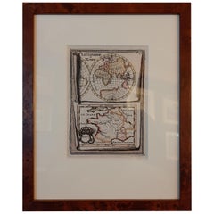
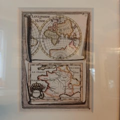
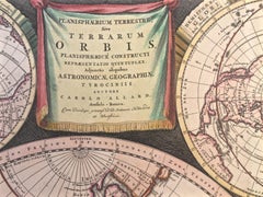
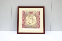
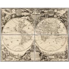
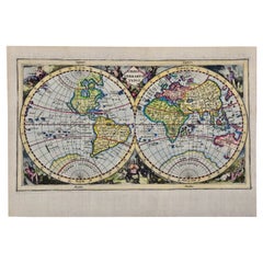
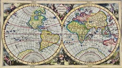
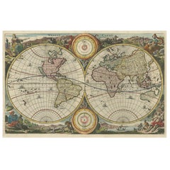
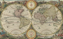
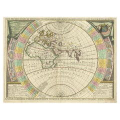
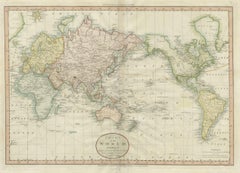
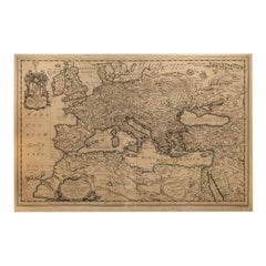
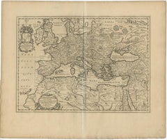
17th Century World Map

5
to
52
504
82
556
483
61
33
27
22
19
15
9
9
6
6
5
5
3
3
3
3
3
2
2
2
2
2
2
1
1
1
1
1
1
40
19
13
12
9
Sort By
17th Century Toulouse, Savve, Sommieres Topographical Map by Iohan Peeters
Located in New York, NY
Fine topographical 17th century map of Toulouse, Savve and Sommieres by Iohan Peeters Beautiful
Category

Antique 17th Century Dutch Maps

Materials

Paper

17th Century Topographical Map of Cote D'azur, Avignon, Frejus by Iohan Peeters
Located in New York, NY
Fine topographical 17th century map by Iohan Peeters of the towns of Avignon and Frejus in the Cote
Category

Antique 17th Century Dutch Maps

Materials

Paper

Antique Map of Germany from a 17th Century Pocket Atlas, 1685
Located in Langweer, NL
authentic antique maps from the 16th to the 20th centuries. Buying and collecting antique maps is a
Category

Antique 17th Century Maps

Materials

Paper

Antique Detailed World Map Drawn on Mercator's Projection, 1700
Located in Langweer, NL
Antique world map titled 'Carte generale du monde, ou description du monde terrestre & Aquatique
Category

Antique 17th Century Maps

Materials

Paper

Antique World Map by P. Schenk '1706'
By Peter Schenk
Located in Langweer, NL
decorative Dutch 17th century maps where the margins would be full of classical mythological figures and
Category

Antique Early 18th Century Maps

Materials

Paper

Antique World Map by P. Schenk '1706'
H 20.87 in W 23.82 in D 0.02 in
17th Century Hand-Colored Map of Southeastern England by Mercator and Hondius
By Gerard Mercator
Located in Alamo, CA
A 17th century copperplate hand-colored map entitled "The Sixt Table of England" by Gerard Mercator
Category

Antique Mid-17th Century Dutch Maps

Materials

Paper

"Nova Barbariae Descriptio", a 17th Century Hand-Colored Map of North Africa
By Johannes Janssonius
Located in Alamo, CA
This original attractive 17th century hand-colored map of North Africa entitled "Nova Barbariae
Category

Antique Mid-17th Century Dutch Maps

Materials

Paper

Southeastern Ireland: A 17th Century Hand Colored Map by Mercator and Hondius
By Gerard Mercator
Located in Alamo, CA
A 17th century copperplate hand-colored map entitled "The Second Table of Ireland, Udrone" by
Category

Antique Mid-17th Century Dutch Maps

Materials

Paper

Antique 17th Century Map of the Islands Near Ceylon or Sri Lanka, 1672
Located in Langweer, NL
went to Jaffna, Ceylon with an invading Dutch force during 17th Century. As the first European he
Category

Antique 17th Century Maps

Materials

Paper

17th Century Hand-Colored Map of a Region in West Germany by Janssonius
By Johannes Janssonius
Located in Alamo, CA
This attractive highly detailed 17th century original hand-colored map is entitled
Category

Antique Mid-17th Century Dutch Maps

Materials

Paper

Prussia, Poland, N. Germany, Etc: A Hand-colored 17th Century Map by Janssonius
By Johannes Janssonius
Located in Alamo, CA
This is an attractive hand-colored copperplate engraved 17th century map of Prussia entitled
Category

Antique Mid-17th Century Dutch Maps

Materials

Paper

17th Century Hand-Colored Map of Valencia and Murcia, Spain by Mercator/Hondius
By Gerard Mercator
Located in Alamo, CA
A 17th century hand-colored map entitled "Regni Valentiae Typus, Valentia and Murcia" by Gerard
Category

Antique Mid-17th Century Dutch Maps

Materials

Paper

Original Antique Hand-colored World Map with or without Frame, '1696'
Located in Langweer, NL
Antique world map titled 'Mappe-Monde dressee sur les Observations de Mrs. de l'Academie Royale des
Category

Antique Late 17th Century Maps

Materials

Paper

Gorgeous Antique World Map by the Dutch Mapmaker Visscher, published circa 1679
Located in Langweer, NL
example of Nicholas Visscher's World map, which appeared in his Atlas Minor after 1679. The map is
Category

Antique Late 17th Century Maps

Materials

Paper

North & South America: A 17th Century Hand-colored Map by Jansson & Goos
By Johannes Janssonius
Located in Alamo, CA
A 17th century hand-colored map of North & South America entitled "Americae Descriptio" by the
Category

Antique 1620s Dutch Maps

Materials

Paper

Cartographic Elegance: The Art and Science of 17th-Century Asian Maps, ca.1681
Located in Langweer, NL
the 17th century for producing maps. The copperplate engraving process involves etching or engraving
Category

Antique 1680s Maps

Materials

Paper

Antique Miniature Map of the Old World and France by Mallet, circa 1683
Located in Langweer, NL
shows a hemisphere of the Old World. The lower map shows France. This map originates from 'Description
Category

Antique Late 17th Century Maps

Materials

Paper

Charming 18th Century Miniature Map of Greece, 1685
Located in Langweer, NL
antique maps from the 16th to the 20th centuries. Buying and collecting antique maps is a tradition that
Category

Antique 17th Century Maps

Materials

Paper

Antique Map of Friesland, The Netherlands, 1638
Located in Langweer, NL
interior decorators all over the world. Our collection includes a wide range of authentic antique maps from
Category

Antique 17th Century Maps

Materials

Paper

Antique Map of Belgium and Surroundings, 1692
Located in Langweer, NL
over the world. Our collection includes a wide range of authentic antique maps from the 16th to the
Category

Antique 17th Century Maps

Materials

Paper

Antique Map of Friesland by Guicciardini, 1613
Located in Langweer, NL
over the world. Our collection includes a wide range of authentic antique maps from the 16th to the
Category

Antique 17th Century Maps

Materials

Paper

Flanders, Holland & Norfolk: Hand-Colored 17th Century Sea Chart by Collins
By Captain Greenvile Collins
Located in Alamo, CA
most technologically advanced sailing yacht in the world, the Maltese Falcon. I have 16 of his sea
Category

Antique Late 17th Century English Maps

Materials

Paper

Antique Map of Warwickshire by Speed, c.1614
Located in Langweer, NL
over the world. Our collection includes a wide range of authentic antique maps from the 16th to the
Category

Antique 17th Century Maps

Materials

Paper

Antique Map of Warwickshire by Speed, c.1614
No Reserve
H 14.97 in W 19.69 in D 0 in
Antique Map of Deventer in the Netherlands, 1691
Located in Langweer, NL
interior decorators all over the world. Our collection includes a wide range of authentic antique maps from
Category

Antique 17th Century Maps

Materials

Paper

Antique Map of Coevorden in the Netherlands, 1691
Located in Langweer, NL
interior decorators all over the world. Our collection includes a wide range of authentic antique maps from
Category

Antique 17th Century Maps

Materials

Paper

Antique Map of Celtic Europe by Cluver, 1678
Located in Langweer, NL
maps to collectors, historians, educators and interior decorators all over the world. Our collection
Category

Antique 17th Century Maps

Materials

Paper

Antique Map of Austria by Ortelius, c.1612
Located in Langweer, NL
and most frequently collected of all sixteenth-century mapmakers. Ortelius started his career as a map
Category

Antique 17th Century Maps

Materials

Paper

Antique Map of Austria by Ortelius, c.1612
H 18.71 in W 22.84 in D 0 in
Miniature Antique Map of Glamorganshire, Wales, c.1646
Located in Langweer, NL
interior decorators all over the world. Our collection includes a wide range of authentic antique maps from
Category

Antique 17th Century Maps

Materials

Paper

Antique Map of the Netherlands by Guicciardini, 1612
Located in Langweer, NL
authentic antique maps from the 16th to the 20th centuries. Buying and collecting antique maps is a
Category

Antique 17th Century Maps

Materials

Paper

Antique Map of Gloucestershire by Camden, c.1607
Located in Langweer, NL
decorators all over the world. Our collection includes a wide range of authentic antique maps from the 16th
Category

Antique 17th Century Maps

Materials

Paper

Original Antique Map of Friesland by Guicciardini, 1612
Located in Langweer, NL
maps from the 16th to the 20th centuries. Buying and collecting antique maps is a tradition that goes
Category

Antique 17th Century Maps

Materials

Paper

Antique Map of France by Janssonius, c.1650
Located in Langweer, NL
authentic antique maps from the 16th to the 20th centuries. Buying and collecting antique maps is a
Category

Antique 17th Century Maps

Materials

Paper

Antique Map of France by Janssonius, c.1650
Located in Langweer, NL
authentic antique maps from the 16th to the 20th centuries. Buying and collecting antique maps is a
Category

Antique 17th Century Maps

Materials

Paper

Dartmouth, England: A Hand-Colored 17th Century Sea Chart by Captain Collins
By Captain Greenvile Collins
Located in Alamo, CA
most technologically advanced sailing yacht in the world, the Maltese Falcon. I have 16 of his sea
Category

Antique Late 17th Century English Maps

Materials

Paper

Plymouth, England: A Hand-Colored 17th Century Sea Chart by Captain Collins
By Captain Greenvile Collins
Located in Alamo, CA
most technologically advanced sailing yacht in the world, the Maltese Falcon. I have 16 of his sea
Category

Antique Late 17th Century English Maps

Materials

Paper

Edinburgh, Scotland Coast: A 17th Century Hand-Colored Sea Chart by Collins
By Captain Greenvile Collins
Located in Alamo, CA
and had at the time the largest and most technologically advanced sailing yacht in the world, the
Category

Antique Late 17th Century English Maps

Materials

Paper

Antique Map of Zeeland, The Netherlands, by Jaillot, 1693
Located in Langweer, NL
decorators all over the world. Our collection includes a wide range of authentic antique maps from the 16th
Category

Antique 17th Century Maps

Materials

Paper

Antique Map of Zevenwouden in Friesland by Schotanus, 1664
Located in Langweer, NL
over the world. Our collection includes a wide range of authentic antique maps from the 16th to the
Category

Antique 17th Century Maps

Materials

Paper

Antique Map of the City of Zutphen, c.1650
Located in Langweer, NL
antique maps from the 16th to the 20th centuries. Buying and collecting antique maps is a tradition that
Category

Antique 17th Century Maps

Materials

Paper

Antique Map of the City of Zutphen, c.1650
H 13.19 in W 16.93 in D 0 in
Rare Small Antique Map of the Persian Empire, 1692
Located in Langweer, NL
antique maps from the 16th to the 20th centuries. Buying and collecting antique maps is a tradition that
Category

Antique 17th Century Maps

Materials

Paper

Antique Map of the Franconia Region by Scherer, 1699
Located in Langweer, NL
over the world. Our collection includes a wide range of authentic antique maps from the 16th to the
Category

Antique 17th Century Maps

Materials

Paper

Antique Map of the Koblentz Region by Moll, 1695
By Herman Moll
Located in Langweer, NL
interior decorators all over the world. Our collection includes a wide range of authentic antique maps from
Category

Antique 17th Century Maps

Materials

Paper

Antique Copper Engraved Map of Gloucestershire in England, 1637
Located in Langweer, NL
range of authentic antique maps from the 16th to the 20th centuries. Buying and collecting antique maps
Category

Antique 17th Century Maps

Materials

Paper

Antique Uncommon Map of Bohemia, Moravia and Silesia, 1699
Located in Langweer, NL
world. Our collection includes a wide range of authentic antique maps from the 16th to the 20th
Category

Antique 17th Century Maps

Materials

Paper

Antique Map of the East Indies by Rossi, 1683
Located in Langweer, NL
-seventeenth century it was the best-known printing house in Rome. For his maps, Giovanni worked with Giacomo
Category

Antique 17th Century Maps

Materials

Paper

Antique Map of Gloucestershire in Britain by Camden, 1637
Located in Langweer, NL
decorators all over the world. Our collection includes a wide range of authentic antique maps from the 16th
Category

Antique 17th Century Maps

Materials

Paper

Antique Map of Hertfordshire in England by Speed, 1627
Located in Langweer, NL
antique maps from the 16th to the 20th centuries. Buying and collecting antique maps is a tradition that
Category

Antique 17th Century Maps

Materials

Paper

Antique Map of Fortification of Bellingwolderschans, The Netherlands, 1673
Located in Langweer, NL
range of authentic antique maps from the 16th to the 20th centuries. Buying and collecting antique maps
Category

Antique 17th Century Maps

Materials

Paper

Antique Map of the Maine Region by Janssonius, 1657
By Johannes Janssonius
Located in Langweer, NL
all over the world. Our collection includes a wide range of authentic antique maps from the 16th to
Category

Antique 17th Century Maps

Materials

Paper

Antique Map of Friesland by De Wit, c.1690
Located in Langweer, NL
world. Our collection includes a wide range of authentic antique maps from the 16th to the 20th
Category

Antique 17th Century Maps

Materials

Paper

Antique Map of Friesland by De Wit, c.1690
H 20.87 in W 24.41 in D 0 in
Antique Map of North Africa by Ortelius, c.1600
Located in Langweer, NL
Antique map titled 'Barbariae et Biledulgerid nova descriptio'. Old map of coastal North Africa
Category

Antique 17th Century Maps

Materials

Paper

Antique Map of Gelderland and Overijssel by Guicciardini, 1613
Located in Langweer, NL
maps from the 16th to the 20th centuries. Buying and collecting antique maps is a tradition that goes
Category

Antique 17th Century Maps

Materials

Paper

Antique Map of Zaltbommel in the Netherlands, by Guicciardini, 1613
Located in Langweer, NL
authentic antique maps from the 16th to the 20th centuries. Buying and collecting antique maps is a
Category

Antique 17th Century Maps

Materials

Paper

Antique Map of Harlingen, Harbour City in the Netherlands, 1691
Located in Langweer, NL
decorators all over the world. Our collection includes a wide range of authentic antique maps from the 16th
Category

Antique 17th Century Maps

Materials

Paper

Antique Map of Westfriesland in Ancient Times by Alting, 1697
Located in Langweer, NL
original antique maps to collectors, historians, educators and interior decorators all over the world. Our
Category

Antique 17th Century Maps

Materials

Paper

Antique Map of Saxony and Westphalia by Scherer, 1699
Located in Langweer, NL
Antique map titled 'Saxonia et Westphalia varijs in locis sacris erga dei matre est officiosa
Category

Antique 17th Century Maps

Materials

Paper

Antique Map of the Berchtesgaden Region by Scherer, 1699
Located in Langweer, NL
Antique map titled 'Principat et praepositura Berchtesgadensis (..).' Detailed uncommon map of the
Category

Antique 17th Century Maps

Materials

Paper

Antique Map of Warwickshire in England by Speed, c.1614
Located in Langweer, NL
antique maps from the 16th to the 20th centuries. Buying and collecting antique maps is a tradition that
Category

Antique 17th Century Maps

Materials

Paper

Antique Map of the City of Grave by Blaeu, 1649
Located in Langweer, NL
original antique maps to collectors, historians, educators and interior decorators all over the world. Our
Category

Antique 17th Century Maps

Materials

Paper

1633 Map Entitled "Beauvaisis Comitatus Belova Cium, Ric.0002
Located in Norton, MA
as a result of the discoveries made on the Schouten/Le Maire voyage of 1615-17. * c. 1624 World Map
Category

Antique 17th Century Dutch Maps

Materials

Paper

  • 1
Get Updated with New Arrivals
Save "17th Century World Map", and we’ll notify you when there are new listings in this category.

17th Century World Map For Sale on 1stDibs

Find many varieties of an authentic 17th century world map available at 1stDibs. Each 17th century world map for sale was constructed with extraordinary care, often using paper, metal and brass. Whether you’re looking for an older or newer 17th century world map, there are earlier versions available from the 18th Century and newer variations made as recently as the 20th Century. A 17th century world map, designed in the Baroque or Victorian style, is generally a popular piece of furniture. A well-made 17th century world map has long been a part of the offerings for many furniture designers and manufacturers, but those produced by Johannes Janssonius, B. Schotanus and Jacques-Nicolas Bellin are consistently popular.

How Much is a 17th Century World Map?

Prices for a 17th century world map can differ depending upon size, time period and other attributes — at 1stDibs, they begin at $65 and can go as high as $275,000, while the average can fetch as much as $350.