Items Similar to Authentic 1644 Janssonius Map of the Champagne Region (Campania) in France
Want more images or videos?
Request additional images or videos from the seller
1 of 7
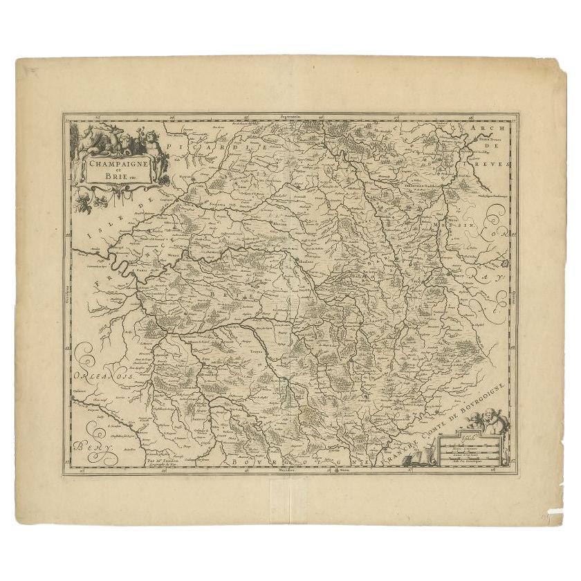
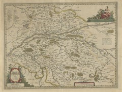
Authentic 1644 Janssonius Map of the Champagne Region (Campania) in France
About the Item
"1644 Janssonius Map of Champagne, France"
This meticulously detailed original antique map, engraved in 1644, is a work by the esteemed cartographer Johannes Janssonius. It depicts the historic province of Champagne, situated in the northeastern part of France. The map is notable for its high level of detail, with meticulously drawn boundaries, city markers, and river courses. It features a beautifully rendered cartouche adorned with the provincial coat of arms, flanked by classical figures, indicative of the region's cultural significance. In the lower left corner, a pair of cherubs are engaged in surveying, symbolizing the scientific endeavor of cartography. The elaborate compass rose and the scale bar further complement the map's utility and artistic merit.
Champagne is renowned globally for its viticultural heritage, being the birthplace of the eponymous Champagne sparkling wine. The region's unique terroir, with its chalky soil and cool climate, is ideal for the production of the grapes used in champagne-making. The historical significance of Champagne extends beyond winemaking; it has been the site of pivotal battles and royal coronations, which shaped the course of French and European history. This map is not only a navigational tool but also a snapshot of a region rich in history and tradition, an artifact that embodies the geographical and cultural prestige of Champagne.
This description provides a detailed visual and contextual presentation of the map, suitable for a catalog entry, emphasizing both its artistic features and the historical and cultural importance of the Champagne region.
THE WINE AREAS:
The Champagne region, known primarily for its production of the sparkling wine that bears its name, encompasses several important cities and sites of historical and cultural significance:
1. **Reims**: Often considered the unofficial capital of the Champagne region, Reims is renowned for its grand cathedral, Notre-Dame de Reims, where French kings were historically crowned. The city is also a center for Champagne production.
2. **Épernay**: This town is another key location for Champagne production and is home to many prestigious Champagne houses, which store and age their wines in extensive cellars beneath the town.
3. **Troyes**: A medieval city known for its timber-framed houses and Gothic churches, Troyes also has a rich history in trade and textiles.
4. **Châlons-en-Champagne**: The administrative capital of the region, it features several historical monuments and is known for its beautiful gardens and canals.
5. **Avezzano**: While this is not traditionally associated with the Champagne region of France, it is a city in the Abruzzo region of Italy. If it were to appear on a map titled "Champagne Campania," it might be indicative of a historical naming or mapping convention that is not commonly recognized today.
6. **The Montagne de Reims**: This is a significant natural region in Champagne, known for its forests and vineyards.
7. **The Côte des Blancs**: This is a key winegrowing area famous for Chardonnay grapes.
8. **The Vallée de la Marne**: This area is known for producing excellent Pinot Noir and Pinot Meunier grapes.
These locations contribute to the fame of the Champagne region, each adding a layer to its historical tapestry and contemporary renown as a producer of fine wines and a place of rich cultural heritage.
- Dimensions:Height: 21.86 in (55.5 cm)Width: 25.99 in (66 cm)Depth: 0 in (0.02 mm)
- Materials and Techniques:Paper,Engraved
- Period:1640-1649
- Date of Manufacture:1644
- Condition:Condition: Good, given age, general age-related soiling and toning. Folding line as issued, with some creasing along the centrefold.. Dutch text on the reverse. Please study scan carefully.
- Seller Location:Langweer, NL
- Reference Number:
About the Seller
5.0
Platinum Seller
These expertly vetted sellers are 1stDibs' most experienced sellers and are rated highest by our customers.
Established in 2009
1stDibs seller since 2017
1,919 sales on 1stDibs
Typical response time: <1 hour
- ShippingRetrieving quote...Ships From: Langweer, Netherlands
- Return PolicyA return for this item may be initiated within 14 days of delivery.
More From This SellerView All
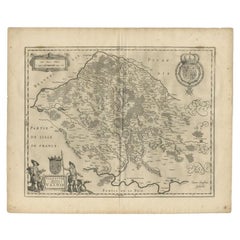
- Antique Map of the Region of Champagne and Brie by Janssonius, c.1650Located in Langweer, NLAntique map of France titled 'Champagne et Brie'. Detailed map of the region of Champagne and Brie. Published by J. Janssonius. Artists and Engravers: Johannes Janssonius also kno...Category
Antique 17th Century Maps
MaterialsPaper
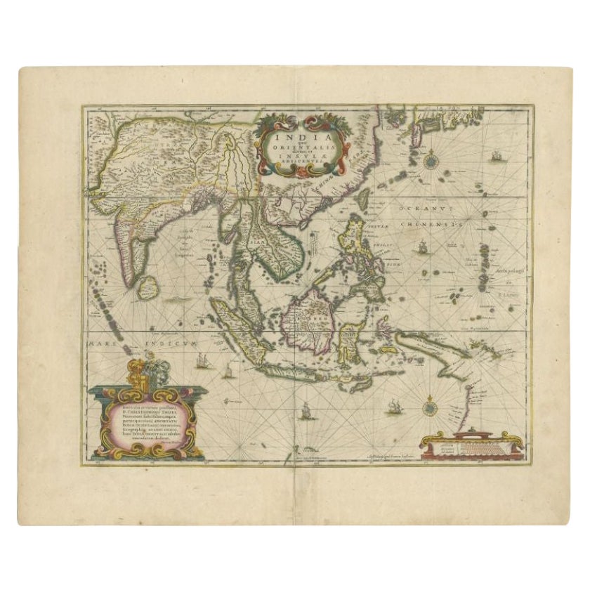
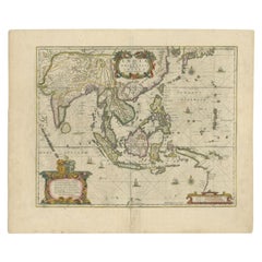
- Antique Map of the East Indies by Janssonius, c.1644By Johannes JanssoniusLocated in Langweer, NLAntique map titled 'India quae Orientalis dicitur, et Insulae adiacentes'. Old map of the East Indies and Southeast Asia showing the area between India in the West and parts of Japan...Category
Antique 17th Century Maps
MaterialsPaper
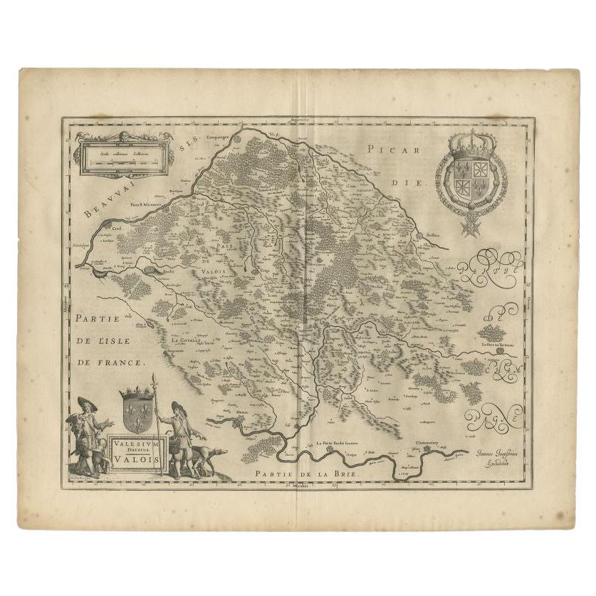
- Antique Map of the Seine-et-Marne / Champagne Region by Janssonius, 1657By Johannes JanssoniusLocated in Langweer, NLAntique map of France titled 'Valesium Ducatus Valois'. Oriented to the north of the Picardy region with Compiegne, Senlis, Meaux, Chateau-thierry and Soissons around the perimeter. ...Category
Antique 17th Century Maps
MaterialsPaper
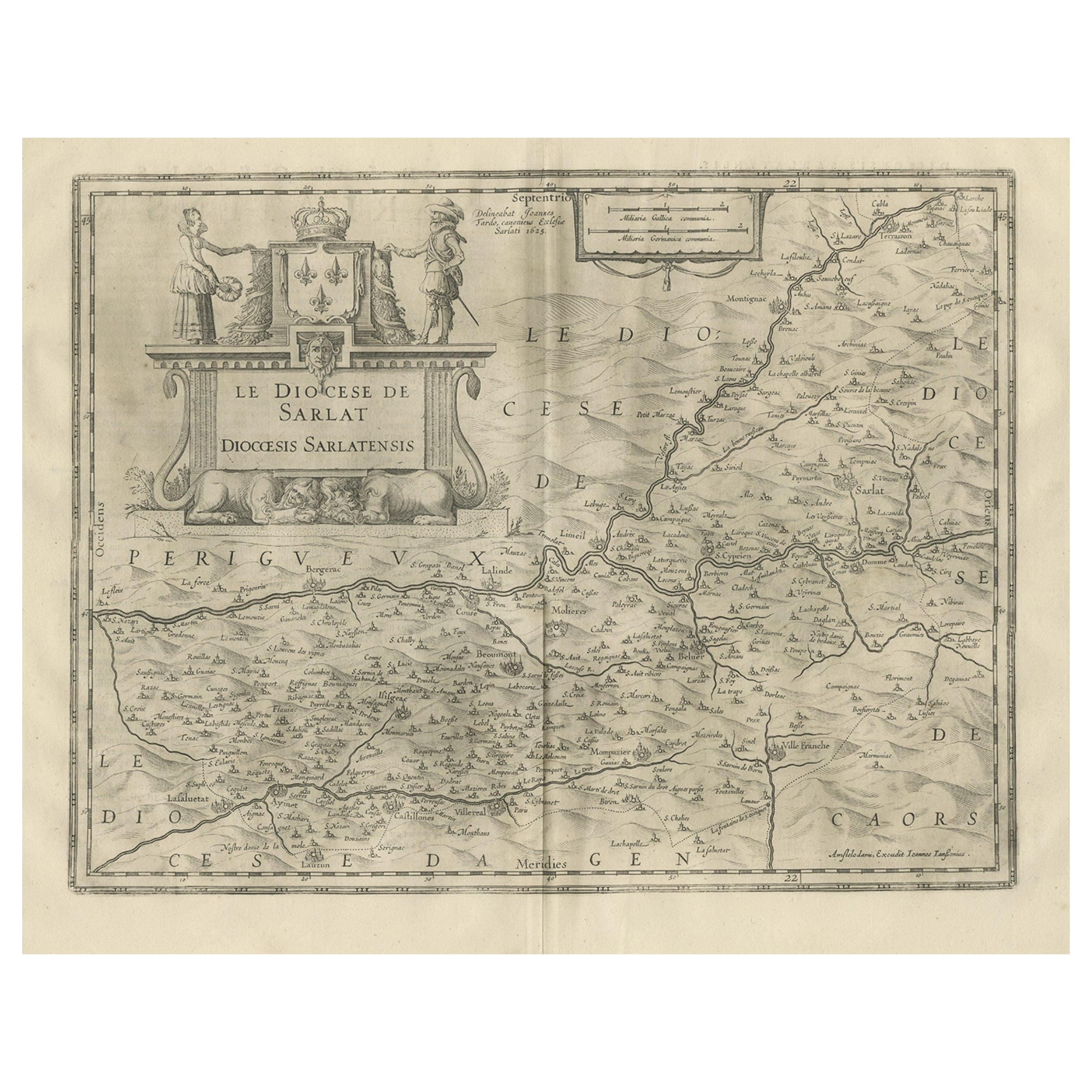
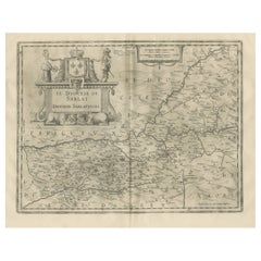
- Antique Map of the Region of Sarlat in France by Janssonius, 1657By Johannes JanssoniusLocated in Langweer, NLAntique map of France titled 'Le Diocese de Sarlat dioccesis Sarlatensis'. Decorative map of the Sarlat region, part of the Dordogne department. This map originates from 'Atlas Novus...Category
Antique 17th Century Maps
MaterialsPaper
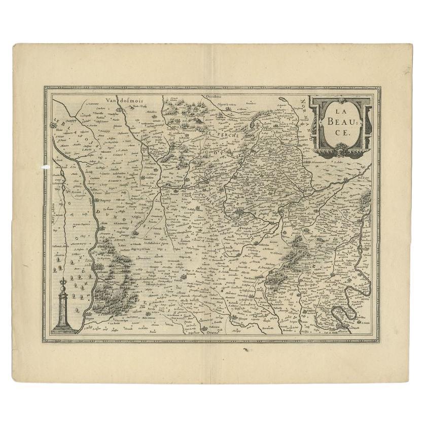
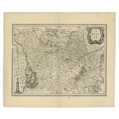
- Antique Map of the Region of Beauce in France by Janssonius, c.1650Located in Langweer, NLAntique map of France titled 'La Beauce'. Decorative map of the region of Beauce, a natural region in northern France, located between the Seine and Loire rivers. It shows the cities...Category
Antique 17th Century Maps
MaterialsPaper
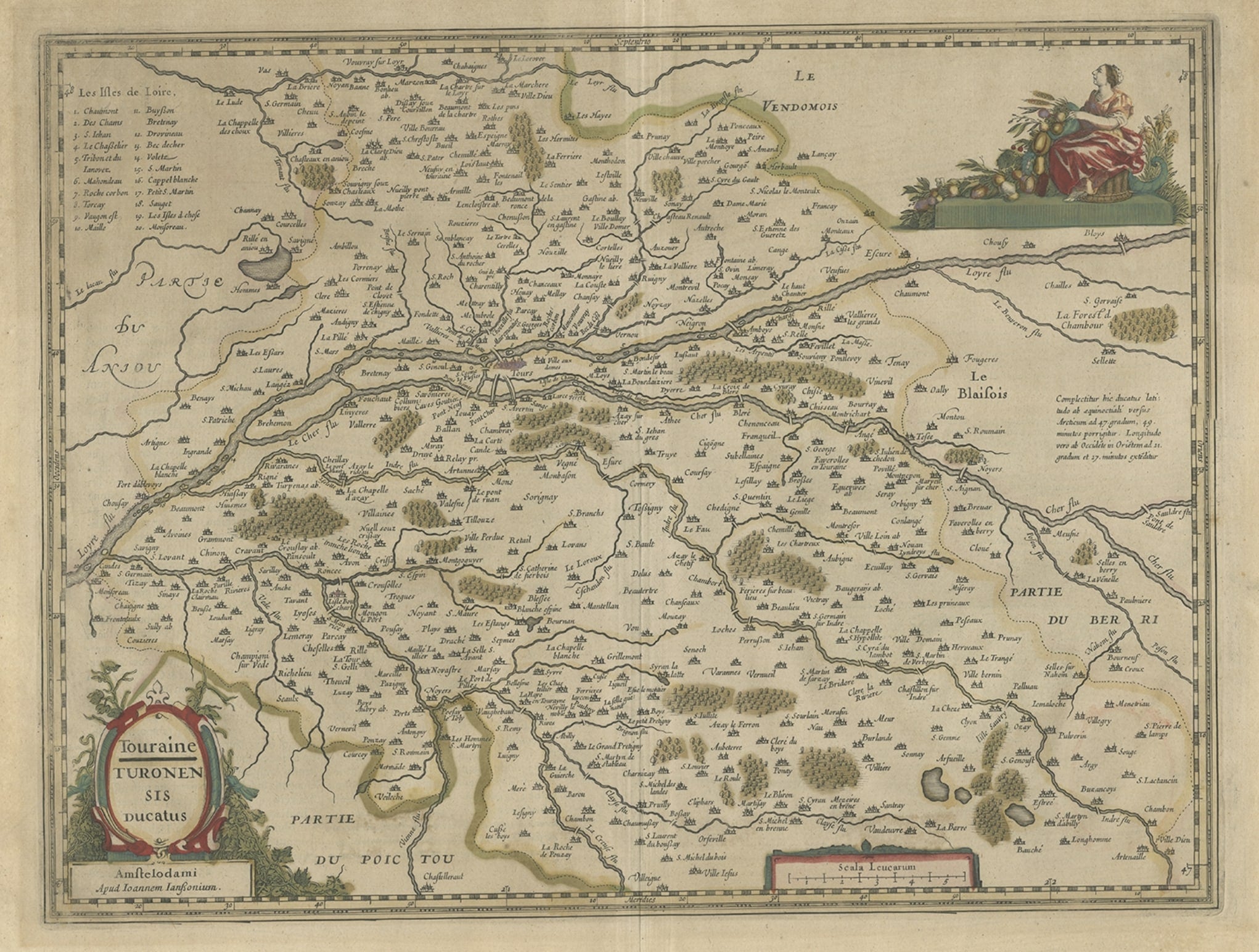
- Antique Map of the Region of Touraine in France by Janssonius, 1657By Johannes JanssoniusLocated in Langweer, NLAntique map titled 'Touraine - Turonensis Ducatus'. Decorative map of the Touraine region. This map originates from 'Atlas Novus, Sive Theatrum Orbis Orbis Terrarum: In quo Galli...Category
Antique 17th Century Maps
MaterialsPaper
You May Also Like
- 17th Century Hand-Colored Map of a Region in West Germany by JanssoniusBy Johannes JanssoniusLocated in Alamo, CAThis attractive highly detailed 17th century original hand-colored map is entitled "Archiepiscopatus Maghdeburgensis et Anhaltinus Ducatus cum terris adjacentibus". It was published ...Category
Antique Mid-17th Century Dutch Maps
MaterialsPaper
- 17th Century Topographical Map, French Champagne Region, Epernay, Iohan PeetersLocated in New York, NYFine topographical 17th century map by Iohan Peeters of the towns of Epernay and Lametz in the Champagne Region of North Eastern France. Fabulous period engraving for a Wine Cellar,...Category
Antique 17th Century Dutch Maps
MaterialsPaper
- 1594 Maurice Bouguereau Map of the Region Limoges, France, Ric0015Located in Norton, MA1594 Maurice Bouguereau map of the region Limoges, France, entitled "Totivs Lemovici et Confinium Pro Uinciarum Quantum ad Dioecefin Lemo Uicenfen Fpectant," Hand Colored Ric0015 Jean IV Le Clerc...Category
Antique 16th Century Dutch Maps
MaterialsPaper
- 1657 Janssonius Map of Vermandois and Cappelle, Ric. A-004Located in Norton, MA1657 Janssonius map of Vermandois and Cappelle Ric.a004 Description: Antique map of France titled 'Descriptio Veromanduorum - Gouvernement de la Cappelle'. Two detailed maps o...Category
Antique 17th Century Unknown Maps
MaterialsPaper
- The Normandy Region of France: A 17th C. Hand-colored Map by Sanson and JaillotBy Nicolas SansonLocated in Alamo, CAThis large hand-colored map entitled "Le Duché et Gouvernement de Normandie divisée en Haute et Basse Normandie en divers Pays; et par evêchez, avec le Gouvernement General du Havre ...Category
Antique 1690s French Maps
MaterialsPaper
- 17th Century Hand Colored Map of the Liege Region in Belgium by VisscherBy Nicolaes Visscher IILocated in Alamo, CAAn original 17th century map entitled "Leodiensis Episcopatus in omnes Subjacentes Provincias distincté divisusVisscher, Leodiensis Episcopatus" by Nicolaes Visscher II, published in Amsterdam in 1688. The map is centered on Liege, Belgium, includes the area between Antwerp, Turnhout, Roermond, Cologne, Trier and Dinant. This attractive map is presented in a cream-colored mat measuring 30" wide x 27.5" high. There is a central fold, as issued. There is minimal spotting in the upper margin and a tiny spot in the right lower margin, which are under the mat. The map is otherwise in excellent condition. The Visscher family were one of the great cartographic families of the 17th century. Begun by Claes Jansz Visscher...Category
Antique Late 17th Century Dutch Maps
MaterialsPaper


