Items Similar to The Illustrated Map of the Var Department from the Atlas National Illustré, 1856
Want more images or videos?
Request additional images or videos from the seller
1 of 8
The Illustrated Map of the Var Department from the Atlas National Illustré, 1856
About the Item
This original hand-colored map is from the "Atlas National Illustré," a work by Victor Levasseur, a French geographer and cartographer known for his richly illustrated maps.
The map of 'Dépt. du Var' from 1856 is a steel engraving, which was a common and precise method for creating maps at the time. The inclusion of the publisher's name, A. Combette from Paris, and the addresses of the various contributors to the map's creation, like the engravers Laguillermie and Rainaud, adds to the historical context of the piece.
The margins of the map are adorned with detailed illustrations that serve as a visual encyclopedic reference to the region's geography, economy, and notable figures. The use of color along the boundaries makes the map not only a tool for navigation but also an educational resource, providing insights into the Var department's landscape, economy, and cultural significance.
The text included in the map's design provides statistical information, a map legend, and discussions about the land, local curiosities, notable personalities, products, and commerce, which would have been invaluable for education and reference at the time.
The 'Atlas National Illustré' is celebrated for its combination of cartographic detail and artistic embellishment, making it a valuable cultural artifact. It represents the height of decorative map-making in the 19th century, alongside the works of John Tallis and Archibald Fullarton.
The map of the 'Département du Var' from the Atlas National Illustré would typically highlight various important towns, cities, and geographical features that make the region famous. While I cannot see the specific details on this map due to resolution constraints, I can provide information on significant places within the Var department that are historically and culturally important:
1. **Toulon**: As the prefecture (capital) of the Var, Toulon is a significant military port on the Mediterranean coast and home to the French Navy's main base.
2. **Saint-Tropez**: This town is renowned worldwide for its beaches and nightlife, historically a fishing village and later a resort for the European and American jet set and a destination for tourists.
3. **Hyères**: Often referred to as Hyères les Palmiers due to the palm trees that characterize its streets, Hyères is known for its medieval core and as a gateway to the beautiful Îles d'Hyères.
4. **Draguignan**: This town was historically the administrative center of the Var and is known for its traditional Provençal culture.
5. **Fréjus**: An ancient town with Roman ruins, Fréjus is also recognized for its beautiful beaches and as a summer resort.
6. **The Massif de l'Esterel**: This mountain range is famous for its red rocks and dramatic landscape, offering numerous hiking trails and stunning views of the Mediterranean.
7. **The Gorges du Verdon**: Often called France's Grand Canyon, it's a river canyon that is considered to be one of Europe's most beautiful. It may or may not be shown on the map, depending on the scope, as it lies on the border of the Var and the Alpes-de-Haute-Provence departments.
8. **The Îles d'Hyères**: Including Porquerolles, Port-Cros, and the Île du Levant, these islands are known for their natural beauty and serve as popular destinations for boating, hiking, and swimming.
9. **The vineyards**: Var is known for its wine production, with vineyards that are part of the Côtes de Provence and Bandol AOCs (Appellations d'Origine Contrôlée).
- Dimensions:Height: 14.18 in (36 cm)Width: 20.87 in (53 cm)Depth: 0 in (0.02 mm)
- Materials and Techniques:
- Period:
- Date of Manufacture:1856
- Condition:Good. The hand-coloring has been done professionally. Some soiling and browning around the edges, not affecting the image. Study the images carefully.
- Seller Location:Langweer, NL
- Reference Number:
About the Seller
5.0
Platinum Seller
These expertly vetted sellers are 1stDibs' most experienced sellers and are rated highest by our customers.
Established in 2009
1stDibs seller since 2017
1,916 sales on 1stDibs
Typical response time: <1 hour
- ShippingRetrieving quote...Ships From: Langweer, Netherlands
- Return PolicyA return for this item may be initiated within 14 days of delivery.
More From This SellerView All
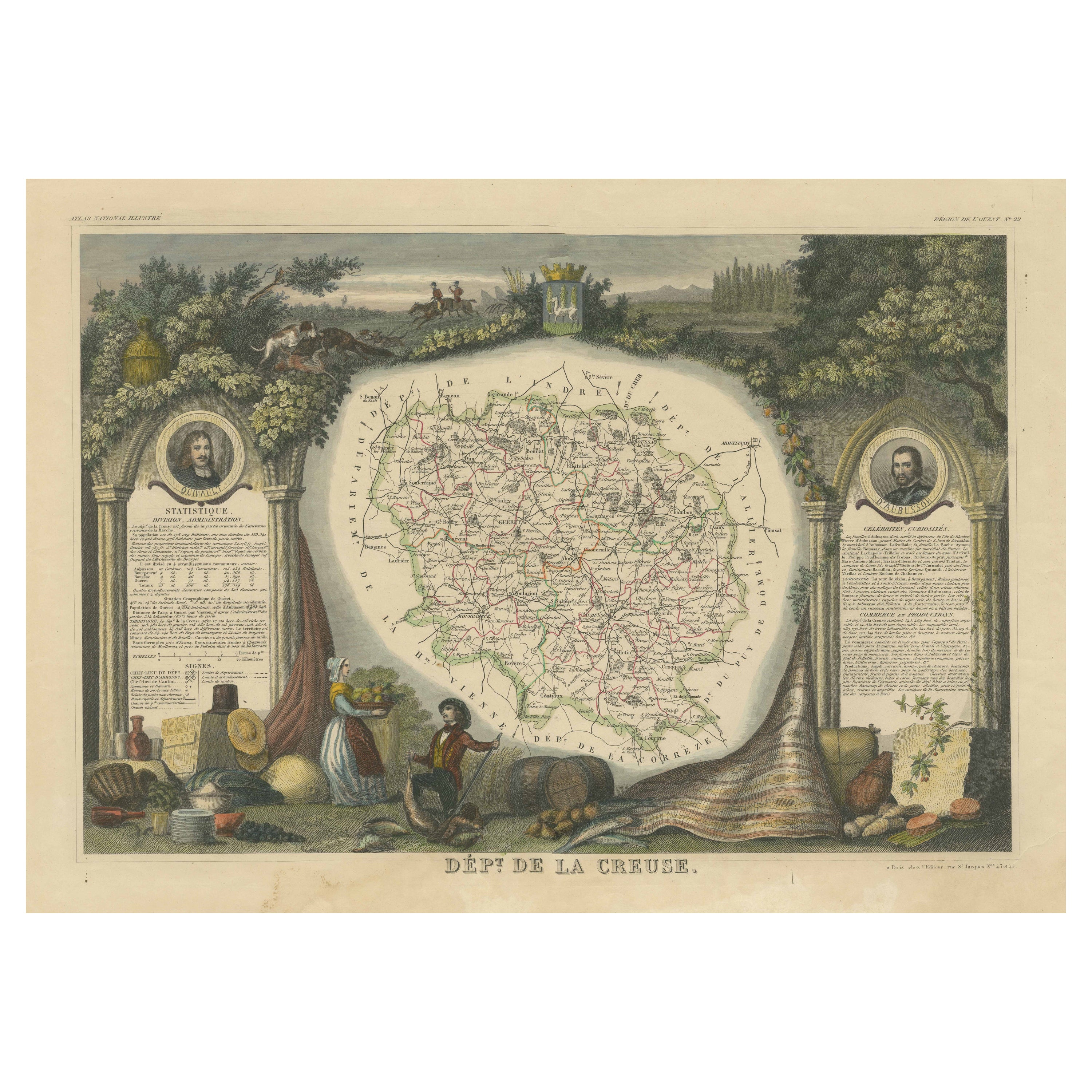
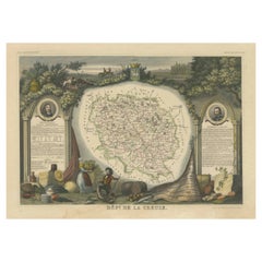
- Old Map of the French department of Creuse, FranceBy Victor LevasseurLocated in Langweer, NLAntique map titled 'Dépt. de la Creuse'. Map of the French department of Creuse, France. This region is well known for its apple cider made from Limousin apples and its international...Category
Antique Mid-19th Century Maps
MaterialsPaper
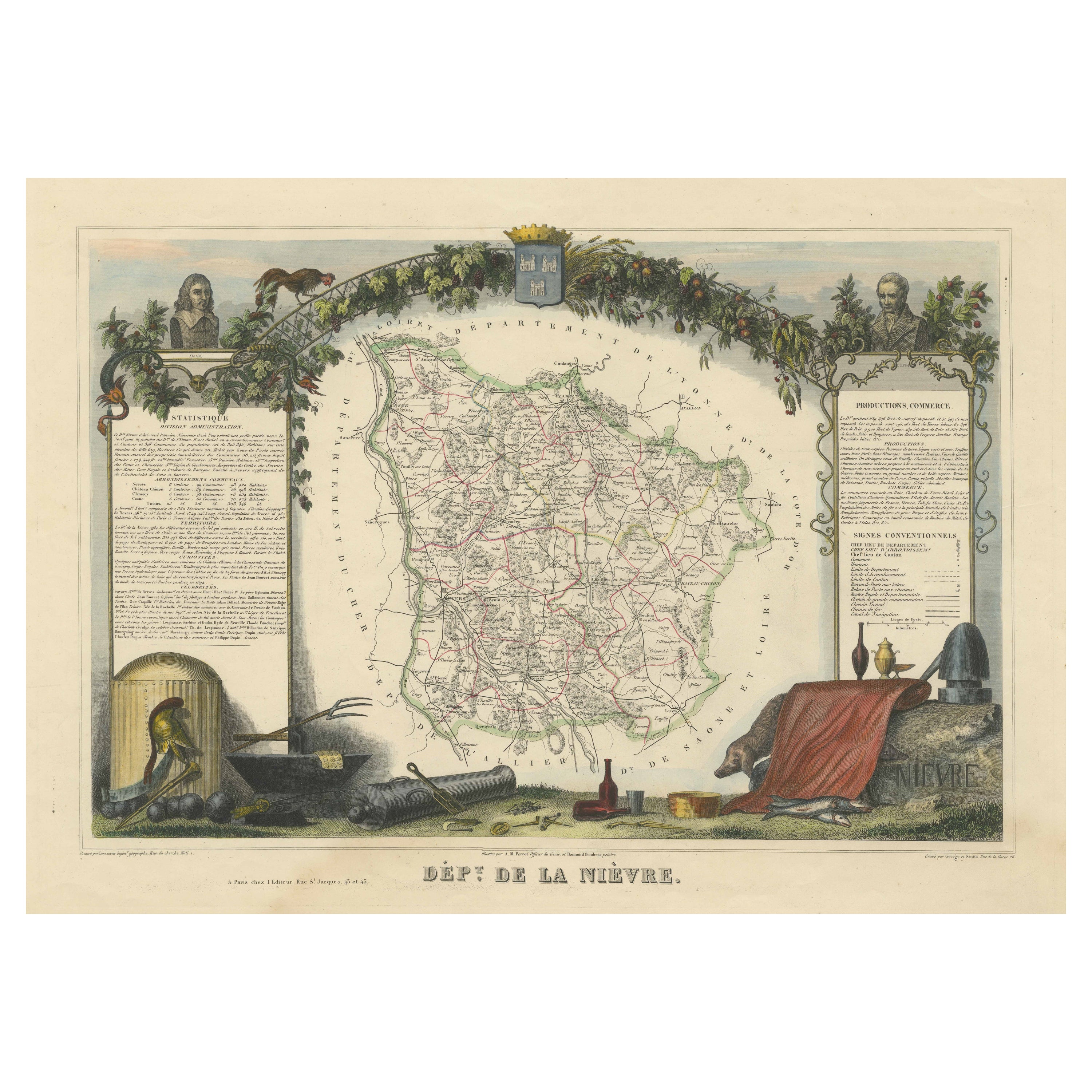
- Old Map of the French Department of Nièvre, FranceBy Victor LevasseurLocated in Langweer, NLAntique map titled 'Dept. de la Nièvre'. Map of the French department of Nievre, France. Part of the prestiegous Burgundy or Bourgogne wine region this area is known for its producti...Category
Antique Mid-19th Century Maps
MaterialsPaper
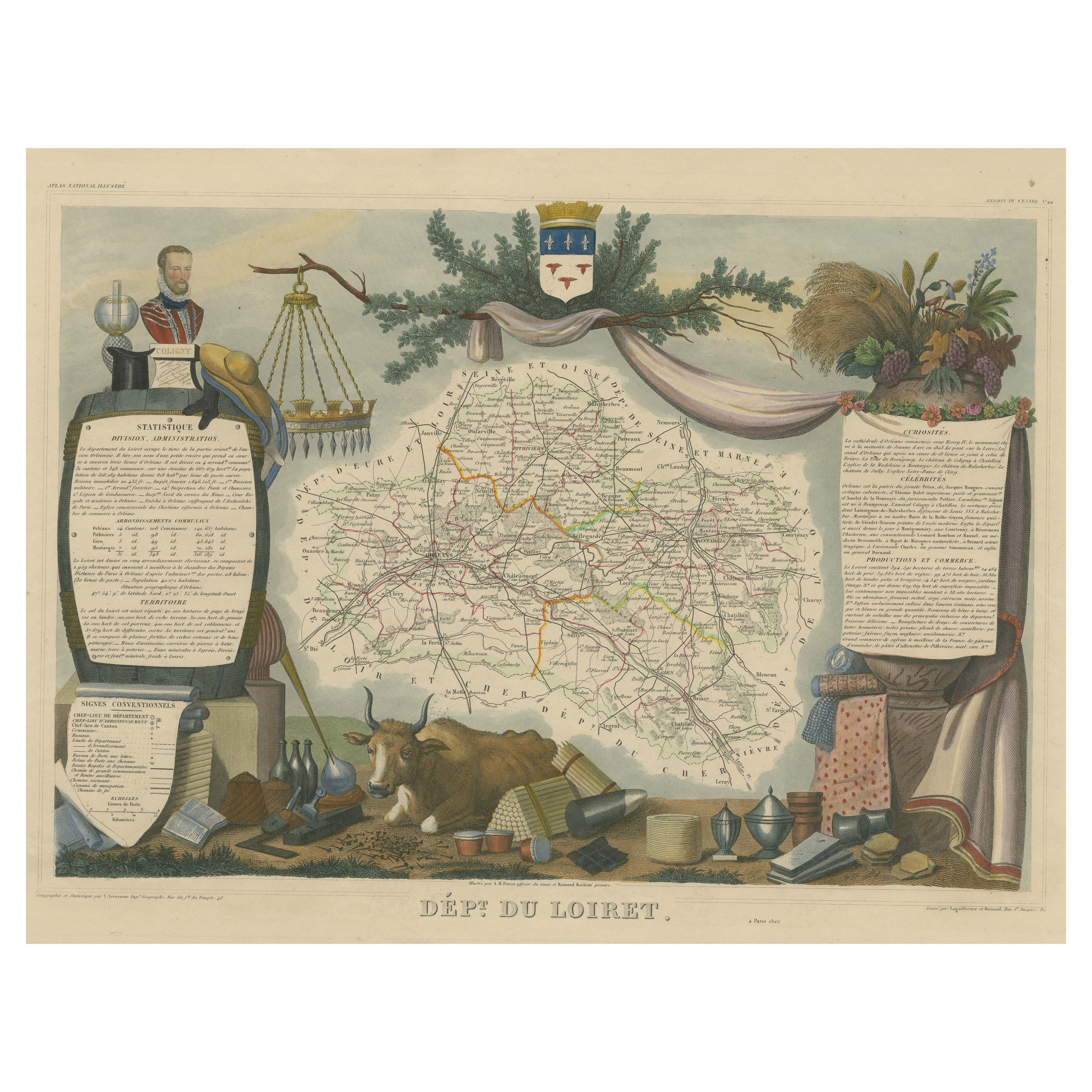
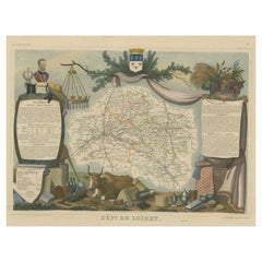
- Old Map of the French Department of Loiret, FranceBy Victor LevasseurLocated in Langweer, NLAntique map titled 'Dépt. du Loiret'. Map of the French department of Loiret, France. Surrounding the city of Orleans, Loiret is considered the heart of France and is a registered Unesco World Heritage Site. This area of France is also part of the Loire Valley wine region, and is especially known for its production of Pinot Noirs...Category
Antique Mid-19th Century Maps
MaterialsPaper
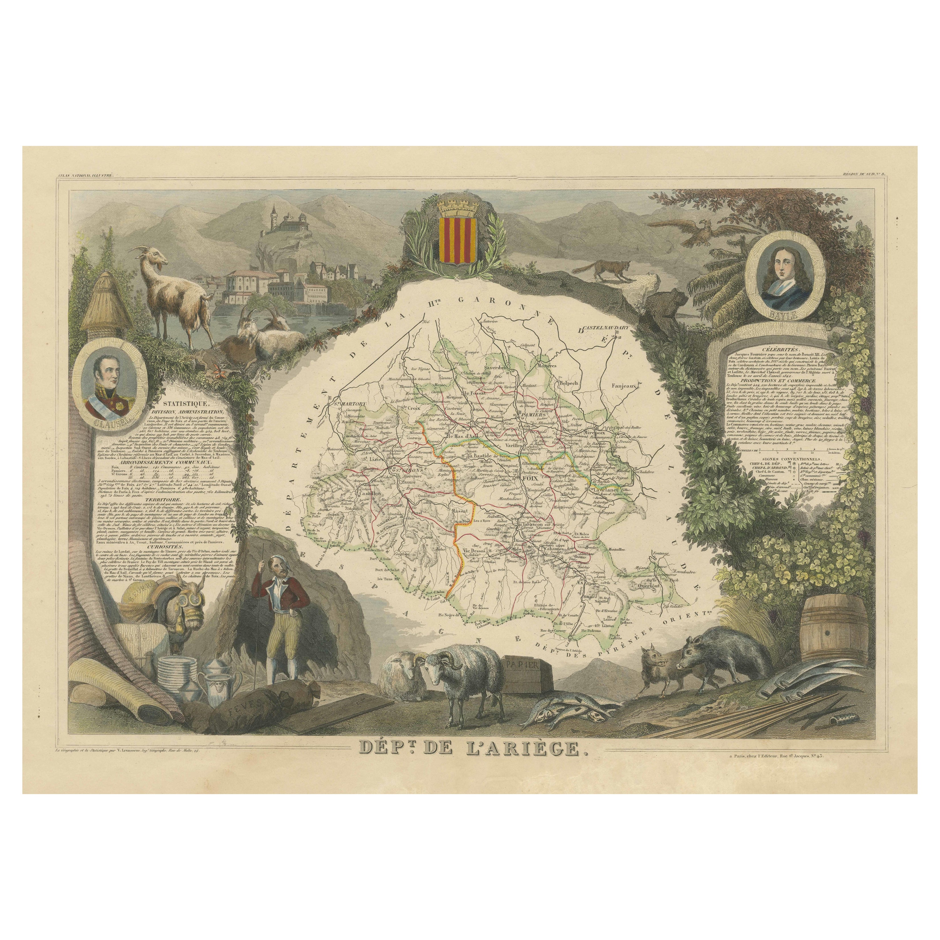
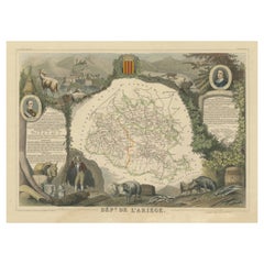
- Old Map of the French department of Ariège, FranceBy Victor LevasseurLocated in Langweer, NLAntique map titled 'Dépt. de l'Ariège'. Map of the French department of Ariege, France. This area of France is known for its production of semi-soft and mild cheeses, such as Bethmal...Category
Antique Mid-19th Century Maps
MaterialsPaper
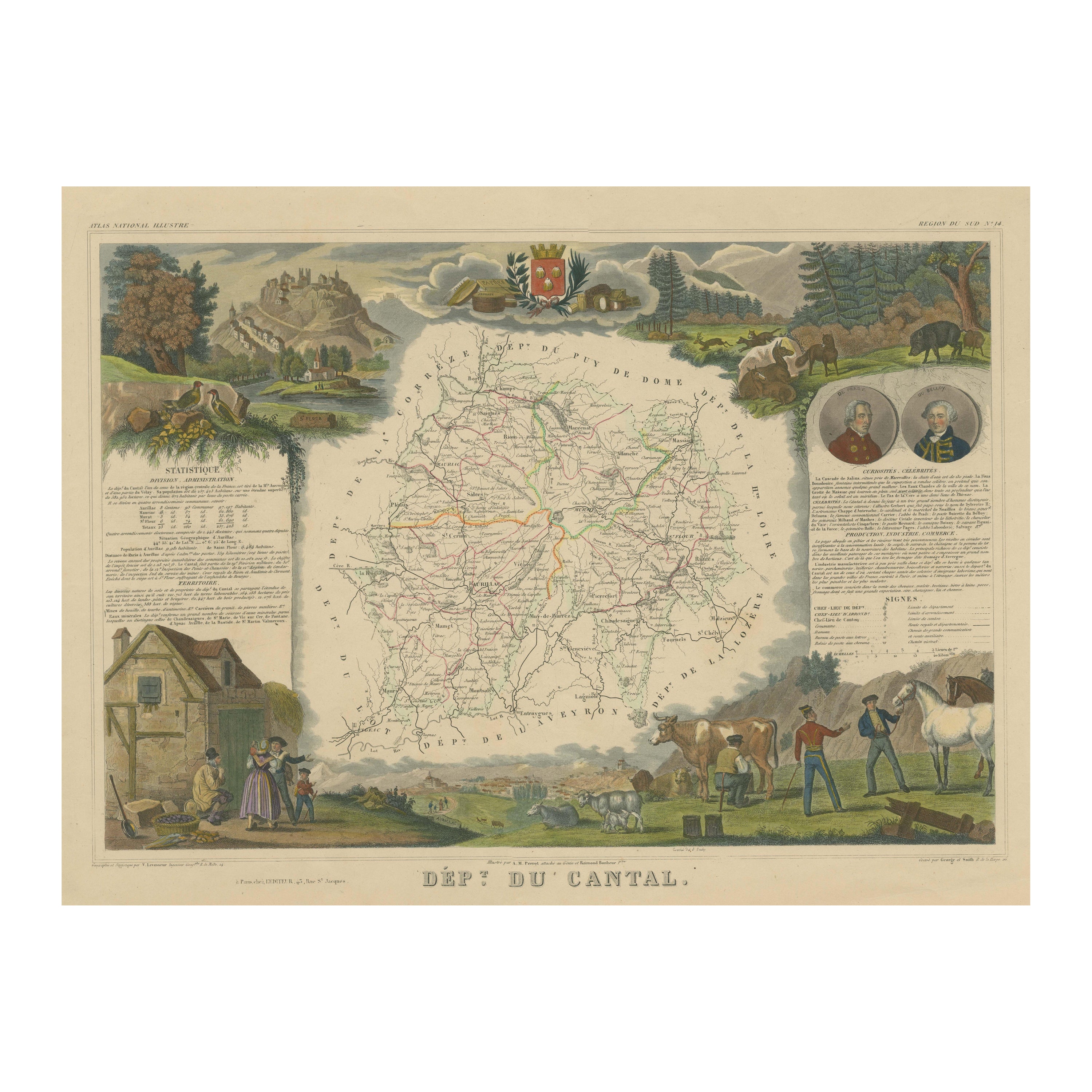
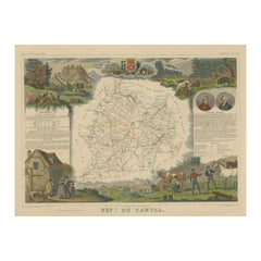
- Old Map of the French Department of Cantal, FranceBy Victor LevasseurLocated in Langweer, NLAntique map titled 'Dépt. du Cantal'. Map of the French department of Cantal, France. This area of France is known for its production of Cantal, a firm cheese, named after the region...Category
Antique Mid-19th Century Maps
MaterialsPaper
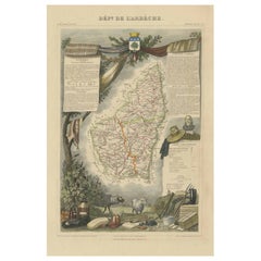
- Old Map of the French Department of Ardèche, FranceBy Victor LevasseurLocated in Langweer, NLAntique map titled 'Dépt. de l'Ardèche'. Map of the Department of Ardèche, France. This region is known for its fine wines, agriculture, distilled spirits, and cheese. The capital ci...Category
Antique Mid-19th Century Maps
MaterialsPaper

You May Also Like
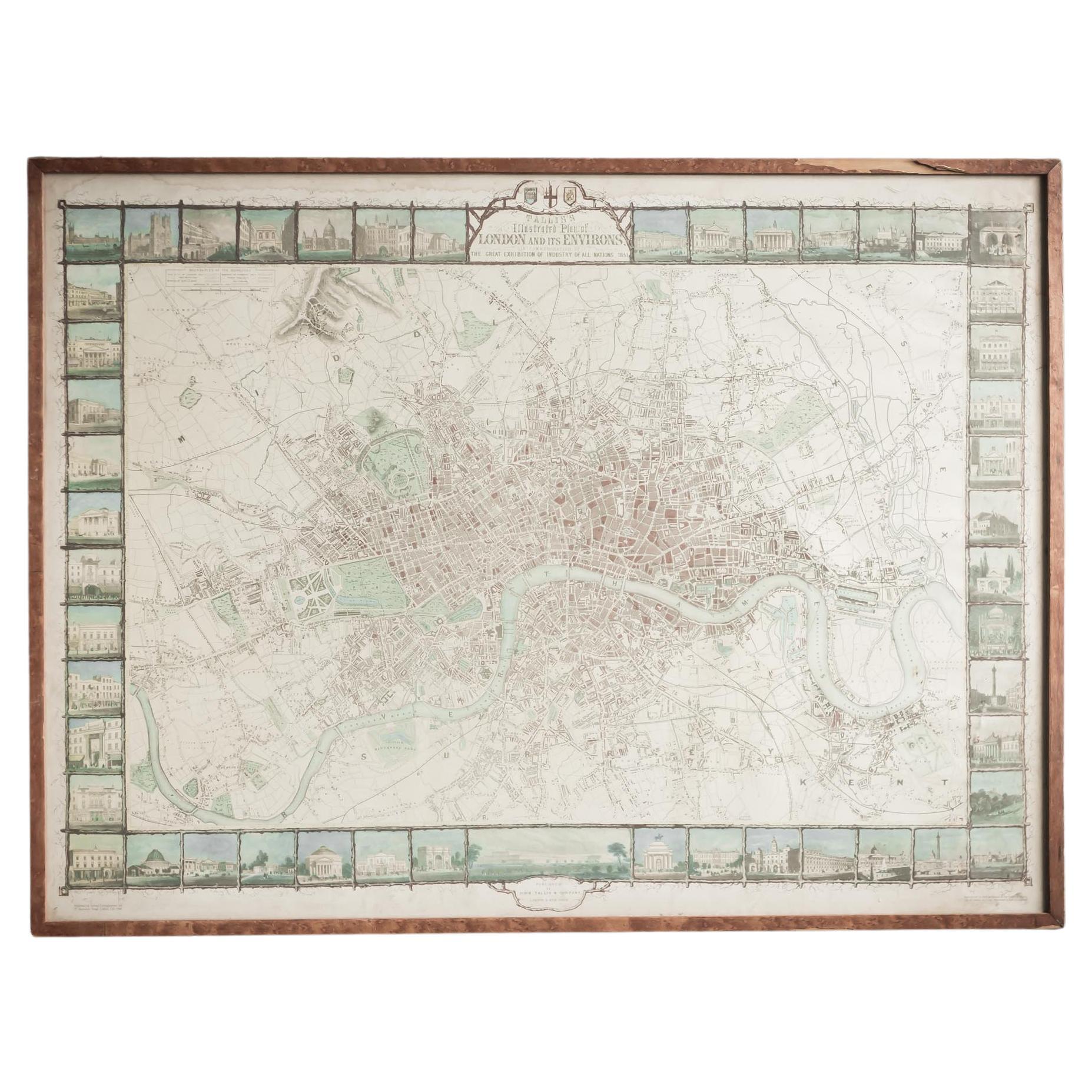
- Illustrated Map of London from ExhibtionLocated in Alton, GBDetailed illustrated map of London from the great exhibition of industry of all nations 1851.Category
Antique 19th Century Maps
MaterialsPaper
- National Geographic Atlas of the World, Eighth Edition Hardcover BookLocated in North Hollywood, CANational Geographic Atlas of the World, Eighth Edition National Geographic This is a beautiful large library or hardcover coffee table book. Title: National Geographic Atlas of th...Category
Early 2000s Maltese Mid-Century Modern Books
MaterialsPaper
- 1856 U.S. Coast Survey Map of Chesapeake Bay and Delaware BayLocated in Colorado Springs, COPresented is U.S. Coast Survey nautical chart or maritime map of Chesapeake Bay and Delaware Bay from 1856. The map depicts the region from Susquehanna, Maryland to the northern Oute...Category
Antique 1850s American Maps
MaterialsPaper
- 1900s Stielers Hand Atlas 100 MapsLocated in Seguin, TXStielers Hand Atlas, Gotha: Justus Perthes, Germany, circa 1905. Linen covered wood box containing 100 folded individual loose leaf maps of the world, text in german. Box made to loo...Category
Early 20th Century German Victorian Maps
MaterialsPaper
- Fine French Antique 1856 Hand Watercolour Map of Dept Des Hautes PyreneesLocated in GBWe are delighted to offer for sale this stunning 1856 hand watercolour map of the Austrian Alps titled Dept Des Hautes Pyrenees taken from the Atlas Nat...Category
Antique 1850s French Early Victorian Maps
MaterialsPaper
- Antique Chicago Illinois National Map Commercial Rollup Classroom Census Map 47"Located in Dayton, OHAntique early to mid 20th century double sided hanging map titled the New Commercial and Census Map of Illinois, Edition 1073. Verso shows the National Map of Chicago and Suburbs - O...Category
Early 20th Century North American Maps
MaterialsPaper


Recently Viewed
View AllMore Ways To Browse
Georg Barque
F V Hayden
Dirk Hartog
De Nile Antiques
Serbia Map
Siam Map
Marthas Vineyard Map
Native American Mountie
Nicolaes Visscher II On Sale
Pierre Fran�ois Tardieu On Sale
Union Pacific Map
Vintage Marthas Vineyard Map
Yemen 1789
Old French Map
Levasseur A
Antique Map Copenhagen
Map Prussia Germany
Frontier Map