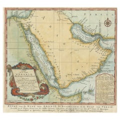
Antique Navigation Map

13
to
18
141
33
92
66
47
40
30
25
24
22
22
17
17
16
13
12
9
8
8
8
5
5
4
4
3
3
3
3
3
3
3
2
2
2
1
1
1
1
1
1
1
1
11
8
2
2
1
Sort By
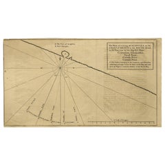
Navigational Chart of Mexico's Coast, with Acapulco and Port Marquis, 1748
Located in Langweer, NL
Antique map titled 'The Form of cruising off Acapulca on the Coast of Mexico in the South Seas in
Category

1740s Antique Navigation Map

Materials

Paper

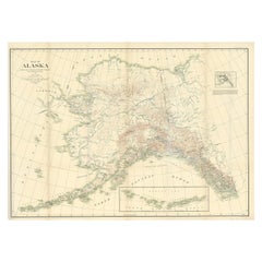
Antique Map of Alaska '1904'
Located in Langweer, NL
Navigation Use**: With its detailed topographic information, the map would have served important functions
Category

Early 20th Century Antique Navigation Map

Materials

Paper

Antique Map of Alaska '1904'
H 33.47 in W 47.25 in D 0.02 in
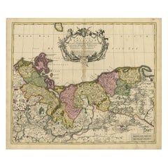
Antique Map of Pomerania by Schenk, circa 1750
Located in Langweer, NL
The "Ducatus Pomeraniae" is a historical map depicting the Duchy of Pomerania, a region that
Category

Mid-18th Century Antique Navigation Map

Materials

Paper

Antique Map of Pomerania by Schenk, circa 1750
H 20.67 in W 24.02 in D 0.02 in
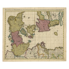
Antique Map of Denmark by Valk 'circa 1690'
Located in Langweer, NL
The map titled "Regnum Daniae, divisum in Dioeceses Arhusiam, Albergum, Viborgum, et Ripam (..)" is
Category

Late 17th Century Antique Navigation Map

Materials

Paper

Antique Map of Denmark by Valk 'circa 1690'
H 20.67 in W 24.02 in D 0.02 in
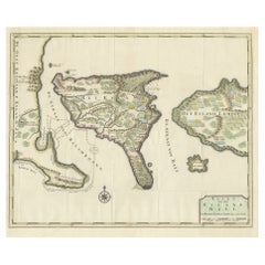
1726 Valentyn's Map of Bali and Lombok, Original Engraving
Located in Langweer, NL
This antique map is a detailed 18th-century chart of the island of Bali, one of the many islands of
Category

Early 18th Century Antique Navigation Map

Materials

Paper

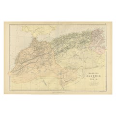
Antique Decorative Coloured Map Marocco, Algeria and Tunis, 1882
Located in Langweer, NL
. 5. **Navigational Aid**: For ships navigating the Mediterranean Sea, the map would have been an
Category

1880s Antique Navigation Map

Materials

Paper

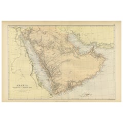
Original 1882 Map of Arabia, Red Sea & Persian Gulf
Located in Langweer, NL
significant for navigation and commerce. The map includes nautical lines indicating sea depths and shipping
Category

1880s Antique Navigation Map

Materials

Paper

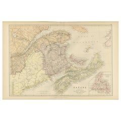
Decorative Antique Map of Eastern Canada, Published in 1882
Located in Langweer, NL
the geographical features all indicate that this map was a practical tool for education and navigation
Category

1880s Antique Navigation Map

Materials

Paper

Decorative Antique Map of Eastern Canada, Published in 1882
Free Shipping
H 14.97 in W 22.45 in D 0 in
Original Antique Map of Arabia and the Red Sea
Located in Langweer, NL
Antique map titled 'Carte de la Coste d'Arabie (..) - Kaart van de Kust van Arabië (..)'. This is a
Category

Mid-18th Century Antique Navigation Map

Materials

Paper

Antique Map of England by Mercator/Hondius, circa 1600
Located in Langweer, NL
Antique map titled 'Westmorlandia, Lancastria, Caernvan, Denbigh, Flint, Merionidh, Dalopia cum
Category

16th Century Antique Navigation Map

Materials

Paper

Antique Map of the Low Countries by Brué, 1822
Located in Langweer, NL
Antique map titled 'Carte du Royaume des Pays-Bas'. Large format map of the Low Countries. This map
Category

19th Century Antique Navigation Map

Materials

Paper

Original Antique Coloured Map of Western Africa, Published in 1882
Located in Langweer, NL
navigation and exploration. 4. **Trade and Exploration**: The map might indicate key ports, trade routes
Category

1880s Antique Navigation Map

Materials

Paper

Antique Geographical, Historical and Statistical Map of Massachusetts, 1822
Located in Langweer, NL
This attractive map of Massachusetts presents a finely detailed overview of the state in the first
Category

1820s Antique Navigation Map

Materials

Paper

Antique 19th Century Map of China by Blackie & Son, 1882
Located in Langweer, NL
This map is an 1882 Blackie & Son map of China. The title "CHINA." is prominently displayed at the
Category

1880s Antique Navigation Map

Materials

Paper

Antique 19th Century Map of China by Blackie & Son, 1882
Free Shipping
H 22.45 in W 14.97 in D 0 in
Antique Map Depicting Burma, Siam, Annam (Vietnam) and Japan, 1882
Located in Langweer, NL
The image shows two maps side by side from the 1882 atlas by Blackie & Son. On the left, the map is
Category

1880s Antique Navigation Map

Materials

Paper

Antique Decorative Coloured Map of South Africa and Madagascar, 1882
Located in Langweer, NL
navigation and trade. Maps from this era are valuable for the historical insights they provide and for
Category

1880s Antique Navigation Map

Materials

Paper

Topographical and Infrastructure Map of the Province of Valencia, 1901
Located in Langweer, NL
's usefulness for navigation and understanding the region's geography during the early 20th century. The map
Category

Early 1900s Antique Navigation Map

Materials

Paper

Large Antique Map of Java ‘Indonesia’ by F. Valentijn, 1728
Located in Langweer, NL
Antique map titled 'Nieuwe en zeer naaukeurige Kaart van t Eyland Java Major of Groot Java'. This
Category

Early 18th Century Antique Navigation Map

Materials

Paper

Antique Map of The United States of North America, 1882
Located in Langweer, NL
, suggests it was a comprehensive educational or navigational tool for its time. The map's scale and grid of
Category

1880s Antique Navigation Map

Materials

Paper

Antique Map of The United States of North America, 1882
Free Shipping
H 14.97 in W 22.45 in D 0 in
Colorful Detailed Antique Map of The World on Mercators Projection, 1882
Located in Langweer, NL
Projection' map is an opportunity to own a piece of navigational heritage—a window to the past that continues
Category

1880s Antique Navigation Map

Materials

Paper

Northern Scotland: A 17th Century Hand-colored Map by Mercator
By Gerard Mercator
Located in Alamo, CA
This is a framed hand-colored 17th century map of Northern Scotland by Gerard Mercator entitled
Category

1630s Dutch Antique Navigation Map

Materials

Paper

Northern Scotland: A 16th Century Hand-colored Map by Mercator
By Gerard Mercator
Located in Alamo, CA
south down, first described in 1569, became the standard map projection for navigation. It is still
Category

16th Century Dutch Antique Navigation Map

Materials

Paper

1627 Map Entitled "Loudunois, " Signed on the Back, Ric.a013
Located in Norton, MA
1627 map entitled "Loudunois," Signed on the Back Ric.a013 cartography close up double
Category

17th Century Dutch Antique Navigation Map

Materials

Paper

Map of Soria Province, 1901: Detailed Cartography of Northeastern Spain
Located in Langweer, NL
understanding of the region at the beginning of the 20th century. This map serves as both a navigational aid
Category

Early 1900s Antique Navigation Map

Materials

Paper

Arctic Exploration: An Original Map of the North Circumpolar Regions, 1882
Located in Langweer, NL
This map, extracted from the 1882 atlas by Blackie & Son, presents the North Circumpolar Regions in
Category

1880s Antique Navigation Map

Materials

Paper

Title: Mid-19th Century Map of Australasia by Carl Flemming - 1855
Located in Langweer, NL
Title: "Mid-19th Century Map of Australasia by Carl Flemming - 1855" Description: This original
Category

1850s Antique Navigation Map

Materials

Paper

Original Antique Map of the Northern Part of Scotland, circa 1640
Located in Langweer, NL
map not only serves as a navigational aid but also provides a fascinating glimpse into the artistic
Category

Mid-17th Century Antique Navigation Map

Materials

Paper

An Illustrated Map of Kabul, Punjab, and Baluchistan by Tallis, 1851
Located in Langweer, NL
This map, attributed to John Tallis and featuring the work of Robert Montgomery Martin, is part of
Category

1850s Antique Navigation Map

Materials

Paper

Original Antique Map of the West Indies by J. Arrowsmith, 1842
Located in Langweer, NL
Title: "J. Arrowsmith's 19th Century Map of the West Indies" This original antique map, crafted by
Category

Early 19th Century Antique Navigation Map

Materials

Paper

19th Century Illustrated Map of Ceylon (Sri Lanka) with Notable Landmarks
Located in Langweer, NL
John Tallis & Company is known for producing maps and atlases that were highly regarded for their
Category

1850s Antique Navigation Map

Materials

Paper

Old Map of Vaucluse, France: A Cartographic Celebration of Viticulture, 1852
Located in Langweer, NL
This original hand-colored map is from the "Atlas National Illustré," a work by Victor Levasseur, a
Category

1850s Antique Navigation Map

Materials

Paper

Mediterranean Tapestry: A 19th Century Map of the Mediterranean Shores, 1882
Located in Langweer, NL
This map, titled "The Shores of the Mediterranean," is part of the 1882 atlas by Blackie & Son, and
Category

1880s Antique Navigation Map

Materials

Paper

Oriental Realms: A Detailed Map of Persia, Afghanistan, and Beloochistan, 1882
Located in Langweer, NL
This historical map from the 1882 atlas published by Blackie & Son is a comprehensive depiction of
Category

1880s Antique Navigation Map

Materials

Paper

1644 Janssonius Original Wine Regions Map: The Ducal and Comital Burgundy
Located in Langweer, NL
This authentic handcolored map is a detailed 17th-century depiction of the Burgundy region
Category

1640s Antique Navigation Map

Materials

Paper

Authentic 1644 Janssonius Map of the Champagne Region (Campania) in France
Located in Langweer, NL
. This map is not only a navigational tool but also a snapshot of a region rich in history and tradition
Category

1640s Antique Navigation Map

Materials

Paper

17th Century Hand-Colored Map of West Africa by Mercator/Hondius
Located in Alamo, CA
A 17th century hand-colored map entitled "Guineae Nova Descriptio" by Gerard Mercator and Jodocus
Category

Mid-17th Century Dutch Antique Navigation Map

Materials

Paper

Cartographic Heritage: The 1901 Map of the Vizcaya Province in Spain
Located in Langweer, NL
This is a historical map of the province of Vizcaya (Biscay) in Spain, dated 1901. The title on the
Category

Early 1900s Antique Navigation Map

Materials

Paper

Antique Map of British North America, The Dominion of of Canada, 1882
Located in Langweer, NL
, possibly for navigation or educational purposes. The detail and scale of the map suggest it was a
Category

1880s Antique Navigation Map

Materials

Paper

Mid-19th Century Decorative Map of Asia with Cultural and Natural Vignettes
Located in Langweer, NL
John Tallis & Company, known for their decorative mid-19th-century maps, created this map of Asia
Category

1850s Antique Navigation Map

Materials

Paper

Antique Map Depicting Sydney and Surrounding Areas, Known as Port Jackson, c1889
Located in Langweer, NL
An antique map depicting Sydney and its surrounding areas, known as Port Jackson, dating from
Category

1880s Antique Navigation Map

Materials

Paper

Antique Map of the City of Leuven, Belgium, with Original Coloring, 1609
Located in Langweer, NL
An original antique map titled "Lovanium Brabantiarum," which depicts the city of Leuven in Belgium
Category

Early 17th Century Antique Navigation Map

Materials

Paper

Territories of Antiquity: The Northern Division of Syria, A Detailed 1882 Map
Located in Langweer, NL
This 19th-century map from the atlas published by Blackie and Son in 1882 is titled "SYRIA (NORTH
Category

1880s Antique Navigation Map

Materials

Paper

An Ornate and Historical Tallis Map of Jamaica with Decorative Vignettes, 1851
Located in Langweer, NL
the period. These picturesque and detailed insets would serve to make the map not just a navigational
Category

1850s Antique Navigation Map

Materials

Paper

Map of New Zealand Showing Maori Culture and Early Colonial Settlements, 1851
Located in Langweer, NL
John Tallis & Company were renowned for their ornate and detailed maps in the mid-19th century
Category

1850s Antique Navigation Map

Materials

Paper

Detailed Original Antique Map of the Turkish Empire with Arabia, 1778
Located in Langweer, NL
. . . 1753 Detailed map of the Turkish Empire, extending to the Black Sea, Georgia, the Caspian
Category

1770s Antique Navigation Map

Materials

Paper

Antique Map of the Malay Archipelago with Images of Indigenous People, 1851
Located in Langweer, NL
of the British public. Tallis's maps are more than just navigational aids; they are visual
Category

1850s Antique Navigation Map

Materials

Paper

1852 Map of Haut-Rhin: An Illustrated Gateway to Alsace's Viticultural Splendors
Located in Langweer, NL
This original hand-colored map is from the "Atlas National Illustré," a work by Victor Levasseur, a
Category

1850s Antique Navigation Map

Materials

Paper

Large Antique Map of Guadeloupe and Antigua with Adjacent Isles, 19th Century
Located in Langweer, NL
Title: "Antique Map of Guadeloupe and Antigua with Adjacent Isles, 19th Century" Source: New
Category

Early 19th Century Antique Navigation Map

Materials

Paper

An Insightful 19th Century Map of Syria and the Surrounding Regions, 1882
Located in Langweer, NL
This map, titled "SYRIA (SOUTH DIVISION) including PALESTINE & THE HAUARAN," is a historical
Category

1880s Antique Navigation Map

Materials

Paper

Antique Map of Canada, The Province of Ontario and Part of Quebec, 1882
Located in Langweer, NL
and latitude markers are indicative of the map's utility for navigation and education. The precision
Category

1880s Antique Navigation Map

Materials

Paper

1856 U.S. Coast Survey Map of Chesapeake Bay and Delaware Bay
Located in Colorado Springs, CO
Presented is U.S. Coast Survey nautical chart or maritime map of Chesapeake Bay and Delaware Bay
Category

1850s American Antique Navigation Map

Materials

Paper

Detailed Map of the Madura Strait, between Java & Madura Island, Indonesia, 1825
Located in Langweer, NL
Fort d'Orange. This map originates from 'Journal de la navigation autour du globe de la frégate "la
Category

1820s Antique Navigation Map

Materials

Paper

Rare Authentic Engraved Map of Large Part of Indonesia by Stavorinus, 1779
Located in Langweer, NL
Antique map titled 'Carte de la Navigation de Batavia a Amboina'. Rare chart of Indonesia including
Category

18th Century Antique Navigation Map

Materials

Paper

Decorative Original HandColoredAntique Map of South America by J.B. Elwe, 1792
By J.B. Elwe
Located in Langweer, NL
craftsmanship suggests it was created in a time when maps were not just tools for navigation but also works of
Category

Late 18th Century Antique Navigation Map

Materials

Paper

Southeastern Ireland: A 17th Century Hand Colored Map by Mercator and Hondius
By Gerard Mercator
Located in Alamo, CA
A 17th century copperplate hand-colored map entitled "The Second Table of Ireland, Udrone" by
Category

Mid-17th Century Dutch Antique Navigation Map

Materials

Paper

Map of Rhône: Culture and Commerce in Lyon's Silk and Wine Legacy, 1852
Located in Langweer, NL
white wines, including Côte-Rôtie and Condrieu. These maps are not just navigation tools but also serve
Category

1850s Antique Navigation Map

Materials

Paper

1859 "Map of the United States of America..." by J. H. Colton
By J.H. Colton
Located in Colorado Springs, CO
Presented is an 1859 “Map of the United States of America, the British Provinces, Mexico, the West
Category

1850s American Antique Navigation Map

Materials

Paper

Crossroads of Empires: A John Tallis Map of the Isthmus of Panama, 1851
Located in Langweer, NL
The Tallis map of the Isthmus of Panama is a beautifully detailed work, characteristic of the maps
Category

1850s Antique Navigation Map

Materials

Paper

Decorative Early Hand-Colored Map of the Northeast of England, ca.1620
Located in Langweer, NL
Antique map titled 'Eboracum, Lincolnia, Derbia, Staffordia, Notinghamia, Lecestria, Rutlandia et
Category

1620s Antique Navigation Map

Materials

Paper

1817 Map of Puerto Rico and the Virgin Islands with Original Hand Coloring
Located in Langweer, NL
map. This piece would have served as both a practical guide for navigation and a work of art for those
Category

Early 19th Century Antique Navigation Map

Materials

Paper

  • 1
Get Updated with New Arrivals
Save "Antique Navigation Map", and we’ll notify you when there are new listings in this category.

Antique Navigation Map For Sale on 1stDibs

With a vast inventory of beautiful furniture at 1stDibs, we’ve got just the antique navigation map you’re looking for. Each antique navigation map for sale was constructed with extraordinary care, often using paper, glass and metal. Whether you’re looking for an older or newer antique navigation map, there are earlier versions available from the 18th Century and newer variations made as recently as the 20th Century. An antique navigation map is a generally popular piece of furniture, but those created in Georgian, Art Deco and Baroque styles are sought with frequency. A well-made antique navigation map has long been a part of the offerings for many furniture designers and manufacturers, but those produced by Gerard Mercator, Johannes Kip and Arent Roggeveen are consistently popular.

How Much is a Antique Navigation Map?

Prices for an antique navigation map start at $153 and top out at $250,000 with the average selling for $857.

Read More

Pamela Shamshiri Shares the Secrets behind Her First-Ever Book and Its Effortlessly Cool Interiors

The sought-after designer worked with the team at Hoffman Creative to produce a monograph that beautifully showcases some of Studio Shamshiri's most inspiring projects.

Moroccan Artworks and Objects Take Center Stage in an Extraordinary Villa in Tangier

Italian writer and collector Umberto Pasti opens the doors to his remarkable cave of wonders in North Africa.

Montecito Has Drawn Royalty and Celebrities, and These Homes Are Proof of Its Allure

Hollywood A-listers, ex-pat aristocrats and art collectors and style setters of all stripes appreciate the allure of the coastal California hamlet — much on our minds after recent winter floods.

Whaam! Blam! Pow! — a New Book on Pop Art Packs a Punch

Publishing house Assouline and writer Julie Belcove have teamed up to trace the history of the genre, from Roy Lichtenstein, Andy Warhol and Yayoi Kusama to Mickalene Thomas and Jeff Koons.

The Sparkling Legacy of Tiffany & Co. Explained, One Jewel at a Time

A gorgeous new book celebrates — and memorializes — the iconic jeweler’s rich heritage.

What Makes a Gem-Encrusted Chess Set Worth $4 Million?

The world’s most opulent chess set, weighing in at 513 carats, is literally fit for a king and queen.

Tauba Auerbach’s Geometric Pop-Up Book Is Mighty Rare, Thanks to a Hurricane

This sculptural art book has an epic backstory of its own.

Step inside the Storied Mansions of Palm Beach’s Most Effervescent Architect

From Spanish-style courtyards to fanciful fountains, these acclaimed structures abound in surprising and elegant details.